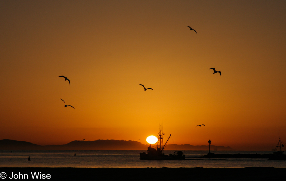
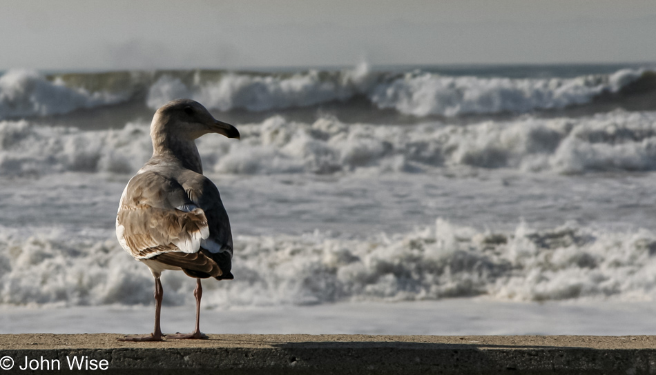
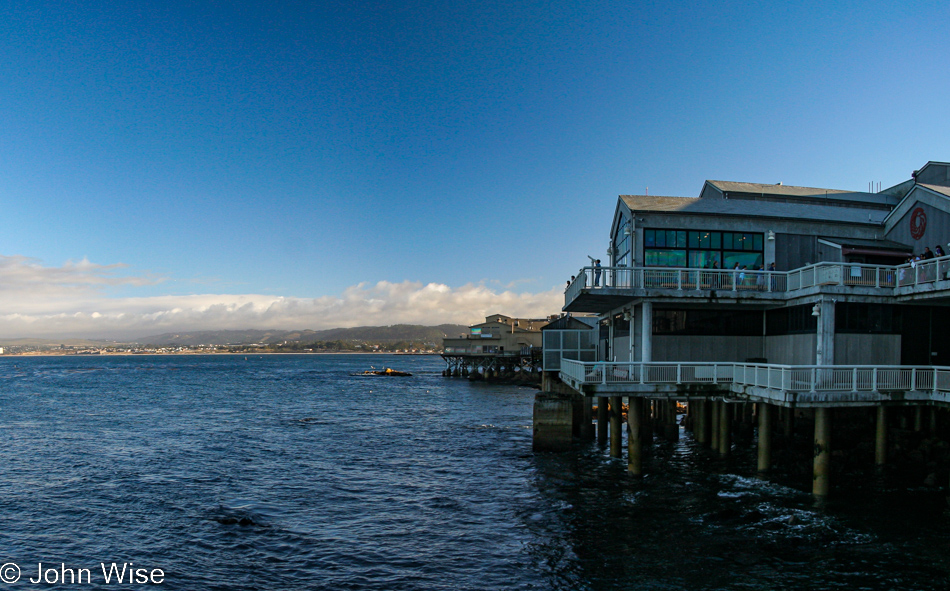
This is the view across the street from Sambo’s Restaurant at the Santa Barbara Harbor during sunrise. Wow.
Dreams, Moments, Travels
This is the view across the street from Sambo’s Restaurant at the Santa Barbara Harbor during sunrise. Wow.
Attention: These posts following our coastal Christmas-thru-New-Year’s trip are named a bit specifically, that’s because when these were originally shared, they only had one photo each due to bandwidth limitations back in the day. Since that time, I’ve updated them to include images that relate to the details of each day.
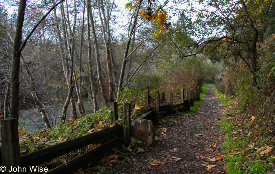
We stayed at the Glen Oaks Motel in Big Sur last night; they had a tiny little closet of a room we could rent for under $500 a night. Actually, I think we got it for about $100 which in Big Sur is unheard of. The woman who checked us in gave us this tip that in the morning we might want to consider a hike out to the Andrew Molera State Park. This is our trail in.
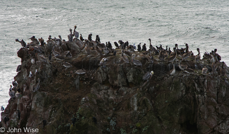
It seems like the lighting conditions were changing by the minute. Maybe I should have stuck around until the pelicans were better lit, but the commotion we could hear in the distance demanded that we keep on moving.
It’s beautiful out on this trail; I have to wonder why we’d never been here before.
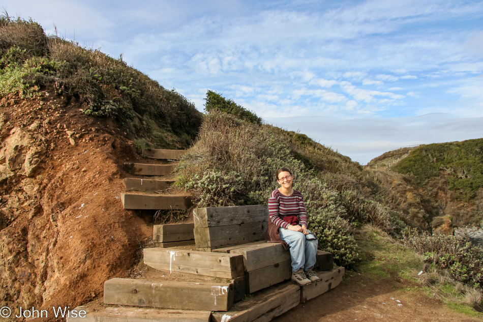
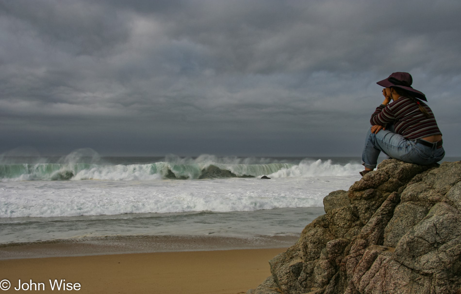
Caroline took up a seat for the show that was going on below.
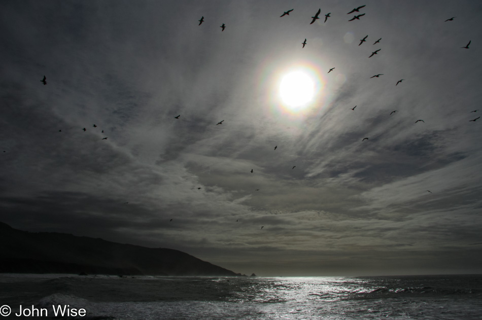
Birds were amassing and just as quickly peeling off.
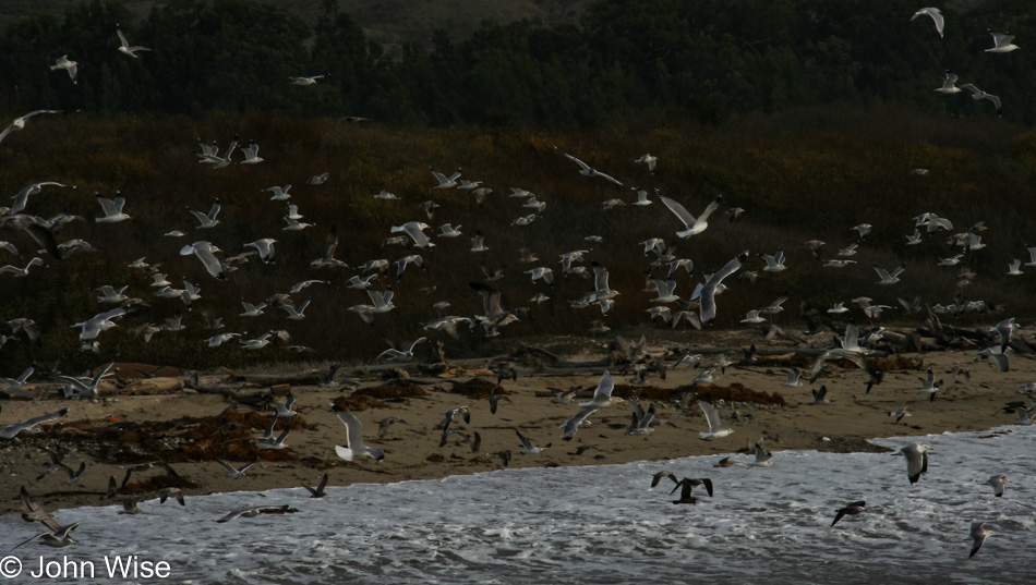
At times it looked like a tornado of birds swirling up into the sky after they took off from the water below.
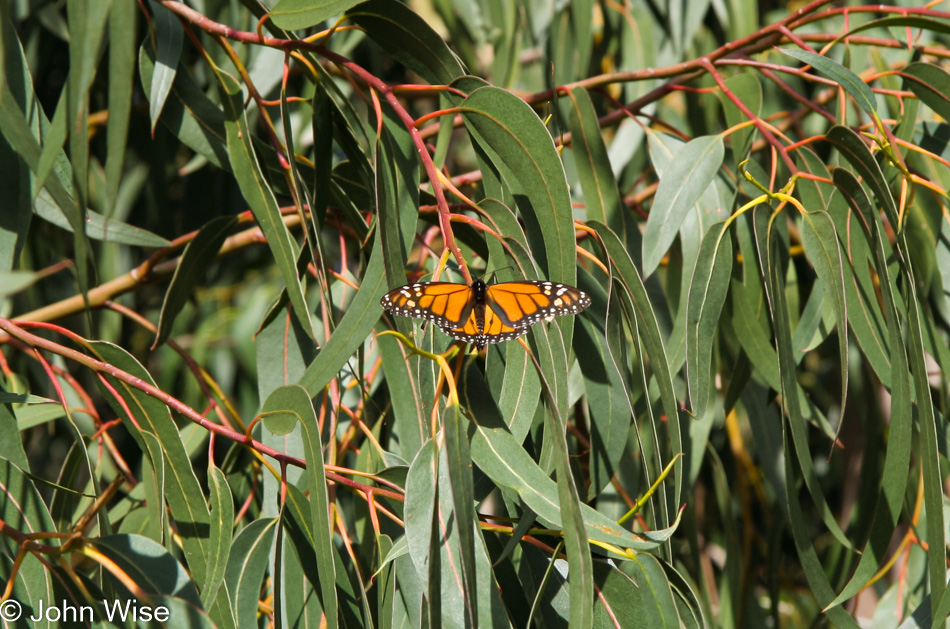
On our way into the park, we saw that we were passing thousands of Monarch Butterflies, but they were still warming up, so we figured we catch them on the way back out.
Garrapata State Park in Carmel-By-The-Sea is the kind of place in which we get easily lost as our senses are tickled from all sides.
If I told you that this might be our single favorite place along the entire California coast, it wouldn’t be too far from the truth.
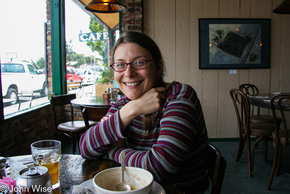
Old hippie cafe Tillie Gorts in Pacific Grove, California, is still serving up some great eating. [edit: closed in 2018]
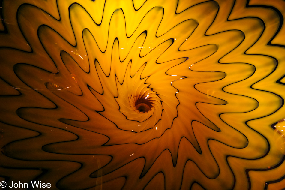
Having bought a new membership earlier this year for your whale-watching adventure, we just had to make a return visit to make sure we wrung as much value as we could from the cost. One of the membership perks for the Monterey Bay Aquarium is free entry. All we needed to do was pick up a pass, and in we went. Dale Chihuly has a number of pieces on display at the aquarium.
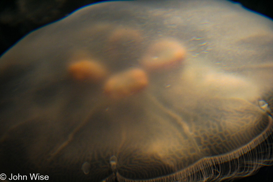
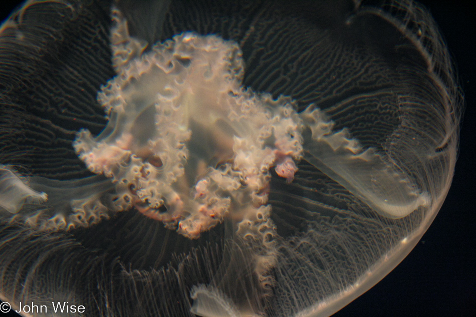
This afternoon, having the “better camera” doesn’t really work in my favor. Sure, this is a decent photo of a jellyfish, considering the poor lighting and all, but Caroline, with the older point-and-shoot, got some great results, even if they were inadvertent.
Sorry to my wife for having the copyright as John Wise on this, as it was taken by Caroline Wise; it’s just a matter of my being lazy in photo prep. I love the result she got.
I don’t typically like blurry shots, but there’s an aesthetic quality to these that struck my senses, and just had to include them with this post.
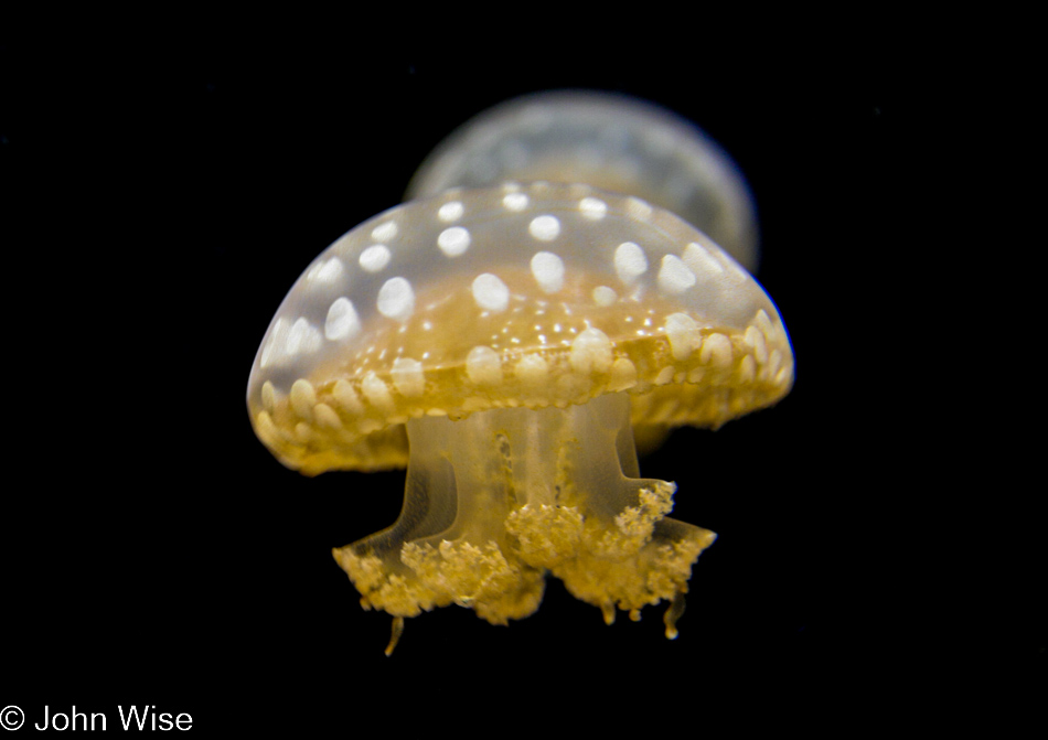
Yep, this one is from Caroline, too.
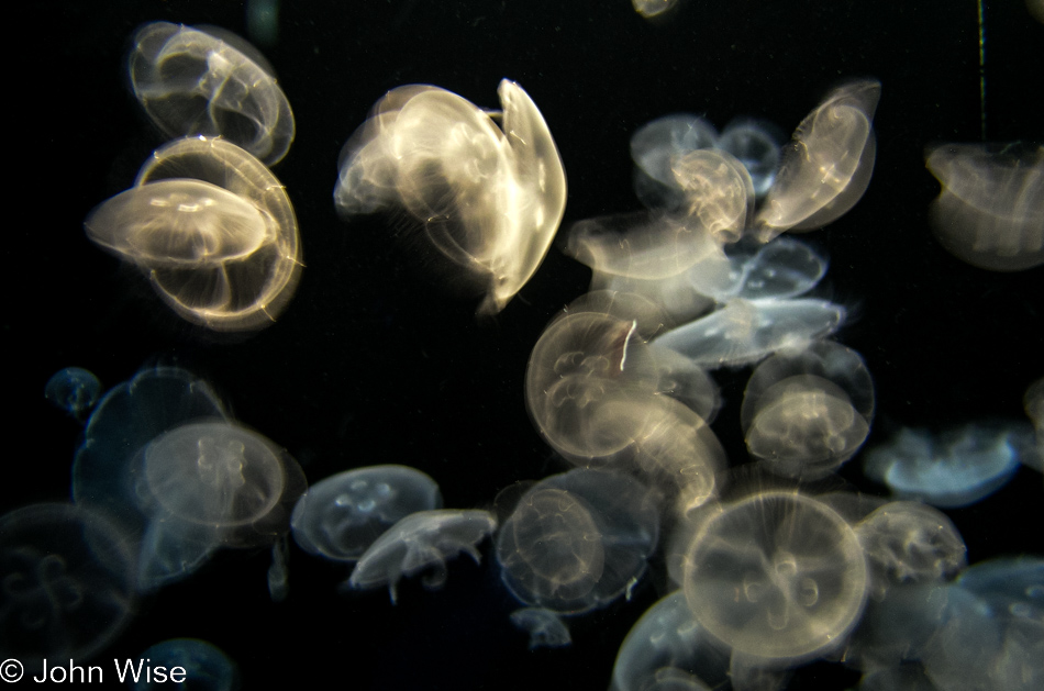
As is this. I like the nearly monochrome look.
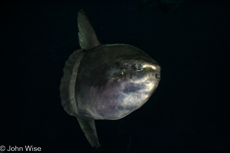
I took the photo of the sunfish catching someone else’s flash at the exact right moment. The tank we’re in front of implores visitors not to use flash but that doesn’t always work out.
Fish of any sort wouldn’t have been on the menu here at Dharma’s Restaurant in Santa Cruz, as they only serve up vegetarian fare. If you wonder if I like vegetarian food, does that look like the face of someone who doesn’t?
Attention: These posts following our coastal Christmas-thru-New-Year’s trip are named a bit specifically, that’s because when these were originally shared, they only had one photo each due to bandwidth limitations back in the day. Since that time, I’ve updated them to include images that relate to the details of each day.
We are on our way up the California coast through New Year’s, stopping for overnights in Big Sur, Santa Cruz, San Francisco for two nights, Point Reyes for two nights, and then back to Santa Barbara for a night before returning to Phoenix.
This is our third and obviously final trip on this stretch of coast this year.
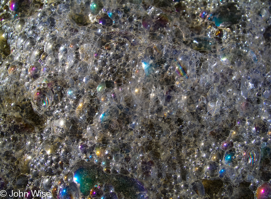
Once again, we must linger on details of the small things that exist for mere moments and are seldom seen. The bigger pictures are shared everywhere, but things such as this seem all too often to be overlooked.
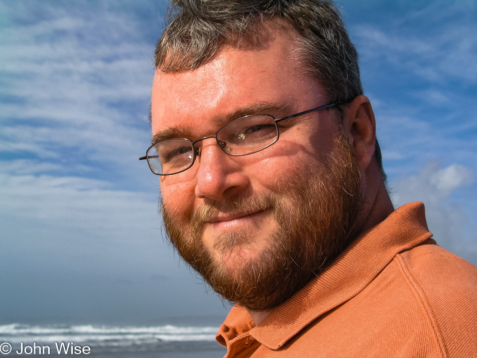
On rare occasions, I’m seriously happy about the photos Caroline snaps of me, it must be something about the way I look at her that made them turn out good in my eyes.
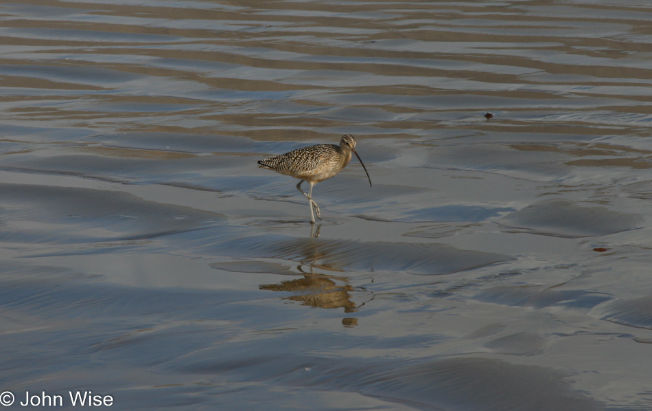
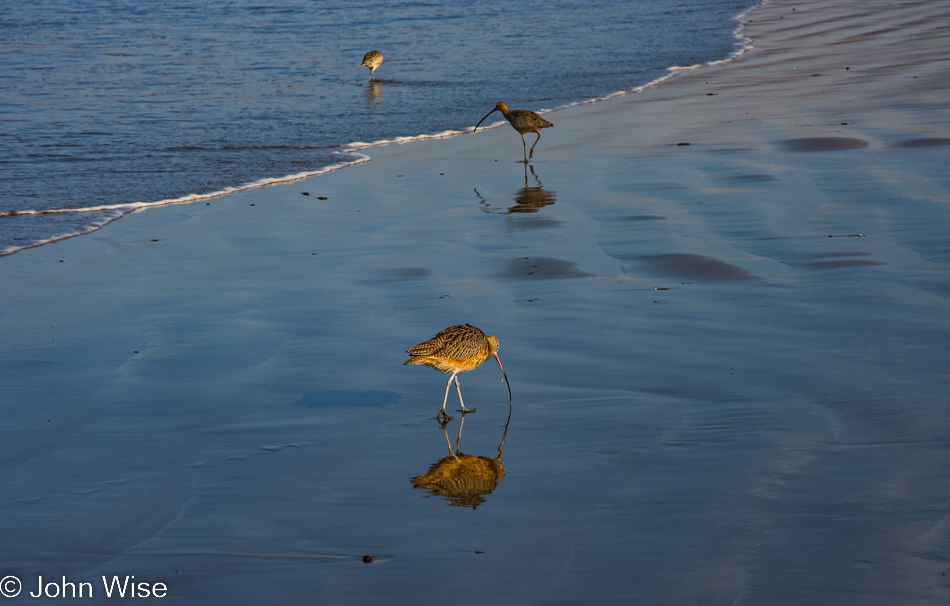
Who doesn’t love the curlew?
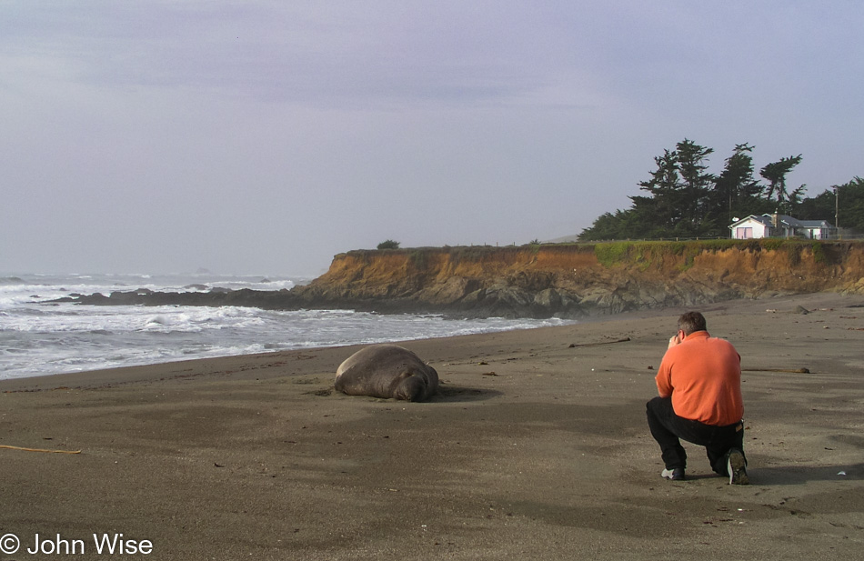
North of San Simeon at Piedras Blancas, we spotted three male elephant seals on the beach away from the main group a few miles south. Thanks to this random guy we ran into named Brad for pointing out that just a little further up the road, there was an even bigger specimen. This was Caroline’s view of me and the elephant seal, while my view is just below.
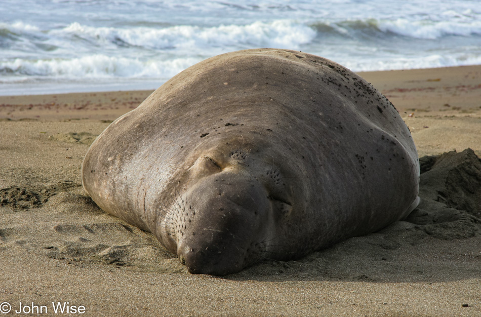
Whoa, this massive elephant seal looks…well…kind of dead, but NO, it is not dead; he opened his eyes to check me out, scratched, and went back to sleep. I guess weighing more than 2000 pounds and being able to crush me like a gnat he wasn’t much interested in my presence to pay me any attention.
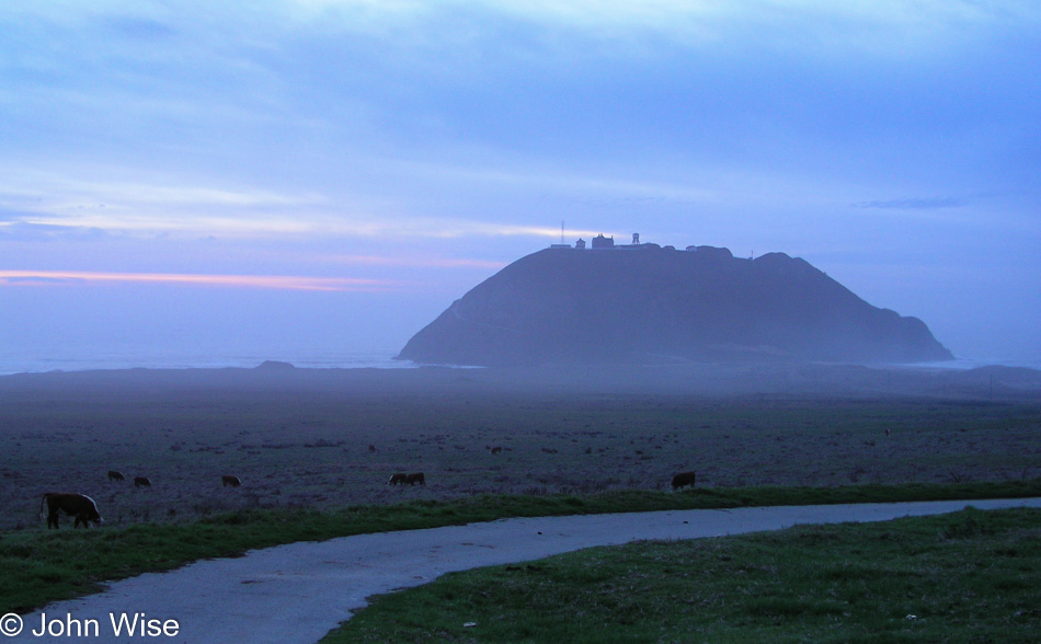
Sometime, someday, we’ll make it out here at a time when we can finally visit the lighthouse up on that rock.
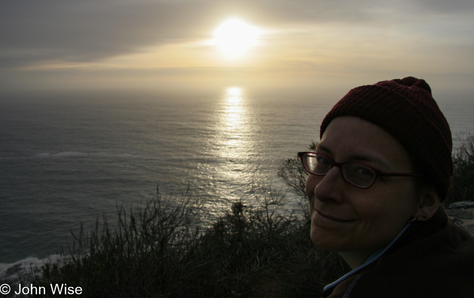
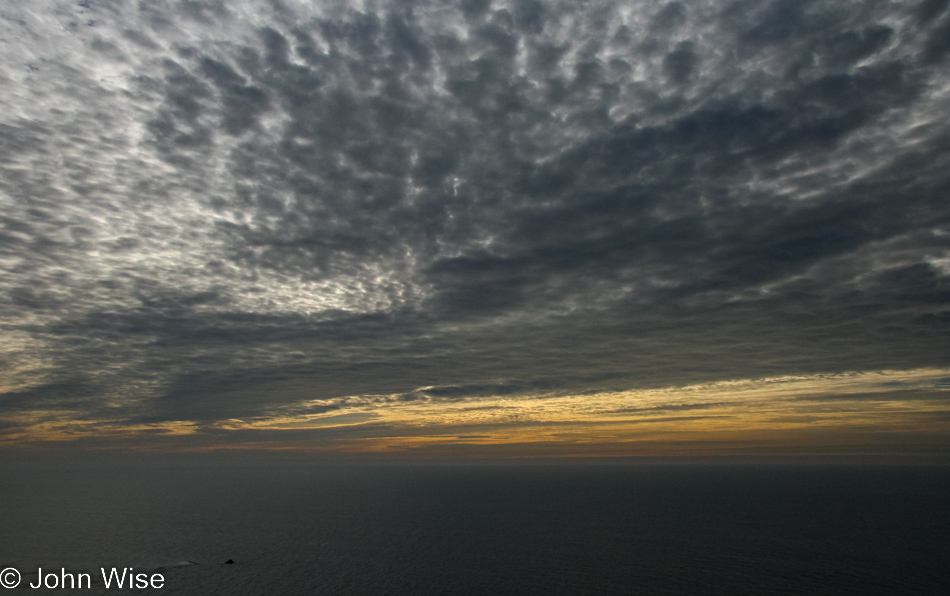
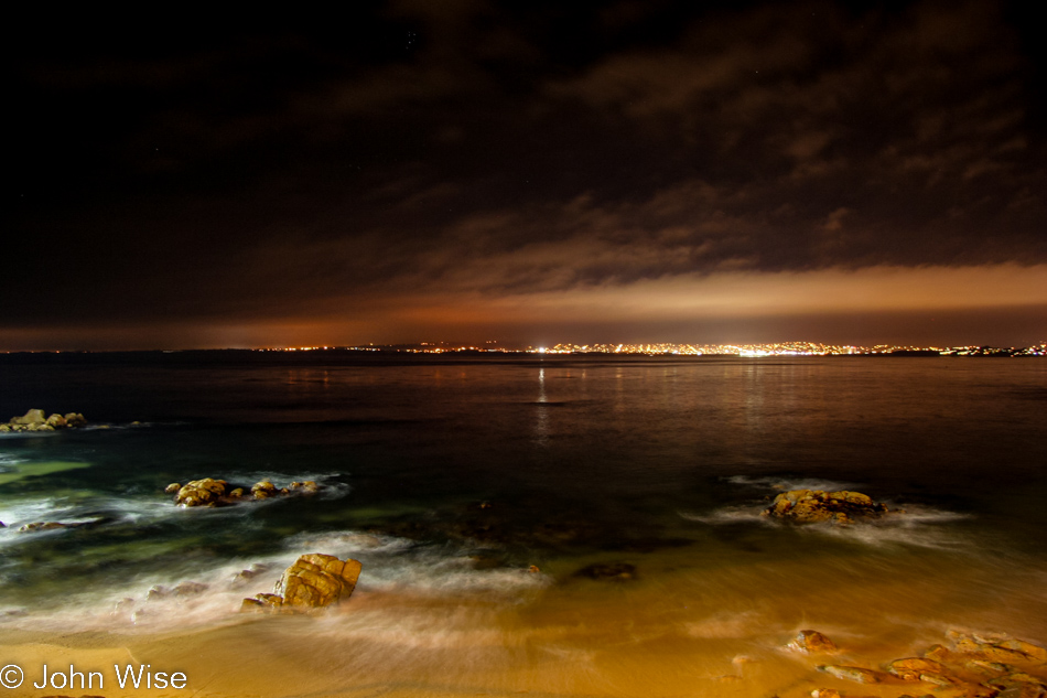
We love the sunset; we love the coast; we love one another.
This is a cheat and has been taken on one of the days I could get out to take some photos, but what the heck, it’s about the coast, and that’s where I’m at. Only, I don’t see the ocean on a daily basis, and do you really want to see the open-heart zipper scar my uncle has running down the middle of his chest? Yep, I’m still in Santa Barbara and will remain through Christmas.
Disclaimer: Back in November 2005, when I was posting about our trip up the coast, we were severely limited regarding photos I could post on the blog due to bandwidth limitations. Here in 2022, I’m updating these posts using the original image and text, but I’m adding the rest of the photos I would have liked to share 16 years ago if bandwidth and storage had not been an issue.
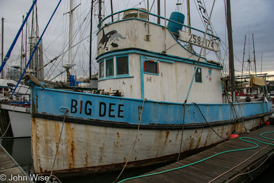
That’s right, we’re boarding the rusty old Big Dee (pun intended) for our adventure today, as this looks way more thrilling than those regular boats that hit the open sea for whale watching.
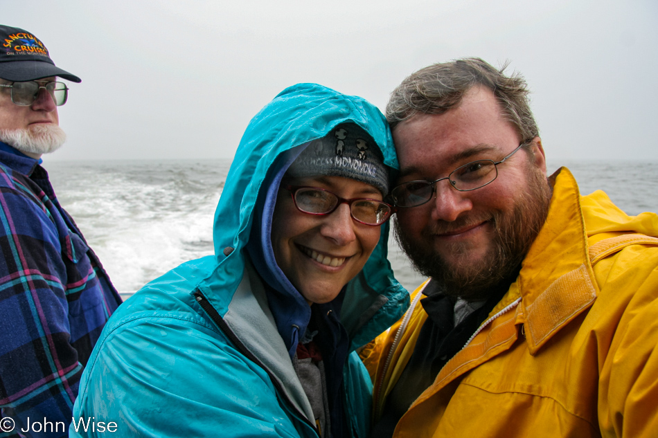
Why are people compelled to look right into the lens when they see others taking selfies? I could have cut him out, but I kind of like the creepy factor.
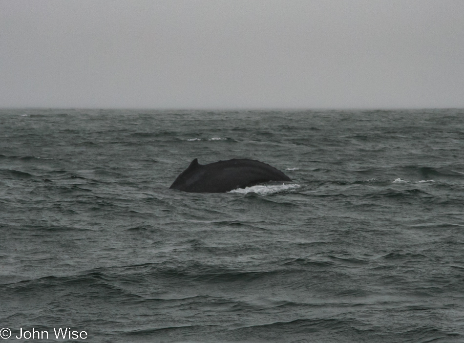
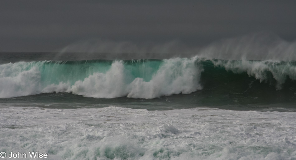
With unexpected cloudy skies that were not afraid to let off some rain, the whale watching with Sanctuary Cruises on the Monterey Bay almost failed to deliver results, and then, at the last moment – a Humpback whale.
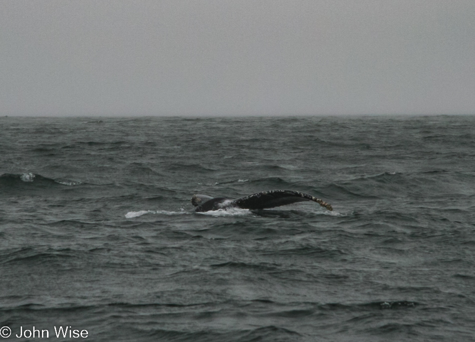
Then another.
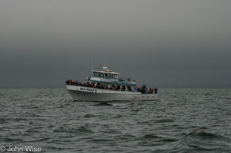
I suppose that’s what you get when you are on one of those fancy modern expensive boats; you enjoy spotting a whale right off the bow while we over here on the Big Dee just suck it.
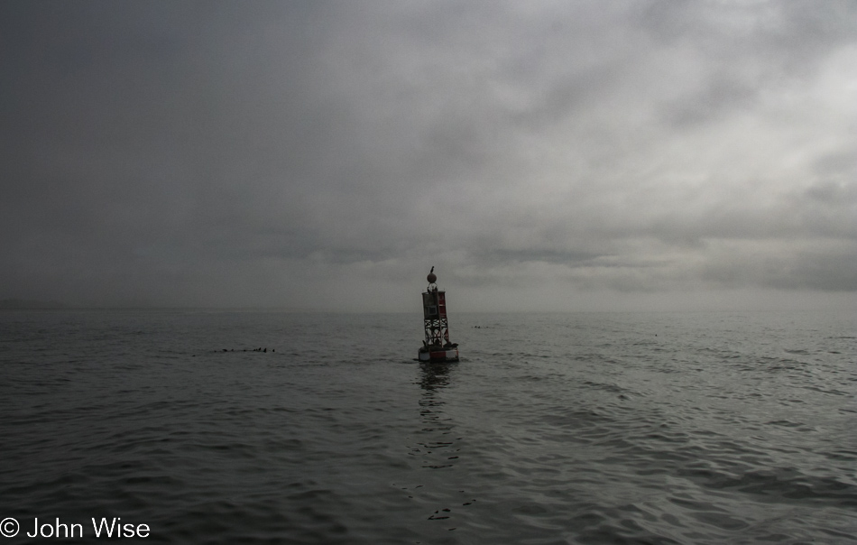
Oh well, we got this buoy with a pelican perched atop it and a number of seals riding shotgun off our bow, so there was that. Seriously though, this was another fantastic experience in the unfolding bizarre reality that is our good fortune.
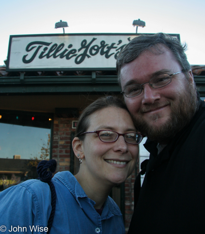
Cold and wet, we returned to the motel to dry off before heading over to Tillie Gort’s for a great vegetarian lunch.
Nothing left to do but visit the Monterey Bay Aquarium again.
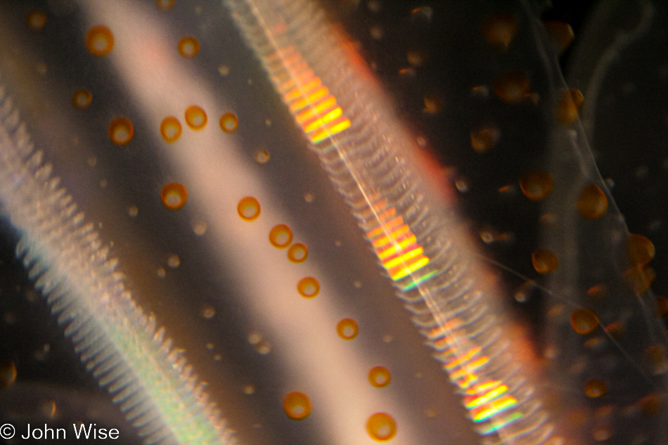
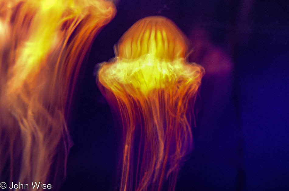
Yellow and orange pulsing lights with orange bubbles on translucent flesh, what could be more interesting?
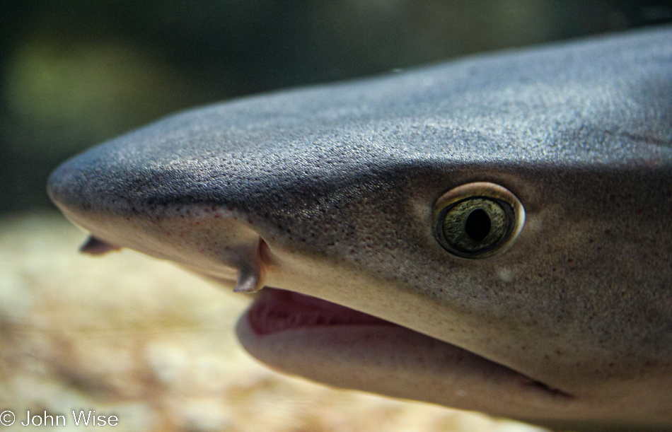
I have no idea how I snagged this photo of a shark; they’ve proven difficult time and again to capture.
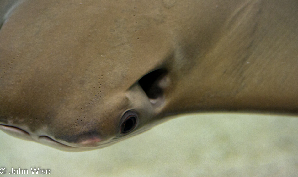
Somehow, I missed in my biology lessons (did I even have any?) that rays and not only sharks have these pores on their heads that signify their ampullae of Lorenzini.
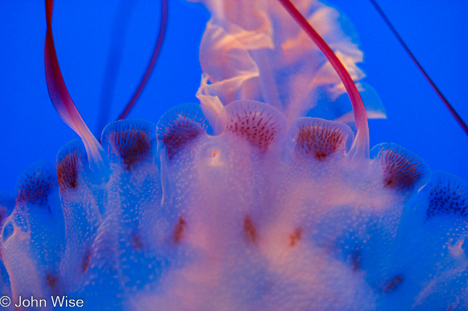
Fun facts, jellyfish are some of the oldest animals on earth. There are species that grow tentacles longer than 100 feet, while others can grow as large as 400 pounds.
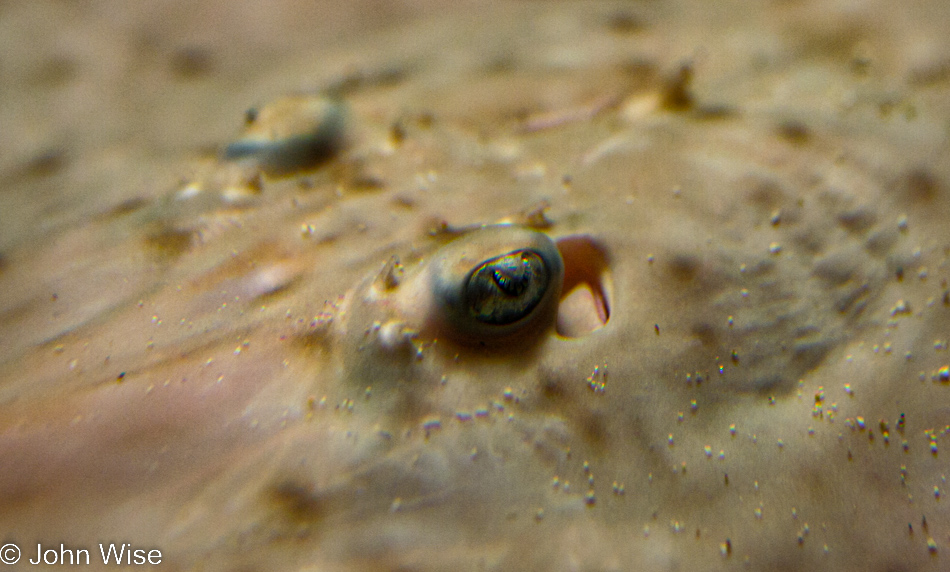
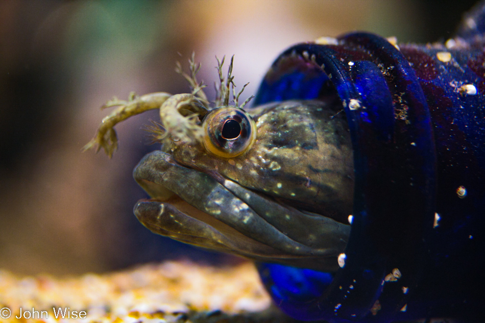
How do you see your world living down on the bottom of the sea, half-embedded in the sand with those peculiar eyes watching things overhead?
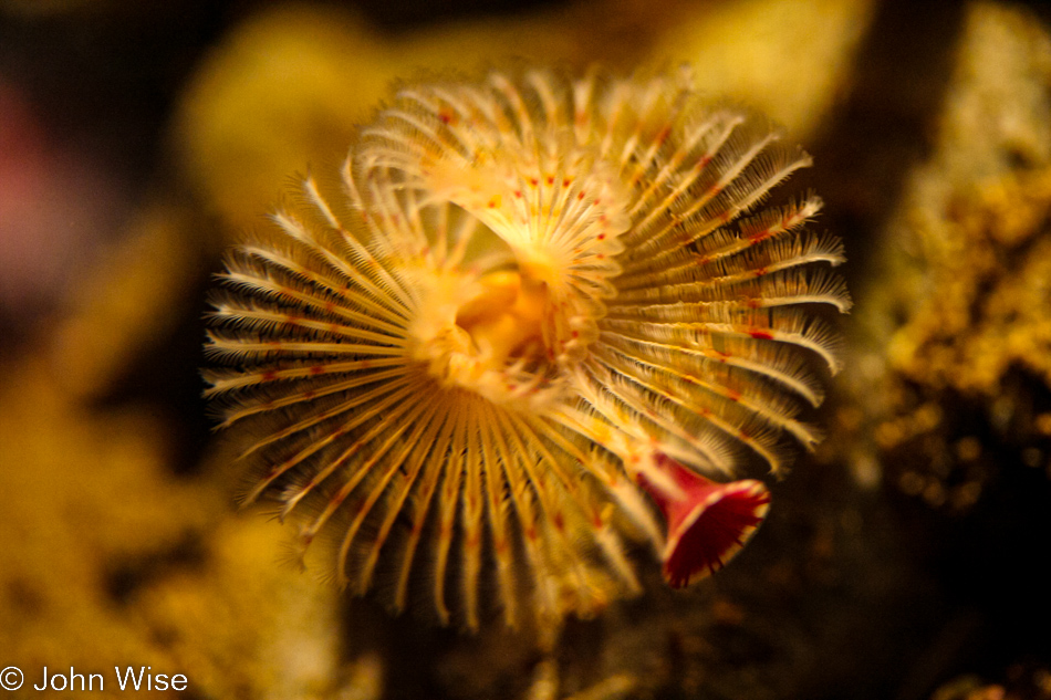
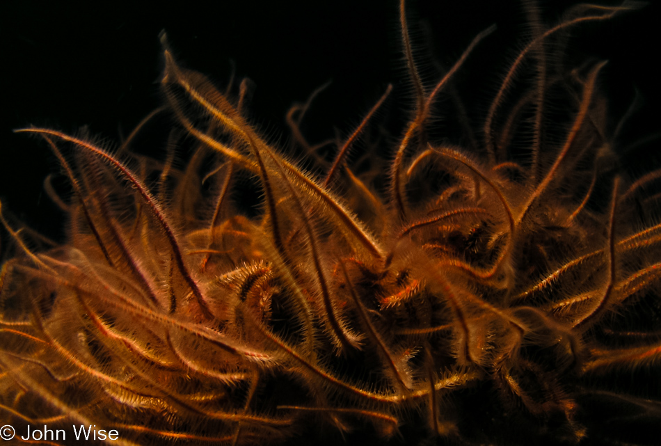
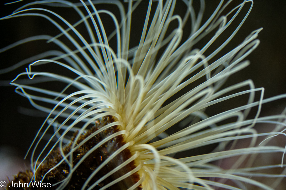
I guess we can assume that this is a filter feeder with the hairs capturing food flowing by.
I could have made my life easier with this post by limiting the number of photos, but then I’d have just left many of those that struck me languishing on my hard drive, never to be seen.
Prior to updating this post, it was this fish in a bottle that represented the day for more than 15 years. Looking at it now, I’d still say it’s my favorite from the day if I could only choose one.
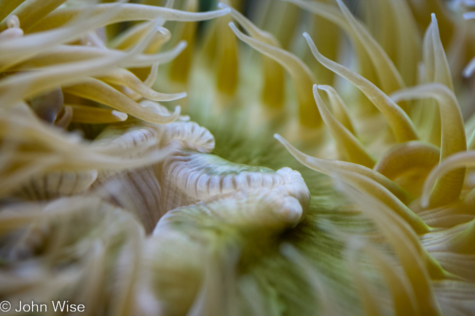
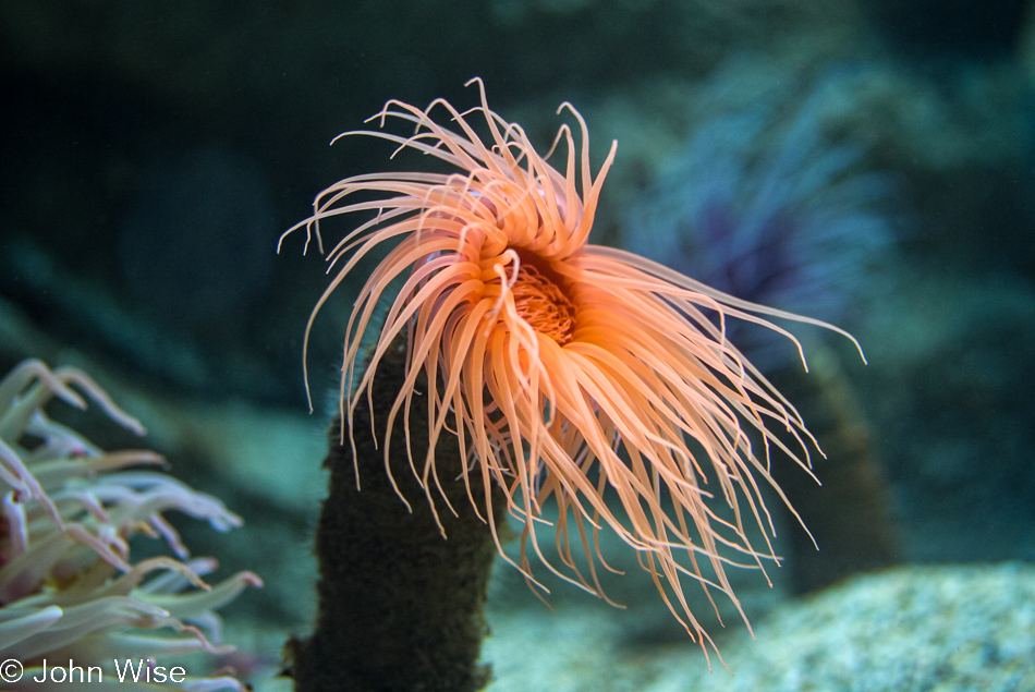
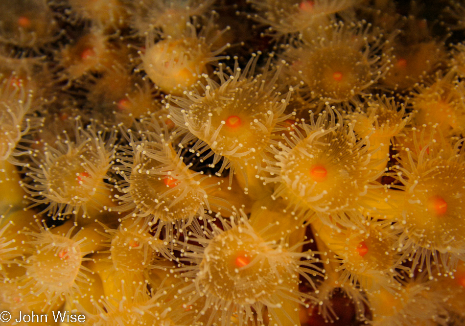
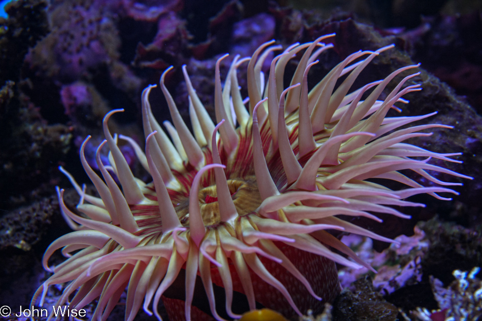
No matter what we humans think we know, no matter the invention, we will never know what the life of an anemone is like. I know that some might argue they do not have a life per se and simply exist, but those arms are grown as a response to food availability, and while I can almost understand the genetics behind that, I cannot fathom what it might be like to have dozens of physical sensors that can work in concert to direct food to where it needs to go if the thing is 100% mindless.
If we could genetically engineer a new and improved self, I’d opt for anemone hair.
And with this, the aquarium was closing, but no worries! Since we are new members, we’ll be right back again tomorrow.
Disclaimer: Back in November 2005, when I was posting about our trip up the coast, we were severely limited regarding photos I could post on the blog due to bandwidth limitations. Here in 2022, I’m updating these posts using the original image and text, but I’m adding the rest of the photos I would have liked to share 16 years ago if bandwidth and storage had not been an issue.
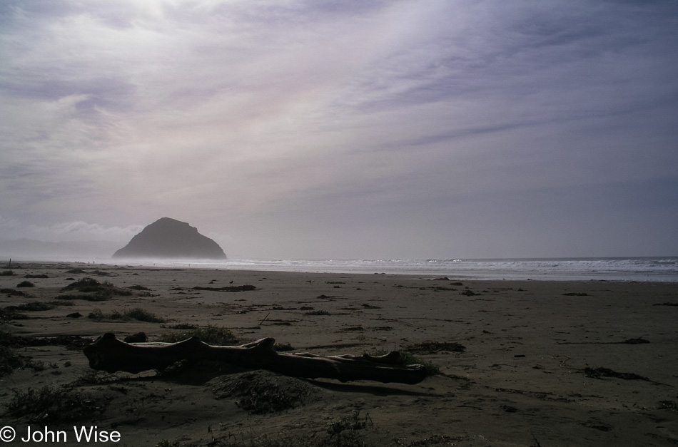
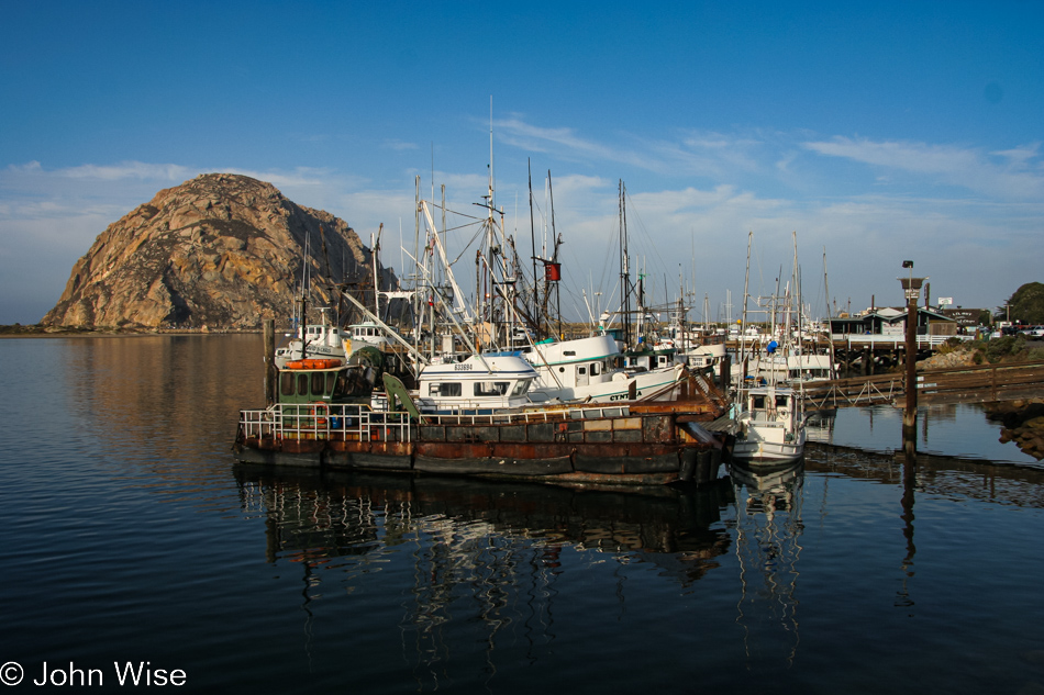
Thanksgiving. Today, we were on the slow boat to China, I mean Monterey Bay Aquarium. Left early with fog still hugging the hills, but that burned off quickly. Our first stop of many to come was here at Morro Bay.
The fishing boats were quiet on this holiday, but the shorebirds kept busy squawking at each other. Bayside, we stood and watched seals who watched back; we also saw sea otters eating and listened to them as they tried to crack open shells with rocks.
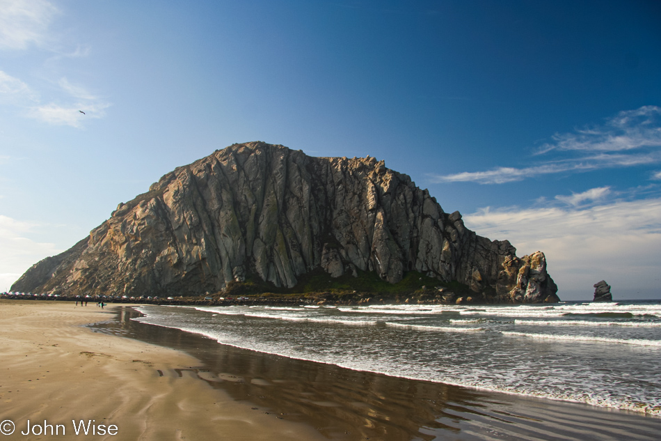
Beachside, we walked along the shore and could have possibly been happy staying right here for the rest of the day.
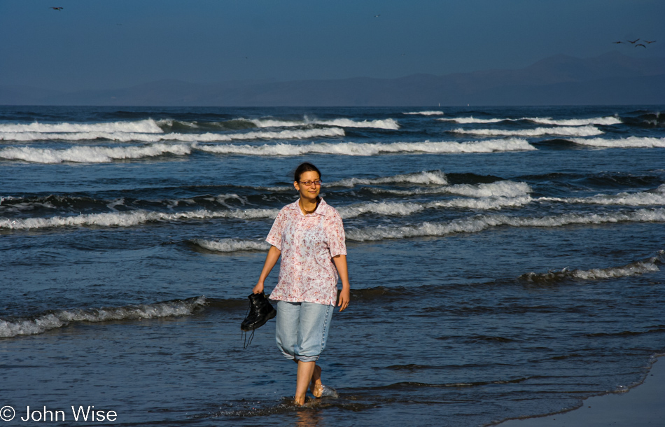
Where Caroline finds the fortitude to walk in the late November waters of the Central Coast is beyond me. Maybe you think I should do her the favor and carry those boots? Well, then, who would take the photos?
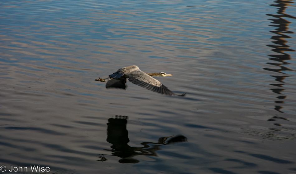
A heron, some pelicans, along with many a seagull, were taking care of morning business.
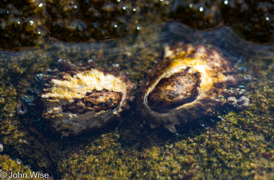
That’s barnacle mom on the left and barnacle dad on the right, and if you look close you’ll see a couple of baby barnacles.
It’s nice that when the ocean makes trash it will biodegrade or become food for other species and contribute to the health of our planet.
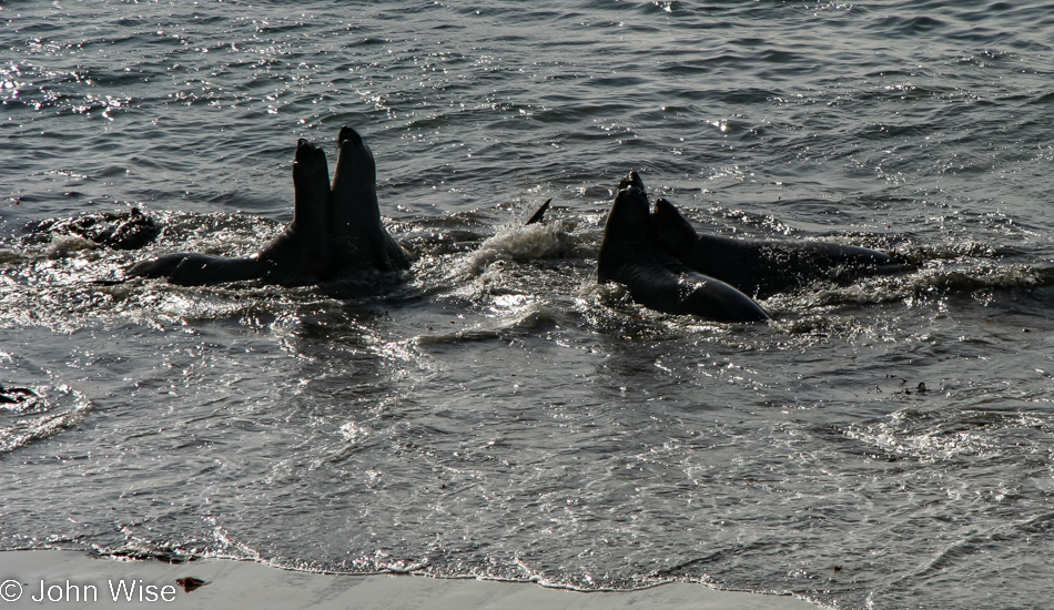
Juvenile male elephant seals practicing for what will one day become serious combat and bloodletting.
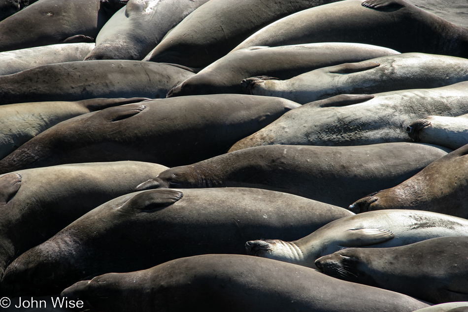
Meanwhile, the females (obviously the smarter side of the species) lie around in the sun, toss sand on their sides, scratch their noses, grunt, and fart.
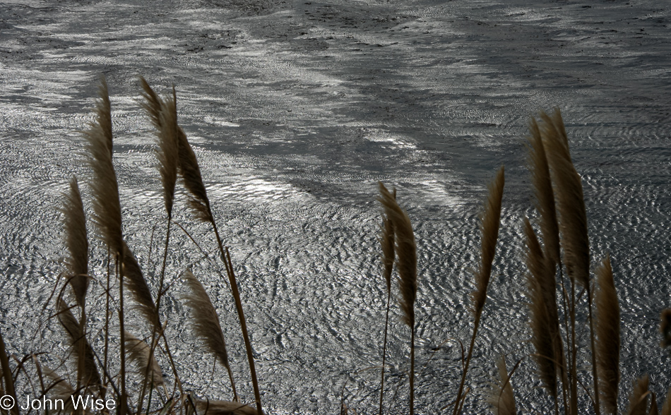
We’ll never tire of pampas grass, and while it’s invasive, it sure looks beautiful to us as it graces the cliffside of the Big Sur coast.
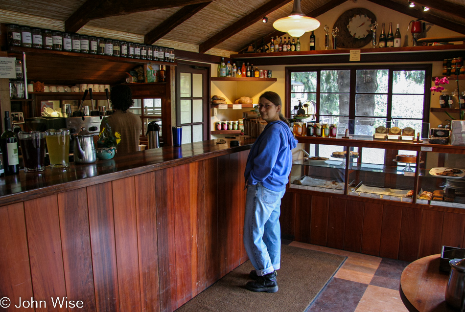
You might glean from the number of baked goods in the case here at the Big Sur Bakery that it’s rather late in the day; just look up at the clock it’s already 2:10 in the afternoon. They could have crumbs left, and still, they’d be the best crumbs anywhere.
Where we’re going, clouds mean nothing.
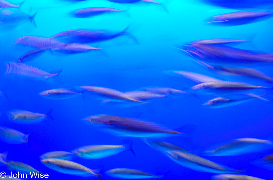
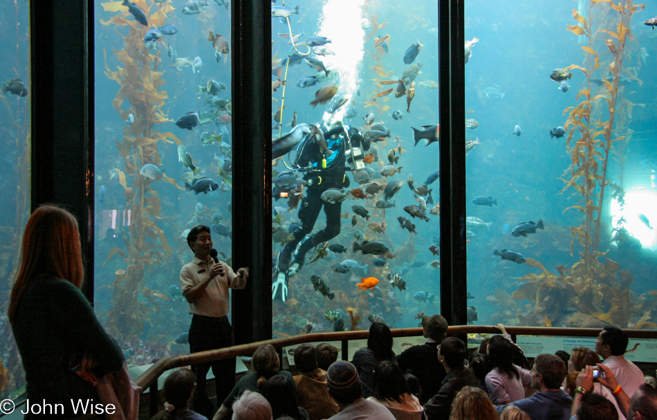
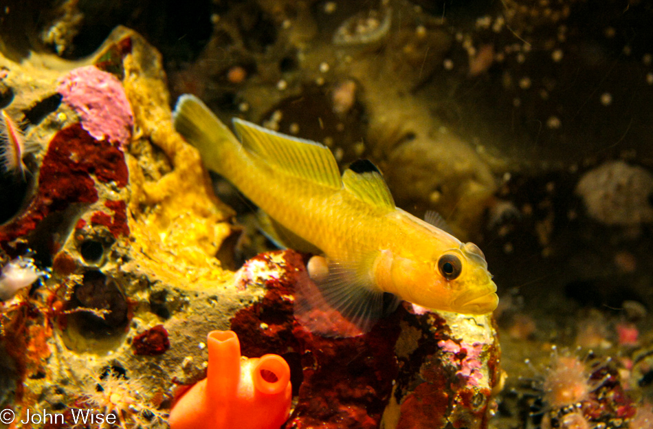
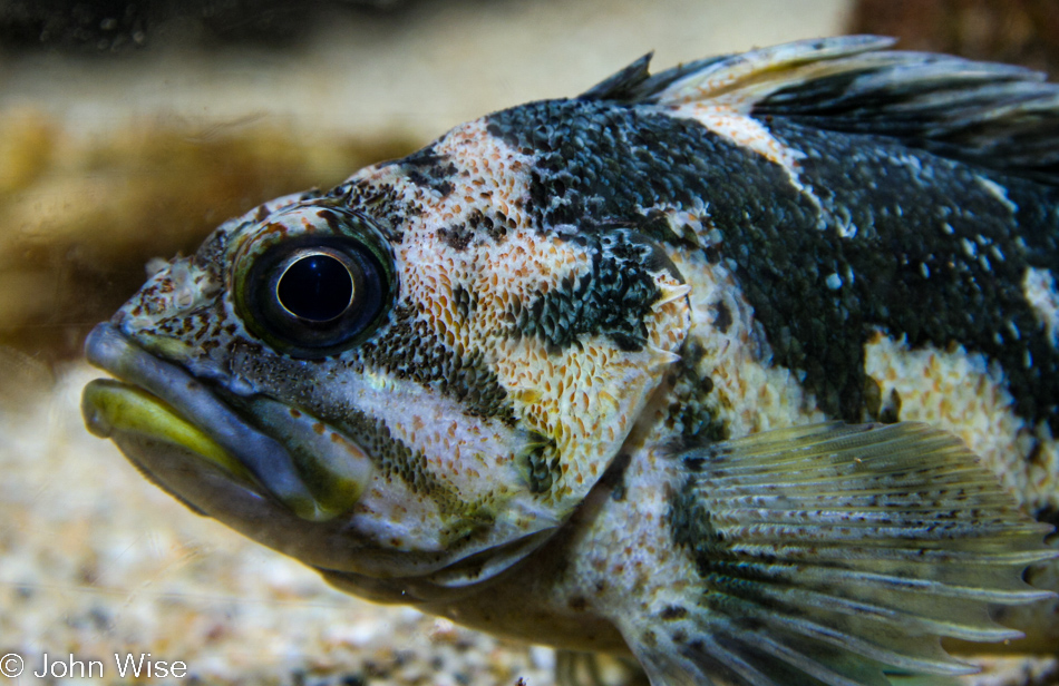
Inside Monterey Bay Aquarium, where life is perfect and everything is beautiful.
I’d have a fish tank at home if it could support such things.
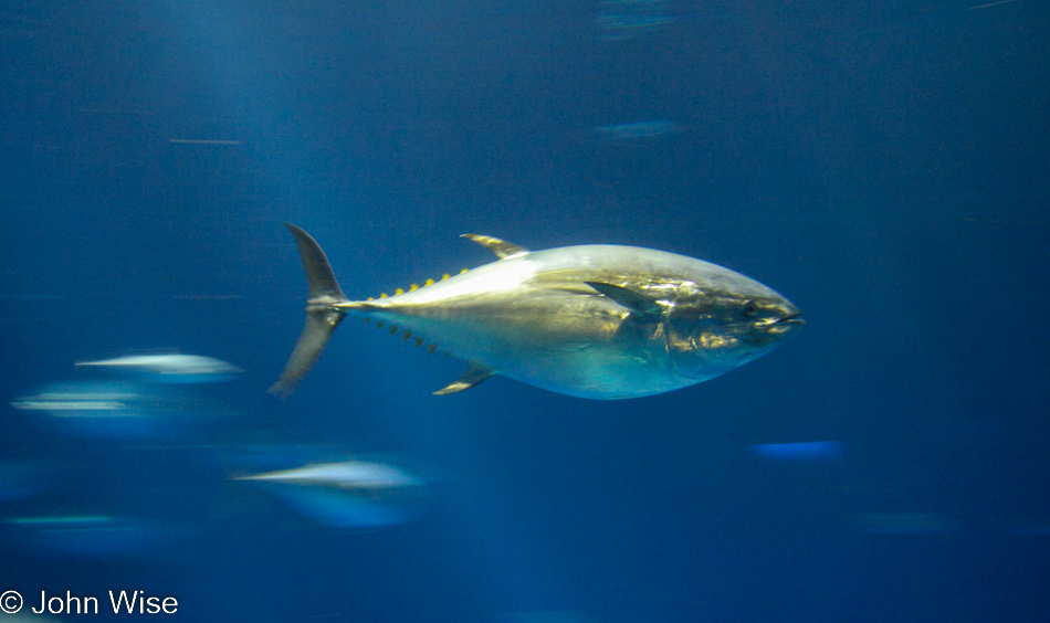
Well, not these things: yellowfin tuna can hit speeds of 30 miles per hour and can weigh over 400 pounds; that sounds like a weapon to me.

Okay, so I wouldn’t want these in my tank at home, as I can only imagine having to jump in and detangle them from time to time.
And just look at the get-up you need to clean one of these tanks; this is why we come to the aquarium instead of trying to bring the aquarium home.
Sure, having these little fish would be easier, and while I don’t mean to slight its stature, it does look a bit common. Yeah, I know; I can just hear the Angelena Jolie fans saying, “But look at its lips!”
Some people prefer candies; we prefer sweets for the eyes.

Not finding the sweet in this guy; there’s something about horns that spells danger.
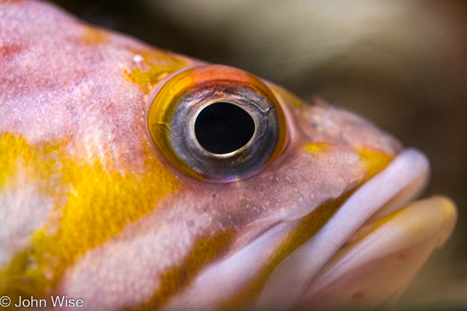
I can’t believe how psychedelic the fish world can be while we idiots on land try sanitizing our world into blunt conformity.
I’d bet a dollar that this fish is thinking, “What an asshole you are on the other side of this glass where due to your envy of our world, you have imprisoned me and my kind, forcing us to swim in endless circles eating the same crap pre-cut fish that gets boring. How would you like to live in some 1,000-square-foot space and eat McDonald’s every day?”
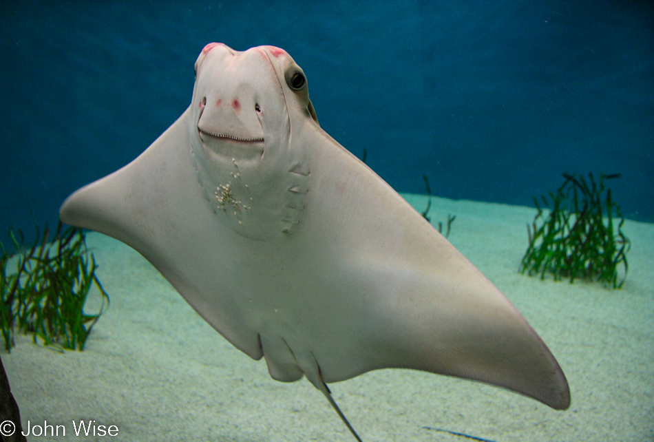
I think this ray is making fun of me by sticking sand to his chin as he comes over to the window, pretending to be the fat bearded guy trying to take these National Geographic-quality images.
Since it was after 3:30 when we arrived we didn’t have much time in the aquarium tonight, but any time at all is wonderful for us.
If only we could bypass the motel for one night and just wander along the coast or, even better, play night security guard in the aquarium.