Dry Tortugas

Caroline Elizabeth Wise in Key West, Florida

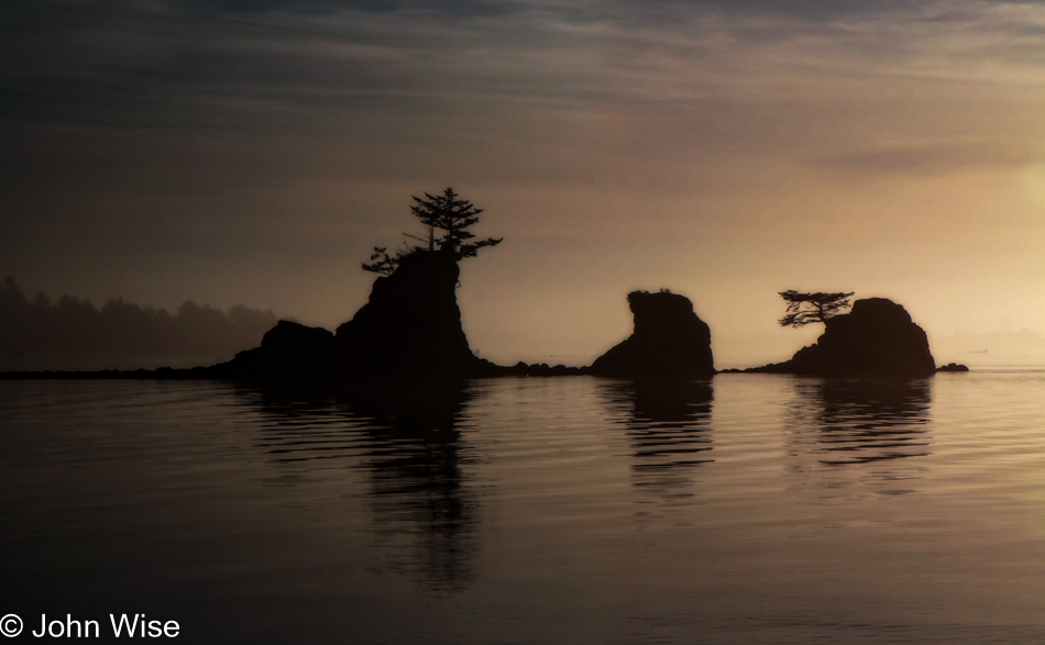
Disclaimer: This post is one of those that ended up being (partly) written years after the experience was had. While there were a few paragraphs posted way back then with a small number of photos, there were no other notes taken, so most of what is shared here must be extracted from the images and what memories they may have lent us.

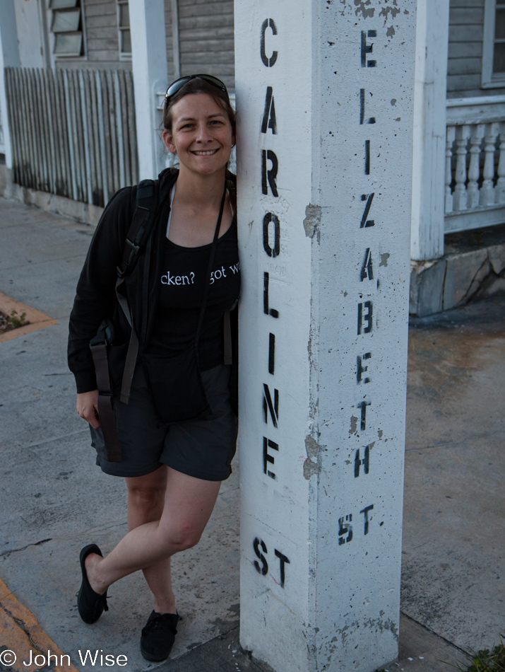
After a comfy sleep and an early morning alarm at the Banana Bay Resort in Key West, we were quick to get ready for a speedy exit out the door for breakfast to get our day underway. Denny’s was about our only option, and lucky for us the one and only Starbucks down here in Key West opens at 6:30. For those of you who don’t know, Elizabeth is Caroline’s middle name.

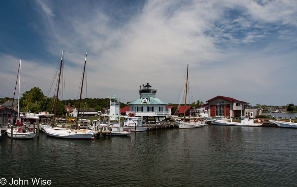
Check-in is at 7:00 with Sunny Days for our Fast Cat transport out to the Dry Tortugas National Park. Don’t worry, tourists desiring a day trip to the island, the normal line-up is 8:00 while this earlier time is for campers.

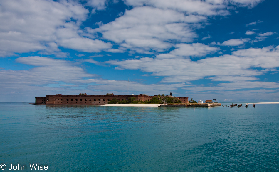
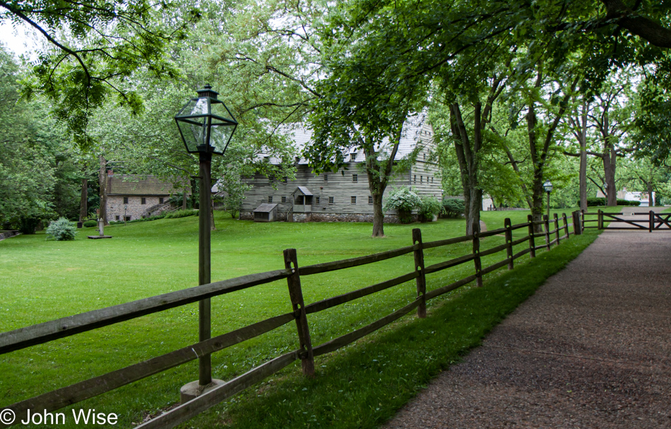
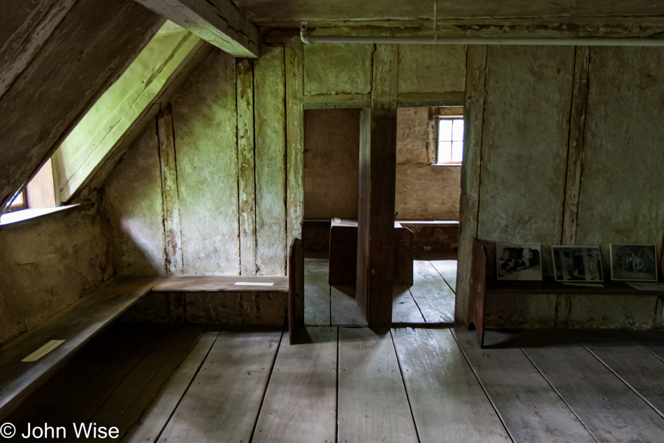
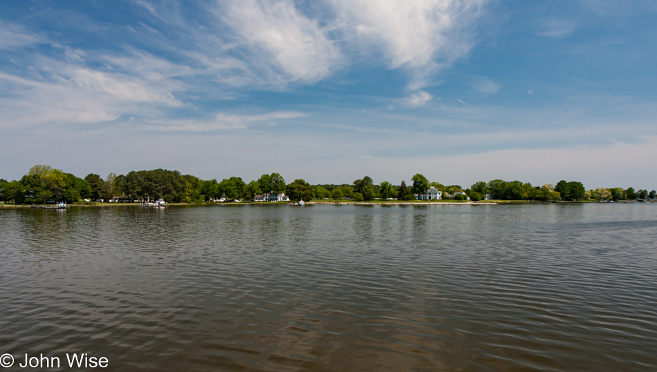
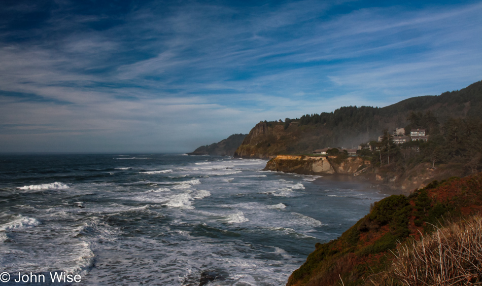
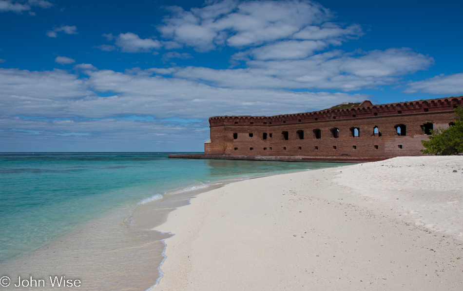
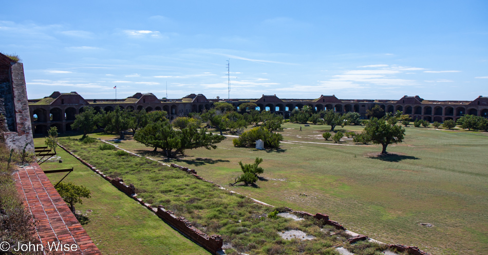
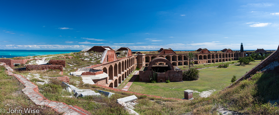
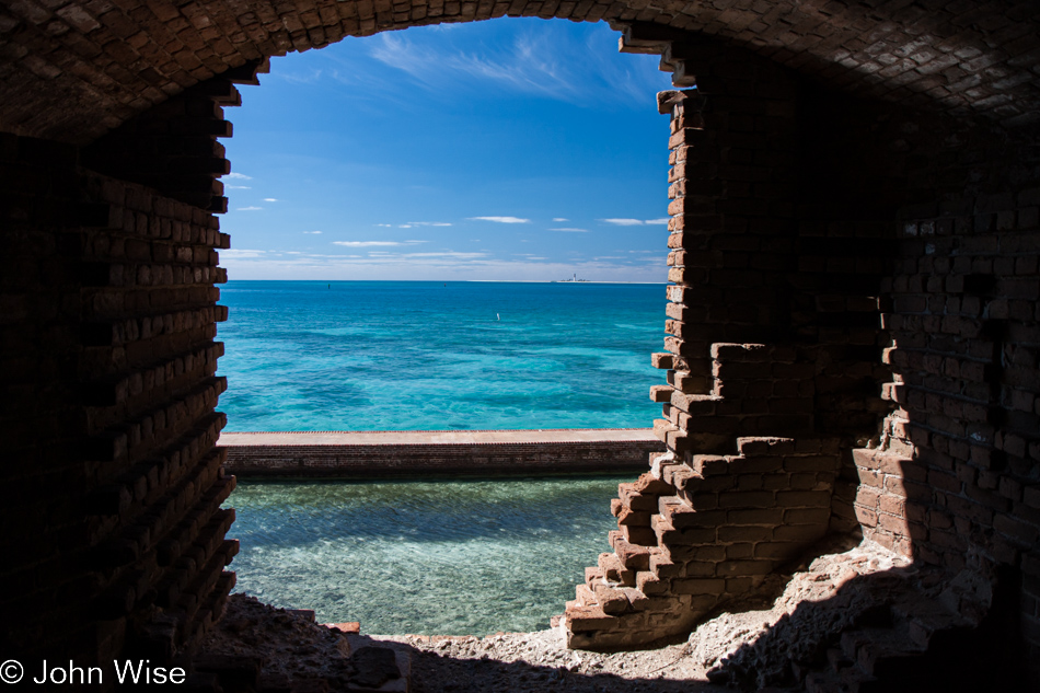
Fort Jefferson on Garden Key is the main attraction here in the Dry Tortugas National Park. This remote island is a mere 16 acres in size. As we approached, the fort appeared to sit right on the water.

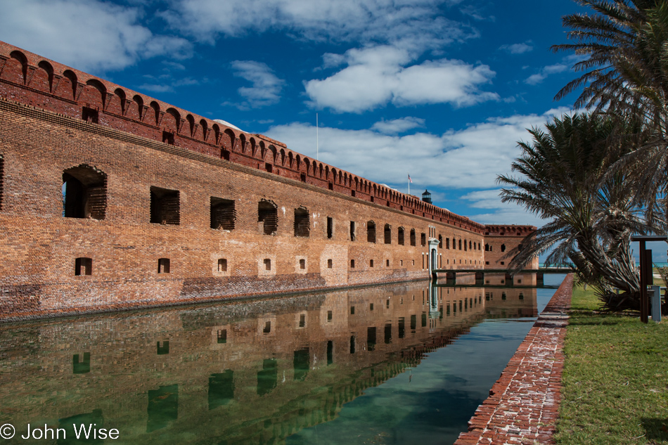
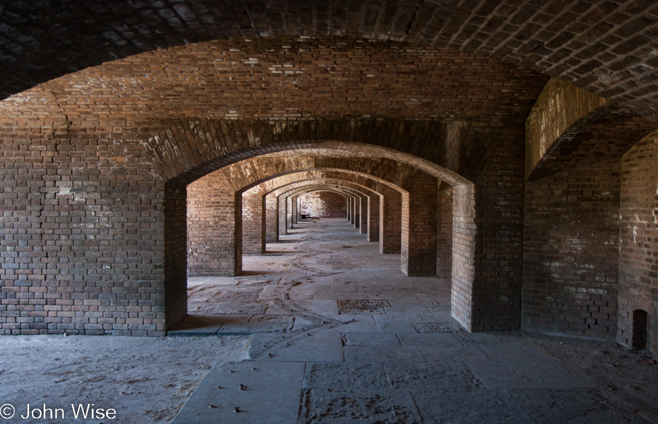
A low wall rings this all-brick structure, building a moat along its six sides. Construction of the fort began in 1846, but with its remoteness, lack of fresh water, and frequent hurricanes, the fort was only half-finished by 1860. The buildings were turned into a prison until the mid-1870s, and later, the place served as a refueling station until it fell out of use for the most part.

While the majority of visitors were on a tour of the main building, Caroline and I set up our tent at camping site number 5 with an incredible western view of the ocean, perfect for watching the sunset.

After a slow, quiet walk around the sea wall, it was nearly lunchtime aboard the catamaran that brought us out here. Many of the seventy or so other passengers now went snorkeling while Caroline and I had the fort to ourselves.

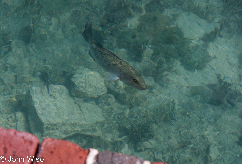
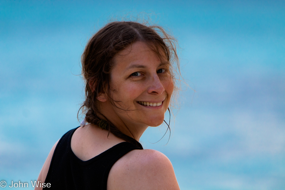
The welcoming committee.

This is the point in my updated post where the writing jumps forward to 2022; there are more original notes below that were posted in 2009, but first, an update about our good fortune to have been here in 2009. We arrived at the Dry Tortugas a year before Instagram launched and started its march towards ruining many beautiful places on earth, and apparently, the Dry Tortugas is one of those places that has found a kind of popularity that neither Caroline nor I would enjoy today. You see, if you want to camp on this island today, you’ll be lucky to find a reservation a year out. That means that every single day of the year, every campsite is taken.

Below I write about a group site taken by fishermen while we were here; they arrived with their own boat a day before us and were out on the sea until just after we tucked into our tent, so it was like they weren’t even here. The other small group I referenced was just a few people at one of the other sites. We felt really alone out here, and I think that sense might be gone now.

If there were to be a regret, it might be that we didn’t understand how much we enjoyed kayaking and that we would have benefited from having a couple of them with us, along with another night out here so we could have paddled over to Loggerhead Key to visit the lighthouse and simply indulge in more of the solitude we experienced in such a remote place.

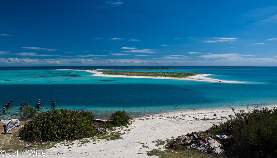
A nearby bird sanctuary was off-limits to visitors. When I wrote this previous sentence in 2009, I said, “…is off-limits,” which I now changed to was off-limits as the channel between Garden Key, where we are, and Bush Key across the way, which is currently connected.

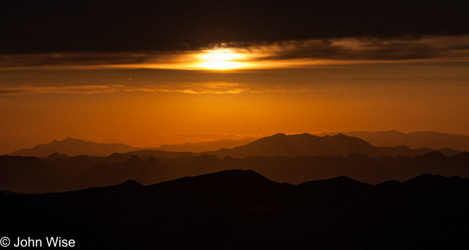
What a scary place this would have been to be stationed when tropical storms or hurricanes whipped through the area 100 years ago, but today, it’s blue skies and calm ocean for as far as the eye can see.

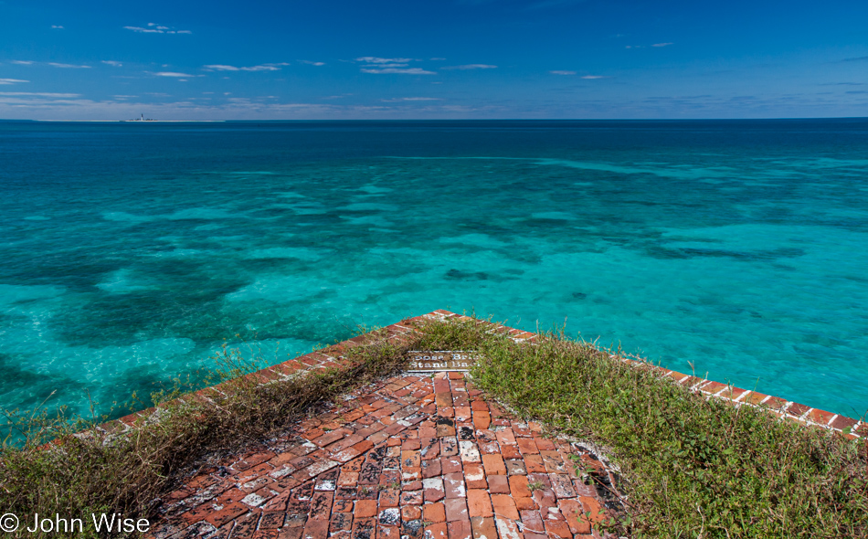
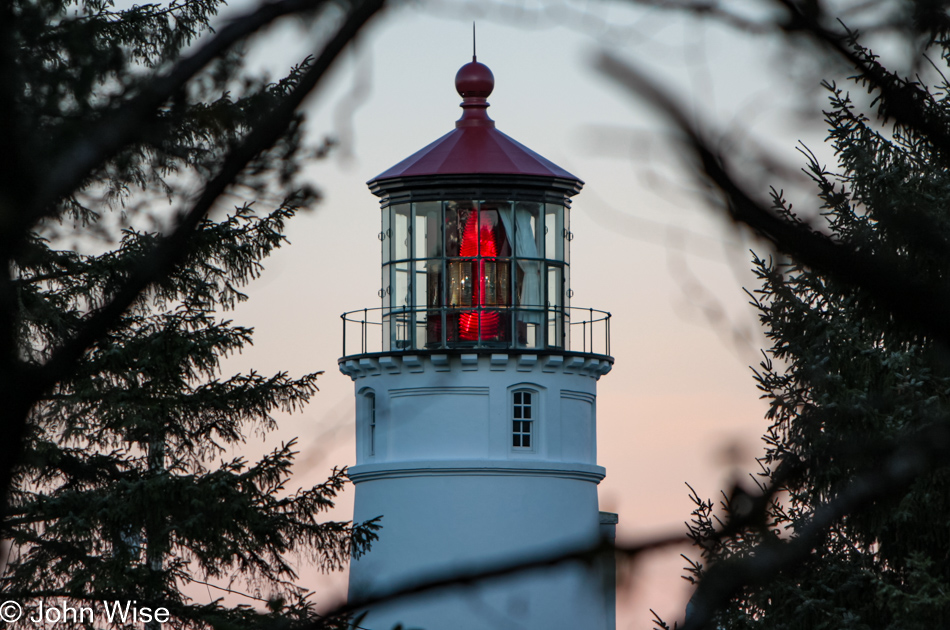
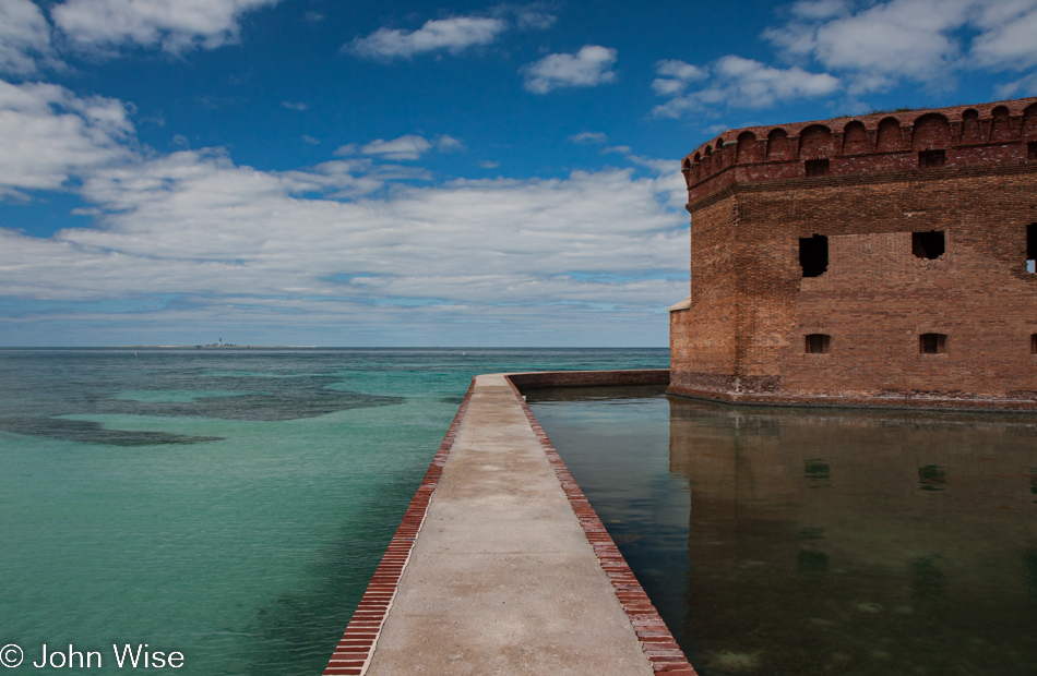
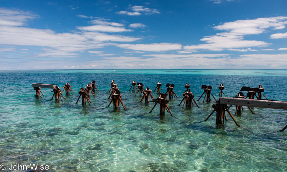
While almost impossible to see, to the left on the horizon is the Loggerhead Lighthouse.

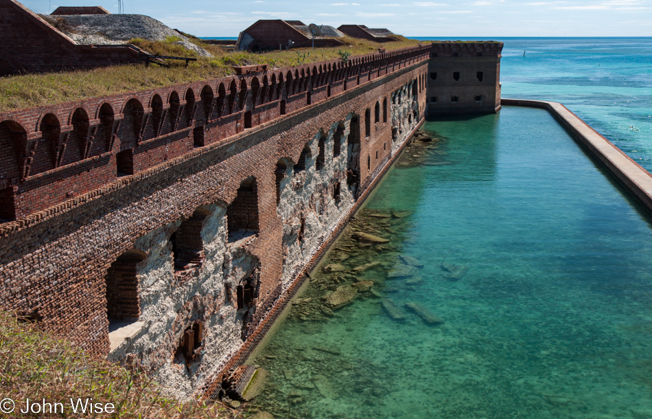
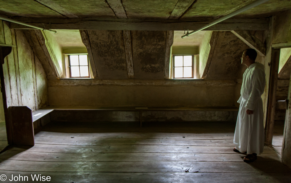
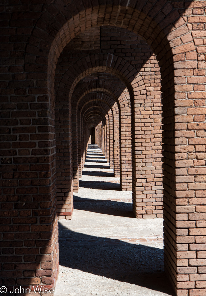
Storm damage is taking its toll, and while there are signs that some things are being repaired, it’s easy to get the idea that others are being allowed to continue falling into decay.

It’s obvious that a single day will never be enough to explore everything here.

By the way, this is the largest brick structure in our hemisphere and is constructed from more than 16 million bricks.

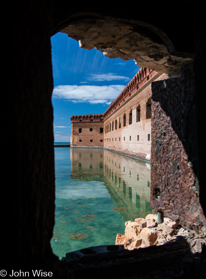
This is not a deserted island either as there are at least a few people that live here who work for the National Park Service. Had there been a way to see how the old brick rooms were being used as apartments, we would have jumped at the chance; the quiet inside of them at night must be astonishing.

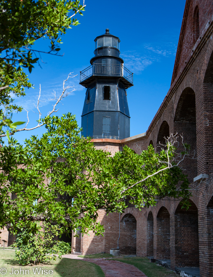
This old lighthouse predates the fort and was erected here back in 1825, while construction of the fort began in 1846. To let you in on a secret, we might have been so lucky to get a tour on the low-down of this old lighthouse later in the evening but I won’t swear to that as they are not allowed, just saying.

It wasn’t long before 2:30 p.m. rolled around, and the day visitors were leaving the island. There was a small group of campers who set up near us while the group campground had a few tents already set up but the fishermen who were staying in those were out for a day of fishing.

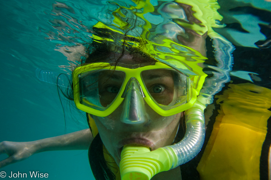
With no one else in sight, we grabbed our snorkel gear and jumped into the warm Gulf of Mexico waters.

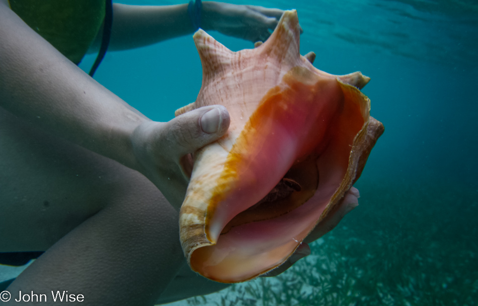
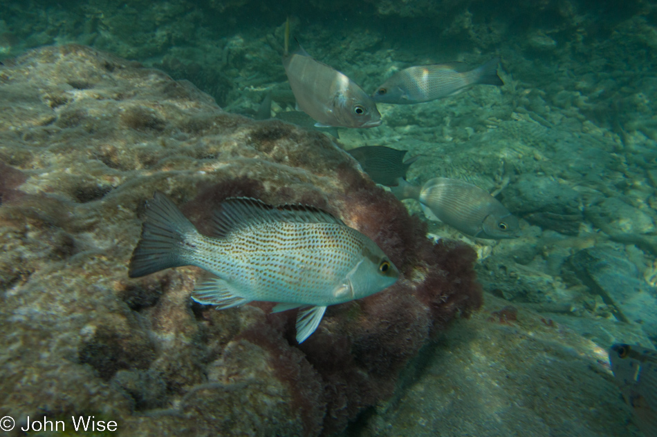
We had the clear waters of the Dry Tortugas all to ourselves. Over corals and past jellyfish, we floated along the perimeter wall inspecting conch, sea urchins, parrot fish, and dozens of other fish varieties.

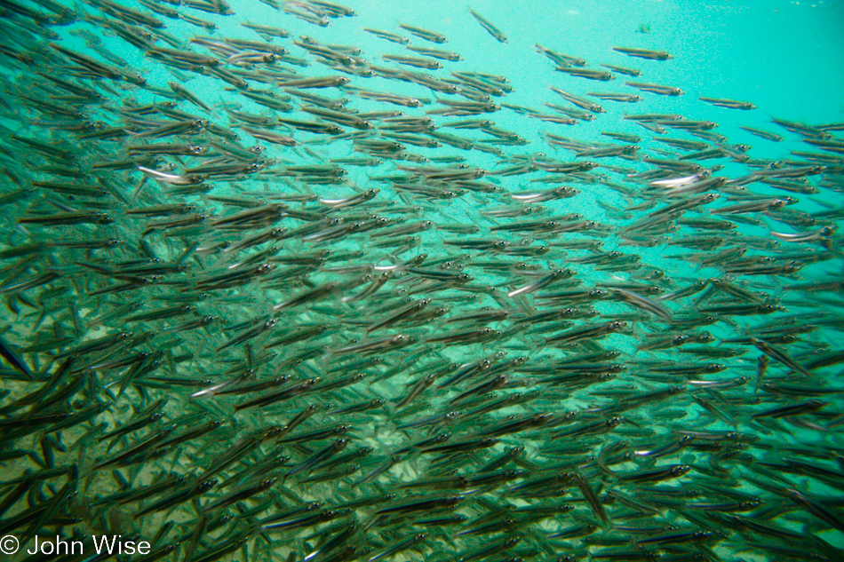
Out of the water and over to North Swim Beach we slip into the water and are surprised, overwhelmed, and thrilled to quickly find ourselves swimming through a school of thousands of fish. The small fish would swim around us, dart to and fro as they avoided other larger fish that may have been intent on feasting on these little guys. We could have stayed here all day watching the flashes of silver glistening in the reflected light of the sun shining down on the sea. Matter of fact, this is nearly just what we did and it was almost 5:00 before we exited our underwater wonderland.

After more than two hours of snorkeling, we needed a break and thought it was a good time to prepare dinner for our sunset feast – on peanut butter and jelly sandwiches. As we would only be on the island one night, we had opted for simplicity in bringing our small tent, one sleeping bag that we opened and both slept on, along with one cotton blanket for keeping warm. With lows in the mid-70s (24c), I didn’t think we’d be chilly.

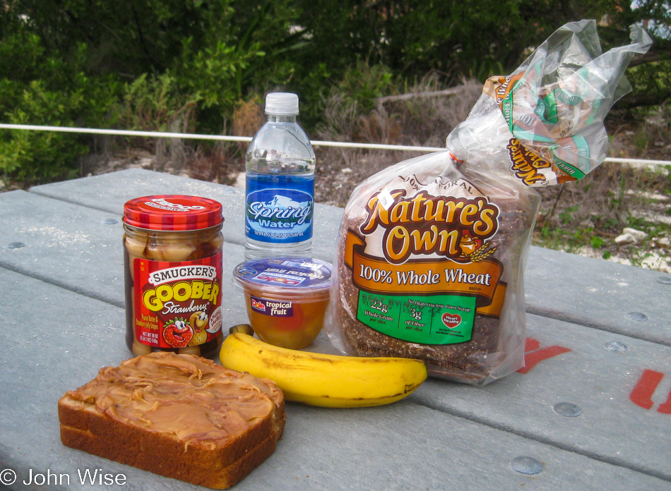
Our food choice was made just the night before at a local grocery after finding inspiration in a jar of Goobers PB & J – this stuff is a mix of peanut butter and jelly all in one jar; check it out here. We also bought some bananas to add to the sandwiches and to enjoy with our breakfast of Clif Bars the next morning.

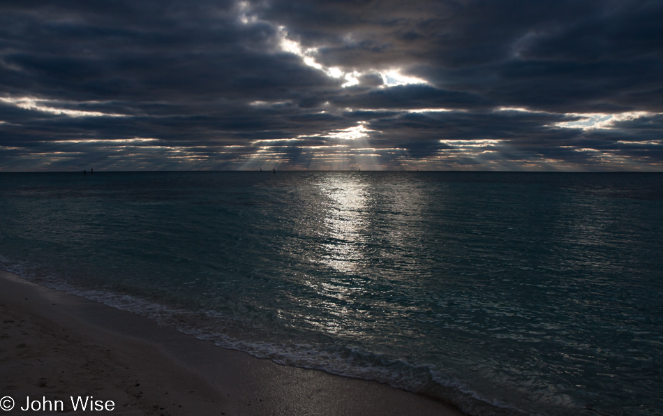
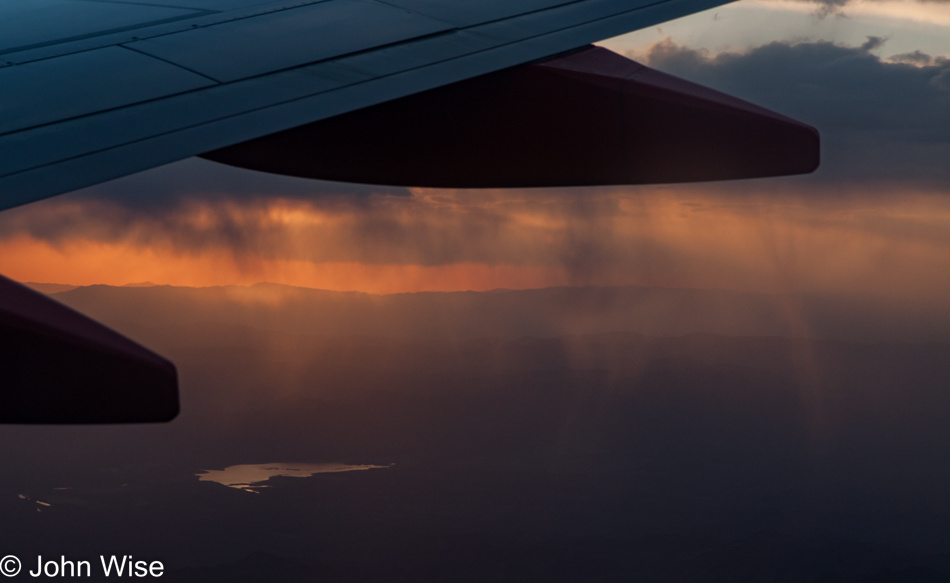
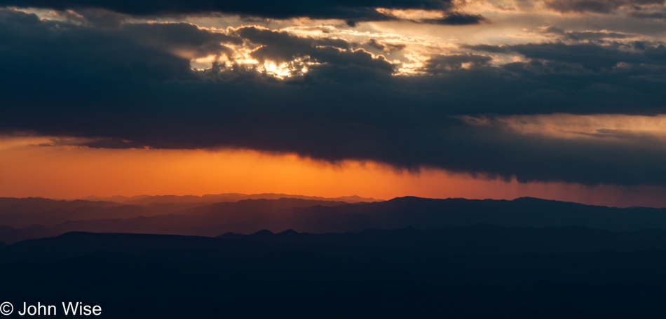
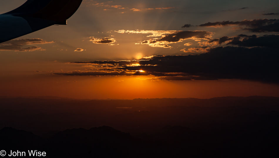
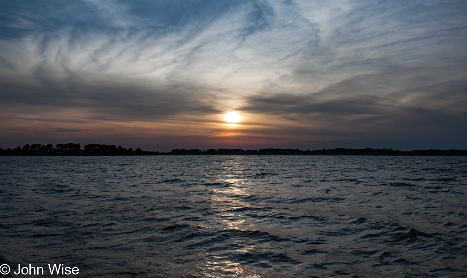
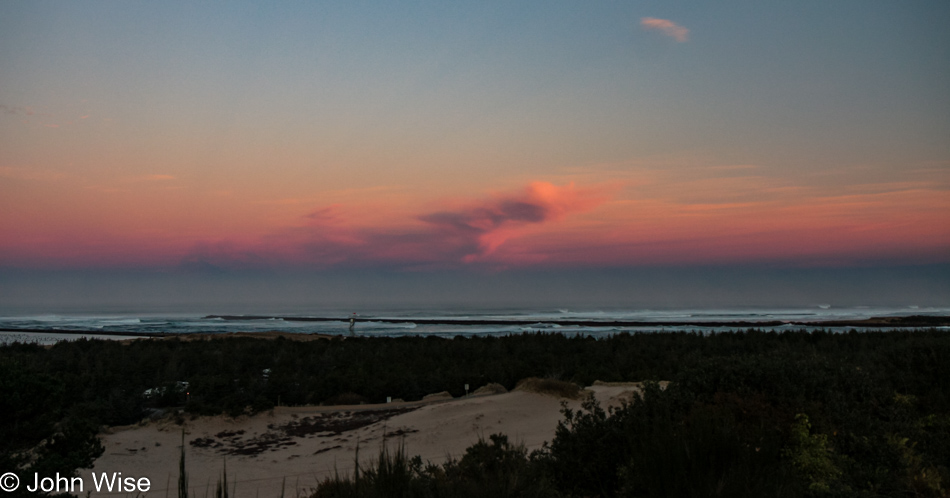
The late day brought in a good cover of clouds, none of them threatening poor weather. From time to time, the sun would poke through, casting a beautiful golden light upon the calm ocean. At other times, the sun would spread distinct rays across the horizon as we sat in the sand, oohing and ahhing at how gorgeous all of this was. The view is from campsite #5.

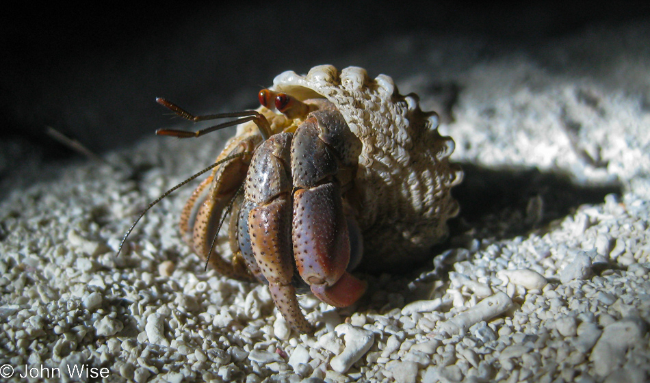
Be careful where you walk at night as others much smaller than you might be out for a stroll too. We probably watched this little guy for a good half-hour; what an unbelievable encounter with wildlife today.

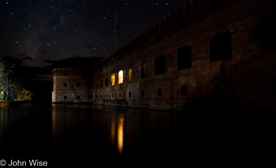
Not to forget to tell you of the stars we saw this evening, but look close, that’s the Milky Way over on the left. I’d love to share more about the night sky out here in the middle of the Gulf, but that would take another complete blog entry.

Wandering the Old West with Jutta – Day 1

Burro Jim Motel in Aguila, Arizona

This is another one of those blog posts that might have never been if it weren’t for my desire to build a comprehensive index of all of our travels. For more than a few years, I’ve been returning to old directories of photos and teasing out the exact days we were away from Phoenix. On more than a few occasions I find trips of which not a word or photo was ever shared. While on a lot of old posts, there were a minimum of images due to bandwidth issues at the time; I’m flummoxed how some trips never found their way up here. So here August 8th, 2022, I’ve brought together the best photos from this quick two-day getaway, and now I have to craft something or other to say because there’s nothing.

First up is an easy one; you see, back in 2001, Caroline and I passed right through here. On that day, this sign appeared to still be perfect, but here on the day I’m writing this in 2022, the Burro Jim Motel in Aguila, Arizona, is dead and gone. Click here to visit that trip from 2001.

Sunset Motel in Wenden, Arizona

The Sunset Motel in Wenden is defunct, too, though it probably was so even back in 2009. Knowing that we were traveling from Phoenix to Aguila and then Wenden allowed me to start determining the direction of our trip, and that made it a bit easier to put things back together.

Old horse tie-up and ruin in Salome, Arizona

I’ve looked for information about this old stone building with horse tie-ups still out front here in Salome but have never found anything.

Hope, Arizona

You enter Hope and just as quickly are leaving Hope behind.

Old Brayton Ghost Town & Museum near Bouse, Arizona

Old Brayton Ghost Town & Museum near Bouse, Arizona, was already fading fast here in 2009, but somewhere between then and 2022, it was removed from the map.

Old Brayton Ghost Town & Museum near Bouse, Arizona

This old stuff makes me curious about driving out this route once again and seeing how things have changed in the intervening years. Heck, for all I know, I’ll stumble upon another directory of photos featuring this exact trek.

Near Parker, Arizona

That’s the Colorado River with California on the left and Arizona on the right. We are traveling north on State Route 95.

Bill Williams National Wildlife Refuge near Parker, Arizona

This is the Bill Williams National Wildlife Refuge, and in the over 25 years we’ve lived in Arizona, we have yet to hike its short trails; this must be fixed.

Jutta Engelhardt and Caroline near Parker, Arizona on Knitting in Public Day

Caroline posing while holding her knitting with Jutta can only mean one thing: it’s World Wide Knit in Public Day.

Jutta Engelhardt and Caroline Wise on old Route 66 a.k.a. Oatman Highway in Arizona

Okay, Caroline, we get it; you are knitting in public. Yeah, but when has anyone else ever knitted in public on Historic Route 66?

Old Route 66 a.k.a. Oatman Highway in Arizona

When you travel the broad expanse of Interstate 40, you can only wonder why the original highway planners of Route 66 brought the road through areas such as this. Talk about being off the beaten path.

Old Route 66 a.k.a. Oatman Highway in Arizona

I would have bet $100 there was NO chance we’d be seeing burros on this road.

Caroline Wise in Oatman, Arizona

And then all of a sudden, you have two of them jamming their heads into your car, pleading that we take them with us or feed them. It’s probably the latter, as who has ever seen a burro in the backseat of a car?

Donkey's in Oatman, Arizona

Good thing I didn’t bet $100 per burro.

Donkey's in Oatman, Arizona

Nothing like a braying burro to get others to laugh with them.

Oatman, Arizona

The sign, aside from telling us about gold mining in the area, warns visitors to avoid the burros as they are wild and will bite and kick. Later, we also found out that local shops sell carrots to tourists as burro food, which makes some of them rather fat. Interestingly, fat donkeys carry a lot of their extra weight on their necks.

Caroline Wise in Oatman, Arizona on Knitting in Public Day

Apparently, the burros are either domesticated by now due to all the visitors feeding them, or they’ve come out to politely watch the knitting-in-public-day festivities.

On Pierce Ferry Road to Meadview, Arizona

At this point in identifying our road trip, I got lost on the map for quite a while.

Caroline Wise and Jutta Engelhardt nn Pierce Ferry Road to Meadview, Arizona

From where the next day started photographically, it only made sense that we stayed in Kingman, Arizona, for the night.

On Pierce Ferry Road to Meadview, Arizona

But these photos looked like nothing around Kingman.

On Pierce Ferry Road to Meadview, Arizona

Joshua trees and vermillion cliffs weren’t triggering our memories, so both Caroline and I continued scouring StreetView on Google Maps, trying to find something from our photos that would hint at our location.

On Pierce Ferry Road to Meadview, Arizona approaching South Cove Marina

It turned out that we went in a very unintuitive direction, far away from either of our best guesses.

On Pierce Ferry Road to Meadview, Arizona approaching South Cove Marina

This overlook is on Pierce Ferry Road, which travels out to Meadview, Arizona, as we were approaching South Cove Marina. We turned around at this point as there were over 70 miles ahead of us that would need nearly 90 minutes to cover before we’d reach somewhere for dinner. This is how we wander into the Old West.

Amish Buggy, Ephrata Cloister, to Phoenix

The blog posts of the previous 14 days were all updated in August 2022 to include more photos. Going from 3 to 5 photos to 2 dozen or more per entry, such as with this one, is common. As I’ve explained before, years ago, the bandwidth constraints made it difficult to include all the photos that I might have wanted. The good thing about these other posts is that while there were a minimal number of photos, I had written the narrative of what was happening over the course of the day, so while you may not have seen a photo of fireworks at Niagara Falls, I’d written of them. That’s not the case regarding this 15th day of our North Atlantic States vacation with my mother-in-law, Jutta Engelhardt. There were no photos and nothing written for this day, and I have no idea why not, but when I started moving sequentially through the day, I was surprised by this omission. So what follows is derived from the images, the itinerary that I still have, and the memories of Caroline and me that have been brought back to these days from the processes of updating the posts from the days prior.

Abe’s Buggy Rides in Bird-in-Hand, Pennsylvania, was our first order of business after the obligatory taking care of breakfast. Seems that we’ll be out on the town in the limousine of buggies.

How can one move through the communities of the Amish, see them going about their day using horse and buggy, and not wonder what it must be like to slow things down and travel in a way that is reminiscent of another age? I suppose if you grew up here and you found these traditional people tedious or annoying as you wished to pass them on your way to work or school, then you probably have no romantic ideas of such an experience, but I did, and today here we are learning firsthand what’s it’s like to venture out behind a horse.

Our coachman supplied pastries this morning in case we did not have time for breakfast. nice touch. Among others, Caroline is holding a whoopie pie for later consumption. As you can see, it’s quite comfortable back here. I can almost hear the cynic who says, “Tell me how much you enjoy this ride come January when it’s snowing.” Sorry, cynic, I’m opting for a life of self-delusional happiness where smiles, pastries, and love are readily available and always within reach.

While the Amish may eschew gas and electric devices and machines, it doesn’t mean they aren’t crafty when it comes to dealing with the needs of life. I was so impressed with this manure spreader I had to stop to ensure I got a proper photo of a horse and gear-driven contraption of poop flinging.

Utility and symbiosis with the task at hand, be it a farmer, a father, or a member of his community, you gotta respect that. Towards the end of our buggy ride, our guides stopped at a sewing workshop, allowing us to take a look at another type of Amish ingenuity: air-powered treadle sewing machines.

Caroline and I have been here before; on our first cross-country trip in 2000, we arrived at Ephrata Cloister well before they opened, and so we had to skip a proper visit. We were not going to miss it this time.

Nearly ten years ago, I wrote, “Conrad Beissel, a man of German descent, was Ephrata’s founder and established this corner of Pennsylvania as somewhere he felt he could live as a hermit. By the early 1750s, Beissel was no longer alone, having attracted nearly 80 others who chose the monastic life of celibacy and self-discipline.”

Two years prior to this visit, Caroline attended a 4-day workshop in Harveyville, Kansas, called Yarn School, and now all of this equipment used in making yarn is looking familiar. A year after our visit, Caroline would acquire her first loom, and the process of making fabric would become part of her practice in the fiber arts.

Our tour brought us into an unrestored section of the cloister, allowing us to get a sense of the condition of the place prior to the efforts to save this tiny corner of American history. If you look at the photo three images below this one, you’ll see what a restored kitchen looks like as compared to this one.

Many of the rooms we looked at didn’t have doors and instead featured curtains because, living a life of celibacy, what need would there be for privacy?

Conrad Beissel died in 1768, the last celibate practitioner passed in 1813, and the church as it was ceased to operate in 1934. It wasn’t long after that that the Pennsylvania Historical and Museum Commission took over the buildings and grounds to preserve things.

A restored kitchen.

This looks a bit too luxurious for the celibate members, so I’m guessing that this was the living quarters of one of the “householders” who oversaw the operations of the order so its members could devote themselves to the life of an ascetic.

Maybe someday, holidays will be able to be taken in living history settings where one could live as a monk for a week, a prisoner in an old jail, or as an Amish farmer.

The grounds here are beautiful and are what really instilled in us the desire to one day return.

I think there’s an underlying thought that maybe Caroline and I could have adapted to this kind of lifestyle as the isolation felt in our youth, led both of us to, at times, believe we might always be alone, so why not take it to an extreme? For her, it was a nunnery, and for me, it was the philosopher’s cave or mountaintop.

Next time we visit, it’ll have to be on a sunny day.

Time to leave.

About to turn in the rental car here in Baltimore, Maryland, and go home.

Shortly after departure, we were flying over some bad weather.

Just as Howard Hughes learned while he was making films, clouds make for great dramatic skies.

Rain falling but never reaching the earth.

This is what happens when you can’t pick just one sunset photo…

…because they keep getting better, like our wonderful vacations.

Skipjack Sailing

Jutta Engelhardt in St. Michaels, Maryland

No time for jetlag, yet. After Jutta was afforded the opportunity to sleep as long as she wanted, we went for breakfast before heading out for a tour of the St. Michaels area by boat.

Chesapeake Bay in Maryland

Just a short hour out here cruising the Chesapeake to get a flavor of the area.

Jutta Engelhardt piloting a tour boat on Chesapeake Bay in Maryland

As we were walking around, the captain of our slow boat offered my mother-in-law the opportunity to take the helm, nervously, and with some encouragement, she agreed and I don’t think she could have been happier for such a unique experience.

Chesapeake Bay Maritime Museum in St. Michaels, Maryland

The copper-topped building in the center of the photo is the 1879 Hooper Strait Lighthouse, which is part of the Chesapeake Bay Maritime Museum. After our visit, it was time for Jutta to grab a nap; this was expected as jetlag is not her friend.

Jutta Engelhardt sailing on the Chesapeake Bay in Maryland

After that nap/sleep, it was time to head over to Tilghman Island to catch a ride on a skipjack. Captain Wade piloted the Rebecca T. Ruark, the oldest working skipjack (a flat-bottomed sailcraft used for dredging oysters), out on the waters of the Chesapeake.

Tilghman Island from onboard a Skipjack on the Chesapeake Bay in Maryland

These are the days I hope will never leave my mother-in-law.

Sailing on the Chesapeake Bay in Maryland

Proof that we were under sail.

Approaching Tilghman Island from onboard a Skipjack on the Chesapeake Bay in Maryland

The sun was nearly set upon our arrival back on the island, and by then, we were ready for dinner. We stopped in at the Bay Hundred Restaurant for some fish and were rewarded with the good fortune of a table next to ours, sharing some of the 25-pound rockfish they had caught earlier in the day with us. The first full day with the mother-in-law was A-okay.

Driving Into The Sunset

Late afternoon going into early evening on the 10 freeway driving west

On our way to Santa Barbara, California, for the weekend, we were able to get out of Phoenix near midday but were not fast enough to glimpse a view of the ocean before dark. High winds and rain pummeled us just before leaving Arizona and crossing over the Colorado River into SoCal, but from there on, we were treated to beautiful, cool, clear weather for the rest of the weekend.

Umpqua to Siletz Bay

Umpqua Lighthouse State Park in Reedsport, Oregon

Disclaimer: This post is one of those that ended up being (mostly) written years after the experience was had. While there was a paragraph or two posted way back then with a single photo, there were no other notes taken, so most of what is shared here must be extracted from the images and what memories they may have lent us.

Our last day on the Oregon Coast started in our rental yurt at Umpqua Lighthouse State Park. This view is from the overlook in front of the lighthouse, and between us and the ocean, you’ll find many an offroad enthusiast with some kind of vehicle racing over the sand.

Umpqua Lighthouse State Park in Reedsport, Oregon

These romantic artifacts from our past survive both as beacons beckoning us to remember the past and drawing those of us attracted to the light still visible from another age.

Siltcoos Beach in Florence, Oregon

With 375 miles ahead of us today, we will not be able to stop everywhere, but that doesn’t mean we won’t push things. We walked over the sand dunes here at Siltcoos Beach, hanging out for about a half-hour.

Siltcoos Beach in Florence, Oregon

Maybe because we don’t live here, we have to hold fast to these images and memories, immortalizing them on these pages so we can always refer to them. I wonder if those who live in these places put as much emphasis on seeing intently what might be too easy to take for granted.

Jessie M. Honeyman Memorial State Park in Florence, Oregon

Another short drive and we pulled over to Honeyman State Park, a park that we had somehow missed stopping at on any of our previous visits to Oregon. The air was still, and with the sky speckled with light, thin clouds, we were treated to a perfect reflection of trees, sky, sand dune, and clouds on the small lake.

Prichard Wayside in Florence, Oregon

That’s the Siuslaw River Bridge over there, and we’re at the Prichard Wayside on the south side of Florence as we take this opportunity to see this bridge from a different angle. If time allowed, we’d make it a project to capture all of the coastal bridges of Oregon from various perspectives and different lighting situations; heck, I should include that we’d like to do the same for the nine lighthouses out here, too.

Big Creek Bridge in Lane County, Oregon

Big Creek Bridge is just north of Carl G. Washburne Memorial State Park, which we are indeed passing by without a brief return visit.

Devils Churn Cape Perpetua Scenic Area on the coast of Oregon

The same could not be said about our next stop as we pulled into the parking lot at Devils Churn for a brief stop.

Devils Churn Cape Perpetua Scenic Area on the coast of Oregon

I swear, we’ll only be here a few minutes.

Devils Churn Cape Perpetua Scenic Area on the coast of Oregon

Yes, Caroline, I’m almost done. I think.

Devils Churn Cape Perpetua Scenic Area on the coast of Oregon

But how can we leave when things are this spectacular?

Devils Churn Cape Perpetua Scenic Area on the coast of Oregon

Well, it required nearly an hour for us to pull ourselves away and get back on the road. Let me correct this before Caroline does: it took nearly an hour of prodding. In Yachats, we drove next to the bay and marveled at the rough surf under the deep blue skies and then had a lunch of clam chowder at Mo’s Annex in Newport. Obviously, there are no photos of this segment of the drive as maybe, just maybe, I was a bit too indulgent at the Churn.

View from Devils Punch Bowl area in Otter Rock, Oregon

In Otter Rock, we threw a last look into the Devil’s Punchbowl.

View from Devils Punch Bowl area in Otter Rock, Oregon

No, I won’t get lost in the crashing surf here, too; I know we still have about 300 miles ahead of us, and it’s after lunch.

View from Devils Punch Bowl area in Otter Rock, Oregon

Yeah, but I would have missed this one had I jumped back in the car.

View from Devils Punch Bowl area in Otter Rock, Oregon

We’ve only been here for about 15 minutes.

View from Devils Punch Bowl area in Otter Rock, Oregon

That is a gutsy surfer on a good 8-foot wave on a late fall day in these cold northern waters. Now we can get back to the car, and we’ll just keep going all the way to Seattle for our flight home.

Depoe Bay, Oregon

Wouldn’t you know it, we ran into another distraction in Depoe Bay, where we watched water shooting no less than sixty feet into the air. This shot is not of that 60-footer; just keep scrolling.

Depoe Bay, Oregon

Getting closer…

Depoe Bay, Oregon

A spouting cone was working hard as the tide was at just the right height for this horn to spout a jet of misty water high in the air, accompanied by the onlookers’ oohs and aahs. With the perfect shot in the camera, we can take our drive north seriously now.

Rocks rising above the water in Siletz Bay, Oregon

By the time we reached Siletz Bay, the sun was low in the sky, and we were trying to convince ourselves that we really should stop making all these roadside visits, but the day was so beautiful, and we suckers for beauty were mere moths drawn to the light. Click here to compare to the photo I took of the same place three days before.

Tillamook, Oregon

Under a pink, lavender, and dark blue sky, we reached Tillamook with the hopes of nabbing one more sandwich from the Blue Heron Cheese Company, but unfortunately, we were more than a few minutes too late. We arrived in Seattle, Washington, sometime late in the evening with heads full of terrific Oregon memories from our 10th visit to the state.