Southern California – Day 1

Arizona

Taking off a Friday for a long weekend in the Los Angeles area. This is our last stop in Arizona before hitting the Golden State of California.

Joshua Tree, California

As if the Arizona desert wasn’t enough, we are venturing into Joshua Tree National Park today for some more desert and cactus.

Joshua Tree, California

You know you want to hug this stuff, and even if you don’t it might just want you enough to find its way to attaching to your socks or even your leg. This is a cholla cactus, also known as the jumping cactus or the seriously cute-sounding teddy bear cholla.

Joshua Tree, California

Rocks, because a visit to Joshua Tree without seeing rounded, soft-looking boulders wouldn’t be the same. There are locations within Joshua Tree that are absolutely famous for their rock formations.

Joshua Tree, California

A few examples of Joshua Trees from where this National Park got its name. Our visit here today was for the primary purpose of traveling some back roads we normally don’t get to see when in a regular passenger car. What you can’t see here is that Caroline has been driving the Expedition while I am afforded the luxury of having her pull over while I jump out and snap a photo here and there.

Joshua Tree, California

From here forward, I took over the driving as the road got a bit sketchier and narrow, and Caroline didn’t feel like testing her off-road skills any further. Once back on the 10 Freeway, we headed into Los Angeles for the night.

Organ Pipe National Monument

Gila Bend, Arizona

Driving through Gila Bend on our way to Southern Arizona.

Cactus and speeding cars are the main attraction at Organ Pipe National Monument in Southern Arizona

This is Organ Pipe National Monument, not an easy park to get to as there’s not a lot to see or do along the way. On this particular visit, the main loop trail was closed to traffic due to some fawning activity of the local pronghorn antelope population. Located on the Mexican border south of Tucson, the park’s main road is also the highway to Rocky Point, so beware of flying beer cans, ice chests in the middle of the road, and speeding 12-foot tall four-wheel-drive pickup trucks with teenagers racing south for a weekend of debauchery.

Cactus and speeding cars are the main attraction at Organ Pipe National Monument in Southern Arizona

On our way back home, this was just a day trip.

America – Day 21

Alamogordo, New Mexico welcome sign in German

Only about 90 miles north of El Paso, Texas, is this little outpost of Alamogordo, New Mexico, where the German Air Force comes to train its pilots. Sadly there’s not a German restaurant to be found, not much of anything else for that matter. To say Caroline was surprised by this sign would be an understatement. Breakfast was here in town at a place called Ramona’s, where we were treated to another yummy Mexican meal. (As of 2018, this place no longer exists)

Caroline Wise at White Sands National Monument, New Mexico

This is the reason we didn’t continue west from El Paso: Welcome to White Sands National Monument.

Caroline Wise leaves a footprint at White Sands National Monument, New Mexico

Wonder what the chances are that 10 million years from now someone discovers my wife’s footprint?

John Wise and Caroline Wise's hand prints in the sand at White Sands National Monument, New Mexico

Or maybe in 100 million years, someone will find our handprints?

White Sands National Monument, New Mexico

After enjoying near-perfect weather for most of the trip our last day out here is again spectacular. Nothing like a thin layer of water to make for a nice reflection of the dune.

Caroline Wise looking through a piece of ice at White Sands National Monument, New Mexico

While the sand might look like snow, it is not, though from the piece of ice Caroline picked up from some pooling water, it’s apparently cold enough out here for it to snow.

Caroline Wise and John Wise driving in New Mexico

Starting the final leg home and our last selfie on the road.

A dollar bill we left at Steins Mercantile in Steins, New Mexico

Ultimately, there would be four dollars stapled to these walls and shelves from four different occasions at Steins Mercantile (pronounced Steens) here in Steins, New Mexico. Sadly, this old ghost town location was shut down after the owner, Larry Link, was murdered in an unsolved crime 11 years after our visit. As of 2018, there might be some limited tours available by reservation only, but I can’t confirm that as of this writing.

The Mighty Bussalo brown VW bus in Arizona

We finally had to try to get a picture of this old VW bus christened the “Mighty Bussalo.” We’d been passing each other since the Louisiana border, and here we were in Arizona, passing one another for the last time. Over the years, we’ve looked for a sign of this car on the internet but never found a thing. The amounts of times we’d passed each other had started to become absurd, and each time it would put giant smiles on our faces.

Sunset entering Phoenix, Arizona

I tried to tone down the colors, but as vibrant as they were as we were entering Phoenix, Arizona, I blamed our camera for not being able to properly deal with the contrast in light and dark. Anyone who has lived here will know that, in fact, this is not all that far off from the truth. We are almost home after driving 8,722 miles out and back across America.

Various food stuffs from across America

While out for these past 21 days we did a fair amount of shopping trying to collect local flavors. The next images are the results of our haul.

Various food stuffs from across America

Various food stuffs from across America

Various food stuffs from across America

Various food stuffs from across America

America – Day 15

Kentucky countryside west of Wilmore

Here we are on Harrodsburg Road in Nicholasville, Kentucky, minutes after we left our motel up the road on Route 68. It looks like we might have another beautiful day out in America.

View from 9236 Harrodsburg Rd Nicholasville, Kentucky

View from the same house on Harrodsburg Road.

Crossing the Kentucky River on Route 68

Crossing the Kentucky River as we make our way west today on Route 68. On the east side of the river, the road is named Harrodsburg Road, while on the west side, it will change to Lexington Road and be the combination of Routes 33 and 68.

Sunrise in Kentucky

It might be difficult to see the detail (this old Sony digital camera shot 1600×1200 or 2-megapixel images), but up in one of those trees is a huge cluster of birds greeting the rising sun.

Finding Jesus in Kentucky

Seeing we couldn’t visit Kentucky Home State Park because, of course, it was closed, we offer you salvation in Jesus and a roadside sign that can bring you into the fold of God. Back in the day, people prayed for poor souls to keep them from purgatory, but by 2018, we spent most of our time praying about the loss of children killed by mass shootings in our schools.

Abraham Lincoln Birthplace National Historic Park in LaRue County, Kentucky

Before arriving here at the Abraham Lincoln Birthplace National Historical Park, we visited the Lincoln Museum up the road in Hodgenville. It was so cheesy that the potential for good kitsch was lost, and the place instead verged on the depressing. This is not a place marked on the map for return. Even the birthplace monument leaves a lot to be desired. It does hold the distinction of being the first Lincoln Monument, and it is, in fact, the location where the Lincoln family lived, but the cabin in this monument is a “symbolic” building of something that “could” have been similar to the one President Lincoln was born in. Walking the grounds and visiting the somewhat cave-like Sinking Spring, where the Lincoln family drew their water, is the best part of the visit.

Mail Pouch Tobacco stenciled on a barn in Kentucky

We must have been on the tail end of the nostalgia for traveling to hokey places because after we visited the Lincoln birthplace, we went back to town and had lunch at the Lincoln Jamboree, where Joel Rays Restaurant had been serving diners for 41 years. It was lunchtime on a Wednesday during our visit; years later, their hours would be reduced to Saturdays only, opening at 3:00 p.m. Such is progress. Another Mail Pouch Tobacco stencil greets us back on the road. And for the curious: no, we’ve never tried chewing Mail Pouch Tobacco. Trivia: Bloch Brothers from Wheeling, West Virginia, was the tobacco company behind these advertisements that were once featured on over 20,000 barns!

John Wise in Mammoth Cave National Park, Kentucky

If it’s in the National Park system and we are nearby, we are going. Here we are, wiggling and squeezing through Mammoth Cave National Park in Kentucky. This section of the cave I’m in inspired Caroline to take my photo as I shimmied through the “Fat Man’s Misery.” I wasn’t so much worried about fitting as I was about some brief moments of claustrophobia.

Ferry crossing of Green River in Mammoth Cave National Park, Kentucky

Worst photo ever of a ferry crossing. This is the Green River Ferry in Mammoth Cave National Park which is required traveling if you are driving north out of the park.

Somewhere along the road to Tennessee in Kentucky

Kentucky is an incredible state for its beauty. Hopefully, we’ll return someday in late spring or early summer when everything is in bloom, and the abundance of green is greener than any green we’ve ever witnessed in the deserts of the Southwest.

Sunset in western Kentucky

Sunset doing what it does best besides giving way to night, creating dramatic skies of extraordinary color.

Caroline Wise and John Wise in front of the Welcome to Tennessee state sign

We effectively just passed through Nashville, Tennessee, though we did stop for a very uninspired dinner. These pre-smartphone travels were severely hampered by not having the ability to find restaurants with the help of the internet; phone books were a joke. We had failed so frequently asking locals for great places to eat with answers coming back at us like “Red Lobster, Olive Garden, or Sizzler” that we had to give up and take the path of least resistance by opting for the first place that had a few cars in the lot and wasn’t a chain or fakey Chinese food. From dinner, we drove to the northern terminus of the Natchez Trace Parkway, looking for a place to stay, except there was nothing out there, so we headed to Franklin, Tennessee, figuring it would be cheaper than anything found in Nashville.

America – Day 9

Caroline Wise and John Wise at Frenchman Bay in Acadia National Park, Maine

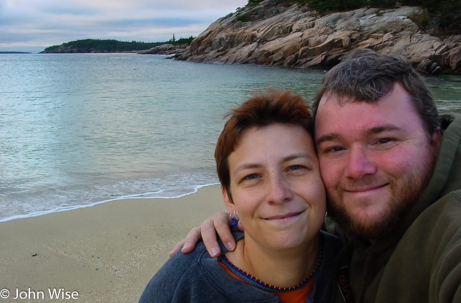
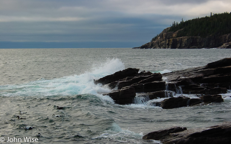
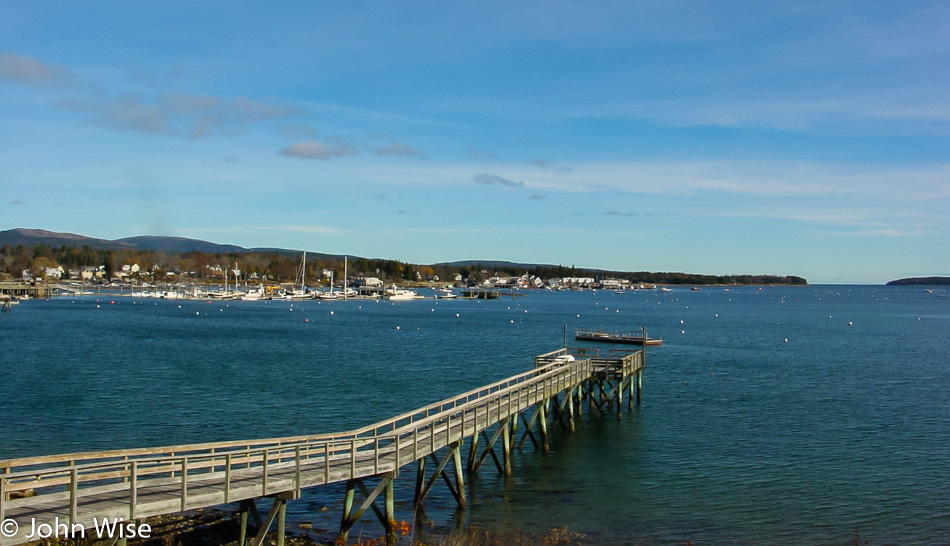
We live for being next to the water. Everything feels perfect when we are at the coast including here at Frenchman Bay in Acadia National Park.

Panorama of Frenchman Bay in Acadia National Park, Maine

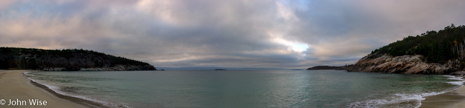
Our old Sony camera only shot 1600×1200 pixels during this trip, but the magic of Photoshop stitching images together let us resolve things just a wee bit better. Here’s Frenchman Bay from side to side. Click the image or click here to load a larger view to see more detail.

Acadia National Park near Bar Harbor, Maine

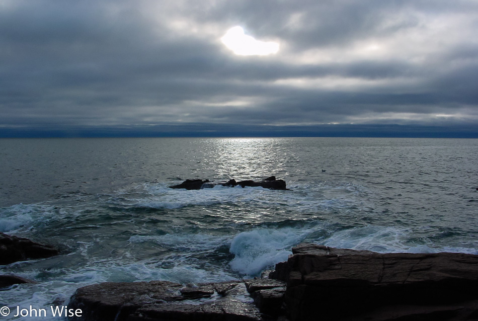
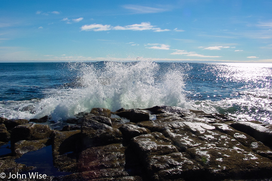
Hours could pass, and as long as the weather stays dry, we’d be happy as clams to just walk along the shore all day.

Acadia National Park near Bar Harbor, Maine

The distinctive look between the northwest Pacific coast and here is striking. After Oregon, Maine might be the next choice of where we’d love to live. The only problem with living out this way might be the roads, though the area around Bar Harbor is fairly maintained. Maybe someday we can spend some months up here and get a better idea of what things are like in winter and summer.

Mushroom in Acadia National Park near Bar Harbor, Maine

There’s certainly a lot more here than just the sea, but it takes some serious effort to avert our eyes from that body of water that seems to be calling us.

Mushroom in Acadia National Park near Bar Harbor, Maine

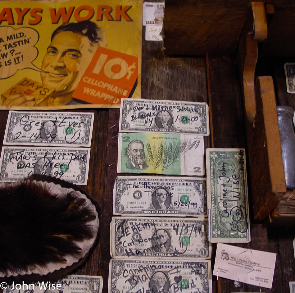
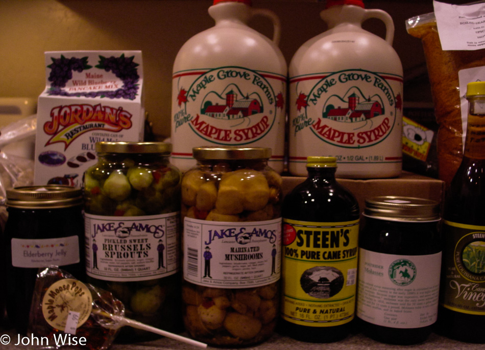
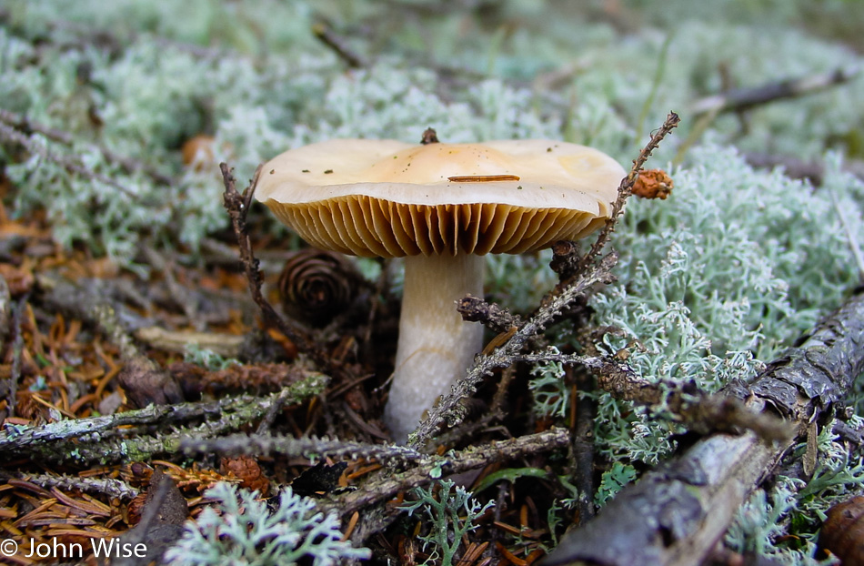
I have no idea what this is, but it looks yummy, though I’ll bet a dollar it doesn’t taste as good as it looks.

Cadillac Mountain in Mushroom in Acadia National Park near Bar Harbor, Maine

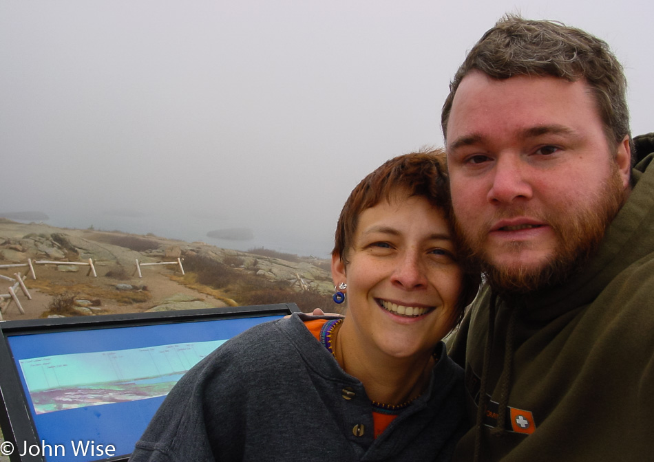
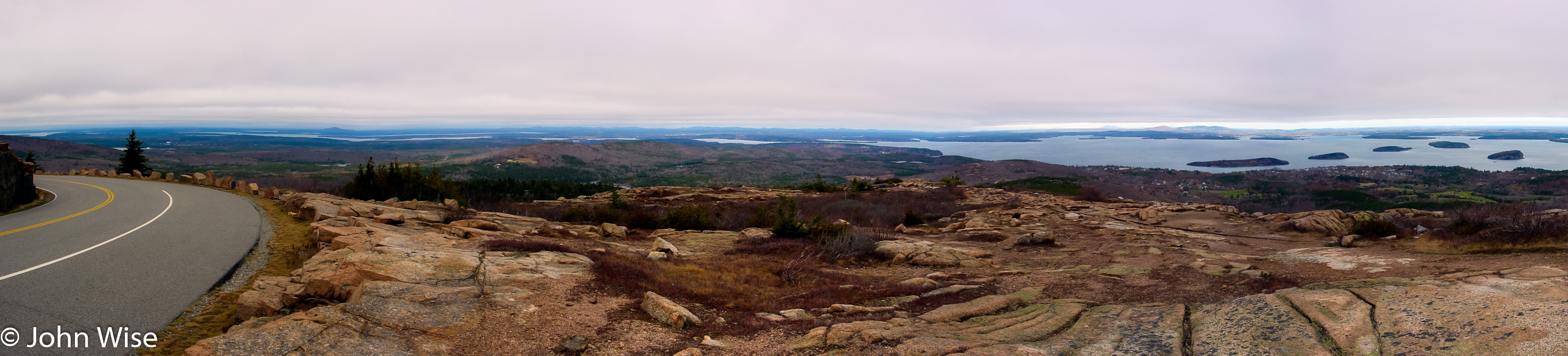
The strong wind makes the peak of Cadillac Mountain in Acadia National Park brutally cold. We are only at 1,533 feet above sea level, which is called a hill out west, but out here on the east coast, this is a mountain and it’s the highest point on the U.S. Atlantic coast. While the thermometer reads 42 degrees, I’d bet that with the wind chill factor, it’s not a degree over 10. Quick, let’s jump back in the car!

Cadillac Mountain in Mushroom in Acadia National Park near Bar Harbor, Maine

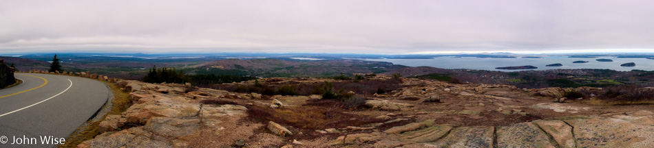
A panoramic view from near the peak of Cadillac Mountain. Click here or the image to see a larger view.

Near Bar Harbor, Maine

Finally, it was time for breakfast, so we headed back to Bar Harbor for something to eat at Rika’s Family Restaurant. Our server tells us how Bar Harbor becomes a ghost town this time of year, and during the summer, it’s difficult to move down the street because the crowds are so thick. This feast or famine situation makes things difficult for those who can’t winter down in Florida or over in Arizona, where most of the town is already. Afterward, we stroll down the street searching for the refrigerator magnet we must find. We found a magnet but also a ceramic tile of the Bass Harbor Head Lighthouse so now we’ll have to head that way and witness it for ourselves.

On the way to Southwest Harbor by Tremont, Maine

With the sun out and blue skies, the Atlantic Ocean shimmers in beauty. We are on the way to Southwest Harbor out towards Tremont, where the Bass Harbor Head Lighthouse is situated.

On the way to Southwest Harbor by Tremont, Maine

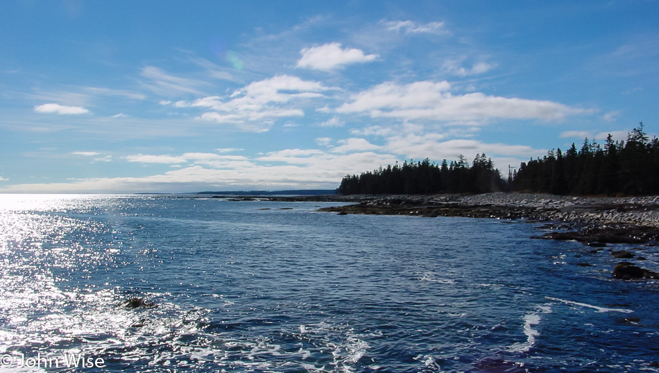
Moving slowly along the coast as we find places to stop and explore the shore. I should point out that these rocks can be slippery: my butt found out the hard way as I went down flat on them.

Bass Harbor Head Lighthouse on the Maine coast

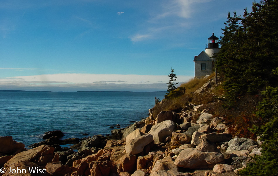
This was the best view we could muster of the lighthouse. It was built back in 1858 and is located in Tremont, Maine.

Caroline Wise and John Wise with a snail we named "State of Maine" that we got as our reminder at the Purple Baboon in Belfast, Maine

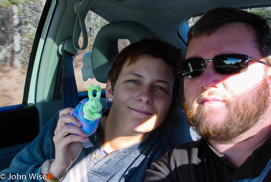
So this was the souvenir we ended up with from Purple Baboon over in Belfast. We named this snail “State of Maine.” You might also notice we are traveling with a Kodama hanging in the window just behind Caroline. The Kodama are spirits from Japanese folklore that inhabit trees, similar to the dryads from Greek mythology, with the name dryads being the basis for the plant dryas, which will figure in a couple of our trips in the future after we go to Alaska and the Yukon, but that’s 12 years from now so I’ll wait to write about that stuff then. This particular Kodama was featured in the film Princess Mononoke.

Around this time, we also returned to Belfast for some lunch at the Maine Chowder & Steak House and then pointed the car towards Camden, where we made note that we would have to visit this small village on a subsequent trip.

Witch Dungeon Museum in Salem, Massachusetts

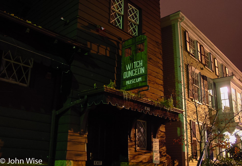
Before reaching Salem, Massachusetts, and the closed-for-the-day Witch Dungeon Museum, a guy at a gas station in Maine recommended that we visit both Annapolis and Mystic Seaport. From Salem, we drive into Lynn (established in 1629) and believe we are in the land of hairdressers, doughnut shops, roast beef dives, pizza joints, and Chinese restaurants. It should also be known as the place of the world’s smallest street signs.

Sumner Tunnel in Boston, Massachusetts

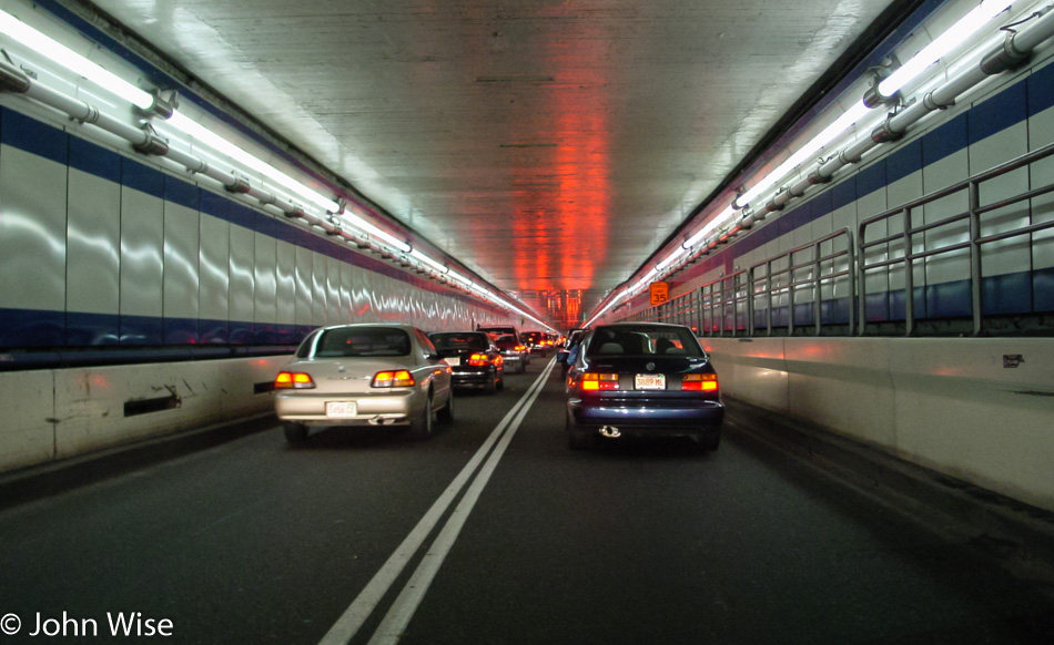
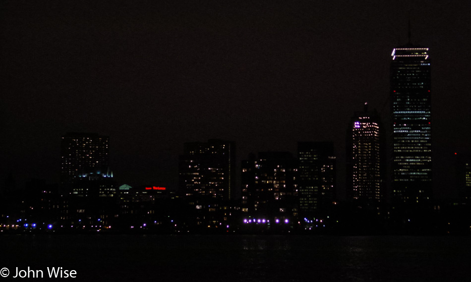
Boston is a madhouse of traffic anarchy, and this tunnel is no better. Only $2 to pass through Sumner Tunnel with our nerves already frayed, and then here comes an emergency vehicle forcing all of us to merge right in a tunnel that was already bumper to bumper. We looked for the area of the Boston Tea Party so we could see it in the dark while it was closed too, but we never found it.

Boston skyline at night in Massachusetts

Leaving Boston behind, we head for a quieter destination to stop for the night; Plymouth sounds interesting, so we’ll invest the hour and drive south. Once in Plymouth (yep, that one made famous by a rock), we stopped at Plymouth House of Pizza for dinner and then checked into the Pilgrim Sands Motel with an ocean view!

America – Day 2

Texas border sign on Highway 287

Sure, it’s a dismal photo, but it’s all we got. By this time, we’d already been on the road for nearly two hours. This is looking south back into Texas on Highway 287 just north of Kerrick, Texas. Traveling this route involved a minor bit of backtracking, but we saw Rita Blanca National Grasslands on our map, and as we’d never seen such a thing, we took the detour. As we don’t have a fixed destination or a time when we need to return to Arizona, our opinion is we can go anywhere and do anything.

Welcome to Oklahoma on highway 287 with Caroline Wise and John Wise

Staring into the sun has never been an ideal situation for Caroline, and so after one tries to get this selfie in front of the Welcome to Oklahoma state sign, I had to give up. This was our first visit to the Great Plains, and for that matter, it would be our first time together anywhere east of here for the rest of the trip.

Grasslands across Oklahoma

We were never really sure where the “Grasslands” started and finished as most everything out here was flat and brown. The color of the landscape makes sense because it is well after summer and quickly approaching winter. This kind of flat expanse is something new to our eyes. If memory serves us, this is State Highway 171 traveling flat north.

Kansas state sign near Elkhart, Kansas on highway 56 with Caroline Wise and John Wise

Crossing into Kansas just south of Elkhart on Highway 56, staying away from the big roads.

Small shop in rural Kansas

It struck us that there is little out here besides grain silos, barns, and homes scattered about, and then we come upon this little “Beer To Go” shop with a drive-up window that doesn’t appear to have any way to drive close to. Or at least nobody has directed their vehicle there for a while. We’re still on the 56, heading northeast through Rolla, Kansas.

Moscow, Kansas

A standout city, this place is called Moscow, Kansas. It was here while getting gas ($1.63 a gallon) that an elderly guy approached me, curious about our Beetle. He’d not seen one yet in person and so he inquired about how we liked it. I assured him that it was amazing (I’d later grow to hate the thing). He asked if we were visiting family, and I answered no. He pointed out how far away the main highway was, and I agreed that it was a good place for it to be. Then he asked our ages, “Thirty-seven and thirty-two,” to which he said in near amazement how lucky we were to be so young and on such a big adventure. Those words stuck with me the rest of the trip, and little did I know then that they would travel with me for years into my future.

Edwards County Historical Museum And Sod House in Kinsley, Kansas

From time to time, we’ll take photos of places to act as reminders that we wanted to visit but didn’t have time or the place was closed while we were in the area. The Edwards County Sod House & Museum in Kinsley, Kansas, is one of those places. Note: Eighteen years later, we still haven’t made it back here.

Fort Larned National Historic Site in Larned, Kansas

We made a brief stop in Dodge City to visit the Boothill Museum but felt it was too expensive for what we saw. On the way out of Dodge, I had the “Epiphany Burrito,” which may have been the best burrito I’ve ever had. Back on the road, we took another break to visit the Fort Larned National Historic Site in Larned, Kansas. If there is an element of history to be learned about at any location we are traveling by, then more often than not, we feel compelled to stop. By the way, when we essentially pass through somewhere like Dodge City, the reasoning is if we can easily visit by catching a plane into a local airport and spend some quality time exploring more of what a larger city has to offer, we are probably using our time smarter by seeing the outlying areas.

Somewhere in Kansas

This is our last daylight photo worth sharing; it’s of the Cheyenne Bottoms Wildlife Area. Trying to keep things rural and off larger roads occasionally takes us down dirt roads with the hope of getting a truly alternative view. I’d say we scored with this route, as I don’t believe sunset could have been any better than right at this moment. A half-hour later, we were passing through the Quivera Wildlife Refuge, but we weren’t ready to call it a day and decided to keep on driving. We ultimately made it to Atchison, Kansas, about 250 miles up the road.