Mount Rushmore Trip – Day 3

Sunrise in Wyoming

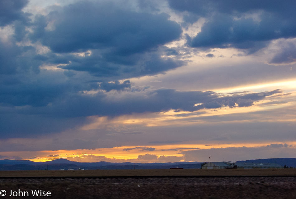
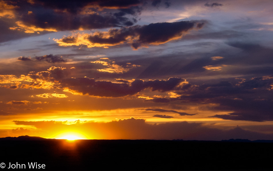
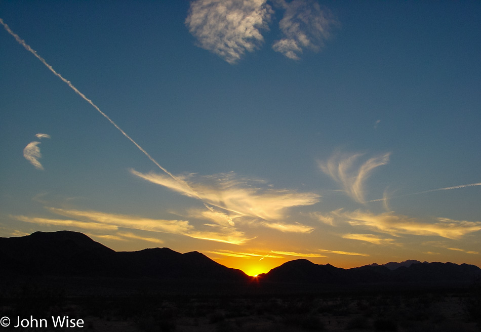
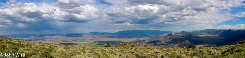
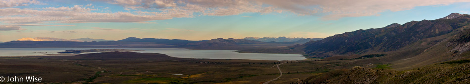
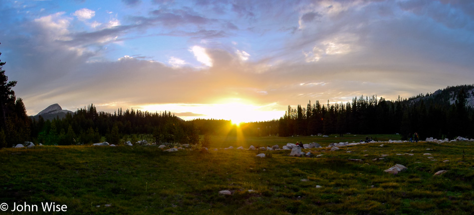
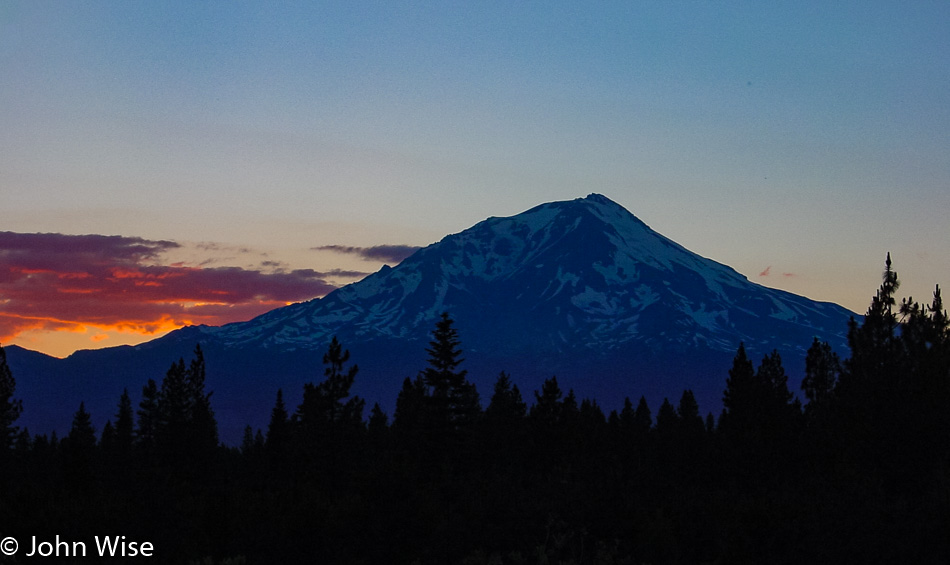
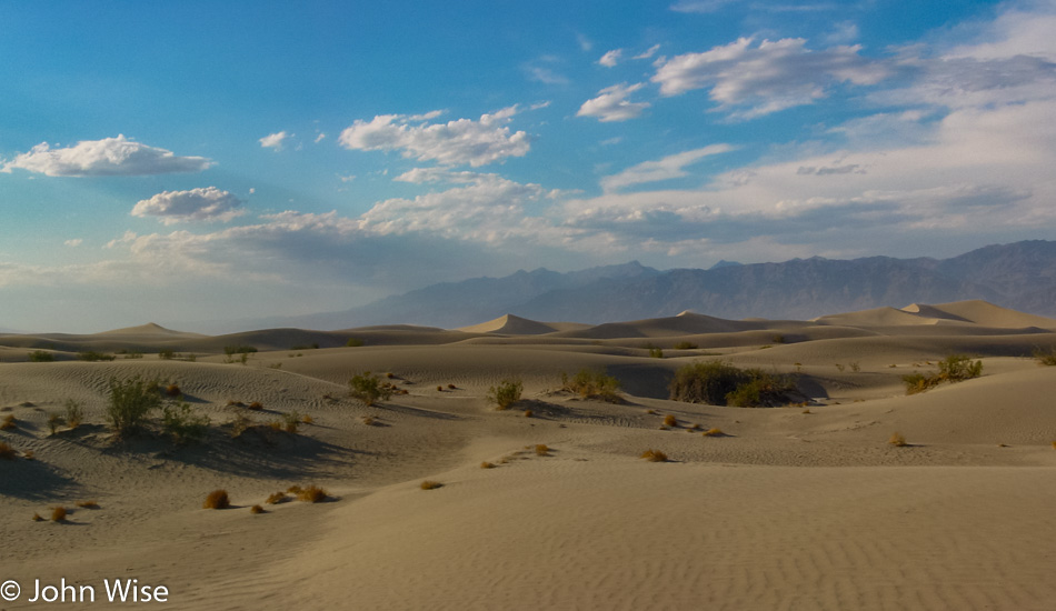
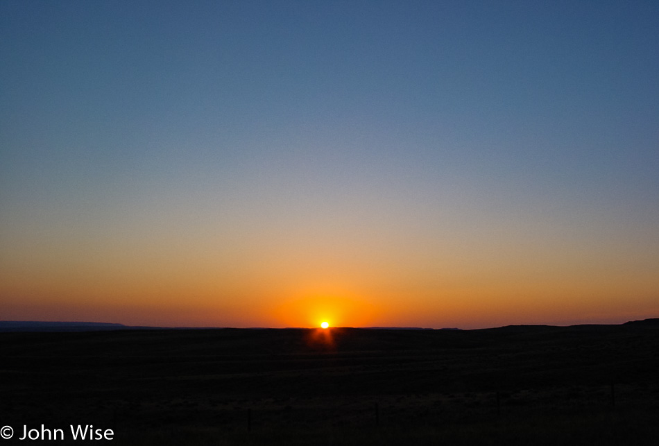
The night and day are punctuated by the beauty of the sun, turning the sky into gorgeous shades of the spectrum that strike our eyes in just a way that makes us ooh and aah. We love these travel days when we are motivated to rise early and witness these moments of dawn where the stillness and quiet are about to give way to the world reanimated.

John Wise getting a ticket in Wyoming

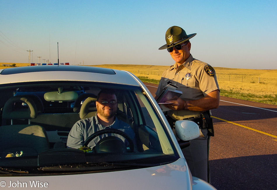
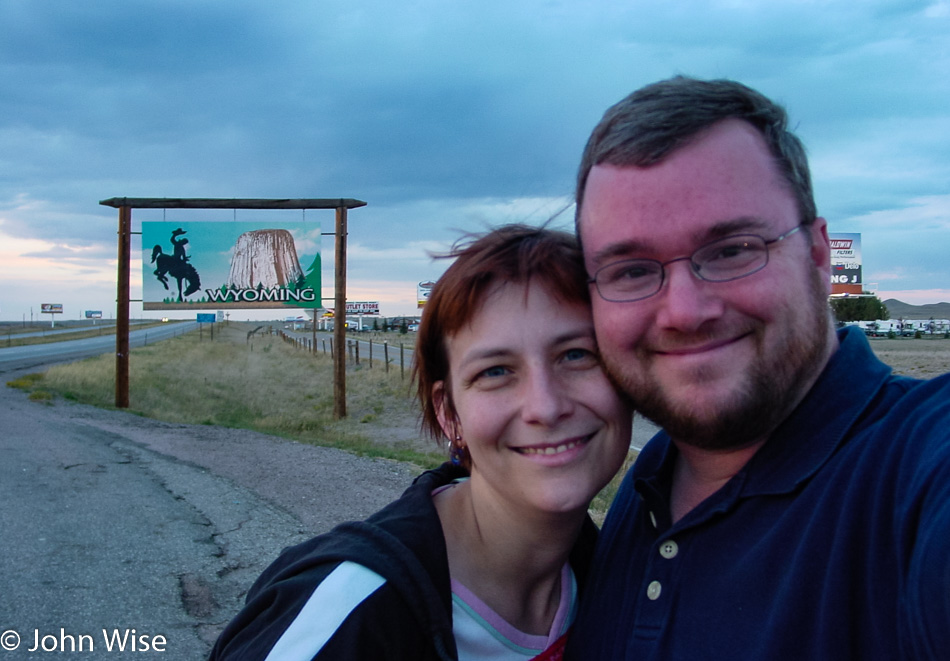
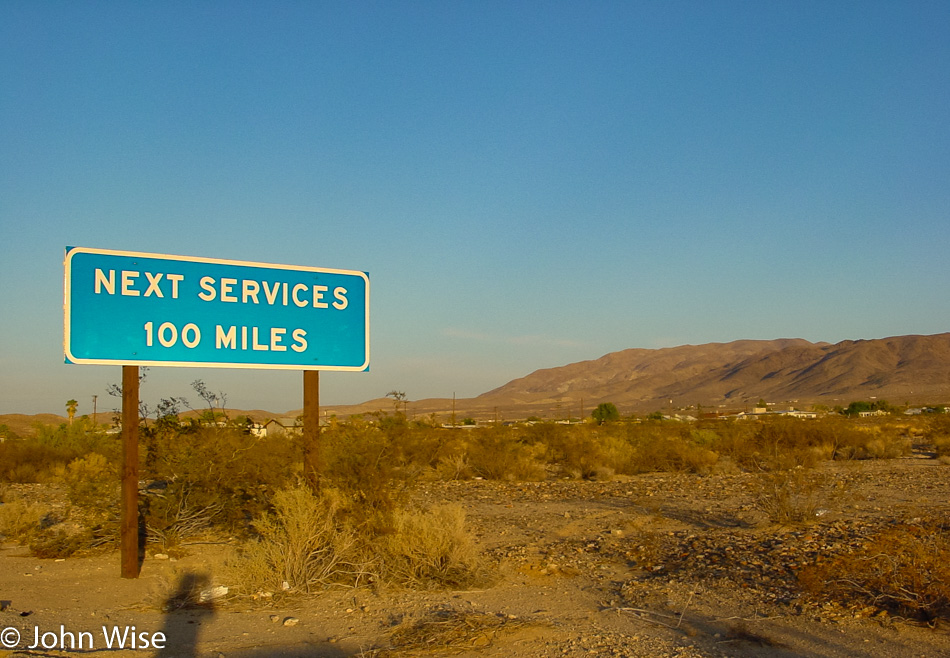
“I swear I did not see the speed limit sign or you hiding wherever it was that allowed you to come out of nowhere to give me this ticket.” Come on; we are out on the Great Plains where I can see for 100 miles; this state trooper must have been in an underground camouflaged bunker using a periscope radar to see that I was “kind of” going over the speed limit. He was a great sport in letting Caroline take his photo while he was giving me my ticket; all officers should be as nice as Wyoming troopers.

Bison in Wyoming

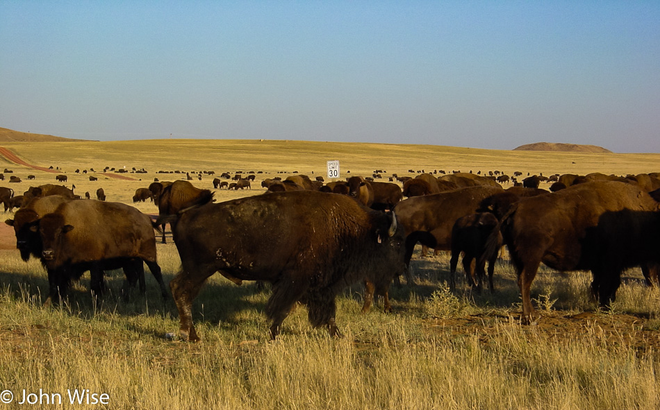
See, I told you that I couldn’t see the speed limit sign; it was behind all those bison milling around it. Come to think about this was probably some intricate speed trap, but how they trained an entire herd of bison to participate in these shenanigans is beyond my comprehension.

Devils Tower National Monument in Wyoming

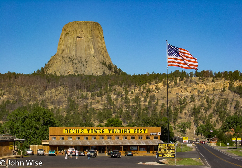
I’d like to know the statistics of how many people who visit Devils Tower National Monument have that iconic 1980s music from Close Encounters of the Third Kind in their ears.

Devils Tower National Monument in Wyoming

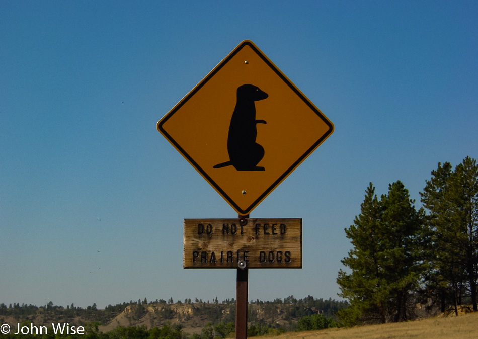
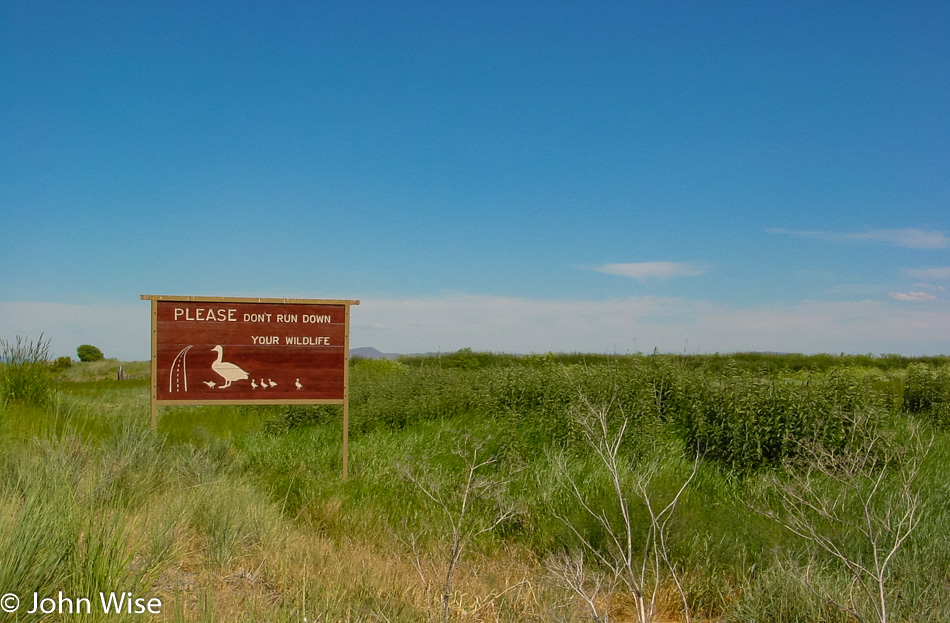
Another one of those wildlife signs that will prove disappointing because, just like the ones that warn of elk ahead or deer crossing, there obviously will not be any prairie dogs seen today that might be ready for some potato chips.

Devils Tower National Monument in Wyoming

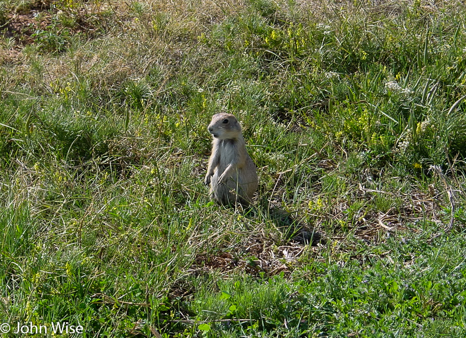
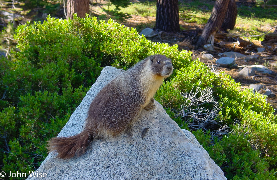
Okay, well, it looks like this one has already had his fill of potato chips. And no, Mr. Prairie Dog, it’s not the photo that makes you look bottom-heavy; you are that fat, did some kid give you their entire pizza?

Caroline Wise in Wyoming

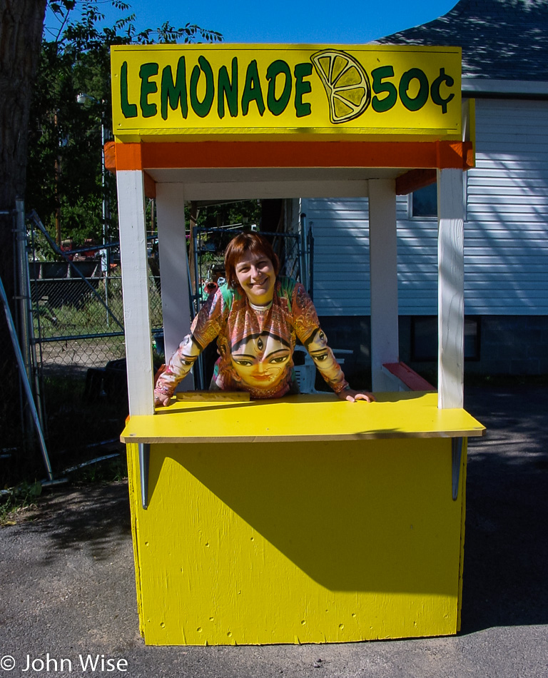
Somebody built their lucky kid the greatest lemonade stand ever! Unfortunately, there was nobody else here who had some lemonade to sell us, so we commandeered it for our photo-taking purposes.

Tipple in Wyoming

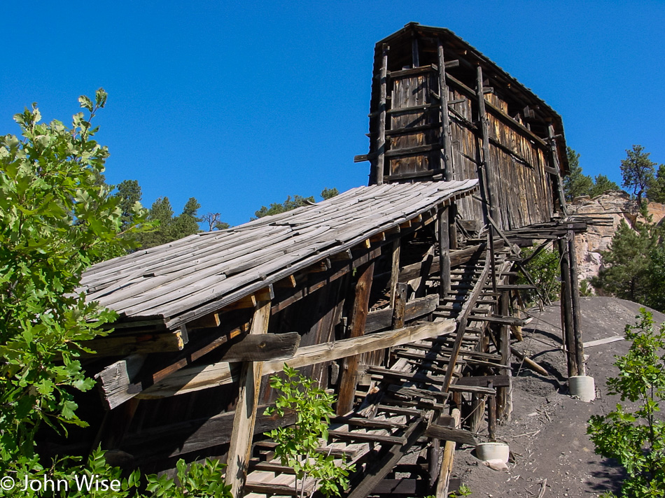
This is the Aladdin Coal Tipple, built in 1898, and when it was in use, it transferred coal to rail cars. That coal was sent through Belle Fourche, South Dakota, to gold smelters at nearby Lead and Deadwood. If you ever dreamt of visiting a tipple, I’d recommend you get busy, as this is one of the last remaining of its kind in the western United States.

Aladdin, Wyoming

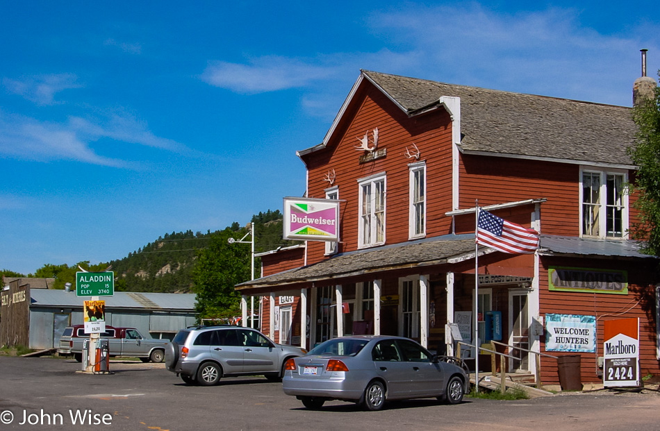
The town of Aladdin has shrunk from its coal mining days of having a population of about 200 to just 15 today. The old general store is now over 100 years old. A nice little place to stop for a drink and a treat on Wyoming Route 24.

Caroline Wise and John Wise entering South Dakota

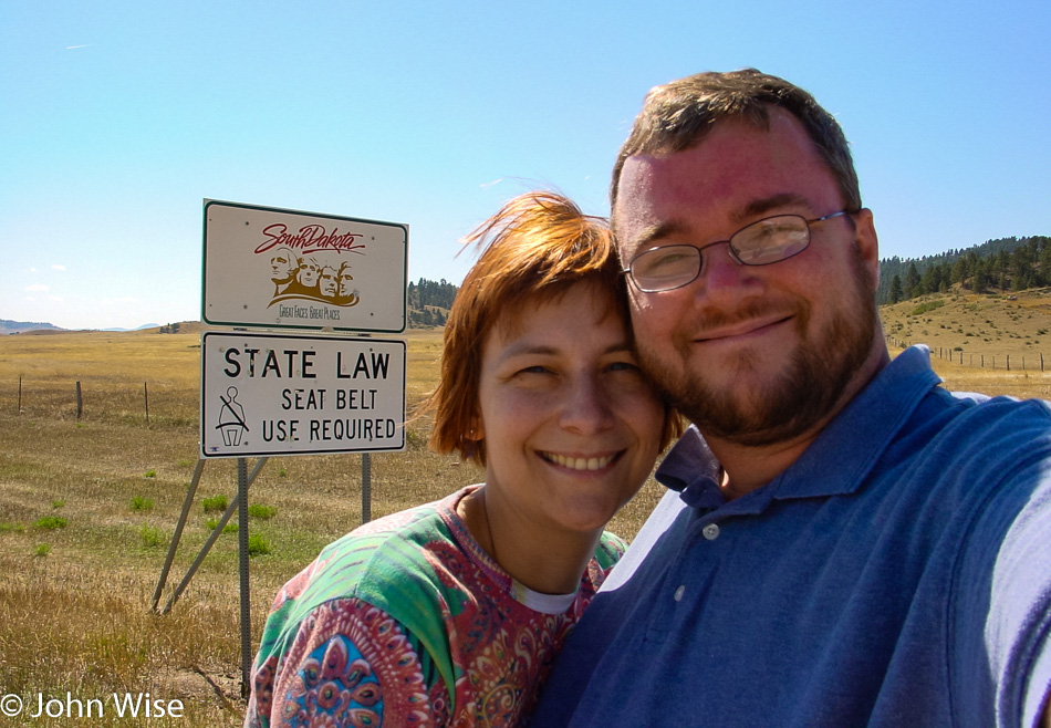
Entering South Dakota for the first time from the west because this is the “Western Edge” trip to Mount Rushmore.

Black Hills of South Dakota

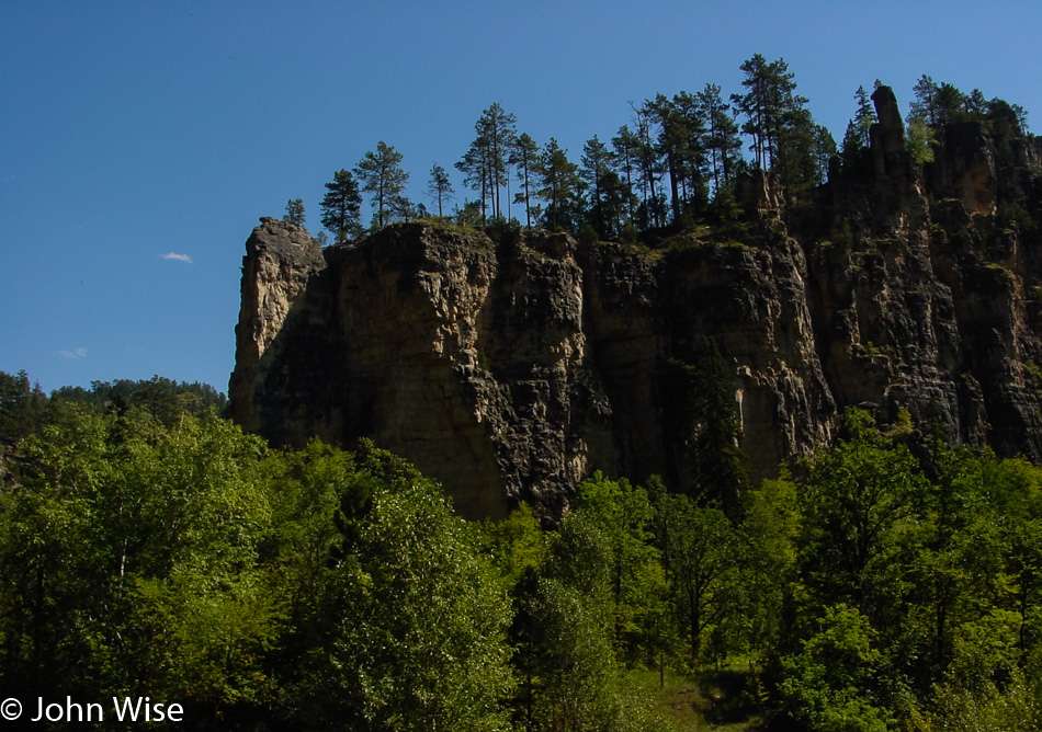
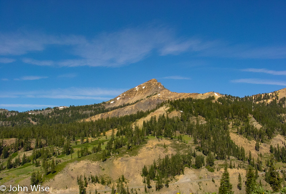
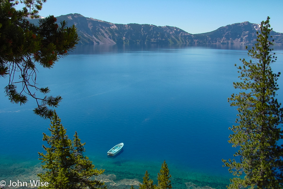
Into the Black Hills of South Dakota because this place is known for the Black Hills, and we have a deep desire to know all of these iconic places throughout America.

Caroline Wise in the Black Hills of South Dakota

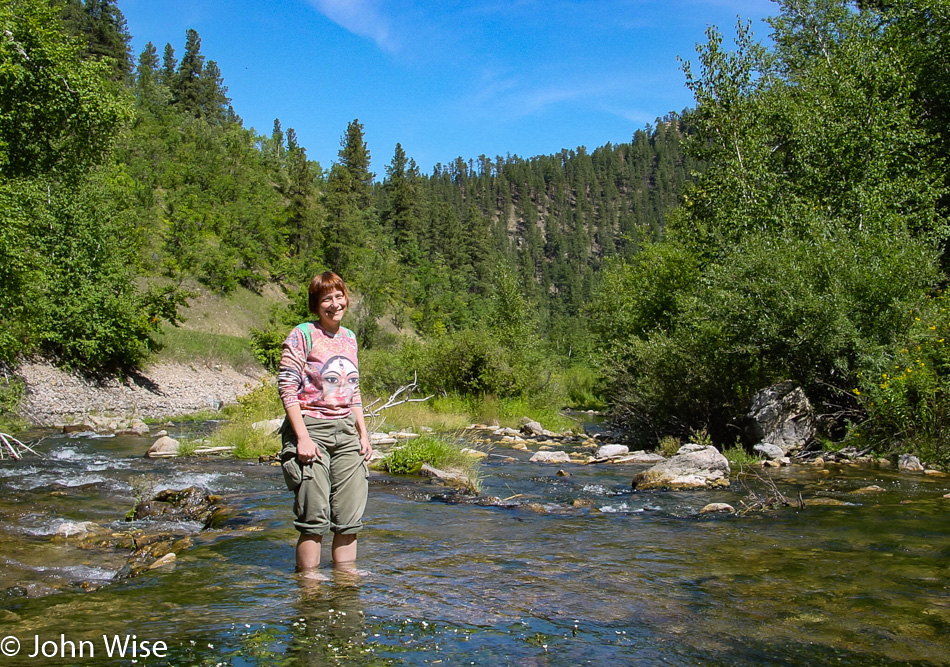
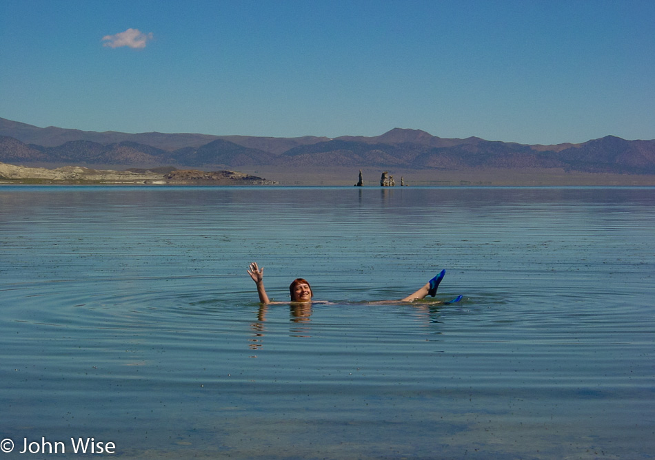
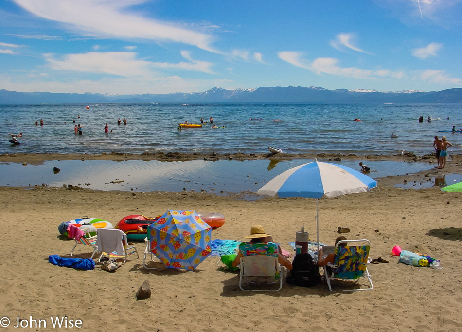
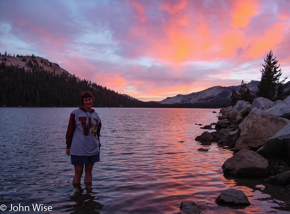
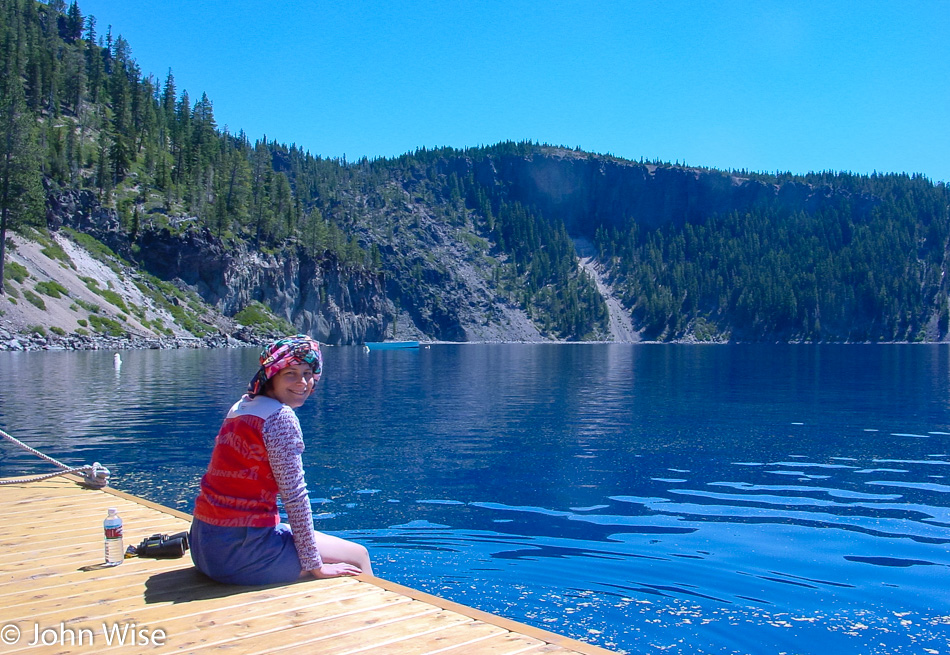
And, of course, Caroline has a deep desire to stand in as many waterways, lakes, rivers, streams, oceans, and bodies of water across America as she can.

Caroline Wise and John Wise at Mount Rushmore in South Dakota

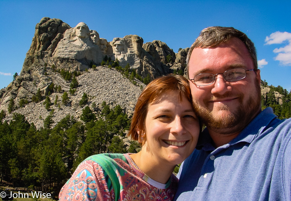
Maybe there’s a bit of cheesy factor going on here, but it’s still impressive. Caroline and I, being who we are, had to learn about the controversy of using Native American sacred lands for celebrating white Americans when we, as a country, have done little to nothing in gratitude for their sacrifices. You wouldn’t think it all that hard to offer at least an apology and an expression of gratitude to the many diverse peoples of our country in trying to modernize our magnanimity.

Custer State Park in South Dakota

Custer State Park is as beautiful a place as one could hope for, but I do have to scratch my head that there is not one park in America named after Crazy Horse, Sitting Bull, Chief Joseph, or Geronimo. While we do have Pontiac, Michigan, the honor of those whose lands were taken for our nation remains sadly neglected.

Custer State Park in South Dakota

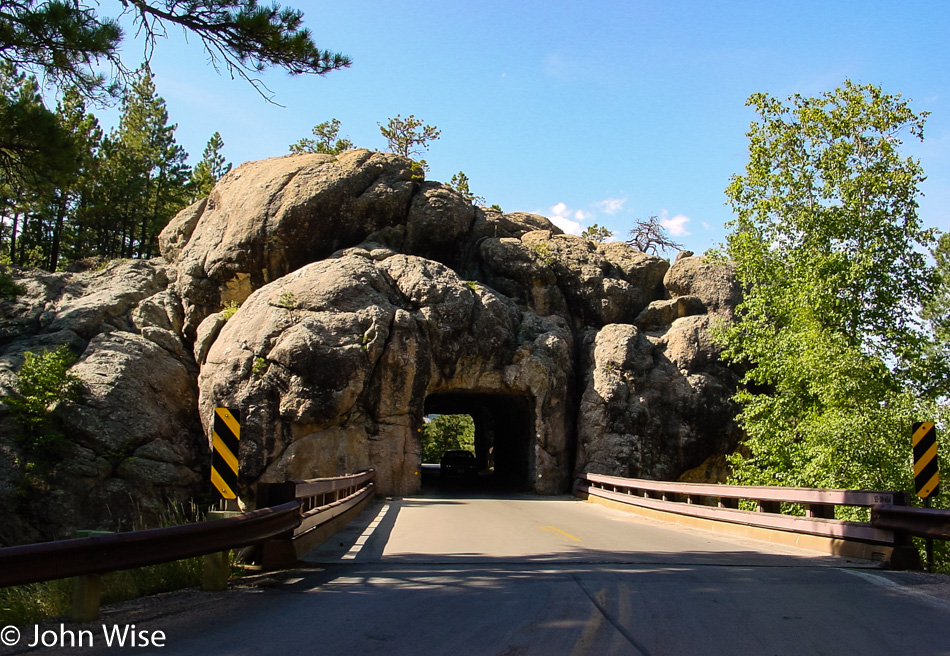
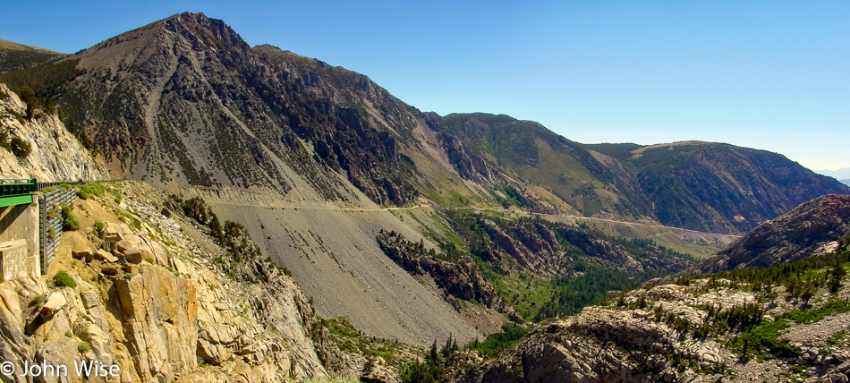
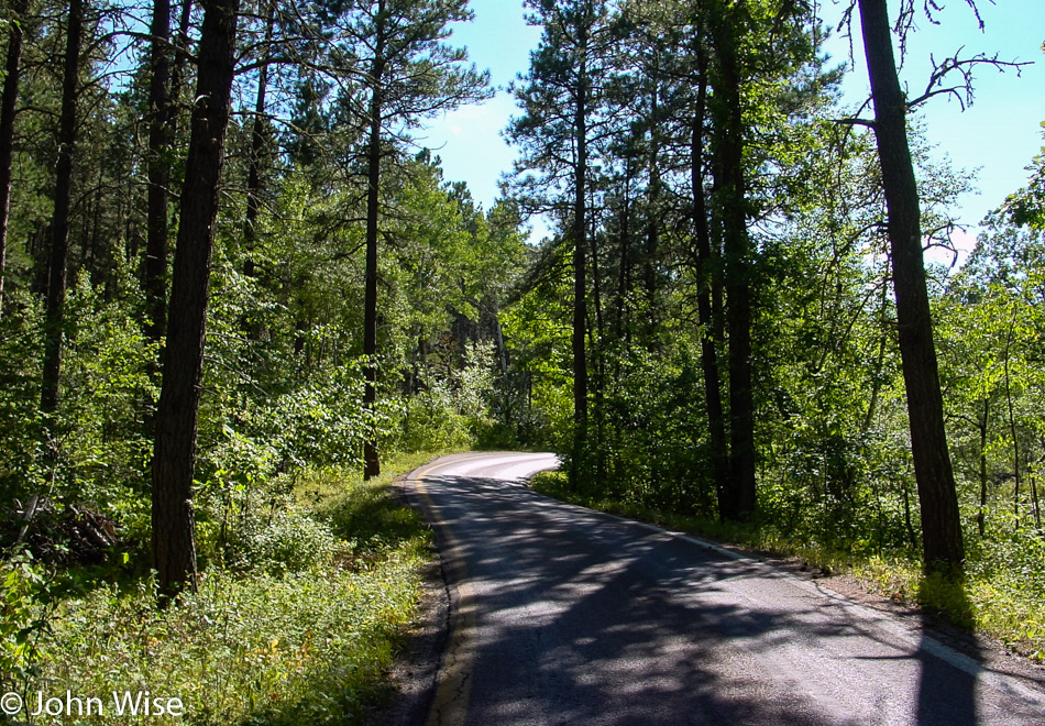
From the old wooden corkscrew bridges to tiny tunnels carved through boulders instead of being blasted to smithereens that would have allowed RV’s and small airplanes to navigate these roads, the designers and engineers responsible for the layout of Custer State Park did a great job.

Custer State Park in South Dakota

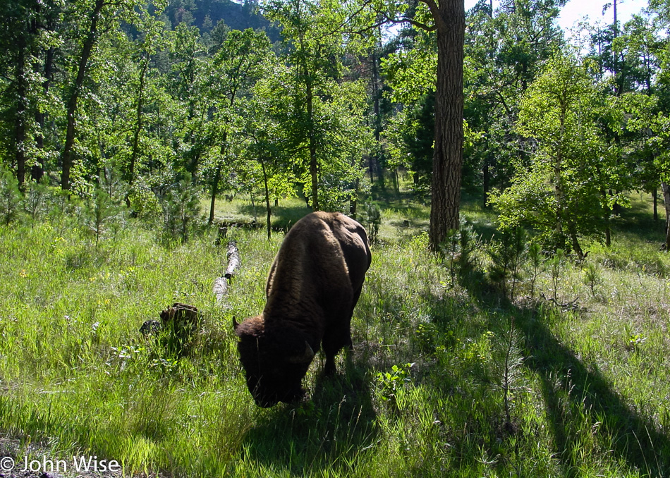
We ran into a couple of bison jams on the road, but this solitary one grazing in the shade won the “Bison of the Day” award.

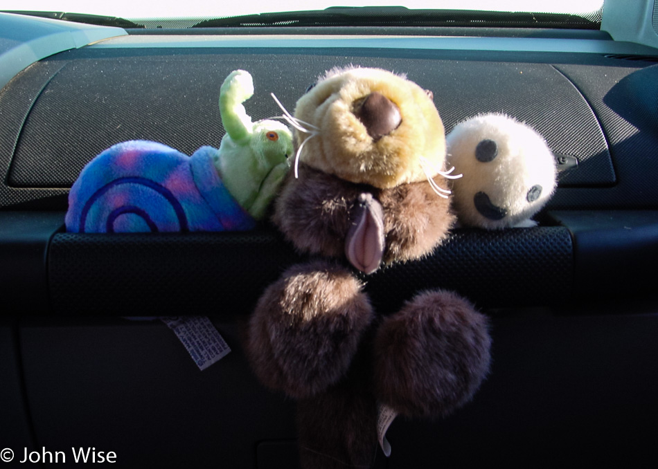
The snail was named “State of Maine” because we bought it while in Belfast, Maine, at the Purple Baboon back on our first cross-country road trip. The otter travels with us from the Monterey Bay Aquarium in Monterey, California, and if I’m not mistaken, the Kodama from the movie Princess Mononoke was picked up at Kinokuniya bookstore in Los Angeles, California.

Caroline Wise and John Wise entering Nebraska

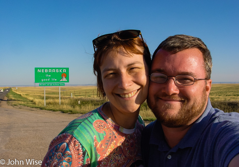
Out collecting states, making sure we see as much of America as possible. That’s our motto, and I believe we’re doing pretty good living up to it.

Nebraska

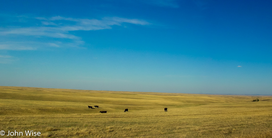
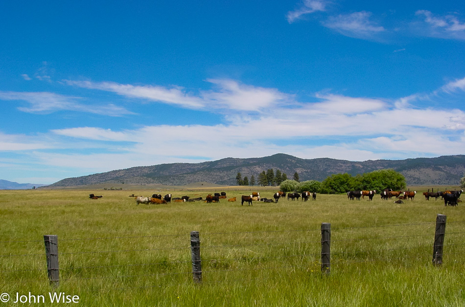
Cattle on the windswept Great Plains. By the time we get home, we’ll order “The Great Plains” by Ian Frazier after falling in love with these sights and the idea that, at one time, there were seas of bison out here that painted the landscape black with their numbers. Hopefully, we’ll get a chance to read Steinbeck’s “Grapes of Wrath” before our next visit.

Nebraska

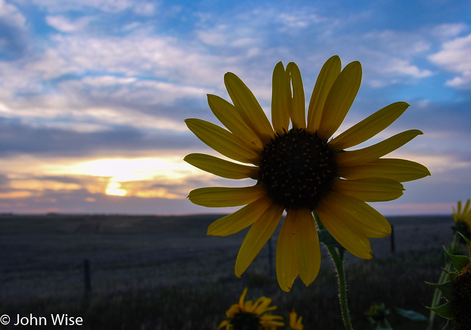
What would a visit to Nebraska be without sunflowers at sunset?

Caroline Wise and a giant sunflower in Nebraska

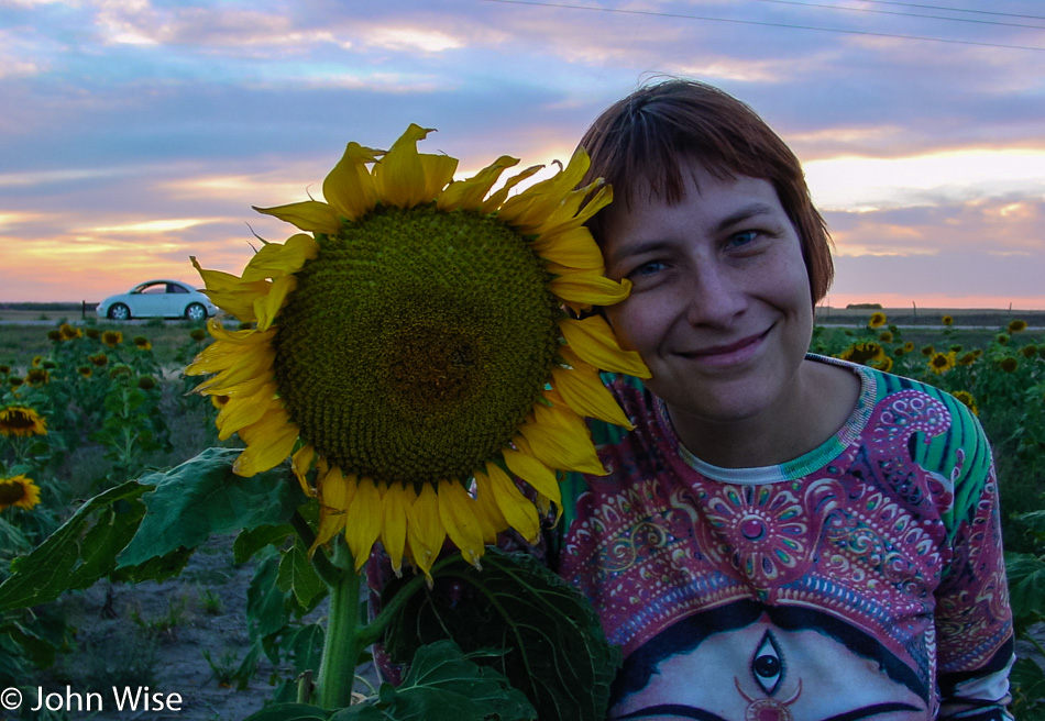
It would be nothing if I couldn’t beat that with the largest sunflower I’ve ever seen, along with my wife’s smiling face.

Nebraska

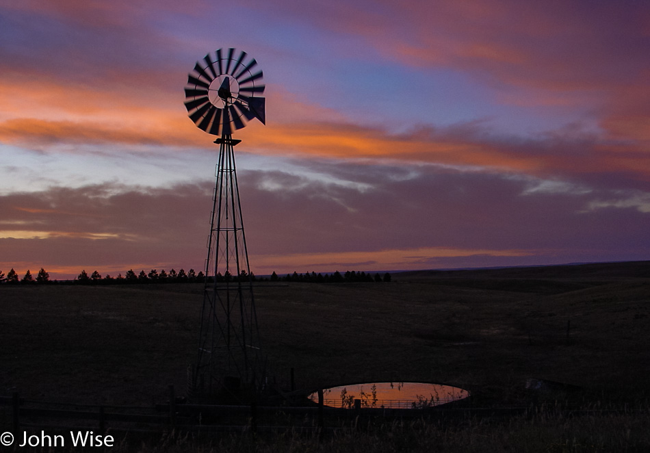
The metallic clang of the windmill spinning at dusk against the purple and red sky makes for a perfect close to an extraordinary day where it felt like we experienced three or four days all smushed into one.

Mount Rushmore Trip – Day 2

Albuquerque, New Mexico

We’re running late. It’s already 6:15 a.m. when we are getting back on the freeway. Why the rush? We are trying to get to Mount Rushmore in South Dakota, which is about 1,200 miles (2,000 km) from home. Our first stop this morning is 383 miles (616 km) from this overpass. Time to move quickly.

Garden of the Gods in Colorado

The trip of the “Western Edge” appears to be a theme here as we are just to the west of Colorado Springs, Colorado, when we arrive at Garden of the Gods, our first stop. This free-to-visit park was designated a National Natural Landmark in 1971, and should you find yourself driving up the middle of Colorado one day, you should drop in.

Garden of the Gods in Colorado

If we had the time, we’d be out there on that wagon for a hayride.

Garden of the Gods in Colorado

Our visit to Garden of the Gods was brief, but we did get a great impression of the place.

Caroline Wise and John Wise at Rocky Mountain National Park in Colorado

Anybody who knows us knows that there was no way we were going to pass up on the opportunity to visit a national park, even if it meant we’d have to drive through midnight. To dip our toe into Rocky Mountain National Park was only going to add about 100 miles (160 km) of driving, which sounded easy peasy to us, too, and so up the mountain, we strode.

Rocky Mountain National Park in Colorado

Out in these mountains, the Colorado River is born, which makes possible the abundance of food, life, recreation, and prosperity that many people enjoy from around the globe. Without the snowfalls in the Rockies, our lives in Arizona, Nevada, and Southern California would be vastly different.

Rocky Mountain National Park in Colorado

How lucky are the people of Earth that America’s 18th President, Ulysses S. Grant, established Yellowstone National Park? He was followed by our 26th President Theodore Roosevelt, who was one of the park system’s greatest supporters in giving to all of us these pristine, undeveloped treasures that we can experience in the way nature has shaped them without the heavy hand of man who has often been less than kind on our environment.

To the west are mountains, mountains, some desert, more mountains, and the ocean, and to the east, the Great Plains for as far as you can go, sort of.

Caroline Wise and John Wise entering South Dakota

While to the north is Wyoming and beyond that are parts unknown to the two of us, though we are willing to go into that void to see for ourselves just what is there.

And what we find is the golden sunset of perfection and you need to know that we had to bask in this beauty as long as we could because these two travel cheapos are on the hunt for a motel and not just any motel.

Carpet in cheap motel, Wyoming

We scored with that vintage kind of flair that lets you know these rooms have not been renovated since 1974. The great thing about this carpet is that it doesn’t matter how many people before our arrival have bled, ejaculated, vomited, urinated, defecated, blew snots on, or rolled around with open sores on the carpet because that’s all lost in the pattern. No, we do not travel with a black light, as knowledge is not power when you are only interested in saving money.

Cheap motel in Wyoming

These types of bed covers are a kind of Russian roulette where you just want to close your eyes before pulling back the corner. Then you have to decide if you really want to count how many pubic hairs are on the sheets and pillows. Almost worse is when you realize there’s no blanket underneath it and that this thing is going to be lying right on top of you. Our favorite moments, though, are when we finally do lay down, and gravity pulls us into the developing black hole at the center of the mattress that hardly qualifies as being such, as it is more a membrane funneling us into the center of the universe known as the “pile of John and Caroline trying to not roll onto each other.”

Independence Day in Oregon – Day 5

It’s not even 6:00 in the morning yet but already we’ve missed the sun coming up over the horizon. Time to hit the road for a repeat of some of yesterday. Our motel is located right next to Route 120, also known as Tioga Road, making our next move very convenient.

Up here by the park entrance, the sun is yet to rise, but if you look over my shoulder you can see it on the mountain tops. Yesterday was so beautiful we are throwing caution to the wind, and instead of going home and arriving at a reasonable time, we decided to drive back up the Tioga Pass to catch a few more glimpses of a side of Yosemite we’d not seen before.

Tenaya Lake looks quite different in the early morning, not better, not worse, just different and still magnificent.

We are venturing further into the park than we were able to yesterday as we were losing daylight.

Siesta Lake was as far as we were willing to go, and we accepted that we couldn’t do it all even though we try. Just seeing upper Yosemite in this light has made our detour worth everything we have to give up in sleep.

Back at our car, a proud marmot was posing with its scat that, in its world, must be a super load otherwise, why the staredown?

The view from Olmsted Point offers a look at Half Dome that I’m guessing few ever get to see based on how light the traffic up here yesterday and this morning was, it can easily be surmised that the majority of park visitors only go to Yosemite Valley.

Another view from Olmsted Point.

Our last encounter of greenery meeting water before we descend into the desert and its harsh environment.

Viewed from here, driving over that scree slope looks sketchy.

Hey anyone up for a swim in the salty water of Mono Lake with the brine shrimp and blackflies? Of course, Caroline would be interested in making her way through the swarming critters both in the water and on its surface; she’s kind of a badass in that way.

Welcome to one of America’s largest concentration camps from World War II. This is the Manzanar War Relocation Center, where a lot of Japanese American citizens ended up, but this was only one of the ten camps in America. In total, our country rounded up 120,000 Japanese and their families, removing them from their communities, land, property, and businesses and fully uprooting their faith in the American system of justice.

It was December 1942 when Edward R. Murrow told the American people that the German concentration camps were, more precisely, extermination camps, and yet since February of the same year, the United States was operating concentration camps of their own. While it could be argued that the American position of incarcerating these fellow Americans didn’t result in their deaths, the xenophobia that gives rise to these types of actions are the flames of hatred that, once unleashed, can be difficult to extinguish.

The rusty nails hammered into our freedoms, into the hearts of a loyal citizenry, into our constitution are then pulled out and left in the sun as grim reminders that our sense of right and wrong can be unpredictable and shifted like so much sand in the wind. When we institutionalize hate as we have for Native Americans, African Americans, Jewish Americans, Muslim Americans, Gay Americans, Mexican Americans, Irish Americans, and any of the other ethnic and religious groups that we as a society have sanctioned hatred for, we are not being the best we can be. We descend into petty small-mindedness and debase what we claim to stand for. We are not inclusive; we are elitists who have lost their way.

While the barracks and the majority of the manifestations that America operated a concentration camp system were bulldozed, there are still stark reminders that we have a long way to go before we can lay claim to operating a moral compass that can guide others. How is it in the 21st century that we are still talking about civil liberties, equal rights, educational disparities that appear to be institutional and biased against people of color, a correctional system that also displays an ugly bias, and the list goes on and on? While the barracks are gone now, ask a Native American how different their reservation is from a camp in the desert that took away the rights of a people, ask a Mexican American in hiding from immigration authorities how free they are beyond picking our food or cleaning our yards to travel, or ask a gay couple how comfortable they are to hold hands in public? Hell, a woman cannot even breastfeed her child in public without raising the ire of the intolerant mob.

Our country is vast; its founding documents are inclusive and welcoming. Yet our actions of isolationism scream louder than the words so eloquently placed on that parchment. There is room for all in America, but our fear of others and our disdain for those falling outside of conformity are a weakness that will continue to hamper our future until the time comes when we can confront our stupidity for what it is.

The deep-fried zucchini was pretty good, but the Mexican food was HORRIBLE.

This is one of those signs that let you know just how big America is. Never in Europe would you be warned that you will not find services for the next 162 kilometers; as a matter of fact, you can’t drive 15 km in Europe without running into another village.

The sun sets on the West and our Independence Day adventure. Tomorrow, that very same sun will return, creating a new dawn, but too many of us will not wake up to this idea of reinvention and new adventures; we will instead drag the same old version of ourselves out of the previous day. Race past your habits and desire to stay in place and get out on the road, both in reality and metaphorically. The world is ready to be embraced and experienced, even if it’s in fits and spurts that don’t allow for total immersion. Better to have tasted the victory of knowledge and beauty than to be a prisoner of an outmoded construct of physical and mental stagnation.

Independence Day in Oregon – Day 4

When we get home, we’ll pay for these long days as we collapse in exhaustion, but for now, we just keep going. This morning, we were out of the motel and on the road by 6:15. We are on the approach to Lassen National Park.

It is this stuff here that delays us getting places in a timely manner, as flowers are a powerful attraction and scream at us to stop and take photos. While we’re in the throes of quickly stopping the car, jumping out, grabbing the photo, and getting going again, it seems rational and perfectly reasonable to think, “What the heck, it’ll only take a minute,” except these minutes add up and it’s probably never as fast as I hope. Part of the allure of these races to get out and around is to capture enough elements that when we look back at the visual arch of the trip, we will be inspired to visit some of these spots again or if there was an abundance of mediocrity we can relegate that corner to the pile of “not interested.”

This is Hat Lake and one of the first big indicators that there’s more to this park than the southernmost active volcano known as Mount Lassen, which is the main draw for our visit today.

Kings Creek runs through this meadow; unfortunately, we weren’t prepared to do the same. Next time in Lassen, remember to bring waders. And this is how it happens for us to be drawn back to a place; these beautiful impressions continue adding up until we reach astonishment levels. This will be accompanied by a bit of sadness that we weren’t able to fully explore this meadow, but then again how in the world does anyone on a five-day trip that takes in Bonnie & Clyde’s Death Car, Devils Hole Pupfish in a remote corner of Death Valley, Ash Meadows Refuge, the Rhyolite ghost town, fireworks in Lakeview, Oregon, Crater Lake National Park, Lava Beds National Monument, Lassen National Park, Yosemite National Park, Lake Tahoe (coming up later today), Mono Lake and Manzanar National Historic Site (giving away where we’re going tomorrow) and not need to be quick about it?

This is Mount Lassen, and while there’s a path to its peak, this will not be the trip where we make that hike.

Lake Helen alone could be a great reason to visit Lassen. Fortunately, there are 1000 other compelling reasons to be here, too.

The terrain is varied and beautifully seductive. Our three-hour bullet tour can never do this park justice, but at least now we know that if we planned a couple of longer hikes here, the time spent would be well worth the effort.

Visiting the Sulphur Works hydrothermal area is an immediate reminder to your nose that this is a geologically alive area. Volcanic activity has been a large part of Lassen’s past and could still be a part of its future.

Gases and boiling water suggest something is cooking below. Mount Lassen’s lava dome is the largest on earth and is definitely still active, with its last eruption occurring back in March 1915.

Here at the southern entrance is the sign we’d been looking for on our way into the park this morning, hence why it’s being shown as we exit the park.

What a great day to be out driving in northeastern California.

Lake Tahoe is a beautiful place, but with the bumper-to-bumper traffic in town, this is coming off the list for a return visit around any holiday weekend. I know, famous last words.

The mountains of the western United States are a treasure comparable to the extraordinary beauty found in the Alps of Europe. It’s kind of funny how when we are not among these marvels, they are “out of sight, out of mind,” but when we are here, I want to remain in their towering stature and bask in their glory, I’m guessing that’s how many visitors feel after visiting this vast land that reaches into the sky and our hearts. Again and again, I should return to these mountains and the memory of John Muir, who not only founded the Sierra Club but worked tirelessly to protect hundreds if not thousands of square miles that include Yosemite, the Sequoias, Redwoods, and uncountable locations in between.

To those who drag heavy machines and asphalt out to the sides of mountains, taming the land so we might cruise along the edge of a place without needing to ride a horse and spend valuable time that is in short supply: I thank you all.

I should probably link higher resolution images to these panoramas as they are much better storytellers; when you can see the details that we saw that day and that are still present in the photos, maybe I’ll get to that task one day.

That’s Mono Lake in the distance, and we need to decide if we should drive down there or not.

Nobody needed to twist our rubber arms as the car seemed to have a mind of its own and pulled us in closer until we were right next to the shore. Who would have ever dreamed that we would visit two endorheic places in one long weekend? Endorheic basins or lakes (such as Crater Lake) have no outlet, and while Crater Lake is always being replenished by a lot of rainfall and up to 44 feet of snow per year, Mono Lake is a saline body of water similar to the Great Salt Lake in Utah and the Salton Sea in Southern California.

Once again, we are on the move, hunting for a perfect sunset.

Well, this seems like a great place for a sunset, but what about further up the road? And what road might this be? We are in Yosemite National Park, having come in via the east entrance.

Lembert Dome in Tuolumne Meadows is almost the perfect place for sunset.

And then we find THE perfect place with the perfect light on a perfect day right smack dab here where we are in the meadow.

Tenaya Lake is where we’ll snap the last photos of the day before heading back down the eastern side of Yosemite. This is an alpine lake with a surface elevation of 8,150 feet (2,484 meters), which is probably the highest body of water Caroline has ever stood in. If you are wondering about the temperature of the water, she let me know it was cold, really cold.

Independence Day in Oregon – Day 3

Though we were up late last night for the fireworks, we still woke up shortly after the break of dawn this morning and were getting gas by 6:30 (we’re still unaccustomed to having someone else fill our tank here in Oregon). Between stretches of the forest, we also drove through some beautiful meadows and spotted four pronghorn antelope basking in the sun while we basked in their glory from our perspective driving by.

Our path wasn’t the most direct, but it was certainly scenic. County Road 676, also known as Silver Lake Road, passes through the wetlands next to Wocus Bay and the Klamath Marsh National Wildlife Refuge. While passing through the refuge, we spotted a beaver, cormorants, and geese.

By 10:00, we are pulling into Crater Lake National Park, and the furthest northwest we’ll travel on this extended long weekend, Silver Lake on the way here this morning was a bit further north. After checking out the park map, it’s decided to take the loop drive around the lake going clockwise.

Our view of the lake is a spectacular one. The color of the water is the bluest we’ve ever seen; maybe it has something to do with how deep it is, as it is the deepest lake in the United States at 1,949 feet or 594 meters. Or maybe it’s the elevation here where the caldera rim reaches heights of 8,000 feet or 2,400 meters above sea level. Maybe it’s the fact that no stream or river runs into the lake, as this lake has been filled with rainwater and snow. But the reality is that it’s probably the combination of all these factors. On the right of the lake is Wizard Island, which is a cinder cone formed about 7,000 years ago. The island’s peak is 767 feet above the surface of the lake, but incredibly, it sits on the caldera floor over 2,000 feet down below. The trees on the island have never been harvested, with some of them clocking in at over 800 years old now.

We are heading down the Cleetwood Trail which is the only trail in the park that takes you lakeside.

Kind of a strange thought that we are atop a 2,000-foot-deep caldera here at water level and that where Caroline is sitting used to be a mountain peak that towered over a mile above her. That mountain peak was called Mount Mazama before it exploded in a fit of volcanic fury just 7,700 years ago. While in human terms, that might seem like a lot, in geological terms, that was a split second ago.

The scenic drive doesn’t exactly follow the crater rim; east of the lake, we drove through a beautiful canyon complete with several waterfalls, including a larger one called Vidal Falls. A little bit further down the road, we returned to the lakeside and were able to catch this great view of Phantom Ship, that black rock in the lake that stands 170 feet high.

Just three hours after our arrival we were already heading for the exit but stopped at the visitors center for some tchotchkes because life without a fridge magnet is meaningless and empty.

Driving south towards California, we pulled over to a scale and learned the useless information that our car weighs 1350 pounds. After arriving in California, we stopped to pay a visit to the Klamath Basin National Wildlife Refuge in Tulelake. Here in the refuge, we spotted some black-necked stilts, glossy ibis, and western coots, so like the sign points out, “Don’t run down your wildlife.”

Just a few minutes south of the refuge, we enter Lava Beds National Monument and are nervous that the visitor center might already be closed as it’s a bit after 5:00. With that in mind, we stopped here at the Devil’s Homestead Lava Flow overlook and were just as quickly off and running again hoping the visitor center might be open longer than others.

Lava Beds National Monument in Tulelake, California

Wow, the visitors center is open until 5:30 leaving us 10 minutes after we arrived to buy a magnet and find out what else we can do with our shrinking day. Drats, there are no magnets, might as well go home! Just kidding. We walked over to the closest and most easily accessible lava cave equipped with lights, explanatory signs, and a stairway right in the visitor center parking lot. One of the major attractions at Lava Beds is that people can explore over a dozen of these caves; helmets and lamps are available at the visitor center for the unprepared, as long as one arrives in a timely manner. Lava caves are formed when the flowing lava cools off on the surface, building a roof, while the hot lava below continues to run until it empties, thus leaving a tunnel. During the cooling process, interesting underground shapes can be formed, and sometimes these tunnels cross or are re-melted and re-cooled during and after a volcanic event.

Lava Beds National Monument in Tulelake, California

Melted stone, dripping calcified minerals, lichen, a bunch of spider webs, and people have replaced the 2,200-degree lava that once flowed through here, and we’re probably luckier for it.

Lava Beds National Monument in Tulelake, California

We are out of the cave less than 30 minutes after we entered it; this is the downside of trying to do a little bit of everything in the shortest amount of time.

Lava Beds National Monument in Tulelake, California

A cinder cone that one day might grow into a full-fledged volcano. Tomorrow, we’ll continue the volcanic theme with a visit to Lassen National Park, but for today, we need to get along as we are hoping to get down to Susanville that on a direct route wouldn’t be too far away, so we’ll take the long way so we can get a glimpse of what you see in the next photo.

Mount Shasta, California

This is Mount Shasta, standing at 14,179 feet above sea level, a dormant volcano. Maybe this road trip should have been themed as the “Volcanic Run.”

VW Beetle covered in insects

It was quite a detour around Mount Shasta and Weed, California, but I’d seen those iconic images of the Weed sign with Mt Shasta framed behind it and just had to see it for myself. We stopped for gas in McCloud, and while we were enjoying the views, we were almost shocked at the carnage on the bumper. I’ll spare you the closeups.

Mount Lassen, California

The sun setting in the distance, and yet another view of Mt Shasta.

Caroline Wise at Frontier Inn in Susanville, California

We finally arrived in Susanville, California, at 11:00 p.m. and had a seriously funky room here at the Budget Host Frontier Inn.

Death Valley to L.A. – Day 1

Caroline Wise and John Wise in Death Valley National Park in California

I have no idea what Caroline was doing or thinking as I was taking this selfie of us visiting Death Valley National Park but this is one of the cuter photos of her in my book. It seemed like a good weekend to dip our toe into the hottest National Park in America, and so here we are on June 1st and thinking, “Well, maybe January would have been cooler?”

The way things started, though, was different, and while maybe we should have left Friday night, it was 7:00 a.m. this morning and as good a time as any to head west. We were only going to Los Angeles when we’d left, but then, in Quartzsite, I had the bright idea we should deviate from that plan and go to Death Valley. So here we are.

On our way, we drove up the 95, which parallels the Colorado River, for a while before entering the deep desert. In Needles, we merge onto Interstate 40 for a short while until we reach Kelbaker Road, going north through the Mojave Preserve. In the small town of Baker, we have one of those moments where you slap your head and ask, “What the hell is this?” The thing that triggered it was a sign saying, “Welcome to Bun Boy Territory.” Too bad it’s not late enough to check in otherwise, it would be party night at the Bun Boy Restaurant and Motel!

Death Valley National Park in California

Bare naked rocks look like a geological marvel while just sitting here, having all the life baked out of them in the driest place of all North America.

Death Valley National Park in California

Where are the other visitors? It’s summer vacation, and we seem to be the only ones here.

Death Valley National Park in California

We can’t even find something cold to drink; all there is here is this Badwater and salt. Getting serious, I have to say, “Wow!” to being here 282 feet below sea level while it’s 118 degrees (48 c). This place is as exotic and intriguing as anything we might see in Yellowstone, just a lot dryer and, at times, nearly as stinky.

Death Valley National Park in California

I wonder how many people and desert-dwelling creatures have looked up and seen clouds forming overhead and were hoping for a respite in the form of a light shower, only to witness the clouds burn off or drift over the horizon.

Death Valley National Park in California

We entered from the southeast and headed to the exit in the northwest as we were trying to get a general feel for what Death Valley is like. Should this ever be our only visit to this National Park, at least we’ll have some impressions.

Death Valley National Park in California

Boiling hot temperatures, bad water, baked mountains, bleached salt, stark skies, and now cracked earth where water once was. All the iconic stuff coming together to make this a true albeit brief Death Valley experience.

Death Valley National Park in California

Wow, and now we even get sand dunes. Just past here, we will turn left onto Emigrant Canyon Road before turning right on Wildrose Road as we head for the exit. We had stopped at the visitor center to inquire about relatively accessible scenic roads we could also visit in the park, and the ranger told us about a back road that is well maintained so that we could travel it, and that’s what we’re going to do.

Wild Donkey's in Death Valley National Park in California

What the ranger didn’t tell us about were the donkey thugs trying to hide out and blend in as we drove by down this old dusty road. While they tried to look intimidating, threatening even, we knew that while they had guns, with those hooves, they’d never be able to pull the trigger. I yelled at them to go home and get domesticated, which apparently infuriated these asses, and they clambered for their weapons.

Wild Donkey's in Death Valley National Park in California

While they were distracted trying to show us how tough they were, we sped away. Just then, Becky bolted out of a nearby ravine, braying for us to save her from a life of servitude in the hostile confines of not just Death Valley but the uncultured brutes that were holding her prisoner. Caroline, without skipping a beat, jumped into the back seat and threw open the door and then just as quickly was back up front as Becky leaped into the car, and I raced out of the park. The last we saw her, she was frolicking off to the North Haiwee Reservoir near the Coco Range Wilderness Area, looking relieved and free to pursue her dreams. Becky will always be in our hearts as the only donkey ever brave enough to leave her burden behind and have the strength to choose her own path.

Mix Bowl Cafe in Pomona, California

What a busy day with a lot of miles driven. Lucky us Mix Bowl Cafe in Pomona is open late. This is our favorite little Thai joint in the L.A. area. Koo-chai and a shared plate of pad kee mow at 10:30 will always hit the spot. Over at California Inn, they still had a room for us, but to our horror, the rooms were being remodeled, and our satanic floor tile in the bathroom was gone. Oh, the sadness and tragedy brought to an otherwise perfect day. In another post, I’ll share the tile and what I’m referring to.