Big Bend, Carlsbad, Bosque, Petrified Forest – Day 2

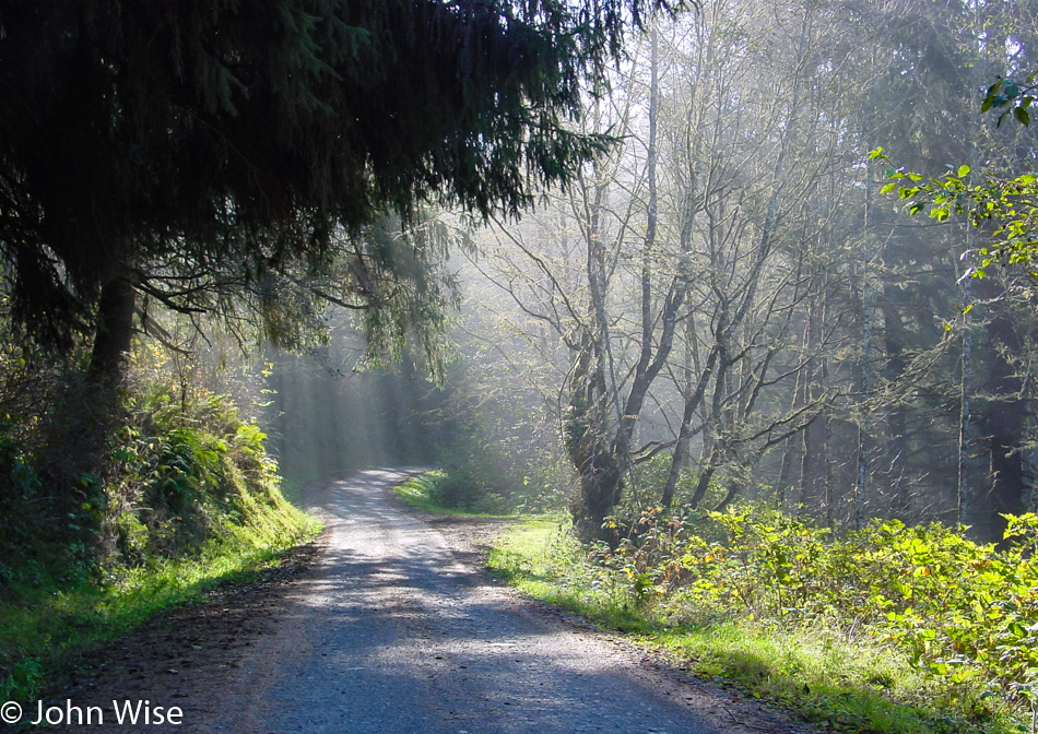
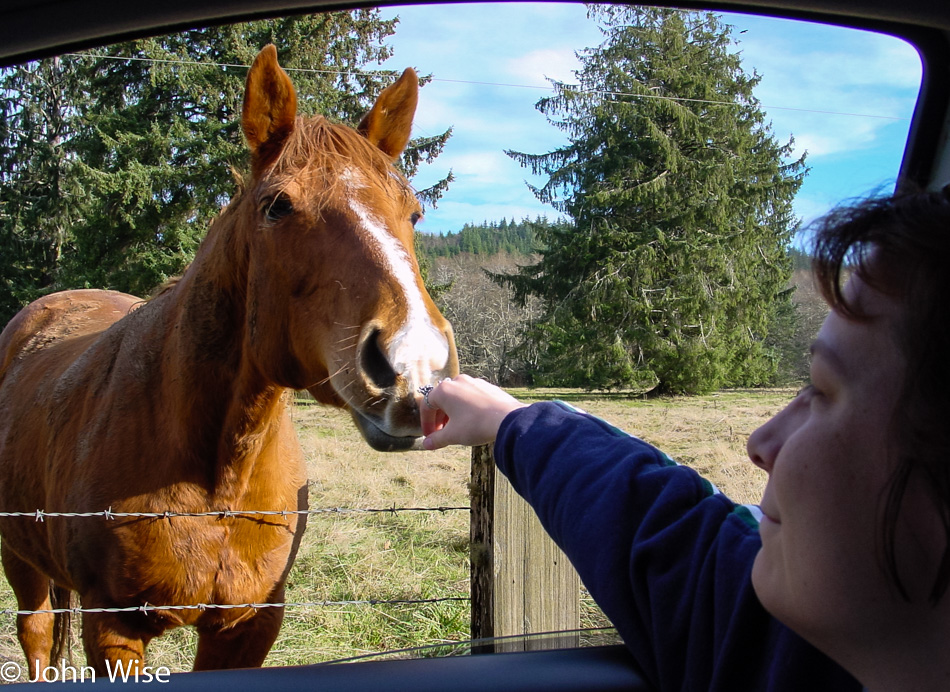
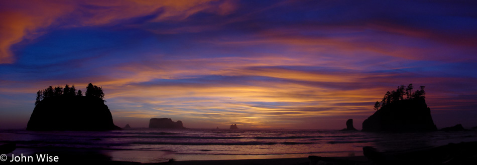
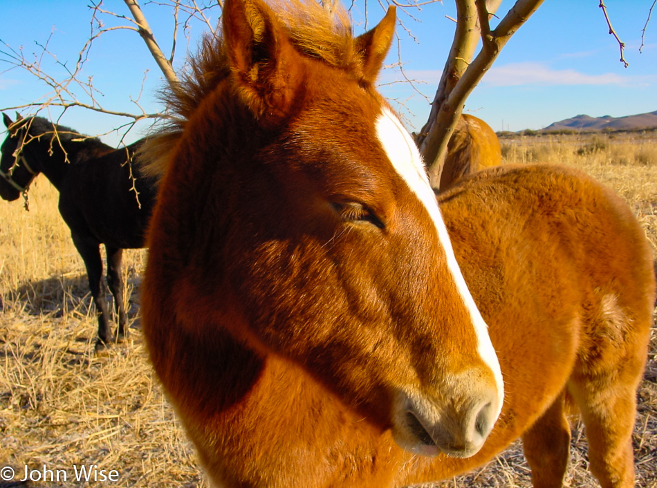
It never fails that getting away from a major freeway allows us to see the world change in dramatic and beautiful ways. We are well outside of El Paso now; as a matter of fact, we entered Texas at 6:00 this morning. By the time we stopped for this photo of the pony in the rising sun, we were on the US-90.

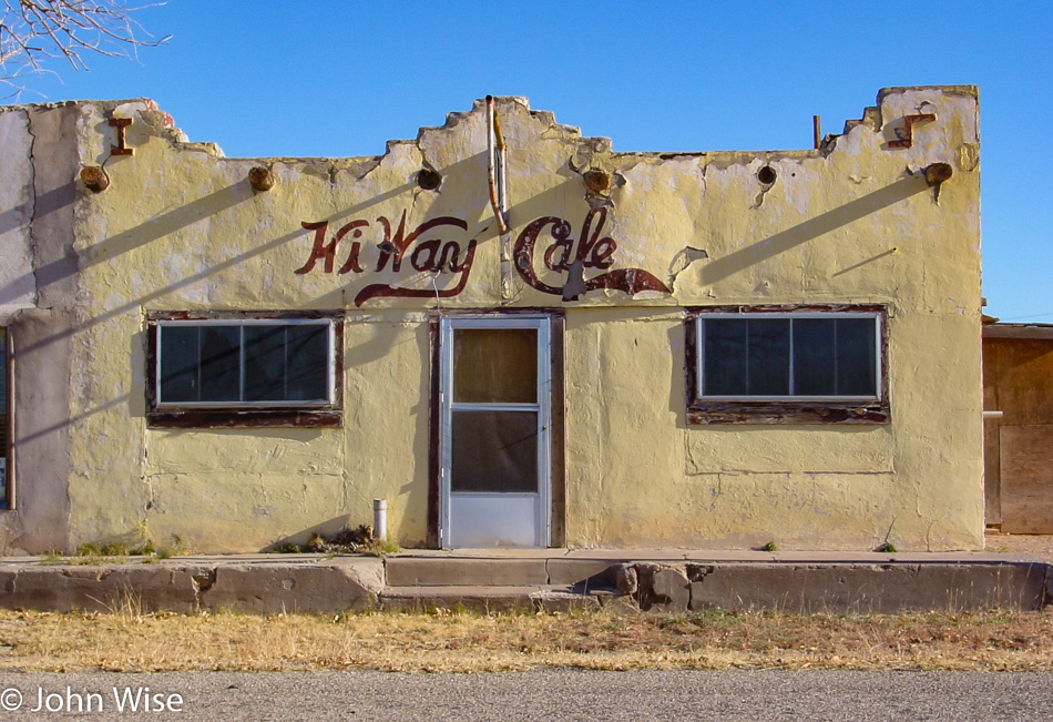
Good thing we have our ice chest with us because eating here at the old HiWay Cafe is now out of the question.

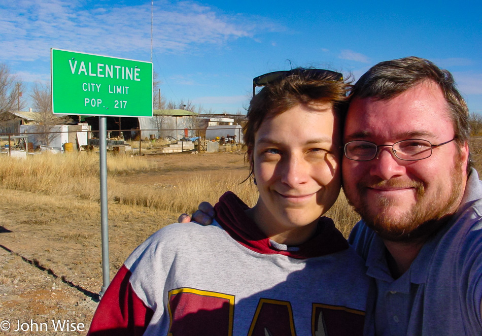
Well, no wonder the cafe had problems staying in business; the town of Valentine, where it’s at has a population of only 217.

Update: As of 2016, the population has dwindled to only 125 residents. By 2023, it was 73.

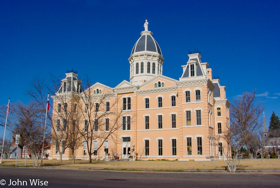
Welcome to Marfa! I’d already known the name of this town from a stint in drug/alcohol rehab I did back in 1983 (I think that was the year). By some freak chance, I ended up in a hospital in Century City, California, across the street from the Twin Towers as they were known (used for the exterior shots of the TV series L.A. Law), and after I’d been there about a week some homeless guy was brought in by a taxi driver who told the people that greeted this transient that he’d been on the floor of the taxi tripping out about the threat of being shot on his way in.

More than a few of us wondered why they allowed the heavily bearded old guy in this place on the edge of Beverly Hills. Over the next days, I’d walk by his room, and on one occasion I heard him listening to Kraftwerk, which at the time seemed kind of out of the ordinary. Another time, I caught the Screamers and thought, “NO WAY!” I was 20 years old and had been deep into the Los Angeles punk scene, and this dude was just too old for punk; he was probably about 50. Yeah, one more time strolling by, except this time, I thought I was hearing Devo’s rumored but unreleased Muzak recordings. I had to stop in and ask.

The guy had told me that the Screamers had recently played at his birthday party. I was incredulous. Regarding Devo, I was correct, and he told me that Mark Mothersbaugh was his friend. “So, who are you?” He answers me with another question, “Have you ever seen the film Giant with James Dean?” My answer was no, as I loved horror and sci-fi growing up. “Well, what about the film Easy Rider?” I excused myself, explaining I was a punk/industrial kind of person and that the hippy stuff of the late ’60s was more my dad’s generation than mine. “What about Apocalypse Now?” With that, he struck a nerve: he was the crazy photographer! I had just met Dennis Hopper. The old guy taught me a lot over the next couple of weeks, including planting the seed of taking an interest in his film career that early on took him to Marfa, Texas, where he was featured in the film Giant with James Dean and Elizabeth Taylor.

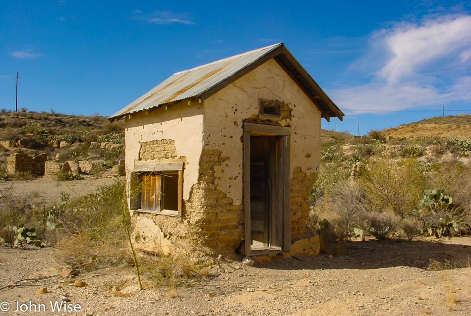
Out of Marfa and onto US-67 heading for the Mexican border. Along the way, we passed through the Shafter Ghost Town; not many ghosts, but many ruins remain, although they are fading from the sun and wind that constantly gnaw at their existence.

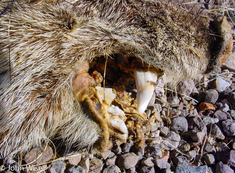
This old javelina didn’t make it out of town and was lying here drying out like the rest of everything that passes through. Looking back, I should have grabbed one of those fangs for a pendant, though I guess that practice was reserved for those who took the animal’s life.

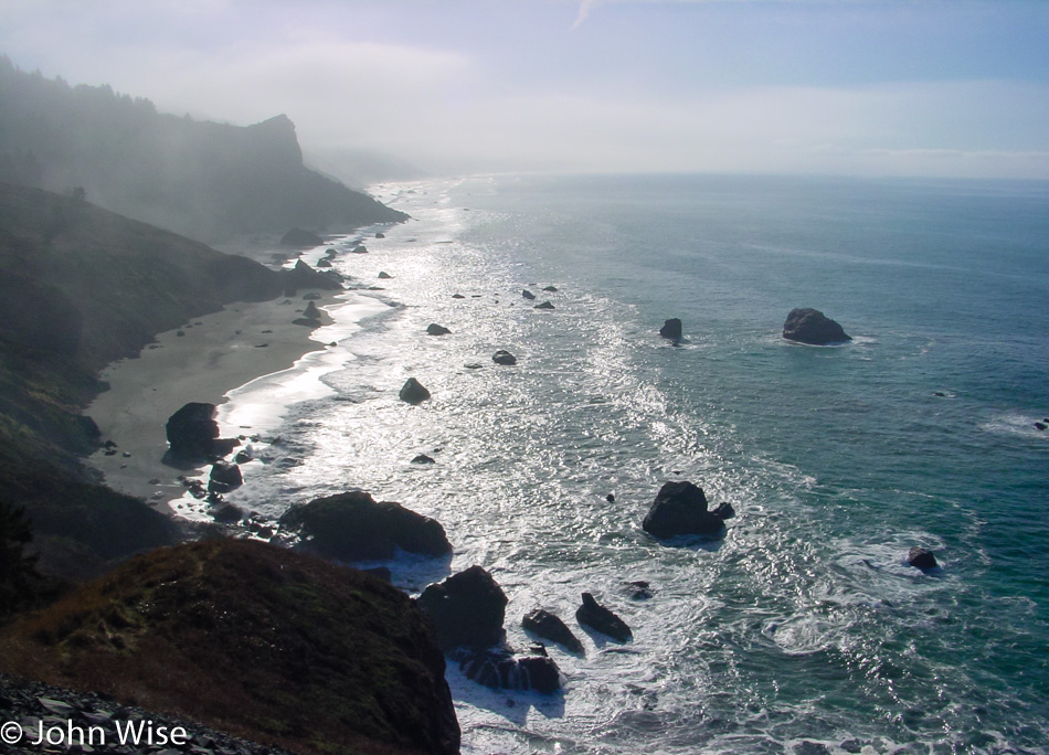
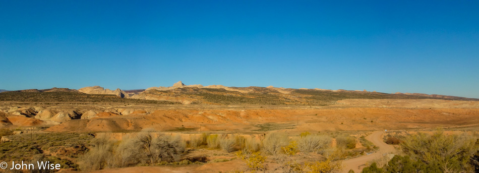
Entering a familiar-looking country reminiscent of Arizona. Strange to think that we’re in America, but just a stone’s throw across the river is Mexico. We tried visiting Fort Leaton State Historic Site in Presidio, but it was locked up tight, the first place to put on the list of places to come back to.

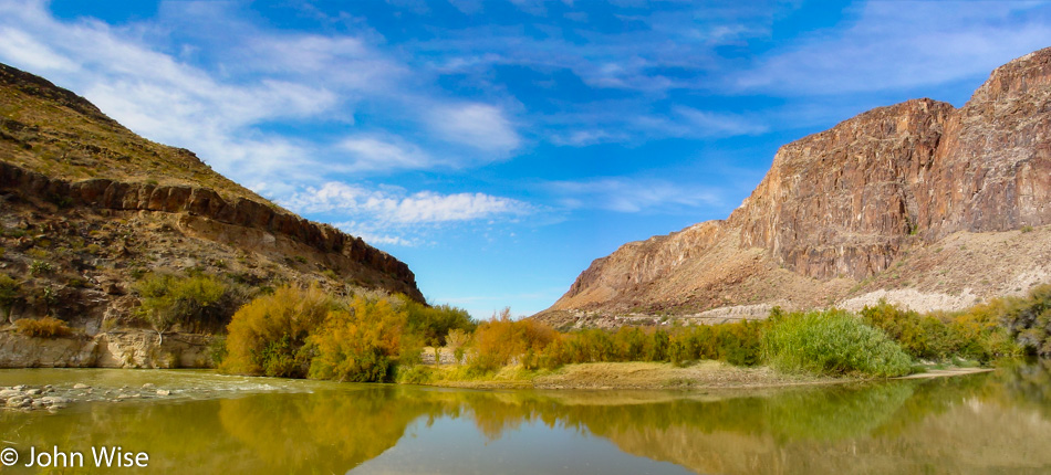
How this “stream” got named the Grand or Big River is beyond me, but this slice between Mexico and the United States is the famous Rio Grande, sometimes known as Rio Bravo. It’s really true what Will Rogers once said about it, “The only river I know of that is in need of irrigating.”

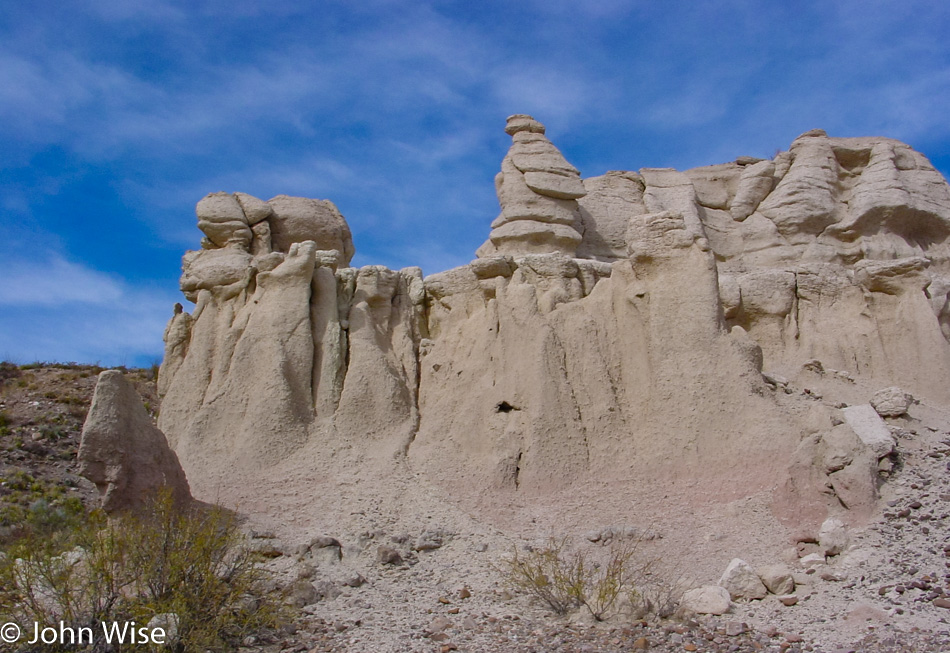
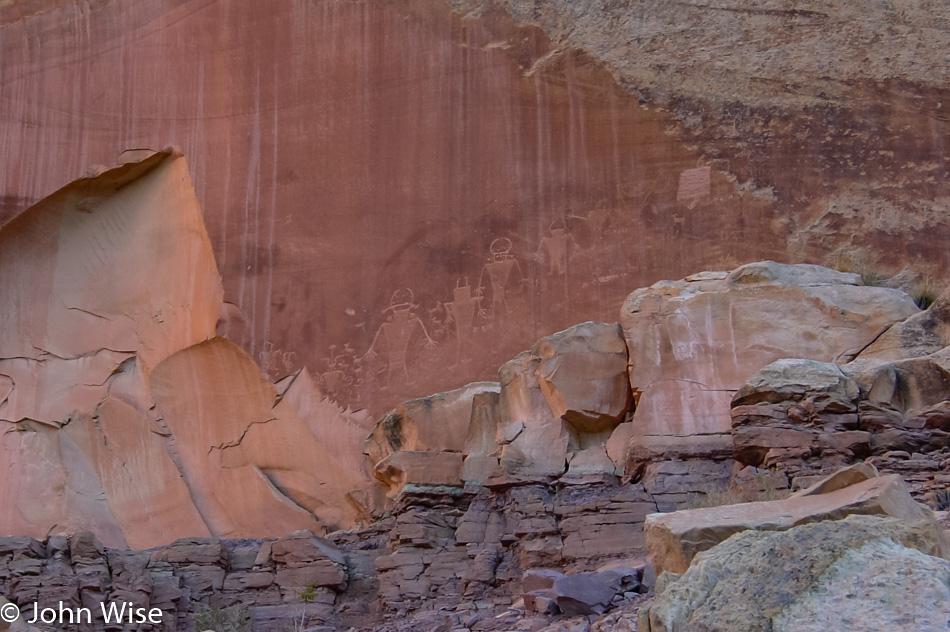
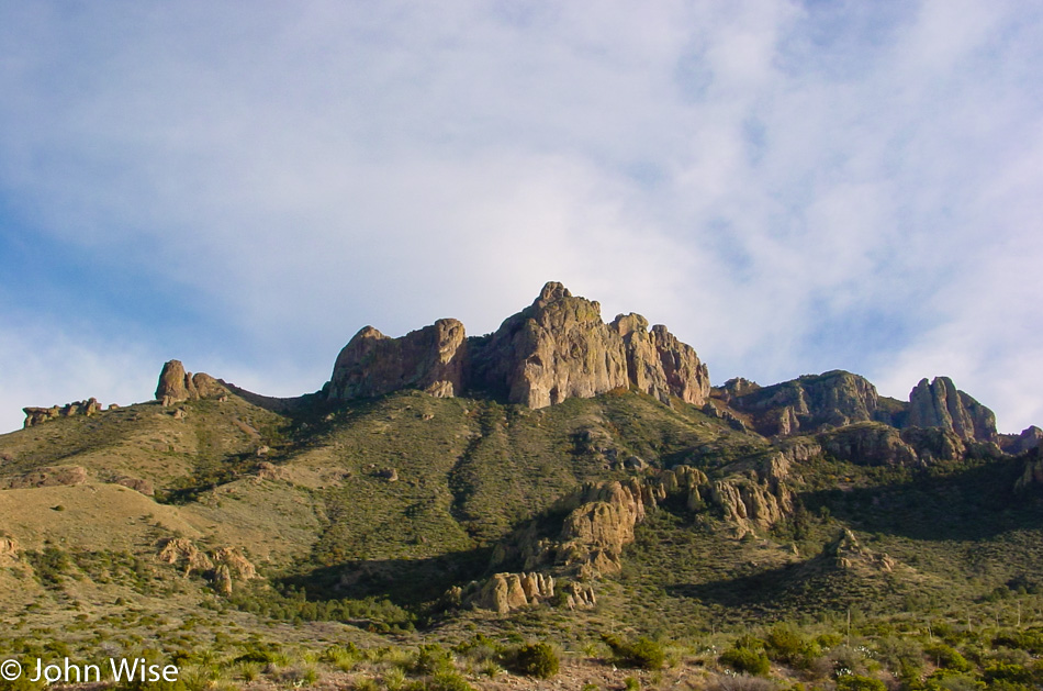
Hoodoos in Texas, who knew?

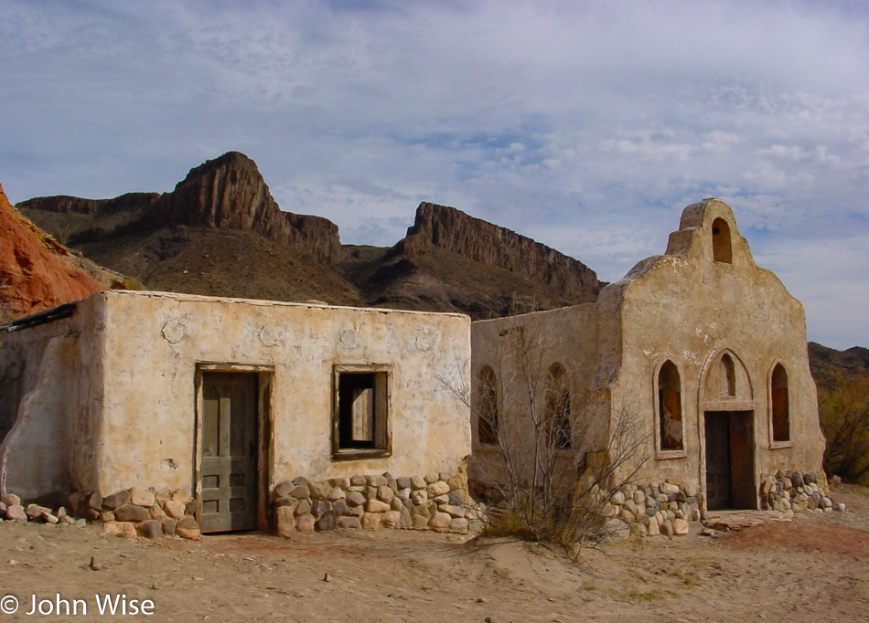
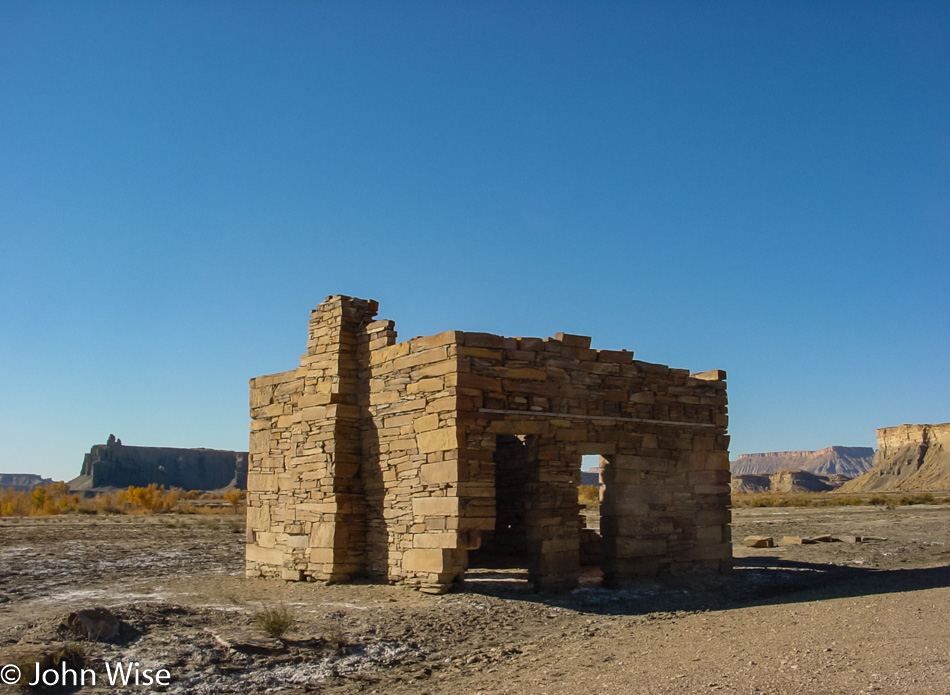
Back in the day, maybe John Wayne and Clint Eastwood visited these places, but today, there are very few people wandering around and even fewer living out here. The truth is more mundane, with this place called Contrabando having been built in 1985 for a Roy Clark film titled Uphill All The Way.

Update: A flood six years after we visited caused serious damage, and by 2015, most of the buildings were removed.

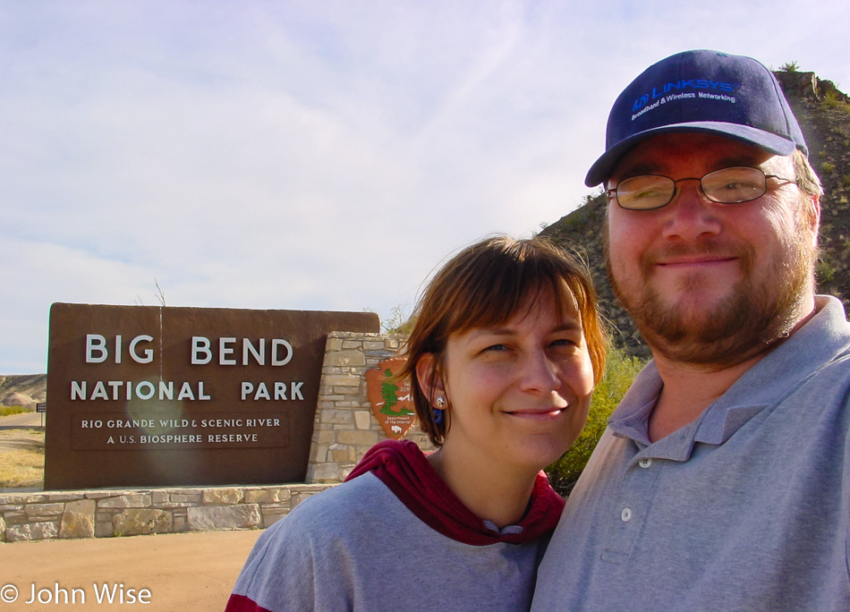
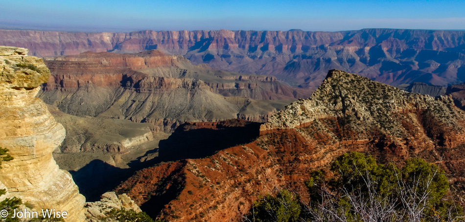
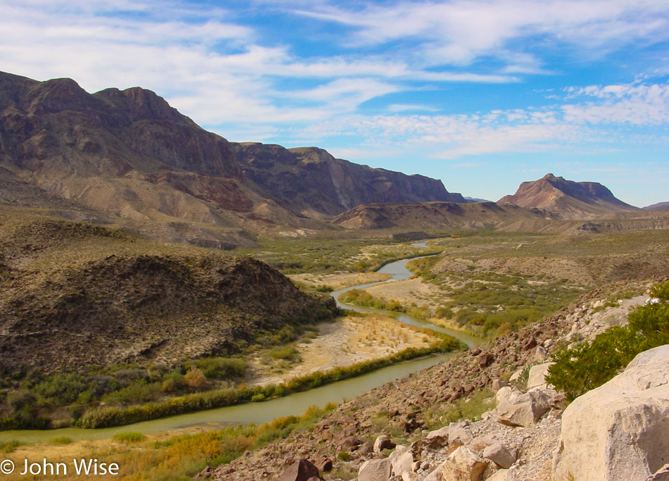
This National Park right here is the primary reason for our visit to our southern border in deep Texas. Big Bend seemed like a remote enough corner that might not be too busy on Christmas day, and so here we are.

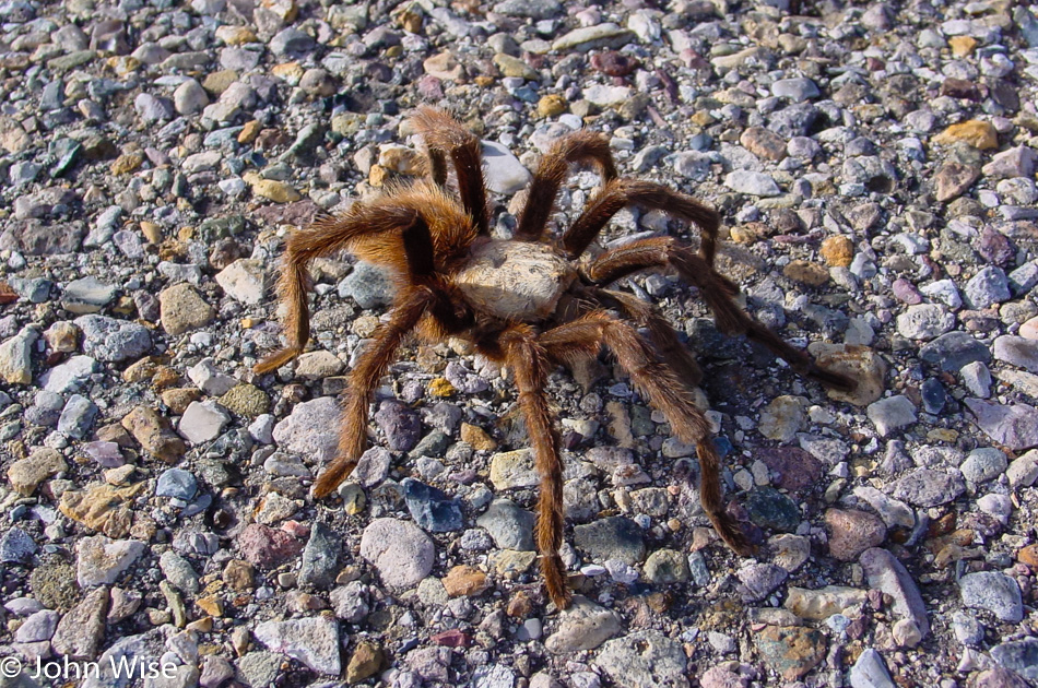
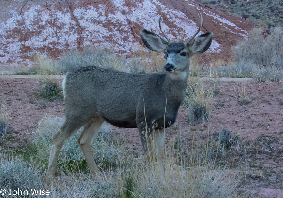
Just us and the tarantulas. Well, there are probably some snakes, scorpions, bats, coyotes, and a few javelinas roaming around too.

With a loose framework identified for this road trip, you can bet we don’t have much time to explore the longer trails that might show us some of the more off-the-beaten-path locations. We’ll just add Big Bend to the list of places we’d like to return to.

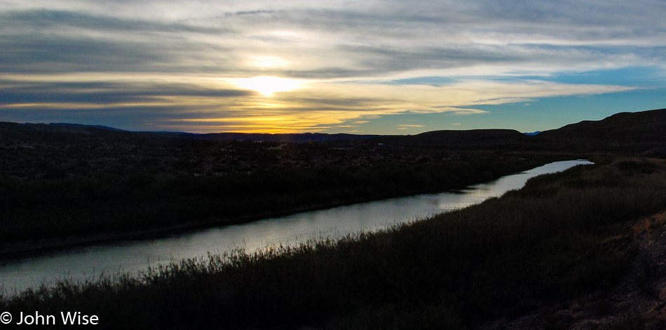
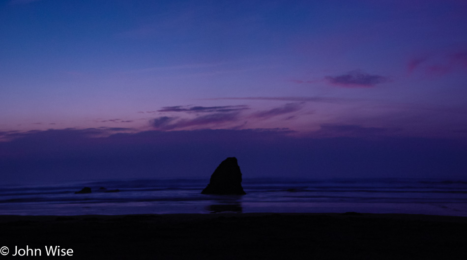
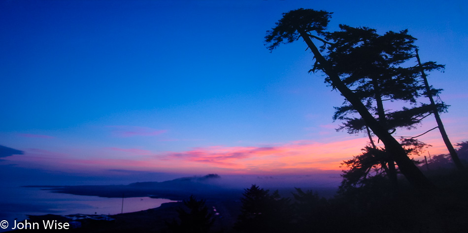
On our way to the park, we had stopped in Terlingua to check into the Longhorn Ranch Motel and RV Park to ensure we had a room for the night else we would have had to leave the area early and head up to Alpine, Texas, on the US-90 for our overnight. With plenty of time now available, we were able to take a hike out along the Rio Grande and enjoy the sunset. We can report that in our entire time along the river from Presidio to Lajita for nearly 50 miles and then again here in the park, we never once encountered the hordes of immigrants racing across the border that so many people up north fear. Matter of fact, in talking with some locals, they said the border issue is grossly overblown and that for hundreds of years, people have been going back and forth across this border for work and family without issue. Sadly that lack of hysteria doesn’t sell well to idiots who feel that the potentially shitty jobs that immigrants often take are under threat.

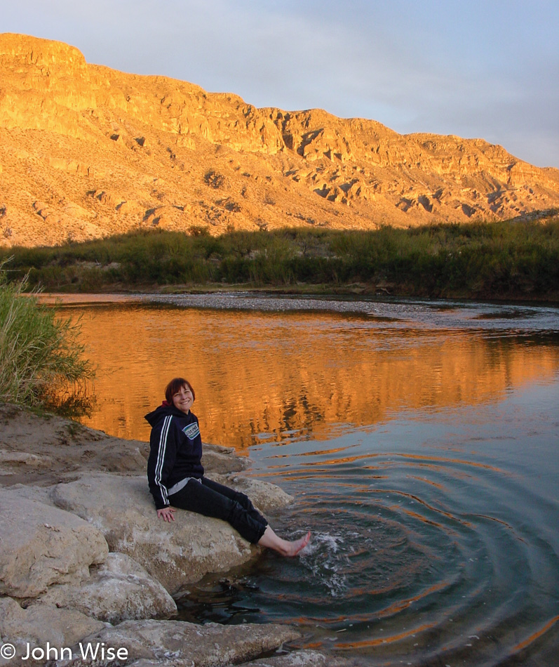
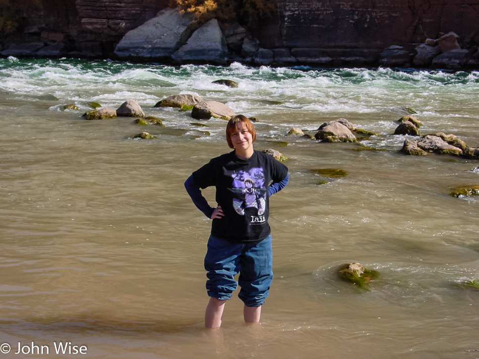
Caroline is dipping her feet in the Rio Grande near Santa Elena Canyon. She would have walked in, but how would it have looked if, at that moment, an official or border agent had seen her walking out of the Rio Grande coming from the direction of Mexico, which is just 30 feet away? What we did see in Mexico were a few wild donkeys yay, wildlife!

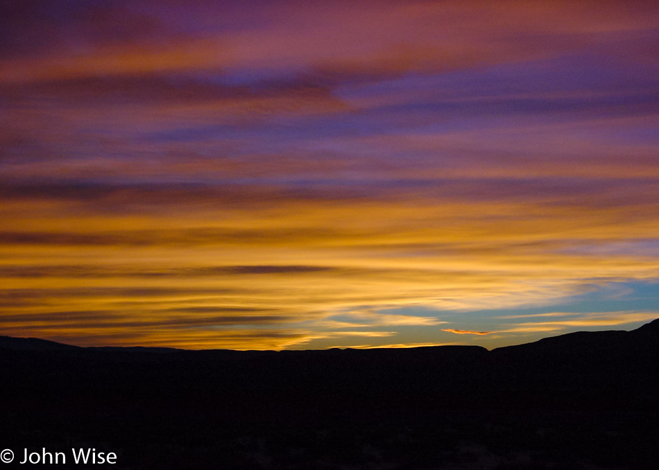
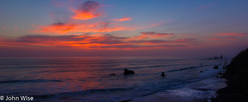
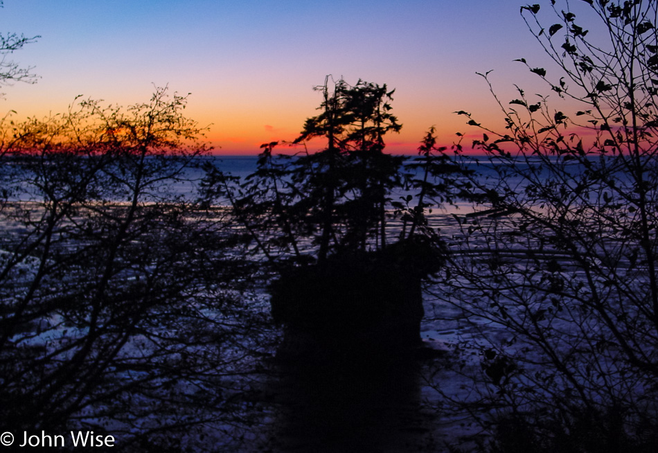
I have to wonder which side is Mexican sunset and which side is American sunset and if they have to have papers to cross borders. Merry Christmas, everyone.

Pacific Northwest – Day 6

Near the California State Line

Smart would have been to stay on Interstate 5 to make our way home, but the Redwoods and another glance at the ocean were calling. In Grant Pass, Oregon, we decided to deviate and get on the 199 that took us through O’Brien, Oregon, before dropping us into California on a new border crossing we’ve not traveled on yet.

Northern California Forest

We are on the edge of the Redwoods.

Northern California Forest

And are about to get on a trail to have a closer look at these coastal giants.

Redwoods National Park in California

It’s not every day that we get to see such giant root balls.

Redwoods National Park in California

But it does seem like it’s almost every day we get to see ferns, well, at least four days in a row on this trip.

Redwoods National Park in California

Trees growing on trees are an interesting sight. Somehow, I have to think about Alien when looking at this parasitic relationship.

California Coast

We can never see enough of the ocean and would rather sacrifice some sleep and driving comfort to have one more beautiful encounter with it than the convenience of arriving home early just to catch up on laundry or some other mundane nonsense.

California Coast

Seeing we are here, we might as well go for it and visit a beach we’ve never explored before.

Fern Canyon in Prairie Creek Redwoods State Park, California

And while we’re at it, why not head down this small road on the Prairie Creek Redwoods State Park to visit Fern Canyon?

Coast along the road to Fern Canyon in Prairie Creek Redwoods State Park, California

Nice views of the ocean can be had out here.

Fern Canyon in Prairie Creek Redwoods State Park, California

But also some amazing god rays cutting through the thin veneer of nearly invisible fog.

Fern Canyon in Prairie Creek Redwoods State Park, California

Here we are at Fern Canyon, unprepared for a hike through the stream, but the view is amazing all the same for how far we did get to walk into the canyon.

Fern Canyon in Prairie Creek Redwoods State Park, California

The colors of fall.

Fern Canyon in Prairie Creek Redwoods State Park, California

And the water that sustains all of this life…

Fern Canyon in Prairie Creek Redwoods State Park, California

…where once again, we encounter the mushrooms that are such an important part of this ecosystem.

Sunset on the California Coast

Well, this is kind of pathetic as here it is getting dark and we’ve just again reached the ocean. We left the 101 in Leggett, California, and thought, “Just how long could it take to get out to the ocean for one final look?” Turns out that Highway 1 from Leggett to Hardy is a switchback nightmare that took forever, and while we missed the sunset, we were still able to capture some of the glowing remnants.

Sunset on the California Coast

To help shorten our drive home tomorrow, we decided to keep driving past Fort Bragg and managed to stay awake until Pleasant Hill, California, which is in the Bay Area.

Pacific Northwest – Day 5

Olympic National Park Washington

We woke before dawn in the sleepy town of Forks, Washington, to make our way south in the hopes of being the first into the Hoh Rain Forest which is a part of the Olympic National Park. Not only is this place not busy due to the time of year we are visiting, but we also should never really worry about crowds when we can creep down the main road into a park at five mph with nobody coming up behind us. The parking lot is empty as we leave the car and decide to take the Hall of Mosses trail, which sounds more mysterious and lush than the other trail known as the Spruce Nature Trail.

Olympic National Park Washington

Below a fragment of bark which had tiny buds of moss growing upon it was a mushroom, and below its cap and gills was another even smaller mushroom growing in its shadow. What a perfect metaphor for us humans: the bark of humanity representing knowledge is adorned with pearls of wisdom found in the moss, while the tiny mushroom sits underneath the larger mushroom, representing our ignorance of the larger world while the sunlight of enlightenment is far above and beyond. If we are lucky, we will push through and find the luxury of knowing what is out there, but if we are too weak to throw off the sheltering layer, we may shrivel and die without ever knowing that we lived in the tiniest of universes within a greater world we could have otherwise explored.

Olympic National Park Washington

So many fungi abound in the wet forest, working to overturn the decaying floor of fallen plant material as it pushes through, helping to turn things over on the way to them becoming mulch and the nutrients of life yet to occur. A part of me wants to pick the mushroom, to grab a handful of rotting slimy leaves and wet earth to inspect and smell what I have clutched in my grasp, but I also do not want to disturb the natural process of regeneration that is occurring in this biological and bacterial carpet of wonderment.

Olympic National Park Washington

Out of the soil, atop dead trees, and clinging to the sides of living trees, mushrooms are everywhere in the rainforest. I cannot know the species, nor can I begin to guess how many variations of moss and liverworts might live here in this tiny patch of America. What I do know is that the clear-cut forest on our way to this corner has radically disturbed the balance of what nature has so perfectly articulated in its presentation. Instead of intelligently managing our forests so the diversity of our ecosystem has a fighting chance, we lay waste to the entire hillside and strip it bare so that even the microflora and fauna that require the shadowy depths below the tree canopy are burnt to a crisp ensuring we can sterilize the environment much as we do to our emotions of empathy for the planet.

Olympic National Park Washington

This area of land was carved by glacial activity and, over the thousands of intervening years sat evolving and growing, undisturbed by humans. Most of those lands have been cleared of trees that had grown for more than a hundred years, these small pockets preserved by the Olympic National Park are what remains. Our world, which had been natural, is turned into a sideshow where we pay a small token to the caretakers who invite one and all who can pay the fee to witness the last remaining freaks that are placed on pedestals curated like a corner of Disneyland. We, the people of Earth, do not make life; we harvest it, burn it, exploit it, and move on. The symbiosis of existence is skewed towards the dumbest of creatures that walk upon our planet.

Olympic National Park Washington

Like legs of the sky that hold up the clouds, these tree trunks share the burden of being the last of their kind. Moss covered and heavy with the life they have evolved to host, their time is not certain, and under the guise of progress, we could also move on them when convenient to make the money that will somehow support the human population. Without them, the clouds will certainly fall and evaporate. With the fall of the sky, we, too, will fall and evaporate. Maybe then nature can get on with grooming itself to once again find a balance.

Olympic National Park Washington

Left undisturbed and not eaten by a predator, the spider will live its existence dancing through the patterns of what its DNA has programmed it to do. Barely visible and often unseen by the flying insects snared in its web, the spider lives on the edge of its creation and takes what is needed. It could be said that man does the same, the difference being that the spider doesn’t destroy its environment for the next generation. If I try to be less emotionally reactive about my impressions of our haste to destroy, I suppose I can admit that we are the incarnation of a two-legged tsunami, a volcano, or a deep freeze that nature delivers to radically alter the status quo. Still, I find it abhorrent that the collective minds of our species are still digging out of the fecal decay of primitivism so readily accepted by the majority and that we race into our ignorance while obliterating most of what is profoundly beautiful.

Olympic National Park Washington

In all of our planetary nature, death is but a substrate for a new life. The fallen tree does not go to waste; it is the nutrient base for life that will continue to grow within and upon it for many years to come. It will be a harmonious relationship that, over time, will give rise to a new life that evolves to respond to the changing chemistry of what happens over time.

Olympic National Park Washington

Contained in these gills are spores waiting for maturity before being distributed to help grow the mycelium network that is vital to the health of this forest. If only more of us humans understood our role in the network of people to support our environment, we might one day grow up to be wiser than these mushrooms. Too bad it doesn’t look like it will happen in my lifetime.

Olympic National Park Washington

And with that, we have arrived at the Spruce Nature Trail that will take us out by the Hoh River. The forest isn’t so dense by the river as the gravel banks are scrubbed clean by periodic heavy river flows, allowing more light into the thicket. Due to the heavy rainfall, up to 14 feet a year, the earth is still covered in a heavy green carpet that begs us to linger and discover its details.

Olympic National Park Washington

The hairs on this leaf appear to capture water droplets, I can only wonder what is the purpose of having evolved to be able to perform this for the larger plant.

Olympic National Park Washington

We are circling back to the parking lot and visitor center along with the noise of those who have now started arriving. For nearly four hours, we have been alone with the forest and its quadrillions of lifeforms found in thousands of species, most of which we will never see. How can humanity, who has never seen a place such as this firsthand, be so careless and disrespectful as to not care an iota if it is turned into houses or a parking lot?

Sadly, there is no one to call for answers.

Caroline Wise and John Wise in Olympic National Park Washington

We have fallen in love with the rainforest of Washington but will not be able to adequately visit the Quinault part of the rainforest further south due to our crazy ideas of time allocated to do a million things per road trip, though we will have a small peek in. Hopefully, there will be another visit in the future that will allow further exploration of the Olympic National Park.

The shiny object known as the coast quickly distracts us from our contemplative, slow journey into the forest.

Ah, but then we spot this crab shell and have to consider the great fortune of the shorebird that had an amazing meal or the unfortunate crab who had to make the ultimate sacrifice so the bird could hunt more of its kind. The balance of life is a weird thing.

For a moment, Ms. Tidepool Huntress was stranded on an island as the sea skirted around her; lucky for us, there were no birds large enough to snatch her off her perch and peck her guts out.

Caroline has a fetish for signs that make her chuckle. Descriptive pictures of the obvious are key to how much they tickle her before asking me to take a photo so that she may always remember that moment of awareness.

One of those rare times when we sought the help of another human as we needed to have the camera far enough away for us to remember just how big the thing was we were taking a photo in front of. And just what is this thing? It is the largest Douglas Fir tree on EARTH!

Update: On July 8th, 2016, this giant tumbled in a wind storm, and while the 20-foot stump is still technically alive, the tree is effectively gone. One of the reasons given for its demise is seen right here in this photo: people standing on its roots. It kind of sucks knowing we contributed to its fall.

The road to the giant.

Never before have we seen so much driftwood on a beach.

We are about to leave the Washington coast and make our way to Interstate 5, unceremoniously cutting through Oregon on the freeway well inland and in the dark. We’ll end up staying in Roseburg, Oregon.

Pacific Northwest – Day 4

Shortly after the moon goes to sleep and while the sun is just returning to wakefulness, there is a calm and quiet in the transition zone between night and day. The city hasn’t stirred yet, but the birds know that this is one of the best times, and we tend to agree with them. To their song of return, we depart Sequim and will have to watch the sunrise in our rearview mirror because we are heading west.

If it’s quiet in the early dawn, it is absolutely still under the blanket of fog. Living in Arizona, we might have an occasion once every four or five years where the valley has a fog layer, but those are rare and short-lived. In these places where the mist is hugging the very surface of the land, it is easy to entertain the idea that the day will be kept at bay, and the intimacy brought by the low ceiling will make the entire day cozy.

We are on the move and heading into the mountains. We are near the entrance gate of Olympic National Park, and much to our surprise, they have started their limited seasonal hours. Lucky us, it’s not too long until the road opens, and not far from where we are waiting is a peek at the kind of forest environment we hope to visit tomorrow when we visit the western side of the park.

This is Hurricane Ridge, and while the peaks are snow-capped, in a few more weeks, there’s a good chance that the entire environment up here will be covered in snow. Should you arrive on one of those snowy days, you’ll have to travel with tire chains, or you will not be allowed passage, or so says the park ranger who reminds us how lucky we are.

The policeman on the side of the road is not here for a sobriety check; he’s recommending that if we can detour or delay our travels, it would be best. Ahead, there is a car that has gone off the road due to the black ice; that is a driving hazard, but for us forward is the only way to go. We go very slow and do our best to be careful.

This bit of fog hadn’t gotten the message that it was time to burn off and instead showed off its perfect reflection in the calm waters of Lake Crescent on Highway 101.

And then we’re deep in the fog again; this seems like it could be a theme today.

This roadside psychic horse was beaming its brain waves at our car as it must have sensed I was traveling with a Caroline who loves horses. It said, “Hey, fellow hairy chin person, bring that sweet-smelling, friendly woman over here and let us connect a moment.” I’m a sucker for telepathy and making my wife and random creatures happy.

On the road to Cape Flattery.

On the footpath to a point out on Cape Flattery that will take us to the end of the trail.

As we reach the ocean, the rocky cliffs and turquoise waters align to show us perfection in which trees, birds, air, and space exist for just this moment, dazzling the observer who is out participating in their life.

We are the farthest out we can go. This is the northwestern edge of the contiguous United States. Behind us are Tatoosh Island and the Cape Flattery Lighthouse. To our left is the Strait of Juan de Fuca in Canada. And we can be here because the people of the Makah Reservation are sharing their lands with us.

Heading back through Neah Bay, there is no other way to make our way down the coast.

Our backtracking worked in our favor as it allowed Caroline to step into the waters of the Strait of Juan de Fuca with Vancouver Island behind her.

Check into our motel early? Not a chance with a tiny bit of available sunlight still available. We drove out to La Push on the Pacific Ocean on the chance we might see a nice sunset.

We never anticipated witnessing one of the most spectacular sunsets we may ever see. Just so you know, this image is made up of half a dozen photos, as it would have been impossible to photograph otherwise. You just can’t take these digital cameras for granted in how they allow us to stitch panoramas together, making up for not owning incredibly expensive cameras and lenses or being limited by the amount of film we have, though memory cards can get expensive.

Dinner was at The In-Place, right next door to our motel, the Pacific Inn.

North Rim Grand Canyon to Capitol Reef – Day 2

Up and out early for a visit to Capitol Reef National Park.

I wish I could tell you what’s on this Mule Deer’s right eye; maybe it’s a mini-satellite tracking device.

We are seduced by the golden colors of fall glowing in the sunrise. Our positive first impressions of Capitol Reef are already hinting at the need for a follow-up visit.

Being suckers for petroglyphs, we add these to the list of stuff we must return for in order to have a fuller picture of the park than our quick tour is going to allow us to have.

Dirt roads are the paths to quiet riches because where the pavement ends, the crowds remain at bay, not that this place is swarming with visitors today.

A bit of Chaco cultural influence is at work on this relic of a “modern” building.

My best guess for what created these multi-colored layers is that this was a floodplain at one time. I think it wasn’t a lake as there are no black layers that would imply plant and fish life that was settling at the bottom, and the layers are seriously almost uniformly thin, so maybe it was quickly disappearing floodwaters that came and went?

If we are in Hanksville, Utah, this must be the famous Hollow Mountain gas station. We are about to turn off Route 24 for the 95 before taking the 276 to Bullfrog. Where…

…we were hoping to catch this ferry across Lake Powell. We just missed it by minutes and with almost two hours before the next ferry going in our direction, we opted to drive back towards Hite and take the bridge over the Colorado.

While we will always enjoy a good ferry trip over the water we don’t much mind a stunning drive over the desert either.

Colorado River flowing into Lake Powell in Utah

Can you guess just where the Colorado meets the lake?

Wow, this is one spectacular approach to a bridge.

Hite Crossing over the Colorado River in Utah

Back in 1983, Lake Powell was in danger of spilling over the top of the Glen Canyon dam; under the bridge, you can see the bathtub ring the full lake left behind. Matter of fact, besides the ugly tragedy of destroying Glen Canyon by backing up the Colorado River, the water bleaches the sandstone and deposits tons of sediment in the lake, depriving the Colorado River in the Grand Canyon of the kind of river dynamics that made rafting a huge variable. Taming the beast to remove the risk of encountering the wild has been one of humanity’s greatest faults.

Caroline Wise and John Wise on the Colorado State Line

Why go straight home when you can detour and take in four states in one day? And I don’t mean some short little detour either; we go large and head through Blanding up to Monticello, where we catch Highway 666 so we can drop into Colorado going to Dove Creek. South through Cortez, we continue on the Devil’s Highway, where we can have a meaningful and potentially evil encounter with the Colorful State. Sadly, I have to report that neither Satan nor his minions were found on this day.

Snow-capped mountains and bald eagles, that’s America.

Caroline Wise and John Wise on the New Mexico State Line

Into New Mexico, we are still on Hell’s Highway as we cruise past Shiprock and south to Gallup before turning west for the final drive home on this blistering fast loop out around the Four Corners of the American Southwest.

North Rim Grand Canyon to Capitol Reef – Day 1

Hot Air Balloons over Scottsdale, Arizona

Hmmm, balloons are floating overhead; that must be a signal to get in the car and race to the Grand Canyon. Sounds good to me, and so better late than never we spontaneously pack a bag and start the drive the north.

Navajo Bridge in Arizona over the Colorado River

These are the Navajo Bridges in northern Arizona. The bridge on the right was opened for traffic in 1929, and for many years, it was adequate to serve the purpose of crossing the Colorado River. As time went by, vehicles became wider, and although pedestrian traffic was forbidden on the original bridge, the temptation to stand over the middle of the Colorado and look into the canyon was too appealing. So in 1995, a second, almost identical-looking wider bridge was opened (on the left), and the old one was relegated to being a purely pedestrian bridge.

This is Balanced Rock on the way to Lees Ferry at the northeastern corner of the Grand Canyon National Park.

Caroline Wise standing at the confluence of the Colorado and Paria River at Lee's Ferry in the Grand Canyon National Park, Arizona

Lees Ferry is Mile Marker 0 in the Grand Canyon. It is here that white water rafting trips get underway. Caroline is standing in the confluence of the muddy Paria River where it’s entering the cold green waters of the Colorado right behind her. This is also the first rapid boaters encounter on their journey into the extraordinary world of the Grand Canyon.

North Rim Grand Canyon National Park, Arizona

The view from the North Rim of the Grand Canyon is roughly 1,500 feet above the other side. Funny how it’s “just” 23.9 miles to hike across the canyon and over 200 miles to drive from side to side.

North Rim Grand Canyon National Park, Arizona

It’s nearly impossible to see her in the pic but Caroline with her hands in the air standing over the hole in the rock. We were both out there a few earlier trying to grab a selfie from over our heads so I could show you how narrow the rock is that she’s standing on, but that didn’t work out.

Fredonia, Arizona

Had to stop and teach Caroline about Fredonia, not this one in Arizona, as much as the fictional Freedonia referred to by the Marx Brothers in their 1933 movie titled Duck Soup. My introduction begins with the song “Hail Hail Freedonia,” followed by a bunch of mumbling to the tune that rings in my head nearly 30 years after I first saw this movie.

Thunderbird Restaurant in Carmel, Utah

Well, this was unexpected to find in the state of Utah and begs the question, “Just who are the hos that make these pies, and are they Mormon?” Should you think you, too, would like to try some Ho-Made Pies, you’ll find them in Mount Carmel Junction, where the road turns off to Zion National Park.

We made it another 160 miles past this to Torrey, Utah, to spend the night at Austin’s Chuckwagon Motel.