Jutta On The Road – Day 7

Disclaimer: This blog entry wasn’t written until 15 years after the trip. It should be noted that this was a huge mistake to have not written it way back when. Sometimes, after writing so much about other days, it happens that at the time directly after the trip (or even during), I convince myself that the details are not that important. Years later, these details are that important, and pulling them out of foggy memories is difficult. The photos help and often leave clues, and then Caroline’s memories are usually far clearer than mine. With that said, here goes.

Thinking about the dearth of photos I posted back then due to bandwidth limitations, I’d nearly forgotten just how difficult it was handling the images we were shooting back in the day. First off, we had a brand new Canon Digital Rebel XT sporting 8 megapixels of resolution. Whatever we shot, we had to wait until we got home to work with the images, even if we’d had a notebook: dealing with the images would have been too slow. Once home, they were transferred to a spinning hard disk using Windows XP and Photoshop CS2. Adjusting images was slow and cumbersome compared to these days when I can assemble panoramas made of 10 photos in under a minute, and I can use presets to get a quick idea of what color corrections will look like. Exporting a couple dozen images also takes less than a minute.

But here we are in 2021 and the biggest conundrum I face is not using too many images as I’m the one who’s attempting to write something to each image. The photo above is from Cape Lookout and was taken as we left the state park with the same name. We were out here to have another night in a yurt.

Tillamook means cheese and ice cream here in Oregon, and that means COWS!

We did some backtracking here by driving through Pacific City past the Cape Kiwanda Haystack rock. Last night, we took the drive out past Tillamook Bay, and so today, we are mixing things up by approaching from the southeast back towards Tillamook.

Ice cream stop in Tillamook.

We’re not making a lot of stops as we have quite a few miles to cover today, like most days we were traveling with Jutta. This is Crab Rock, just north of Garibaldi.

The views of things I couldn’t imagine my mother-in-law ever having seen with her own eyes is what drove me to plan these trips and then where to stop. Sometimes, the inspiration for stopping came from the backseat as Jutta would exclaim how beautiful something was. Coastal woods and an overwater cabin reflecting in a large, quiet pond were just one such sight.

Looking back down the coast as we’re about to leave Oregon.

With the addition of the state of Washington to Jutta’s list of places she’s visited, bragging rights to having traveled the entirety of the Pacific coast of the United States is now in the bag for her.

Off in the distance is our next stop on this major road trip.

This is Mount St. Helens seen from the Johnston Ridge Observatory in Washington. On a previous visit, Caroline and I visited the Windy Ridge Viewpoint, which, in my opinion, is the most interesting location to visit in this park. Johnston Ridge offers a great view of the blast zone from the perspective of being in it, while Windy Ridge offers an overview of looking into the direction the blast traveled and getting a great view into Spirit Lake. Windy Ridge also offers a closer view of the Crater at the cost of a more isolated backcountry drive.

World’s Largest Egg in Winlock, Washington. Admit it, you’d have stopped, too.

Mt. Rainier in the distance.

There was no way we were going to let Jutta be this far north on the coast of the western United States and not have her walk barefoot in the sand and surf. Sometimes, I thought she was a bit reluctant but the enthusiasm of her daughter pulled her along.

Speaking of her daughter Caroline.

Staying the night in Forks, Washington, at the Town Motel, so we are well-positioned in the morning to visit the rainforest and Olympic National Park.

Jutta On The Road – Day 2

Caroline Wise and Jutta Engelhardt in Death Valley National Park California 2005

Disclaimer: This blog entry wasn’t written until 15 years after the trip. It should be noted that it was a huge mistake to have not written it way back when. Sometimes, after writing so much about other days, it happens that at the time directly after the trip (or even during), I convince myself that the details are not that important. Years later, these details are that important, and pulling them out of foggy memories is difficult. The photos help and often leave clues, and then Caroline’s memories are usually far clearer than mine. With that said, here goes.

Little did we know just how exotic and meaningful a stop in Death Valley National Park would be to Jutta, but we learned on approach that this was a dream come true. She couldn’t believe that she would ever experience this iconic out-of-the-way spot on earth in person. Had we known this fact, I would have planned more time for us to be here, though a cooler time of year might have worked out better for her.

Death Valley National Park California 2005

On our way into the park, we stumbled upon these two guys on the south end of West Side Road near Shoreline Butte in Death Valley. They had been out here since 5:00 p.m. the day before. The previous day’s high temperature was 112 degrees (44 Celsius), and by 8:00, when we pulled over to offer assistance, it was already nearly 90 degrees (32 Celsius). Three other cars had passed them and never stopped. After supplying the men with water, fruit cups, and granola bars, we reported them to a park ranger at the Death Valley Visitors Center and were assured help was on the way.

Death Valley National Park California 2005

For those who know, this is the approach to Bad Water.

Caroline Wise and Jutta Engelhardt in Death Valley National Park California 2005

Yes, it was already hot for Jutta out here, and it was little comfort for her that in a few hours, it would be 20 degrees warmer.

Death Valley National Park California 2005

Good thing walking on a dry salt lake was so enchanting that she didn’t give much thought to anything other than the magic of being in Death Valley.

Death Valley National Park California 2005

I think Jutta was surprised by the water in the park as it was her impression that there would be none.

Caroline Wise and Jutta Engelhardt in Death Valley National Park California 2005

While no story exists about the details of this 15-year-old journey, I’m happy to have our photos that tell at least part of the narrative.

Death Valley National Park California 2005

No other photo of this exists in the history of the human race, nor can one ever be taken in the future. That is how important it is for all of us to get out and see our ever-changing world.

Caroline Wise and Jutta Engelhardt in Death Valley National Park California 2005

Sand dunes are a new concept to Jutta. While she’s been to various beaches, never had she walked over a sand dune in the middle of a desert.

Death Valley National Park California 2005

And with this departing view of the park, we were once again underway to points further west.

The rivers were running high with snowmelt; we were just happy to see lots of water before reaching the sea.

The contrast between forest, meadow, and desert is not lost on us as we stop to grab a keepsake for the memories.

I can’t tell you if there’s a corner of California that isn’t astonishingly beautiful.

What’s not to love about the view?

And before we knew it we were in the San Simeon area and visiting the elephant seals once more. Eight years ago, during Jutta’s first visit to the States, we had brought her up this coast and it was on that trip that all three of us had our first encounter with these beautiful creatures. We are staying in town at the Sea Breeze Inn so we can have another visit with the seals in the morning. The room cost us $79 plus tax.

Hiking the Chiricahuas

On the road to Chiricahua National Monument for some hiking near Willcox, Arizona

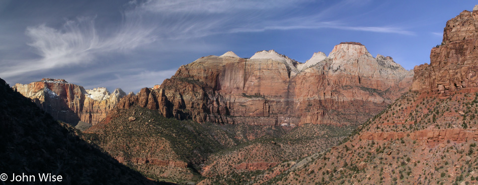
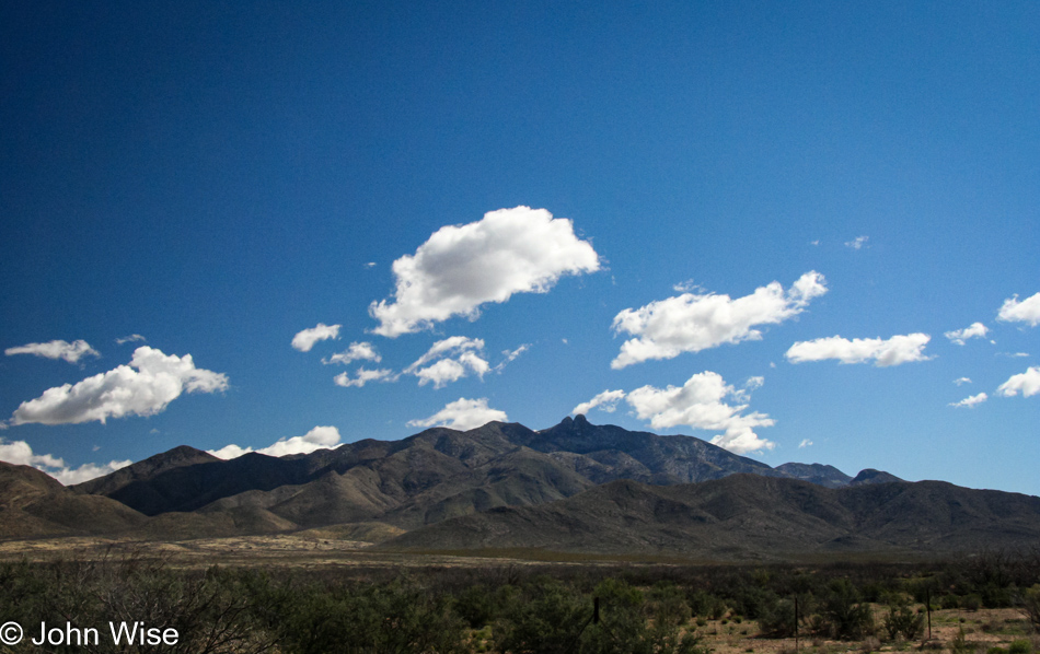
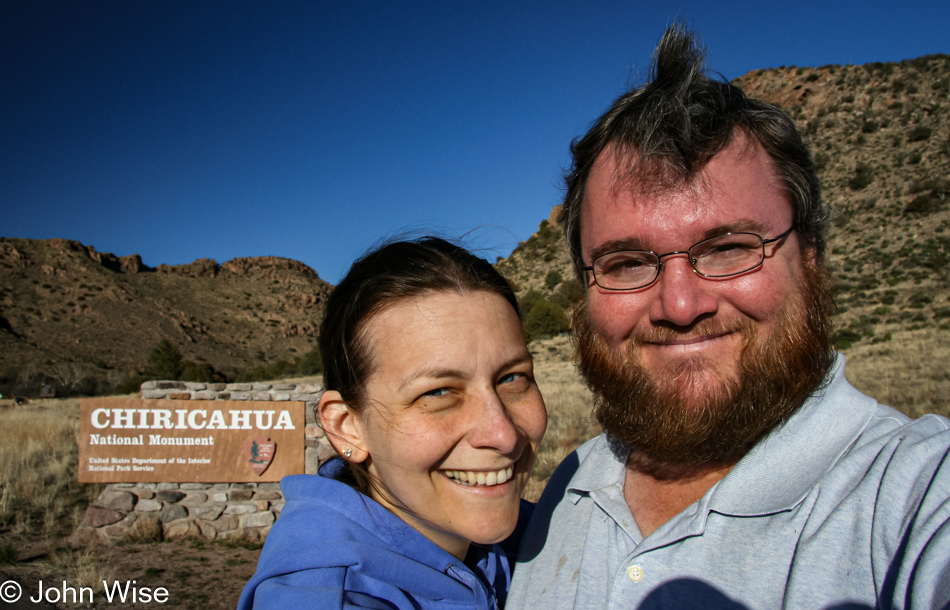
On the road to Chiricahua National Monument for a day of hiking, the weather is perfect. We are excited about our return to this park since we have been here before without being able to spend enough time and have wanted to come back. From Phoenix, we drive south towards Tucson, staying on Interstate 10 to Willcox, where we join State Road 186 to the Monument.

Dos Cabezas, Arizona is not much more than an old forgotten Ghost Town these days.

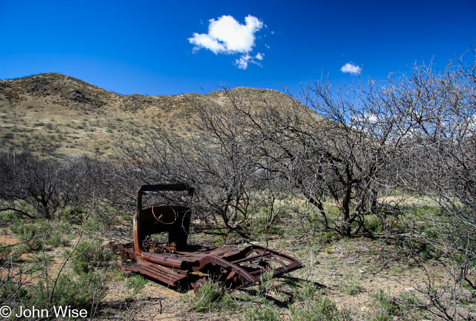
South of Willcox is Dos Cabezas, now an old forgotten Ghost Town with a few old buildings in ruin and this shadow of a car lying next to the road. The town was established in 1878 and once had a barbershop, brewery, general store, and hotel, but by 1960, the post office closed, and the town was no more. Today, a few stragglers call this home, while a  curio shop is the last business plying its trade.

Wildflowers next to State Route 186 on the way to Chiricahua National Monument in Arizona

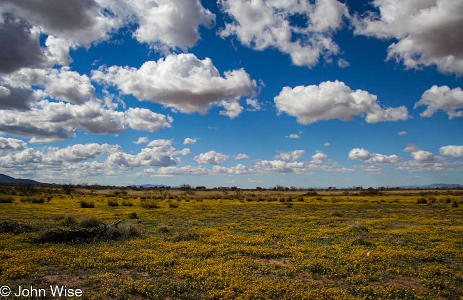
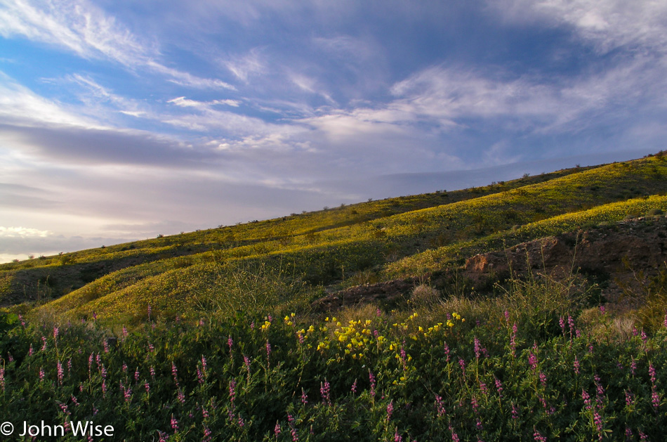
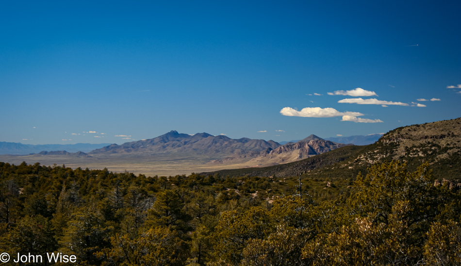
Further along through a wide-open valley here in Southern Arizona, we pass some spectacular views of wildflowers that stretch for as far as the eye can see. The drive from Willcox to the National Monument entrance is only 36 miles; after 210 miles from Phoenix, this last stretch is brief.

The trail to Heart of Rocks in Chiricahua National Monument south of Willcox, Arizona

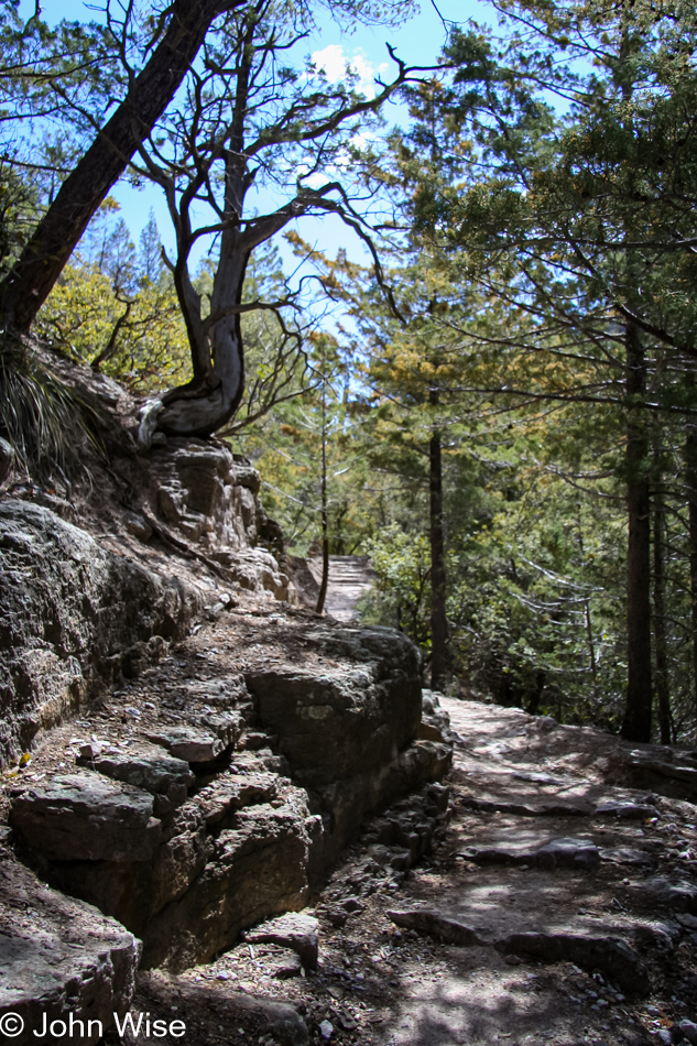
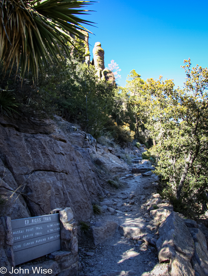
Our National Park Pass gets us in the park, this yearly $50 pass is one of the best bargains Caroline and I invest in every year. We stop at the visitor center to confirm which trail is recommended for a day hike and are directed to take the Heart of Rocks trail. An eight-mile drive through the park deposits us at the Echo Canyon parking lot and the last chance to visit a restroom. We find the trailhead and almost immediately are walking under the pines on a well-maintained trail. The round trip is going to be 7.2 miles (about 11km) and it has been suggested to us to allocate about 5 hours to get there and back.

The balancing rocks here at Chiricahua are the main attraction

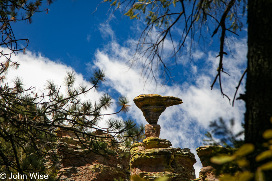
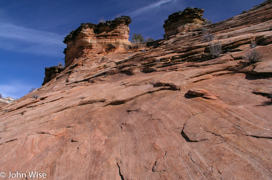
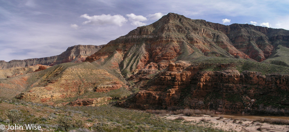
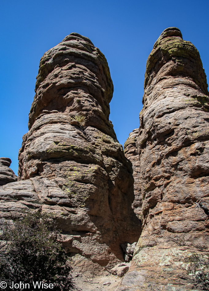
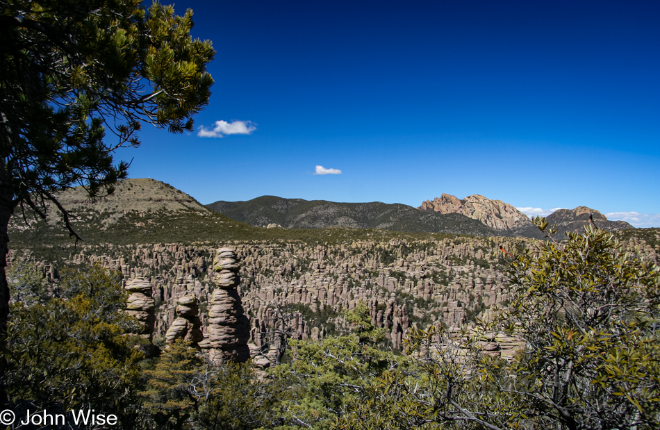
The main attraction here at Chiricahua is the balancing rocks, and it’s not long before we spot Mushroom Rock through the trees. These formations were created by processes that began 27 million years ago when a volcanic eruption showered the area with two thousand feet of siliceous ash and pumice. This mixture fused into rhyolitic tuff and, through the processes of erosion, became the spires and formations that are the signature of Chiricahua today.

Moss grows on rocks under the tree cover along the trail to Heart of Rocks in Chiricahua National Monument, Arizona

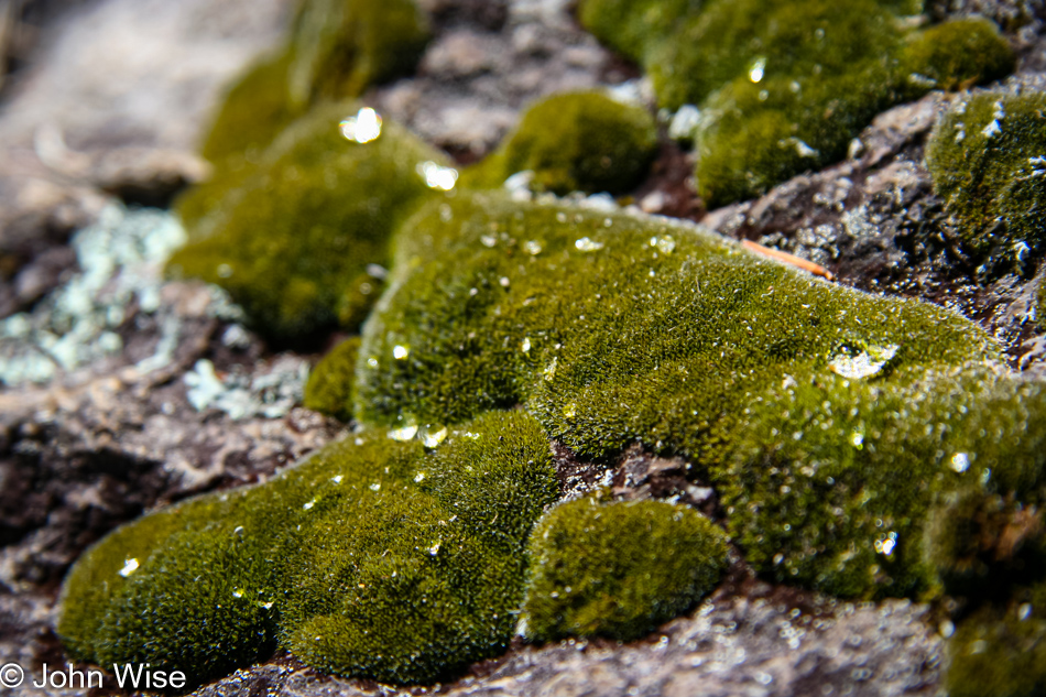
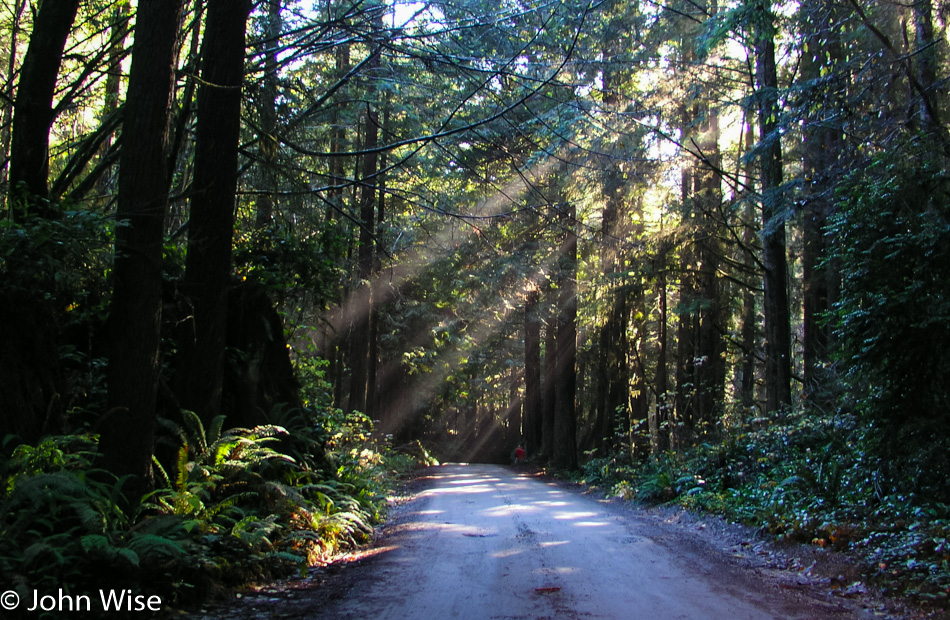
Our relatively slow pace allows us to look at the details along the way. The trail starts at 6780 feet (2066 meters), descending to 6400 feet before climbing back up, eventually topping out at 7010 feet (2137 meters). Although surrounded by desert, the Chiricahuas receive enough moisture to create a lush environment where even moss has the chance to grab hold and thrive in the open, such as on the rock above.

The trail descends to 6400 feet before climbing to 7010 feet in the way to Heart of Rocks in Chiricahua National Monument, Arizona

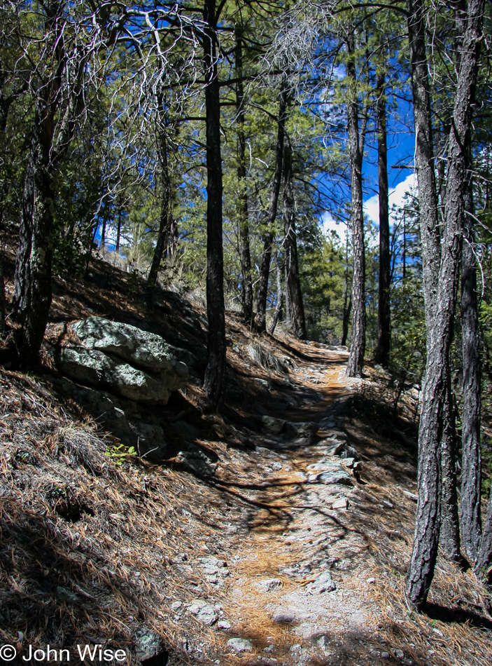
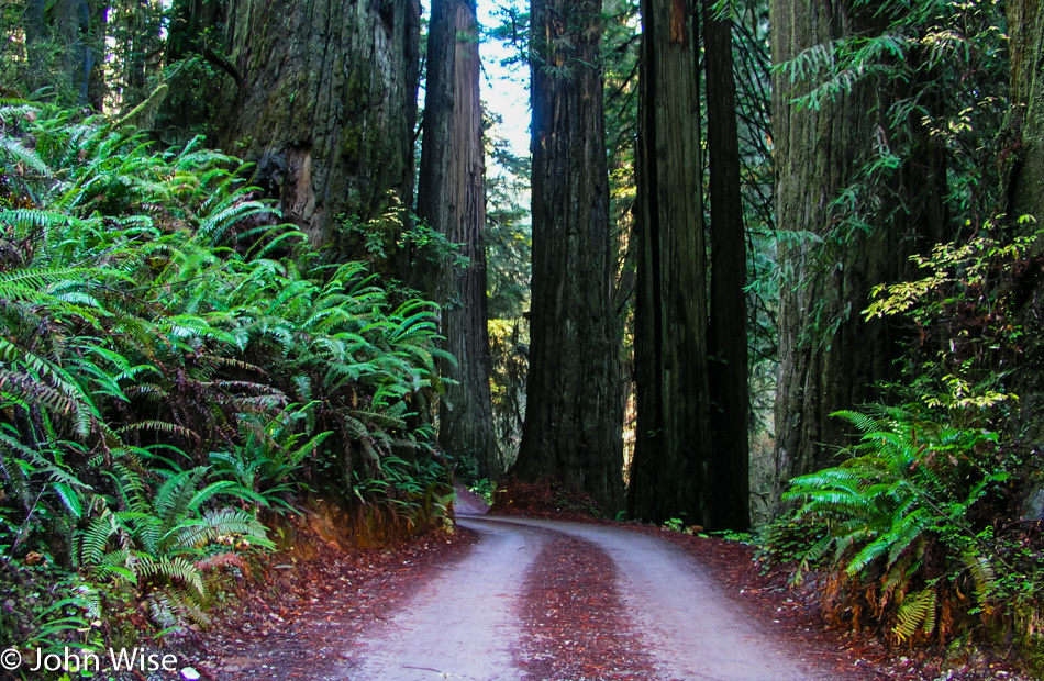
The hike up to the top of the plateau is mild and should be accessible to day hikers of all ages and fitness. Be sure to bring water and plenty of it, especially in summer, where at this elevation, it becomes easier to dehydrate than out in the open desert, or so I have been told. A recurring theme in our life due to living in the brown landscape of Phoenix is our appreciation of green and the walk in these woods is no exception. We stop to take photos, listen to the wind blow through the trees, examine bark, and look for birds, wildlife, or anything else that might catch our eye.

A large balanced rock perched precariously on a much smaller rock in Chiricahua National Monument, Arizona

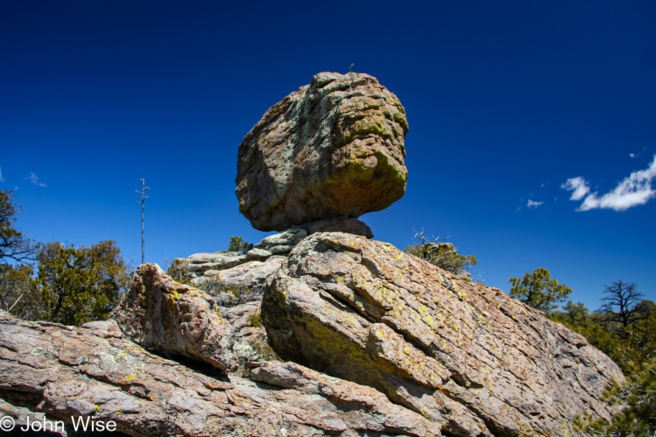
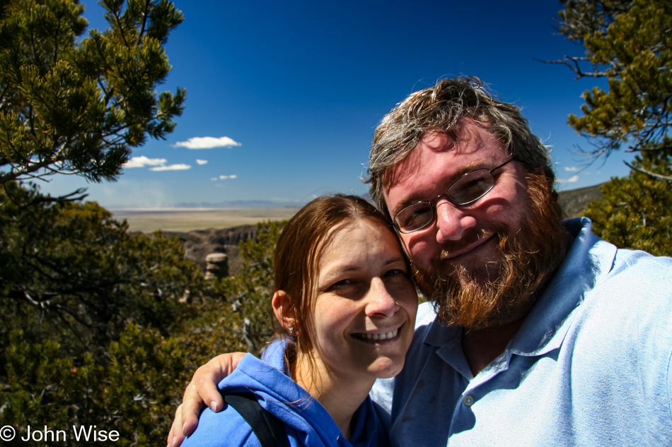
On top of the plateau, we are once again in view of the main features, balanced rocks, and spires. After years of visiting National Parks, when at times our visit was so brief that we would do as little as following the scenic loop through the park, it is a great feeling to be going slowly and taking in the surroundings as casually as we are today. We are all smiles as we gaze at this very large, balanced rock.

Our first view of Heart of Rocks at Chiricahua National Monument in Arizona

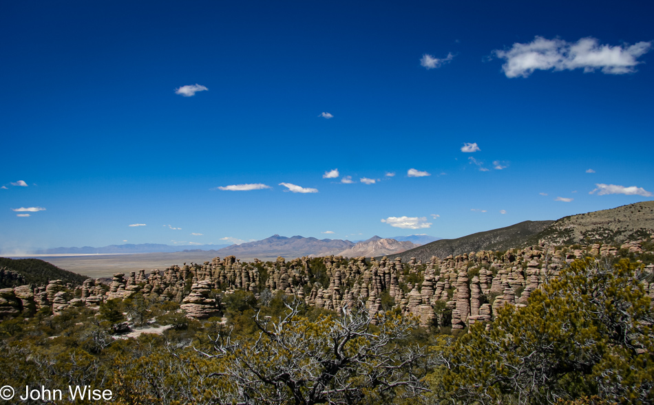
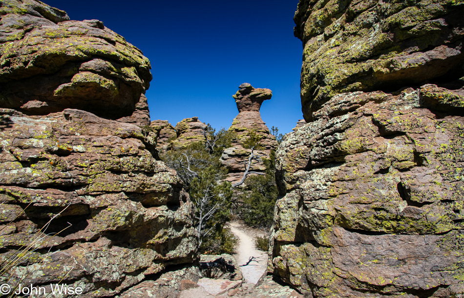
Around the corner, we get our first view of the Heart of Rocks. Looking down into the maze, it is no wonder this area was a favorite of the Apache to evade enemies and U.S. soldiers chasing them down. With the clear skies, we can see seventy miles into the distance, but we are focused on getting into the maze.

The sculptures that are the signature of Chiricahua National Monument in Arizona

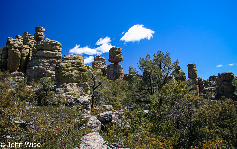
The hike is very easy at this point, the land is nearly flat up here. Mountains in the distance are still covered in a light dusting of snow, but here, away from the tree cover, we start to feel that sunblock would come in handy, along with a nice hat. The balance of the rock features doesn’t fail to thrill us. How these boulders, resting on the rocks below with the smallest of attachments, have managed through eons of wind and storm not to tip over creates constant amazement at every corner we turn.

A close-up view of a balanced rock appears that a bird landing on top it could topple it at Chiricahua National Monument in Arizona

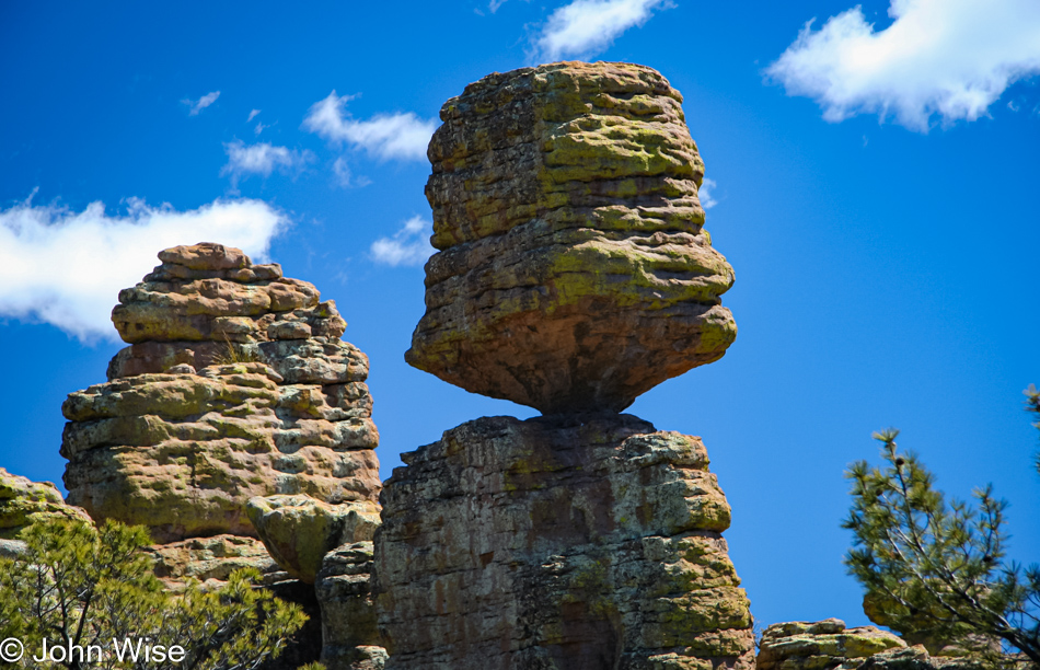
A close-up view of the balancing rock we just passed looks as though a landing bird would easily topple this giant. Imagining that so many years ago, a volcano exploded with a force a thousand times that of Mount St. Helens, which filled this area with the same material that made this balancing rock, is a stark reminder of the power of Mother Nature.

A crack an inch or two wide in the rocks at Chiricahua National Monument in Arizona

We are now in Heart of Rocks. This part of the trail is a 1.1-mile loop, and some of the park’s most famous features are to be seen here. Rocks are now known as Punch and Judy, Duck on a Rock, Camel Head, Pinnacle Balanced Rock, and Kissing Rock. At times narrow and, on a few occasions, a steep, tall step up to continue on the trail, we follow the suggested direction of taking the loop clockwise. A few lizards scurry under and over rocks, and small birds flutter under the brush and then take flight as we come closer.

Spires towering over a narrow section of the trail in Heart of Rocks at Chiricahua National Monument in Arizona

We left Phoenix this morning at 7:00, arrived in Willcox at 9:30, we’re at the visitors center at 10:15. It is now shortly past 1:00 in the afternoon and we are getting hungry for lunch. Finding the perfect spot for lunch, though, will take another half hour. Between spires that tower overhead, we can appreciate the work that went into building this trail that enables so many casual visitors to easily experience the Chiricahua. As we walk along, we remember that this was once a favorite place of the famous Apache warrior Geronimo. Well-maintained signs signal that you are approaching a particularly named feature. At times, it is not easy to determine what the folks had in mind when they chose to characterize these rocks. More than once, we are left scratching our heads.

Camel Head rock on the Heart of Rocks trail at Chiricahua National Monument in Arizona

Speaking of heads, on the right is an easily identifiable feature; this is Camel Head Rock. Nearby was the Old Maiden; I couldn’t find it, nor could Caroline. We march on, looking over, around, and under, while our stomachs holler out to stop and feed them.

Stairs on the trail in Heart of Rocks at Chiricahua National Monument in Arizona

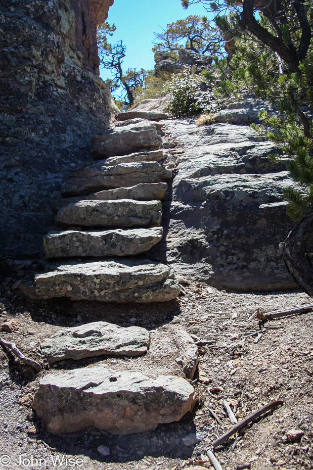
Down the stairs, we find a perch with a nice scenic view for lunch. Granola bars, cups of fruit, and water were a simple affair, but we are glad to have this as the decision to come down to the Chiricahua had just been made the evening before, and we did nothing in preparation. Of course, we don’t recommend other visitors be so lackadaisical, especially when it comes to water. We always pack plenty of water. We live in Phoenix and know better than most travelers to the southwest: always have enough water for yourself and your car when you travel, even if it is not 125 degrees in the shade.

Rejuviinated after our brief picnic we continue on the trail through Heart of Rocks at Chiricahua National Monument in Arizona

Rejuvenated by our brief picnic, we get back on the trail and are ready to go. Earlier in the day, there were some clouds bunching up, looking as though they were going to cluster into something menacing. By this time, they have completely broken up, and only tiny remnants float by.

A sea of spires at the Chiricahua National Monument in Arizona

A sea of spires pokes out of the earth, but the trail doesn’t point that way. Our loop is coming to an end, and we are about to begin the hike back to the roadside. This is just as well as my feet are getting tired. Our hiking adventures are not frequent enough, and so these first 4 miles are letting us know that we should make greater efforts to get out and exercise.

The Kissing Rocks at Chiricahua National Monument in Arizona

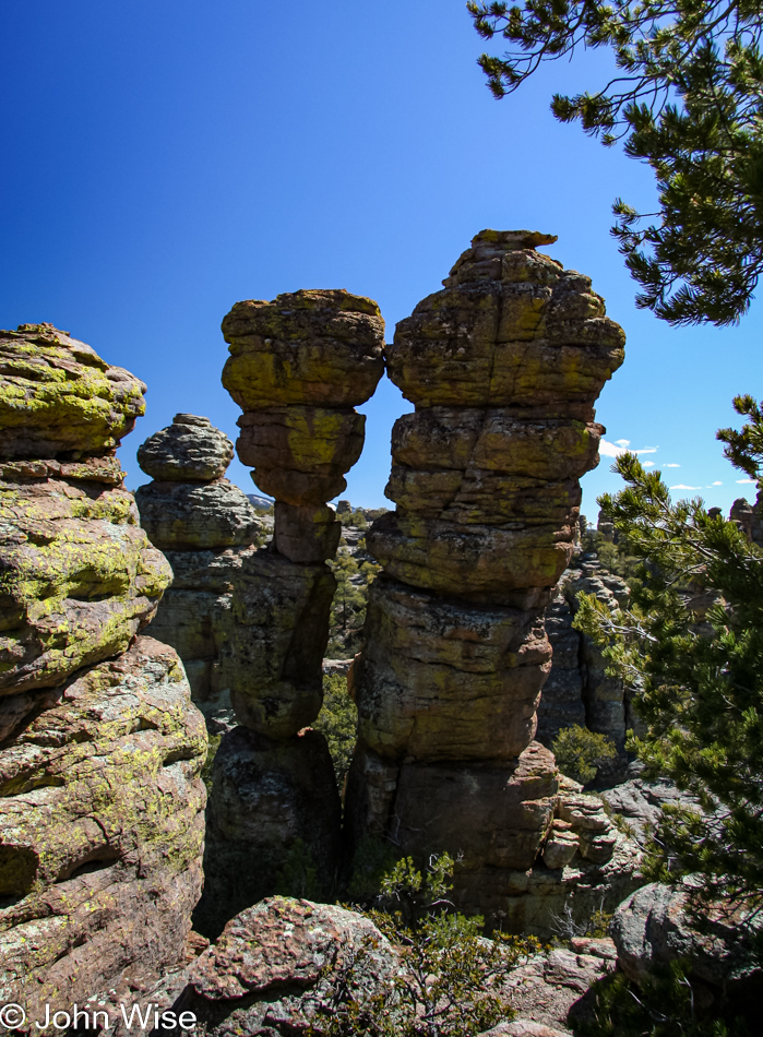
The Kissing Rocks will be the last feature we concern ourselves with. How can any couple who are at least a little romantic pass this by and not feel a tug of romance themselves? Enough romance; we want shade. The next part of the trail is over a plateau at the highest elevation of our hike, and it won’t be until we start our descent that we get back under tree cover. We step up our efforts to get back to the forest. Not only the shade is motivating us, but our desire to get home at a reasonable time is starting to push us along.

Tree bark detail on the trail in Chiricahua National Monument, Arizona

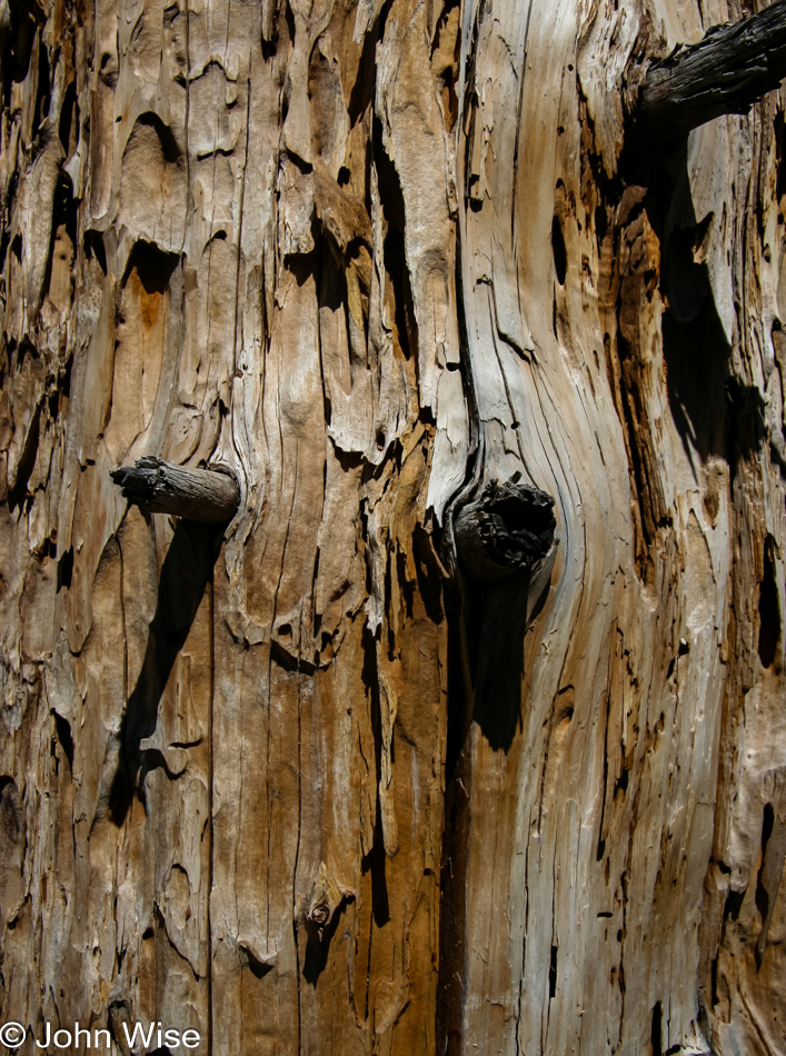
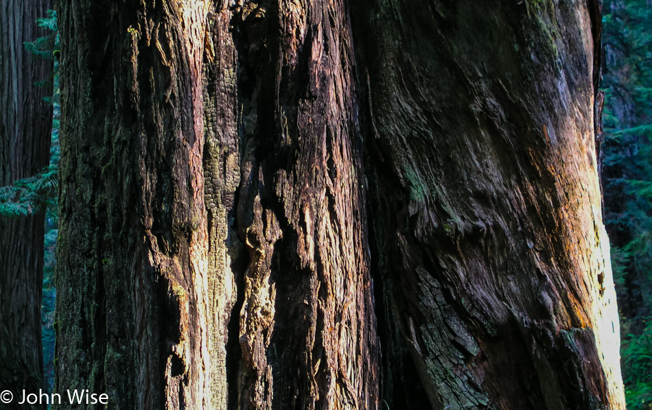
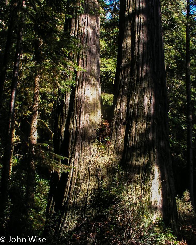
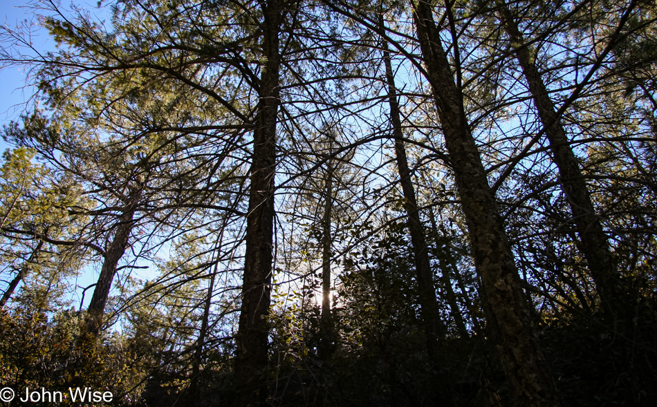
Back among the trees, our pace slows again, giving us time to inspect our surroundings with an eye on details. We look at bark, branches, limbs, leaves, needles, the trail, stones, small plants, large trees, bushes, insects, and surprisingly an absolute absence of trash, including cigarette butts. Our skills in identifying plants are non-existent. On occasion, we will travel with a birding book, we own a roadside geology book for Arizona, and even an insect identification pamphlet but own nothing to help identify the flora of our state.

A red barked branch of an unidentified plant at Chiricahua National Monument in Arizona

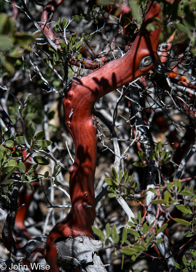
So this sharp-looking red-barked branch of what remains an unidentified plant is left to us to name. Maybe someone reading this will someday send us the correct name, but until then, it is the Rediolis Bushicus Foundio on the Trailio or Red Branched Bush for those less familiar with formal Latin names. Not only is the forest shaded and cool, but it smells great, too. It is early spring, and new growth surrounds us. A creek bed runs through the canyon we are hiking but is dry, but for a few wet spots here and there.

Chiricahua National Monument in Arizona

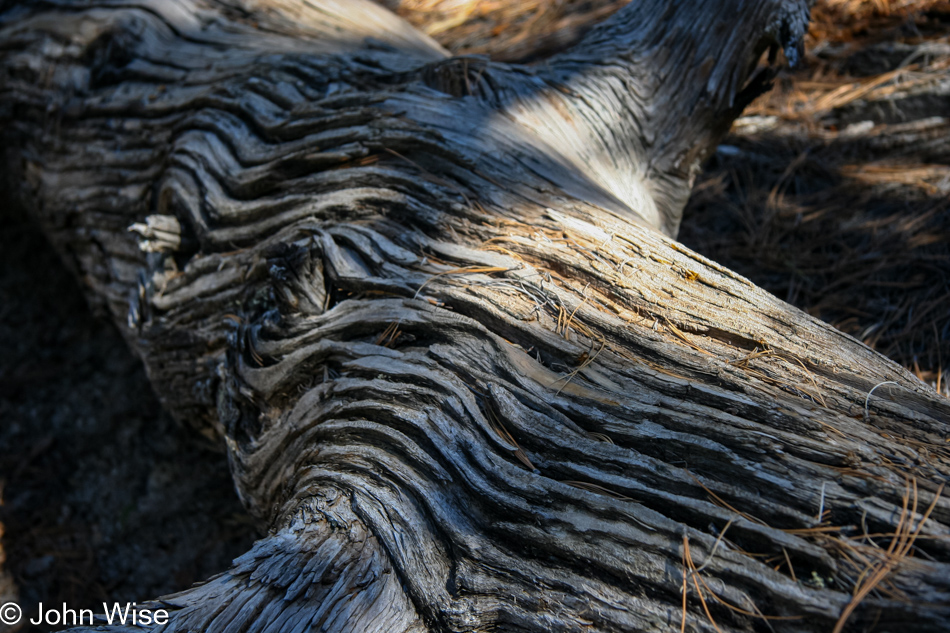
Pine trees stand tall, with new branches showing off fresh green needles. The tops of the trees whisper and shuffle with the wind blowing through. This oasis forces us to tread slower yet to gain even more appreciation for the environment. A fallen tree grabs Caroline’s attention, and she zooms in to preserve a memory.

A fallen tree taking its time to fade away on the forest floor at Chiricahua National Monument in Arizona

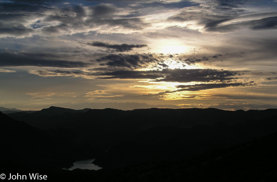
We enjoyed the forest as much as the time we spent amongst the spires and balancing rocks. Our time at Chiricahua is almost over. The sun is getting lower in the sky as we pass a couple of women who are just heading out on the trail. We chat briefly, exchanging points of origin and recommendations for other sites.

Tall pines deflect the sun giving us a cool shadowy walk through the forest at Chiricahua National Monument in Arizona

The ladies begin to walk away, and Caroline mentions how much she likes one of the women’s hats. I call out to get their attention and inquire about the hat. Turns out the liner has a website address and soon Caroline will have her own SundayAfternoons hat.

The last remainder of the trail before reentering Echo Canyon parking lot at Chiricahua National Monument in Arizona

The home stretch, 7.2 miles nearly complete. Our hips hurt, our feet hurt, I’m a bit sunburned, we are hungry, our lips are chapped, we need to sit down. The car never felt so good. That is not true; after walking for 16 hours in Disneyland the car feels as good. That last segment of the trail was rocky and uphill; neither was a welcome feature.

Caroline Wise and John Wise at Chiricahua National Monument in Arizona

As bad as we felt, we felt worse for the guys who had passed us earlier and were now doubling back to another parking lot because they just went to the wrong lot – ouch.

One more stop in Dos Cabezas to rattle some ghosts awake in southern Arizona

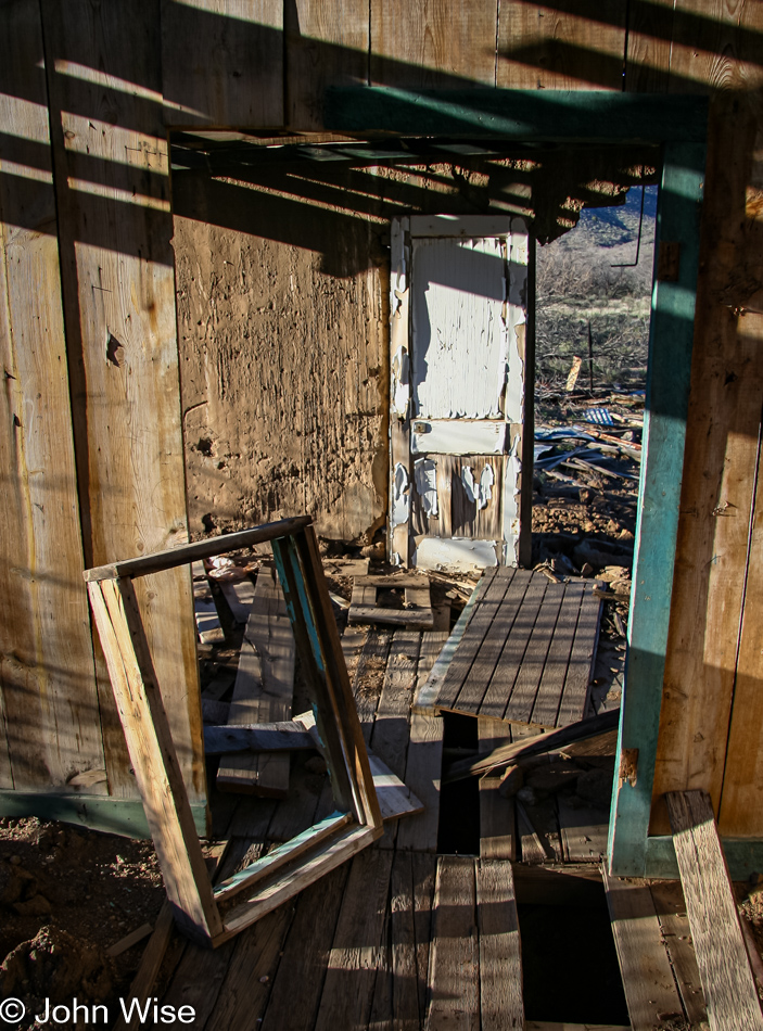
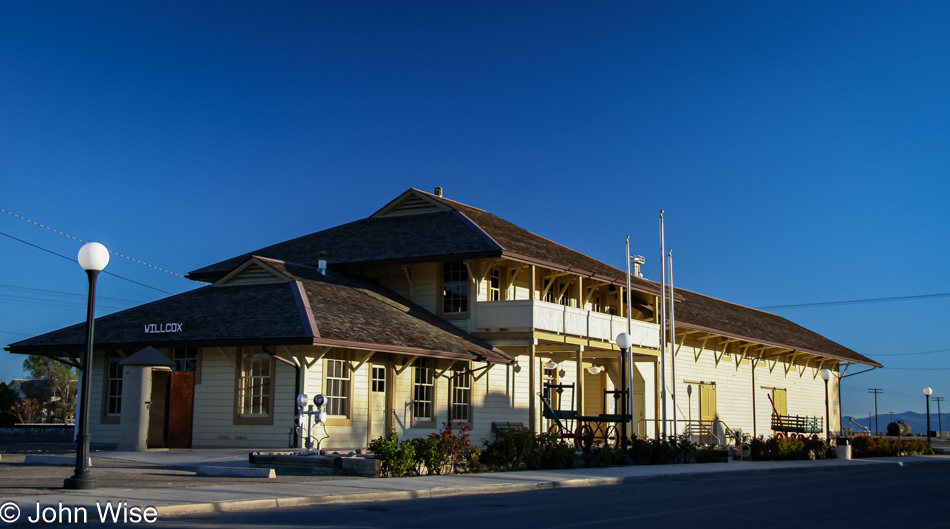
Another stop in Dos Cabezas to rattle some ghosts awake – maybe houses without walls can’t keep spirits prisoner. I putz around some old buildings and ruins looking for another photo but am soon overcome with the reminder I need something to eat. Willcox feels like it is one hundred miles from Chiricahua, When we finally get to Willcox, we can’t easily spot a restaurant nor find a sign directing us to some eats. We do pass the old railway station again which looks beautiful in the late afternoon sun. The rail car BBQ across the street only looks closed.

An old railway station glowing in the late afternoon sunlight in Willcox, Arizona

Dinner was at the first place of convenience, Denny’s, in Benson, Arizona. This reminds me, we need to come back to Benson and visit the Kartchner Caverns again! We didn’t get home until nearly 10:00; too bad a bullet train doesn’t operate out of that old railway station.

Zion National Park

Caroline Wise near Cedar Breaks, Utah

With upwards of 11 feet of snow on the road ahead, there was no visiting Cedar Breaks National Monument today.

Near Cedar Breaks, Utah

It’s nice to visit places with snow as opposed to living in places with snow, and the opportunity to visit on such a blue-sky day is just an absolute delight.

Caroline Wise near Cedar Breaks, Utah

Friendly horses next to the side of the road also help bring another level of happiness to our travels.

Caroline Wise and John Wise in Zion National Park in Utah

And then we arrive at another National Park and have to stop for yet another selfie in front of the park sign.

Zion National Park in Utah

This is such a beautiful place with fond memories of our first visit back in 1999.

Zion National Park in Utah

The deep blue sky forms the perfect backdrop for the bands of red rocks punctuated by puffs of sage and a few random trees.

Zion National Park in Utah

Carved out and worn down, the sandstone that remains offers many hints of what was once here before the weather and time wore the earth down.

Zion National Park in Utah

Epic views pop out at you when driving into the park. If only we could walk in instead of rushing in with a car.

Caroline Wise in Zion National Park in Utah

My less-than-virgin steps into the icy waters of the Virgin River right here in Zion National Park.

Zion National Park in Utah

The colors of fall hang on until spring starts to show its face, which is still about six weeks away.

Arizona Strip

Never thought we’d visit this corner of Arizona. Welcome to the Arizona Strip, the one corner of the state you cannot visit if you are trying to get here from Arizona. The only way in and out is from Highway 15, which crosses between Utah and Nevada.

Hoover Dam in Arizona

The memory of Lake Mead lapping at the spillway feels like it was 100 years ago. The white rock is bleached from when the waters were that high.

Near Hoover Dam in Arizona

While it may still be winter in Utah, here in Arizona, south of the Hoover Dam, it is apparently springtime already.

Near Hoover Dam in Arizona

Our last glimpse of the Colorado River as it makes its way down to Havasu Lake before a trickle of the flow might make it to Mexico. Our weekend jaunt is over, and with about 45 minutes of light left, we’d be getting home in the dark. All-in-all it was a great little trip that put great little smiles on our faces.

Lake Powell to Bryce National Park

Lake Powell in Arizona

Well, at least there’s still some water left in our quickly disappearing lake here in Page, Arizona. It’s a beautiful though slightly chilly morning here as we point the car north and head into…

Caroline Wise and John Wise at the Utah State line with Arizona

Utah! Isn’t it nice to just go out on some random day and see what the world around you looks like?

Road side in southern Utah

The spectacle of our exposed earth shows us its long, deep history by putting itself on display for all to see.

Dirt road in Utah

Pahreah Ghost Town is up that road, and while it’s tempting to go check things out, we couldn’t be sure that we wouldn’t find a wet, impassable part of the road, so we played things safe and made a note to help our memory bring us back this way someday.

Pie and Coffee at Thunderbird Restaurant in Mount Carmel Junction, Utah

We finally did it and stopped at the Thunderbird Restaurant in Mount Carmel Junction, Utah. This is the home of the “Ho-Made Pie,” and in that classical all-American setting where pie and coffee are able to put your mindset of the 1960s road trip on Route 66, this is that place.

Caroline Wise and Maisy the Donkey in Glendale, Utah

Meet Maisy the Donkey. This cute young lady lives in Glendale, Utah, and might be the friendliest donkey EVER!

Caroline Wise making snow angels in Utah

We leave Arizona with spring-like weather and end up visiting winter, where the snow angels take flight.

Bryce National Park, Utah

A bit more snow than we’d counted on.

Bryce National Park, Utah

We had entertained the idea that we might hike a short trail here in Bryce National Park, but upon looking out here, we were not prepared with the proper clothes or shoes.

Bryce National Park, Utah

Seeing Bryce covered like this is certainly a treat. By the time we landed in Cedar City, we were early enough that we were able to have a luxurious dinner at Taco Time before checking into the Cedar Rest motel for the great rate of only $26. Saving so much money on food and lodging, we stepped up the indulgence and visited the Stadium 8 theater to catch a screening of Clint Eastwood’s new film, “Million Dollar Baby.”

Thanksgiving 2004 – Day 4

Eureka, California

Welcome to Junkie City, USA, a.k.a. Eureka, California. What is the attraction of this place to those who prefer life on a needle instead of working to find something akin to happiness? Oh, I know the answer is that those who’ve taken this path are suffering from deep pain inflicted upon them by those who have denied them love and betrayed the trust that should exist between family members. Well, that’s likely the most common cause, as why else would someone have so little self-confidence and self-loathing to try a little bit of suicide every day?

As for this small town of only about 27,000 people, it is beautiful and loaded with Victorian homes, so it’s certainly worth a visit.

Eureka, California

Across from Old Town Eureka is Woodley Island, and behind that is Indian Island.

Clam Beach County Park in Northern California

By 8:30, we were out on Clam Beach, walking north to the Little River State Beach.

Clam Beach County Park in Northern California

There was a lot of ice out on the beach and even something called Frost Heave. When ice is forming below the surface and pushes up it can create some very strange soil extrusions. While I got a couple of photos of the phenomenon, I wasn’t happy enough with any one of them, so I give you a giant jellyfish, of which there were many on our oceanside walk.

Northern California Coast

I have no idea where this was, but it adds to the beauty of the day, so here it is.

Fern Canyon area in Redwoods National Park, California

This is on our way to Fern Canyon at the Prairie Creek Redwoods State Park and marks our second visit.

Fern Canyon area in Redwoods National Park, California

Yes, it’s still that cold out here.

Fern Canyon area in Redwoods National Park, California

Fern Canyon and our camera do not like each other. What a strange place this is with these vertical fern-covered canyon walls. We weren’t able to hike too far in as we weren’t wearing the right shoes for getting through the creek that runs through the canyon.

Fern Canyon area in Redwoods National Park, California

I’ve got a hunch that we’ll be bringing my mother-in-law Jutta up into this corner of America on her next visit.

Fern Canyon area in Redwoods National Park, California

About to leave Prairie Creek Redwoods State Park and head up to the Redwoods National Park.

Redwoods National Park, California

Into the woods we go with god rays leading the way.

Redwoods National Park, California

Big, thick bark on big old Redwood trees makes big old me happy.

Redwoods National Park, California

The roads less traveled are the perfect trails for us to follow.

Redwoods National Park, California

Has anyone ever seen all the redwoods that there are to see? How many people will attempt to hike the few remaining forests where these giants continue to exist in order to witness them firsthand before we lose our minds and finish the process of pushing them to extinction, which we were almost successful with?

Caroline Wise at Redwoods National Park, California

How could we have ever been so merciless to just go after these forest dinosaurs and never consider anything other than the financial gain?

Redwoods National Park, California

We take the energy of the sun while it smiles upon us, giving life. The symbiotic nature of it all is so easy to take for granted, as though reality is just this thing that happens and always has. I wish to know if, even for only a day, how the minds of early humans walked past this scene and interpreted the air visualized with the light of the sun that seemed to reach out to the observer.

O'Brien, California

Caroline is over there behind the door on the right. We are in O’Brien when we have a really great stupid idea.

Caroline Wise and John Wise at Dutch Bros in Grants Pass, Oregon

How about we drive up to Grants Pass for a cup of coffee from Dutch Bros? But wait a second, don’t we have to be in Phoenix tomorrow? So, what’s your point?

Gold Star Inn in Sacramento, California

If you think this “bath mat” is indicative of our $50 room at the Gold Star Motel in Sacramento, you wouldn’t be too far off. Good thing we only have 750 miles and about 11 hours of driving tomorrow otherwise, we’d probably have to remain on the road tonight beyond the already late hour of nearly 11:00 p.m. My apologies in advance if there are no photos posted tomorrow, as we’ll have to focus on driving.