Up early and downstairs before 6:15 for the “Wake up to Wildlife” tour. Our guide this morning is Tyrene, who also happened to be our driver last year for the snow coach drive from Mammoth to Old Faithful. Tyrene is a vet in Yellowstone, having worked here for more than ten years. She tells of the more than five thousand miles put on her hiking boots over that time and that her favorite past-time is fly fishing, hence her love affair with Yellowstone. During our current trip, Tyrene will twice more handle the driving and tour guide chores while Caroline and I hope to return one day for a chartered tour led by her, where we can choose to linger a little longer to enjoy the sights at our pace instead of meeting the schedule of the group. For you fly fishing aficionados: Tyrene leads chartered tours of the many rivers in Yellowstone, such as the Firehole and Madison during Summer.
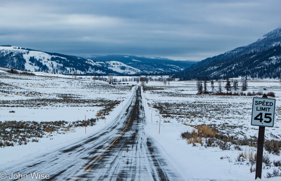
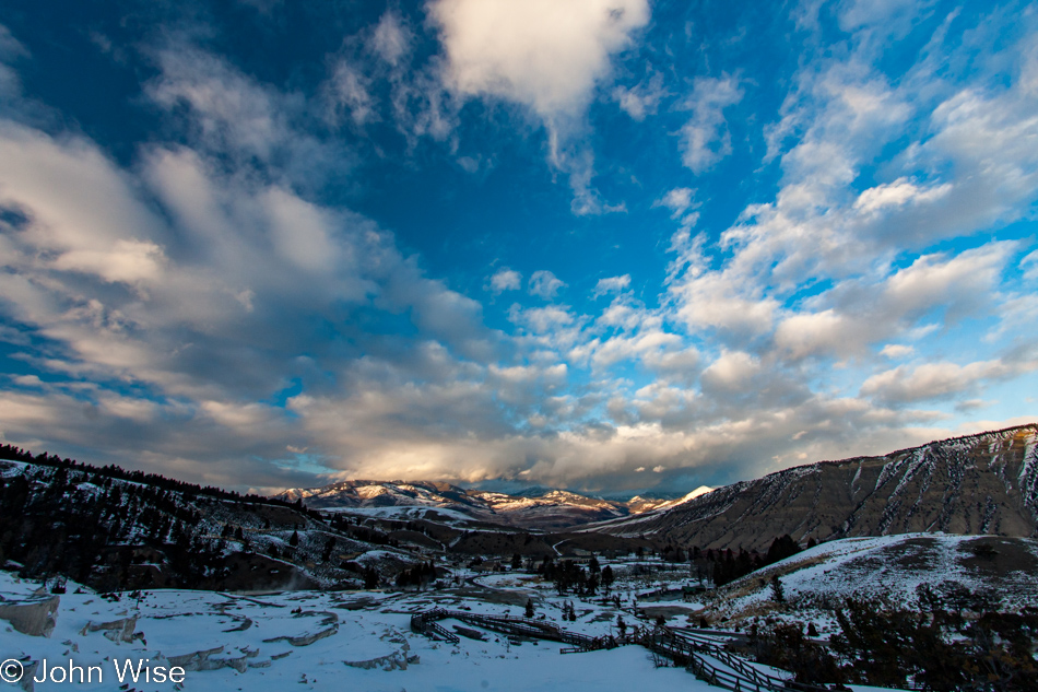
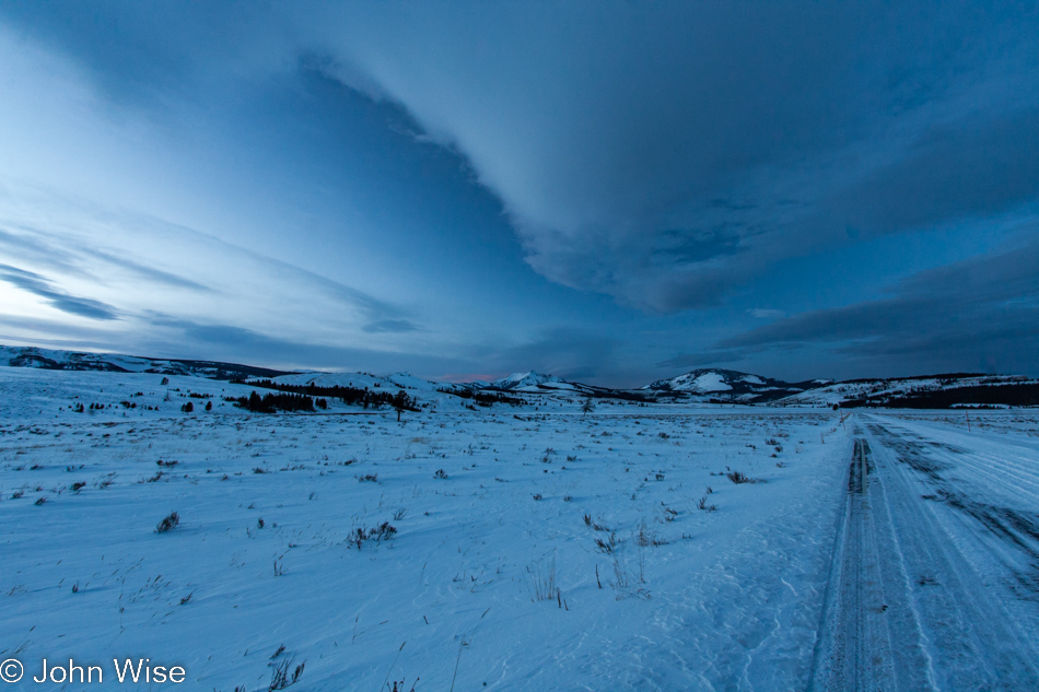
Pulling away from the hotel, the road to Lamar Valley is a mix of clear to snowy with intermittent icy spots. From out of the dark blue of twilight, the sky begins to brighten, and I can see clouds stretching along the north and south with a patch of clear sky to the east that is brighter than the heavens surrounding us. Even that small window to where we should have greeted the rising sun soon disappears. Occasional flashes of pink illuminate low wisps of clouds as the sun finds holes in the heavy overcast sky.
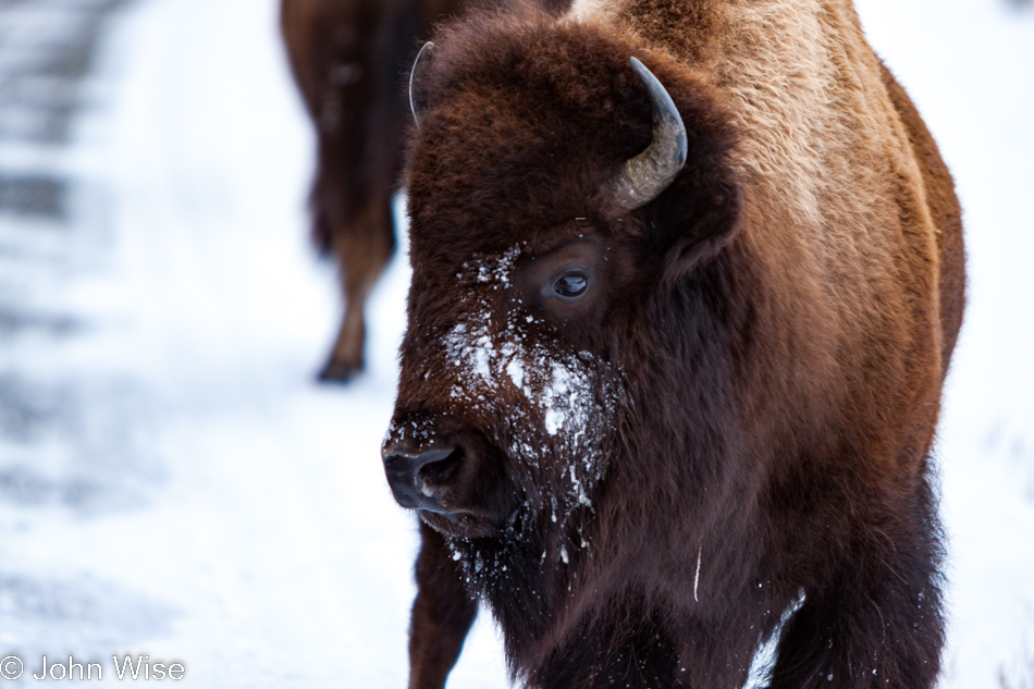
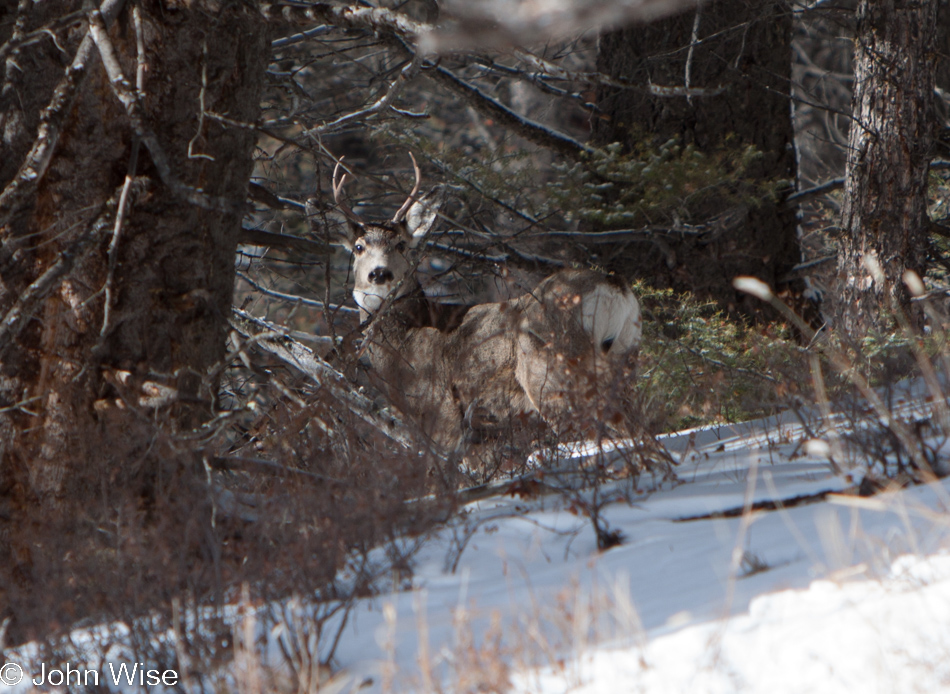
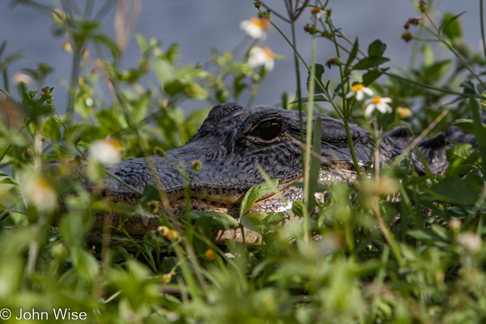
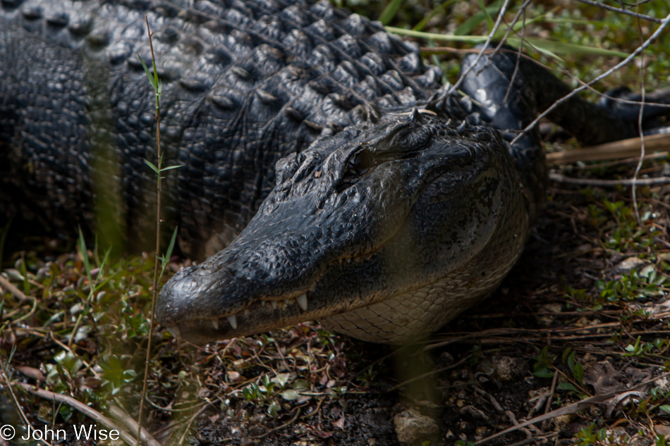
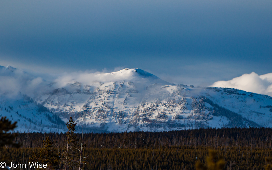
It would be more than a few miles before we spot wildlife. Elk, first on a shadowy ridge in the distance, then a large herd covering the hillsides. While plentiful enough, they are a goodly distance from the road, great for viewing, less so for photography. Then we encountered a forlorn bison calf walking up the road, seemingly lost of its herd. As we approached with our snow coach, the little bison turned tail ambling down the road in front of us. About a mile later, the juvenile rejoined its extended family.
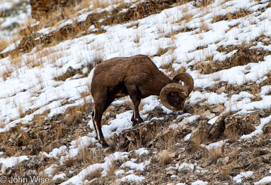
After the bison jam spread out, letting us pass, Tyrene pulled over near Slough Creek for a facilities break for those who might need it – seems as though everyone did. Piling back in the van, off in the distance, I heard the unmistakable howl of a wolf and then a second howl. Initially, the loud conversation nearly drowned out the canine call until I was able to arrest the group’s attention so they, too, could enjoy the call of the wild. Seeing a wolf, though, was not in the cards on this tour. But a surprise was on hand that didn’t disappoint. Two bighorn sheep were grazing the hillside next to the road just north of Soda Butte Creek.
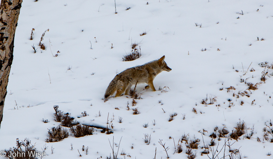
Soda Butte Creek, which lies east of the Lamar River, sandwiched between Mount Norris and Druid Peak, was also our turnaround point. The return to Mammoth would take us back up the road we came down on with little promise of seeing more wildlife than we had seen on our first drive-through. That turned out not to be altogether true, though. Shortly after we passed the same bison, we had spotted forty-five minutes earlier, someone in the coach noticed a coyote in the snow not far from the road.
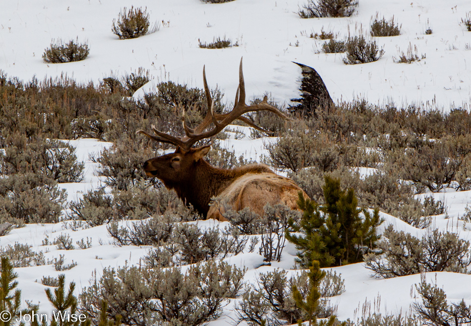
One and all, we scoured the hillsides looking for an elusive wolf. In some sad way, Yellowstone is reduced to collecting trophy sights; one is spotting wolves, the other witnessing Old Faithful erupt. So much more exists, seen and unseeable, that requires more than a casual drive-through with an itinerary that demands we stop only at the famous and predictable. Then, there on the left, lying in the brush, a bull elk. Not just any bull either, this is number ten, six’s rival. Well, if six were still alive, he died in a freak accident about a year ago; you can read about that here. And that, folks, concluded our Wake up to Wildlife tour of the Lamar Valley.
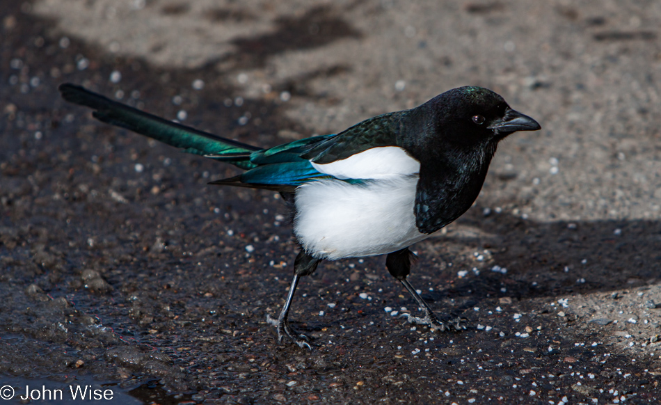
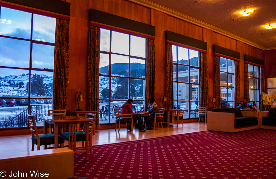
Back at the Mammoth Hot Springs Hotel, we have but a short time to grab some lunch in the dining room before the next tour gets underway. The sandwiches are ordered and delivered in less than seven minutes; we are gone ten minutes later. Now early, we cross back over to the hotel to await the snow coach. A black-billed magpie walks along with us as though it were awaiting falling snacks; somebody hasn’t been listening to National Park rules, nor probably would have I if it weren’t for the constant reminders from my wife.
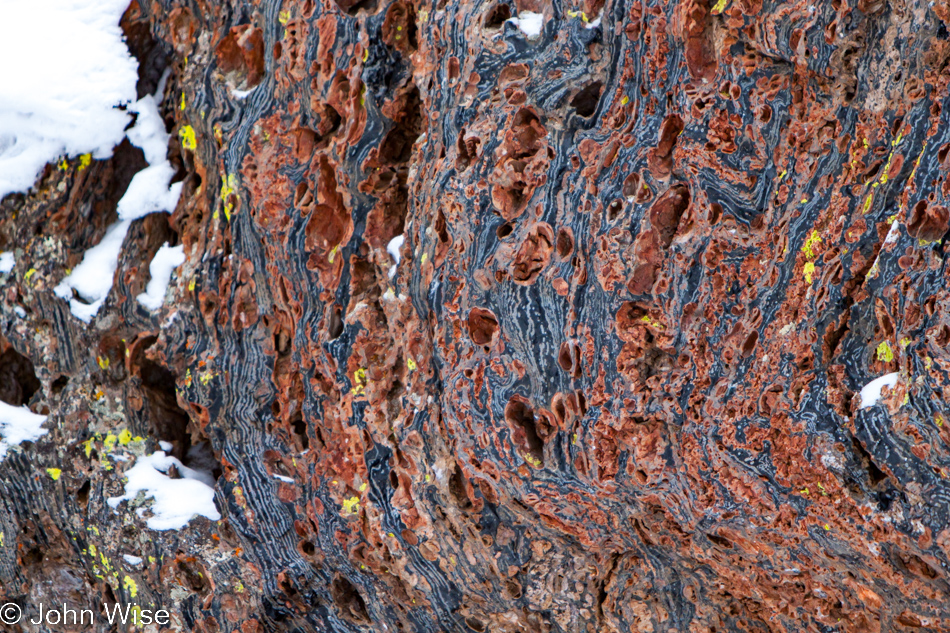
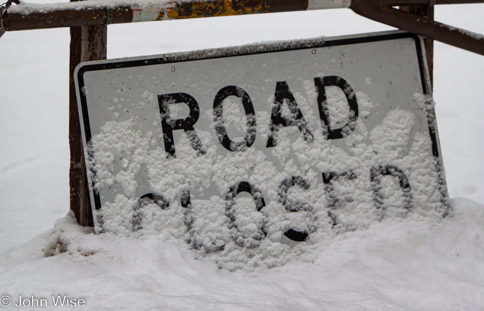
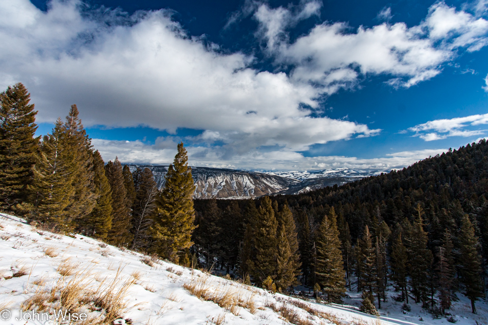
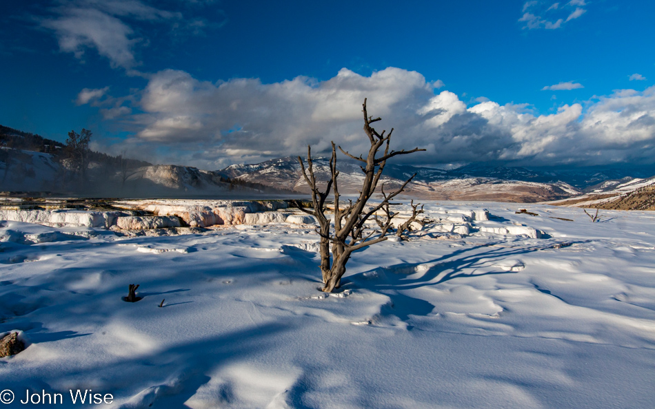
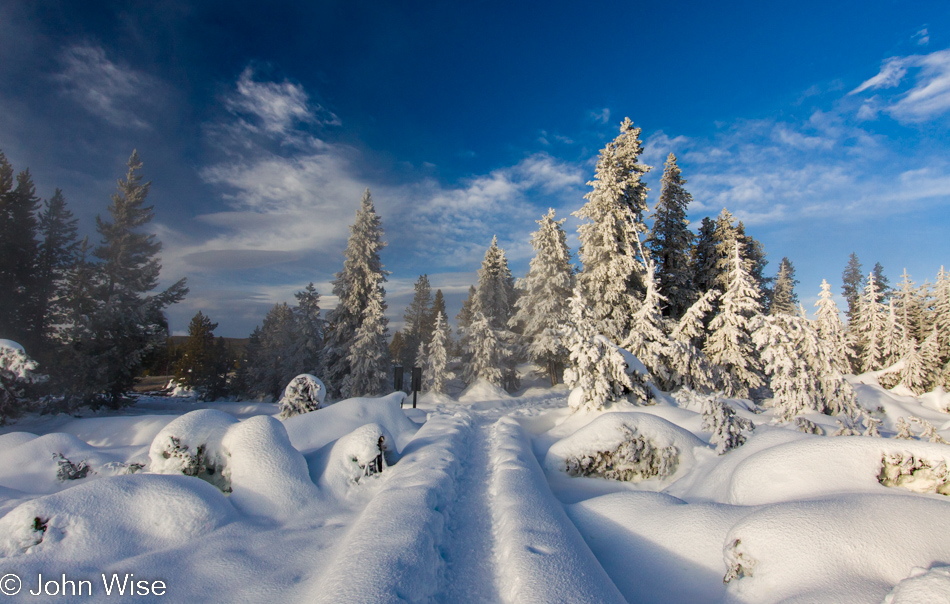
Going south, we require a tracked vehicle, specifically a Mattrack snow coach. At the wheel for our afternoon trip to the Norris Geyser Basin is Tyrene one more time. The bumpy drive down is gray and getting colder; only a few bison are spotted in the distance. At Obsidian Cliff, the vehicle comes to a stop for us to learn about and see the obsidian embedded in the cliff on our left. About 180,000 years ago, a lava flow here quickly cooled, probably buried under a glacier, and formed obsidian. For centuries, Native Americans made arrowheads and spear points with this form of volcanic glass, then used them for trade with other tribes, with some pieces being found as far away as Oklahoma. Amazing what we can learn here in the park.
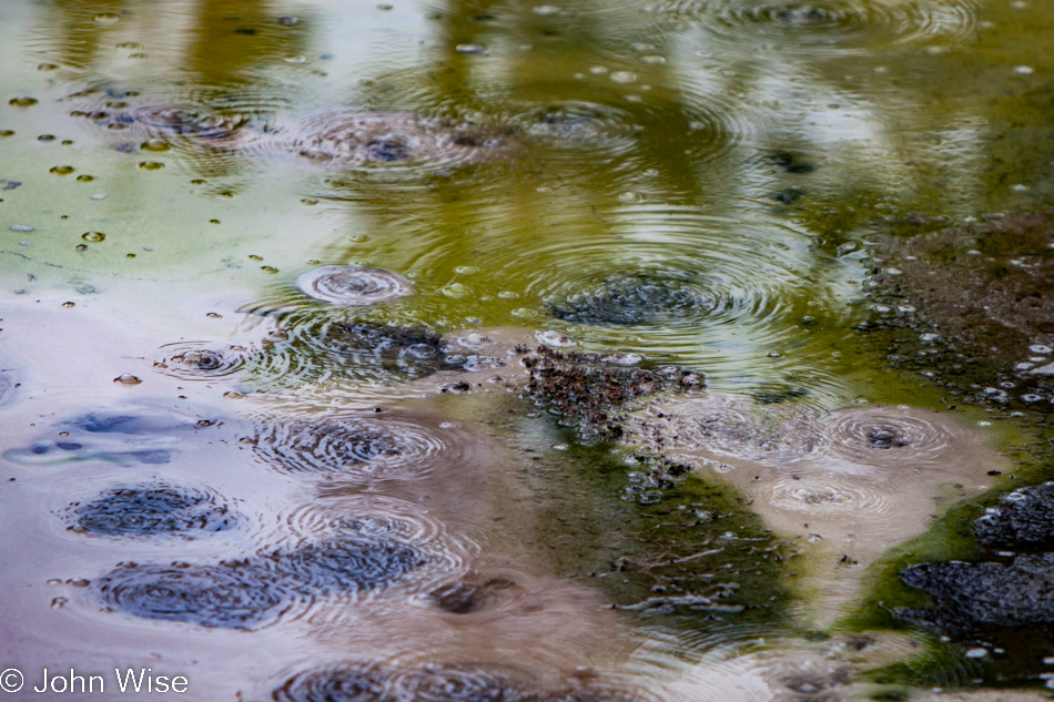
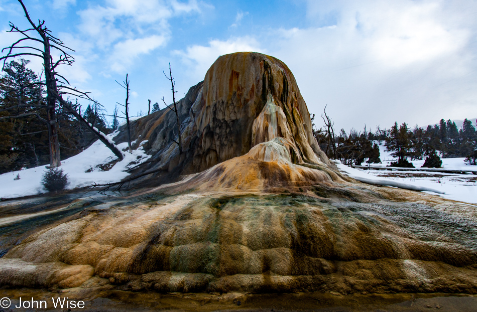
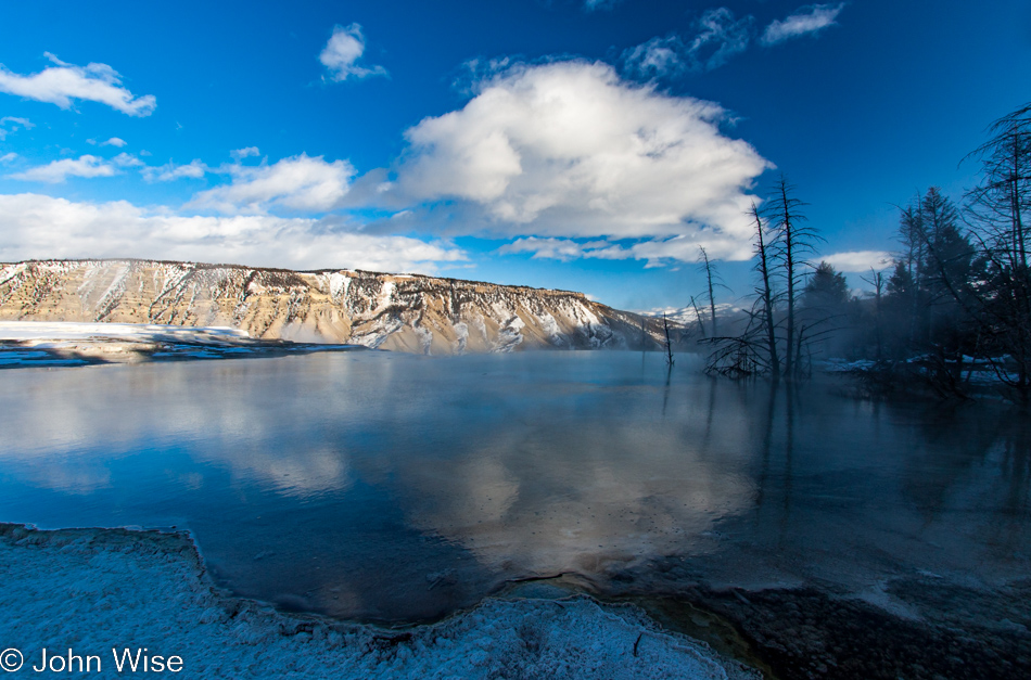
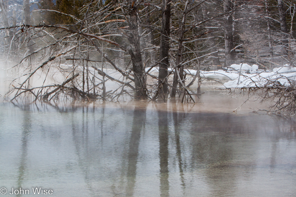
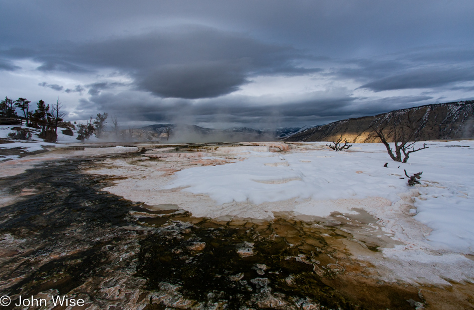
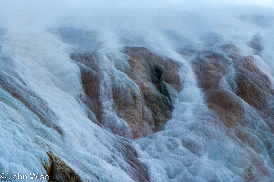
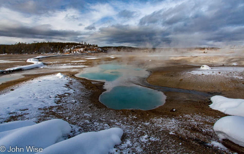
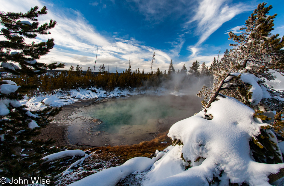
Another stop is in order here on the Grand Loop Road, traveling south. Five hundred feet south of Nymph Lake is Frying Pan Spring and fumarole. With the windows down, we listen to the escaping gas as it hisses, passing through tiny pebbles and stone, forming little bubbles of water boiling out of the earth, sounding indeed like a sizzling frying pan. On the other side of the coach are steaming hot water pools over shallow clay and mud craters, with a hint of bacteria growth tinting areas green. How easy it could be to get lost in the intricate patterns and rippling waters, the sounds and smells of even the most insignificant roadside features that many probably pass by without a second thought.
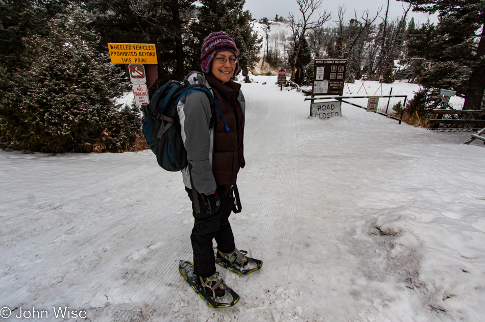
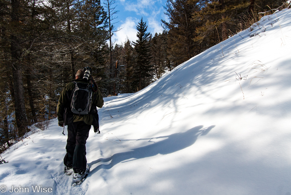
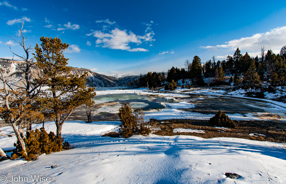
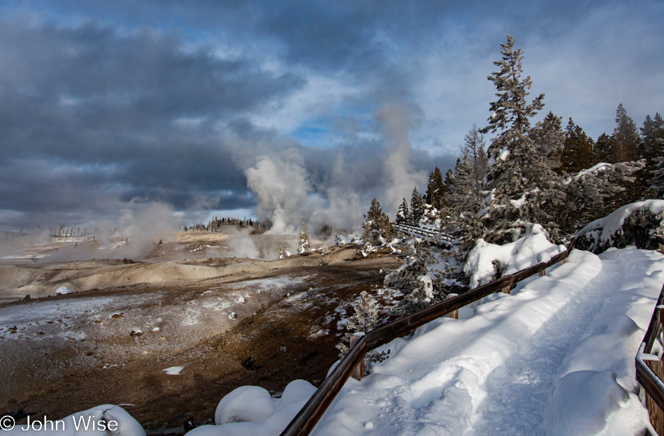
As if on cue, the sky begins to part, the sun emerges, and blue is the new background that will remain the backdrop for the hour and a half we are afforded to tour the Norris Geyser Basin. With our Yaktrax pulled onto our boots and the temperature comfortable enough that our outer shells are left in the vehicle, Caroline and I depart company with the group and head towards Porcelain Basin while Tyrene takes the remainder to the Back Basin.
Depending on the average age and condition of the group members, the pace and amount of features seen can be greatly encumbered, and the group is encouraged to stick together, limiting our time to get lost examining in minute detail those bright, shiny objects we find ever so interesting. Furthermore, our selfish desire to not listen to the comments or occasionally inane attempts at sulfurous humor urges us to break away on our own. For all of you who feel compelled to equate nearly all you see and do to something you once saw on television, please stop the narration. Those of us who do not participate in that form of entertainment cannot relate nor do you best exemplify your experience when blurting out that you once saw this or that on some random program. Pardon my grump; I’ll try to keep my lament contained to this one time.
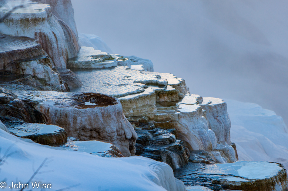
While Caroline insists I have seen the Norris area looking so beautiful before, to me, this was the most spectacular sight on these boardwalks ever. With a mere ninety minutes to cover an area that can easily consume a day, we waste no time and walk two or three more feet to view the same relative area from a slightly different angle. After uttering another series of “oohs” and “aahs,” we do the unthinkable and move from our perfect perspective, taking up a perch yet another two or three feet from where we just were and would you believe it? Even stronger, more emphasized “OOOHS” and “AAAHS” follow. I wouldn’t bet against that an occasional “WOW” fell from our lips.
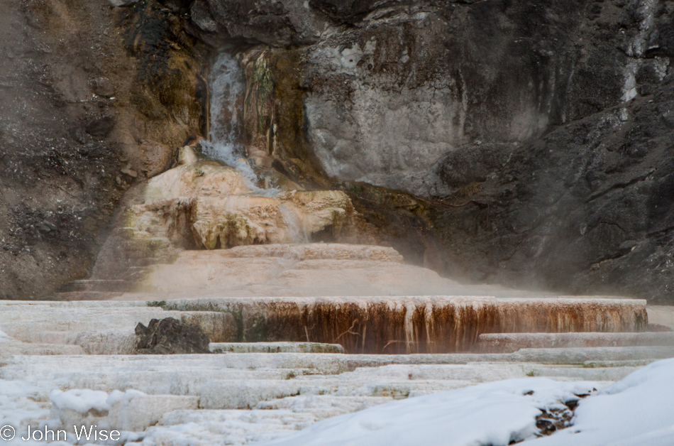
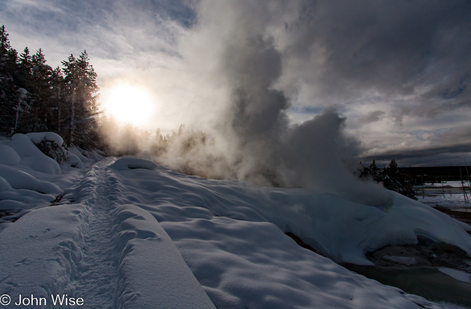
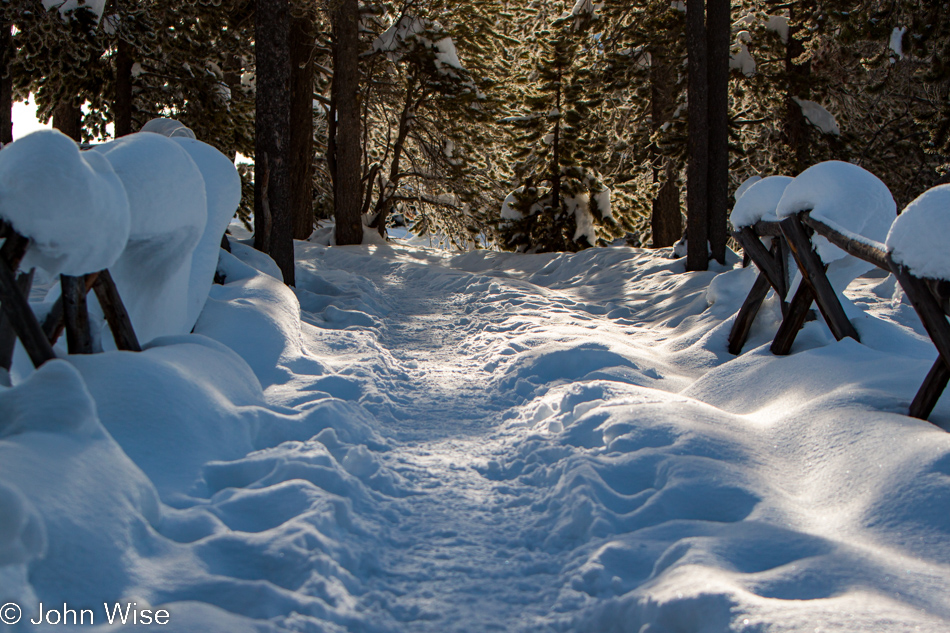
There are moments when light, shadow, steam, and sparkle are so overwhelming that we stand in awe, admiring how perfect the nature of this scene is as it stands before us. The path has been tamped down; the narrow center of the boardwalk is surrounded by fluffy, deep, fresh snow. We trudge up the trail towards steam plumes that pull us forward.
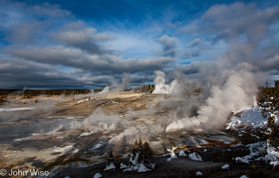
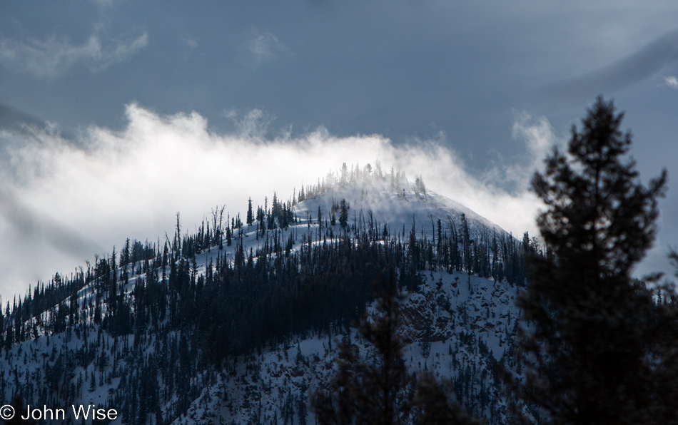
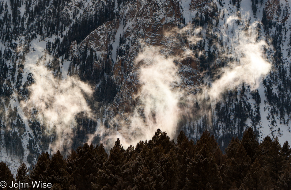
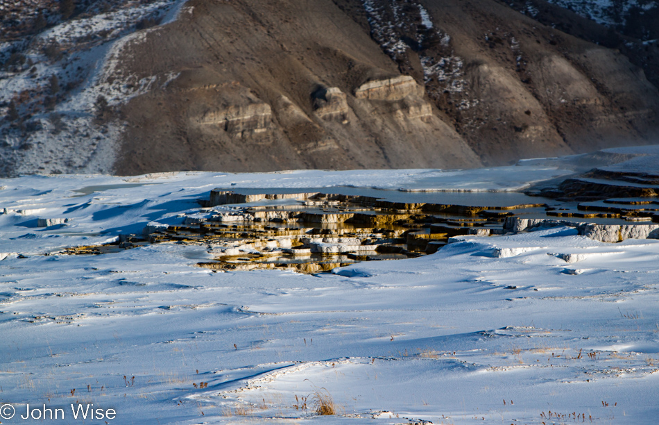
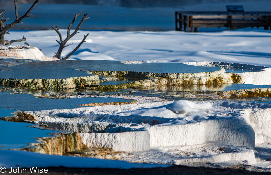
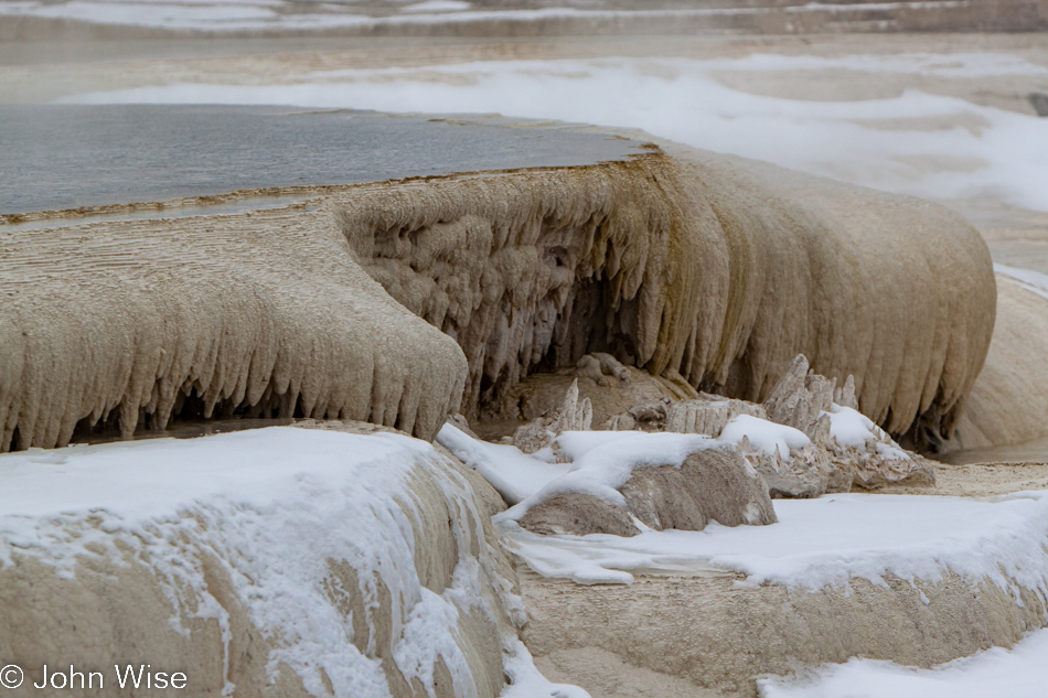
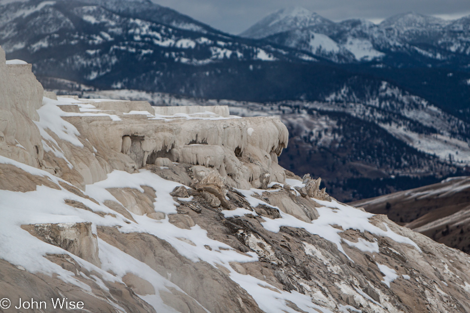
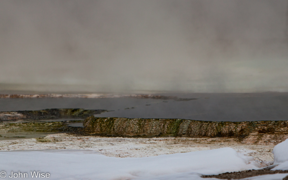
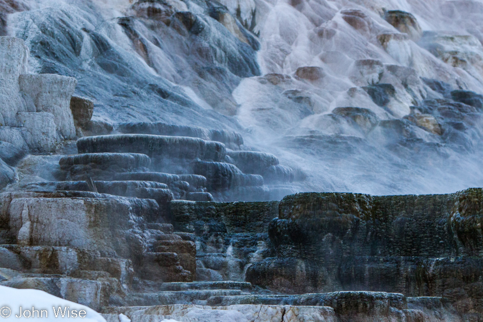
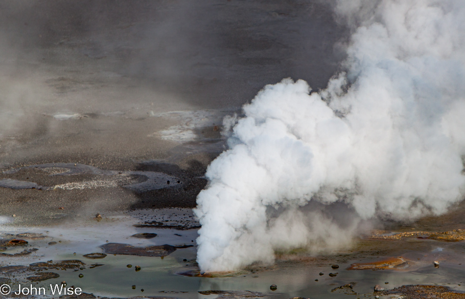
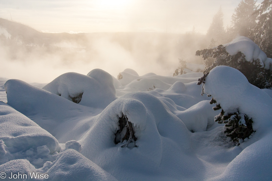
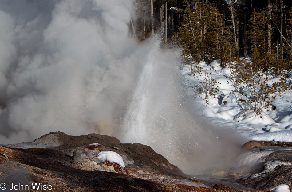
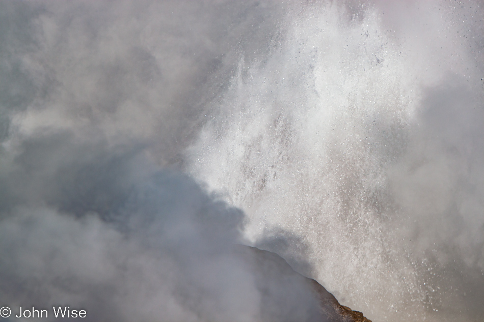
Jets of steam are pulsing and rushing from vent holes. Hot Springs and geysers are obscured by billowing clouds rising into the blue skies, with lodgepole pine trees in the background delineating the border between the geyser basin and the world at large. An orchestra develops from the various earthly wind instruments hissing and bellowing, joined by bubbles of water and gas boiling out of the gravel.
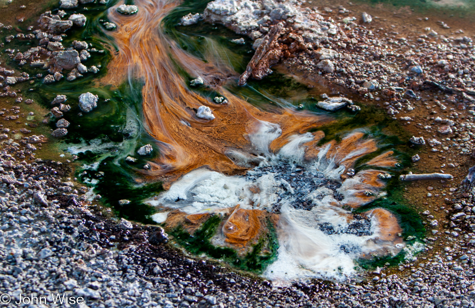
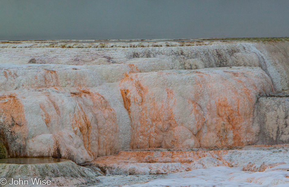
Birds chirp above, flittering between branches while flowing hot water glides over orange, red, brown, green, black, and yellow bacteria mats. At millions of times per second, dissolved minerals are building new geyserite deposits, promising us a future we won’t recognize even if our memories could recall the minutiae of detail. Clouds glide by as the steam dissipates, and the entire scene is built anew, again and again.
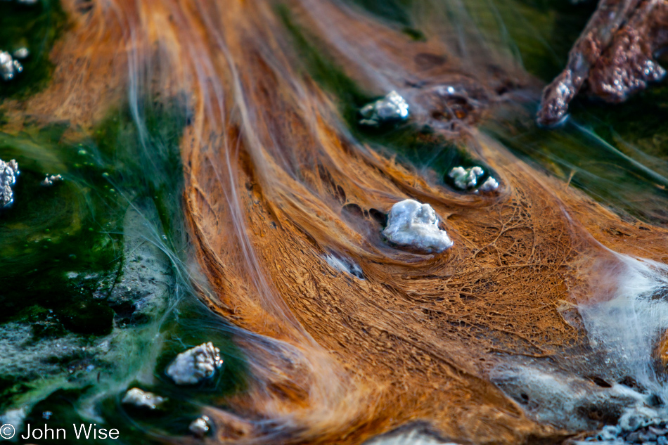
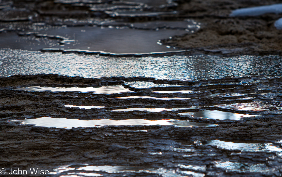
Terrence McKenna once said, “The further you go, the bigger it gets.” Here at Yellowstone, that idea could be explored by close examination of the thermophile bacteria mats. From above, a splotch of gooey, bumpy, slimy-looking stuff, but down close, down on your hands and knees as you hang precariously over the edge of the boardwalk, as you risk planting your face in acidic hot water for a closer look at just what is this bacterial mat stuff anyway, you see an entire universe of possibility. How many layers of this fibrous tendril-like thread structure are there below what I can see? Will the broken geyserite pebbles that alter the flow of water, even changing the color of the bacteria that lies in its shadow, be the building blocks of something yet to be seen with its own astounding characteristics? The filaments flutter and dance, waving from side to side like so many fish swimming upstream as we lose ourselves in a trance before the spectacle. You see, ninety minutes for one who is curious is barely enough time to examine even a small patch of magic that exists on these geyser basins.
And that is just what we see in thirty seconds in one spot. Move ten feet up the boardwalk, and the shifting shadows, sounds, and smells create a nearly entirely new experience. We long to linger; we dream of a day when we can return to Yellowstone and spend unmeasured time with each location that demands our attention. During the main tourist season, when we are allowed our own car to whisk us from location to location, it will then once again be our choice how long we will tolerate the ever-present throngs of crowding, often loud fellow visitors, but during the winter we are delivered by and scooped up by the immutable schedule of the snow coach. But we are alone. The human rock concert of screams singing to the beat of feet running over boardwalks erases the subtle sounds we proffer greedily standing here in the crystal-cold blue of our perfect day at Norris. I say perfect day because we cannot allow our short hour and a half to be a limitation – we are in an infinite moment, our eyes transfixed on the immensity of the universe of Yellowstone growing larger in our ever-expanding imagination.
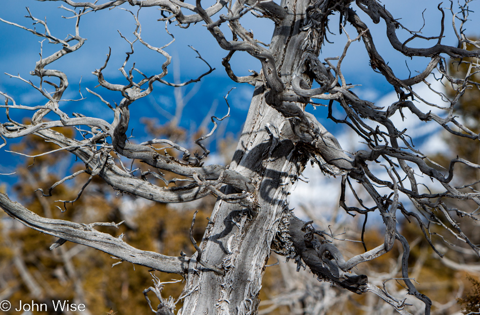
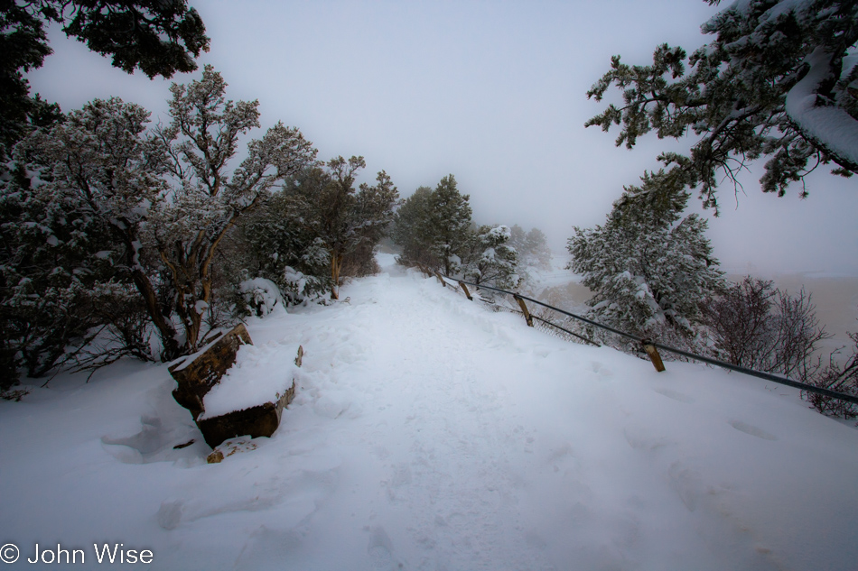
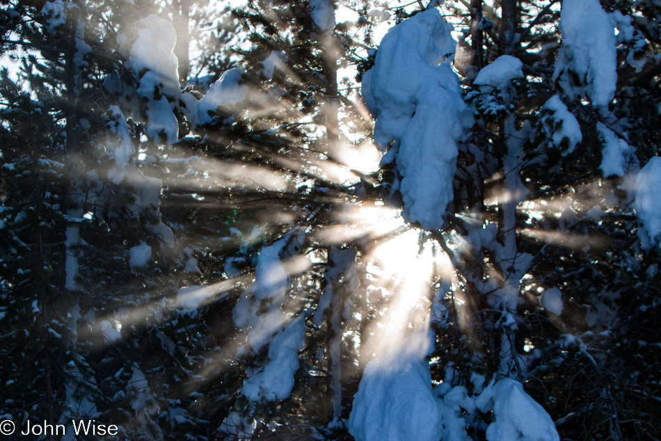
Recognition that the weather and availability of sunshine are not as predictable as this geyser basin that will continue hissing, sputtering, and boiling away, we break the fall into a hypnotic state and move again. We exit beauty and find majesty. A collection of perfection is growing while we mush over the trail to amazement found in dazzlement at how snow collects and covers fence, bush, and tree.
The wind shifts the steam; clouds fill a new corner of the forest and sky. I fight the impulse to photograph so much that if I were to snap more photos, I would probably be better served to simply shoot video. I have heard more than one nostalgic grumble from an old-timer who stops short of sneering at the wasteful amateurishness of those who have picked up digital photography and our ever-growing capacity to shoot a thousand photos a day. While I often think of Ansel Adams waiting for that special moment before exposing his expensive large format film to light that was to become a classic in landscape photography, I am of a different generation, here for my own memories, and cannot help myself in trying to recognize a thousand special moments a day.
By the time we are halfway through the Porcelain Basin, I feel like I’ve shot a thousand photos already. Time started to chase us as I began the climb up the hill; Caroline would have to be prodded from her hunched-over position on the boardwalk, still mesmerized by the mottled surfaces of bacteria mats that, according to her, can only be truly appreciated when one is but inches above the water on the precipice of the edge. I wait on the trail as she indulges herself. Anyway, I’m content to catch my breath and gaze out over this spectacular scenery.
With a half-hour left before we must rejoin our group, the trail leads us to Steamboat Geyser. The wheels of our mind try to convince us we can speed-march the Back Basin, but the magnetic world of possibility tricks us into watching Steamboat with the idea that it’s not impossible this geyser can actually erupt during the very moments we are standing here.
No matter that it hasn’t erupted since 2005. Luck might be on our side! I’m still almost certain that it could have erupted and I am sure it will yet happen, but not while we were to be the witnesses who would have the good fortune to experience the world’s highest geyser do what it does so infrequently. Our guide Tyrene had mentioned on our drive to the Basin that she missed Steamboat’s last eruption by a quarter of an hour. With a mere ten minutes left, we debate, running downhill to see just one more geyser. Echinus Geyser is almost right there; it’s just down…
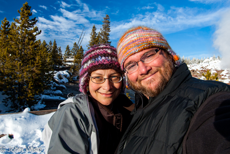
We stopped to take a selfie. This hasn’t occurred very often on this visit. Our eyes and minds are so transfixed by our environment we scarcely find time to recognize one another. From previous visits to Yellowstone, we are well aware of how fleeting our time in the park feels when, just days before, we couldn’t see the end of our trip, and before we know it, we are driving away for what could very well be our last ever visit this corner of Wyoming in America’s wildlands.
Beginning our short trek away from the Back Basin feels like leaving the park, for we are leaving the Norris Geyser Basin with the knowledge these are the final minutes here. Any and all impressions we are going to carry with us of this particular winter sojourn are being captured and stored. Those areas not seen will remain unseen as time will not allow even a glimpse into those corners we could not visit.
Our path leads us out of this wintery wonderland of steam and delight. Just around the corner, we will return to civilization, albeit not one that in any way is similar to the one writ large in the metropolis we are going to find ourselves once again in five days. The civilization we are about to find ourselves reintegrating with momentarily is the society of schedules, complaints, and motorized vehicles. For a brief time, we escaped the trappings of mass-shared reality and were afforded the luxury of communion with a bigger world around us, free of the noise we encumber our lives with.
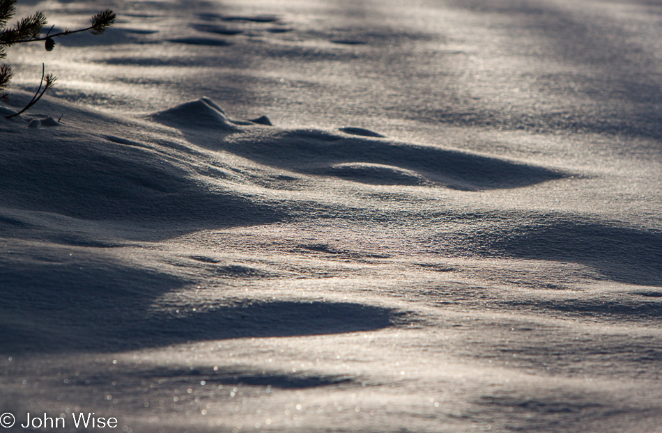
Just one minute more to glimpse the light gleaming over the untouched, sparkling, soft snow. This effect of witnessing a sight so beautiful that maybe only the passing of decades of experience and being inundated with artifice can the eyes begin to appreciate the subtle beauty no object of man’s creation can hope to imitate. While said before, it bears saying again: we stand in awe and humble ourselves before thine greatness. Here in Yellowstone, one finds god in nature and the nature of god.
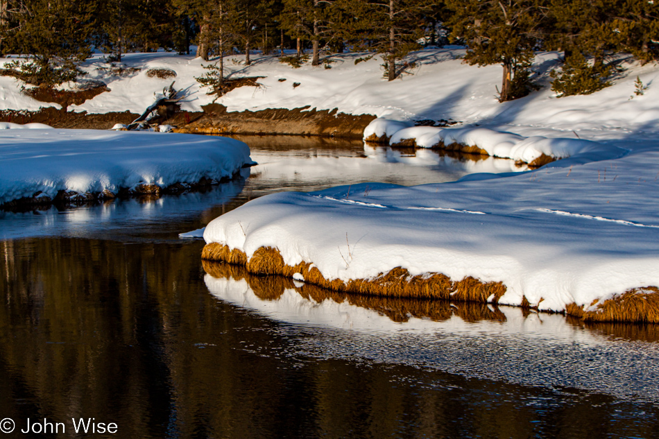
Rumble and bump, groan and hiss, the snow coach awakes from its slumber to carry us back. We sit in stunned silence, still gawking at the munificence nature has on parade as our windows offer us a view of what we are now only allowed to see in passing. All too fast, snow-covered trees come into view and are gone just as quickly. On our left, here comes a lake; there it goes, too. The sun is sinking ever lower in the sky while we race to find our way out of the trees to a clearing for a panoramic view of the landscape bathed in all the glorious colors of the sunset.
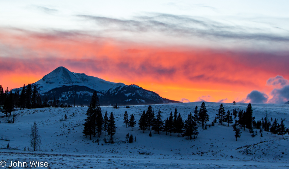
Swan Lake Flat is only hundreds of feet in front of our slow-moving snow taxi, with the light and colors of sunset moving faster than we are. In a minute or two we passengers rave in unison with a chorus of expressed manna, each afforded a thousand beautiful sunsets in one. By the time our vehicle rolls to a stop, a band of luminous hot orange glow is all that remains of what seconds before was a symphony of light reaching a crescendo pitch that danced upon the clouds and behind the mountains. Our mind’s eye will never be the same; we have seen a sunset that all other sunsets will now have to compare.
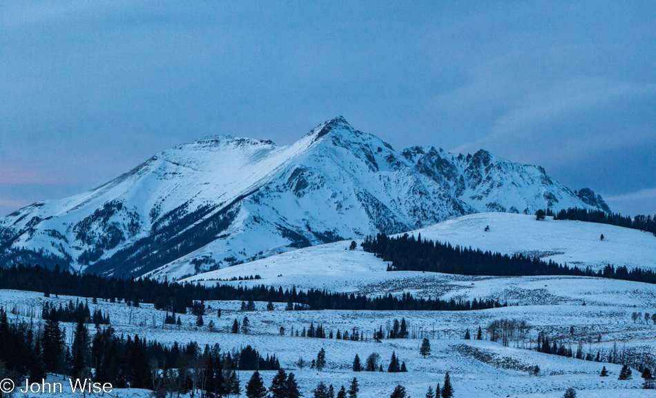
Had you rested with a brief nap, it would have stolen you of this experience. It would be forever lost, for it lasted but seconds. The sky was just as quickly divided between various shades of blue with an onslaught of approaching gray. And with the last flicker of sunlight, twilight laid in to grip the land, animal and human alike, in its encroaching cold. Welcoming the warmth of body and engine that would hug us for the remaining few miles, we return to the final leg of our drive in the metallic cocoon birthed by Mother Chevy.
One last look, one last glance at the poorly illuminated land of Swan Lake Flat. Even in the poor light just before night overtakes the day, the emotions wrought by Yellowstone tug at the desire for more. Sad but grateful, a day over but one of extraordinary charm, it will be but a few more minutes before we touch down at the hotel and collect the parachute of experience that delivered us safely and rewarded to where our day began.
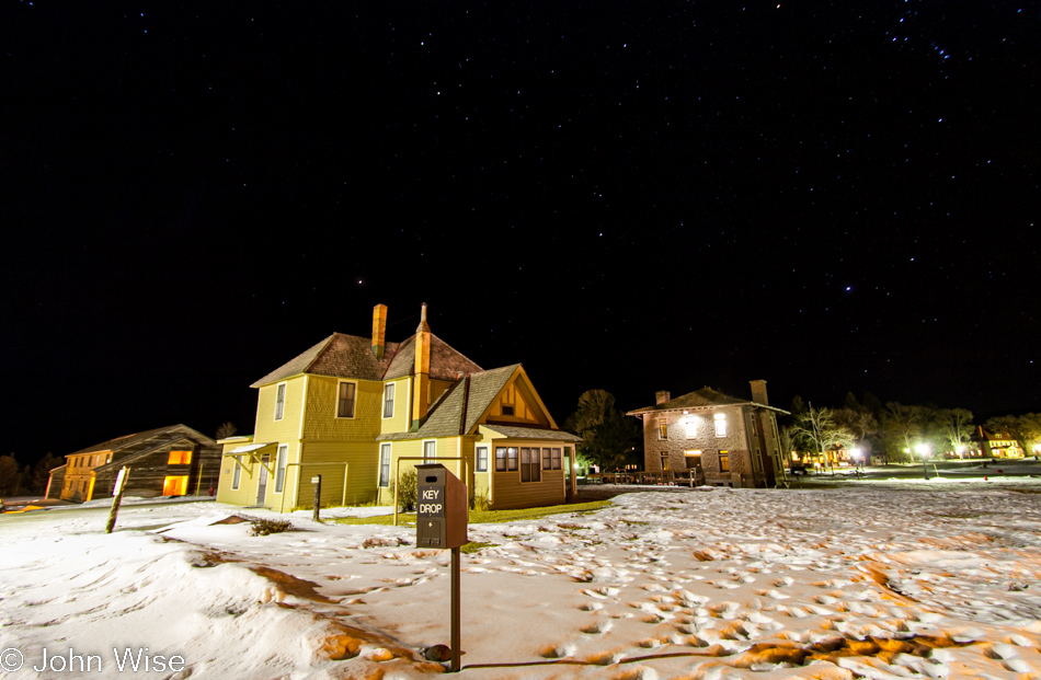
Thinking that somehow the day was over, that the wow factor was being diminished as routine and darkness shrouded our exploration, that line of thinking proved wrong. Following dinner and a hot tub under a starry clear sky, Caroline and I made ourselves cozy in the Map Room here at Mammoth Hot Springs Hotel just as Park Ranger and Interpretive Historian Carissa Black was beginning a talk about the Wilderness. Her program was far more interesting than I had first anticipated, leaving us with serious food for thought about how our role as visitors affects wilderness and just what wilderness is anyway. After the talk, we snagged her attention to discuss some of her points, and she recommended I read “Confessions of a Barbarian” by Edward Abbey, “Searching for Yellowstone” by Paul Schullery, and “Wilderness and the American Mind” by Professor Roderick Nash. The first two I now own, and the third I am awaiting confirmation from the Ranger if that is, in fact, the correct title. And the very best bit of information given to us was actually directed to Caroline, “There is no age restriction for qualifying to become a Junior Ranger”!