California via Utah, Nevada, Idaho, Oregon – Day 4

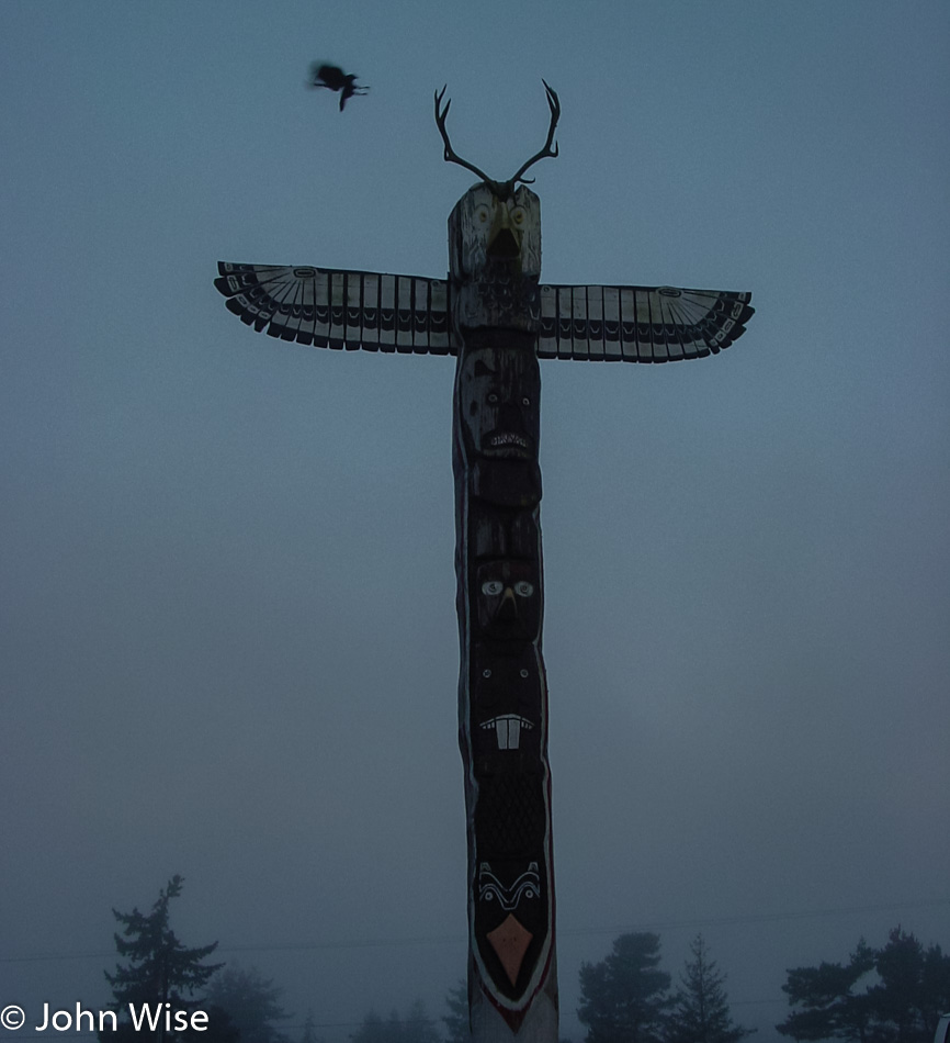
Just as we went to sleep in Florence, we woke there too, except now we are in a heavy fog. Across the street from our motel is the Benevolent and Protective Order of Elks lodge number 1858 and a very cool totem pole with a bird of prey emerging out of the middle of the sky to grab hold of an antler, allowing it to channel the energy of the totem as it prepares to enter the forest in its hunt for breakfast. We, on the other hand, just need to head for the drive-thru, if only we did that kind of crap. Okay, in an emergency, we would.

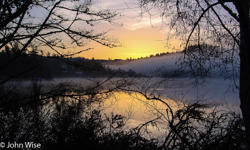
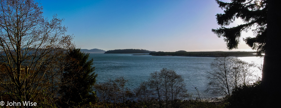
Just north of town, we stop to admire the dawn sky reflecting on Sutton Lake as the fog has been clearing. But hey, why are we going north when Arizona is to the south? Last night, on the way down, we saw a sign pointing our attention to the Sea Lion Caves right up here on the coast, a short drive from Florence, so we thought we’d go by in the morning.

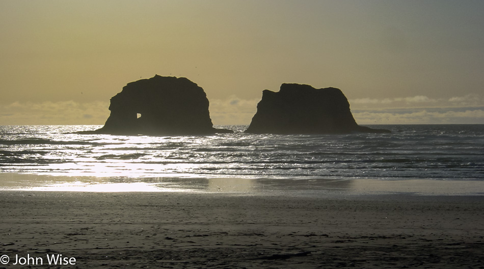
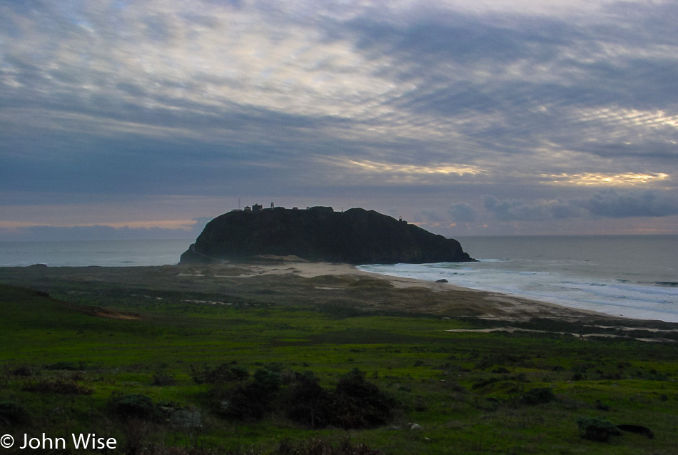
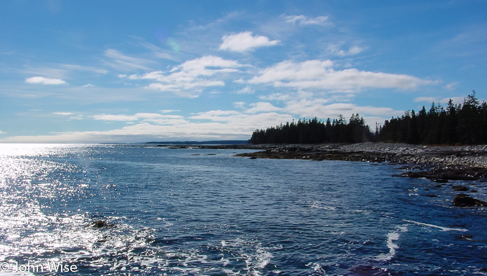
Looking south on our way to the Sea Lion Caves at what we missed last night while driving in the dark.

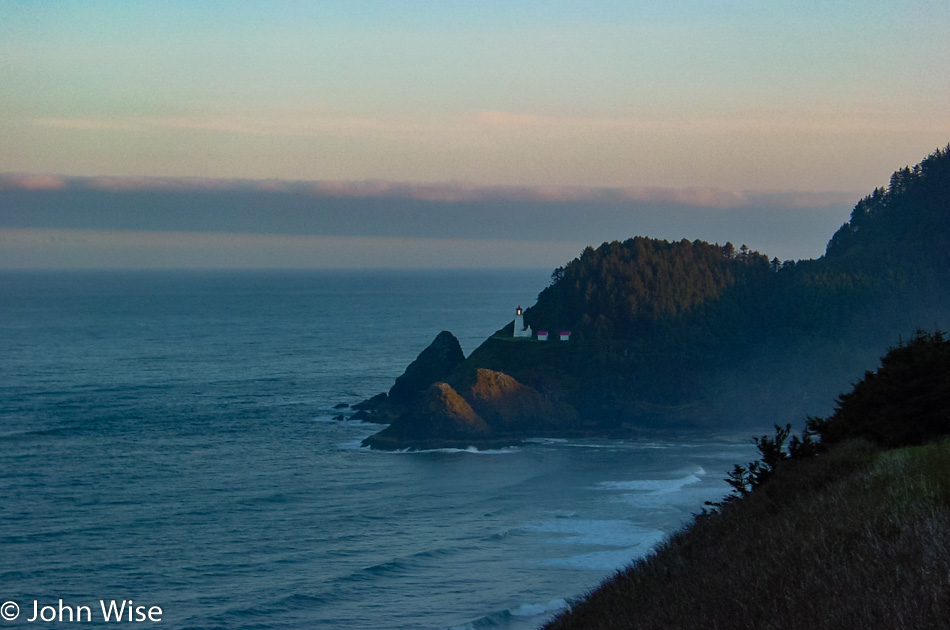
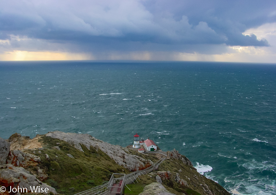
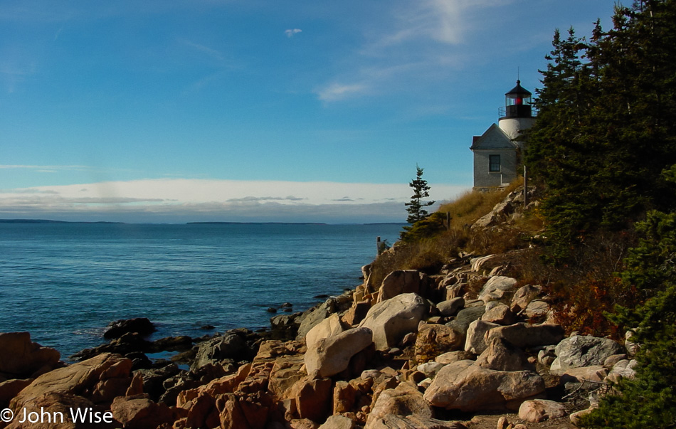
Well, it turns out that the caves are not open at 6:30 in the morning, and neither is the Heceta Head Lighthouse. This is all mighty inconvenient as we are here ready to visit, but no one is at work yet.

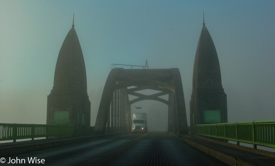
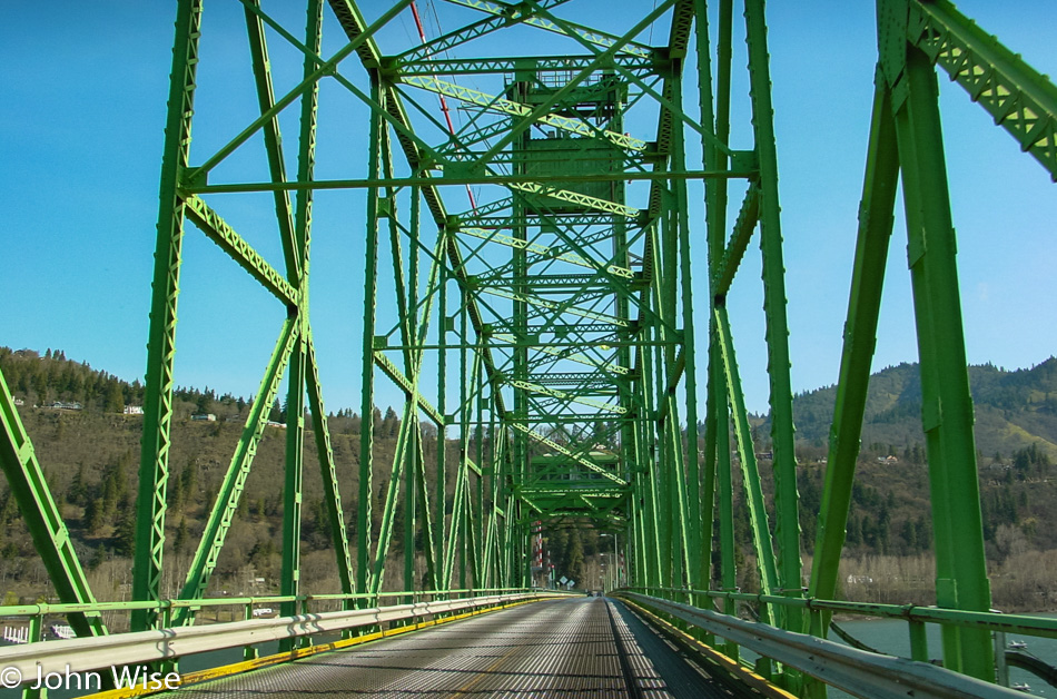
Back down in the Florence area and crossing the Siuslaw River Bridge. We have reentered the fog, but it will be short-lived.

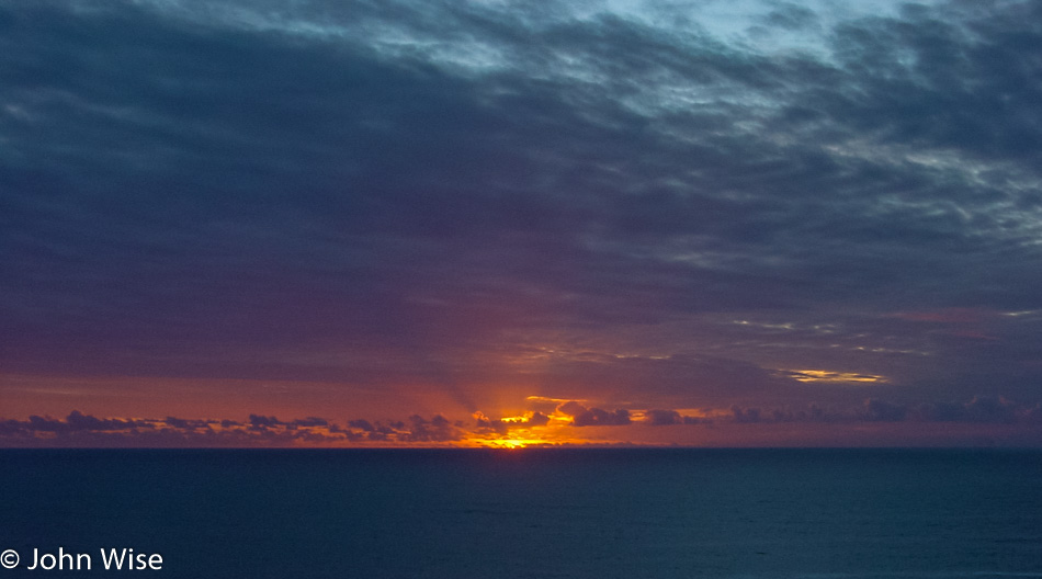
By the time we are passing Siltcoos Lake, the fog has once again dissipated, opening up the world to the warm colors of sunrise and calm waters undisturbed by so much as a fly’s wing.

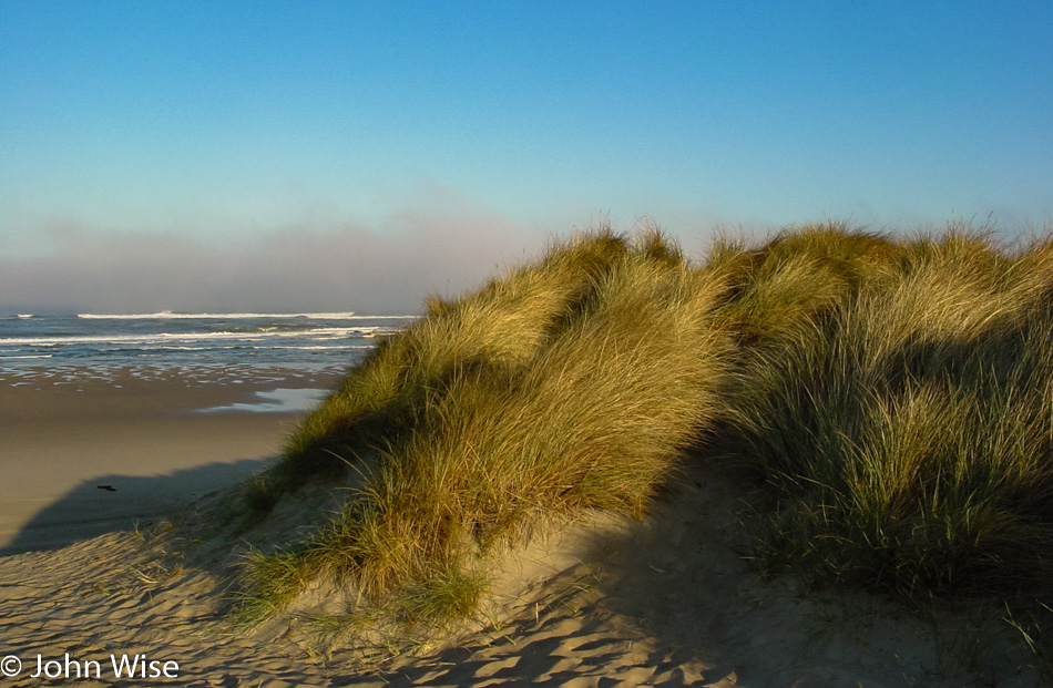
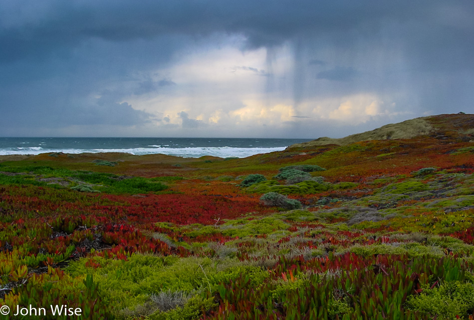
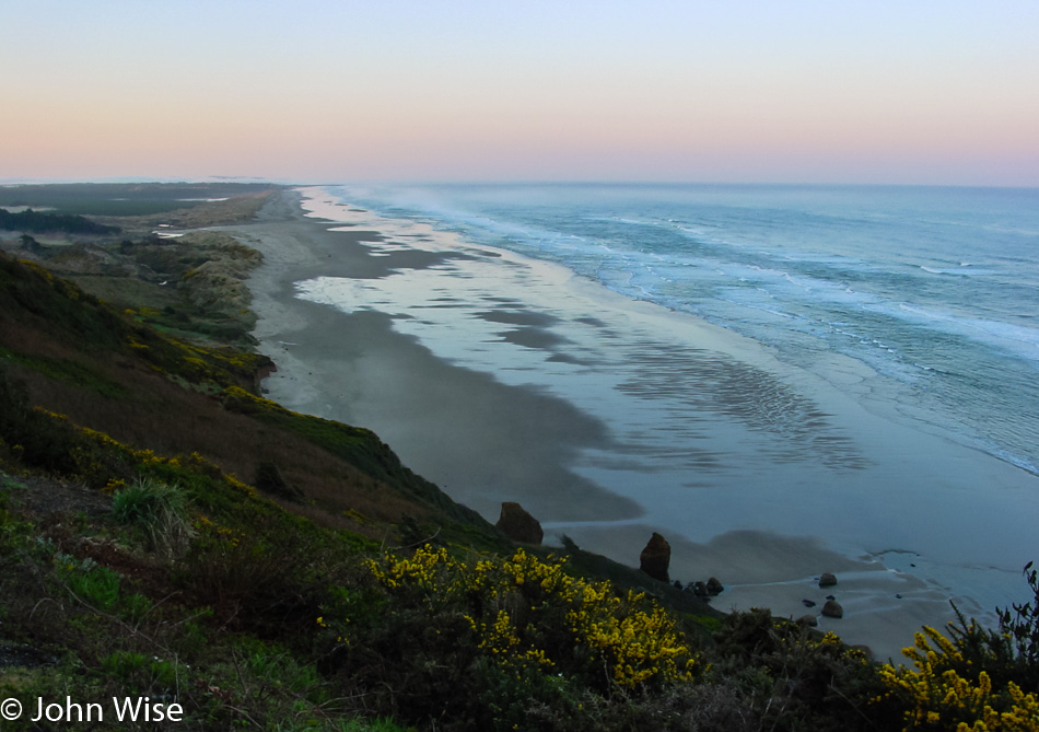
We spot a turnout with the promise of a beach walk that we can’t pass up. Coastal seagrasses kind of look furry and cozy while performing the duty of helping dunes stay together and not just blow away. While that’s probably important to the coastal ecology, it is simply a sight we don’t often get to see, and so whatever its role, for us right now, it is here as a beauty enhancement for purely cosmetic reasons that are forcing us to love this coast of Oregon all the more.

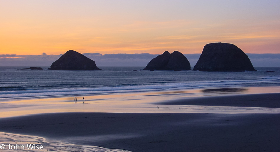
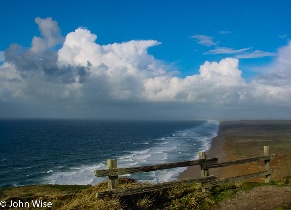
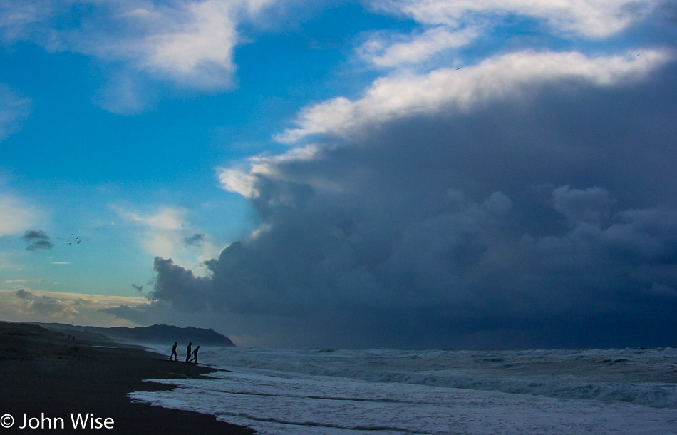
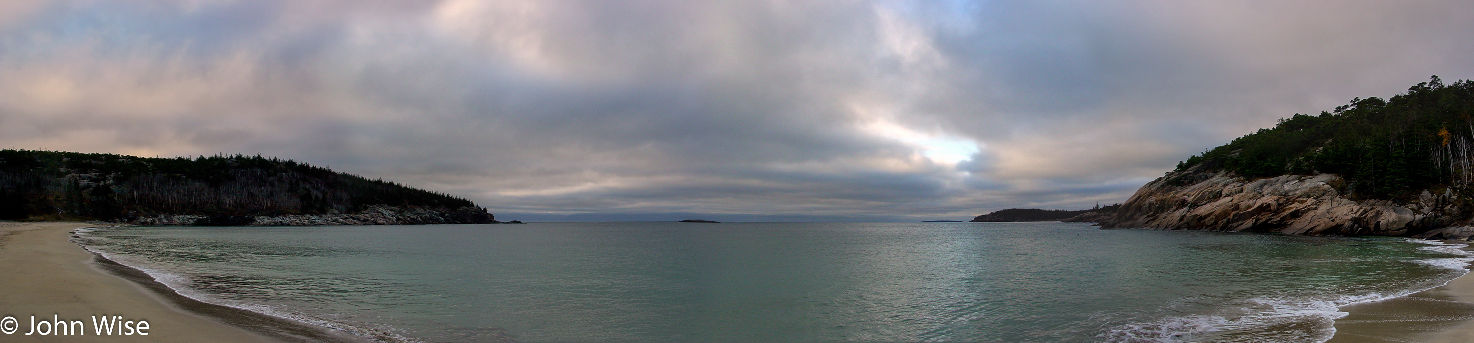
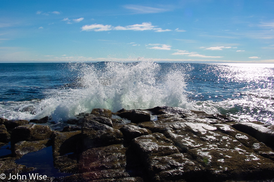
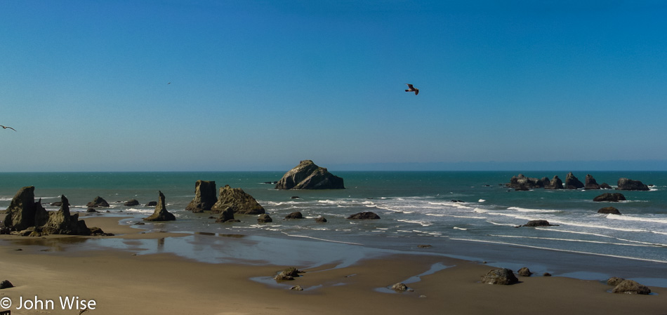
Empty cold beaches that stretch for miles with the sound of pounding surf, shorebirds, the blowing wind, and the two of us walking along, astonished that we should be the only ones out there.

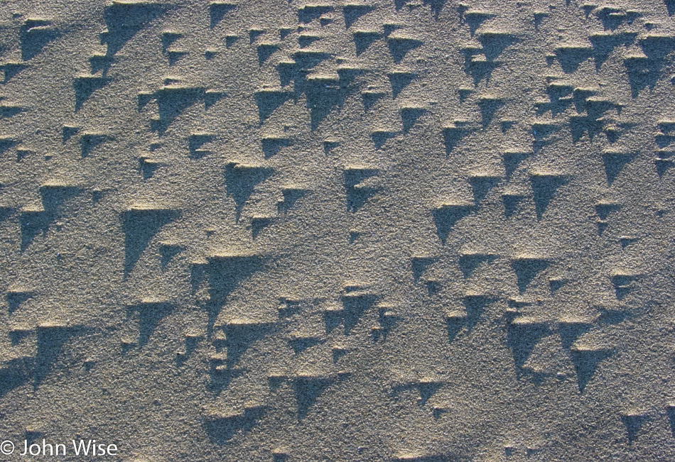
The mystery of how these Morse code dots and lines are made in the sand should remain outside of our knowledge, so they may always inspire us to wonder just how and why they look as intriguing as they do.

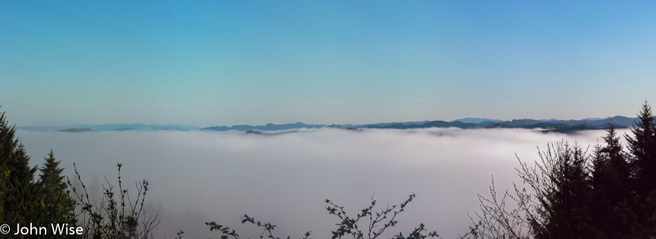
Fog is lingering over Tahkenitch Lake, and our road is just high enough to give us this birds-eye view of the top of fog, in case you too, wondered what it looked like from above.

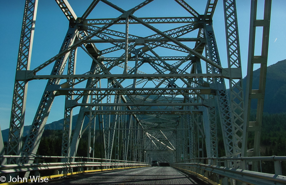
These bridges are beautiful and we are enchanted that every one is different than the last one we crossed. Here we are passing into North Bend.

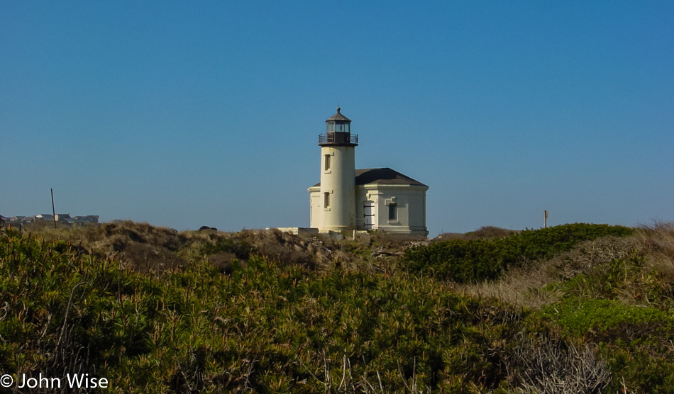
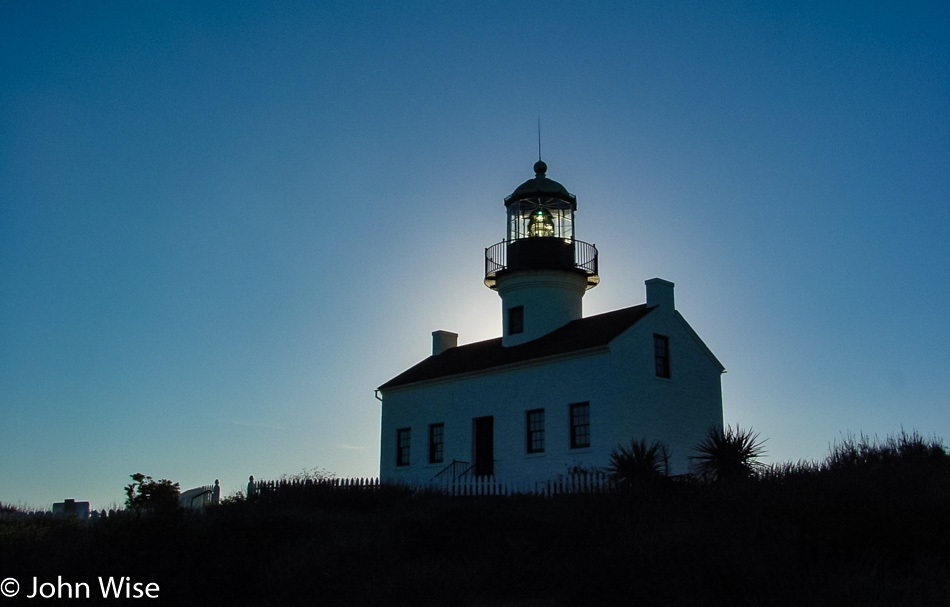
The Coquille River Light stands as a sentinel at the mouth of the river where it meets the ocean. It’s not very tall, and the Fresnel lens is long gone. Visitation is only available from May through September, so it goes. This light is at Bullards State Park, which also has yurts for rent, which sounds interesting.

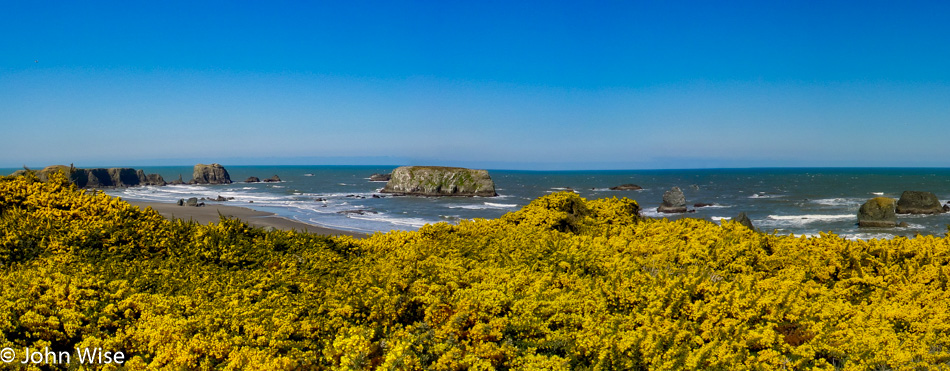
The yellow flowers seemed very familiar to Caroline, but she couldn’t put her finger on just why. It turns out this is gorse, and she had indeed seen it many years ago on a visit to Scotland. Gorse is native to Western Europe and not the Oregon Coast, but the founder of Bandon, who was originally from Ireland, thought the plant would remind him of home. Then, in 1936, some sixty years after the town was put on the map, a fire spread quickly and destroyed about 485 of Bandon’s 500 buildings. Turns out that gorse has a high oil content that loves to burn explosively. Needless to say, gorse was not a favorite shrub after that; however, it was too late, and the plant was here to stay. Over the years, gorse has proved to be extremely invasive and hard to eradicate.

The aptly named Face Rock is just left of center, also here in Bandon.

Viewpoint at Spruce Creek in the Samuel H. Boardman State Scenic Corridor, Oregon. We have now driven 2,230 miles on this road trip, or 3,612 km, which is about the same as driving from Dublin, Ireland, east to Moscow, Russia, or from Stockholm, Sweden, south to Athens, Greece.

We crossed back into California and drove until we reached the Redwoods.

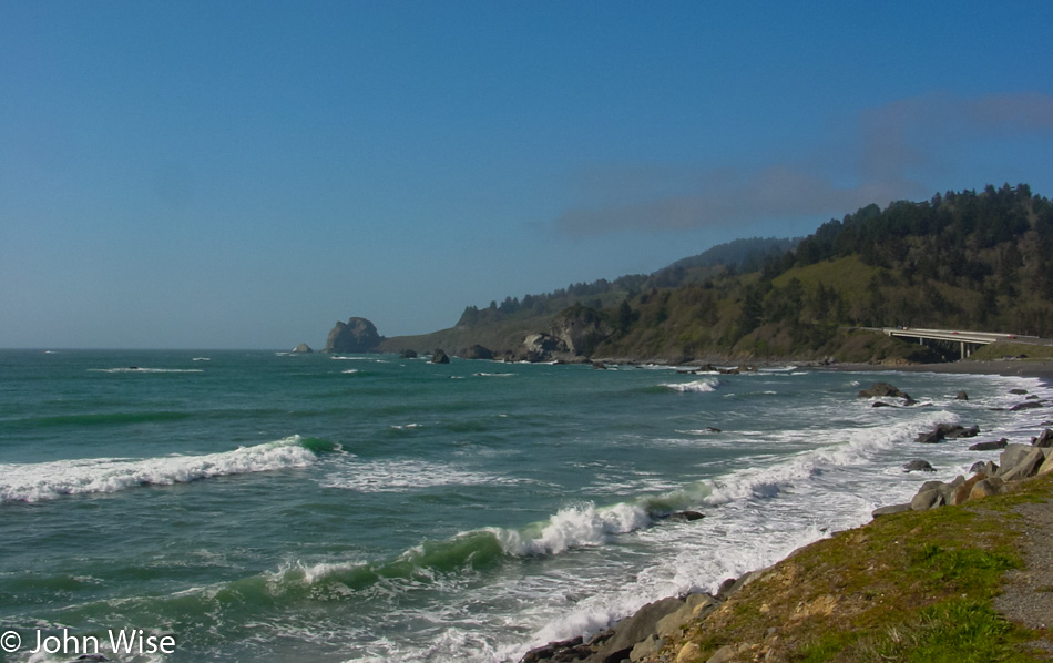
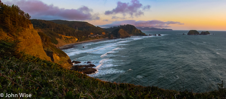
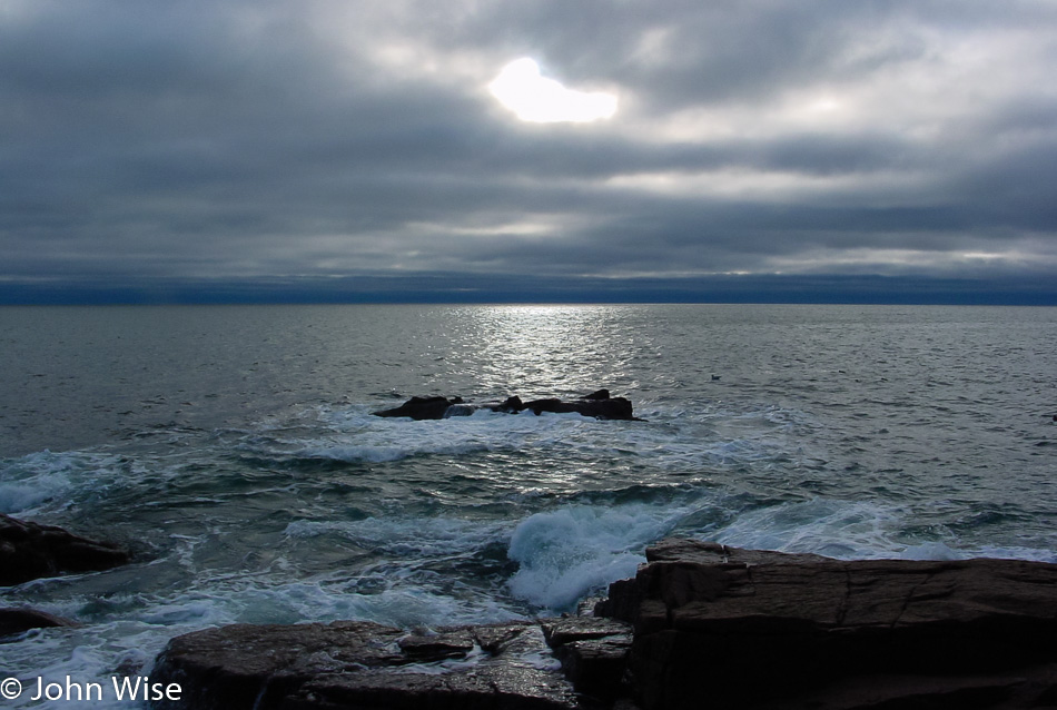
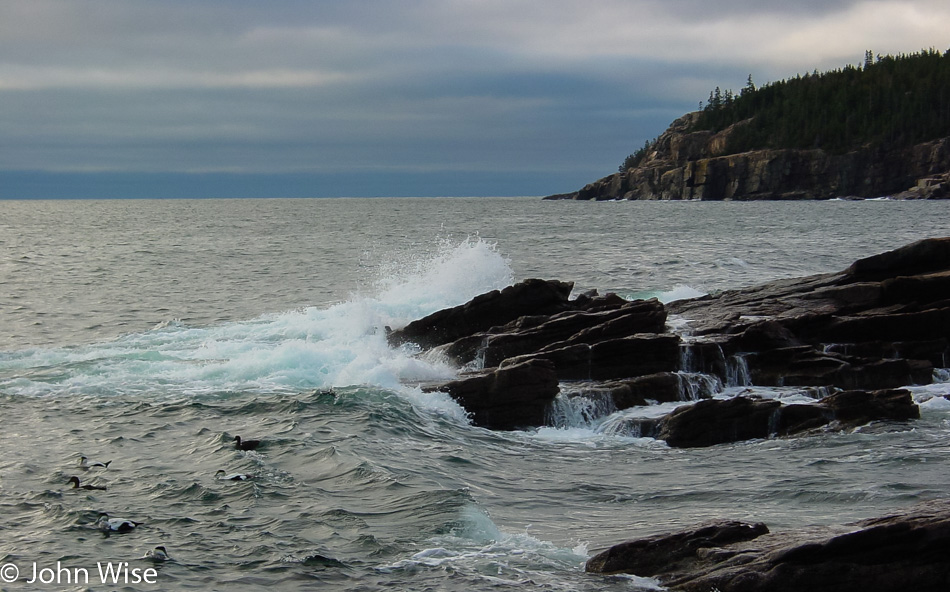
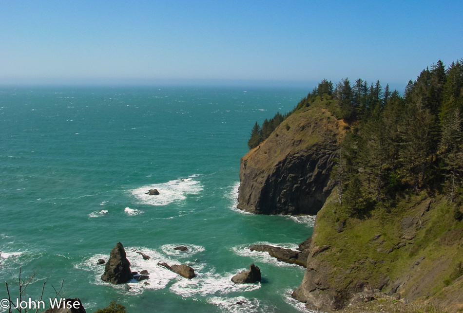
One of our last chances to see the ocean on this trip as Highway 101 weaves back and forth inland so we take the opportunity to stretch our legs and take a deep breath of that beautiful ocean air.

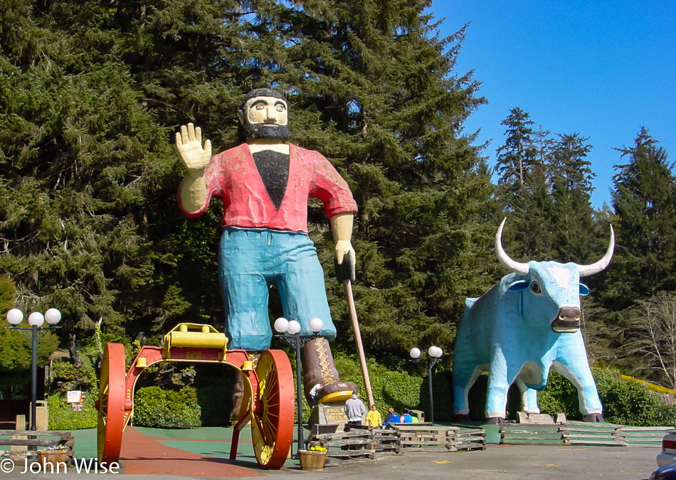
Well, this is interesting and annoying all at the same time: welcome to the Trees Of Mystery. It’s interesting because there’s a gondola ride up through the treetops of the Redwoods and annoying because immediately we start intoning “Treeeeeeees of Mmmmmmisterrrreeeeeee” and will do so the rest of the trip. We don’t have time to visit this time, but we will certainly make an effort to return someday.

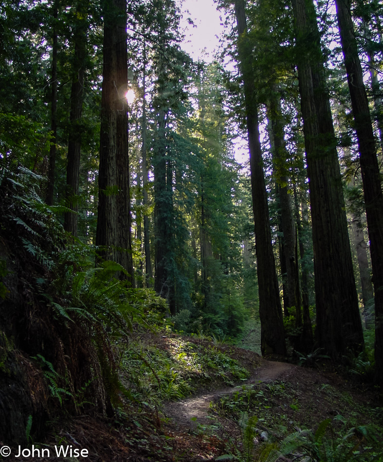
We couldn’t just stay in the car and drive through; we needed to get out and get a feel for the ancient forest. We randomly found the Ah-Pah Interpretive Trail, which gives travelers a great and easy view into the woods. Interestingly, there used to be a road here and signs are explaining the efforts employed to remove it and restore the original vegetation.

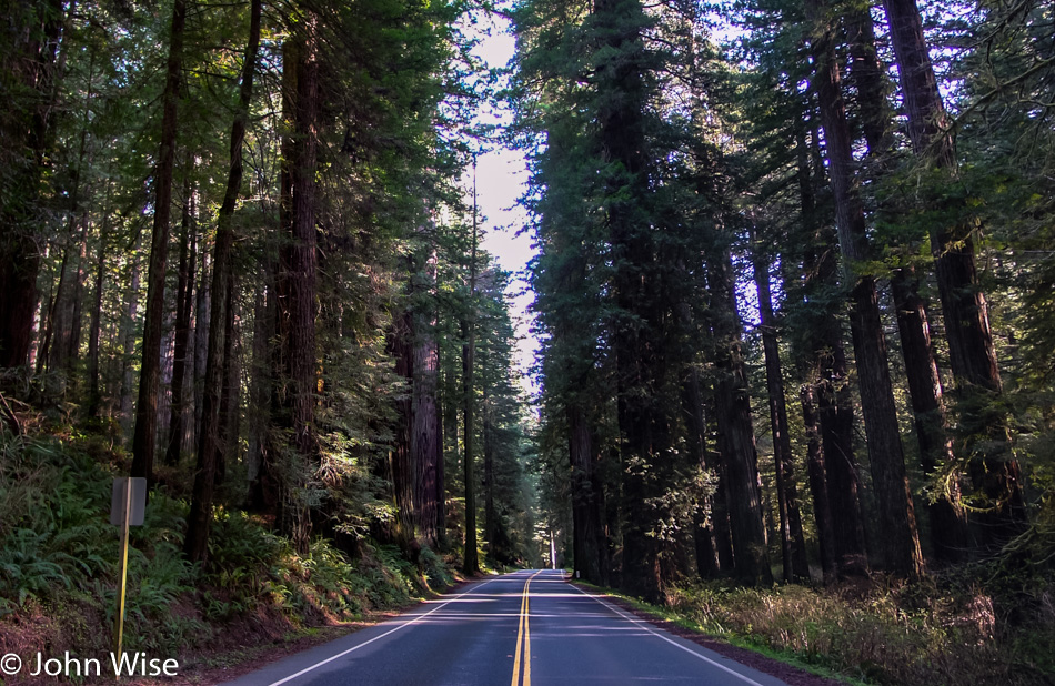
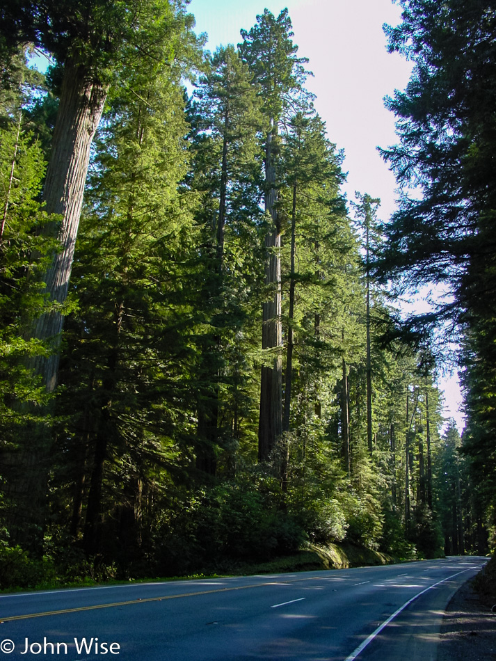
There should be a traffic jam of people gawking at the spectacle of these giant old trees just growing right next to the road. Instead, everyone else is over on the 101 while we cruise along like snails on a side road.

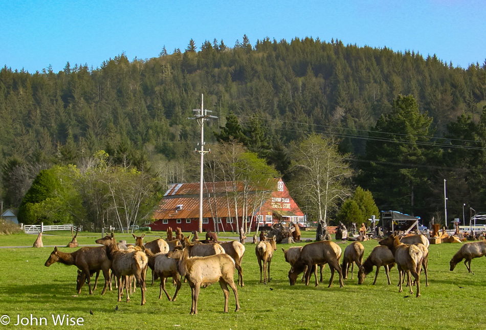
How many times do signs tell us about wildlife ahead and to slow down? We know better that there are no elk, donkeys, deer, or javelinas that we’re going to see, and then BAM, here is the Roosevelt elk herd. An entire murder of elk was just standing around munching grass. They weren’t fenced in; they were just wandering around looking for some good green grub.

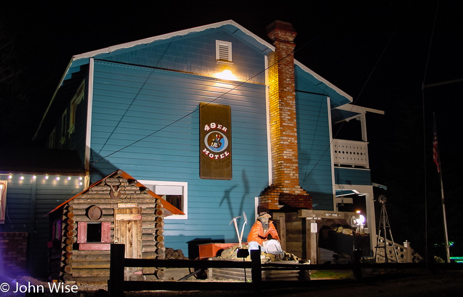
On road 299 to Interstate 5 in Weaverville, California, we pass this cool-looking 49er Gold Country Inn and wish this were where we would be staying, but we need to get as far south as possible tonight so we can be back in Phoenix by the end of the day tomorrow. It was only 7:30 p.m. as we drove through, and it would be 10:00 p.m. when I was too exhausted to go on, and we checked into an Economy Inn in Willows, California.

California via Utah, Nevada, Idaho, Oregon – Day 3

This is the kind of perfect day that cements a sense of what a place is like allowing us to easily fall in love with it. So many times, Caroline and I have been so fortunate to head into an experience uncertain of what we’d find, only to end up delighted with what we encountered. We crossed from Oregon into Washington for our first visit to this state today, crossing at Biggs Junction, Oregon. How can we be this lucky to see Mount Hood in the distance while looking down the Columbia River?

Our drive west keeps us snug up against the north bank of the Columbia. The reason we are over here (besides the fact that we like collecting visits to new places on the map): Interstate 84 on the Oregon side is a divided highway, meaning there will only be a few places we might be able to pull over for a photo while on this side we can stop anywhere there’s a shoulder. If traffic is light, we can even stop right in the middle of the street and jump out for a down-the-middle-of-the-road shot.

While between us, only Caroline can say she’s ever been to Bingen, Germany, which sits on the Rhine River downstream from Wiesbaden, we can now brag that we’ve been to Bingen, Washington, the sister city of its older sibling in Germany. The Loafers Old World Bakery here is instantly one of our favorite bakeries we’ve ever been to in America. We especially enjoyed their granola.

We crossed the Columbia to visit Hood River, Oregon, because there was a bridge there, but we wouldn’t stay long. I wish we’d had time to stop in at the International Museum of Carousel Art, though.

Back the way we came over the Columbia River to the slower Washington side.

And back to Oregon on Bridge of the Gods. Yes, that really is its name. We are heading over to the Bonneville Dam.

Wow, a salmon ladder and an actual salmon in the wild, another first for us. Of course, we’d prefer that their natural habitat was being maintained, but the damage of damming our waterways has been done, and while not perfect, at least there’s some level of effort being made to allow the fish to keep this stretch of the river alive and healthy.

Not as easy to see the salmon swimming up the ladder from out here, but you get to see what it looks like from above, which salmon never will. During the salmon season this place gets busy, we hear.

To reach Multnomah Falls, we have to remain on the Oregon side of the river as the next bridge isn’t found until we get to Portland on the Oregon side or Vancouver on the Washington side. While in the area, we visited Horsetail and Wahkeena Falls. Beauty overdoses were had by one and all.

Don’t forget to see the little details while gawking at the giant awe-inspiring waterfalls that might otherwise steal all of your attention.

This was the last view I saw before I went over the edge in a barrel; just kidding.

We had no idea how rare this view was at the time, and while it may be difficult to make out details in such a small version of the image (I have a much larger panorama on my hard drive), to the left is a little white bump called Mt. Rainier, towards the middle, is Mt. St. Helens, and on the far right is Mt. Hood.

Just north of Garibaldi, Oregon, and up the road a hair from Pirates Cove Restaurant, is this pullout looking out on Tillamook Bay.

We are heading south towards California as we have quite the drive home if we are to make it back to Phoenix, Arizona, by Monday night. Still, though, we take time to visit beaches that look promising for a romantic walk along the shore.

Looking north while we hike out to the Cape Meares Lighthouse.

We probably couldn’t have timed this any better on arriving at the Cape Meares Lighthouse at sunset.

Looking south from the lighthouse and wishing we had a few more days out here on the coast.

Three Arch Rocks National Wildlife Refuge as seen from Oceanside beach near Maxwell Point. Moving south, we dawdled with stops everywhere we saw another small glint of sunset, but it turned out this was our best shot of the late day. It was after 10:00 p.m. when we finally got into Florence, Oregon, for an overnight stay at the Le Chateau Inn.

San Diego

Caroline Wise and John Wise in San Diego, California

Drove out to Los Angeles yesterday to visit my father and hang out in Ontario, but today is all ours. We’ve driven down to San Diego for some ocean time.

San Diego Aquarium

The fountain in front of the Birch Aquarium at Scripps Institution of Oceanography is beautiful, and this is just one small part of it.

San Diego Aquarium

Once inside, though, it was obvious that we’d been spoiled by the Monterey Bay Aquarium, a rock star among aquariums.

San Diego Aquarium

We did enjoy seeing the baby shark in its casing so there was that.

San Diego, California

Back out to the ocean to see what we wanted to do next.

San Diego, California

It was kind of crazy watching surfers launch themselves into the pounding surf, hoping to have enough forward momentum that they wouldn’t be thrown back onto the rocks. Surfers are a bit nuts anyway.

Cabrillo National Monument in San Diego, California

It seemed natural to just stay along the coast and drive out on Point Loma and the Cabrillo National Monument.

Cabrillo National Monument in San Diego, California

This monument is for Juan Rodriguez Cabrillo, who in 1542 was the first European to step foot on what would become California: so who was the first-ever Native American to do so?

Cabrillo National Monument in San Diego, California

The Point Loma Lighthouse is an old reminder of an age gone by.

Vegas, Great Basin, Tahoe, Pt Reyes, Monterey – Day 5

Monterey, California

A million wonderful impressions of places that we visit even briefly are better than the alternative of having never been to them. This is not our first time to Monterey, and over the previous nearly ten years, this might be the fourth or fifth, maybe even the sixth or seventh time we’ve been here. So collectively, we have a ton of memories nurtured here, 100 miles south of San Francisco on the California coast.

Monterey, California

You didn’t think we’d stop here and not dip into the Monterey Bay Aquarium, even if it was just for an hour or two, did you?

Pacific Grove, California

A short walk in the Monarch Butterfly Sanctuary in Pacific Grove during the fall and the height of the migration season is also mandatory.

Big Sur, California

That’s a lighthouse and some historic buildings out on Point Sur, but its visitation hours and days are very limited. Check out the Point Sur Lighthouse website for more info.

California Coast

We stayed along the ocean as long as we had available light to enjoy the views. From the coast, we headed inland for the night. The next day, we stopped in Los Angeles for breakfast at the Original Pantry Cafe with our old friend Mark Shimer before finishing our drive back to Phoenix after our epic Thanksgiving road trip.

Vegas, Great Basin, Tahoe, Pt Reyes, Monterey – Day 4

California

Our trip out of Carson City to Truckee and the famous Donner Pass area just west of town was a white-knuckle ride that didn’t allow a single photo to be taken. Yesterday’s icy road communicated to us that there was a good chance for snow on the Sierra Nevada mountains. Without snow tires or chains, we approached a check-in station at the California border and explained our situation and the officer told us to catch up with the snowplows that were just ahead of us and stay behind them until we were out of the snowline. We were as nervous as could be as it snowed nearly the entire time we were in the mountains, and while it was incredibly beautiful, we were too attentive to the trucks in front of us and the snow that was accumulating on the road even as they cleared it. Out of the mountains and finally back into the sunlight, we were able to relax.

Pt Reyes, California

This abandoned boat and rainbow will stay with me forever as my first impression of the Point Reyes area.

Pt Reyes, California

Looking north up the Point Reyes seashore.

Pt Reyes, California

The road out here is not for the faint of heart, and I thought the coastal highway between San Simeon and Big Sur was nearly panic-inducing.

Pt Reyes, California

Wouldn’t I love to tell you that this was the place we’d be spending the night, but it wasn’t, as we tend to opt for the cheapest places we can find. Maybe someday.

Pt Reyes, California

Even in relatively poor weather, this place shines with all the beauty and solitude of an unspoiled coast not overrun by commercial enterprises and private residences. This is the Point Reyes Lighthouse that, weather permitting, allows visitors during very limited hours between Fridays and Mondays.

Pt Reyes, California

Guess where we’ll have to come back to?

Pt Reyes, California

Even under the threat of a hostile weather front on the horizon, this place is incredible. It’s almost unbelievable that just across a bay is the city of San Francisco.

Pt Reyes, California

I can’t believe we only had a few hours out here, but it was enough to ensure that we’d return.

America – Day 9

Caroline Wise and John Wise at Frenchman Bay in Acadia National Park, Maine

We live for being next to the water. Everything feels perfect when we are at the coast including here at Frenchman Bay in Acadia National Park.

Panorama of Frenchman Bay in Acadia National Park, Maine

Our old Sony camera only shot 1600×1200 pixels during this trip, but the magic of Photoshop stitching images together let us resolve things just a wee bit better. Here’s Frenchman Bay from side to side. Click the image or click here to load a larger view to see more detail.

Acadia National Park near Bar Harbor, Maine

Hours could pass, and as long as the weather stays dry, we’d be happy as clams to just walk along the shore all day.

Acadia National Park near Bar Harbor, Maine

The distinctive look between the northwest Pacific coast and here is striking. After Oregon, Maine might be the next choice of where we’d love to live. The only problem with living out this way might be the roads, though the area around Bar Harbor is fairly maintained. Maybe someday we can spend some months up here and get a better idea of what things are like in winter and summer.

Mushroom in Acadia National Park near Bar Harbor, Maine

There’s certainly a lot more here than just the sea, but it takes some serious effort to avert our eyes from that body of water that seems to be calling us.

Mushroom in Acadia National Park near Bar Harbor, Maine

I have no idea what this is, but it looks yummy, though I’ll bet a dollar it doesn’t taste as good as it looks.

Cadillac Mountain in Mushroom in Acadia National Park near Bar Harbor, Maine

The strong wind makes the peak of Cadillac Mountain in Acadia National Park brutally cold. We are only at 1,533 feet above sea level, which is called a hill out west, but out here on the east coast, this is a mountain and it’s the highest point on the U.S. Atlantic coast. While the thermometer reads 42 degrees, I’d bet that with the wind chill factor, it’s not a degree over 10. Quick, let’s jump back in the car!

Cadillac Mountain in Mushroom in Acadia National Park near Bar Harbor, Maine

A panoramic view from near the peak of Cadillac Mountain. Click here or the image to see a larger view.

Near Bar Harbor, Maine

Finally, it was time for breakfast, so we headed back to Bar Harbor for something to eat at Rika’s Family Restaurant. Our server tells us how Bar Harbor becomes a ghost town this time of year, and during the summer, it’s difficult to move down the street because the crowds are so thick. This feast or famine situation makes things difficult for those who can’t winter down in Florida or over in Arizona, where most of the town is already. Afterward, we stroll down the street searching for the refrigerator magnet we must find. We found a magnet but also a ceramic tile of the Bass Harbor Head Lighthouse so now we’ll have to head that way and witness it for ourselves.

On the way to Southwest Harbor by Tremont, Maine

With the sun out and blue skies, the Atlantic Ocean shimmers in beauty. We are on the way to Southwest Harbor out towards Tremont, where the Bass Harbor Head Lighthouse is situated.

On the way to Southwest Harbor by Tremont, Maine

Moving slowly along the coast as we find places to stop and explore the shore. I should point out that these rocks can be slippery: my butt found out the hard way as I went down flat on them.

Bass Harbor Head Lighthouse on the Maine coast

This was the best view we could muster of the lighthouse. It was built back in 1858 and is located in Tremont, Maine.

Caroline Wise and John Wise with a snail we named "State of Maine" that we got as our reminder at the Purple Baboon in Belfast, Maine

So this was the souvenir we ended up with from Purple Baboon over in Belfast. We named this snail “State of Maine.” You might also notice we are traveling with a Kodama hanging in the window just behind Caroline. The Kodama are spirits from Japanese folklore that inhabit trees, similar to the dryads from Greek mythology, with the name dryads being the basis for the plant dryas, which will figure in a couple of our trips in the future after we go to Alaska and the Yukon, but that’s 12 years from now so I’ll wait to write about that stuff then. This particular Kodama was featured in the film Princess Mononoke.

Around this time, we also returned to Belfast for some lunch at the Maine Chowder & Steak House and then pointed the car towards Camden, where we made note that we would have to visit this small village on a subsequent trip.

Witch Dungeon Museum in Salem, Massachusetts

Before reaching Salem, Massachusetts, and the closed-for-the-day Witch Dungeon Museum, a guy at a gas station in Maine recommended that we visit both Annapolis and Mystic Seaport. From Salem, we drive into Lynn (established in 1629) and believe we are in the land of hairdressers, doughnut shops, roast beef dives, pizza joints, and Chinese restaurants. It should also be known as the place of the world’s smallest street signs.

Sumner Tunnel in Boston, Massachusetts

Boston is a madhouse of traffic anarchy, and this tunnel is no better. Only $2 to pass through Sumner Tunnel with our nerves already frayed, and then here comes an emergency vehicle forcing all of us to merge right in a tunnel that was already bumper to bumper. We looked for the area of the Boston Tea Party so we could see it in the dark while it was closed too, but we never found it.

Boston skyline at night in Massachusetts

Leaving Boston behind, we head for a quieter destination to stop for the night; Plymouth sounds interesting, so we’ll invest the hour and drive south. Once in Plymouth (yep, that one made famous by a rock), we stopped at Plymouth House of Pizza for dinner and then checked into the Pilgrim Sands Motel with an ocean view!