When the heights of happiness are potentially infinite, the opposing depths are likely equally distant. We strive to reach the heavens as though there are riches to be found in what lies out of reach, but do we care to consider the breadth of unhappiness many struggle to get out of? How deep have the many traveled, and how few grasp at just how distant the important things are that might always be out of reach? The pious among us will claim to care for those around us and use doctrine as proof that they are commanded to act on their brother and sister’s behalf. Yet, we continue to swirl around the drain of our own ignorance, blind to the violence inflicted on the masses when poor education, fear, and dangerous mythologies guide them into our modern existence. Figuratively speaking, the paint is chipping off the old system, and it’s time to renovate and revitalize the most important part of the American experience: our collective education that helps inform how we perceive life around us.

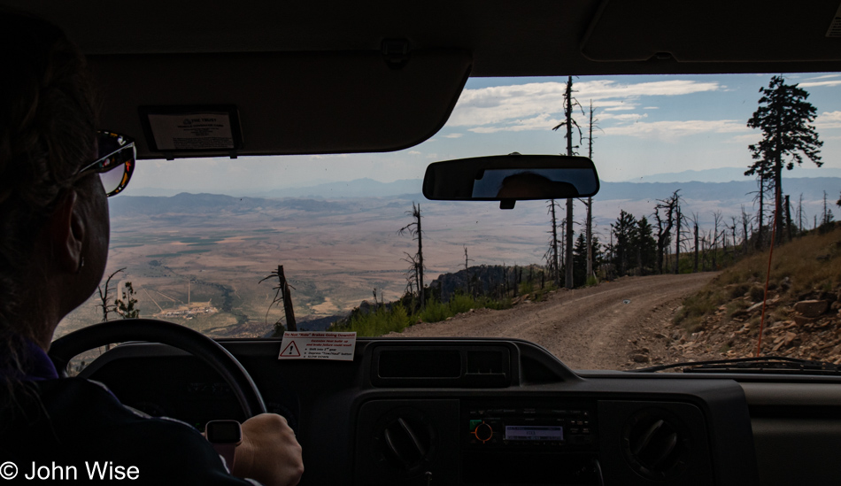
Our escape from the blistering 118-degree heat (48c) of Phoenix took us 200 miles east to the town of Duncan, Arizona, elevation 3,652 feet (1,113 meters), but that wasn’t quite good enough. At 10,469 feet (3,191 meters), the temperature promised to be much cooler, about 35 degrees lower than the distant desert below, but it wasn’t only the pleasant climes we’d find on the mountaintop to which we were heading after our first night in Duncan. We’ve been sitting on reservations to visit the Mt. Graham International Observatory (MGIO) since February, and today is the day we get to take advantage of them.

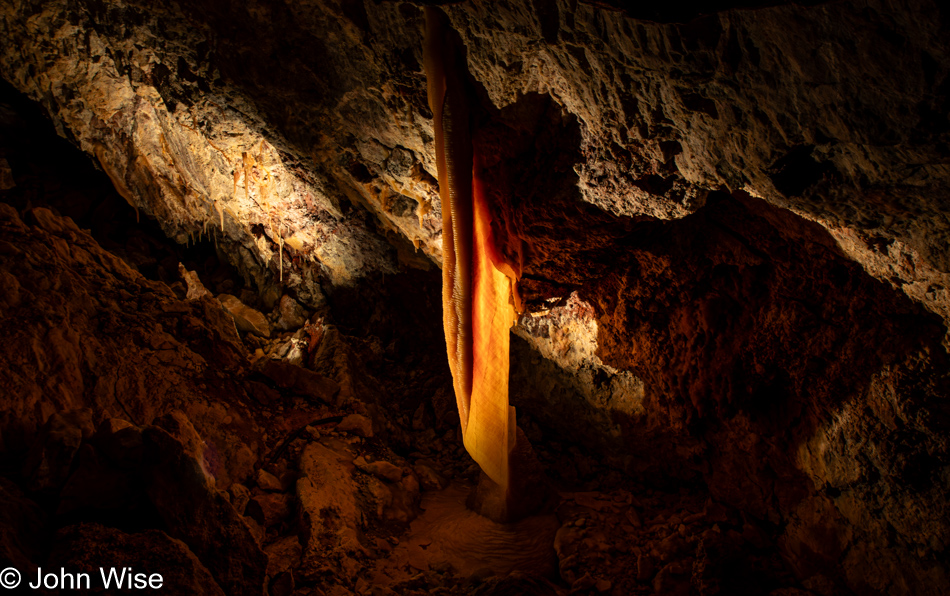
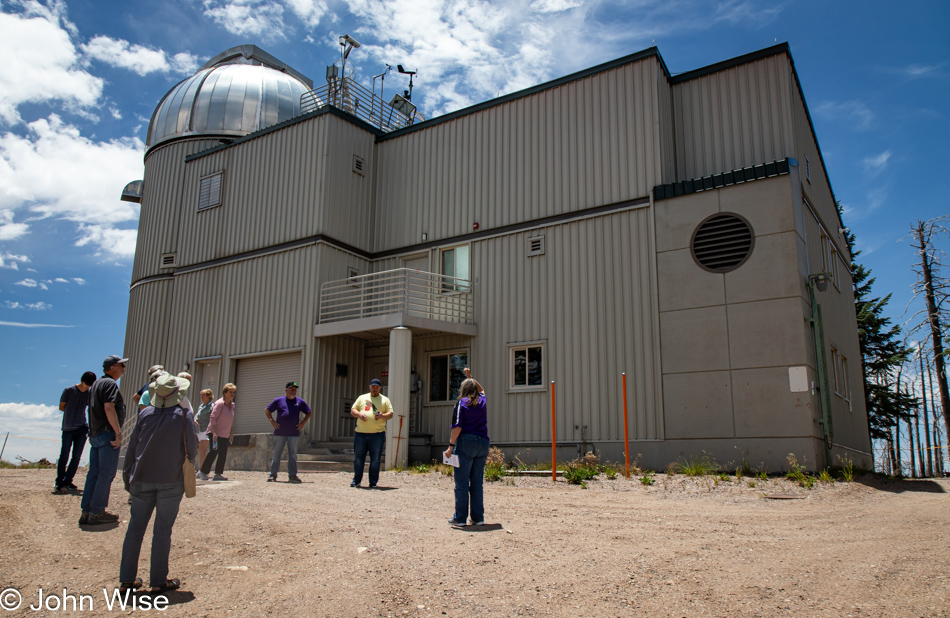
These excursions, you should know by now, are not always about seeing as much as they are about understanding. To begin with, we are visiting the facility in the middle of the day instead of in the evening when most of the observation is taking place. Second, this is monsoon season in Eastern Arizona, and many of the researchers are away because in the heat of summer, observations are not as ideal as they are on dry winter days. So, while we’ll be gazing upon the telescopes and learning more about their function, we’ll not be gazing upon the stars or listening in on the frequencies of the symphony the universe is creating. This then lends itself to a purely intellectual exercise of understanding instead of gobbling up a bucket of eye candy that I believe many visitors will expect.

Please keep in mind that we are aware of these limitations, and yet it was still worth the 400-mile roundtrip and $75 per person cost. You should then be able to surmise that many of our travels are not purely for the visual aesthetic qualities we’ll gather but for what we can learn about ourselves or others. True, sometimes that learning is a reinforcement of our shared love while we lollygag through the woods, but often, time is spent searching to discover more about this thing called life and our relationship to it.
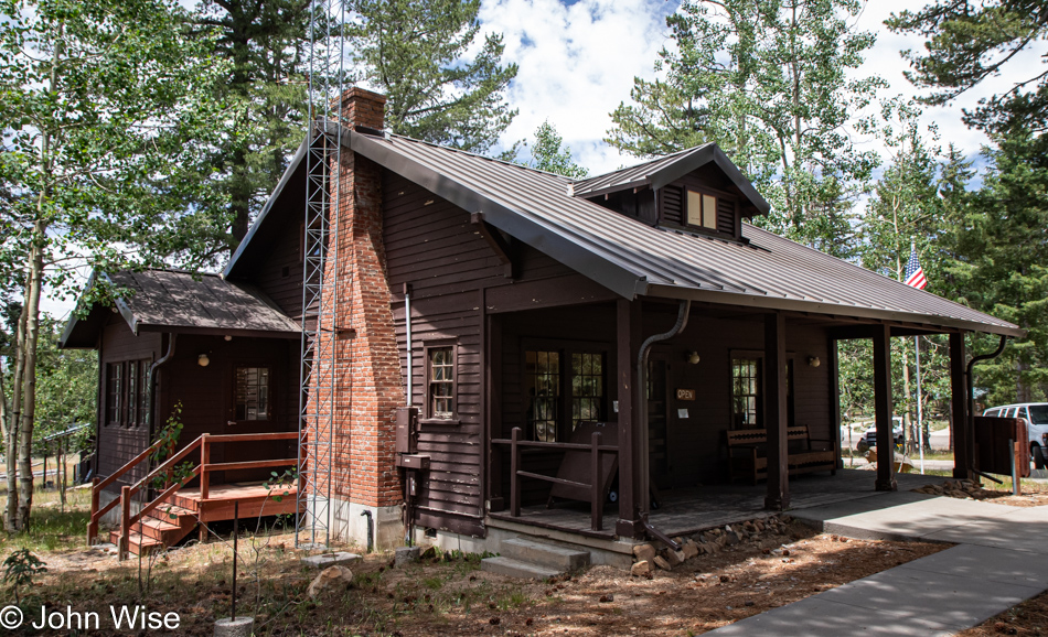
This is the Columbine Visitor Center here in the Pinaleño Mountains just below Mt. Graham, known to Native Americans of the area as Dził Nchaa Sí’an – Big Seated Mountain. We are taking a lunch break before making our way up the final stretch to where the observatories are located.

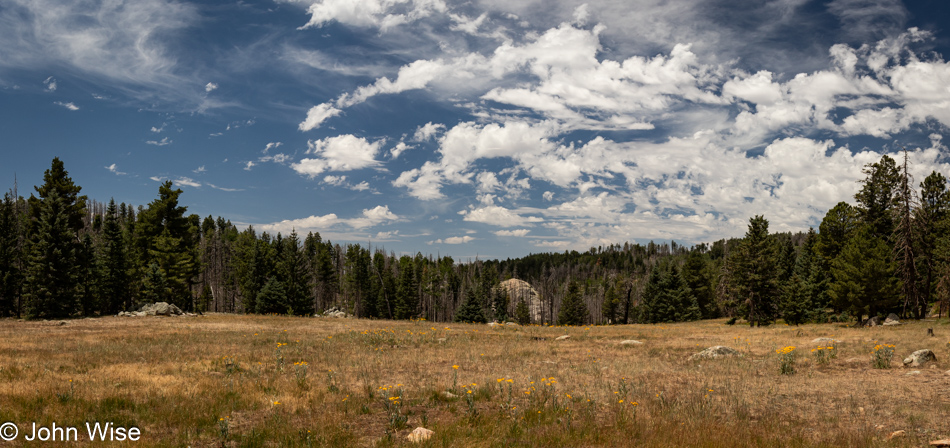
The potential worlds that might exist far away in the distant corners of our universe might hold more interest to many than wondering about the galaxy in which a pollinator exists. I walked over to the meadow (pictured below) to take a photo of this yellow ragwort flower, and while I have better-focused specimens, I don’t have another with a bee flying in to fetch hive supplies. That bee is a forager; its job is to collect pollen, nectar, and water. When its work is done, it will return the goods to the hive, where others will pick up the pieces and perform their respective tasks while the forager rests. The hive is in constant motion and is an essential spoke in the ecosystem of life far beyond the place it calls home. If the bees could tell us their story of mapping the world around them, fending off predators, raising baby bees, tending to the health of the hive, acting as heaters and air-conditioners, and waiting on their queen, maybe we could better empathize with their struggle for life and do our part to ensure the health of an environment that remains supportive of their colonies.
The hive can be seen as a microcosm of our own world where the queen bee is our planet. The queen lives 52 times longer than a worker bee, whose life is a brief five weeks on average. Put in human terms, as we live to be about 80 years old, our queen mothers would live for about 4,160 years comparatively. Give me a moment with this poetic license. What I mean to show is that a worker bee born today on July 15, 2023, will be dead by September 1st, 2023, but is working for the health and welfare of a queen bee that will be producing other bees, maybe 30, 40, or 50 generations into the future. Now bring this back to our human scale: a woman gives birth to a child, and now we must care for this mother as she’ll be around in the year 5,000, looking over her children and siblings we’ll never know. What might we change about our consumption and pollution if we knew that our mothers should thrive as their life extends thousands of years into the future?
From a recent note taken on the verge of sleep:
Negotiating the waters of stupidity while in casual conversation, we are often dragged into the shallow end of the gene pool and drowned in the sea of banality.
I understand that there are times when the folly of silly thought is de rigeur for bringing levity and mindlessness to a moment, allowing great comfort often found in laughter to take over some of the pressures encountered in the day, but this begs for an answer to the question, “When do we delve into the depths of consideration of ideas that are uncomfortable?”
As Bertrand Russell once said, “In all affairs, it’s a healthy thing now and then to hang a question mark on the things you have long taken for granted.”
Shall we all aspire to become dry, loquacious scepters of nerdity, converting scientific theory and philosophy into binary speak in order to dazzle those of lesser minds? That would be a mendacious accounting of what I’m seeking. My goal in the lamentation of what I perceive to be stupid is nothing more than begging others to show a modicum of curiosity beyond what is already fully familiar to their staid routines. Again, we can consider this thought from Bertrand Russell and put a question mark at the end of what we state we like and do.
Just as the various telescopes at MGIO look for clues arriving from the vast expanse of time, we, too, can look for hints about ourselves as we survey the world around us. The great thing about humans is that we require no special equipment, optics, or particular places high in the mountains to look within. We have our senses, but maybe the one great piece of sophisticated equipment that is missing is an inquisitive mind to process any of it. I cannot quantify the quality of mind secreted in my skull, but with the little, I believe I know, I can take stabs into the darkness to pull out the few observations that find their way onto the electronic paper where I share these musings.
Without too much consideration of conflict, we can openly share twaddle, such as what we thought of a movie, a video game, the weather, the local sports franchise, the nature of our pets, or how our children are doing in school, but don’t cross the line and make generalized statements about the quality of people and risk stepping on the toes of blind nationalism. Insult a people and risk having the collective boot of fascism stomp down on your neck. Good benign opinions make for great small talk; perceived criticism turns the potential traitor into fodder ready for the meat grinder of indignation. And why is this? Because, to some extent, we despise critical thinking while silently cherishing its opposite.
All things steeped in ideas of permanence are mere bandaids waiting to be torn from the flesh in order for healing and scar tissue to make the body more resilient, and the same applies to the mind. I’ve never once shared something that is a law; I even doubt the veracity of what I might imply to be factual, and should you believe that my delivery is stout enough that you’ve confused me with a self-anointed expert, then you’ve taken the idiot and elevated him beyond where I find myself. Not to insinuate a false modesty as if I might seriously offer that I’m stupid. That much I wouldn’t profess, but knowing what I don’t know and will likely never know, I recognize that we are by-and-large but useful idiots.
This knowledge doesn’t extend to the premise that could justify stupidity as that state of being is repugnant. Stupidity, as I see it, is wilful and worn as a badge of conformity in this age of mass consumption, where it’s better to look good than to be curious. To find one’s self in the mainstream is an assignation with a jester employed by King Fool.
There are things that readers can’t know about the intentionality of the author or precisely the landscape they are designing. No words, telescopes, or microscopes can help you see or understand what’s at work if things are not explicitly shared. Take this paragraph here: I’ve recently reached the two million word mark on my blog and am now excited to change direction by throwing my focus on something I thought I’d never try again, and that’s writing outside of this electronic medium of distribution. Not only am I looking forward to opening the dome of my mind’s eye to peer farther into the darkness of possibilities, but I’m delusional enough to believe I might have a work of philosophical fiction within this imagination.
Out of the liminal space that is the mind, we turn corners to discover the linguistic monsters of poetry, beauty, fantasy, and deep thought while near certainty travels with each step that tells us that there is nothing ahead. Yet, each new word set down arrives with one to follow that somehow flows from fingers, eyes, the mind, or some other dimension that the writer finds mysterious in its origin. The more one practices, the more exciting the intensity of discovering the depth of the river of thought until, splashing in the wash of words, we start to direct where the waters will fall. The divinity of intelligence begins forming a new universe, but the audacity to state such lofty ideas could rightfully be frowned upon as our ambition is likely far greater than the tools we bring to the task.
And yet, every day, we sample the unseen and the unheard to give form and meaning to invisible signals we are awash in. Our lack of awareness of the density of that in which we are immersed is an astonishing ignorance that tricks our senses into paying attention to flickers of a tiny fraction of the reality that wraps us in its clutch. The light, sound, movement of air, humidity, pressure, gravity, various signals across a broad spectrum, smells, sights of other things, people, and phenomena bombard our entity, and the best we are able to mutter is something about aliens, conspiracies, boobies, or external tragedies we desire to own in order to further our ability to share inanities that offer the appearance of wakefulness to others.
Have you heard or read this all before? Of course, you might have, depending on how much of this crap on my site you’ve bothered with. So why do I continue digging in the same pit? I’m trying to discover the perfect treasure of how to express things that might find refinement through heavy repetition, like smelting and alloying a purer metal used in casting the perfect katana.
Without attention to the finer details of the tools and intellects that propel humans into their future, we’d have remained dullards hiding in caves, but then again, what exactly has the man cave become?
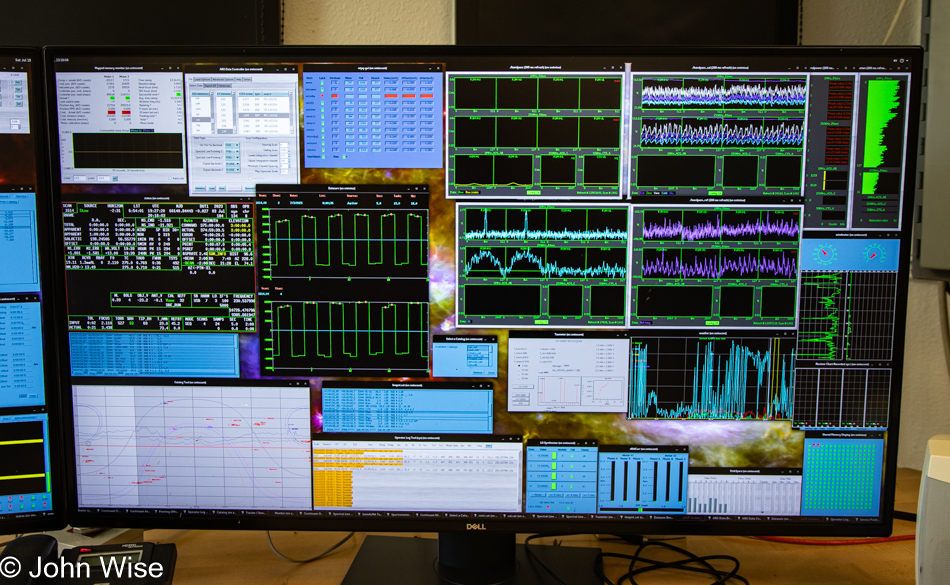
My low opinion of humanity (excluding the mass of scientists, artists, creators, educators, doctors, and those who invest in moving society forward in a hopefully healthy direction) can be exemplified by our tour of the Mount Graham International Observatory when a Swedish engineer at the Heinrich Hertz Submillimeter Telescope started answering questions from Caroline and me about the equipment and signal processing equipment. Literally, everyone else on the tour took leave of the three of us as things turned complex and technical while the enthusiasm of the engineer appeared to become amplified, as though it was passed through one of the many filter arrays used in the analysis of otherwise weak signals arriving from the cosmos.
Maybe the issue is that we observe ourselves through the microscope when a wider view is in order. To focus on a tiny aspect or two of who we are is myopic; we need to pull back and look at the bigger picture, pull up to a telescope, and look far beyond the small parts of ourselves that we believe we know.
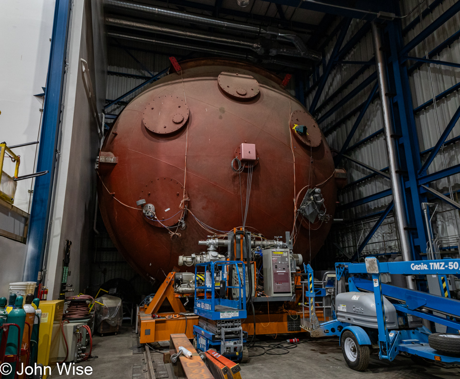
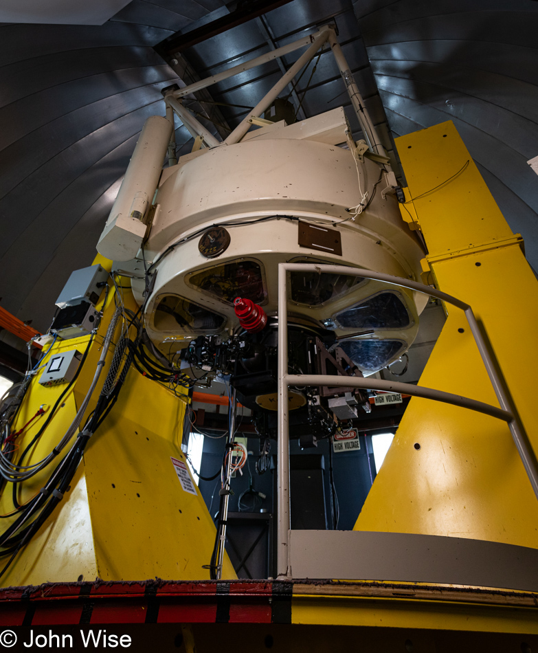
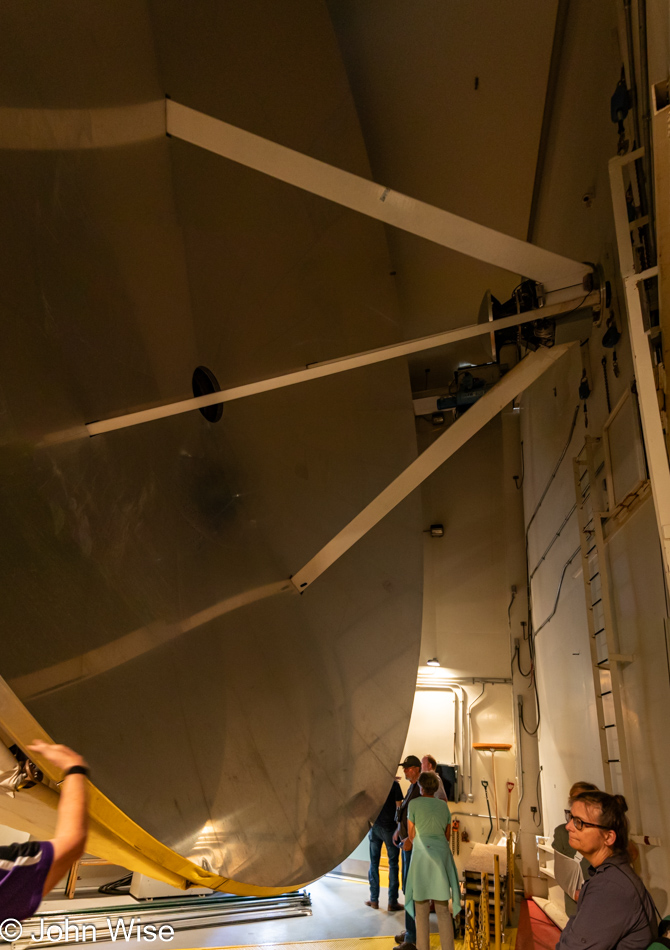
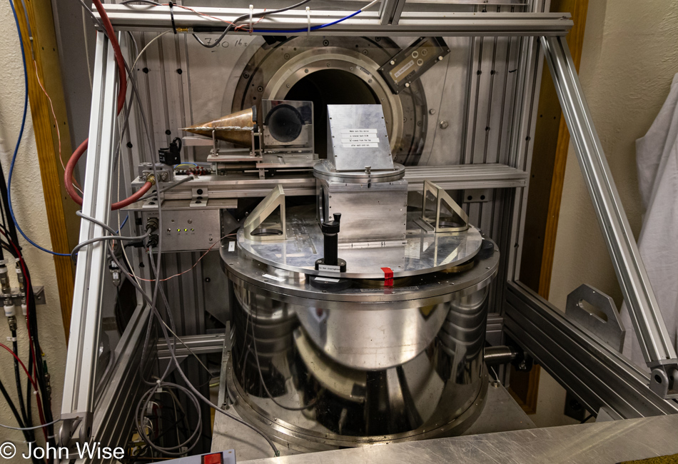
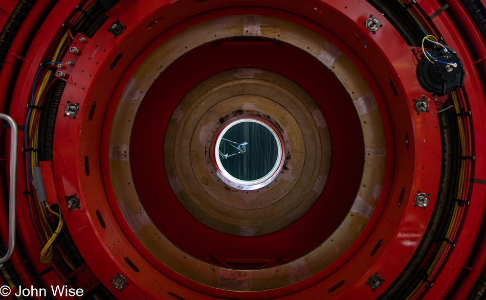
You can choose to see this machine as just that, or you can recognize that it represents our knowledge, that it is a tool of our brilliance. This giant sphere-like object is a bell jar that a crane moves out into the middle of this facility on the ground floor before it’s transferred to another crane that will pull it up into the telescope room above this one. Once upstairs, the mirror you see in the next photo below will be rotated 90 degrees so it can be coupled to the chamber before about 15 grams of aluminum (an aluminum can worth) is vaporized and coats the mirror, restoring its optical integrity. What else do you choose to see without seeing the bigger picture or understanding the nuance buried underneath layers of unknowns?
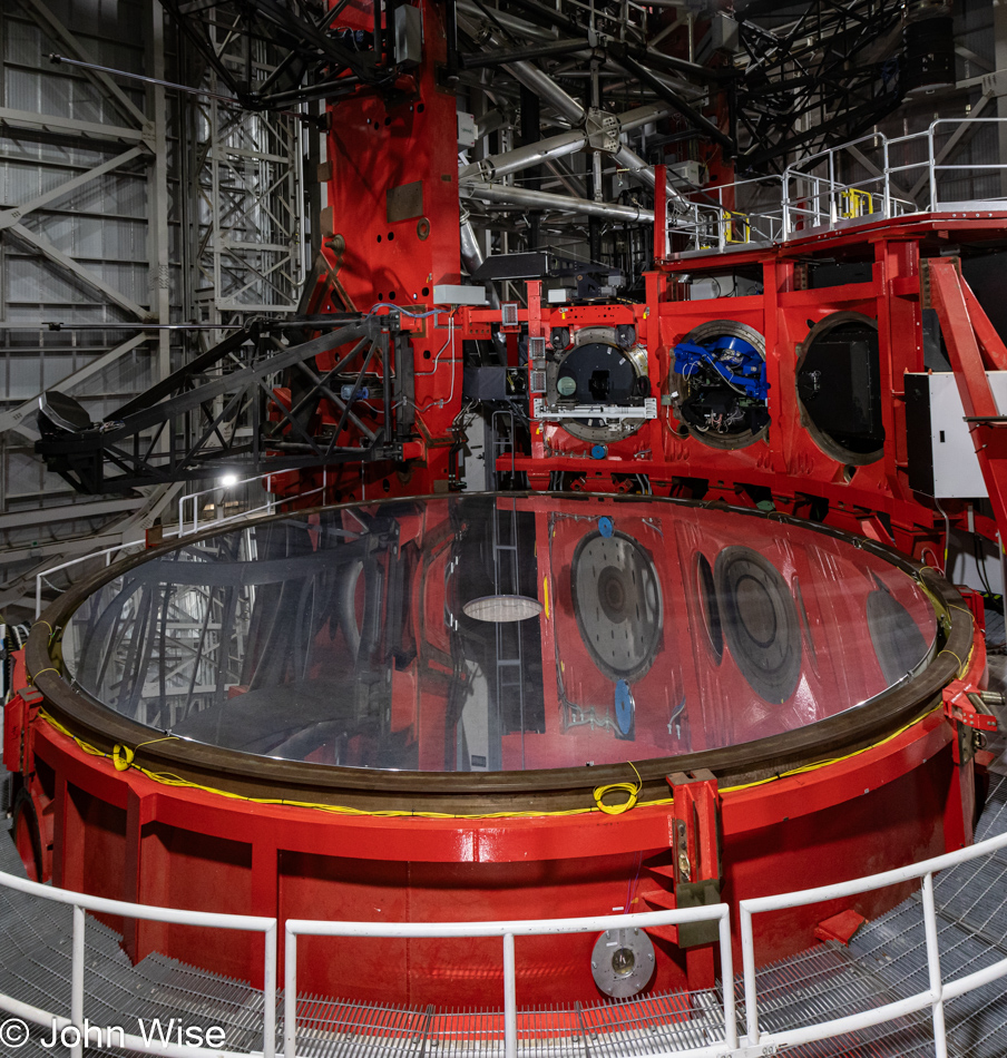
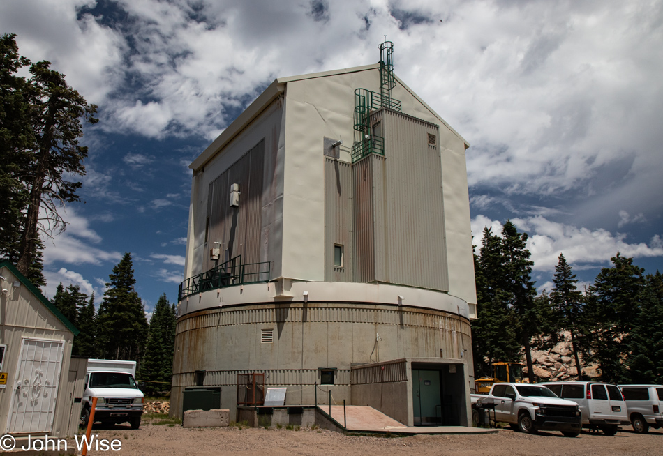
Scale is difficult to determine from this relatively flat image without a banana for comparison, but that mirror you are looking at, which is but half of this binocular-type configuration, is 8.4 meters (330 inches) across. The other lens, as measured from the centers of each, is 14.4 meters away or 47 feet. Working together, the binocular telescope (as of today, the world’s largest) spied galaxy cluster 2XMM J083026+524133 back in 2008, shortly after the two lenses began operating in tandem, capturing light that’s been traveling for 7.7 billion years to reach us. Meanwhile, some guy looked at his phone screen the other day where the light took 1.7 nanoseconds to reach his eyes, and using some well-developed confirmation bias allowed a bit of nonsensical information to lend affirmation to his evolving stupidity that he was quick to share with anyone falling into his orbit. I should have learned much earlier in life that this is simply the average man.
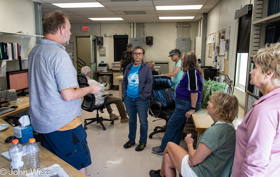
My constant derision of the less intellectually endowed likely reflects poorly on my own intelligence, but then I’ve never told anyone I’m any smarter than your common box of rocks. I am curious which I do find less common than those who are still sporting mullets. Obviously, I’m not a wee bit interested in explaining what most of this stuff we saw was and appear perfectly content to whine about others for I find so much disapproval, but let me level with you: that has a lot to do with the others on this tour who’ve shown me once again that a plurality of people, even when invested in gathering an experience, no longer desire what they thought they wanted. The “great idea” of doing something educational proved to involve too much heavy lifting, so let’s just meander aimlessly and talk among ourselves about stuff that has nothing to do with the environment we are currently supposed to be immersed in.
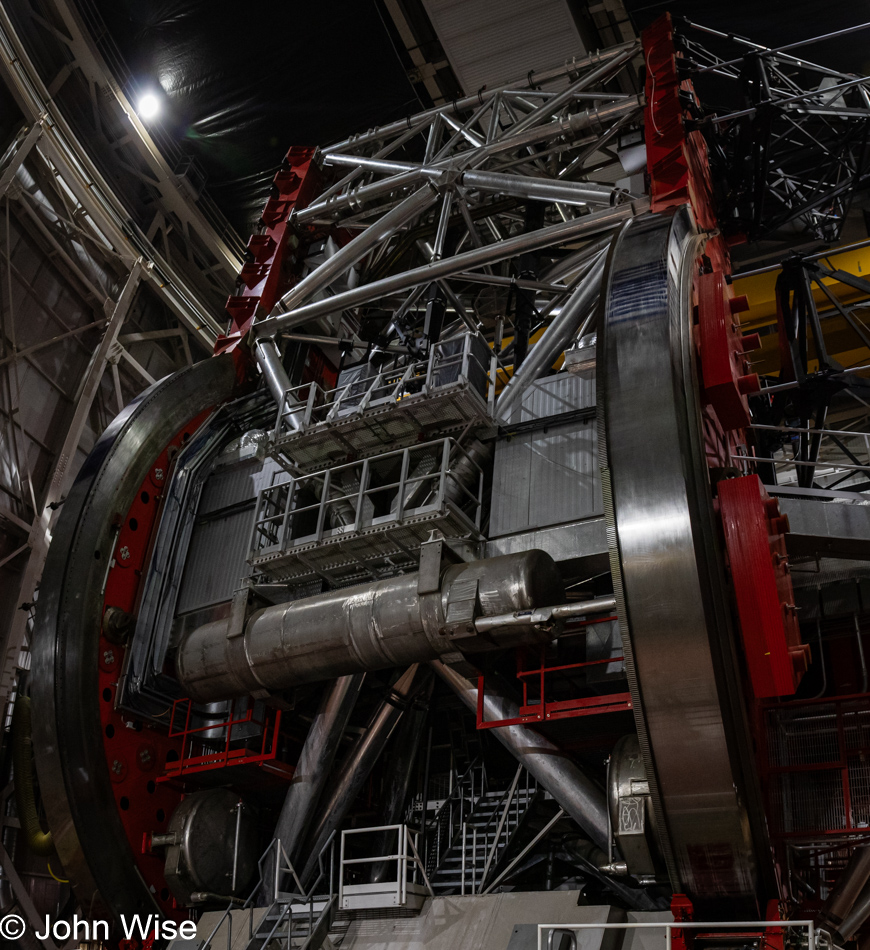
The rarely-seen underside of a telescope. I just made that up. I have no idea how common it is to be under a telescope, but here it is. And because in the years to come, I could easily forget what some of these sights pertained to, the image above this one is the fixture where the mirrors are mounted. The giant wheels are used to position the lenses but also to turn them up a full 90 degrees so the bell jar can be moved into position to resurface them.
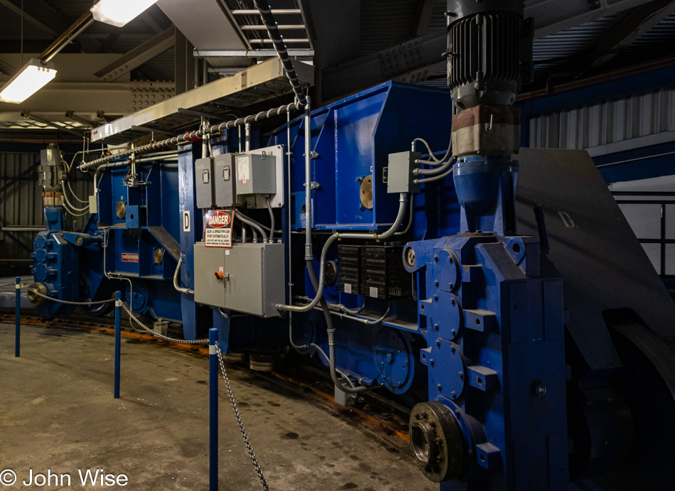
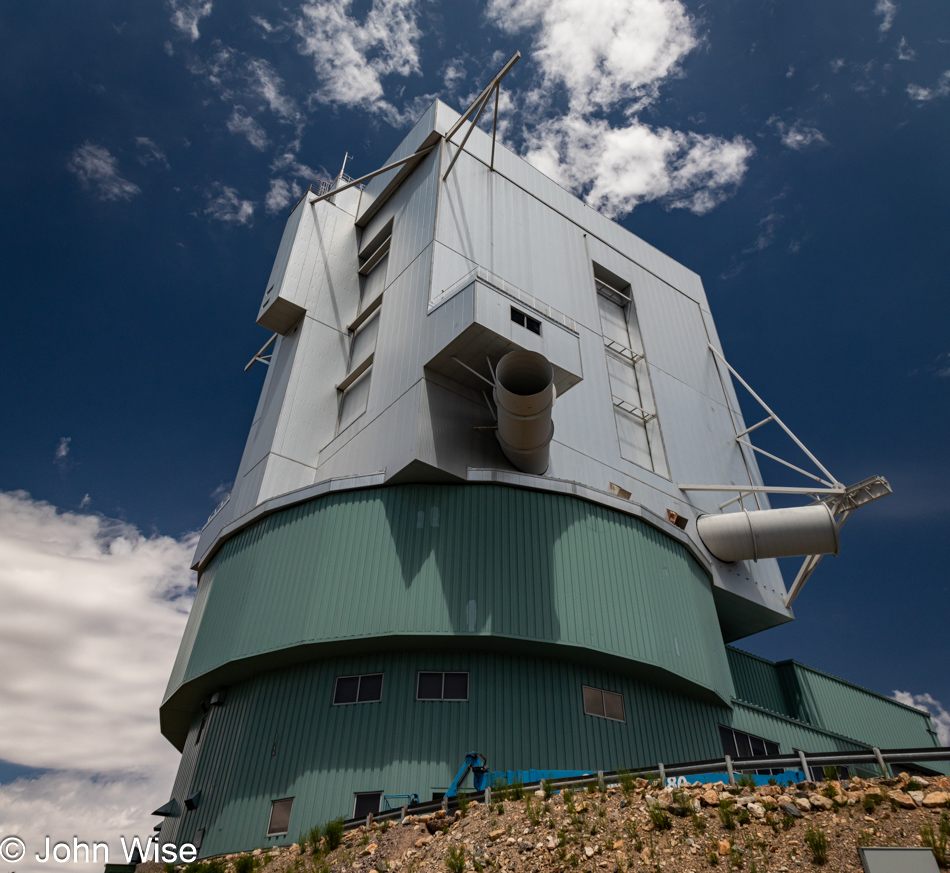
Five photos above this one is the image that shows the externals of the telescope we are visiting at this moment. The gray structure is the housing where the binocular telescope lives. At the moment we are standing in the middle green metal part of it all. Here, four of these blue mini-locomotive-like machines are responsible for moving the entire 900 tons of gear and building into the optimal position for stargazing.
And just like that, our day on the mountain in contemplation about the tools that enable our species to survey the heavens must come to an end, and while we learned some things here and there, we leave with the desire to know even more about how we look into the cosmos.

In the background are the Pinaleño Mountains, where our tour of the Mt Graham International Observatory took place, while in the foreground, the cotton fields are blooming.

Here in the Gila Valley, where the Gila River flows, the famous Pima Cotton grows.
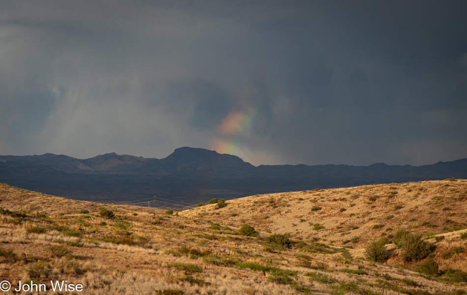
To the east in New Mexico, it was obviously raining, which makes sense as that’s generally the direction from where monsoons move into Arizona, while this oddly shaped rainbow appears to be a bit north over in the Clifton/Morenci area of Arizona.
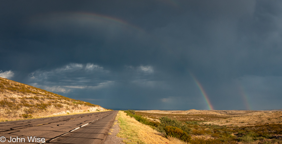
A faint double rainbow stretches across the sky. The elixir found in the vibrancy of refracted light bending in water drops shouldn’t be carelessly dismissed for the effect they play on exercising face muscles pulled into smiles. It has been proven that the frequency of smiles in our lives corresponds directly to the absolute joy we’ll be able to experience at any given moment in the day. And if that smile is reflected upon the face of a person(s) you are with, the joy is exponentiated. Warning: if, upon looking at rainbows, the other person seeing it at the same time fails to smile, you are likely in the company of a sociopath: run away.
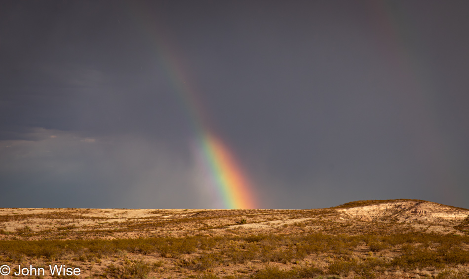
Can a blog post ever have too many rainbow photos? That’s like asking if cake can have too much yummy. Thank you, rain and sun, for offering us all this sky cake. Now, please stop, as our cheeks are starting to hurt from the incessant smiling.