Short Hike in Bryce and Go Home

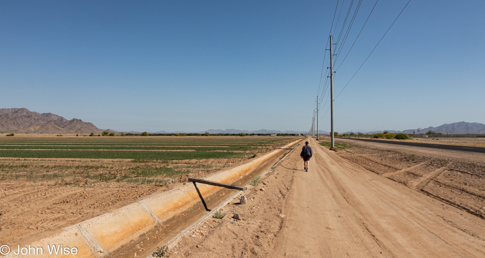
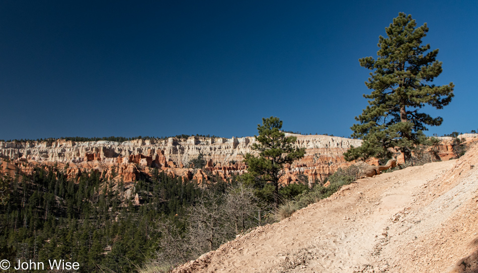
Yesterday’s pain party was worse than I whined about in yesterday’s blog post, so on our way back to our hotel after dinner, we’d decided we’d had enough and that Sunday would be a chill day with some sightseeing, but we’d lay off the hiking. After waking and packing the car, we turned left out of the driveway in the direction of home. We didn’t make it a mile before I suggested that we should at least take a look at the Tropic Trailhead that was just around the corner. Caroline agreed, and we whipped a U-turn. Both of us felt pretty good, and we agreed that at the first sign of knee or hip pain returning, we’d turn around from this trail that was rated as easy.

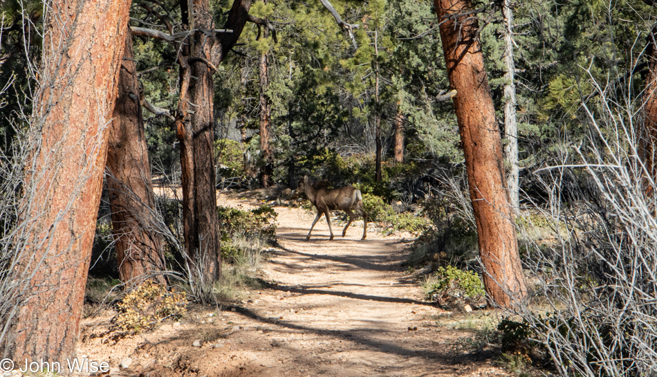
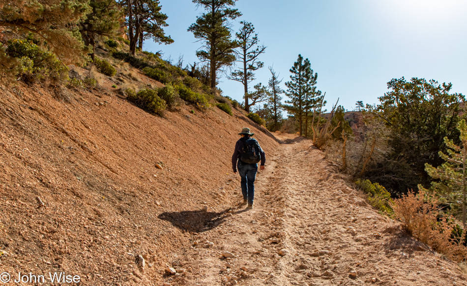
The elevation change is so subtle that it’s almost like walking on level ground out here; we sigh a relief and confirm that we are both okay and ready to continue. That solo deer walked along on our right for nearly a minute before jumping forward and then cutting right to cross the trail; once more, I’m foiled from getting a better photo as I failed to anticipate needing a zoom lens. Maybe if I write this enough times to myself here, I’ll remember to bring it next time. I’ll also point out that nearly every trailhead has a sign warning people parking there to NOT leave valuables in their car, and there are times we simply don’t want to lug that 3-pound lens in Caroline’s backpack. Oops, I think I wrote “we” in that last sentence when I meant Caroline. I might even feel guilty if I saddled that weight on her shoulders with the water, sweaters, food, sunblock, and the multitude of other things she takes responsibility for carrying as I’m too sensitive to be bothered with anything that detracts from taking perfect photos. Just try to think of it as I’m the deer moving lithely, independently, and free of burden in case I have to respond to capturing something important while my devoted wife remains at a safe distance, ready to support me and react to my beck and call. We call it happiness through structure. She’ll call this last bit BS after reading it, I’ll bet ya. [Eye rolling intensifies – Caroline]

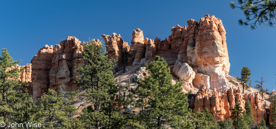
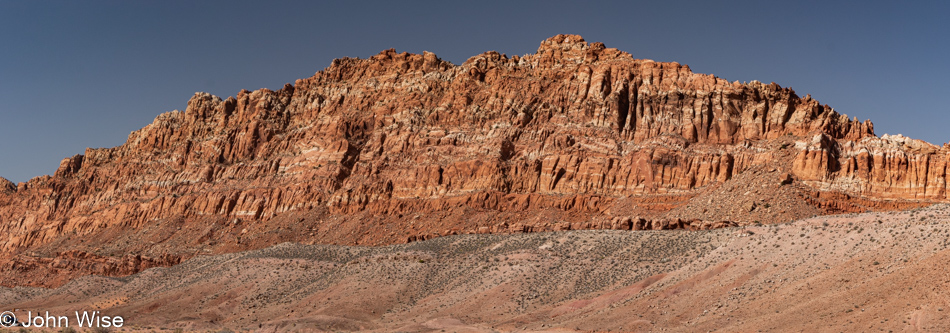
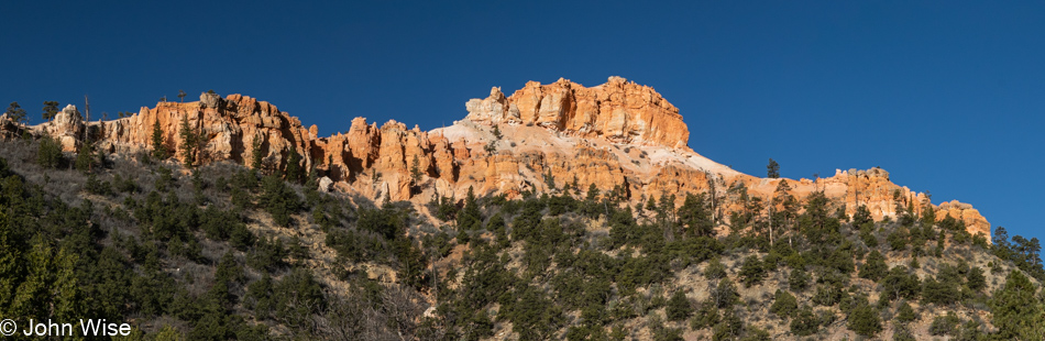
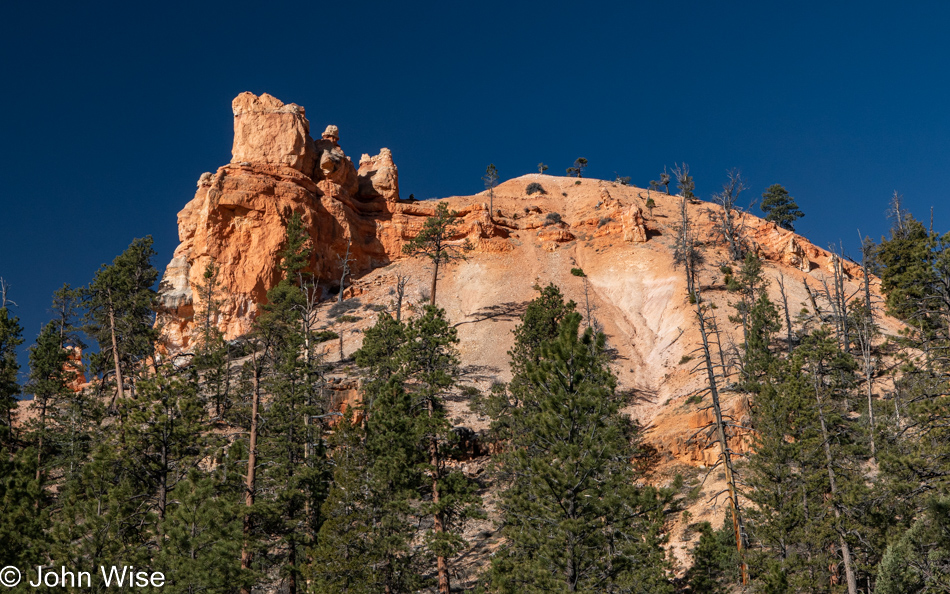
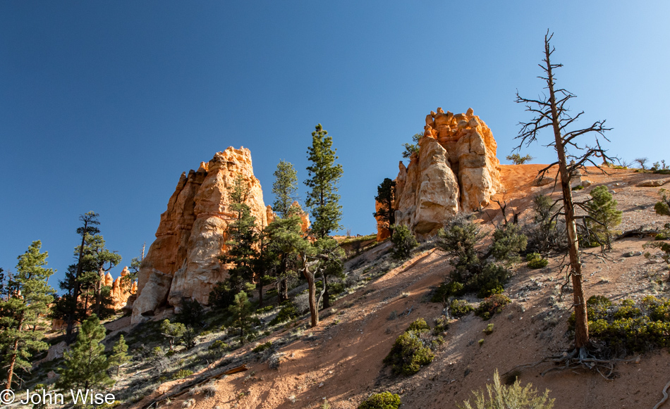
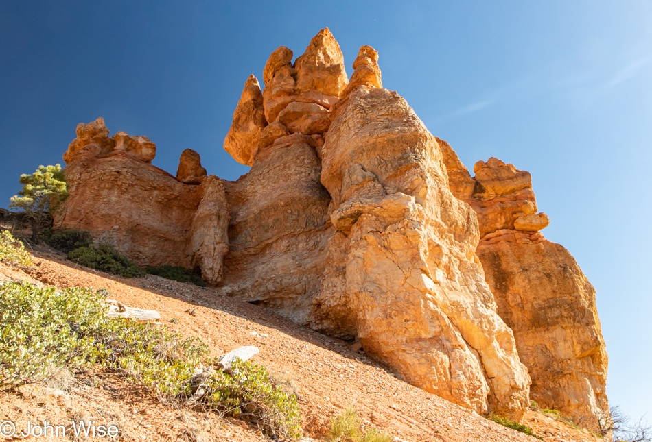
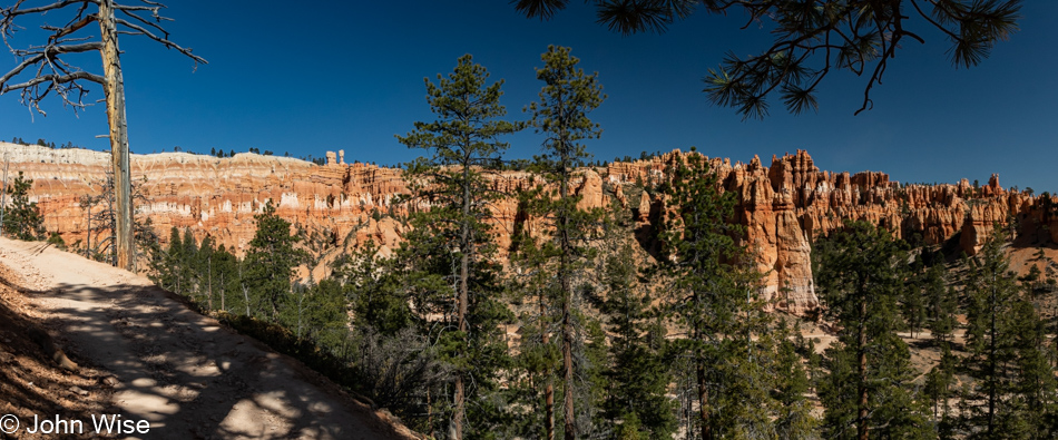
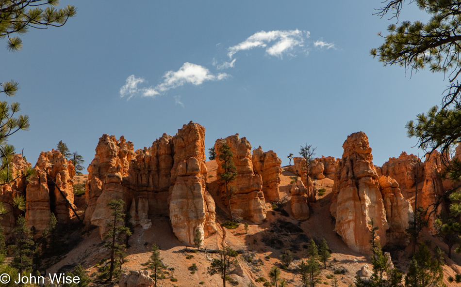
Shenanigans and nonsense are not what we are here for, nor what my writing about the day’s events should be about, but after this weekend’s slog of writing a mega-ton of love stuff, I’m nearly exhausted at even the idea of trying to share meaningful prose here. So, on that note, these are beautiful orange and white rocks that also fall in the category of hoodoos, which have everything to do with our hike into Bryce Canyon from the only way in that doesn’t descend from the rim.

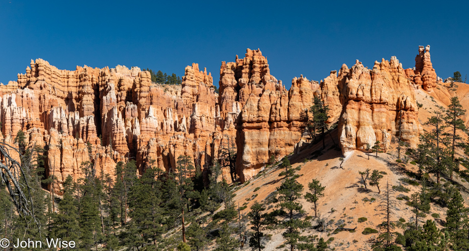
It’s only a 1.8-mile hike to the fork in the trail, and as long as we don’t hit any steep parts along the way, we feel confident we’ll have a good majority of the requisites steps we need for the day or about 8,000 of the 10k we aim for. Considering that we were comfortable with just heading south out of Utah for the trek home, we are thrilled that we didn’t cut bait and go.

Met a Swiss couple crossing our trail as we reached the spot where the Peek-a-boo, Queens, Navajo, and horse trails converge. They went left, and so we went right to not be right on their heels.

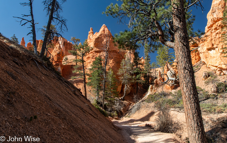
Hey, wait, I thought we’d agreed that there would be no up or downhill of any significance. With neither of us finding insurmountable pain in our joints, we decided that it was okay, but just this one to see what’s around the bend. There wasn’t a spectacular view, so after about five more minutes up this horse trail, we were about ready to turn around.

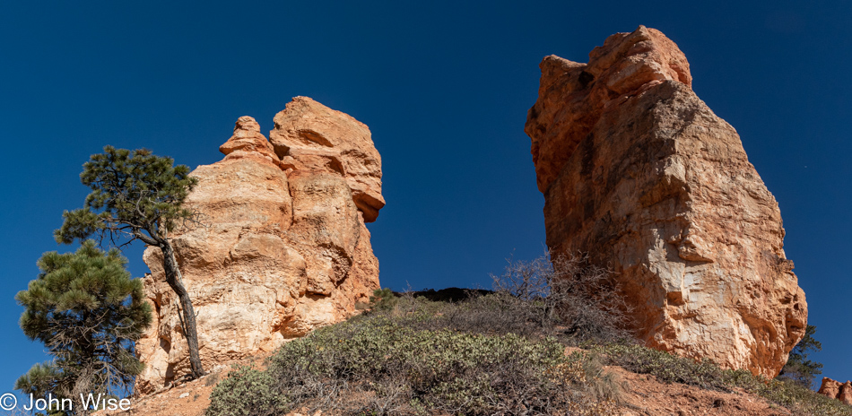
This was as far as I wanted to go while Caroline continued up to the saddle between these hoodoos as her gut said unto her, “A great view is just ahead.” Wrong. Turn your ass around and return from whence you came.

Somewhere down on the forest floor below is where we are heading.

Did I not see this on the way up the trail, or does it just look that different from a change in perspective?

We are on the other side of the branch in the trail heading up Peek-a-boo.

The idea is to go as far as we’re still comfortable after starting on the trail in a counter-clockwise direction.

The Peek-a-boo is only 3 miles long, and we half-considered trying it, seeing our entry into the basin had already afforded us the chance to avoid the seriously difficult part of the trail that descended from Bryce Point and required us to leave that way too had we not hiked in on the Tropic Trail. But here in the curve the trail narrowed while the hillside dropped precipitously, so that’s it, I’m done, no more exposure for me.

Having considered no hiking at all today and now being on the verge of 5 miles, we are happy that we’ve seen as much as we have.

Seeya some other day, Bryce, or at least we can hope to return someday.

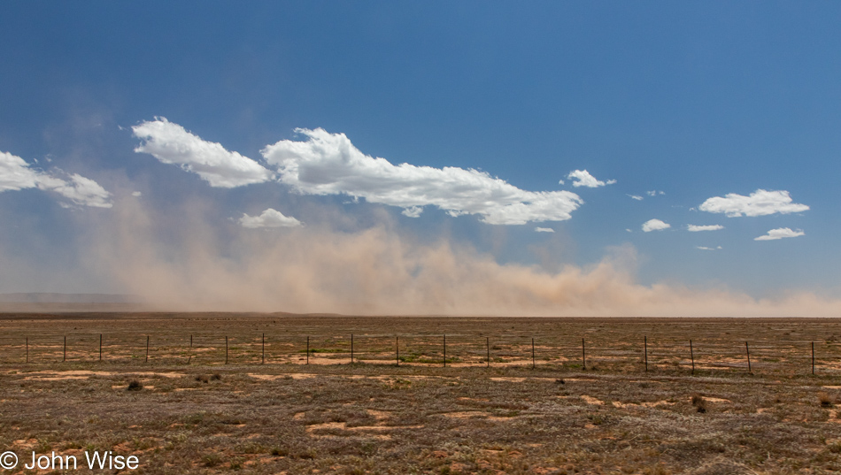
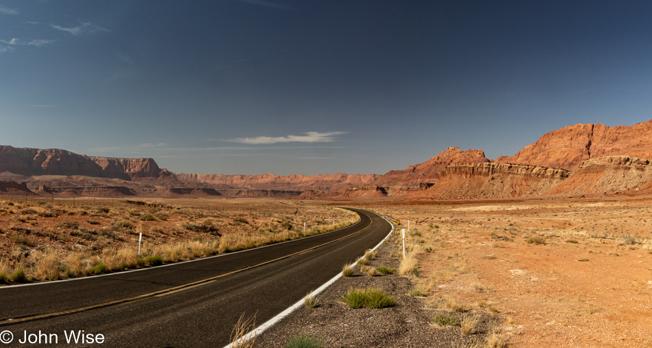
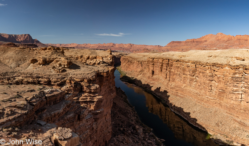
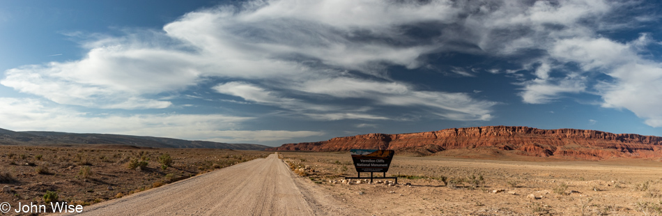
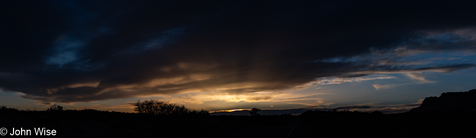
We are back in Arizona, where the winds have gathered steam and a considerable amount of dust. Our time out here on the Colorado Plateau is growing short, but our desire to return home before dark is curtailing the throwing that concern out the window so I can photograph every sight that knocks at my sense of sharing what I find intriguing or attractive.

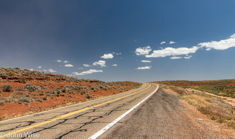
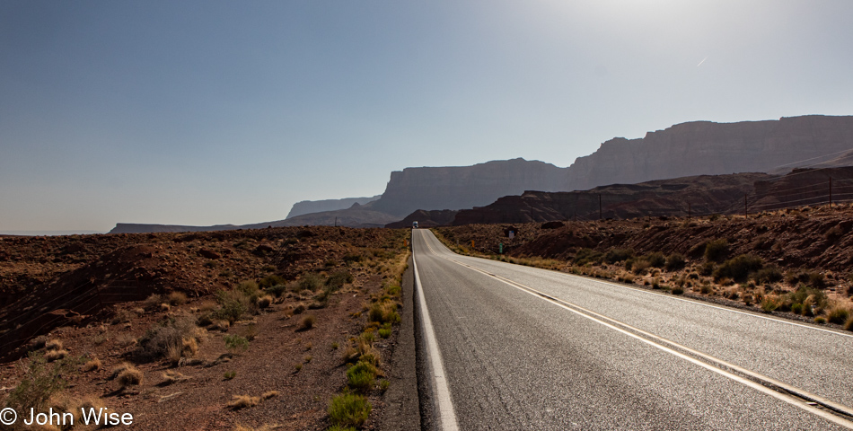
As much as we are moving forward, albeit relatively slowly, others are simply in a hurry. They race up behind us, except I’m now old enough that when I see them a mile behind me, I start looking for pullouts so I can take a short pause, allowing the insane to speed into impatience. This view from a pullout is just one of those moments.

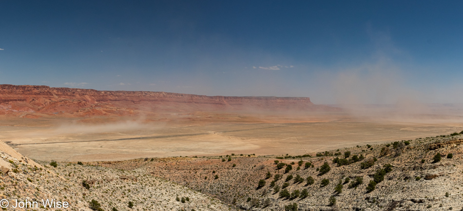
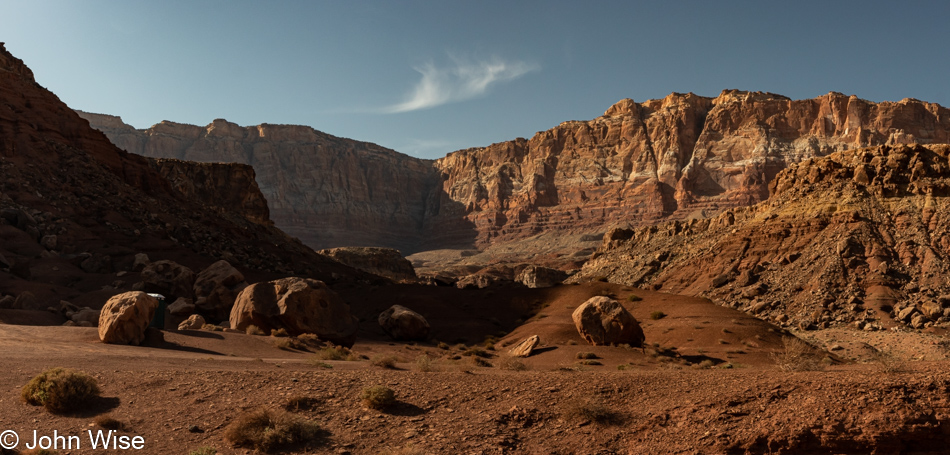
The scale here is lost in the midday sun, where shadows are rare. The amount of dust held aloft by the strong winds also fails to look as foreboding as it did to our naked eyes, but no matter as we’ll hopefully retain a sense of things long after we forget that we were traveling through the Vermillion Cliffs at this point after leaving the North Rim of the Grand Canyon behind us.

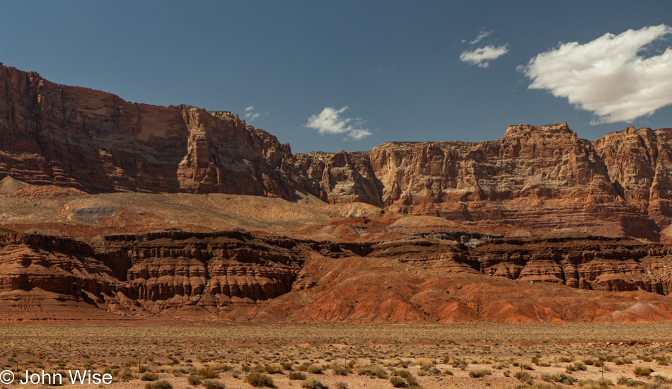
Come October, we’ll be right back here in the Marble Canyon area as we take a night before climbing up the road to spend the night at the Grand Canyon, north rim, of course, on the last day of their season. Come to think about it, we will drive through here again at the end of June with a night in Fredonia, Arizona, on our way into the Wasatch Mountains east of Salt Lake City, Utah.

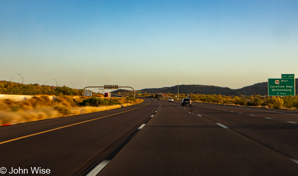
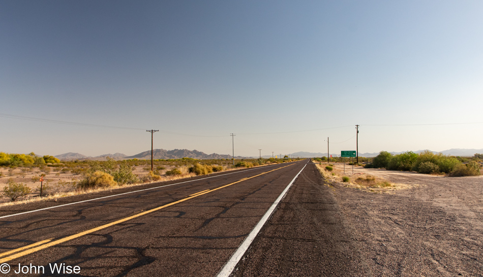
Our worst fears about driving home in the afternoon on a Sunday once Phoenix started hitting the upper 90s are the traffic jams created by everyone else leaving the high country and their weekend in the Flagstaff area. Well, here we are, and there’s nobody out here! Talk of recession, $5 a gallon gas, and the conversation about overpriced hotels must be taking their toll, as this is just not normal. I can only hope that gas hits $8 a gallon over the summer.

North Out of Arizona – Trip 8

Caroline Wise and John Wise driving north in Arizona

It’s already been a fortnight since our last travels that took us south, down to Ajo, Arizona, on the Mexican border; today, we head north. For the trip before that weekend in Ajo, we headed to Los Angeles, and so, as a preview of our next outing two weeks after this, I hope you might already guess that we’ll be going east. Today’s adventure, however, will bring us to Bryce National Park in Utah, about 80 miles north of the Arizona border.

Late last year, I took our friend Brinn up to Bryce to get his head out of some difficulties he was dealing with and realized it was likely well over ten years since Caroline last visited. After checking all blog posts, I surmise it might actually be closer to 20 years. It’s unfathomable that it’s been that long as the images of the park are never very far from our memories. Another aspect of this being a shame is that we are a mere 420 miles from the park. On the other hand, we have to avoid the place in summer: too crowded, yet we likely won’t be hiking in the winter because of too much snow. And so we have late April through the end of May and late September to early November to spend quality time there.

While I would love to bring Caroline back to the trail we’ve hiked together before (the same one that Brinn and I were on last year), it’s time for the two of us to capture the park from different perspectives, and to that end, I have a 7.8-mile hike scheduled on Saturday and an 8.7-mile hike for Sunday. While we are prepared for chilly mornings, both days should be mostly sunny with highs in the mid-60s; sunrise won’t be until 6:30, while sunset doesn’t arrive until 8:15.

Well, enough of this small talk; I have a few things to finish before we depart in a short 2 hours, as in lunch…

…That was 10:00, and now it’s noon. We are packed, fed, and about to get on the road. Next stop, Flagstaff for coffee and gasoline.

We are now well north of the big cities and moving deeper into the quiet of a landscape we are in love with. Along the way, we pass dozens of Native American roadside vendor stands that often look as though they’ve been abandoned for years. I’ve likely shared this more than a few times, but we miss the old Chief Yellowhorse stop along the road up here as they really worked the cheesy signs welcoming drivers traveling along this dusty path. Occasionally, there’s a bit of art that adorns these plywood stands that somehow endures the harsh winds and blistering sun that wears down the surrounding mountains. Maybe I’m drawn to them due to a romantic notion of what these stands harken back to from a different age when innocence and naivety allowed people to enjoy simpler things that still felt exotic.

But, like with all things, there is no such thing as permanence. Everything under the sun fades away. With enough time, mountains are turned to dust, and maybe too quickly, people’s dreams turn to dust, too. We’ve passed this fin countless times and while its erosion is imperceptible to us, the erasing of human activity here appears accelerated. There are homes and families that exist right along this road that straddles an invisible Grand Canyon on our left that is just out of view, but opportunities to succeed are rare, and with fewer and fewer travelers interested in souvenirs from the exotic old west and the Indians that scrape by, what’s here that represents humanity, aside from the asphalt, will ultimately also turn to dust. So, you better gather your experiences and live your life out in the real while it still remains.

Just ahead and moving off to the northeast is the rapidly disappearing Colorado River. While the river remains flowing from its catchment basin further upstream, our demands on harnessing and wasting it tax the entire ecosystem so we can feed golf courses, fill swimming pools, water the grass at our homes in the surrounding deserts, and create entertaining fountains over in Las Vegas. In other words, we are idiots failing to understand any sense of balance. Is our disconnect from these environments poisoning our responsibility that we’ve offloaded to weak politicians, celebrities, and those who put financial gain above survival? It would appear that we are driving into an oblivion of nothingness.

A shadow mirror deep below the edge is the lifeblood of all living things; we call it water. A dozen years ago, Caroline and I grew wealthier than many people on earth as we were afforded the luxury of traveling this muddy liquid highway called the Colorado River. From above, we are on an old highway bridge turned pedestrian bridge from which we can look right into the Grand Canyon. It’s not the view everyone is familiar with, but 5 miles north is Lees Ferry and the official beginning of the Grand Canyon, where mile marker zero denotes the launch point for rafting adventure into the canyon containing this mighty river. A singular moment was required to make the decision to travel through the “Big Ditch” which turned into one of the best opportunities we’ve offered ourselves. Any and all sacrifices should be met to afford one’s self these once-in-a-lifetime experiences that change the fabric of who we are and how we see our place on this planet. We can no longer see the Colorado or the lakes that try to contain it and not consider the impacts we inflict upon all of life in the Southwest as society takes water for granted.

I’m well aware that many of my themes by now are well-worn and maybe even tired, but if there is any real connection to the beauty taken from these spectacular landscapes that resonate within me, then there must also be a deeper appreciation and desire to protect and respect these environments in such esteem where important words bear repeating. Speaking of repeating, this road has been driven countless times, not that I couldn’t figure out roughly just how many times, but I don’t want to as I enjoy the idea that I can no longer really know as it’s that familiar.

I know these sights, no I don’t. Well, not having a photographic memory, I can’t say I truly know them, but they must be somewhere in the recesses of my mind as I know for certain we’ve passed through here before. We are fortunate to have these imperfect recollections where if we are inclined to return to a place that brought us wonder, it can be new once again and inspire fresh awe.

Did we miss this monument on previous excursions through the area, or is this dedication to the Dominquez-Escalante Expedition of 1776-1777 been placed here recently? Who cares, we needed to stop to even figure out who he was. So, it wasn’t a he but them. They were Franciscan friars Atanasio Dominguez and Silvestre Velez de Escalante, who ventured into the wilderness to document what they found on their 2,000-mile 6-month exploration to California. They never made it to that territory due to the approach of winter, but their journal served to help Lewis & Clark with their expedition in 1803, and so, as you might guess, I’ll head over to Amazon to grab a copy of their document of what they found nearly 250 years ago before the indigenous cultures were forced to cede their identities to the wave of invaders that were at their doorstep.

While back on the Navajo Bridge, a man who’d taken his chair out on the bridge to watch condors told us of a rookery out near House Rock and that there were now over 100 condors in the area. To be honest, I was skeptical, but a sign for the Vermillion Cliffs National Monument with a map showed a condor viewing area up the road in House Rock Valley. Still, we were incredulous and didn’t believe there was any real chance we’d see condors if we made the detour. The turn-off is not well marked and requires a turnaround, but we thought, what does it matter if we get into Tropic, Utah, later than planned?

We might have been 4 miles up the gravel road before we spotted a pickup truck near a covered picnic table and two women, one with an antenna in her hands when we realized we were at the right spot. Caroline looked through a scope that is mounted here and immediately saw one of these giant California condors flying right above what turned out to be streaks of bird poop. While it may be difficult to spot in this lower-resolution photo, there are ten condors in the image above. Once again this year, we wonder out loud about these travels into nature, why we are failing to bring our binoculars and my 70-200mm lens?

We saw more than 4% of the entire population of surviving wild California condors that exist on Earth today. This giant scavenger nearly went extinct with only 22 birds still alive back in 1982, and they are still under threat due to states like Arizona that won’t ban hunters from using lead in the bullets they use for hunting. This then begs the question: I thought hunters were not doing this for sport as much as they were shooting animals for food. If condors are scavenging carcasses that are full of lead, then it can only be due to hunters shooting whatever the fuck they want and leaving the rotting corpse to be claimed by whatever comes along to dispose of the spoils of our war against wild animals.

Then, on the other hand, there are those of us who see our tax dollars at work maintaining these trails into our wildlands where average people can drive up to see things never seeable in our cities. Driving up to a view equipped with shade, seats, a toilet, and even a scope so the curious are offered this kind of experience that is nothing but luxury. Along the way, we’ll find food, gas, lodging, and random surprises that are only accessible due to the constant support of an infrastructure that allows these types of forays, even for the hunters, off-roaders, and those happy to inflict damage to an environment I’d prefer remained pristine. But we live in a world where compromise is supposed to be the rule, and I’m good with that, though we can still try to exist within parameters that best preserve things that are beneficial to people, land, and the various species with whom we share this world.

Do you see that? Can you feel what I’m trying to share? Have you seen the moments I captured over the course of our afternoon? All of this is love, love between the two of us experiencing our world, love of the opportunity to be present, love of the sights, and those who lend massive effort to our ability to have such times of life. Without the entirety of all things working in concert to allow these two people to be here in this precise instant, life might otherwise be a total chaos of randomness where order never finds an equilibrium. We must stop and harness our powers of observation and consideration to see that in the sunset, the condor, the river flowing through the canyon, and the two people tracing a path over our earth are all bringing the potential to recognize unraveling beauty, discover new love, reaffirm an engaging relationship to this brief moment in time where life happens on the most profound terms.

Our source of inner light shines for such a short time once you fall in love with all of this, but if you fail to see the horizon closing in on you, you will waste this precious resource called happiness. The phenomenon where our hearts are allowed to fill with awe, joy, surprise, and magnanimity towards ourselves and the world around us is a fleeting flash of potential that is only illuminated for the briefest of times with a prominence that will be witnessed by very few. Share this opportunity for love with yourself and get out of your way, out of your fear, out of your routine. Escape your cynicism and look for the profound in the tiniest of things, in your heart, mind, and soul.

Not Much in Ajo nor Why

John Wise wearing new socks in Ajo, Arizona

The great luxury of new handmade socks inspires a wonderful sense of appreciation that these were made just for me, for my feet alone. As if such a gift could be graded, these have a special story that catapults them into their own category of impression. You see, this yarn from West Yorkshire Spinners in Britain was sent to Caroline just before Christmas by her friend Claudia, who lives in Germany. The first bit of yarn was cast on back in January, and I noted that she was working on them while we were at the Getty Villa in Pacific Palisades, California. The knitting continued on our subsequent trips to Death Valley, the Grand Canyon, Douglas, Arizona, Mexico City, and San Cristóbal, once again in Los Angeles, and now here in Ajo, Arizona, where they are being declared finished.

Arizona Route 85 leaving Ajo, Arizona

Indecision is the key to flexibility was the adage we learned from boatman Bruce Keller while rafting the Colorado River a dozen years ago, and as this trip south was packed with a lot of indecision, we are now practicing our flexibility by pointing the car northwards early in the morning instead of doing anything more down in a part of the state where there’s little to do, not in Ajo and not in Why.

Gila Bend, Arizona

Arizona Road 85 mostly passes through the Cabeza Prieta Wildlife Refuge and the Barry M. Goldwater Range used for bombing practice, with very little opportunity to take in the sites on the way to Gila Bend.

Gila Bend, Arizona

We were okay with that straight drive-through as we were on our way to getting a greasy breakfast, the kind we could only get on the way through the lesser populated areas of America. Sure, we could go to Denny’s, IHOP, or Waffle House in Phoenix and other big cities, but those options would kill us if they were part of our routine. We’ve passed the Space Age Lodge and Restaurant many a time but have never stopped; that all changed this morning. Breakfast was every bit of greasy we could have hoped for, with two weak-looking eggs, a small mound of hash brown potatoes, toast, and a side of bacon for me. Flavorless coffee rounded everything out, adding all the happiness to a day we needed.

Gila Bend, Arizona

Out behind the restaurant are train lines, and on one of the tracks, a bunch of cars are traveling west. In the distance, I could see another train traveling east right at me; this obviously demanded that we hang out and watch these giants pass.

Old U.S. Highway 80 north of Gila Bend, Arizona

This road was one of two options I’d entertained traveling on prior to our departure on Friday. One direction out of Ajo would take us west and then north for a visit to the Kofa National Wildlife Refuge, and then there was Old Highway 80 out of Gila Bend, which was made nearly redundant after AZ-85 (mostly parallel to this old road) was opened in 1977.

Iron Cross Blister Beatle in Arizona off AZ-80

As we were out here looking at owls, hawks, and various other birds, we came across this mean-looking ant-like thing that Caroline thought was a crazy-looking ant, but on further examination, I was able to determine that this beast was an iron cross blister beetle. My wife got lucky regarding this encounter as she skipped picking it up (she, in fact, picks up a lot of creepy crawlies to get a closer look or better photo) because this particular insect will hurt people. It’s not only toxic to animals, but it’s toxic to us too, not that Caroline snacks on the bugs she picks up, but in this case, there’s a substance on their legs that causes our skin to blister…hence the blister beetle reference.

Old U.S. Highway 80 north of Gila Bend, Arizona

We don’t get a lot of rain in AZ, but apparently, we can pump enough groundwater that for one hundred years, we’ve been irrigating desert lands to grow corn, cotton, citrus, melons, and a bunch of other foodstuffs that allow for these beautiful contrasts between dark greens, the desert, and deep blue sky.

Fire near Gillespie Dam in Arlington, Arizona

What we thought was a wildfire turned out to be a controlled burn, a stinking, eye-irritating, scorching of some earth that is understood by some and lost on us…

Historic Gillespie Dam Bridge in Arlington, Arizona

Lost on us until we reach this Gillespie Dam Bridge and realize that the burnoff of surrounding brush works to protect this 95-year-old truss spanning the Gila River.

Gillespie Dam in Arlington, Arizona

“River” seems relative as the Gila kind of just stops here over on my right. I suppose that when monsoon season arrives, the waters likely move beyond the remnants of the broken Gillespie Dam and find their way to the spillway still remaining here at the section of the dam pictured below. As for the pooling waters, they are actively being pumped out and sent to irrigation canals.

Gillespie Dam in Arlington, Arizona

The ground behind Caroline on the left is still smoking from the fires that obviously burned earlier in the day. Not only is there water in front of us, but behind the wall and in those small coves is even deeper water, and it is back there that we are listening to fish splash about, as are a couple of nearby fishermen trying to entice them to join the party in their ice-chest sitting nearby.

Historic Gillespie Dam Bridge in Arlington, Arizona

While the dam failed back in January 1993 due to an extreme flooding event occurring in Arizona that year, the bridge, while damaged, survived and was subsequently repaired. Well, our day is turning out to be quite interesting.

Hassayampa River in Buckeye, Arizona

Strike another positive impression into our scorecard as here at a Hassayampa River crossing we are seeing water running over the desert. In our 27 years in Arizona, we can’t remember seeing water in the Hassayampa, though as I write this, I have this vague notion that we once saw water running through a broad expanse of the river bed where it passes underneath Interstate 10 west of Phoenix. [Note: The Hassayampa mostly flows underground. There are a few areas that have perennial surface flows, but they are upstream near Wickenburg. Water in this part of the riverbed is a seasonal occurrence. – Caroline]

Glossy Ibis roadside in Arlington, Arizona

As we passed a cattle farm near Arlington, there was a field being flooded, and at first glance, it looked like common blackbirds poking around for food in the water.

Glossy Ibis roadside in Arlington, Arizona

Of course, I failed to bring the long lens once again as we ventured into nature, and now I’m suffering by not being able to capture a close-up image of these birds. It turns out that they are Glossy Ibis. Look closely; they have a rainbow of hues shining off their feathers. They were first seen in Arizona just 19 years ago, so they are not common at all. Also seemingly not common within our own species is this ability to be easily entertained by such ventures into places of relative nothingness.