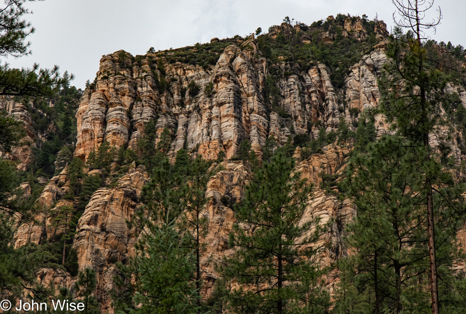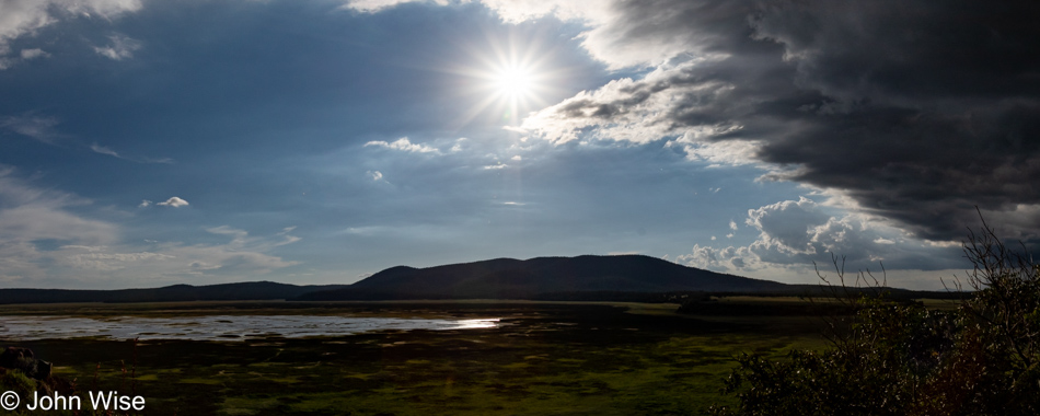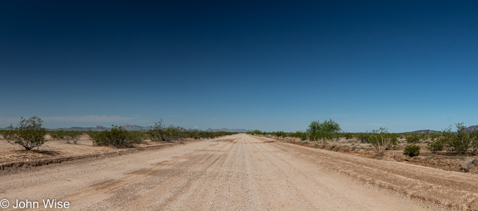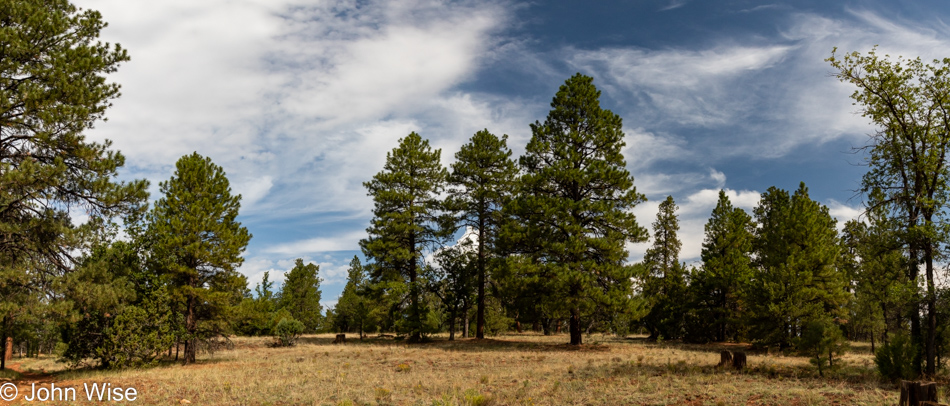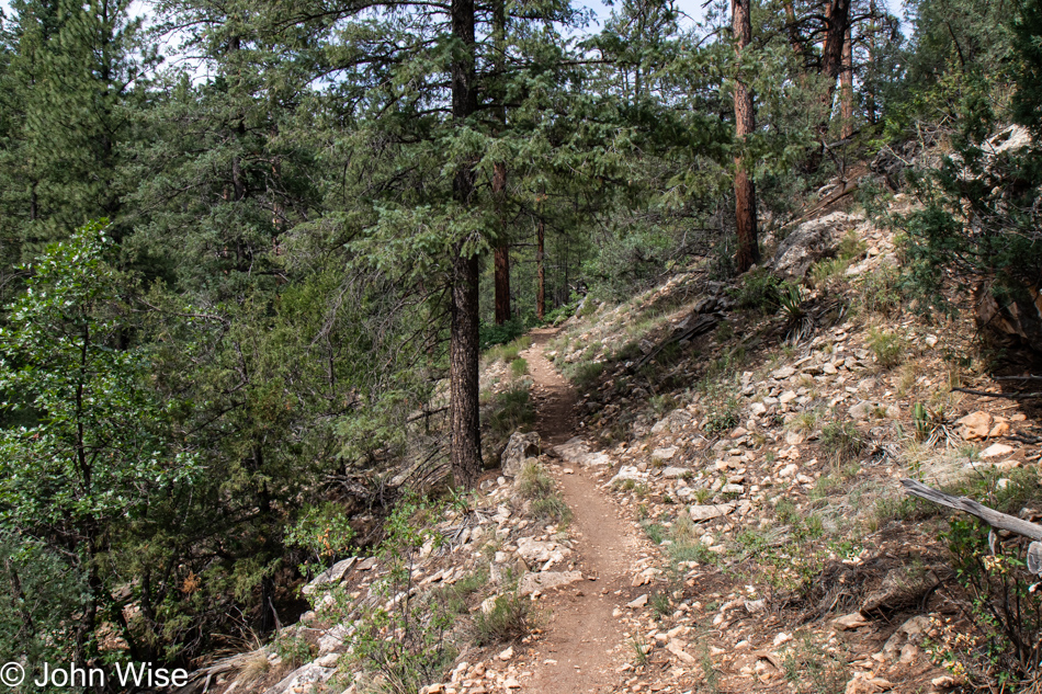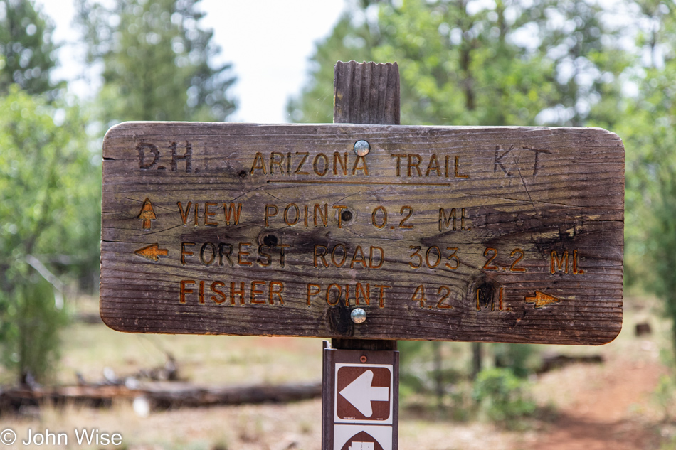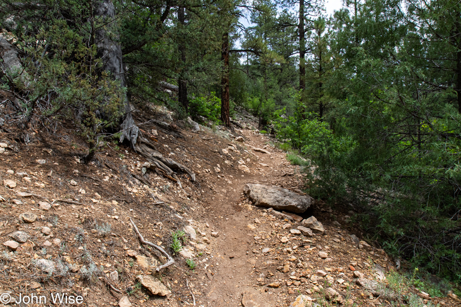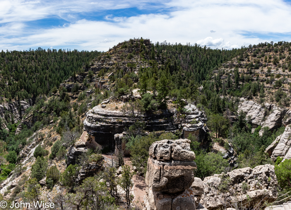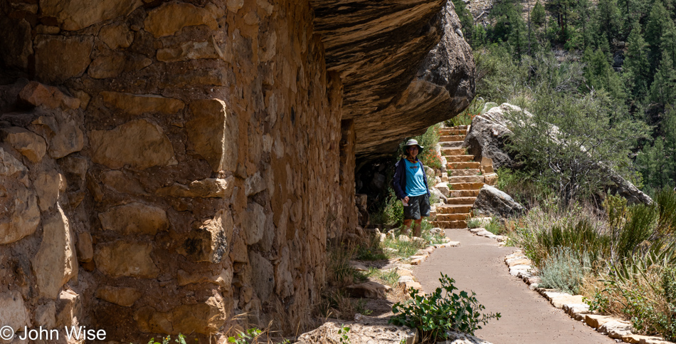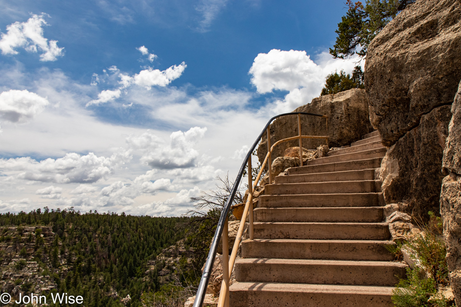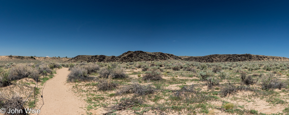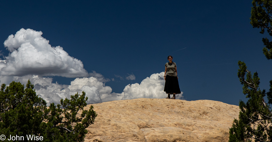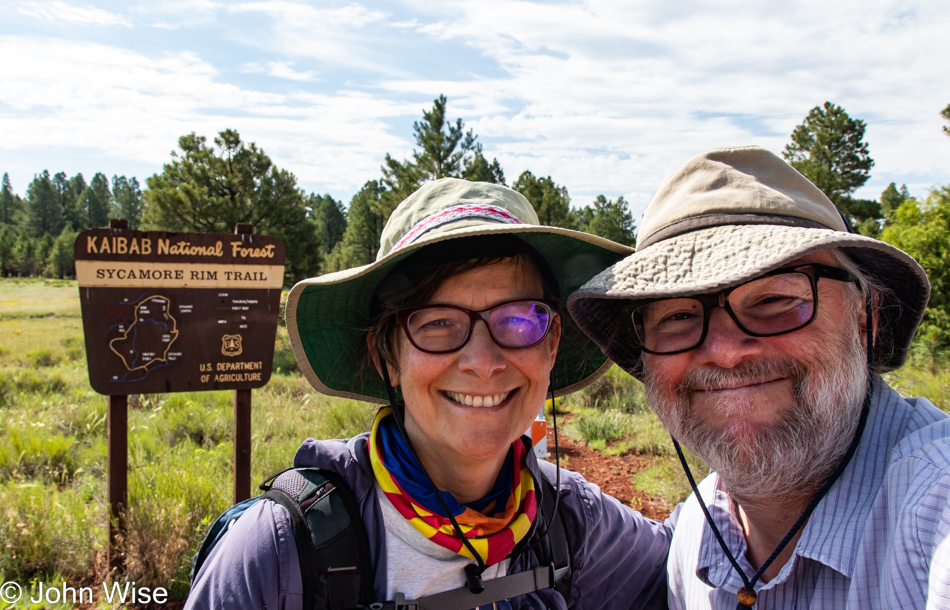
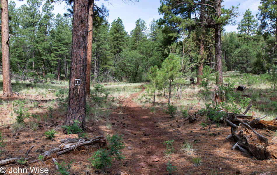
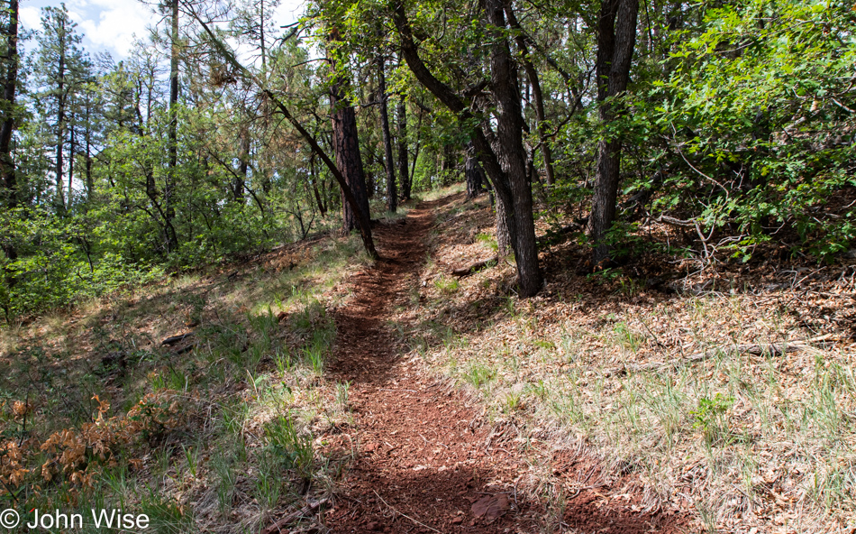
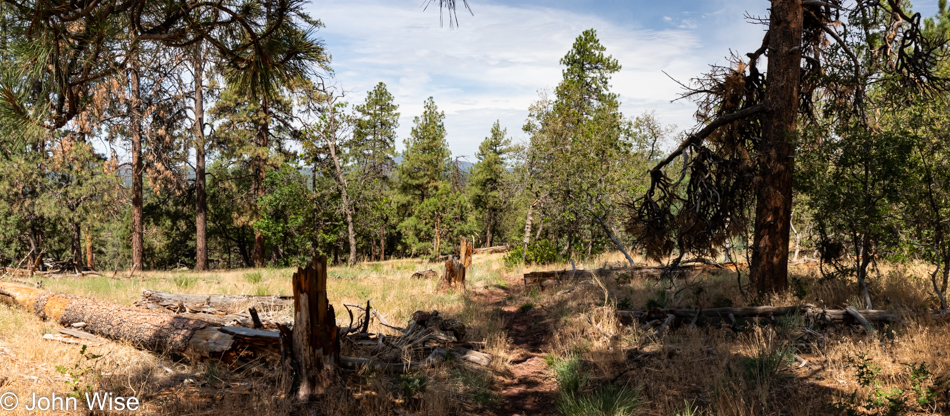
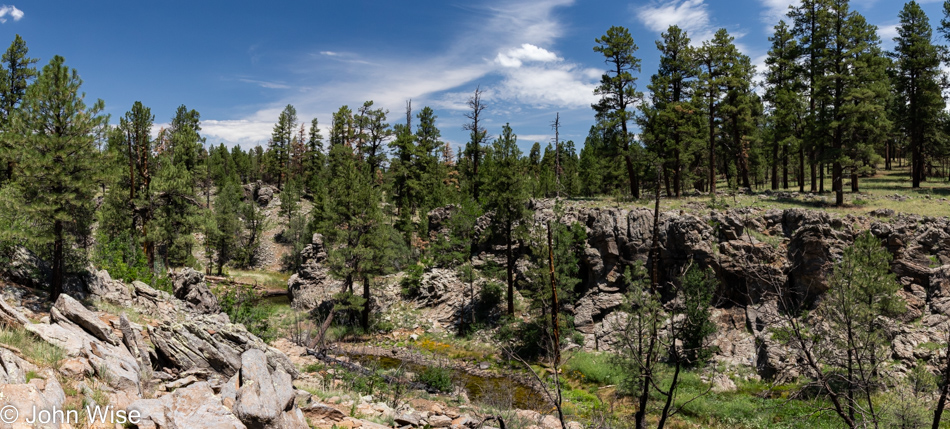
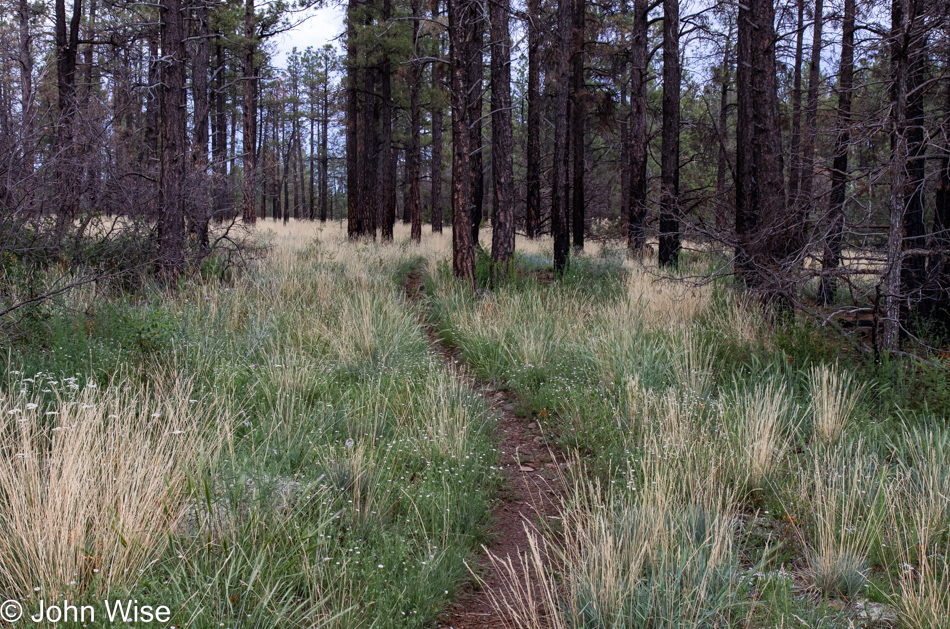
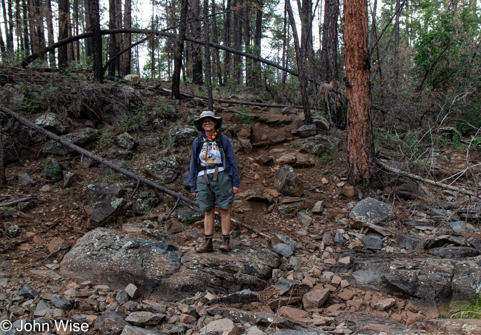
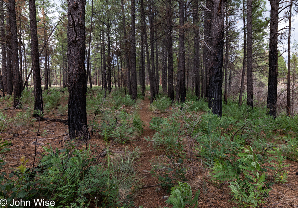
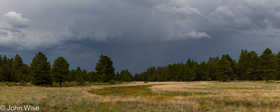
This feels like a strange admission, but Caroline and I have never gone on a 12-mile hike before. We’ve walked that distance plenty of times in New York, Washington D.C., Budapest, Frankfurt, and some other places, but we’ve not intentionally chosen a moderately difficult trail up at 7,000 feet of elevation before. Just last night, we had struck this trail off the itinerary due to a prediction for rain and thunderstorms, but by this morning, it looked like that risk had passed. So, a few miles up the road and then 18 miles down a dirt road, we made our way to the Sycamore Rim Trailhead.
First off, my apologies for the 39 photos that accompany this post, but after us walking 12 miles and me so busy out here snapping photos, this is exactly what you should have expected. As a matter of fact, my first pass on prepping images offered up 63 potential visuals I might have liked to share, but considering my obsession with writing a little something to each image, that’s just absurd, so I pared 24 photos that will never be posted here.
What is the sense of excitement that arrives with heading down a new trail? We’ll not discover a new place, species of plant or animal, or treasure aside from all of those things, metaphorically gracing our eyes and ears with an experience that will feed our desire for another new trail in the days and weeks ahead.
Water, snacks, binoculars, a camera, and sunscreen are the things that travel with us. We don’t carry a gun or bear spray or fear that we’ll need those things; maybe we are too optimistic or naive.
Out of our curiosity, we are possibly prone to being somewhat pollyannish, but I, for one, cannot help thinking, live by the sword, die by the sword. If we remain considerate of the risks, understand we should always make enough sound to ward off predatory animals, and consider the real likelihood of an armed aggressor having made the effort to look for victims in a remote location where finding someone is not a certainty, then I tend to want to believe that we’ll be okay.
Instead, we focus on the journey and the surprising things we’ll see, even when those things are not exactly new but iterations of a theme. Come to think about it, much in life is about iterations of things where, hopefully, the best parts never grow old and boring. To that end, what is our responsibility to assign values to what is good and what is likely destructive? How can we begin understanding those relationships of good and bad when knowledge is ever-evolving, mutable, and influenced by culture?
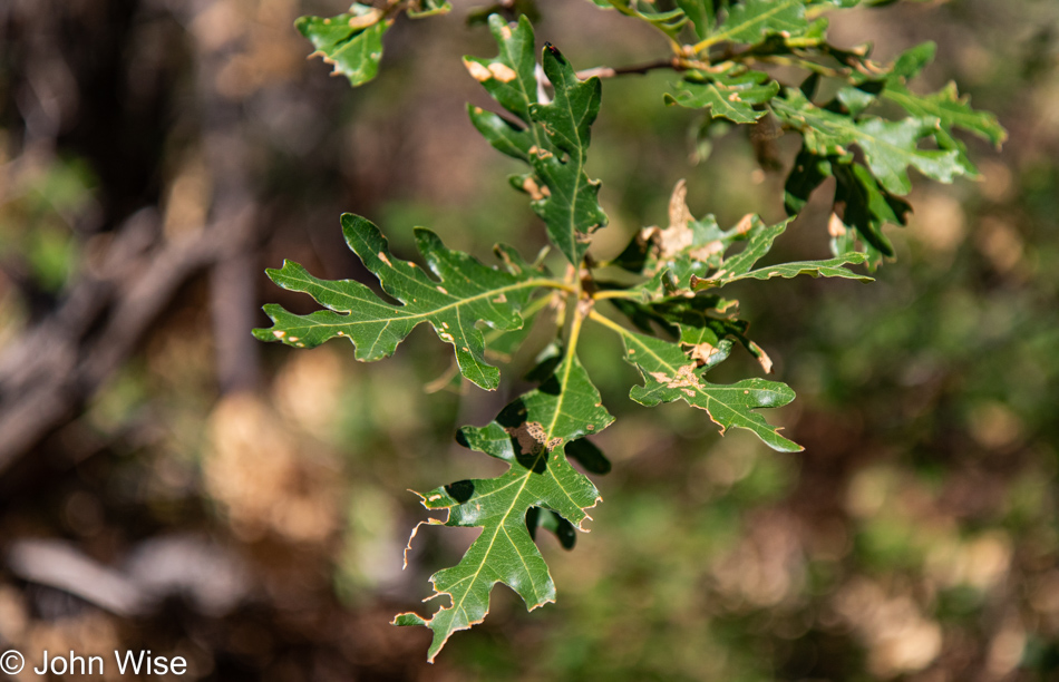
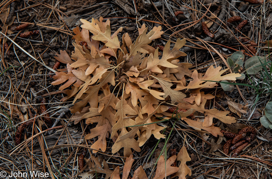
Take this Gambel oak leaf, for example; I find it important due to its role in the health of a forest for the biodiversity and aesthetics it imparts on my journey, while none of those attributes can be assigned to a television. Being outdoors in the world of wild nature, I find a kind of internal reset button where my brain is washed clean of the repetition of fixed imagery that greets me on a daily basis while surviving in a city. As the forest breathes, my mind takes in a fresh inhalation of life-sustaining nature that goes beyond entertainment and connects me to the primordial.
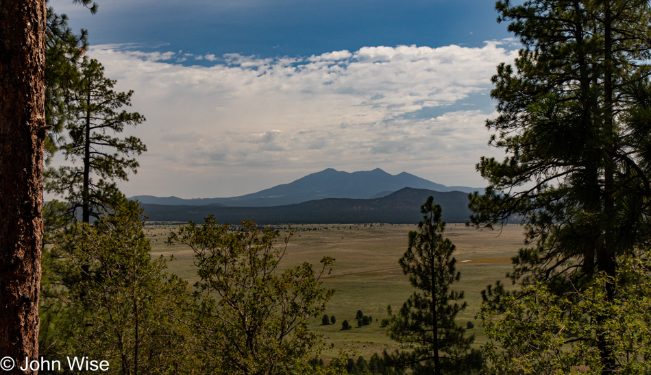
Staring into the distance over a meadow at a mountain, into a canyon, or over the shimmering silver sea, I’m looking beyond what is easily grasped. My modern urban life only needs to be afforded so I can collect the self-contained packets of existence that push aside the mundane, constant repetition of living in the city. We seem to surrender ourselves to a kind of prison where our need for the novel is replaced by an addiction to the familiar.
For those not crushed under the relentless pressure of conformity, they trudge forward in search of discovering everything. Novelty arrives when studying something new about elliptical curves, inexplicably large 3.3 billion light-year wide giant arcs that risk challenging our understanding of the universe, learning about tessellation in computational design, or any multitude of complex subjects or the fineries of long mastered crafts that extend our own personal knowledge and skill set. Novelty is the key to prying open the calcified mind, but it’s also dangerous if too many seek out its intoxication.
Unleash curiosity, satisfy it with the psychedelic inebriation found in discovery, and then challenge it incessantly with access to the vibrant library of human knowledge and the interpretation of nature and culture, and you may never be able to contain the freedom of the individual who must now spend their days seeking.
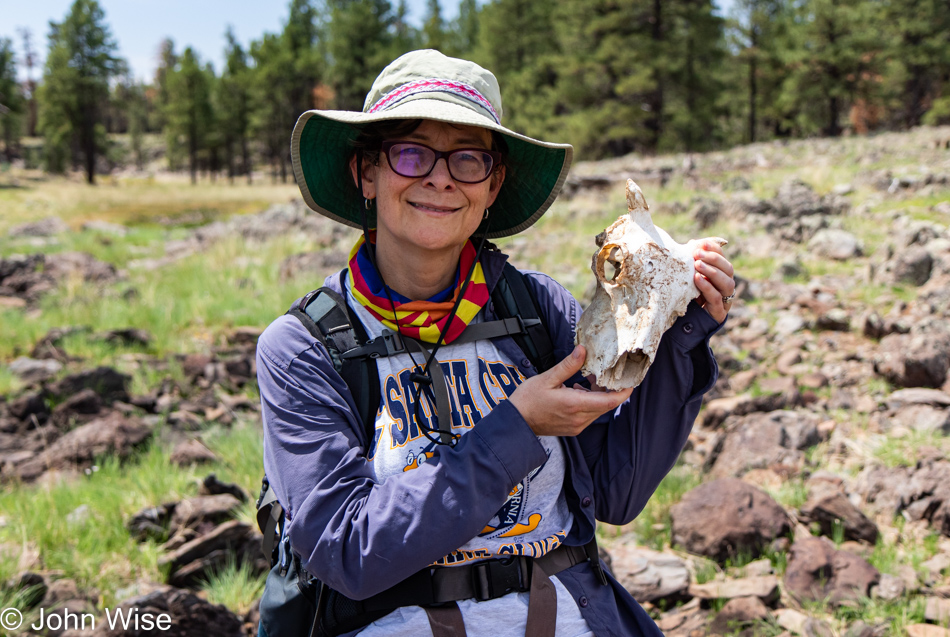
We are not nerds; that’s a pejorative term to marginalize the radically curious in order to diminish their potential impact on the “normals.” Patriots, fans, devotees, and even junkies are preferable descriptors compared to those that might inspire others to venture out on a different path. Calling oneself a member of one of these groups proves that the adherent belongs to something greater. One skull in this photo is of a living and aware creature, while the other is a now-dead, forgotten, faceless animal that will never be known. The same goes for patriots, fans, devotees, and junkies; they are part of a dying herd that will fall to the side, never to have been anything more than an anonymous creature. Those who rise to inspire the patriot, draw in the fan, or bring the devotee to the flock will better know freedom and curiosity as they exploit the herd to dedicate themselves to affording the person at the top a kind of status that their followers live vicariously through instead of grabbing life by the horns for their own selfish realization.
I know that none of this is new, not here on my blog, not in philosophy, not in our works of fiction, so why then does the majority of humanity relinquish their own quest for an abundance of life as though they feared that the watering hole of knowledge and experience would be drained prior to their ability to arrive with a thirst of curiosity?
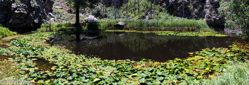
Like music that plays out in all directions for those present to partake in its magical sounds, the tools for feeding our minds are infinitely more numerous than all the lilies in this pond and all the other ponds in this forest. Yet, too often, we choose to dull the spectacular nature of potential that could be found within each of us by affording greater value to a vast number of people around us, all being able to simultaneously share how we each gazed upon the exact same lily pad while missing the pond, insects, boulders, mountains, and forest wherein the lily pad lives. This is what we do with memes, television, talk about the weather, sports, political figures, and celebrity.
For me, the weather is apparent by what’s in front of me and overhead; my ache for celebrity is satisfied looking into my wife’s eyes. Television needn’t be set right here in these rocks, so I might have a path I can follow if I’m to arrive at the end of the show/trail. My inner politician lives in my reasoning of what’s personally important to me instead of relying on outside personalities to tell me on a daily basis what’s important to them.
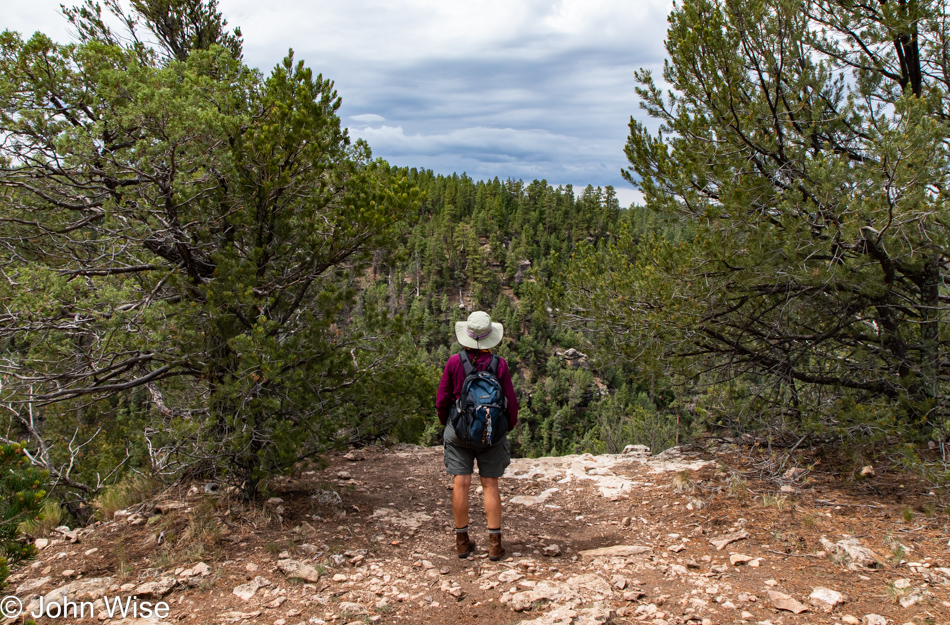
My sad reality is that the chasm between self-awareness, self-determination, and curiosity with the other side where cultural suicide, banality, war, and total submission is a distance I cannot bridge no matter the thousands of words I try to coerce into telling a story I think might strike the eyes and ears of those I never reach. Instead, here I am on that edge, and everything I want and need is here for the taking. You see no one else competing with Caroline and me for this experience because it’s only valuable to the tiniest minority of those who not only venture out but venture deep within.
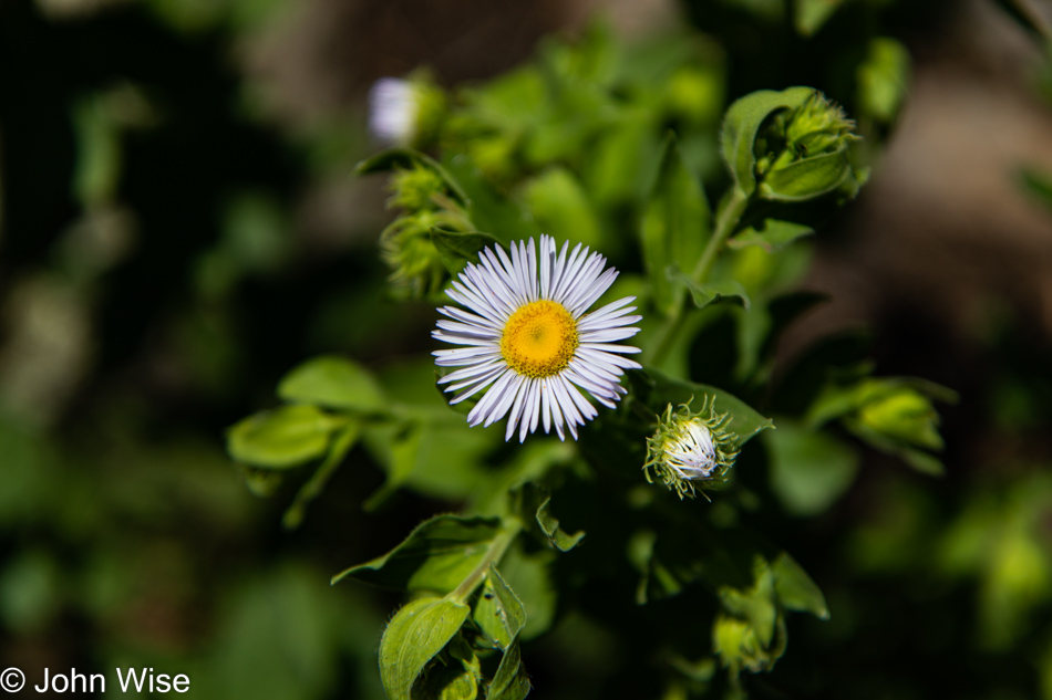
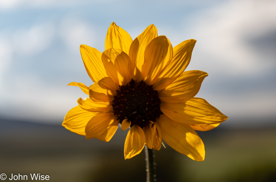
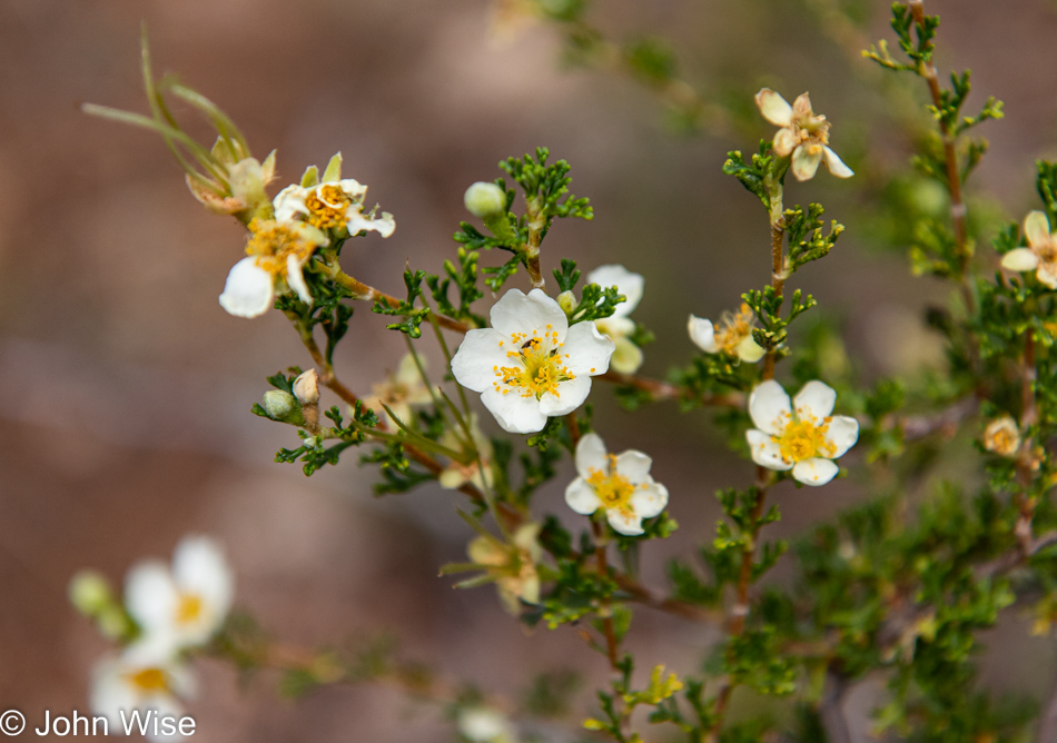
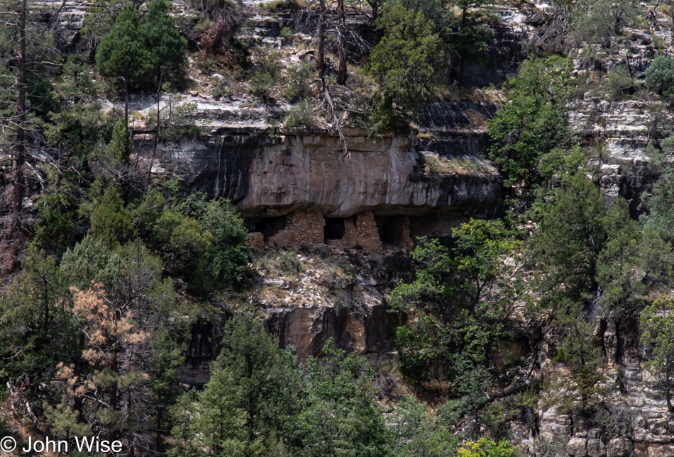
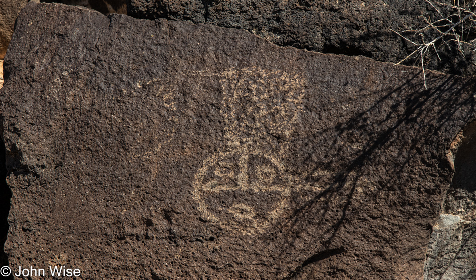
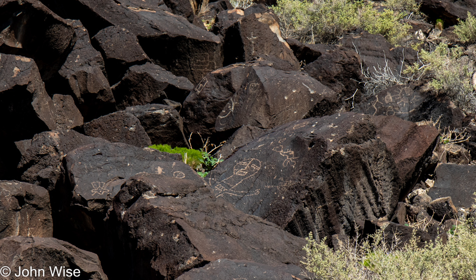
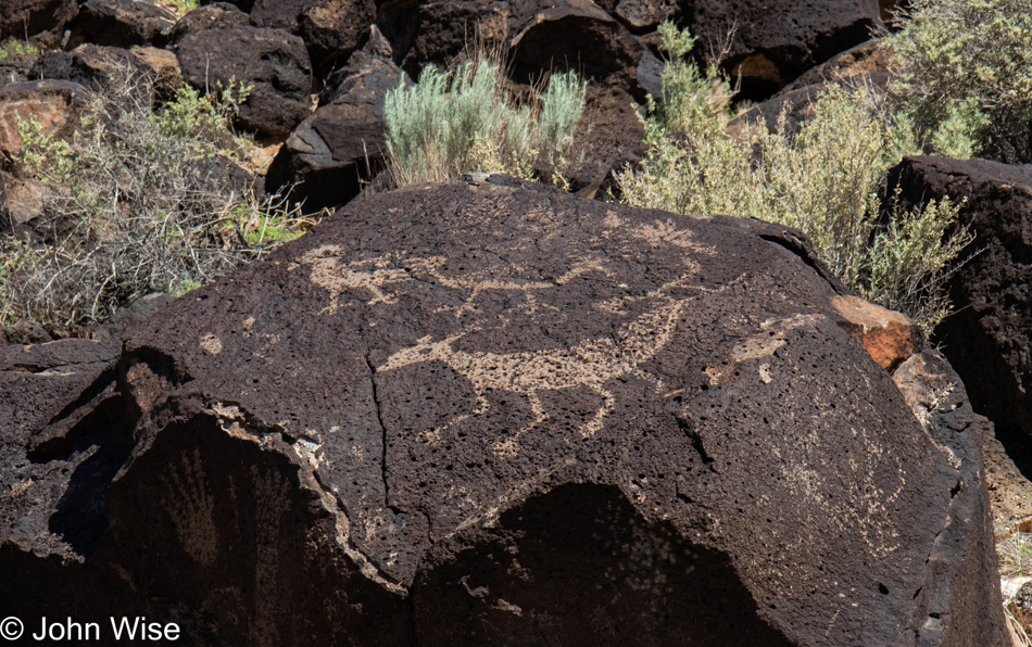
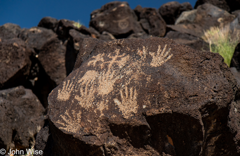
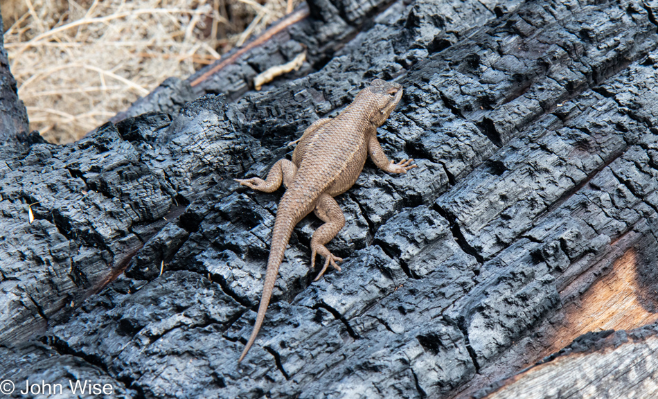
I had to research this next bit, but I’d be willing to wager that at least in the United States, many people know who Lena Headey is and her character Queen Cersei as played on the TV series Game of Thrones. I didn’t know her or her role prior to looking up who was the most widely known character on that show, and while millions, if not tens of millions, know the depiction and whatever controversy that surrounded this fictional person, I am able to lay claim that I’m the only human being in the existence of our species to ever look upon this particular flower known as Erigeron a.k.a., Fleabane in this forest on this day. Does this make me better than others? Absolutely not. I’m well aware that I’m as anonymous as any particular leaf or blade of grass from the entirety of the 1.8 million acres (7,300 square kilometers) that comprise the Kaibab National Forest in which we are hiking today.
But for ourselves, we are the Spirit of Ecstasy hood ornament on a Rolls Royce, gliding through these woods with only the two of us here to appreciate the rarity of such an experience. This, though, is a disservice to the idea of trying to establish some level of individuality when I equate our existence to an emblem that others can relate to because, collectively, our sense of brand awareness is greater than our real knowledge of individuality.
My foundation is not pop culture; it is not Mad Magazine or TikTok videos. I’ve not constructed my underpinnings on the Marvel Universe, Mixed Martial Arts, or the Los Angeles Lakers. My base is not a syrupy plateau of smiles, fake superlatives, and the affirmation of likes. What underlies my being is the deep desire for knowledge and love; it is a lot of isolation because the core of a person, like that of the earth, does not reveal itself easily. It is the shared histories of ancient cultures that allow me to stand atop the precipice of what comes next. The certainty that you’ll survive the next step is not guaranteed, but what lies in the unknown, once discovered, has a greater chance of becoming a part of you than passively having seen things that leave bits of jingles, slogans, or scenes in your memories. These things have nothing to do with you aside from the collective experience that affirms that you, too, are just like your neighbor.
Now, please don’t get it in your head that, while Caroline and I stroll through these environs, I’m knee-deep in the immersion of profound philosophy because, on the contrary, I’m lost in the spectacle of nature. I strain to hear things near and far, to see the smallest movements among the tree branches above my head and between the leaves below my feet. My mind has been cleared of expectation, song, and critical action. I’m looking for an openness that will allow every impression to find a place in the quiet of solitude instead of the chaos of criticism.
But when I return to Phoenix, and I’m looking back at the images and impressions I took from our excursion, I think about what the real personal gain was of being in the out and what was either brought back or reinforced. It is at this juncture between experience and memories that I’m trying to capture the essence of something, an intrinsic delight or insight, and once I attach some significance to what the journey was, I’ll be even more inclined to seek out similar moments which offer so many things to reflect upon.
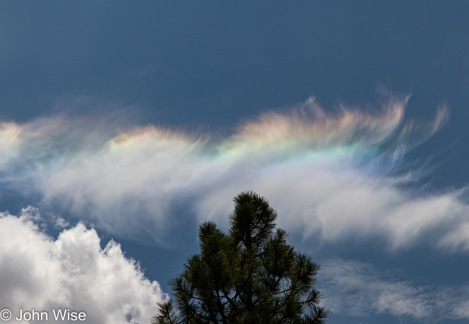
The second time around, nothing is the same as it was before; it becomes a new place on a new day, with different weather and different surroundings. The novelty that inspired such elation on a previous adventure might seep in, but with its unique attributes, it will propel these reminiscings into a higher domain. The rainbow fringe on the clouds will take on new hues, the pattern of the trees will offer a different dance, and the horizon will drag us into the delight found in the most wonderful intimacy found in first encounters.
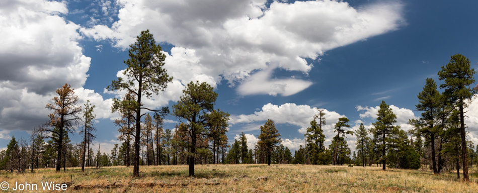
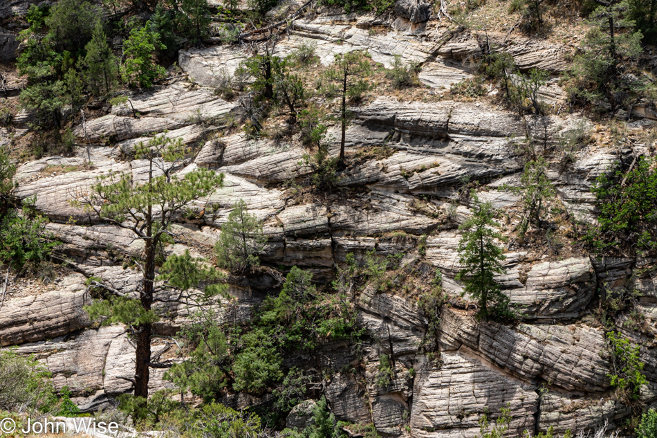
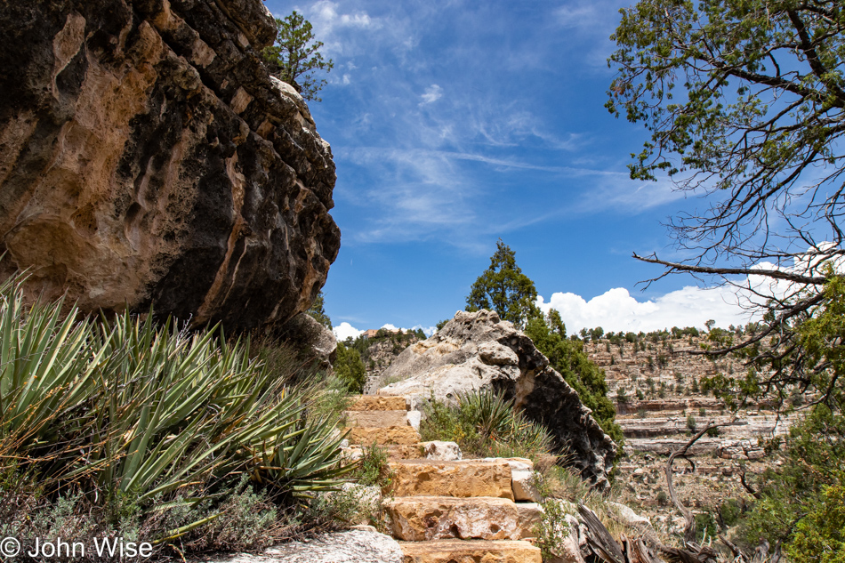
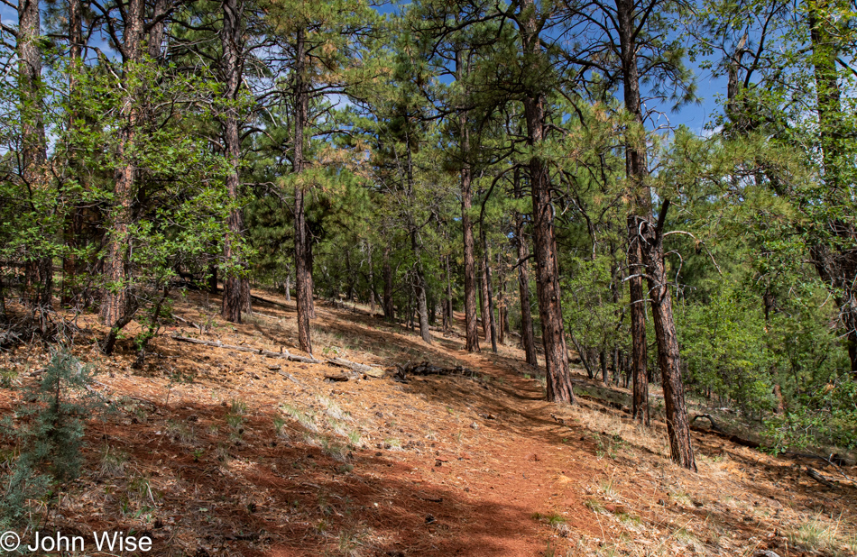
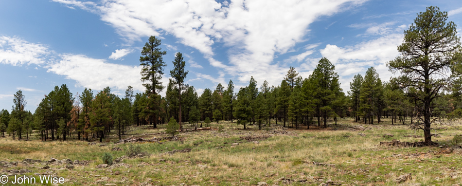
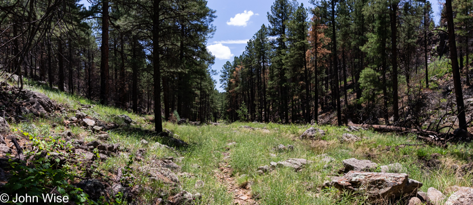
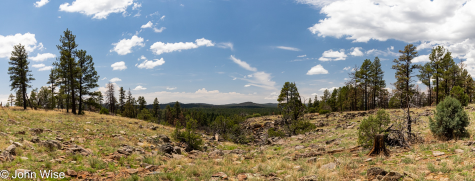
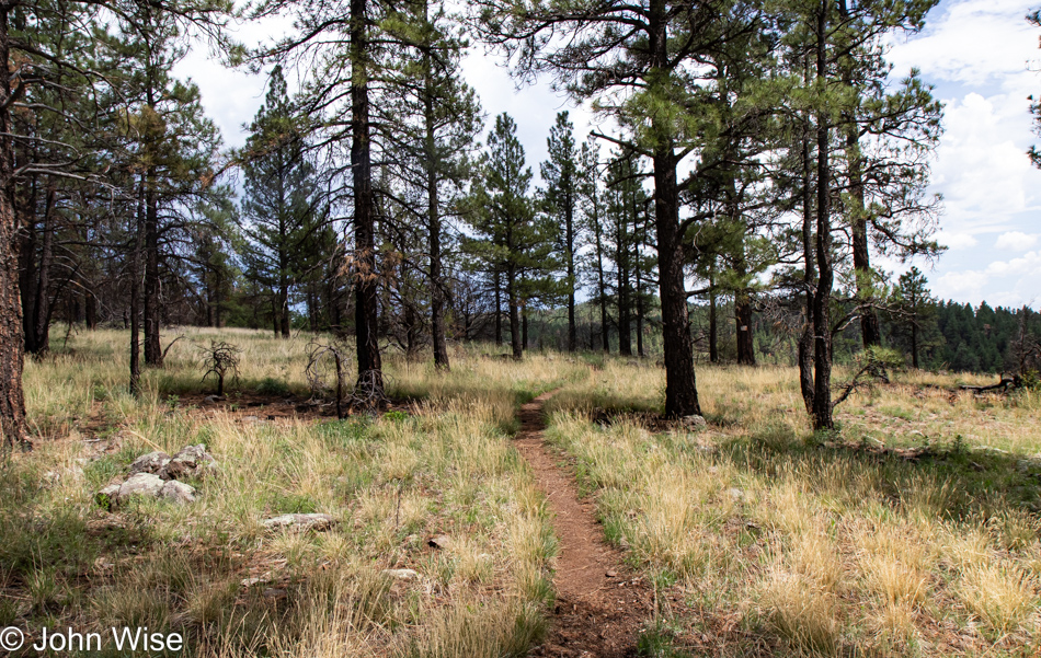
More hillside, more miles, trees, and more trees, clouds streaming by replaced by other clouds changing shape and casting different shadows. You cannot move an inch (2.54cm) without stepping into the future, into beauty, into a version of yourself you were not prior to going forward. Of course, you can choose not to be here, not there, not anywhere. Just stay at home, go to work, and fall into the routine that is set to eternal repeat and you will limit your chances of having to encounter change.
We must shed our skin to grow, a tree must fall to make space for new plants to take hold in the forest, and good and bad weather must trade places so the earth remembers that extremes occur in all things, forcing us to adapt. So why are the angriest among us so averse to change? They burned when the fires of change swept through and claimed their potential to adapt. They failed to stay ahead of the carnage of the past, believing that the way things were yesterday was perfect and, therefore, all they needed to do was hold their ground and demand that the wind stop blowing, the water stop flowing, and the fire extinguishes itself. But we all know that this isn’t reasonable, so why do we allow them to air their grievances on platforms and pedestals that in some way validate their death wishes? You didn’t move when the fires arrived, and now you must return to the earth that gave rise to your moment under the sun; it’s that or sit on the sidelines and recognize that we have ourselves to blame when our obstinance derailed our chances to move with the winds that clear the view ahead.
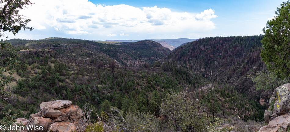
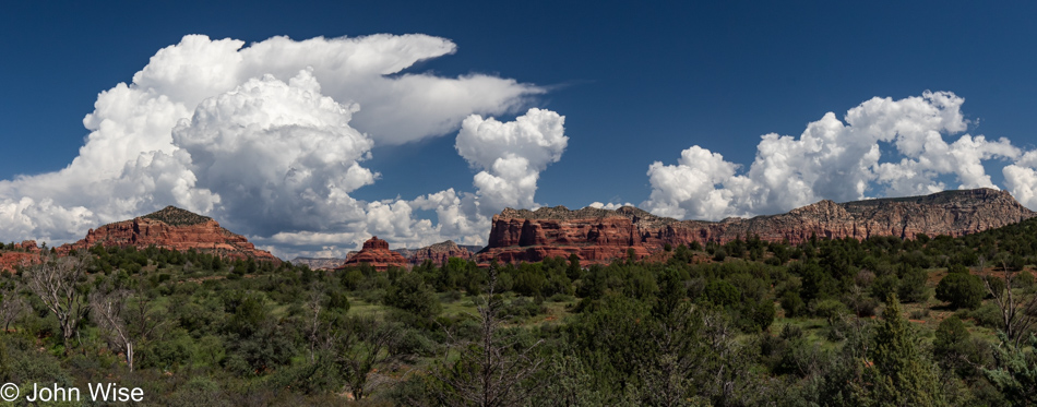
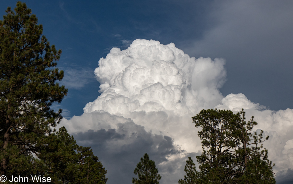
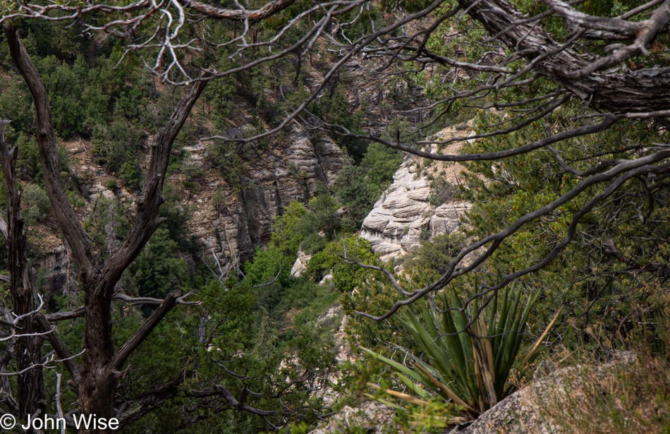
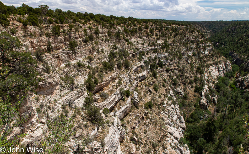
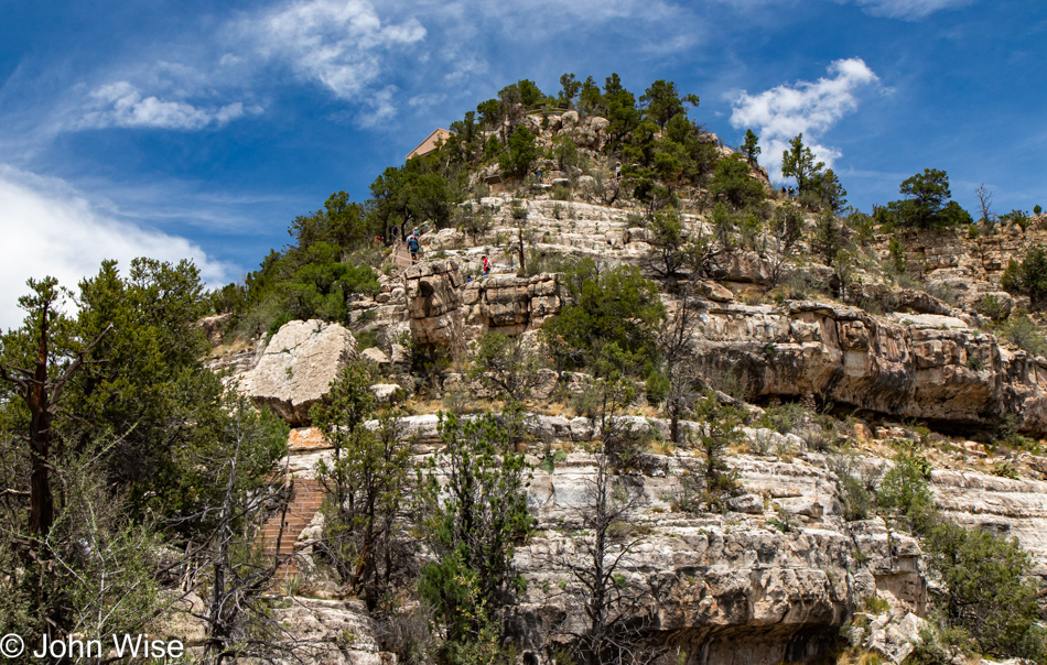
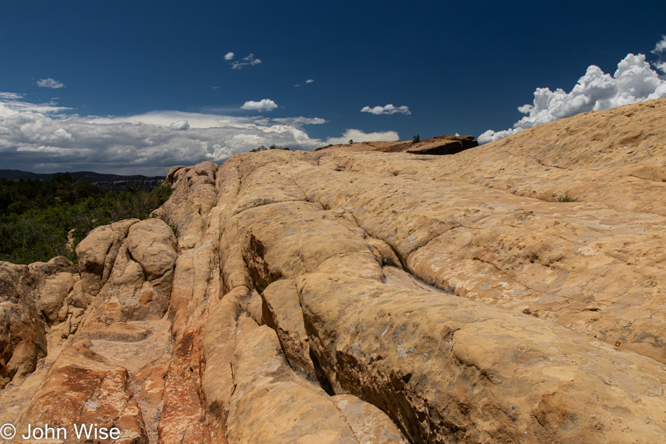
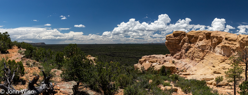
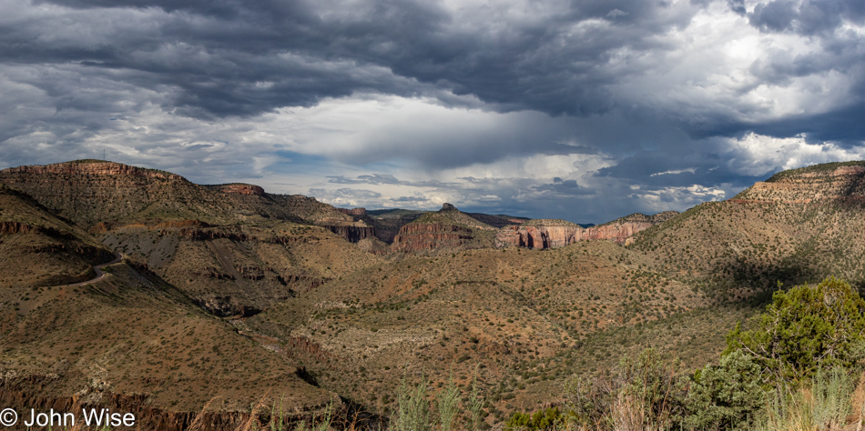
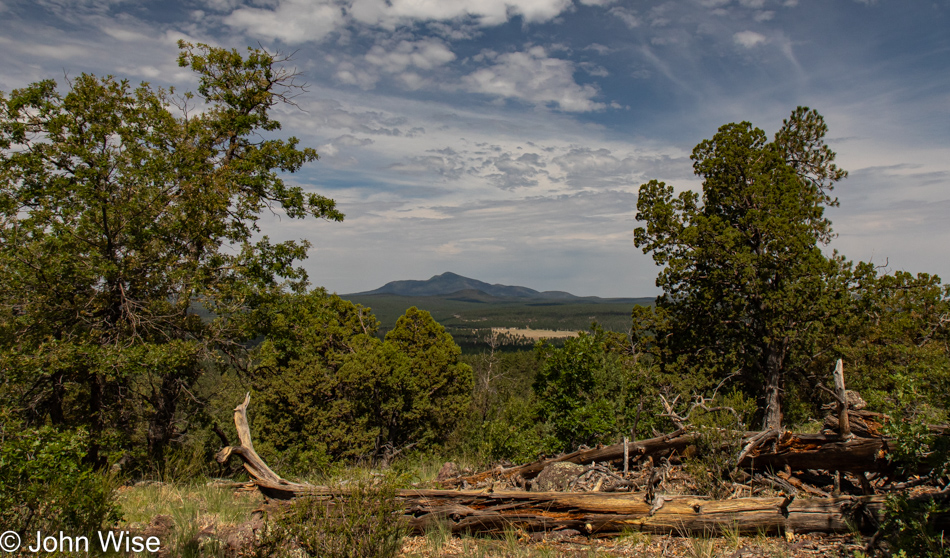
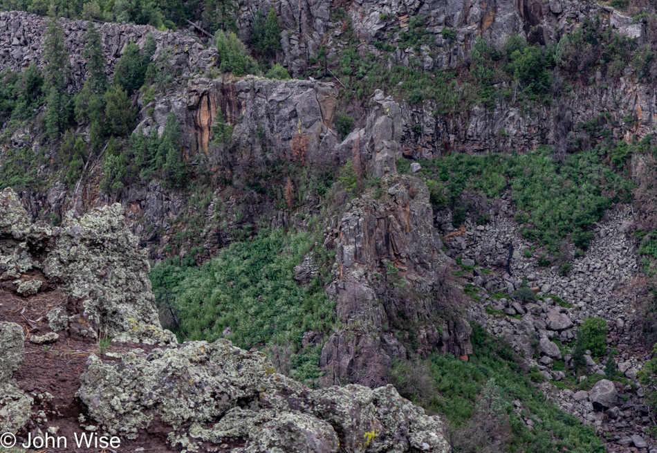
I find irony in the idea that maybe my writing is repetitious, with nearly the same thing repeated in a dozen different ways, but effectively (ineffectively?) I never really alter or add anything new to the story. As I look over the trees into the canyon with the clouds overhead, I see a scene that contains all the parts of a visual story I’ve seen time and again. I can acknowledge that the diversity in trees and clouds might have a conformity that doesn’t really differ all that much on a day-to-day basis, and yet each configuration I peer at from a vantage point to which my car or legs have brought me delights me all over again. And so when I grasp at the words that seep out of my head and into my fingers, I can quite easily see the same old 26 letters sequenced into familiar words I’ve laid down time and again, and yet I hope that the forest of their configuration and the light of the circumstances in which they are viewed will bring a special nuance only available to the reader who happens to glimpse them at a specific moment where their appearance will ripple in delight within the person standing before them.
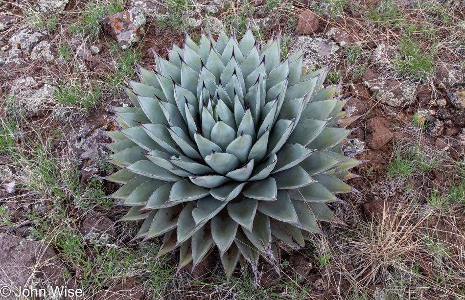
Repetition is all around us; it’s in the most beautiful flowers, it’s all over this agave, and, of course, it’s heard in our favorite pieces of music. This repetition reinforces familiarity with those things that hold special aesthetic value for us. We develop an affinity for experiencing them again and again. This is a double-edged sword because words and phrases that are loaded with poison and hate and repeated again and again until they resonate with us can find a value in their repetition that doesn’t allow the listener to escape their toxic influence. So while an agave can be found to be beautiful, there is also a dangerous element to be experienced in the needle-sharp spike, a kind of beauty and the beast plant. Joking aside, the words we play on repeat, the mantras we choose to cultivate, these phrases and ideas condition our view of the world, and thanks to those hungry to capitalize on the vulnerability of the dejected, a part of our population is given over to the violence of mind and body like this agave. They develop defensive mechanisms that ensure others stay away.
Just as I need to bring the lens up to my eye, I must find a similar magnifying device to look within the container of words called my head in search of a diversity of options to help explain what I believe I’ve taken in. You see, nobody has ever introduced me to these plants before, and if it weren’t for this curiosity to see what I’ve not seen before, I too might be caught up with the endless repeats and rhetorical bullshit that have spoonfed the adult-sized people of childish minds that grow angrier, not aware that this hostility is a reflection of their disappointment with themselves for being stuck and unaware of their predicament aside from believing the nonsense planted in their once fertile heads.
If only it were so simple to follow the path ahead to leave the woods. This is true for our adventure out in nature but certainly not valid for the person imprisoned in the cave of their own ignorance. They must first understand the darkness in which they exist and then discover a way through the forest of disbelief and uncertainty. How sad it is that so many of our fellow human beings are, in effect, trapped in biases, fears, jingoistic programming, nationalism, extremist religious dogmas, and the deafening echo chamber they’ve spent much of their lives digging deeper into.
Sure, sunlight cleanses the way forward, but are you inside or outside of your head? Are you at all desirous of seeing a way out of the morass or, like for a pig in a poke, what a thing really is is of no concern so long as your belief tells you that the thing is exactly what you know it to be?
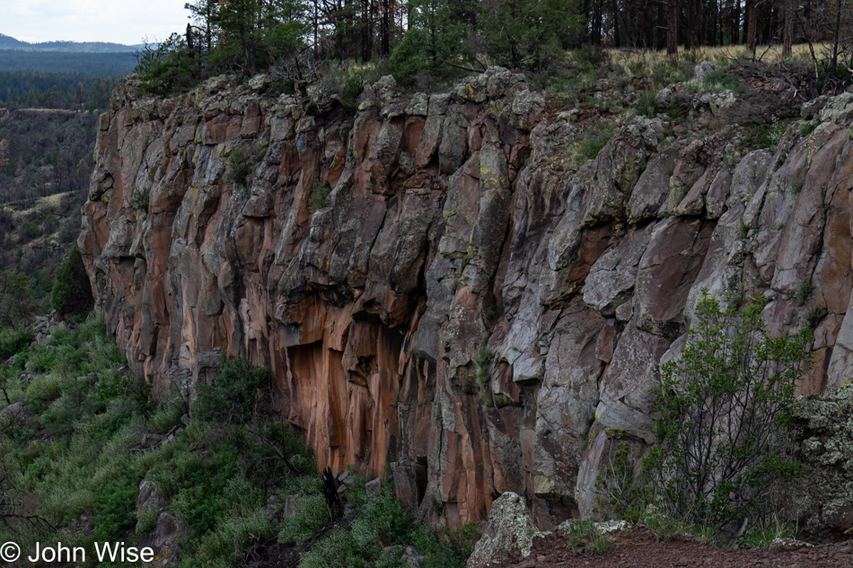
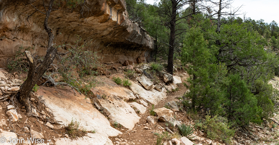
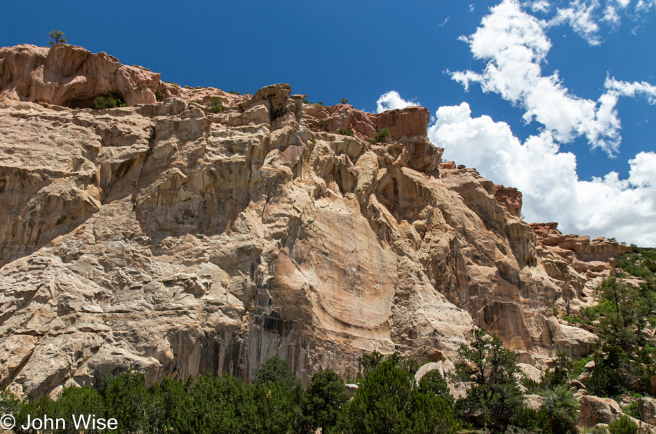
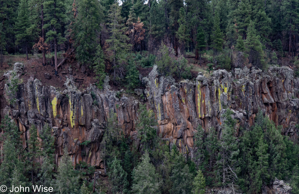
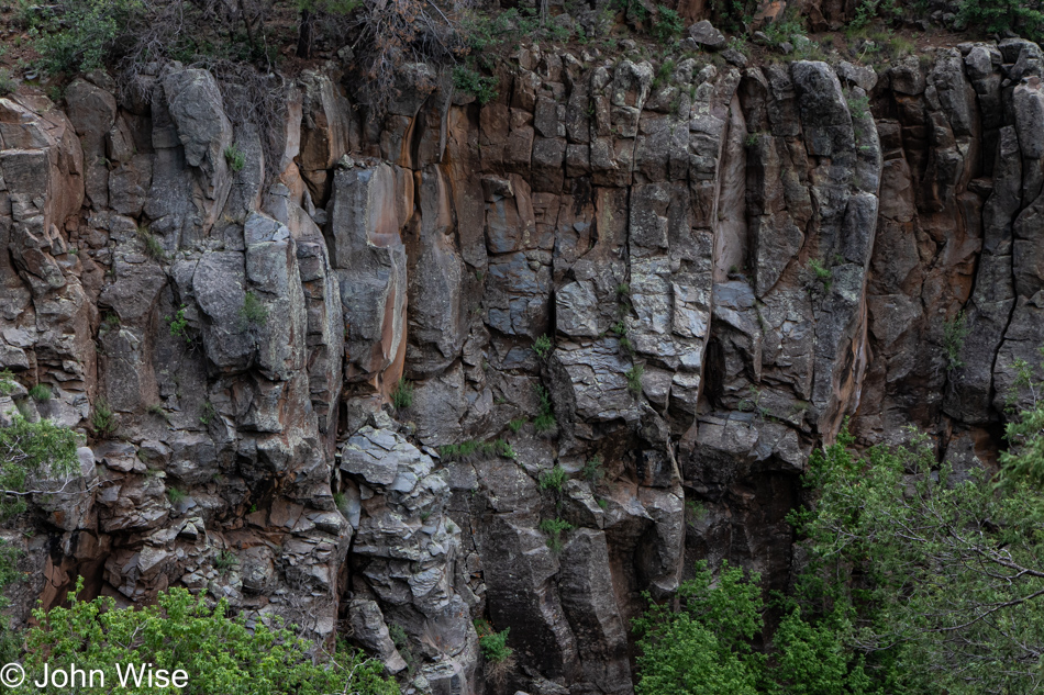
Why do I keep hammering on this subject when the eyes and ears of those I want to reach are sealed shut with minds solidified like these cliffside rocks that are impervious to me screaming at them with the hopes of watching them crumble? Because, like the perennial flower that lives in this forest, I will continue my repetitious existence of repeating myself until one day, the right person happens to be on hand to witness the most perfect bloom captured in the written word, forcing them to stop on their trail to snap a photo and take note.
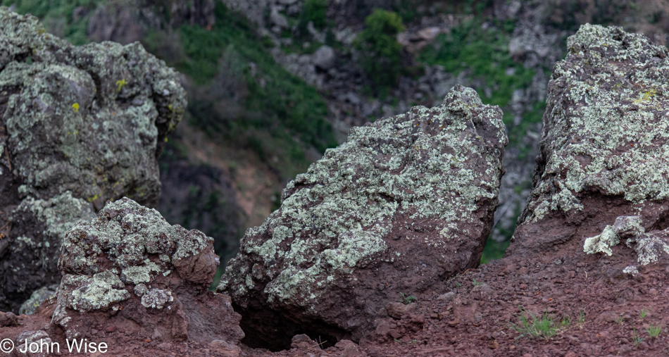
Yep, that’s me, metaphorically speaking. I’m lichen attached to the rock, leeching minerals from a host. Except in my case, my type of lichen existence is feeding on culture and history. While there is but one human species, there are between 18,000 and 1.5 million species of lichen, so while my words might often appear to be similar to others, you can trust that the hue and pattern of what you think you are seeing are never the same twice.
Now here I am, not at the end of the trail but near the end of what I want to say regarding those things I’ve shared above. The time spent on this post gathers moss, and I need to move on.
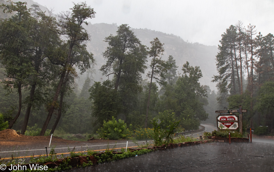
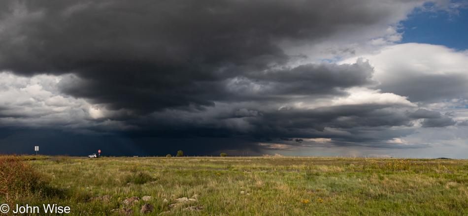
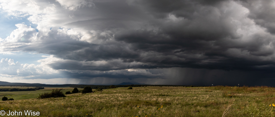
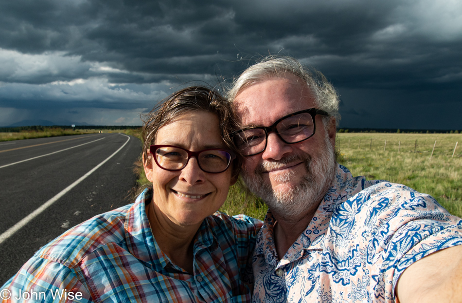
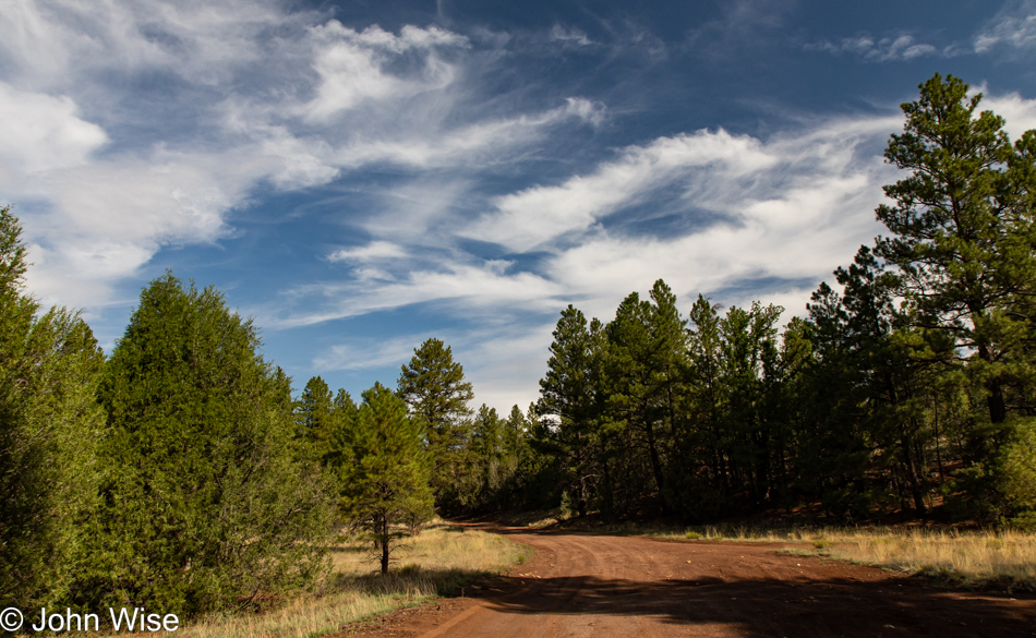
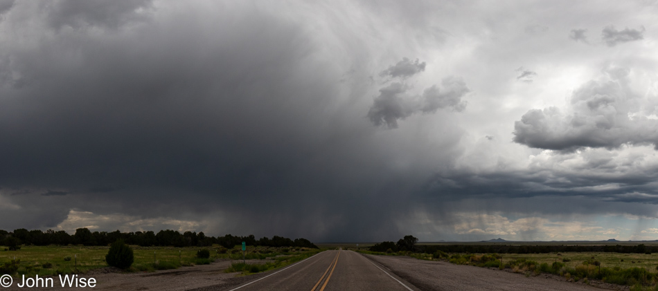
I should blame my abrupt desire to exit on the thunderstorm that was closing in on us, but that would be silly as here I am days after the events of this particular Saturday took place, and there is no impending storm on the horizon that would have me move along. But on Saturday afternoon, we were out hiking the Sycamore Canyon Rim and growing tired; our worn feet put us in overdrive, hoping to miss a downpour. It is, after all, monsoon season.
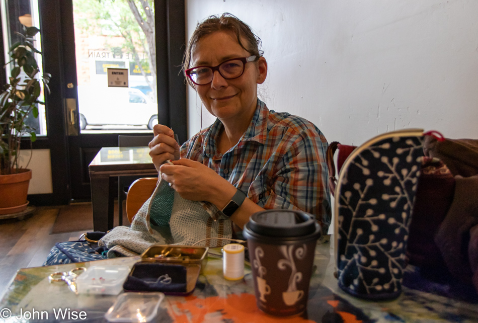
Well, if it’s so important to move along, why was there time for more photos? It’s not every day we venture out on 12-mile hikes, especially considering our advanced ages. Okay, my advanced age of mere months before my 60th birthday. Hmmm, Caroline will probably correct me with this stab at drawing drama into this post so late and remind me that it’s nine months until my 60th, which is the time required to gestate an entire tiny human being.
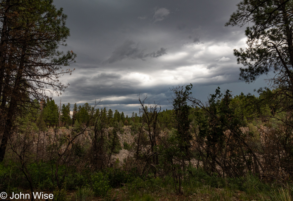
Thunder grew louder and louder as our feet moved faster and faster, and the dark clouds piled up.
Racing to the end of the trail, to the end of this post, I want to take a detour, a shortcut to something else, anything else, so maybe veering into absurdity and talking of dinosaurs or teleporting to the parking lot might be a humorous approach to being catapulted out of here? But no, that would be too ham-fisted. Oh, was this so transparent that effectively, I did just what I said I shouldn’t do, which has now opened the opportunity to jump to the next image?
Poor weather actually turned part of this hike into a blessing in that the threat of being drenched had us moving faster than we would have otherwise, while the cloud cover shielded us from the worst part of the afternoon sun. Then again, the impact of a bright sun within a canyon allows for a greater appreciation of the details that are muted in the shadows, hence the need to pick out nearby perspectives that allow for a different focus on things that are near instead of broad views that seem to carry more impact.
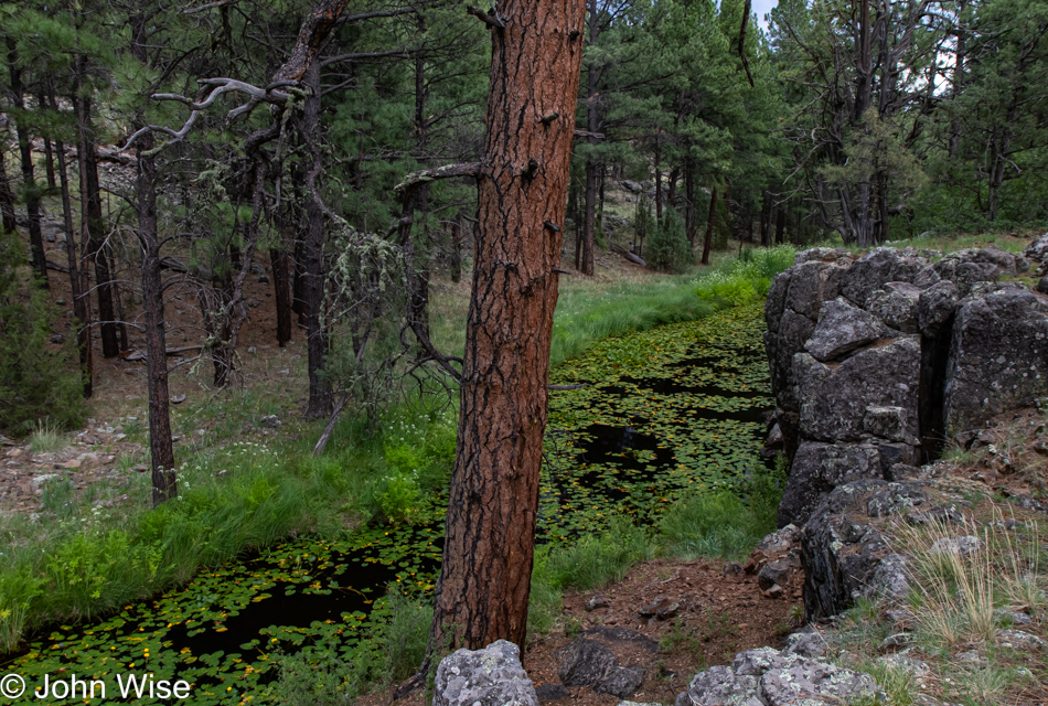
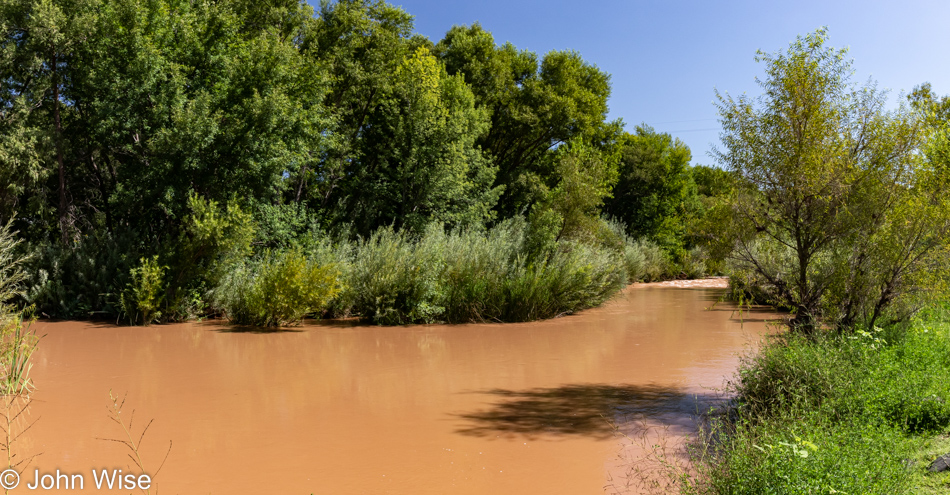
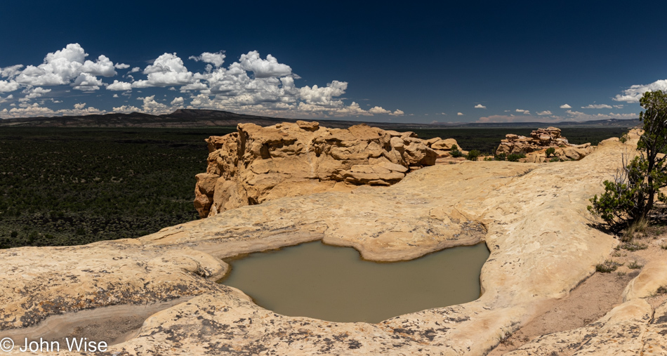
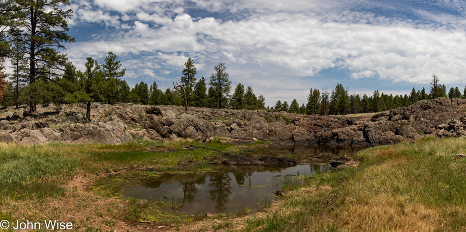
We already felt our first raindrops when we reached the lily ponds along this part of the loop trail, and so, without fanfare, I snapped off a half-assed view with a tree in the middle of it because, in my rushing mind, some lily pond was better than none.
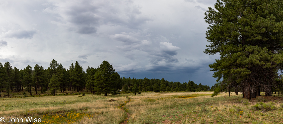
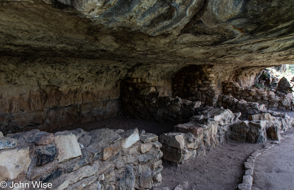
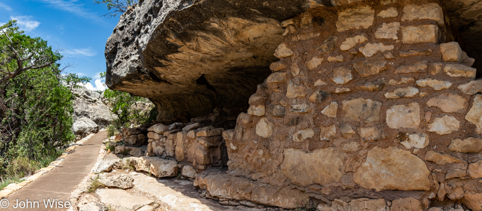
A strange thing happened on the way to the meadow; we were quickly approaching the ruins of an old wood mill when the rain started coming down hard. I shoved my camera into a plastic bag (the only “rain gear” we had brought along), buried my chin into my chest, adjusted my hat, and got ready to be drenched less than a mile to the car. So I blurted out a loud request for the rain to please wait and ask Caroline about this; it stopped raining! [It did indeed ^_^]
Over 26,000 steps were had, not on an easy nor a hard trail, but a moderately difficult trail up here at 7,000 feet above the sea and now we can sit down for the first time since we started this hike at 9:30 this morning.
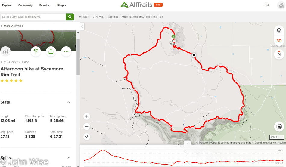
As you can see from the map and stats from AllTrails, we averaged 27 minutes per mile, had over 2,300 feet (700 meters) of elevation change, and took a total of 6.5 hours to complete our hike. FYI, this is our favorite new app.
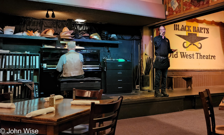
Getting over to Flagstaff was easy enough, even with a 30-minute construction delay, but getting out of the car to walk a short distance to the entry of Black Barts Steakhouse was an incredible chore. Not so much due to the rain that was coming down relatively hard now, but our legs had seized up and didn’t seem to want to carry us further. For those of you who know of my food snobbery and might know of this restaurant, do not ask why; it’s one of those institutions that have been up here forever and, as a poor testament to the people I’ve known over the years, came highly recommended. Well, I’ve obviously known more fools than gourmets, as the price/quality ratio was way out of whack. Then again, the better-than-karaoke quality of the servers serenading us diners was right on. The peculiar exclamation point on the day only made everything better, and for those of you who might have a low opinion of our dining choice, and rightfully so, you should have seen our room at the Rodeway Inn back in Williams; it too cannot be recommended. No matter the groaning that goes along with some of our decisions, this was just a terrifically wonderful day that no other July 23rd, 2022, will ever be able to compare to.