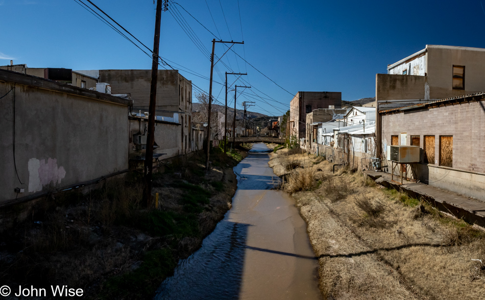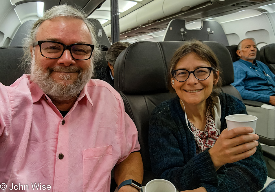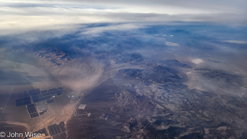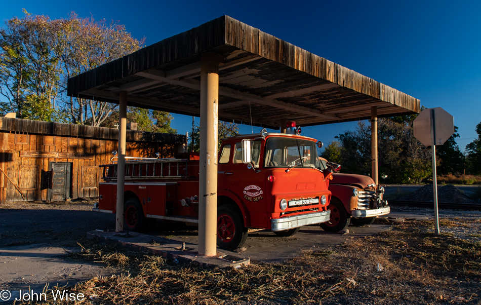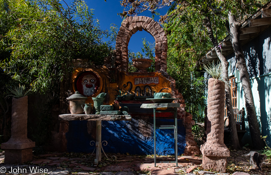
I suppose today is as good a day as any to crack open this new 100 Years of Oregon State Parks notebook (sitting on the table on the right) to jot down a thing or two about our brief two-ish-day out-and-back trip to the Tucson area. The main draw of this excursion is happening later today down in Benson, but we don’t have to be there until 4:30, so we are moving slowly. Slow to breakfast, slow to coffee, and slow to get out of Phoenix.
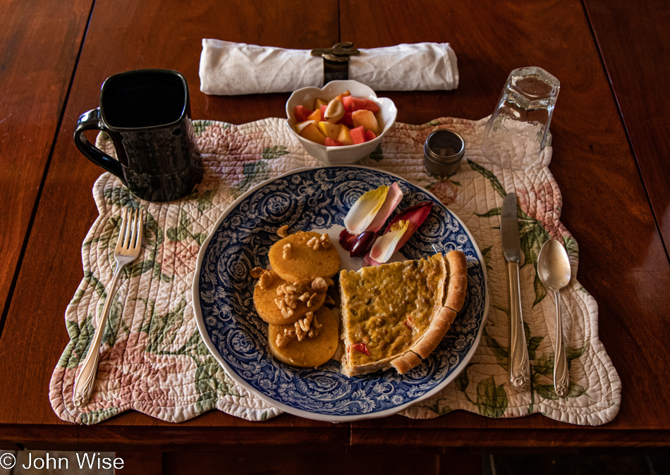
Because future-me might want to know: we had breakfast at Country Boys, a joint at the edge of the Square (a poor high-crime neighborhood of Phoenix) on the same corner as Food City (a discount grocer aimed at the Hispanic community). Caroline had her usual spinach scramble with home fries and a single slice of wheat toast while I went with my predictable pork chops, eggs over medium, hash browns, and English muffin. For jelly, we both agree that mixed fruit is best. Caroline doesn’t mind the hot drink they call coffee; I’d rather stick to water and wait until we have coffee elsewhere, such as we’re doing right now.
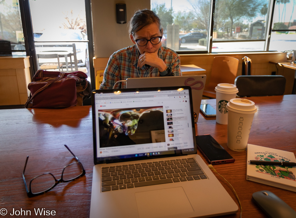
Stopping here at Starbucks was a compromise because nearby Serafina Coffee was just too busy. I hadn’t intended to handwrite anything here, but I thought it would be a good start to our trip, and then once down south, I’d continue with pen and paper. As it turned out, I never returned to what had been a pristine notebook. With my earbuds fit in snuggly to block whatever it is that Starbucks thinks we all want to listen to, I turned on Röyksopp’s latest, Profound Mysteries III, and got to work filling in details for an old series of blog posts from 2006. This particular 7-day journey to the Panhandle of Texas had been taken over the long 4th-of-July holiday and had only included 1 photo and about 200-350 words per day; such was the bandwidth limitations of those days.
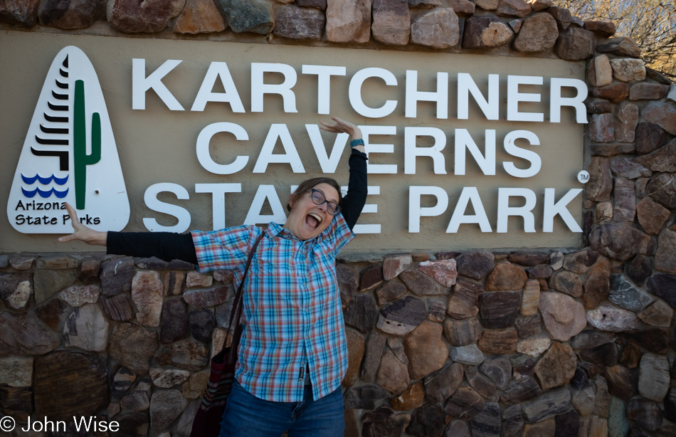
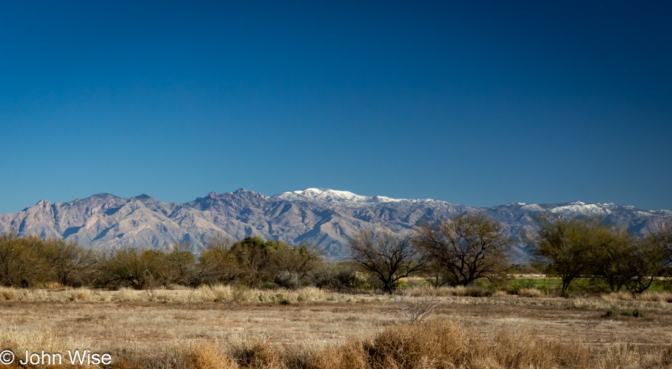
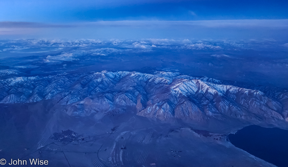
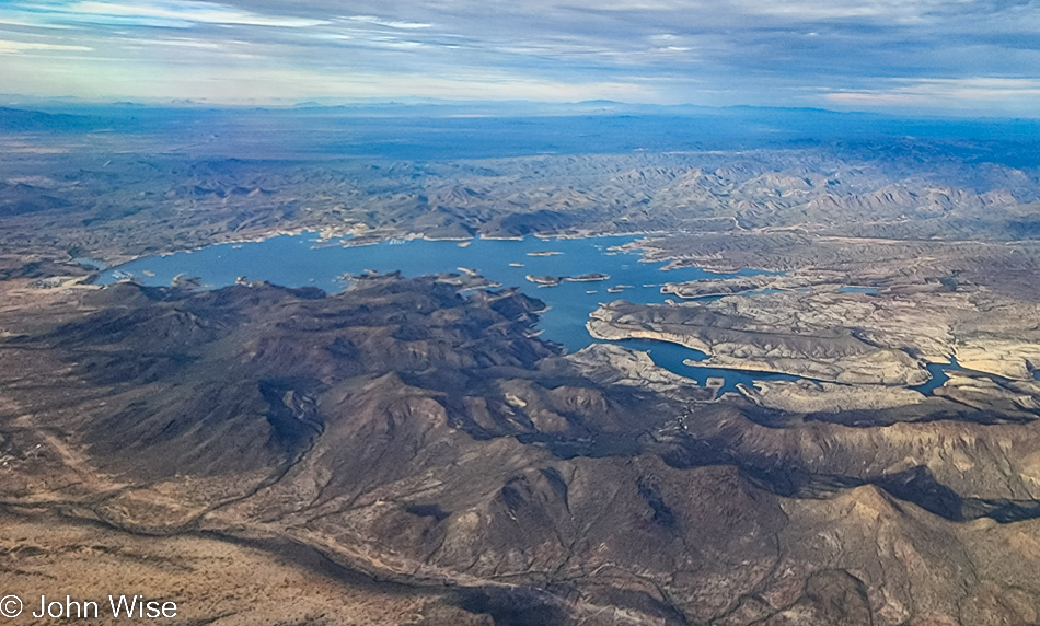
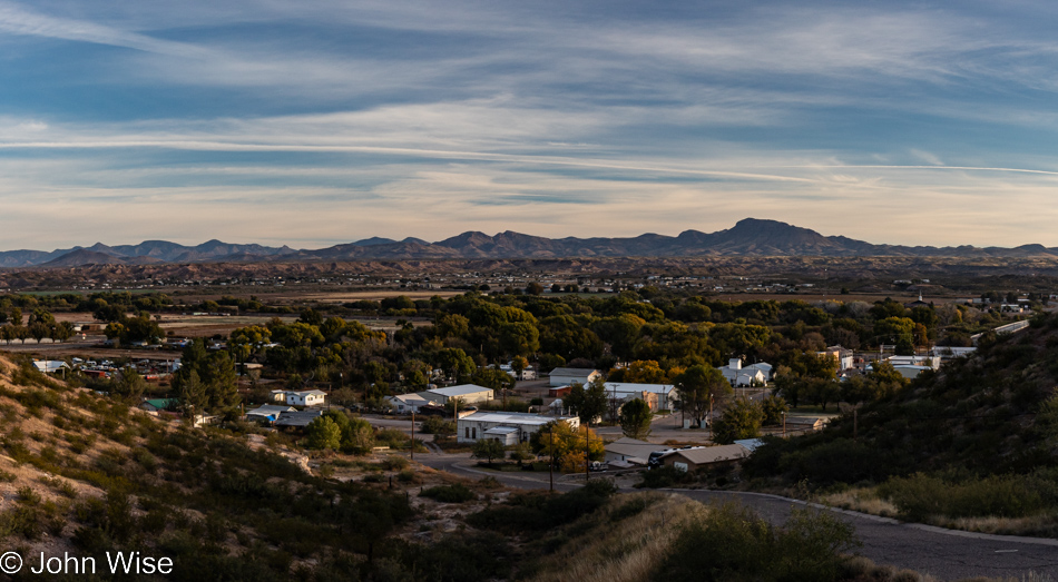
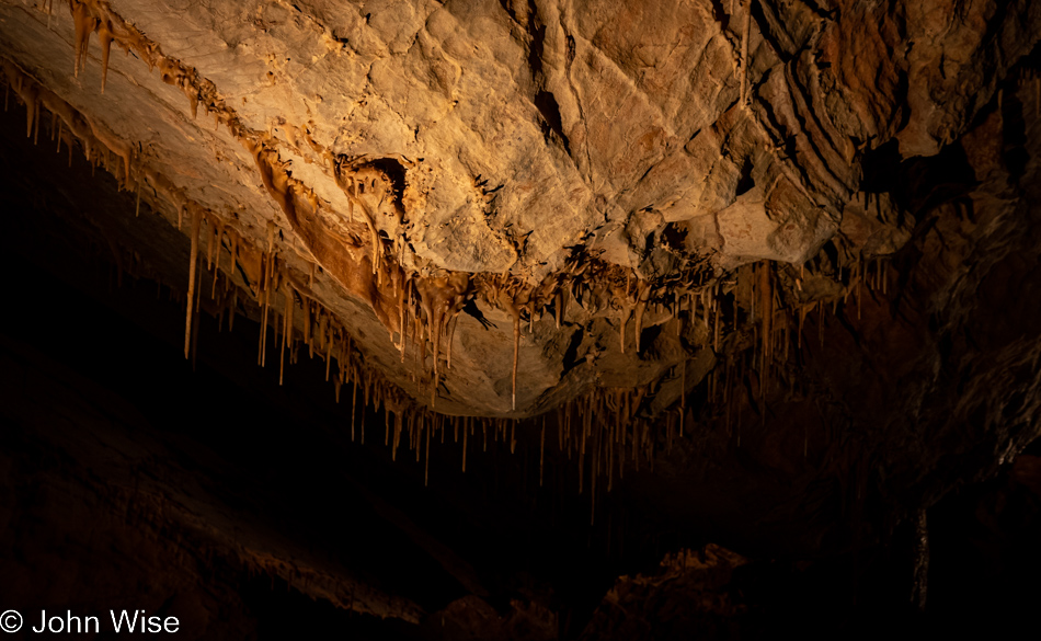
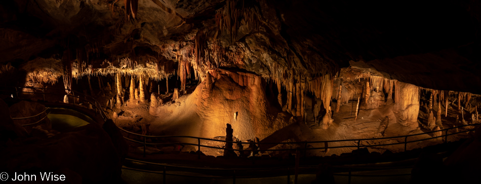
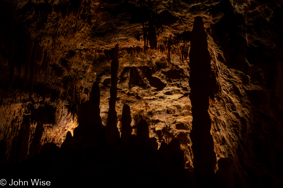
We made the 180 miles south with time to spare before Kartchner Caverns State Park closed. Yep, you read that right, the park closes at 4:30 which coincides with the beginning time of our tour. We last visited Kartchner back in 2012 with Jutta in tow, and while we loved the cavern, we were greatly disappointed that photos weren’t allowed. For someone who has captured so much of our lives through these images and writings, it was a letdown. That’s being rectified this afternoon, and hopefully, Caroline’s enthusiasm will help me capture a few images worthy of sharing.
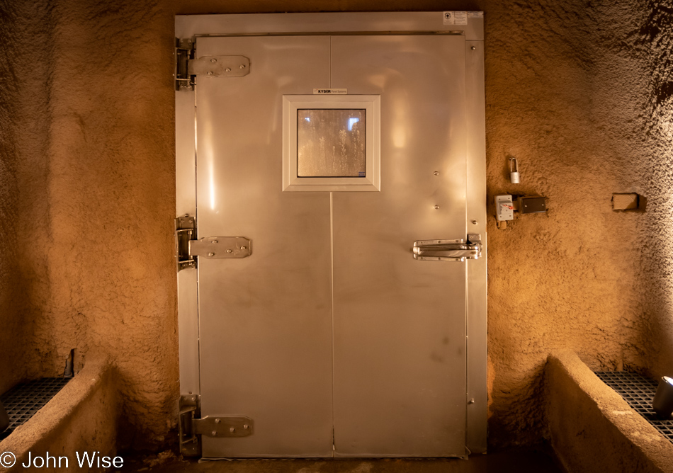
Beyond this door is another door; the two of them, in tandem, create a barrier between the outside world and the humid cavern we are here to experience. This honor to be allowed to photograph what lies in the dark beyond is only given on the third Saturday of the month, beginning at 4:30 and ending at 7:00. For $125 a person, the lights will come up, and we’ll have a solid two hours in the Big Room to photograph what we can.
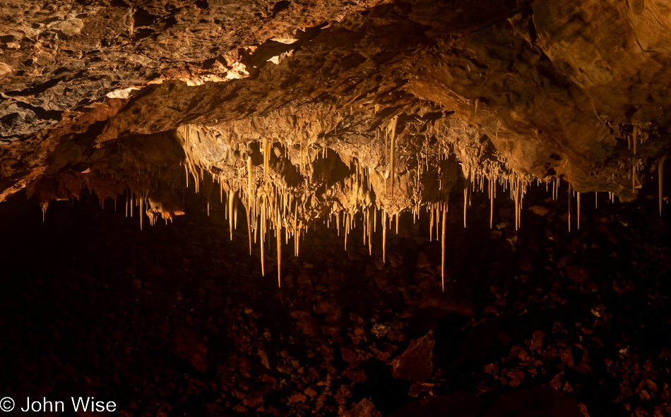
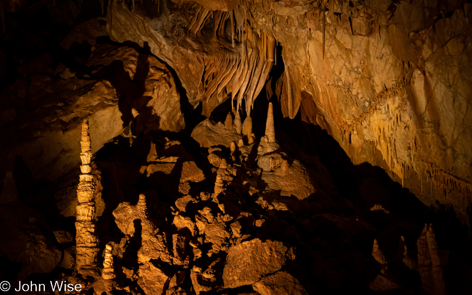
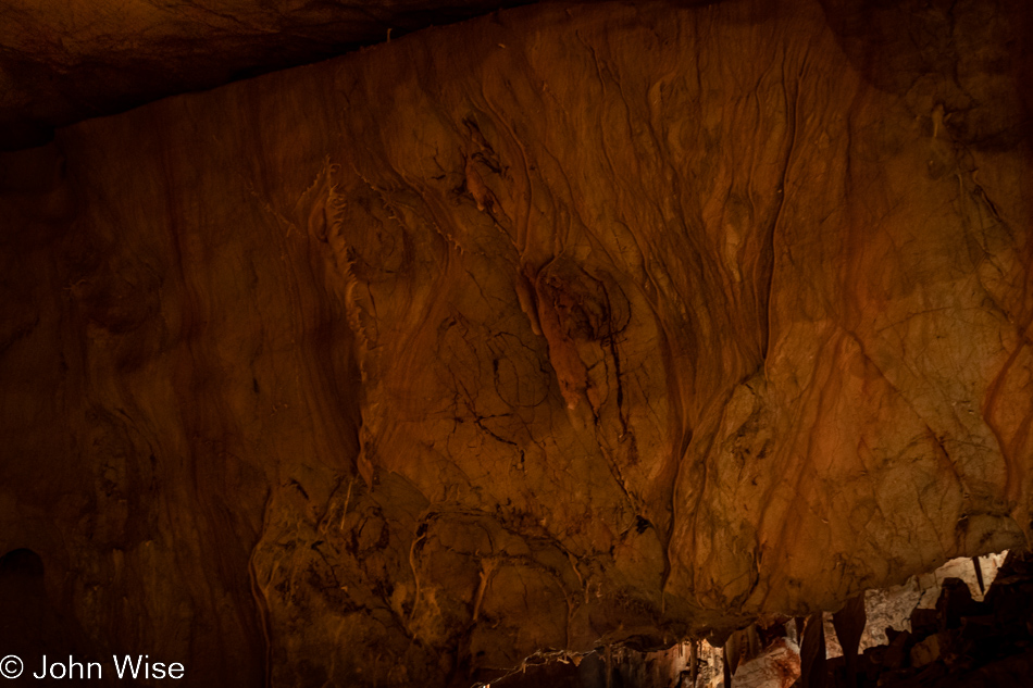
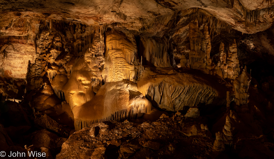
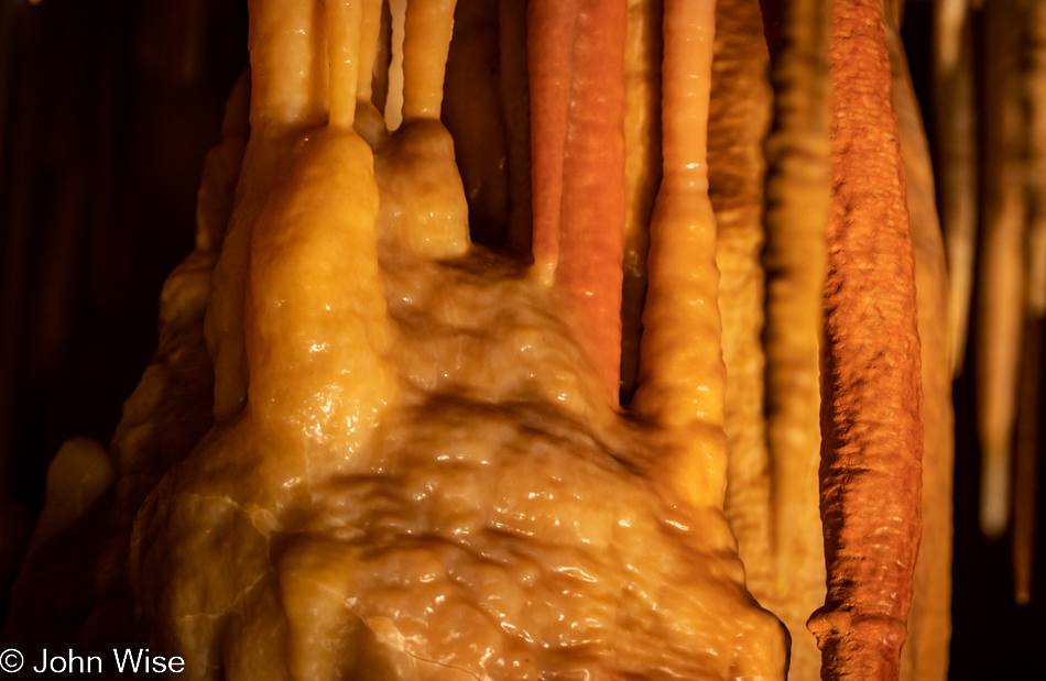
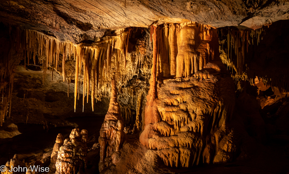
The photo shoot starts on a bitter and difficult note; our cameras have fogged over due to the incredible 99% humidity and heat (70F/21C) in the cavern. My tripod is condensing water to the point that it is dripping, and before I get out of this cavern, every bit of my clothing will be wet. The exertion required to be still while shooting, focusing my gaze on the hunt for something that speaks to me, and then jockeying for position on the relatively narrow walkway had this feeling like a workout. When we were done, I had over 200 active minutes on my Fitbit, and my rib cage felt like I’d been boxing. It took my camera lenses about 15 minutes to acclimatize, though I was still frantically wiping away moisture for another 15 minutes. As for me, I never acclimatized. But enough of that, on to the images. This first one took an incredible amount of work to make presentable, meaning that I made a lot of adjustments in Adobe Lightroom to eliminate the bloom and slight out-of-focusness that came with foggy equipment. It also took time for my nerves to find calm as I had to overcome some panic because we were spending a considerable amount of money to be here for this rare opportunity.
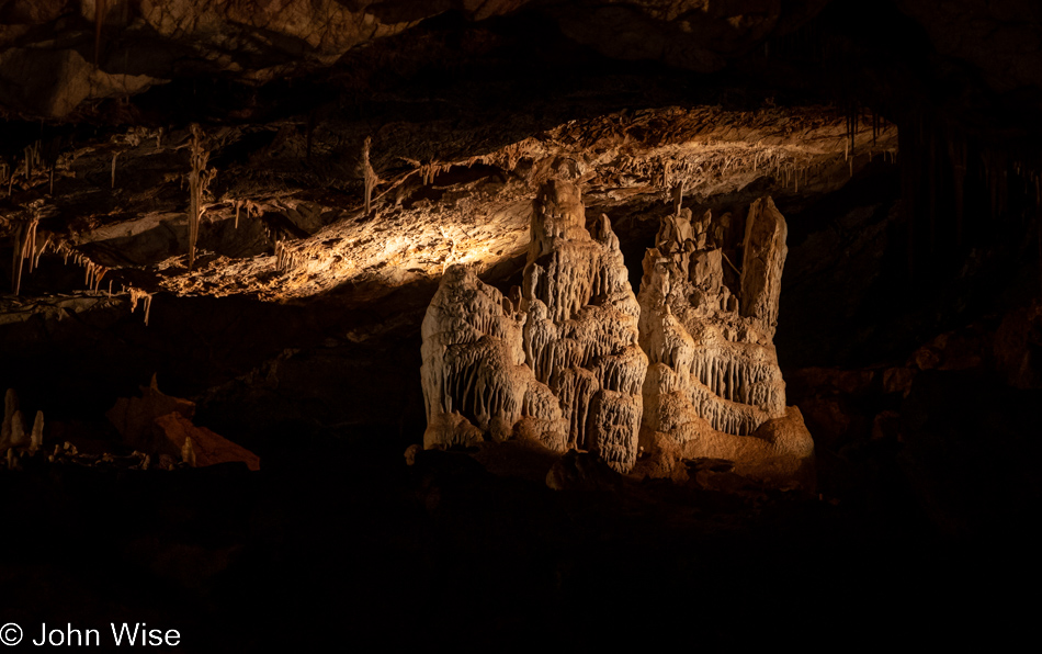
Three lenses, a tripod, and a remote control to minimize camera shake had come in with me, but it soon became evident that I wouldn’t have enough time to capture a fraction of what I was seeing if I took the proper time to set up each shot. So I decided to throw any attempt at professionalism out the cavern door and get busy practicing the kind of recklessness that meant I might be lucky to capture, but a few usable images as the depth of field, focus, and amount of light captured could all suffer. I kept the camera attached to the tripod so I’d have at least one of its legs on the ground to help stabilize the camera, but I knew this was risky. The more I tried to grab a moment of remaining still, the heavier I was breathing in this hot and damp environment, which lent to the sense of getting a solid workout. In retrospect, I should have gone slower and focused on a small number of areas in an effort to take half a dozen perfect images instead of what I’ve ended up with over 600 photos shot and nearly 70 images under consideration for inclusion with this post.
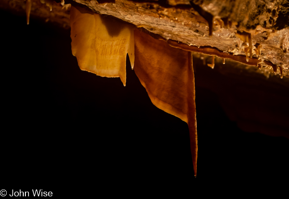
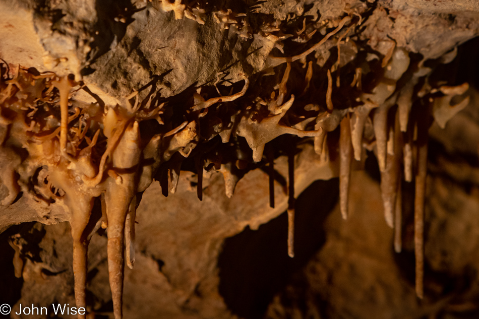
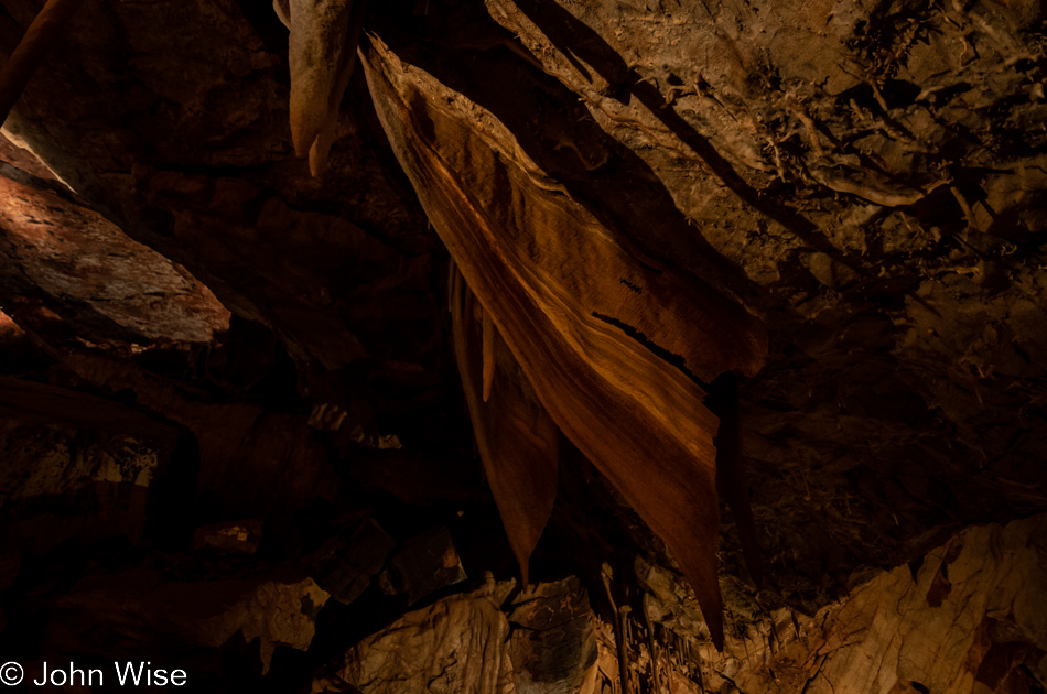
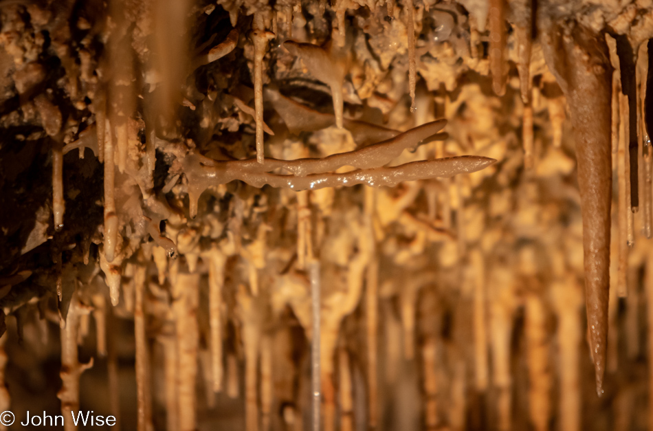
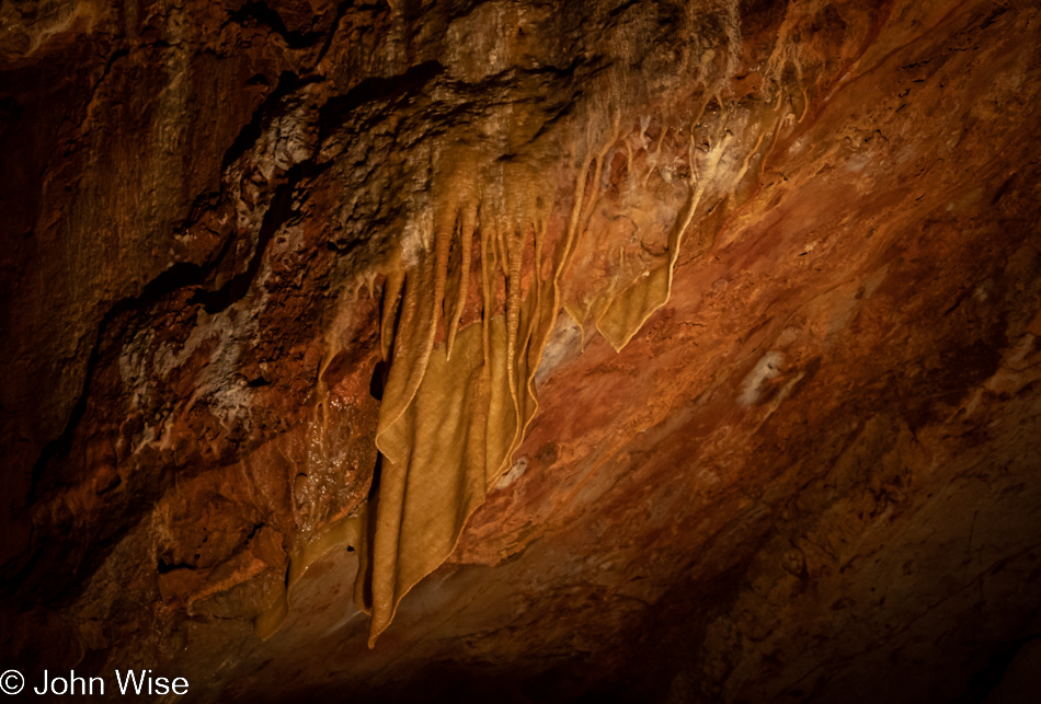
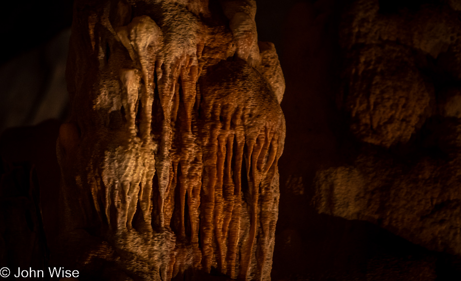
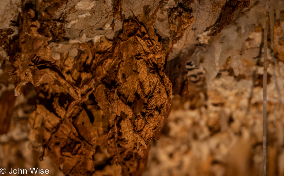
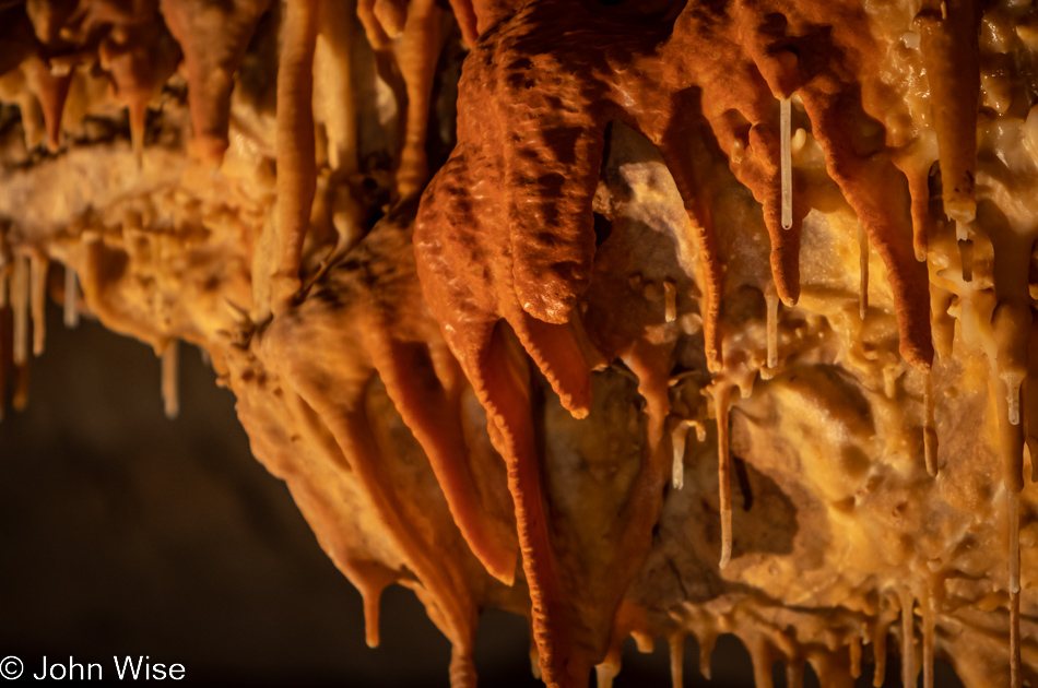
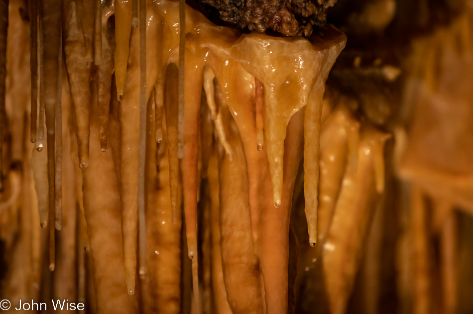
The trick to choosing what will be included comes down to what I end up writing about. If I find something to say, the text will belong to that image, and so it stays. Regarding what looks like a slice of bacon someone attached to this rock ledge, this is cave bacon (the actual term) that forms as water flows over a sloped surface. Caroline and I have also been so fortunate to see ice bacon in Yellowstone. I should point out that, as far I understand things, caves actually do not have any speleothems. Underground formations are the distinguishing feature of caverns. Should cave bacon be called cavern bacon instead?
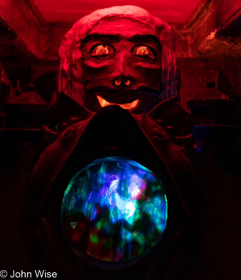
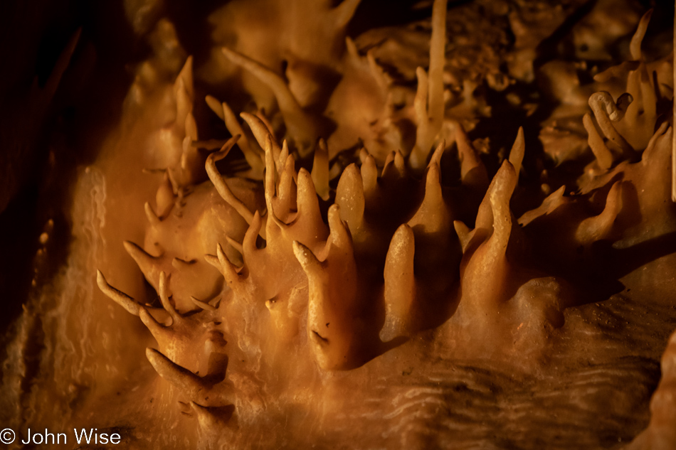
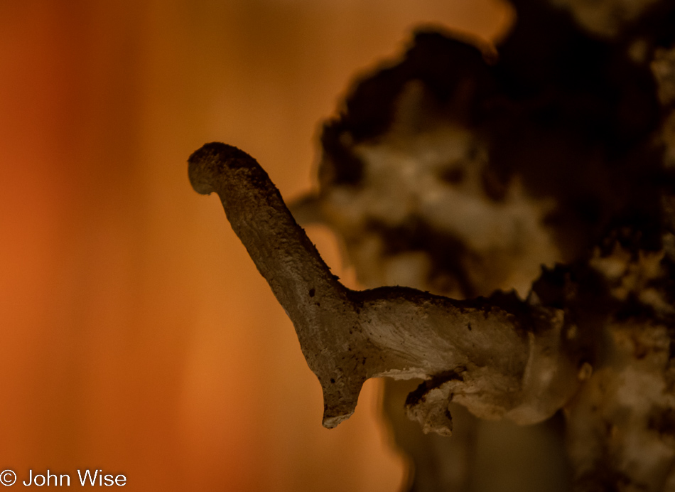
Like the gaping maw of an alien beast, albeit one that is missing the majority of its teeth aside from these few remaining nubs, it opens wide, salivating at the thought of taking one of us as a snack. Alas, it is frozen in time, possibly due to witnessing Medusa.
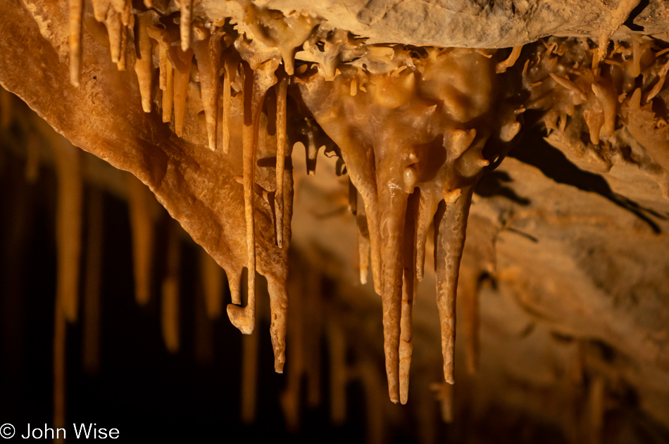
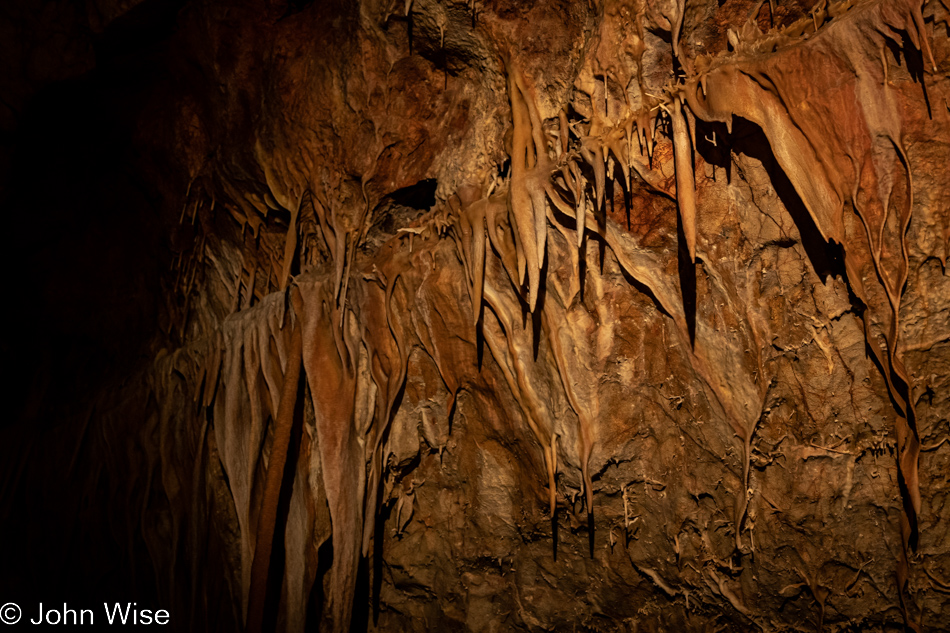
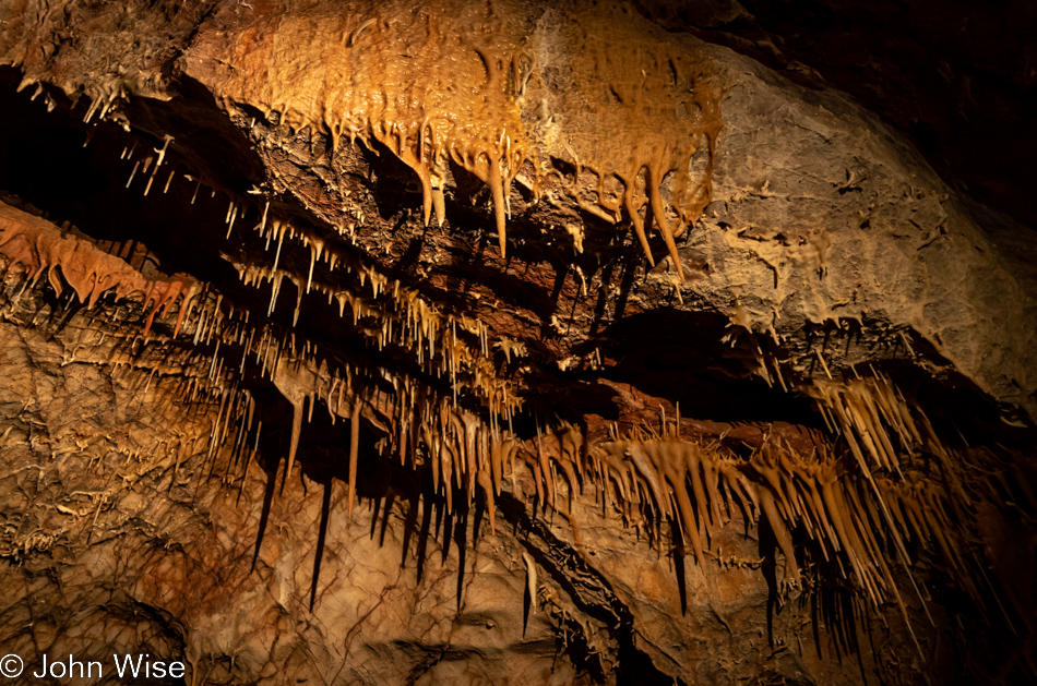
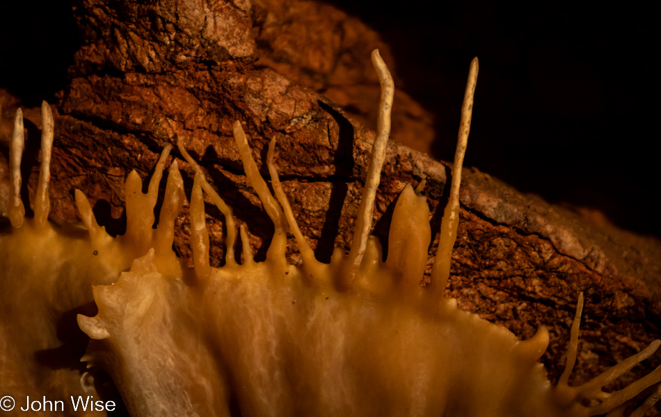
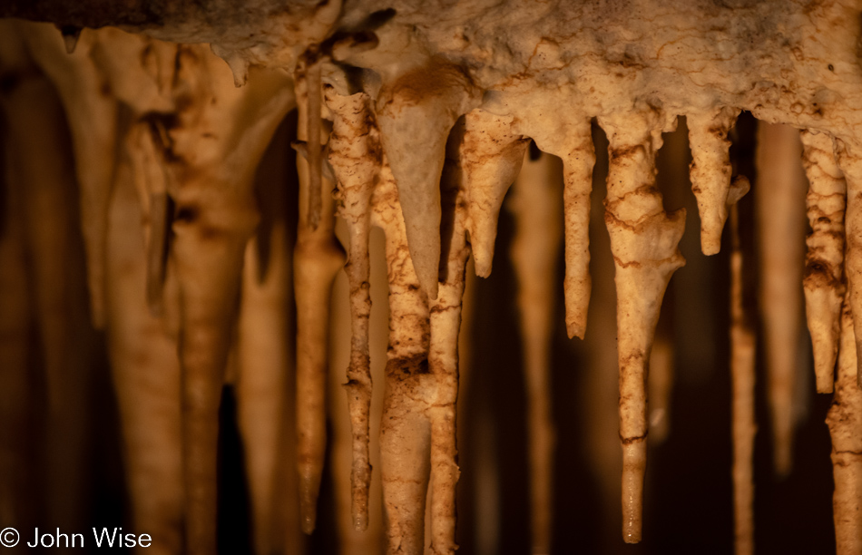
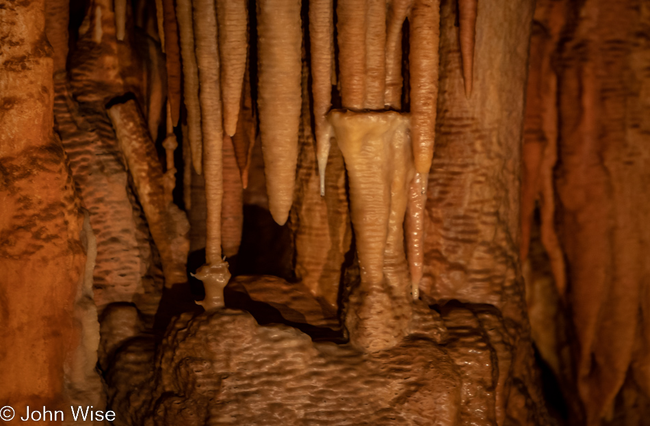
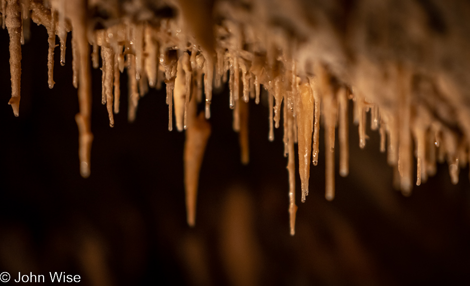
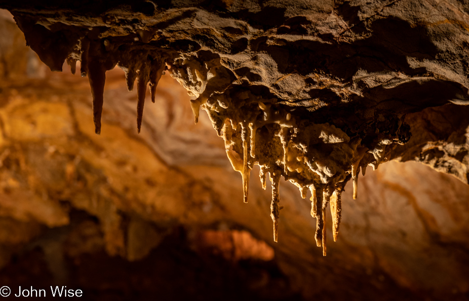
Not all soda straws are equal. Take these tubular stalactites: they are rather short examples of soda straws that never got very far, especially compared to the 21-foot straw found in the Throne Room (also here at Kartchner Cavern State Park). We won’t be visiting that cavern during this trip to Benson, but we are already booked for a photography tour in August that is supposed to get us into the Rotunda/Throne Rooms. By the way, I’m no cavern expert. These may also be the beginnings of stalactites and, therefore, not soda straws at all. Somewhere, sometime along life’s journey, I might gain certainty about what is what.
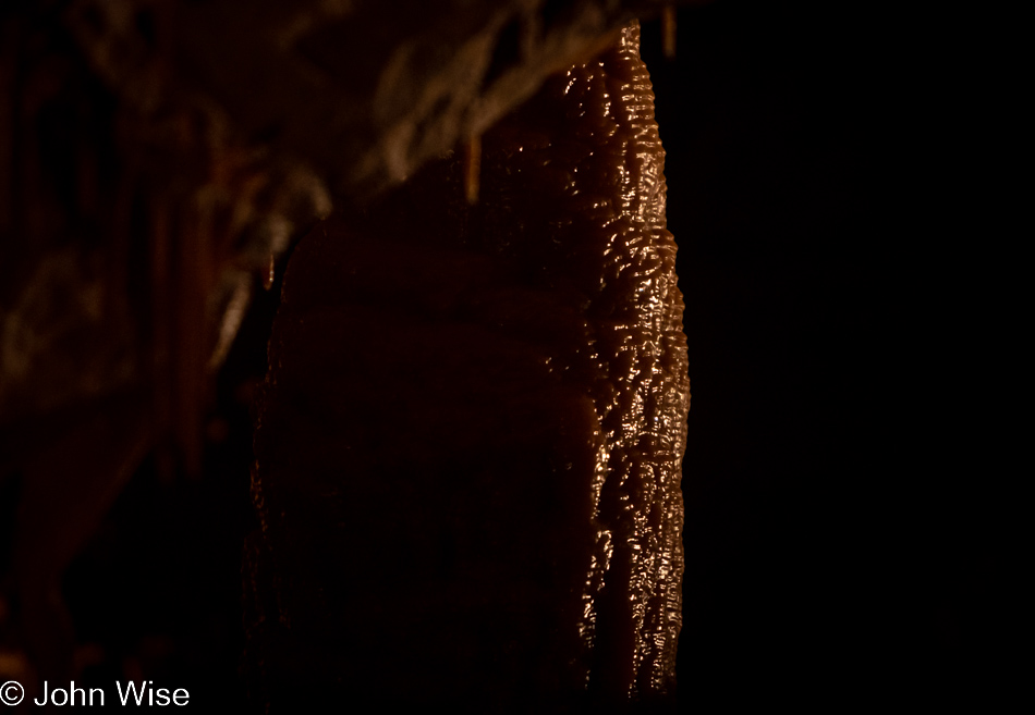
On our way into the cavern, the ranger guiding us pointed out some water pooling on the ground, which is a rarity unless it’s been raining recently, which it has been. This glistening column poking out of the shadows is obviously not an example of that, but it did have me thinking of the water, the 99% humidity, the couple of people who had water drip on them (a cave kiss), and the sound of water drops that occur out of sight but not out of earshot.
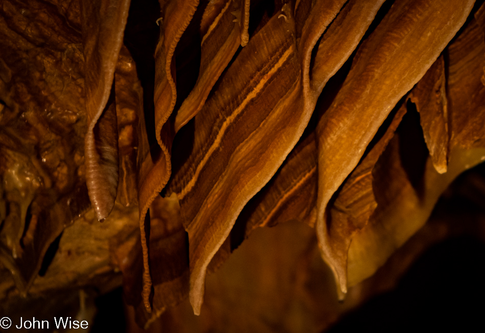
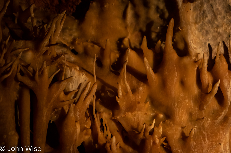
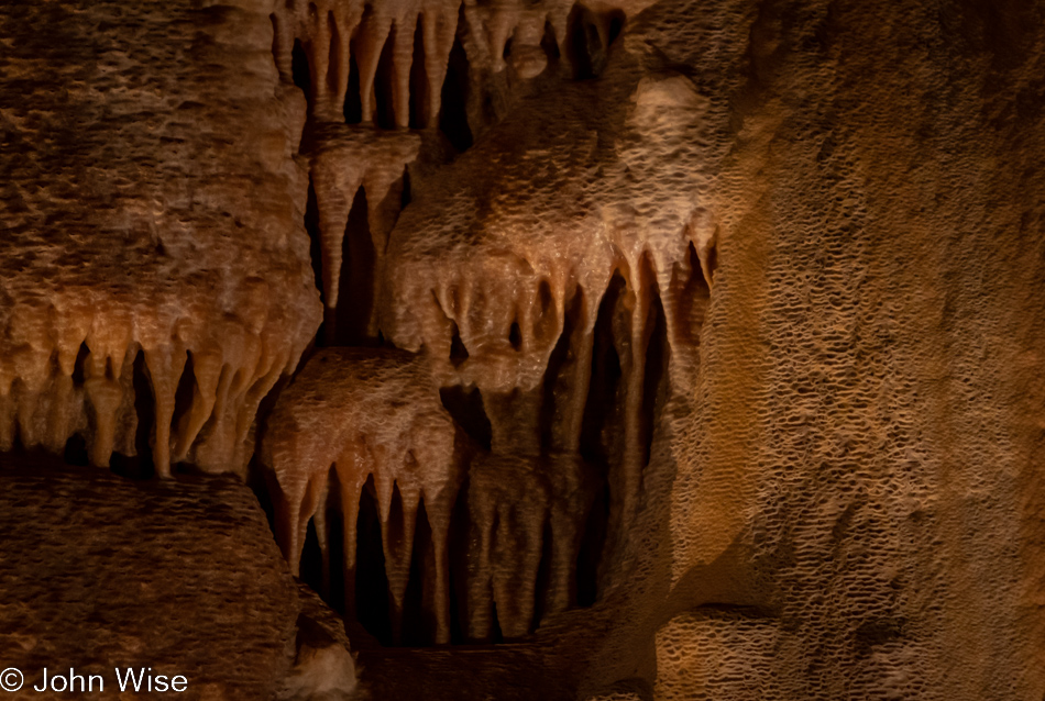
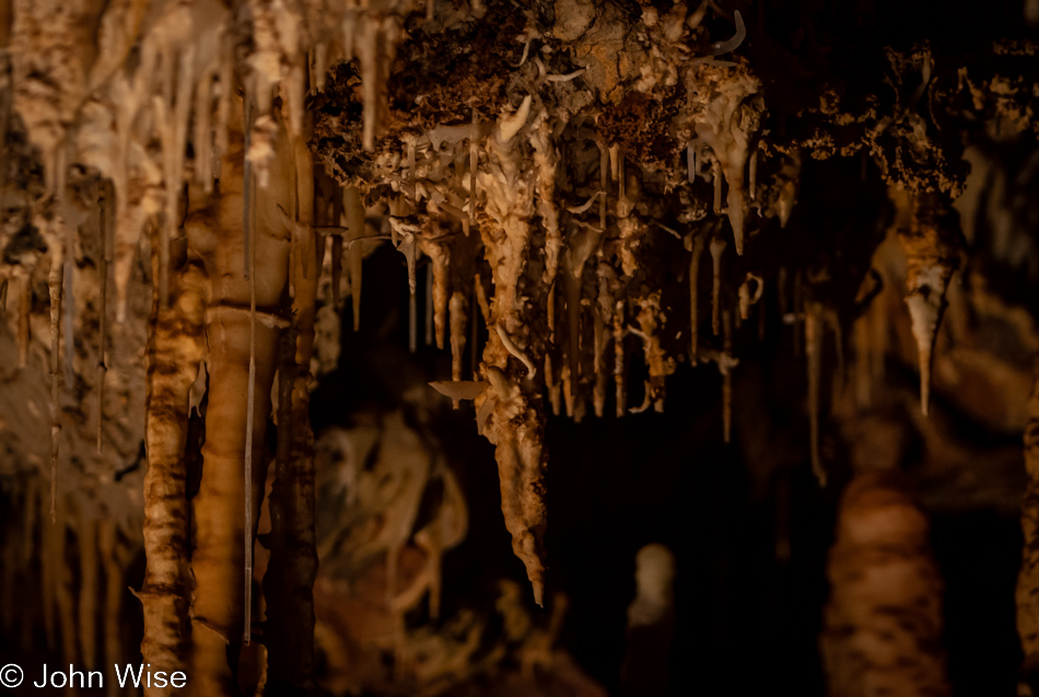
What don’t you see when you see it because there’s no reference or your current knowledge doesn’t allow you to recognize the unique characteristics of a possibly striking anomaly? There are things growing here that appear to defy gravity, considering that it is dripping water that forms so much of what we are here to see for ourselves. I feel that some of these shapes look like thorns or maybe worms, but they are, in fact, helictites. Helictites belong to the family of speleothems, which is the overall term for the various cavern formations that are created by mineral deposits. So, if you know what stalagmites and stalactites are, you already have a rough idea of what speleothems are, but what you may not know is just how many types of them exist. This photo is a closeup of a very small section of the image below.
When I’m in a cavern, my senses are overwhelmed by the gravity and extraordinary nature of everything around me. The smell, sound, light or lack of it, humidity, temperature, formations, and the scale of things are a lot to take in. Scanning the space and trying to look further requires every bit of attention one can muster, and still, you will never see everything. This is compounded by all that you know you will never see. There is no x-ray vision that allows you to witness groundwater seeping through cracks, the naked eye cannot perceive the minerals in drops of water, and even if we were to visit a living cavern yearly, we’d see nary a fraction of growth over the course of a lifetime. And then there’s the proverbial 800-pound gorilla in the room we absolutely fail to see when in such environments.
That giant invisible beast is the limestone that dissolved over time and formed the cavern in the first place. Then, rocks fell and changed the character of these evolving underground chambers. With the surrounding earth still full of minerals, they continue to be leached by the flow of water and slowly, over time, drip into these rooms and form these striking features. Still, you must stop and consider just what has been said here: the limestone dissolved, meaning that a sea with its corals and seashells was once here on this underground land. Obviously, it is long gone, and so are most signs of its presence. It’s as if you are seeing shadows of a distant past displayed, and now you have to find space in your perception to add this detail while simultaneously being overwhelmed by a universe with which you may not be all that familiar.
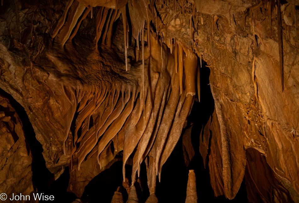
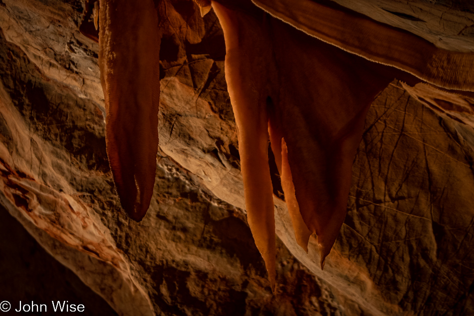
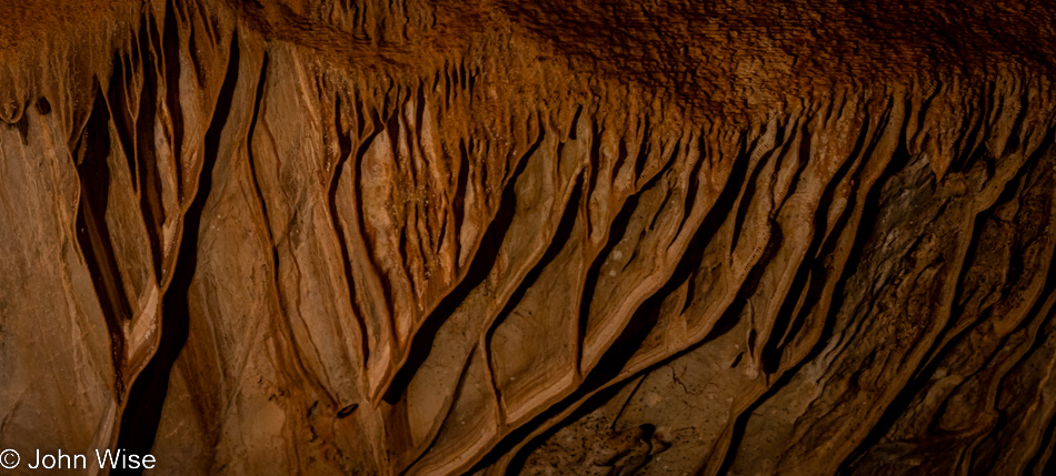
Accretions play an undeniable and essential role here as it is the slow buildup of minerals that is responsible for so much that will capture our interest during this visit. Take these curtains, some with a cave bacon-like appearance; what do they remind you of? Pardon me if you find this vulgar, but some of them appear labial or lip-like, while others remind me of gills. This then had me thinking about how stalactites reach out for what’s below while stalagmites grow from the ground up on their way to heights above their humble beginnings. There is no doubt that this process doesn’t happen in a fortnight but requires tens, hundreds, thousands, and possibly millions of years over time before we start to gather hints of what is forming. Isn’t nature showing us how, throughout its domain, the process of accretion has changed the shape and form of all things over the course of millions of years, including us humans? Our legs are our stalagmites, our fingers stalactites, and all the points, folds, and layers between form the scaffolding upon which we are suspended in order to move this living version of salts, minerals, water, and flesh around in a world of mysteries.
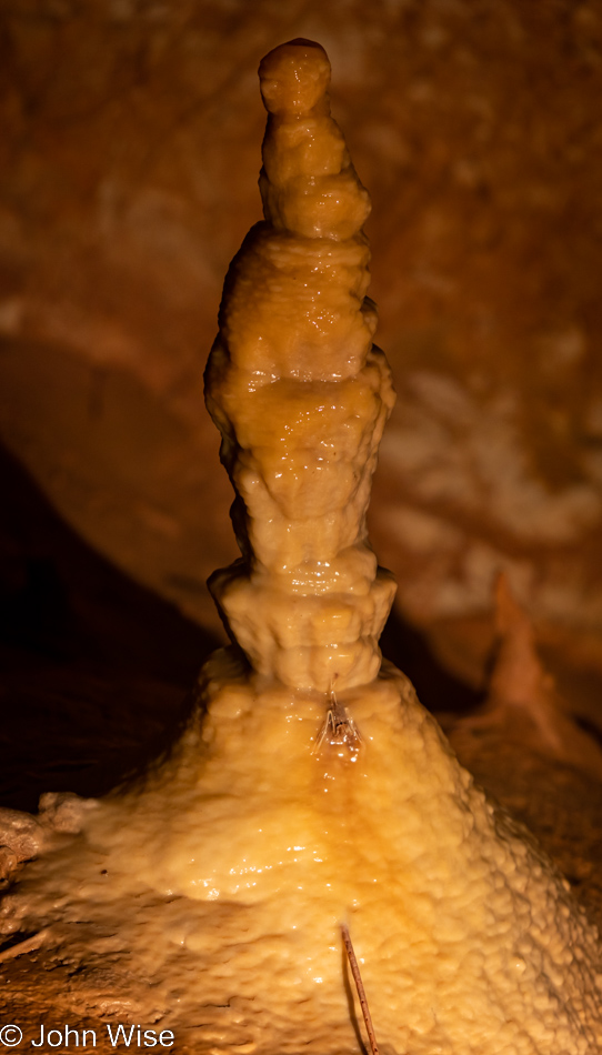
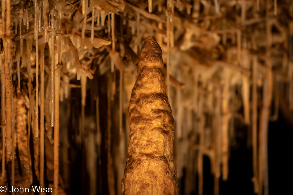
When I took this stalagmite photo, I didn’t recognize something near its base. From the path where I took up my position among others, it was nearly impossible to make out small details other than the fact that I was looking at a glistening formation. It wasn’t until I got home and assembled this shot that something stood out. I should point out that this isn’t a single photo; it’s been built by assembling a vertical panorama of 4 images through what is effectively a 300mm lens. The original 24-megapixel images combined to create a 66-megapixel giant weighing in at 207MB, but you only get to see a 542 x 950-pixel image that is a tiny 228KB. All the same, what I want to point out is the discoloration in the bottom third of the image; not the stick-like thing at the very bottom that I believe is broken soda straw but the thing above that. I’ve convinced myself that I’m looking at the skeleton of Myotis velifer, a.k.a. the common cave bat.
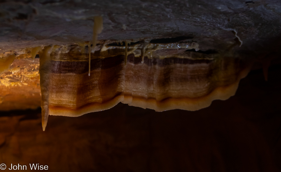
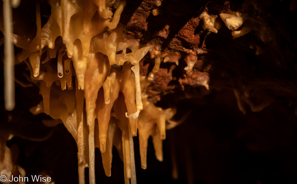
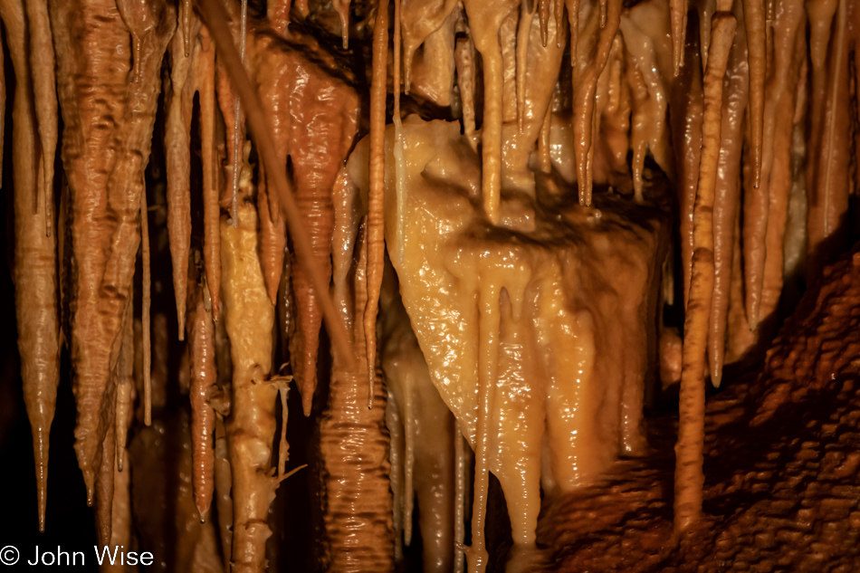
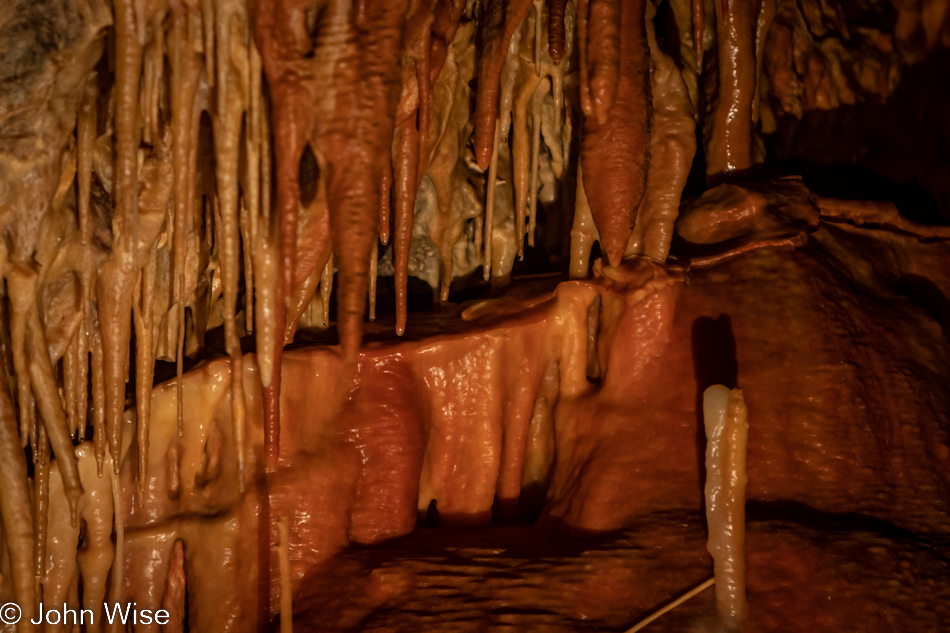
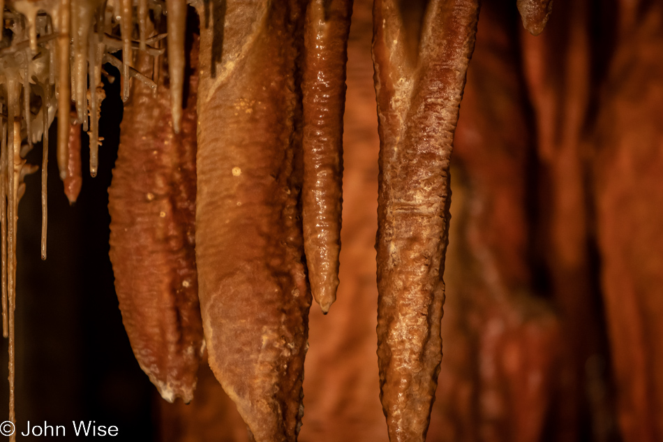
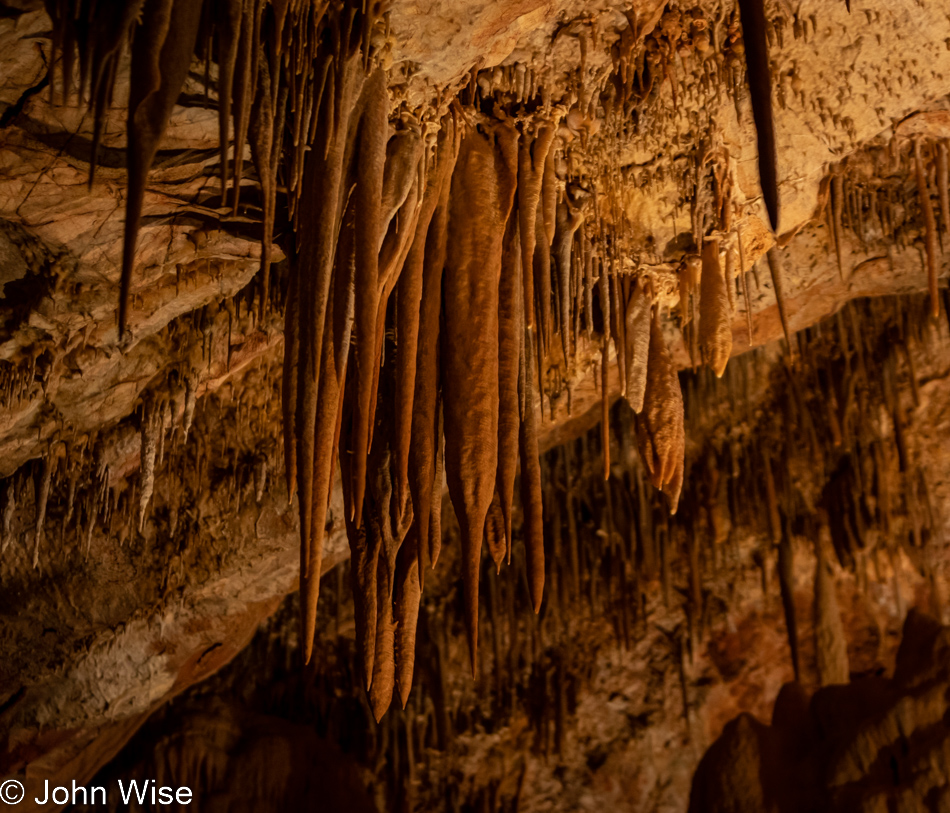
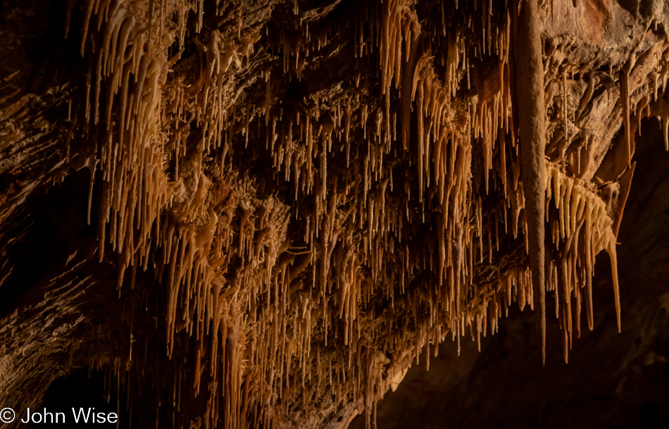
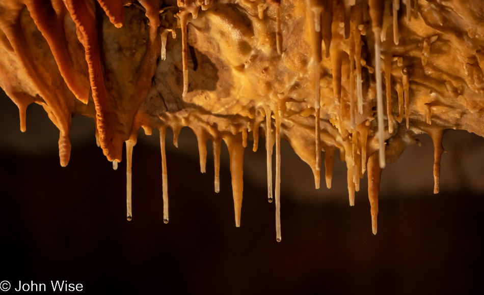
This is the third time I’m sharing a part of the same scene, but in the other photos, the travertine sculptures might look dry. Look closer, and you should be able to make out two distinct drops of water at the ends of the formations (the one in the background on the right is quite blurry). I’m guessing that they’ve already discharged their molecular passengers, adding another tick mark of accumulation during the ebb and flow of water finding its way in before continuing its journey further below.
Like arteries and blood vessels (or maybe more like nerve branches?), patterns are traced on the rock overhead, and like those things I reference, these tracks deliver something from one spot to another. Yet again, I see these comparisons to our own physiology, and I’m not quite done because as I stare at this ceiling above us, I’m now thinking about how it has bonded to the surface and how it’s almost like bone. One thought leads to another and soon I’m searching for what exactly bone is made of: it’s calcium phosphate called hydroxyapatite (HA). On the other hand, corals and bivalves (mussels, clams, and oysters) use calcium carbonate to build their shells, and with the addition of different proteins, shells can simultaneously have mother-of-pearl smooth interiors while having rough exteriors. At what point in the evolution of nature is the use of calcium stumbled upon, leading to calcium phosphate that allows for skeletons that can support land animals, which will require stronger frames due to the effects of gravity? The story of our emergence out of the chemical soup of nature seems so evident, and yet I meet people every day who still believe we are the creation of a munificent being that brought us into being, relatively distinct from nature.
I wonder what designs on the world cave-bacon would have if it were self-aware? Or did I just answer my own rhetorical question with the absurd idea that maybe many people wearing a human facade are metaphorically mobile slices of cave bacon, only slightly aware of what is potentially able to be spun from their minds and imagination if they were unleashed from the slavery of fear?
Instead of tossing insults at the faithful, I should return to cavern thoughts and continue reading about the formation of speleothems, travertine formations in Yellowstone, corals that swim with plankton before the sound of a reef calls them to settle down, the building of bones, or the doctor who only in 1988 saw the similarities shared both physically and molecularly between bones and coral, and just how connected it all is. You could spend your time far more frivolously than researching how a snail secretes calcium carbonate from an interior mantle that builds its shell, meaning accretions are collecting at the leading edge of its protective shell in a process similar to everything that is growing in this cavern…aside from the bacteria, insects, bats, and us of course.
Reading is the solution (as in chemistry, where a solution is the mixture of substances), words are the precipitate that emerges out of the solution, and knowledge is the accretion of the precipitate that, over time, might develop wisdom. What I just spoke of in metaphor regarding the minds of people is the chemical process of what’s building these formations. A solution of water and calcium carbonate transfers (precipitates) the dissolved calcium molecules to a stalactite, thus growing the formation (accretion). This process has been fully analyzed by scientists, and if I understand things correctly, it is used effectively when ingots are dipped in a crucible of molten silicon to grow the wafers that become computer chips used to build our phones, make our cars smarter, and drive the screen you are reading this on. For chip manufacturers, this is like making gold.
One can understand here that accretive processes can bring great value, monetarily or aesthetically, to things. Take gold, for example; one grain of the stuff is tiny and requires 15.4 grains to equal a single gram. As I write this, a grain of gold is worth about $4, which equals about $62 per gram or $1800 per ounce. If you had but two or three grains of gold, you’d certainly be the owner of gold, but you’d be far from rich with your $12 of wealth. Now, imagine you had a bag with 33 pounds of gold in it; that would be $1 million worth. Back to our minds, how many grains, grams, or ounces of intelligence have you accumulated? Are you happy knowing you have some, or do you understand that the more you collect, the farther your intellectual wealth may take you?
But I didn’t want this to be a chemistry or financial lesson; I’m more interested in the letters that make words, words that create sentences, brains that read stories, and minds that grow knowledge and the idea of the intellectual accretion metaphor I shared. There’s something I left out of that equation: time. A cavern, a dark, potentially dangerous chamber within our earth, has plenty of time. Nobody expects the cavern to be performant, social, or responsible to others; it is just a cavern of rocks, sediments, water, and maybe some bats. Our skulls are dark chambers with unknown potential that are too often deprived of time. Outside of youth, time is a luxury few have, and we even try to monopolize our children’s gaze in order to steal their time.
Time, while abundant and free for use by nature outside of us, is a rare find for humans. We occupy people’s moments with frivolity, nonsense, superstition, allegiances to brands, loyalty to celebrities, and manufactured identities in the form of commodities that are tradeable, easily adopted, and exchanged for the next viral flavor du jour. What we don’t ask of people is to invest in exploring the void of time by gazing into the potential found in deeper cognizance. We are, as a collective, afraid of what knowledge might do to the masses and so we have invented mechanisms to cheat people of experiencing the brief moment in time they’ll exist. Meanwhile, the helictites are left alone to take all the time in the world to grow their tendrils so they might surprise our eye one day, should we be so fortunate to witness them for ourselves.
I’m guessing not everyone thinks of tendrils or cilia when looking at cavern formations, but I am, likely in no small part due to an article I recently read that spoke of cilia (short microscopic hairlike structures) in cells and in the part of our brain called the striatum and what their function might be. It turns out that the scientific community long thought they were vestigial elements with functions lost to evolution. Not true; maybe it could be that they are essential to how we tell time, and in mice studies in which cilia were removed from their brains, the report said;
“While the mice could still maintain long-term memories and habitual or already-learned motor skills, various negative effects were observed after the cilia removal. The rodents proved unable to learn new motor tasks and showed repetitive motor behavior as well as noticeable delays in making decisions. Their ability to quickly recall location and orientation information, and their ability to filter out irrelevant environmental sensory information, were negatively affected.” Click here for reference.
Bear with me as I leap into pure conjecture, but I feel that this incredible luxury I’m afforded called time has allowed me to explore fragments of knowledge (precipitates) that accumulate and feed my imagination and sense of place in our world, and while they may end in folly, it is thoughts that are the building blocks of what humans have harnessed to move forward. In this sense, knowledge is the cilia that propel the cell (in my example, a person), and if those tendrils of thought are squashed by not allowing a mind to explore its environment, we march on a path of self-destruction. How many people can say they’ve had an adequate amount of freedom (time) to discover themselves outside the toil of labor and performance for the milieu they strive to entertain?
Yes, my analogy compares brains to travertine. We make efforts to protect caverns while not giving the same consideration to developing minds. With caverns, we wish to see their beauty continue to evolve and be made available to others, but from humans, we require their utility. The exception: we relish in the art, music, craft, and invention of those able to afford the freedom to explore what their deep observations might mean. It’s obvious that simply paying a fee to enter and enjoy a place of great complexity, history, and beauty asks nothing of our comprehension or imagination; it is a simple bargain for simple minds. It’s what we do afterward that is important: are we afforded the time to digest and consider the potential lessons, or must we immediately return to wasting time like prisoners crushing rocks? Unlike the formations in this cavern, my brain is not made of rock, while I remain uncertain of what is in the skulls of others.
Don’t worry; this lesson/lecture about chemistry/intelligence won’t continue forever. I did warn you early on that I have included many photos and that the number of images chosen determines how long this blog post will be. So far, I’ve enjoyed the exercise of studying the photos I brought out of Kartchner and seeing where the tendrils of my curiosity lead me. The good thing for people who pass over the pages I’ve assembled is that I have little to no expectation that anyone will have read much of anything here other than my wife, who reads most every word in an effort to save me from my own poverty of mind.
This brings me to symbiosis and iteration. It is as though a solution coursing through my mind left a precipitate in the form of the word iteration, and now I have to contend with how it relates to the previous accretion found in the word symbiosis. What if I cannot find a story that duly offers something meaningful to the suggestion that I was going to travel in that direction? It doesn’t really matter, does it? We do not question Van Gogh’s use of blue at the center of a sunflower. But as I’m not Van Gogh, I should make an attempt to use this palette of symbiosis and iteration to create my own kind of flower.
Hanging from the rocks above, these seemingly frozen-in-stone icicles called stalactites are secure in their foundation. They are here due to the symbiotic relationship found in an environment conducive to building such long-term alliances. Not content with one single stalactite, soda straw, or helictite, thousands of iterations of mostly identical formations spring out of the space that at one time was nothing but barren rock. Once again, I turn to compare the cavern with people: I live in a symbiotic space between my head, my environment, and my rock of a best friend, my wife. I am a stalactite clinging to her while she offers me a place to iterate accretions of a mind that is rapidly producing variations of a theme, looking for the perfect form.
Thus, I’m afforded the opportunity to be in places like this and then later, somewhere else, dwell and examine what flowing through me. On rare occasions, I might stumble into the umpteenth iteration of saying what at first blush might be more of the same, but over the course of time, I may discover something just a little different – the branch I’ve been searching for. But how would I ever dare encounter my mind crashing into anything new or unknown if my hamster wheel kept me locked into a tightly confined intellectual space of the kind of repetition the majority of people live within? We must take the mental turn and, like these nearly parallel helictites traveling in contravention of the rules of gravitational force, go the way others cannot expect or maybe even understand.
Even if we must stand alone, we are still in a symbiotic relationship with the world around us. No matter what our place on Earth and in society, we’ll always be in nature. Regarding my social environment, I too often feel that I stand alone in isolation on a complicated pretext, striving to feel invigorated at the precipice of potentialities I must struggle to comprehend. This damning demand to be constantly peeling back the myriad layers of meaning thrusts me into the difficult dimension of effectively keeping others at a distance due to my refusal to cultivate the skills and interests that would allow me to have something in common with them. If I could redefine milieu to mean something akin to “One’s place in the environment of potentialities,” then I’d say the milieu I exist in is the best I could hope for, and if that new definition included those I’ve taken inspiration from as opposed to those people who’ve been physically part of the fabric of society I’ve emerged from, then again, I’d be happily acknowledging the milieu from which I came.
Momentum carried me this far, but not so far that I can claim I’ve traveled through even half the photos before hitting the juncture where all of a sudden, I’m wondering: “Where to next?” Maybe I should “Jackson Pollock” my mind with a couple of splashes of random words? Yes, I’m using Jackson Pollock’s name as a verb because I believe he painted by throwing paint at a canvas with the hope art would appear; maybe that’s not exactly true. Anyway, there is no such thing as random words coming from my mind. I could ask someone sitting nearby to offer up a couple of words to attempt the random acquisition of inspiration for what comes next, but I’m not ready for golf and latte to be tossed into the mix.
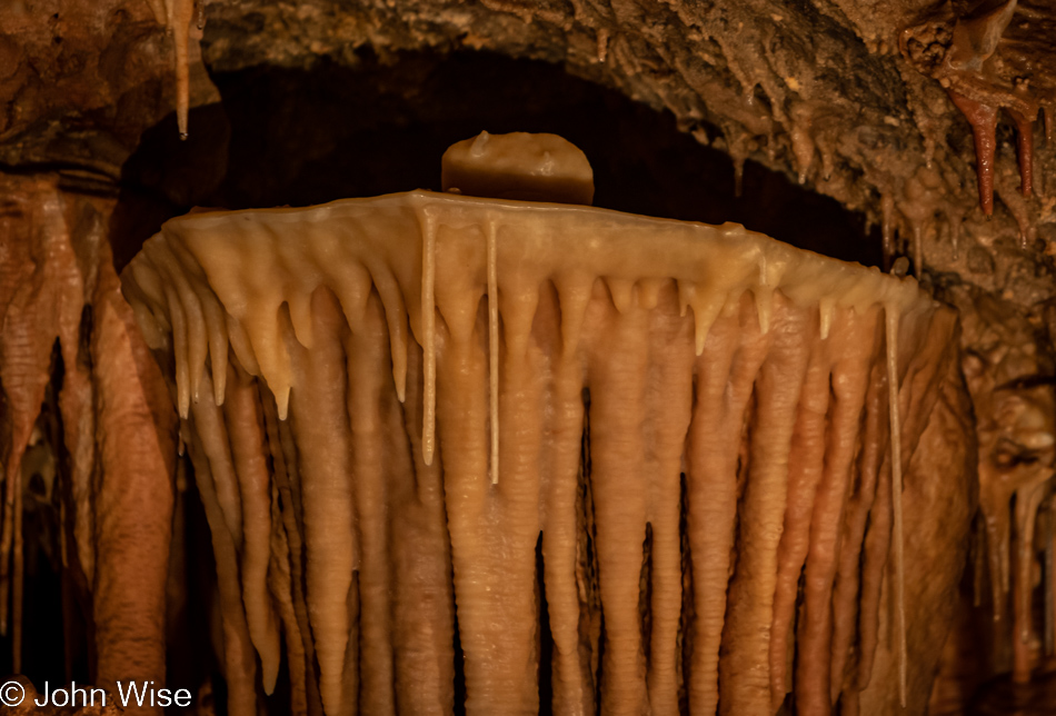
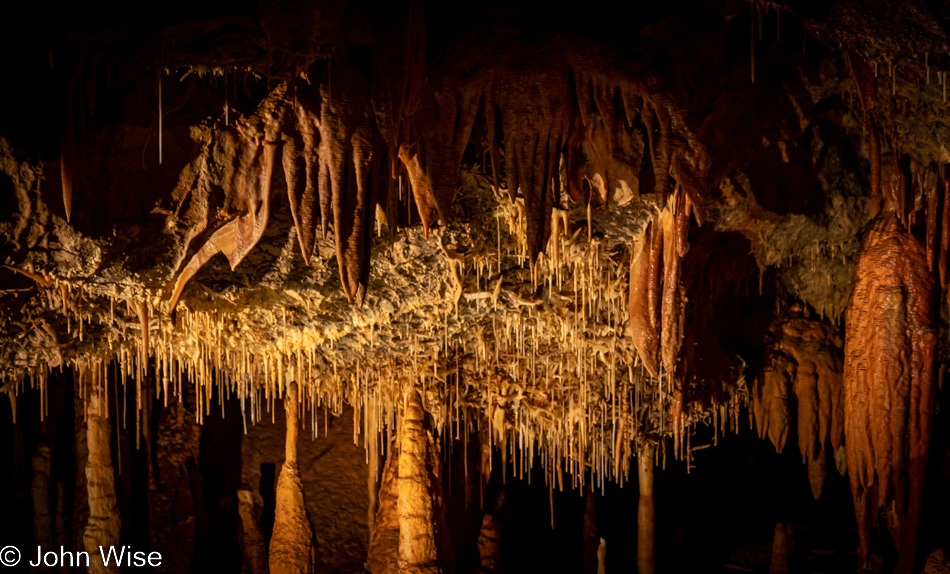
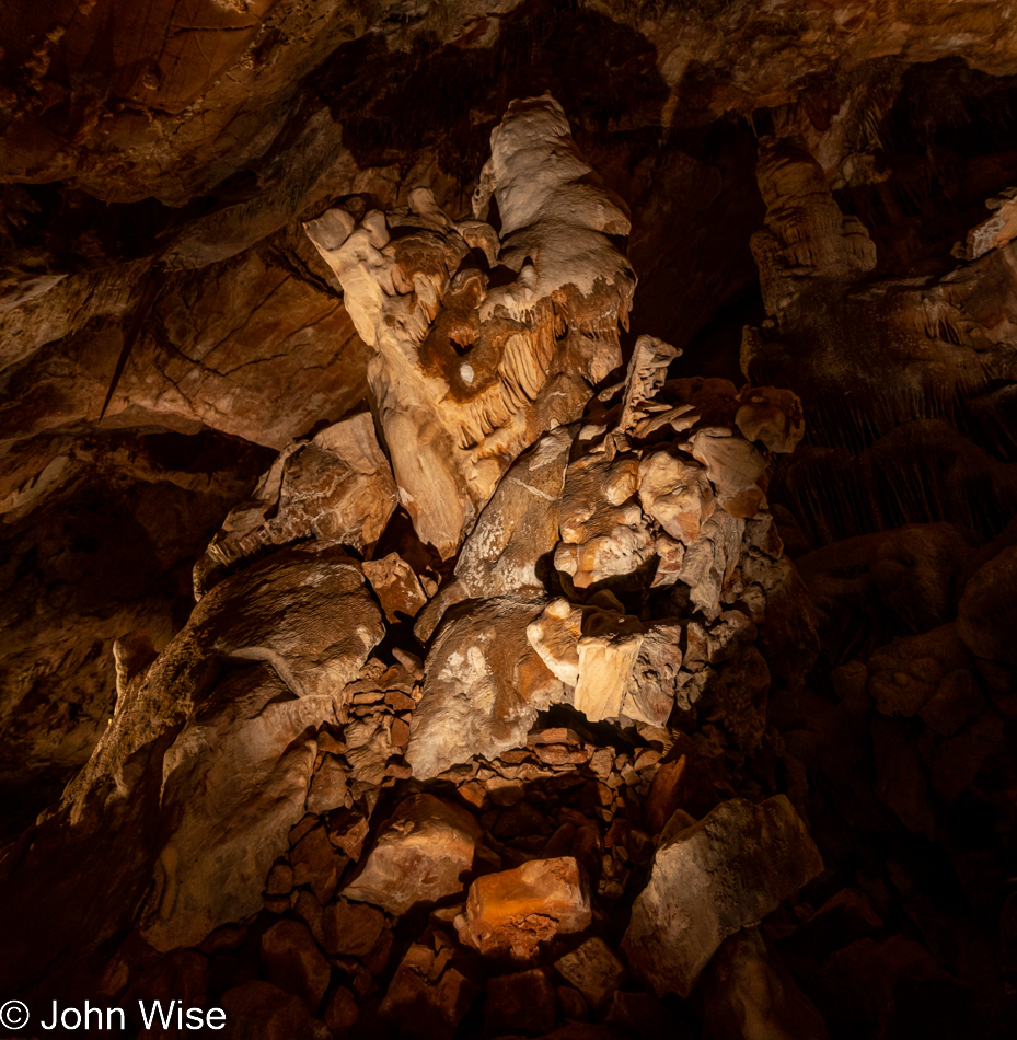
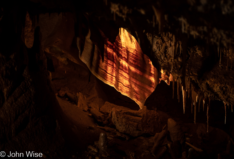
Carrot root cake with cream cheese frosting is how I choose to see this cave shield. It turns out that these formations are a bit of a mystery, even for scientists, with regard to how they are formed. Even more of a mystery to me is how the toy breastplate formation with one long nipple pointing upwards took form atop the shield; there is kind of a chicken-and-egg story going on here. Oh, right, I haven’t mentioned yet that, looking at egg shells, we see calcium carbonate at work, and regarding the chicken/egg reference, you can let your friends and family know that eggs entered the fossil record about 340 million years ago while chickens have only been on the planet about 58,000 years. Just as our ancestors bred wolves, turning them into dogs, I wonder what bird we used to create the chicken. Wouldn’t you know it? A search lets me know it likely came from a bird called Gallus Gallus, also known as the red junglefowl. None of this helps us understand cave shields, but who cares? The picture of one is worth the proverbial 1,000 words.
This is not the bottom of a cave shield, though the way the photos are sequenced, I couldn’t blame someone for that perception. It does appear that this image is a continuation of the one above. I can’t remember seeing another shield here in the Big Room, though as I study some of the photos below, I believe I see hints of older shields that are consumed by the ongoing growth process of the cavern formations. I bring this up as I think back to our one and only visit to Lehman Cave in the Great Basin National Park in Nevada, which has more than 500 cave shields in its system. This also reminds me that it’s been 20 years since that visit, and though we were just in the Great Basin this past September, we were there for hiking and visiting the bristlecone pine trees. Considering the poor quality of the photos I took at Lehman back then and that I am suffering from acute cavern fever right now, maybe it’s time to plan a return visit.
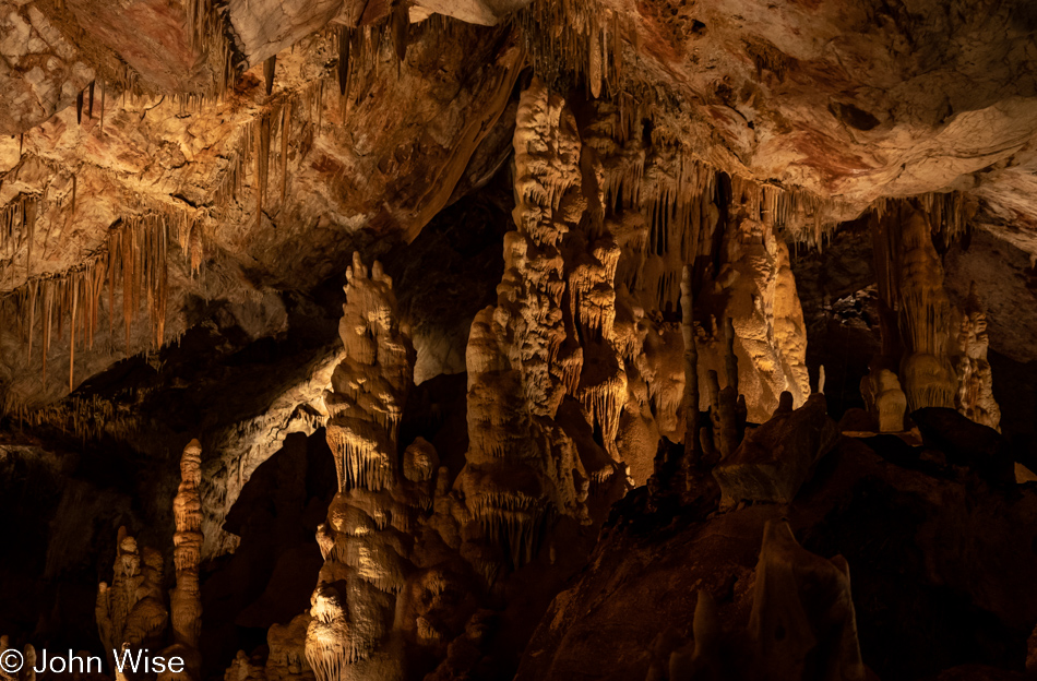
There are currently 32 more photos below this one, while there are 29 cavern images above it. I’ve already removed seven photos along the way to lighten my load, but many remain. I’ve been working on these words for three days now and might need to come up for air, which bothers me as I don’t feel I can really progress on other things before this looming responsibility is taken out of draft status and published. Stopping to take inventory of where I’m at is sobering and simultaneously illuminating the silly nature of what I’m trying to do, as I’m well aware that a dozen of the best images I captured would suffice for this post instead of 62 and who really has the time to read even a fraction of the more than 5,000 words I’ve already written? No matter, I promise you more words and while more photos could be pared, I will persevere as that is the job of nature to never quit.
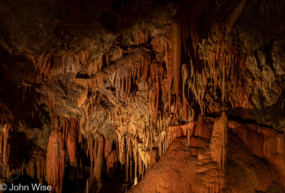
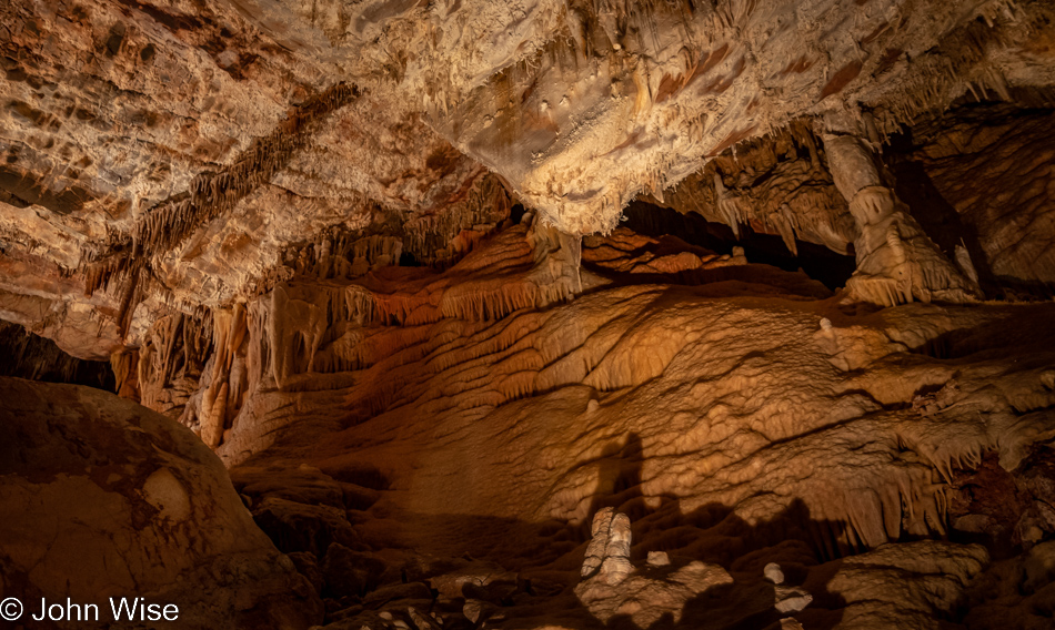
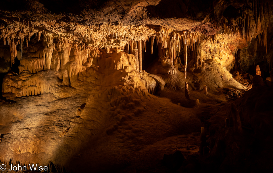
Looking at the complex of various types of formations, our senses are overwhelmed trying to tease out significant details. Is one thing greater to look at than another? There’s no telling while we stand there gawking. Not quite slack-jawed but in astonishment all the same, we scanned the cracks, crevices, highlights, and shadows, searching this impossible-to-comprehend mass for that one detail that is the essence of the whole. Isn’t this idea of reducing the whole to a simple single attribute what we too often do with people outside of the cave of our cultural conditioning?
Finally, the horror of it all strikes me hard. We are looking at the melting exoskeletons of a trillion corals, clams, snails, oysters, mussels, and maybe even the giant nautiloids that are now extinct. I can’t imagine what it would look like if there was a vast cemetery of humans and the calcium from their bones had leached out of their graves to form such sights in the depths below. Fortunately, this thought did not occur to me while down in this cavern, but I suppose I’ll now see other caverns through a similar lens.
But wait, there’s more. Whoever thinks about the fact that marble is metamorphosed limestone? Yep, heat and pressure-treated exoskeletons that form a polishable surface you can prepare your food on. Considering that we might prepare our meals on what was at one time the corpses of other life creates a peculiar picture. Hey, don’t stop there, John. Look at chalk, which is similar to limestone: it is made of the exoskeletons of plankton, meaning that when I was called upon to write on a blackboard as a child, I was scraping the remains of previously living creatures on the wall for the sadistic pleasure of an adult who never told me of the cruel act I was performing. Had enough? I don’t think so; I opened a rabbit hole looking for information about calcium-carbonate-based rocks, and I’m not done. It turns out that frequently, there are bands of other rocks within chalk, specifically flint. Well, it turns out that flint often originates from the skeletons of sponges; these bones are called sponge spicules. We really are a death cult with our ancestors killing animals using spears made of fossilized sponges, butchering them on tables of nautiloid and snail shells, and cooking them on fires started with those sponges. Finally, we learned to cook with their crushed bones in the form of lime, use it to treat the soil for growing food, clean our water, and exploit it for the construction of our buildings.
So there we are, standing on graves, conquerors of all. Proverbial kings of the world, yet we may be too shortsighted to understand our rare but fortunate position, and instead of trying to comprehend this incredible symbiotic relationship with nature, we aim to conquer and destroy it. If and when we are successful and win the extermination of humanity, a new creature will likely rise in our shadow, finding itself burrowing through the tunnels of the earth to walk on our melting bones, buildings, machines, and destruction to revel in their oblique view of what they too may fail to understand while admiring the abstract beauty of a lifeform that was lost to time. The cycle of destruction and ultimate stupidity will continue.
Here we are, deep in the distillate of billions of years of life and evolution, under the excretory process of earth, digesting the life that has fed it as we remain mostly oblivious to the intricacies lying behind the nature we are here to witness. What do we leave the cavern with? What might we have learned? Or are we only playing witness to the incomprehensible exhibition of time that exceeds the common person’s ability to tease the slightest meaning from a complexity billions of years in the making?
These are hallowed grounds, as are the beaches, forest trails, mountains, skies, seas, and all points of the planet in between. There are no less than 27 people around me at the moment I write this. I struggle to find a common thread with them. I feel no kinship as I cannot believe they respect the enormity of what they fail to see and hear. Do they ever concern themselves about how they use their environment, or is it all somehow owed to them? What parts of their minds do they explore with the vigilance they deploy to make money or display their status? How has their religion made them so impervious to the magnanimity of the earth upon which they exist while piously giving credit for their selfishness to some unseen entity in an abstract universe called heaven? I should try to understand the reason for their myopia and allow it to absolve them from grasping what lies behind the veil of their inability to see and learn. Considering their limited perspective, it must simply be easier to exist within the rules and norms of those who promise salvation and riches.
Within our death cult, everything is already dead, including many people’s empathy and ability to find insight. While empathy and insight might have been in abundance in another age, we now treat the world and each other as something to exploit and deplete, yet many would proclaim to respect the holiest of holies. Stop a second and consider: would you act the same if Jesus, the Prophet Muhammad, Buddha, or Brahma offered you the earth as a child? Would you still be able to behave as the destroyer, exploiter, and uncompassionate caretaker of such a precious entity? Would you allow others to harm God’s offspring? For those of you devout souls, how do you reconcile your ignorance, hate, and oblivious natures of seeing God in this creation? And please consider I am not one of you. I’m a non-believer, and yet I can be easily awed by the enormity of the responsibility to tread lightly and celebrate this rare offering of life and all that it entails in what should be everyone’s precious abode, meaning everything we find on this beautiful planet that is our collective home.
When might the flow of consciousness reach the sea of enlightenment? Or is it destined to evaporate in a drought of our own imaginations that never grasped where we are and what we are? Each successive word fills a space I don’t believe exists anymore because I can’t really find what I want to share next. Yet, beyond my self-doubt, letters fall into place, triggered by fingers compelled to continue placing words upon an electronic page. I cannot write to anyone else but myself. I’m the first to see what my mind wants to show me, and though I may feel frustrated in what I think is lacking, the compulsion to continue suggests I just keep going, keep on flowing, and see where the river of thought takes me on my journey into the discovery of time that brings me to the next moment. A diamond might exist for at least a billion years buried in our earth before eyes fall upon it, enchanted by its specularity. These words need not be seen by others today, tomorrow, or the day after, but I must continue to put my word machine under great pressure if I’m ever to produce a single tiny literary diamond.
Words, time, and images shape your mind and possibly feed your soul, though I also think those same things may strip your soul bare when others are able to use you as a tool of harm. In that sense, life imitates the machine with its mindless program of grinding through the task for which it was built. Without the ability to find discernment, people feel threatened by being outside the center of conformity; the malleable mind is easily influenced by one’s own ego along with the oversized ego of a charismatic who tells the disciple how to be and how to find their place. Often in the case of religion, and now with our form of capitalism, those who guide others are likely manipulating empty vessels who are afraid to stand on their own. Bringing the initiate into the fold helps strip them of any unique characteristics and so they become a pliable mass able to perform the bidding of a larger system. When that system lies about things that would normally be in contradiction to reason or one’s own best interest, they are easily misled into performing the bidding of those who wouldn’t dirty their own hands, thus allowing the fool to gain favor with those who know better. The system perpetuates itself in this way, and the congregation grows. These newly minted tools can now be instructed to go forth and destroy.
Destroy the hopes and ambitions of others, contaminate them with the poison of a culture bent on blind repetition, and you can effectively stunt the growth of a society. This is the road we’ve chosen for a large swath of our population, not all, but far too many. Those who desire to elevate the downtrodden masses are as marginalized as those who would protect the environment, save an endangered species, or ask others to consider how they overconsume. Meanwhile, the accretive process within the cavern continues its slow drip toward perfecting its work. Hopefully, the same work continues within the minds and imaginations of those who dare to challenge convention and are willing to risk standing alone.
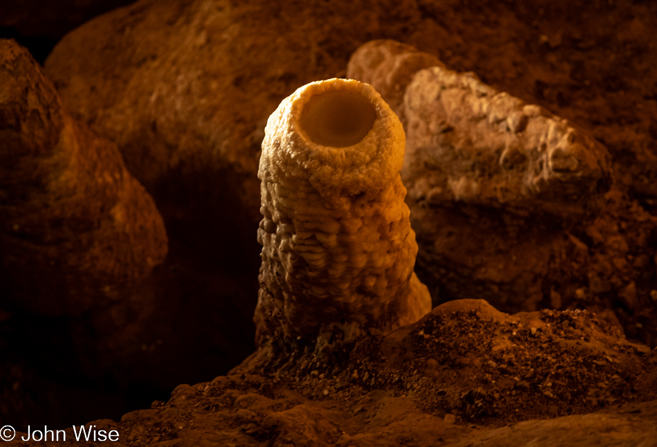
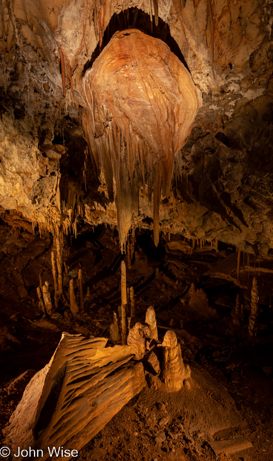
This is the Fried Egg stalagmite. It stands alone, the only one of its kind within the 2.5 miles of passages discovered here in Kartchner Caverns State Park. As a matter of fact, the entirety of the caverns is so appealing to visitors for the very reason that one’s eyes may fall upon extraordinarily unique forms while simultaneously being surrounded by much that is relatively uniform. We, humans, are typically enchanted by the novel and intricate unless we’ve been conditioned to fear those unknown places we’ve been told are the hiding places of bad things, demons, subversion, or horrors waiting to pounce on the person. There are too many examples to share where people find fear, from the simple things like camping and an unqualified aversion for certain animals and insects to politics and anxiety wrought forward that there are those who will steal the only life you’ve ever known.
In rereading some of this, I’ve noticed a glaring omission because I fail to acknowledge the role of abundance and scarcity. I write this from the perspective of someone existing in abundance, including this constant thread through my writing, the incredible amount of time I’m able to indulge in. I concede that when existence is shrouded in economic, food, and security scarcity, much of what I write about is rendered silly. Those basic human needs are too often on a margin that is out of reach, but there are many of us who have the means to consider the options under which we live and survive, and yet we fail to do anything about our own myopia with regards to improving others’ circumstances.
Maybe you start to pick up on my struggle to continue this screed, the tedium that is befalling my well-worn story of lamenting that all too often I feel that I stand in isolation. I, too, would prefer to be a part of the fabric lost in a tapestry of others celebrating the solemn beauty of life that surrounds us, even when in the bowels of the earth. Fortunately, the ones who were there that evening are intensely curious and willing to invest in the opportunity to see farther, to try to understand the inexplicable, and escape the occasional inclination to be sessile. To be fixed in one place is what sessile means, and while I can accept our inability to always be on the move, I find it unreasonable to do the same when it comes to human minds frozen in place like this mountain of cavern formations.
The craftier/greedier among us could tell their tools/subjects that these rocks contain riches beyond their wildest dreams, and if they descend upon these tunnels to bring everything back to the surface with them, a share of that wealth extracted will be their reward. With this activity of performing their bidding, the simple-minded would then be able to argue that this was evidence that they are not, in fact, “frozen in place” but are demonstrating their ability to go out and capture that which benefits them, even at the expense of what is destroyed in the name of gathering. I’d like to put forth that that type of human in this age should no longer be considered sentient because they lack a certain self-awareness or empathy before the face of nature.
To not affect change implies we’ve lost momentum and are as still as all that is before my camera lens in this cavern. We do not want to affect change because we are terrified of what we ourselves might lose by disturbing the status quo. With that all-gripping fear brought on by the threat of change, we become intellectually sessile; our brains perform a mean simulation of the barnacle, the tree, or a coral. The next step is to die in place with our minds long ago having started seeping out of our skulls, liquified by their lack of challenge. Maybe you’ve even conceded defeat and placed your hopes of a better future in your children, gee-whiz, nothing like the lazy pleasure of abdicating the heavy lifting to a generation you failed to inspire as you traveled the path of least resistance. Do you think me heavy-handed, boring, redundant, gratuitously obtuse from time to time? Then you might be picking up on my state of frustration that we humans have, by and large, devolved back into cave dwellers and yet have lost the ability to paint on the walls, tell stories, and dance for each other. As modern troglodytes, the opinions falling out of stupid heads informed by nothing of any real value hurts me deeply. I’d be remiss if I didn’t state it bluntly: it will be the demise of our species.
Quiet and solitude are where I’m heading next, though I’ll have to ratchet the cacophony of my lament down a notch and find a way to bring the ruckus of words to something of a low roar. I’ll try speaking using a soft voice and hushed tones. To compliment my thinking while distilling words, I’m tuning into Brian Eno’s newest work, titled Foreverandevernomore. While chamomile tea will not be part of the method employed, calming breaths should help guide the fingers into pleasantries. Minutes pass as I lose writing focus, drifting into the lyrical content of the track There Were Bells; these charming musings of the man writing to my own heart might prove a bit too distracting. On second thought, what better place for silence to emerge from than the writing of nothing?
More than two dozen drops of water hang in various stages of contemplation, each accumulating the weight required to be captured by the gravity that will launch them into their next journey. Patiently, they wait as what else is there to do? For a time unfathomable to me, this water has traveled across eons, possibly since before the planet formed. It only started condensing on our cooling earth about 3.8 billion years ago. There’s a great likelihood this water was once part of another creature, an ancient plant, or a million-year-old glacier that broke apart a million years ago before seeping through the rocks until reaching this point to glimmer before my eyes before disappearing back into the earth for a billion years or more. How crazy is it that I was on hand during the age when we were capable of understanding such things?
What about you, John? Have you been here before? To look at my midriff, it might be assumed that the pattern found in cave bacon is part of the recipe of DNA that creates the fat on my frame. While I’m taking poetic license regarding the science of living beings, there’s a high probability that the minerals my body is using to construct and rebuild itself were once part of a cavern, a field, a mountain, a crinoid, the nose of a dinosaur, or ejecta from a volcano. All of everything had to precede our arrival, including the expanse of time, in order for us to be here contemplating abstractions or distractions during the short lives we’ve been afforded to discover all that we might find on these journeys.
I find it healthy to indulge in distractions and will argue that a life without distraction is detrimental to the spirit of what it means to be a person on a path toward self-realization. Abstractions and flights of fancy are healthy detours into potentialities, not necessarily the fantasy type where we only wish things to be true, but those lines of thought that take us on epic adventures into knowledge we’d not previously encountered, which can lead us into discovery.
There will always be information hidden in the shadows, and that’s likely preferable as it keeps mystery alive. When everything is laid bare and unadorned before you, the entanglement of imagination to discover the unseen and unknown is stripped away. Maybe a big mistake of us humans is to believe that the ultimate secrets that hold all true meaning are kept by a god figure that may or may not be in one’s future, in which case, should we fail to peel back the layers of our curiosity to discover what we can find in our lifetimes, larger truths and reality may forever elude us. The fear of embarking on that search might just be why a majority of people are using the bandage of easily acquired entertainment to hide the wound of a broken sense of need to know. Is it really so easy to turn on the game, sit down to another binge-watching marathon, or give an ear to wild, half-crazed laments fueled by the paranoid rants of talking heads meant to incense you? Where is your internal dialog about the beauty of silence, shadows, mystery, love, and the questions of what it all means?
Love. It’s here; it not only traveled into the cavern with me, but it’s also right here in front of our faces, locked in everything we are looking at. What is love, after all? Love is familiarity, quiet, stillness, the long gaze, learning, curiosity, lack of judgment regarding the other, seeing the intrinsic beauty that others may fail to appreciate, and it is patience. If you find yourself impatient to take time in the quiet moments, if you are bored when stillness surrounds you, if things unfamiliar to you test your patience demanding you get fast answers to the hows and whys before you threaten to bounce, you likely act the same way in relationships. Urgency driven by scarcity is a wound inflicted upon people that convinces them they’ll miss out on the things they might desire. Living under this threat has conditioned society to exist on the plane of FOMO – Fear Of Missing Out. When fear shows its face in relationships, the risk levels go up, and often they go up exponentially, rising to violence, mental and/or physical. Fear induces the fight or flight response, either catapulting the individual into a full confrontational stance or ensuring they are gone before another moment passes, thus extracting themselves from the situation.
This brings us back to symbiosis and how it fails to establish a firm hold at the beginning of a relationship. In education, we fail to bring the child/teen/adult to a level of understanding of any real benefit from learning. They are surrounded by the artifacts of our collective stupidity, as demonstrated in the conversations heard in public, the dialog found in our movies and television, and the juvenile antics of our politicians. We ask learners to imagine a world where their education will find meaning and purpose, though entertainment is constantly acting as bait with the promise of fun. For those of us isolated from the popular crowd, loneliness is not a comfortable option, and so we turn to cultivate relationships with education, art, music, invention, and other creative endeavors in order to bring us into a kind of symbiosis with the histories and personalities of those who brought us those crafts. Our understanding grows as we go forward and become aware that our curiosity is out of sync with the larger collective who never found pleasure in education and learning. These are the first building blocks where the emotions allow for symbiosis to accrete, grow, and strengthen.
What comes out of that process is a radical new derivation as it relates to appearance and personality. That a person requires stimulation, sharing, and curiosity along with a social environment that fosters bonds with others should be knowledge strong at its root. Growth in a complex of potentiality cannot appear among clones; this is the artifice of the superficial machinations of a marketing/brand-based economy trying to convince consumers that salvation and joy can be found/purchased in things that have no relationship to love, individualism, and the unique character derived from a solid foundation of learning, love, and curiosity.
Take this tobacco-looking accretion emerging from the rocks above it, some might blurt out that this looks like shit compared to the shiny carrot-hued formations just below, but if that same dullard were told that one ounce of the stuff was worth a million dollars, they’d immediately see its intrinsic beauty. Isn’t this how we, far too frequently, consider others in our society? We talk from the perspective of knowing little and as long as we have an adequate distance of anonymity to ensure the wrong people don’t hear our musings of stupidity as we cast aspersions. I believe we hide behind descriptions that refer to this simplemindedness as gossip.
The person, place, thing, or pet that is loved in a sense loves you back the most when you are able to love and respect it for what it is without having the need to alter its fundamental nature. While I’m the first to admit an abhorrence of anthropomorphism by suggesting a rock might love you back, let’s play an imagination game. If one could see in this structure that the travertine is smiling at them and offering thanks for their appreciation, would they so easily take an axe to it, chopping it to bits to find something of value within? This is what so many people metaphorically do to one another, and more than likely, it’s due to fear that the other person will develop in a way that will ultimately exclude the person who desires their love. How many times have we witnessed this for ourselves?
So hang your anger, bias, disdain, lack of understanding, intolerance, and the conditioning of a toxic role on the door of your outside self and open the windows of your perception to see the things you have so far failed to understand. Reawaken the innocence and desire for surprise, which is a key part of discovering the symbiotic self that wants to find unknown and potentially scary things. We are not always allowed to know all the answers, as mysteries keep us coming back to find what we obviously missed before. Just stop and think about it: it is the constant growth, discovery, and wonder of your toddlers that enchant you every day, it is the surprising nature and antics of your pets that endear them to you, and sometimes, it is your own delight once you’ve stepped outside your self-imposed boundaries that give you hope that you might be at a turning point.
From here, we return to iteration. Like the instructions on shampoo recommend: lather, rinse, repeat. Except we change it to love, discover, and grow. Of course, who am I to deny anyone their misery of, despair and rage? But when the beast shows us its fangs in the form of a deadly weapon and exercises its dissatisfaction on anyone who shows the slightest bit of fear, we must accept that this is part of the price of our laissez-faire attitude which gives people the freedom to be as stupid, angry, and broken as they choose to be or that the system conditions them to be.
True, the spectacle of abhorrent violence, intolerance, and aberrant behavior offers us something to gossip about to fill the moments of boredom, but is this really what our species desires? If I were so inclined, I could easily enter a conversation with nearly anyone around me at this moment about nonsensical subjects such as a shooting in Monterey Park, California, the price of eggs, perceptions regarding vaccines, or the veracity of someone’s favorite news source, but I likely cannot discuss the inherent beauty found in my explorations of the world around me. A world without violence, injustice, and mindless fodder is just not interesting; we want big drama, big lies, higher body counts, and proof that “the system” is against us. I find this to be a strange choice of priorities when one has the ability to avert their gaze from such things and chooses to see the inverted world found in a drop of water that reflects the magic found in the extraordinary.
Good thing that life has proven to be resilient and that even after five known major extinction events over the past 500 million years, new life has sprung up. Should we ultimately prove too incompetent to have handled the place we’ve taken in nature, it’s at least reassuring to know that the water of life will continue to flow, new things will emerge, and if some future species is as fortunate as we were, I hope that they’ll recognize the beauty and rarity of having sprung into existence and work to cherish not only each other but the lands and waters that support them.
Inside our heads, we begin life with a nearly empty cavern called the mind. We are constantly visited by culture (our family) that will allow life’s experience and language to grow formations that others can marvel at in their beauty. That growth doesn’t stop with a single giant stalactite/monolith of some specialized knowledge; we are an entanglement of depths with treasures hidden in the shadows that might only be found by others exploring not only the world around them but also trying to understand one another. You will not find any of this in a video game, a TV show, the Marvel Universe, your tuned car, or a big house. Love is not your allegiance to a slogan on your hat, knowledge doesn’t fit in yoga pants, and compassion is not found behind the gate of your fortress or in the lies propagated for popularity with the in-crowd. Truly valuable things are found when we realize the void within is missing our consideration of what we are afraid to see, hear, taste, touch, read, and explore.
I do not say you will find answers; as a matter of fact, you might only find more questions and wonder why the void seems to expand. Understand that, like the universe expanding into the infinite, the mind and one’s curiosity might have their own infinite plane of existence that doesn’t stop at your comfort zone.
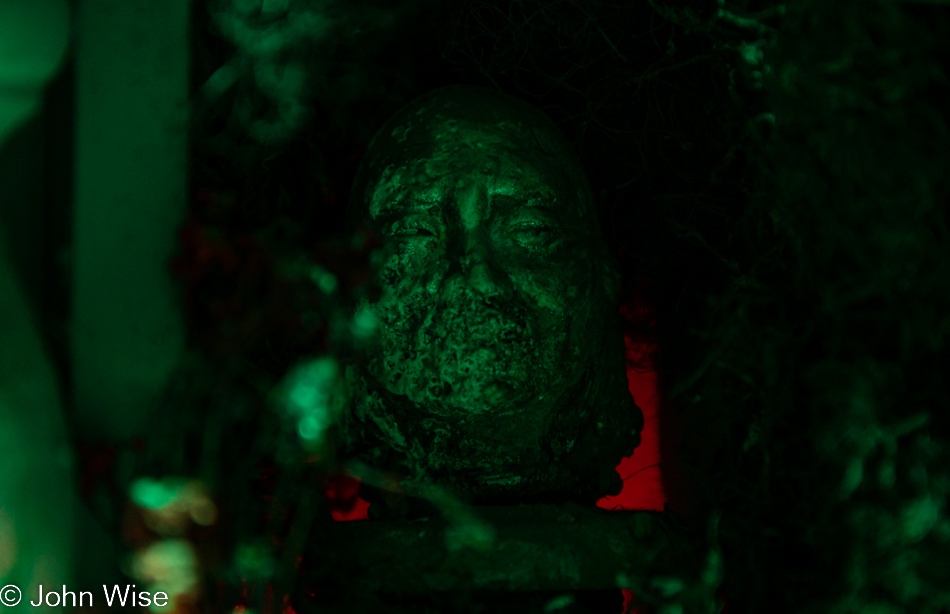
As we near the end of this two-hour indulgence in Kartchner Cavern and upon seeing this cave bacon mask of horror, I’m yet again brought back to that oft-repeated quote by German philosopher Friedrich Nietzsche: “Battle not with monsters, lest ye become a monster, and if you gaze into the abyss, the abyss gazes also into you.” I might change this to, “As society battles with the monster of loneliness and uncertainty, accept that we are creating new monsters, and when we gaze into the empty pit of a mind, the emptiness of life will creep in to destroy all we might cherish.” Meaning, we must venture outward and inward to search for experiences that bridge the chasms we are destined to confront.
When I started this post, I thought my path would take me into a narrative of the beauty found in the cavern and that I’d reflect on our great fortune to be here on one of the half-dozen opportunities to photograph the Big Room per year, but instead, I found myself digging into myself once again. If I’m lucky, the past week has allowed what has flowed through my head to take some kind of form or other. I may never know if I’ve been building stalactites, stalagmites, helictites, soda straws, shields, curtains, cave bacon, masks, monsters, or what, but I can hope that these words act as tiny plankton and will settle down in some random places to contribute to the corals that help support things bigger than the nearly invisible elements that build giant structures humans are in awe of.
Pictorially, this is likely my longest blog post, though I can’t be certain, and I don’t have an efficient means to figure that out. As for word count, I’ve written one post that is longer, though it was actually an amalgamation of many bits and pieces of things I wrote over a 36-day period in Germany a couple of years ago. This is the first post where I endeavored to write for a ridiculous number of images I found enchanting and too difficult to choose the best ones, so I went for it, and now here I am at the end. Not quite the literal end, but the end of the cavern side of things as though this might be a good place to quit; one does not live on words and ideas alone and dinner was in our plans.
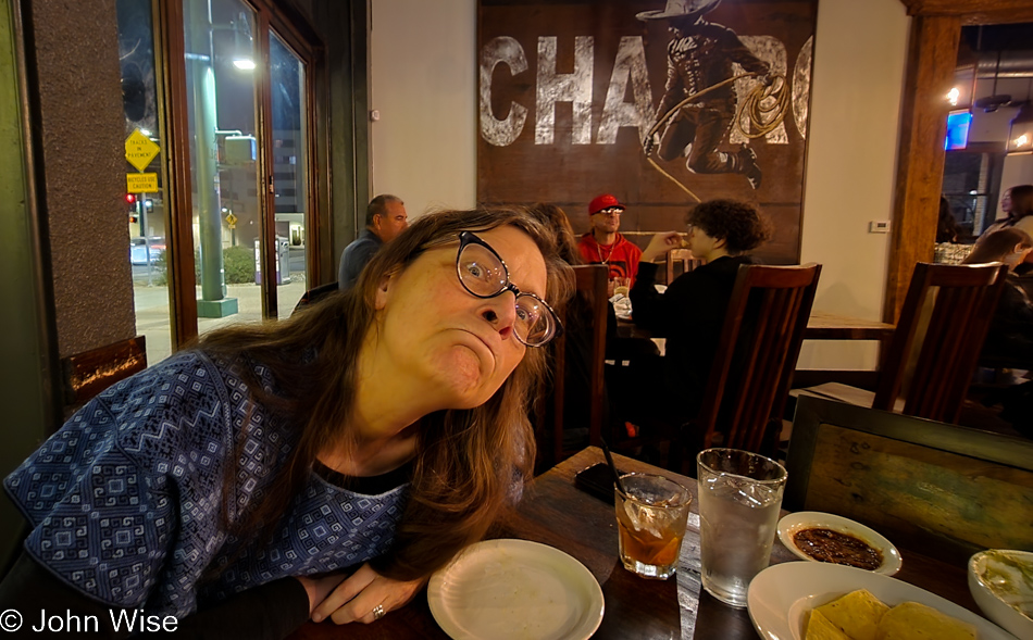
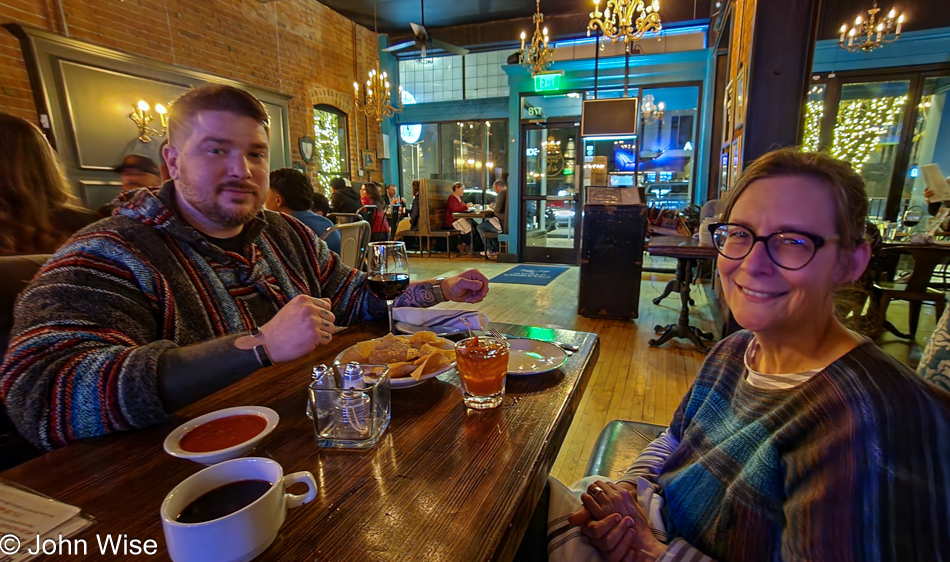
Caroline, what the hell are you doing trying to crawl into my photo? Is this the inner troglodyte coming out of you after such an immersive experience in the cave? I mean, we are here for a shared tomahawk steak that might have certain characteristics of a caveman meal, but this is not flattering. True, I find it funny that you are able to make such faces, meaning you’ve graduated into being a fully-fledged American, and in accordance with what I wrote above, you are fulfilling this idea of keeping the mystery alive, so maybe this is where I should close this down with one more exclamation of how much I love my partner in discovery.