Pacific Northwest – Day 4

Shortly after the moon goes to sleep and while the sun is just returning to wakefulness, there is a calm and quiet in the transition zone between night and day. The city hasn’t stirred yet, but the birds know that this is one of the best times, and we tend to agree with them. To their song of return, we depart Sequim and will have to watch the sunrise in our rearview mirror because we are heading west.

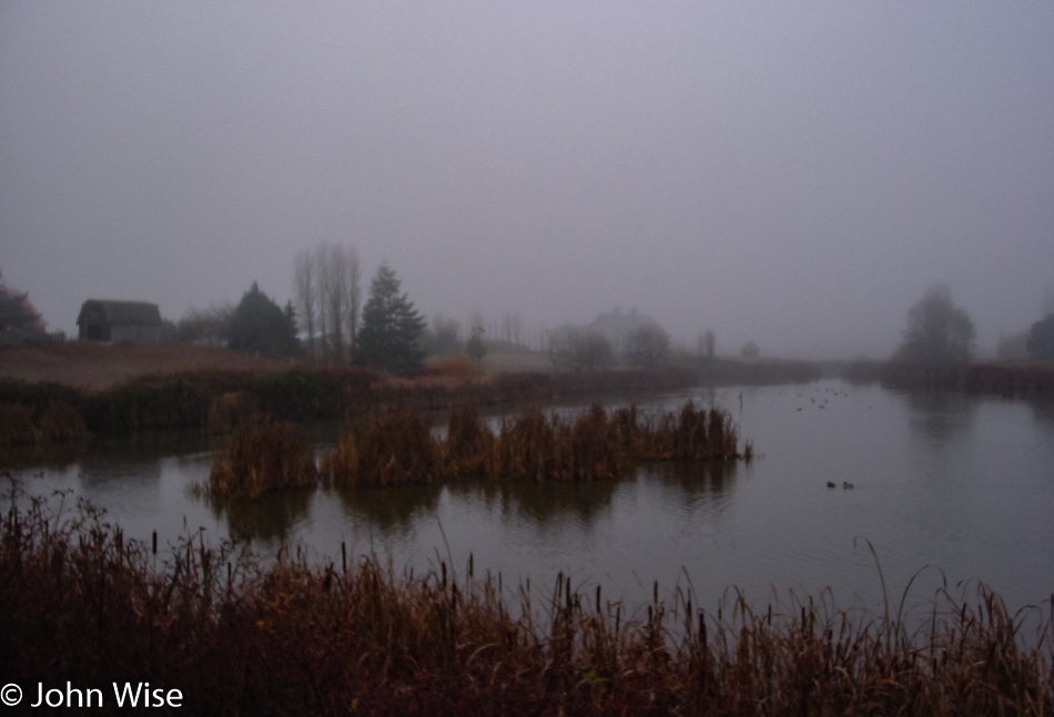
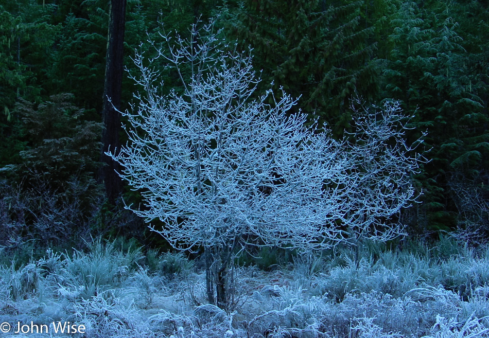
If it’s quiet in the early dawn, it is absolutely still under the blanket of fog. Living in Arizona, we might have an occasion once every four or five years where the valley has a fog layer, but those are rare and short-lived. In these places where the mist is hugging the very surface of the land, it is easy to entertain the idea that the day will be kept at bay, and the intimacy brought by the low ceiling will make the entire day cozy.

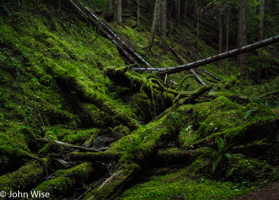
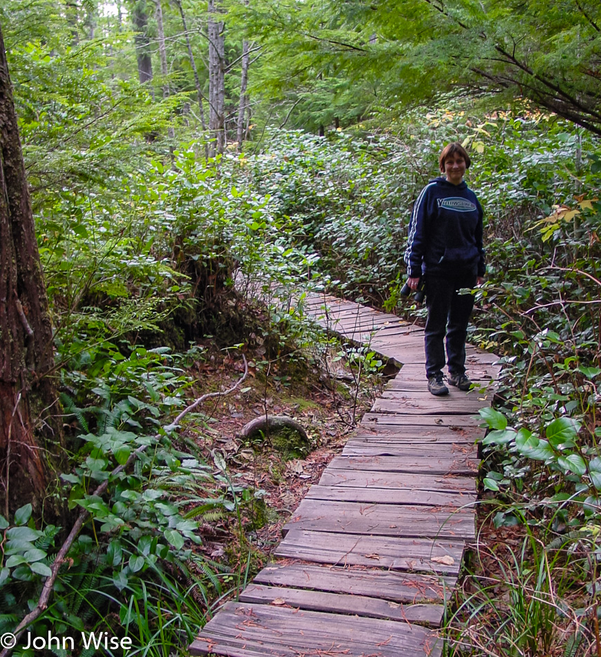
We are on the move and heading into the mountains. We are near the entrance gate of Olympic National Park, and much to our surprise, they have started their limited seasonal hours. Lucky us, it’s not too long until the road opens, and not far from where we are waiting is a peek at the kind of forest environment we hope to visit tomorrow when we visit the western side of the park.

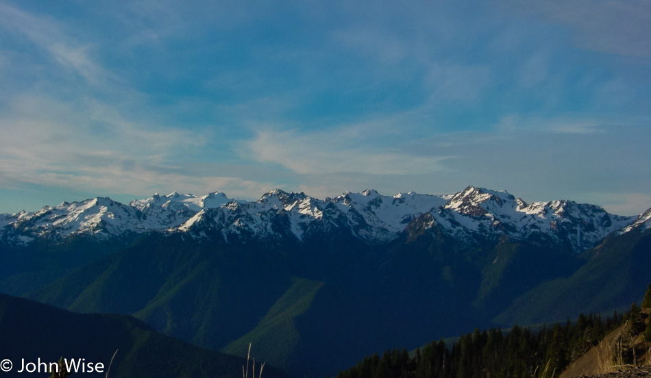
This is Hurricane Ridge, and while the peaks are snow-capped, in a few more weeks, there’s a good chance that the entire environment up here will be covered in snow. Should you arrive on one of those snowy days, you’ll have to travel with tire chains, or you will not be allowed passage, or so says the park ranger who reminds us how lucky we are.

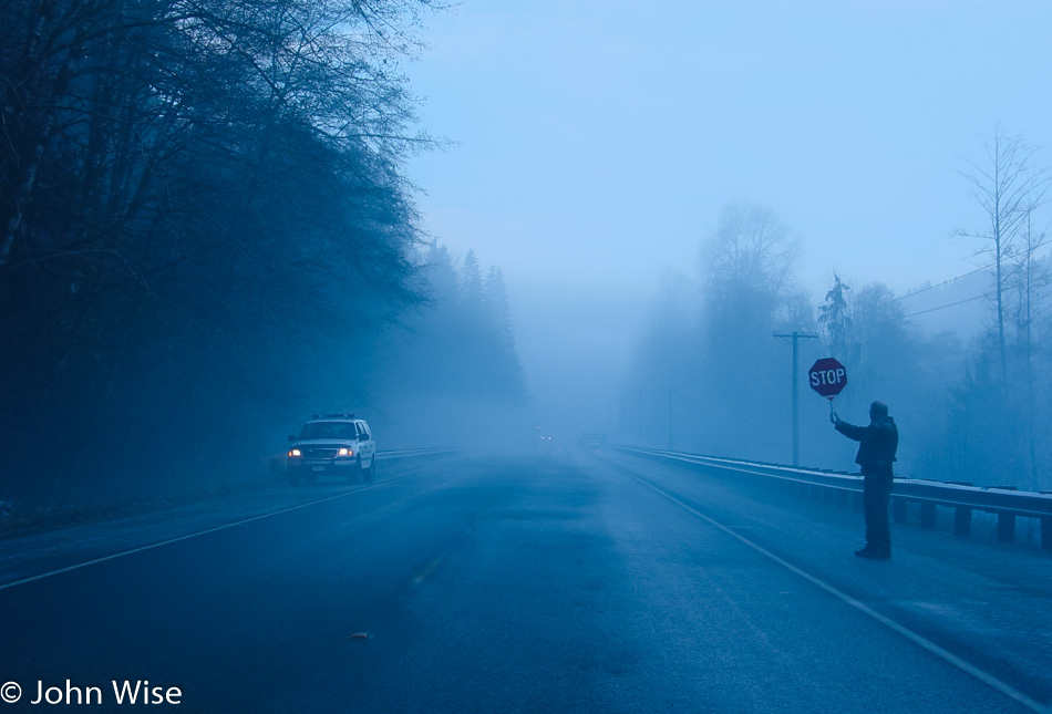
The policeman on the side of the road is not here for a sobriety check; he’s recommending that if we can detour or delay our travels, it would be best. Ahead, there is a car that has gone off the road due to the black ice; that is a driving hazard, but for us forward is the only way to go. We go very slow and do our best to be careful.

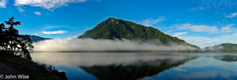
This bit of fog hadn’t gotten the message that it was time to burn off and instead showed off its perfect reflection in the calm waters of Lake Crescent on Highway 101.

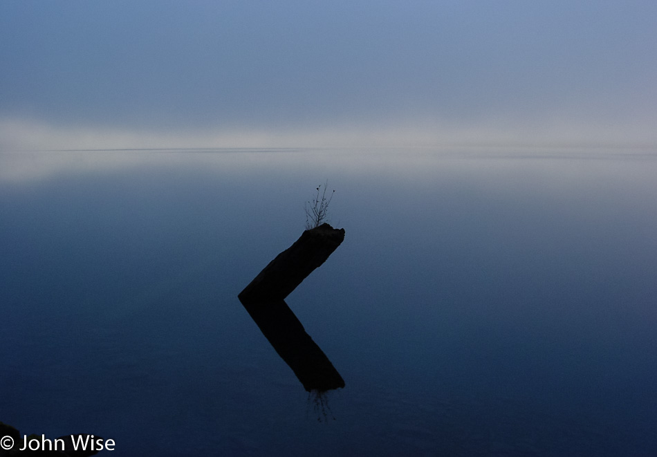
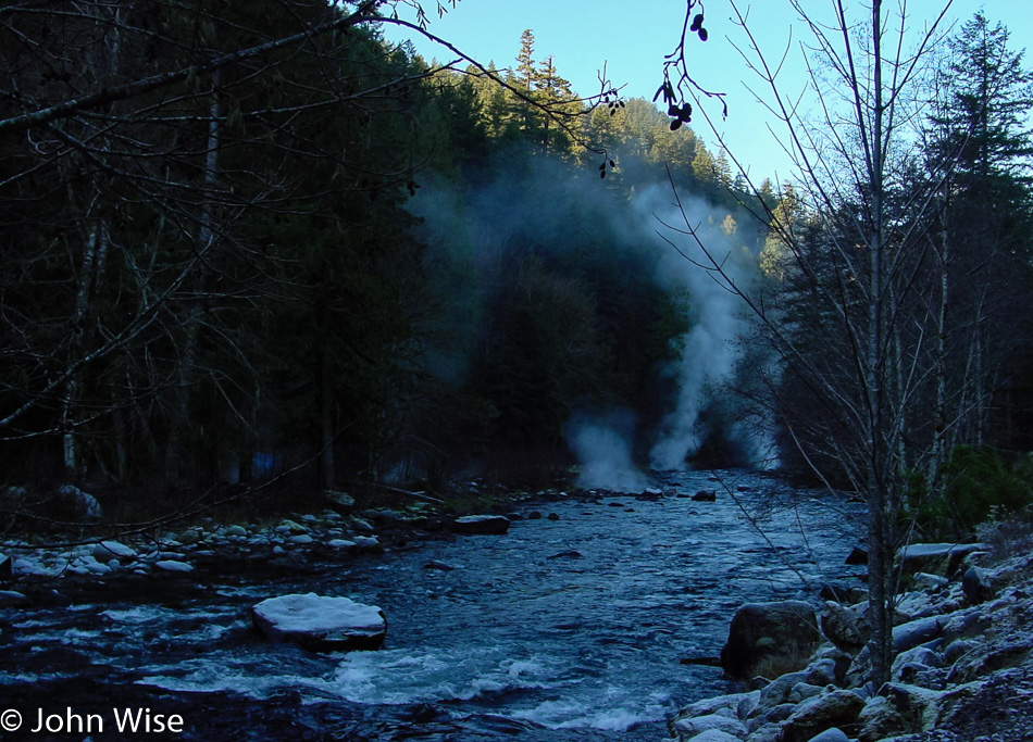
And then we’re deep in the fog again; this seems like it could be a theme today.

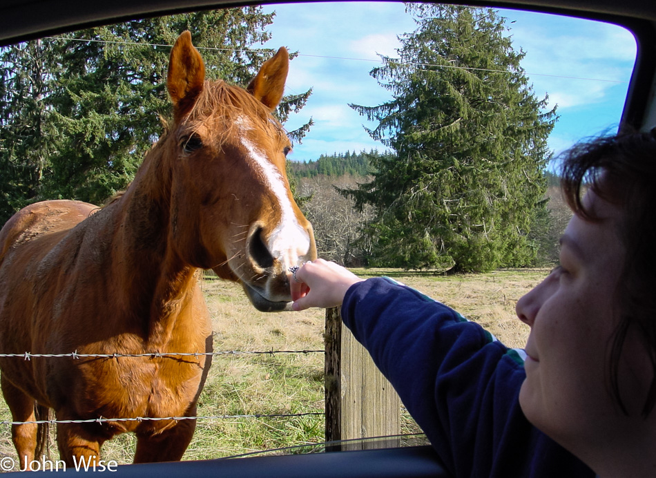
This roadside psychic horse was beaming its brain waves at our car as it must have sensed I was traveling with a Caroline who loves horses. It said, “Hey, fellow hairy chin person, bring that sweet-smelling, friendly woman over here and let us connect a moment.” I’m a sucker for telepathy and making my wife and random creatures happy.

On the road to Cape Flattery.

On the footpath to a point out on Cape Flattery that will take us to the end of the trail.

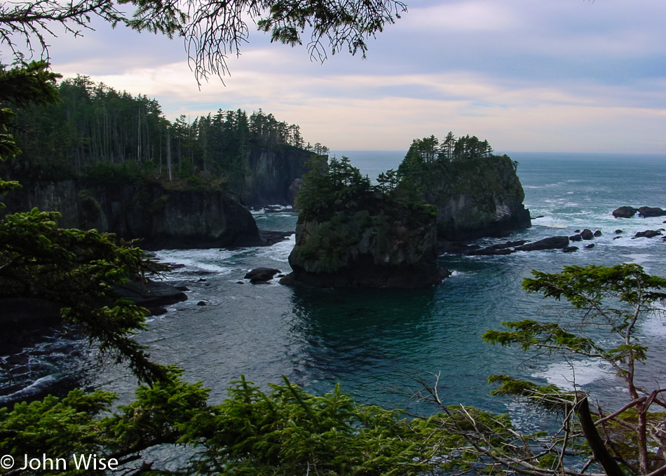
As we reach the ocean, the rocky cliffs and turquoise waters align to show us perfection in which trees, birds, air, and space exist for just this moment, dazzling the observer who is out participating in their life.

We are the farthest out we can go. This is the northwestern edge of the contiguous United States. Behind us are Tatoosh Island and the Cape Flattery Lighthouse. To our left is the Strait of Juan de Fuca in Canada. And we can be here because the people of the Makah Reservation are sharing their lands with us.

Heading back through Neah Bay, there is no other way to make our way down the coast.

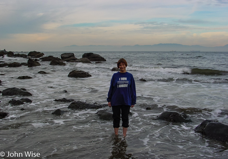
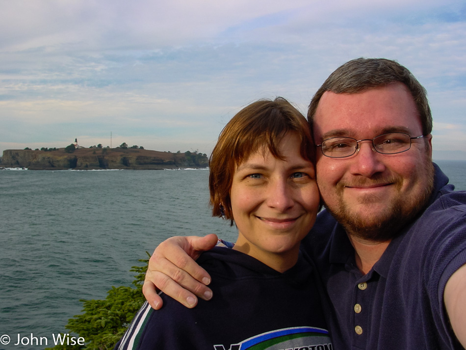
Our backtracking worked in our favor as it allowed Caroline to step into the waters of the Strait of Juan de Fuca with Vancouver Island behind her.

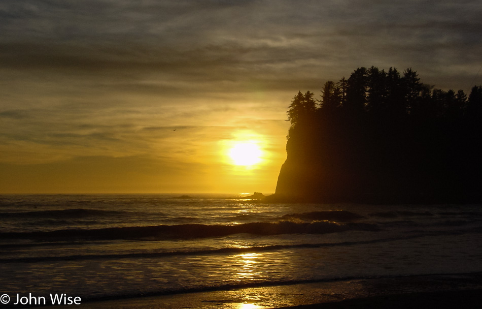
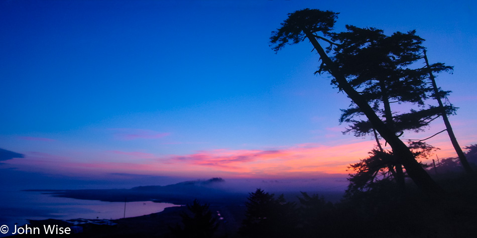
Check into our motel early? Not a chance with a tiny bit of available sunlight still available. We drove out to La Push on the Pacific Ocean on the chance we might see a nice sunset.

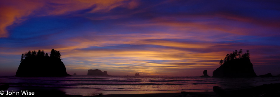
We never anticipated witnessing one of the most spectacular sunsets we may ever see. Just so you know, this image is made up of half a dozen photos, as it would have been impossible to photograph otherwise. You just can’t take these digital cameras for granted in how they allow us to stitch panoramas together, making up for not owning incredibly expensive cameras and lenses or being limited by the amount of film we have, though memory cards can get expensive.

Dinner was at The In-Place, right next door to our motel, the Pacific Inn.

Pacific Northwest – Day 3

Rainbow Motel in Bend, Oregon

You might be thinking that this photo was taken while we were checking in, but you’d be wrong; we were checking out. Not in the middle of the night either, it’s just that we have a lot of miles to cover, and sleep is not going to deliver us to our destination. Yeah, yeah, yeah, I know the argument that it’s not the destination that’s important but the journey, but if we are sleeping, then we are not on the journey, are we? We spent the night in Bend, Oregon and while many motels use the price on the sign as bait, this one delivered, and we only paid $30 for a room.

Blue mountains in the early dawn, better known as Middle Sister (left), Black Hump (center but small), and North Sister (right).

Pink mountains as the morning arrives for the Three Sisters.

Crystal clear peak of Mount Washington in the light of the early sun.

Maybe the frost will melt off as the radiant heat of our local star reaches down from the mountain peaks and touches the lower surfaces of our planet.

I suppose that in a state that sits astride the Ring of Fire, it should not come as a surprise that the earth is boiling just below the surface, but still, I can’t help but stare upon the spectacle of the land belching steam that portends greater things happening below beyond our gaze.

We got off the road for a moment to find a view of Timothy Lake off National Forest Road 57.

Caroline Wise standing in a mountain stream below Mount Hood, Oregon

And then it was on to Mount Hood for a better view of the mountain when we spotted this stream where, of course, Caroline would have to doff her shoes once again to stand in one of America’s waterways.

Caroline Wise and John Wise at the Washington State Line

Add another state to the number we have visited as we step into Washington for the first time.

This is why we are happily married; we are both suckers for bridges. That’s right; nothing else binds us together quite like our fascination with these water-and-canyon-crossing human-engineered pathways. Love is a great bridge; just think about it for a second.

Mt. St. Helens, Oregon

It is pretty exciting, almost intimidating in some way actually, to visit a volcano that has been explosively active within our lifetimes. Mount St. Helens blew up back on May 18, 1980, and lowered the peak of this mountain by 1,300 feet. The violence the eruption unleashed was responsible for the death of 57 people caught up in the wrong place at the wrong time.

Mt. St. Helens, Oregon

Twenty-two years later, the force of the blast is still on display, with trees stripped bare and lifeless from being pyrolyzed in the intense heat.

Mt. St. Helens, Oregon

Spirit Lake is filled with thousands of logs from the more than a million trees that were blasted down following the eruption of Mount St. Helens. The force of the volcano nearly drained the lake, creating waves up to 600 feet tall (183 meters) that crashed into a nearby ridge before settling back into its basin pulling a bunch of trees with it. The lake has been left as is following this calamity for scientists to study the impact of this once-in-a-lifetime event.

Passed this beautiful work of art on the S’Klallam Tribal Center in Jamestown on our way to our motel in Sequim, Washington, on the Olympic Peninsula.

Pacific Northwest – Day 2

Little A'Le'Inn in Alamo, Nevada

Fortunately, the aliens never arrived, and so the day of anal reckoning has been pushed to some point in the future. Wow, we really did make it out here near Groom Lake and can now lay claim to having spent a night in the shadows of the aliens of Area 51 as well as Roswell, New Mexico. I have to admit I’m a bit disappointed we’ve not yet been chosen for abduction as I’m prepared to meet the little green men face-to-face. Then again, how do we know that the people of the Little A’Le’Inn and its restaurant out here in Rachel, Nevada, weren’t aliens in disguise?

Highway 375 The Extraterrestrial Highway in Nevada

Not even one spaceship, hitchhiking alien, lost probe, or mutilated cow next to the road here on Highway 375 better known as the Extraterrestrial Highway.

Caroline and I are always surprised by the beautiful weather we are so lucky to travel with. We’ve commented dozens of times how, even on the less than ideal days, we’ll still spot some blue sky, which never fails to put smiles on our faces and lend a kind of perfection to the day.

Rustic farmland is like a rainbow under the blue sky, and while it may be an idealized perception not taking into account the toil and hardship likely experienced here during harder times, it remains part of the attraction of exploring America’s remote corners.

Austin, Nevada

Here we are nearly a year to the date back in Austin, Nevada, where the E.T. Highway brought us to The Loneliest Road in America: Interstate 50. In this link, you will find a photo of this place, seven images down from the top.

Nevada Route 305

Is that a crop circle out there?

Somebody speeding in Nevada on Highway 50

Seems that the aliens were late: I’m not actually driving at 120 mph; we’ve been abducted and are being transferred to the mother ship through some kind of induction system that has us traveling vertically, seriously! Also, the clock stopped around this time.

Nevada Highway 140

Woah! And then all of a sudden, we were delivered to Nevada Highway 140 and we have no recollection of how we got here. Well, at least the sky is still blue, and the car is no longer traveling at 120 mph.

Caroline Wise and John Wise entering Oregon

Hmmm, this looks like a good place to sneak into Oregon. Unfortunately, we weren’t able to secure a visa allowing us to travel into this state, and our passports explicitly forbid us from traveling into the Pacific Northwest under our current status, but that wasn’t going to stop these two desperados from breaking in.

Of course, by taking this route into Oregon, we have to pass through no man’s land where nothing exists but vast stretches of nothingness. This particular nothingness is a photo reminder to someday return to the Malheur National Wildlife Refuge.

Even the sun is removed from the sky in the continuing void of eastern Oregon that stretches on like a desert of lost dreams.

Then, finally, as we start to approach the middle of the state, civilization remakes its appearance, and the fading sun beyond the horizon reassures us that tomorrow promises to be a wonderful day in the lush green lands of the Pacific Northwest.

Pacific Northwest – Day 1

Caroline Wise and John Wise leaving Phoenix, Arizona

A long holiday weekend means that Caroline and I will be taking another long drive. This Thanksgiving was just that, as we aimed our compass and pointed the car towards the Pacific Northwest. Our ice chest can be seen over my shoulder, so the essentials are traveling with us to minimize our need to lose precious driving time as we need to cover nearly 1,600 miles (roughly 2,600 km) each way for our seven-day adventure.

Arizona Sunset

This may be the most glorious sunset we’ve ever experienced on a trip out of Arizona, a kind of southwest-themed rainbow portending great adventures ahead.

Hoover Dam from Arizona

The art deco architecture of Hoover Dam out in the middle of the desert between Phoenix and Las Vegas is in stark contrast to its environment. It’s an iconic image that is seared into my memory due to driving over it back in 1969 with my great aunt and uncle Annie and Woody. We were nearing the completion of my first cross-country road trip from Buffalo, New York, to Los Angeles, California.

The Extraterrestrial Highway in Nevada

No time for Las Vegas tonight; we have an encounter scheduled out in the desert north of the city. One of us, or maybe both, are getting anal probes.

North Rim Grand Canyon to Capitol Reef – Day 2

Up and out early for a visit to Capitol Reef National Park.

I wish I could tell you what’s on this Mule Deer’s right eye; maybe it’s a mini-satellite tracking device.

We are seduced by the golden colors of fall glowing in the sunrise. Our positive first impressions of Capitol Reef are already hinting at the need for a follow-up visit.

Being suckers for petroglyphs, we add these to the list of stuff we must return for in order to have a fuller picture of the park than our quick tour is going to allow us to have.

Dirt roads are the paths to quiet riches because where the pavement ends, the crowds remain at bay, not that this place is swarming with visitors today.

A bit of Chaco cultural influence is at work on this relic of a “modern” building.

My best guess for what created these multi-colored layers is that this was a floodplain at one time. I think it wasn’t a lake as there are no black layers that would imply plant and fish life that was settling at the bottom, and the layers are seriously almost uniformly thin, so maybe it was quickly disappearing floodwaters that came and went?

If we are in Hanksville, Utah, this must be the famous Hollow Mountain gas station. We are about to turn off Route 24 for the 95 before taking the 276 to Bullfrog. Where…

…we were hoping to catch this ferry across Lake Powell. We just missed it by minutes and with almost two hours before the next ferry going in our direction, we opted to drive back towards Hite and take the bridge over the Colorado.

While we will always enjoy a good ferry trip over the water we don’t much mind a stunning drive over the desert either.

Colorado River flowing into Lake Powell in Utah

Can you guess just where the Colorado meets the lake?

Wow, this is one spectacular approach to a bridge.

Hite Crossing over the Colorado River in Utah

Back in 1983, Lake Powell was in danger of spilling over the top of the Glen Canyon dam; under the bridge, you can see the bathtub ring the full lake left behind. Matter of fact, besides the ugly tragedy of destroying Glen Canyon by backing up the Colorado River, the water bleaches the sandstone and deposits tons of sediment in the lake, depriving the Colorado River in the Grand Canyon of the kind of river dynamics that made rafting a huge variable. Taming the beast to remove the risk of encountering the wild has been one of humanity’s greatest faults.

Caroline Wise and John Wise on the Colorado State Line

Why go straight home when you can detour and take in four states in one day? And I don’t mean some short little detour either; we go large and head through Blanding up to Monticello, where we catch Highway 666 so we can drop into Colorado going to Dove Creek. South through Cortez, we continue on the Devil’s Highway, where we can have a meaningful and potentially evil encounter with the Colorful State. Sadly, I have to report that neither Satan nor his minions were found on this day.

Snow-capped mountains and bald eagles, that’s America.

Caroline Wise and John Wise on the New Mexico State Line

Into New Mexico, we are still on Hell’s Highway as we cruise past Shiprock and south to Gallup before turning west for the final drive home on this blistering fast loop out around the Four Corners of the American Southwest.