Beautiful Day on the Oregon Coast

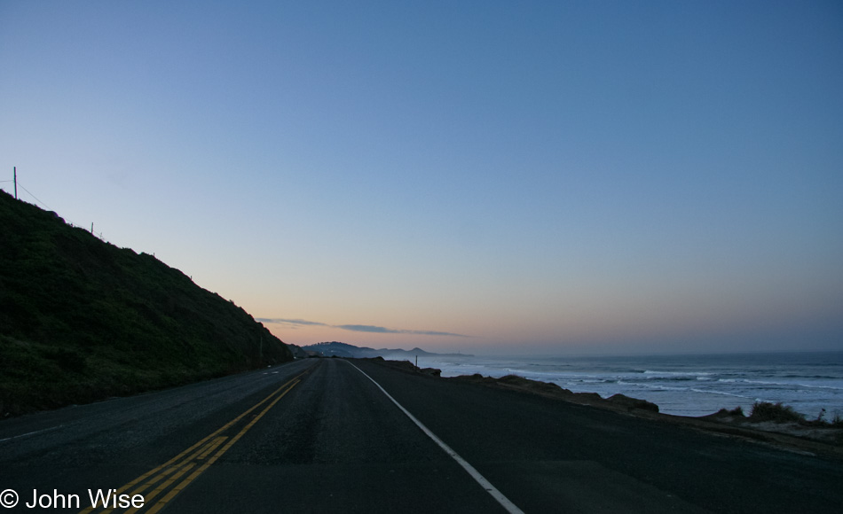
Breakfast was down south, so off to Newport we drove. By the way, as stated in the previous posts, these days are either enhanced with extra photos and blathering like the first few days or, like this one you are reading, have come together 13 years after the trip because, for one reason or another, I never got around to posting anything back in the day. While the photos sit comfortably in their cozy digital beds on my hard drive that’s always warm, they are more accessible to Caroline and me when we are out on the road and looking for something connected to a memory. and hope we’ll find some relevant information on my blog. This doesn’t often happen as WordPress doesn’t have a great search engine, but someday, when it does, or my personal A.I. has already cataloged my 1,226,675 words written, the knowledge we seek will be readily available. As for my word count, that was accurate as of 12:55 p.m. here on December 7, 2020.

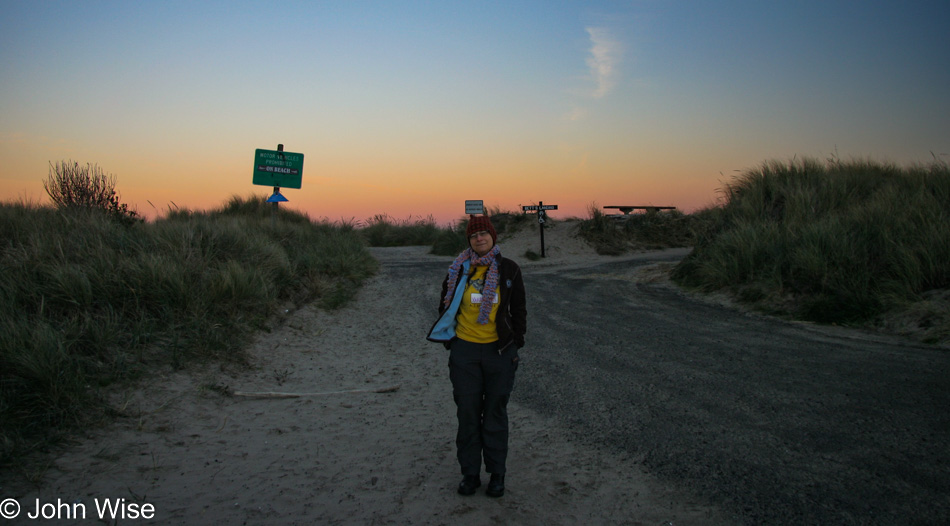
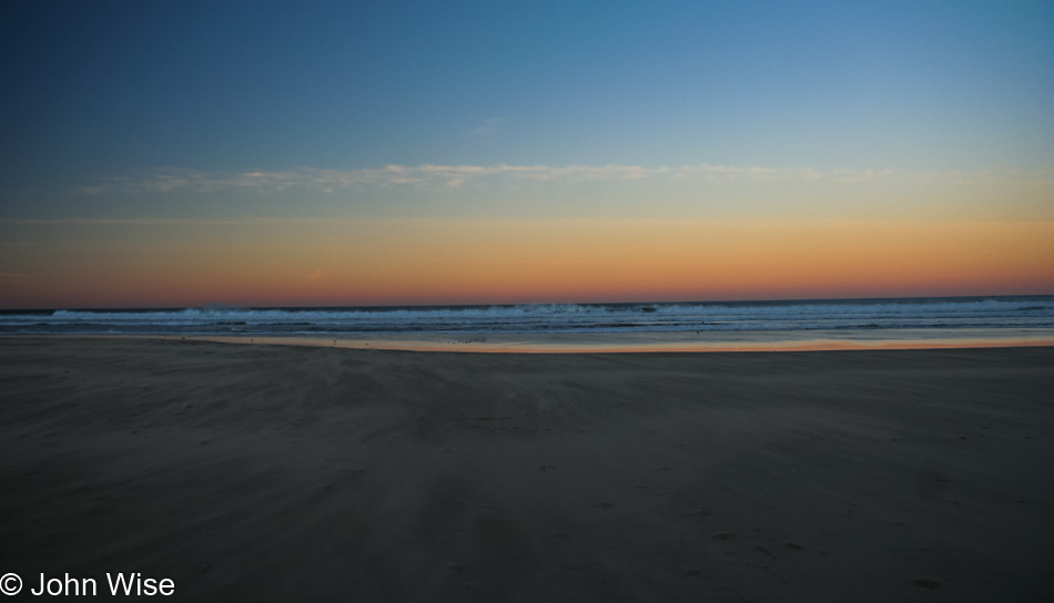
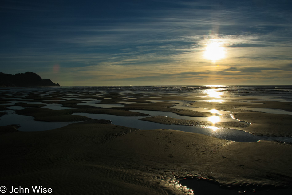
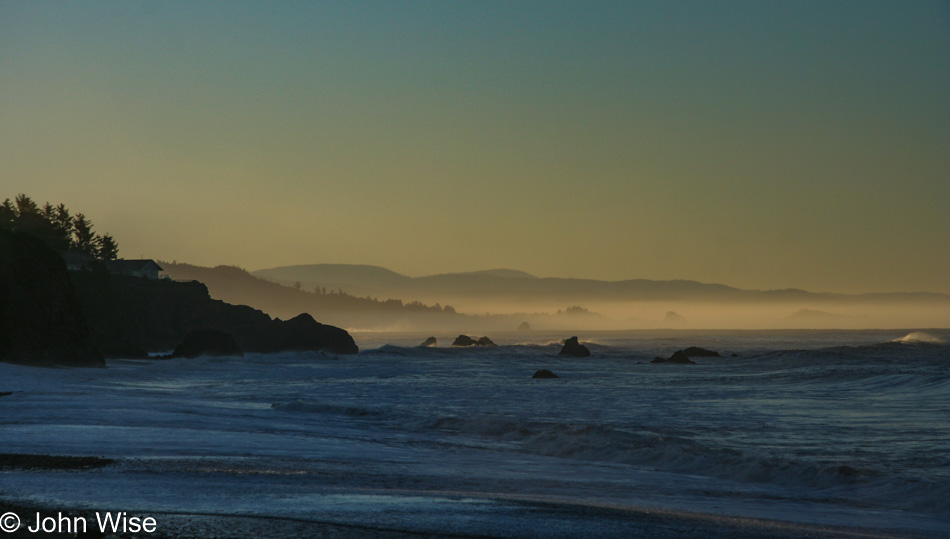
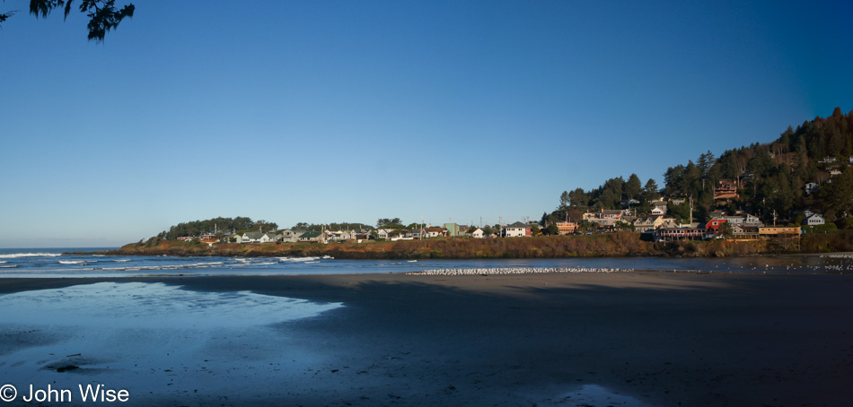
This is Agate Beach, south of the Yaquina Head Lighthouse in Newport, and yes, that’s frost on the beach. According to The Old Farmer’s Almanac, it was 36 degrees out here, but with the wind, we can distinctly remember it felt a lot colder.

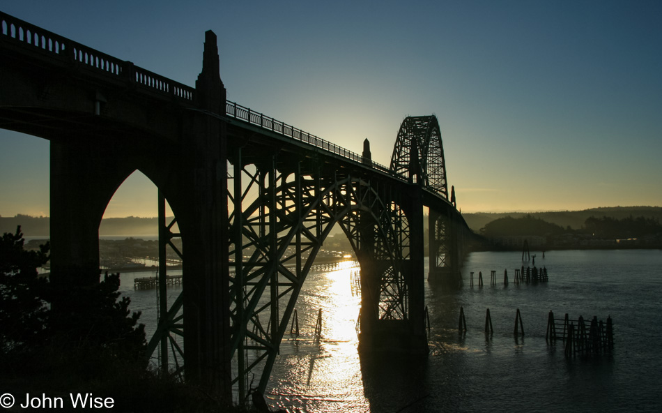
Just a bit of sun is enough to start warming us; well, that and another view of these bridges (Yaquina Bay Bridge in this case) that never fail to impress us.

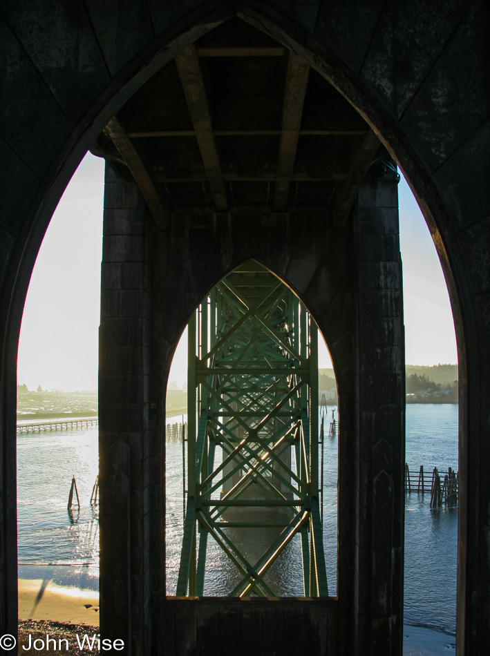
I’d like to think that the person who designed these was aware of the “road temple” nature of his creations.

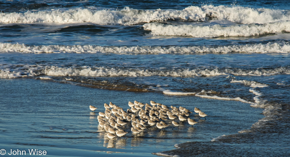
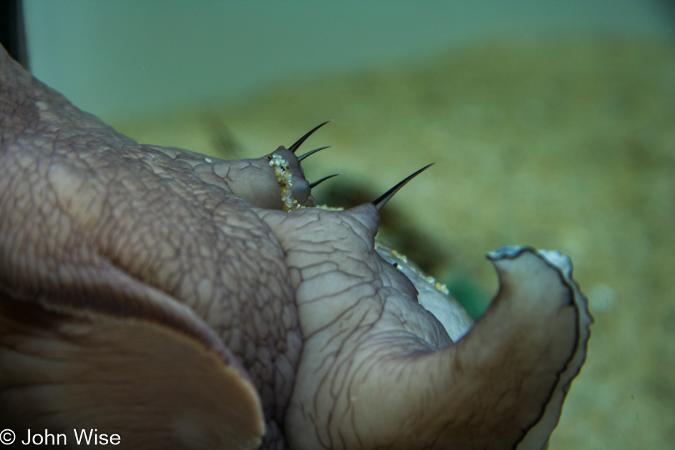
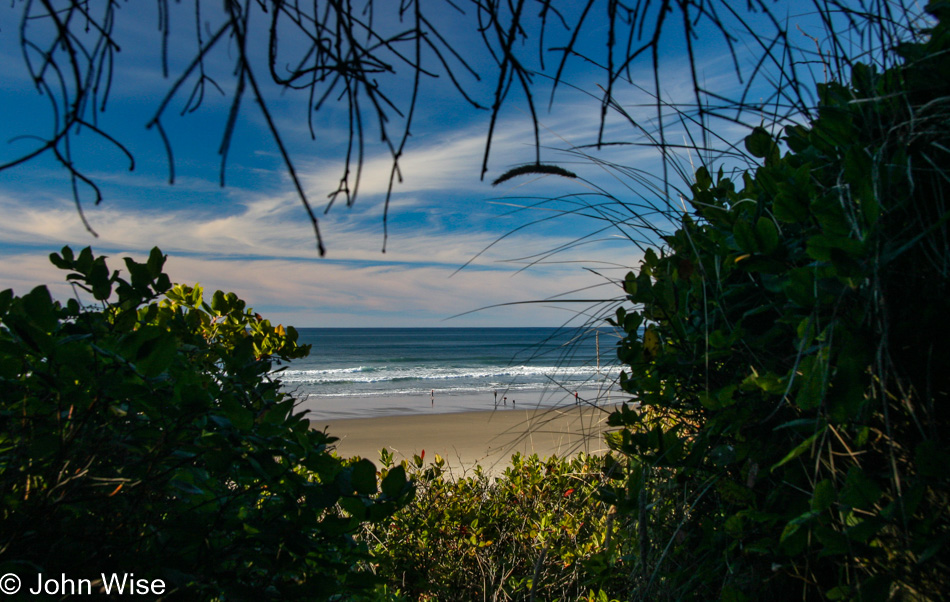
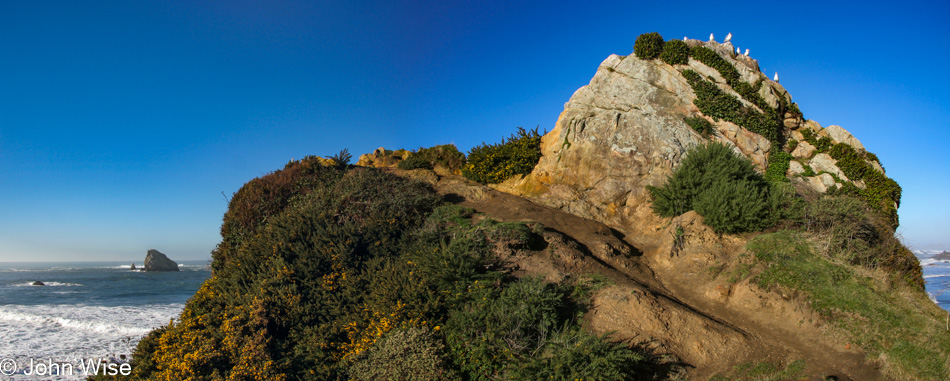
Every time we visit the coast during the late fall, we see these scurrying little fellows as they dart in and out of the surf, but we didn’t see them in our most recent visit here at the end of 2020. The Western Snowy Plover is endangered and has been for a long time; I can’t imagine a day when they are never to be seen again. We saw this flock at Seal Rock Beach.

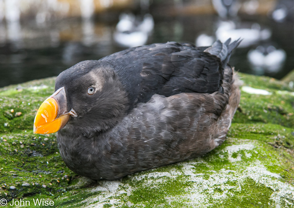
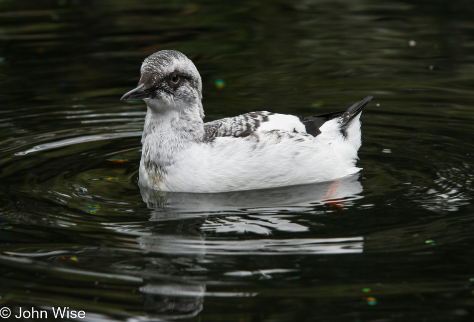
And here are two of the Southwestern Desert Plovers (the “P” is silent). One of them seems more abundant than the other, though you shouldn’t trust me as I’m no ornithologist.

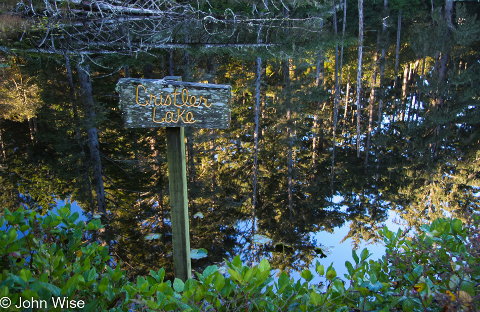
Somebody must have planted this sign personally christening Cristler Lake as such, as there’s nothing on the internet about this place. There is one other photo of it taken by someone a year after we shot this, but that’s it. Welcome to the place that no longer exists.

Yachats might be the first place we wanted to move to here in Oregon, though Bandon would have been a close second. We stopped in town to do our laundry on one of these trips; there’s something about visiting a local laundromat that either endears you or frightens you away – we found it charming. That laundromat is now gone. At The Drift Inn, we first watched and listened to Coin of the Realm Orchestra, playing European folk music. We bought their CD as the music felt like it was the perfect accompaniment to the coast.

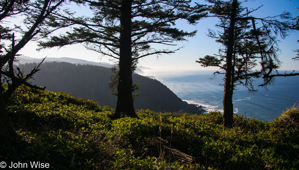
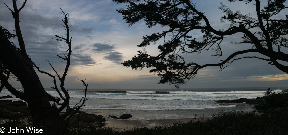
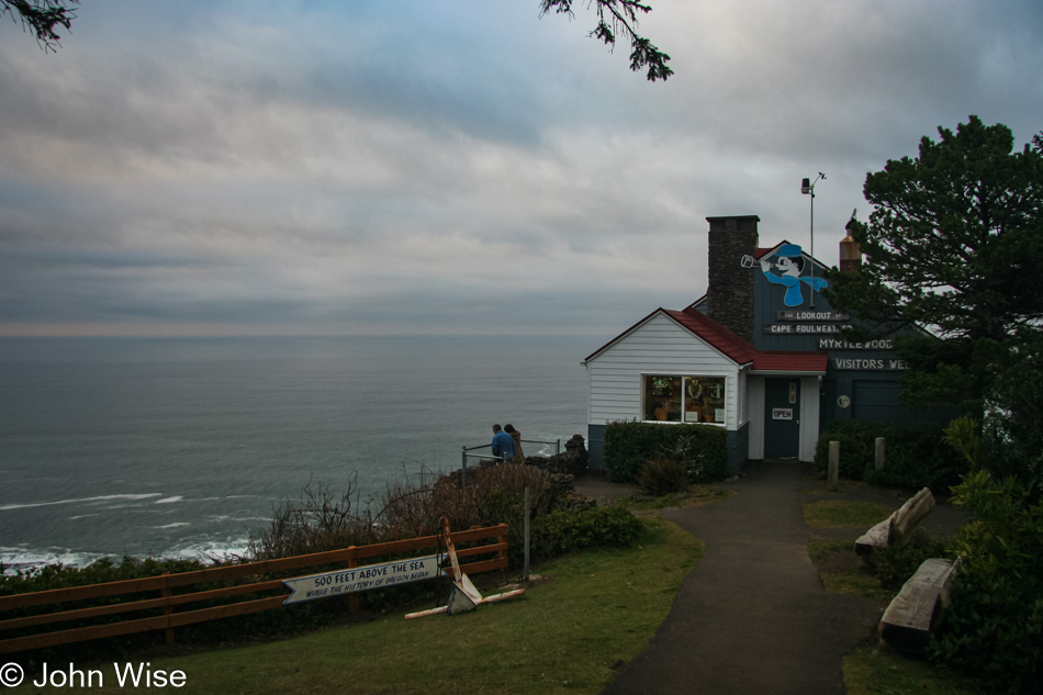
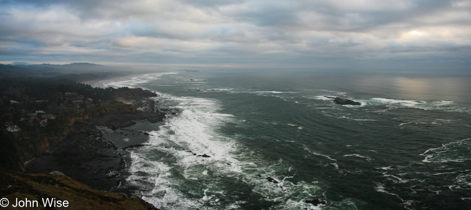
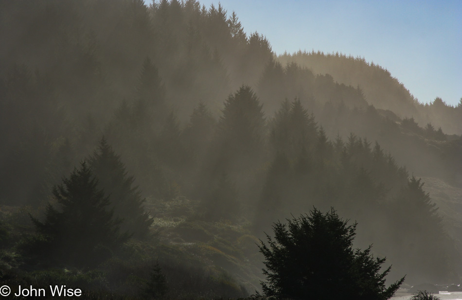
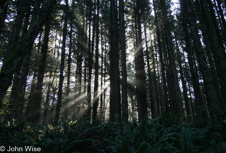
I’m not sharing the frightening views that are closer to the edge, but that’s only because I would have had to stop to take those photos, and when close to the edge and losing sphincter control, the last thing I want to do is stop and take a better gander at the precarious spot I’m standing in. So when I get behind the trees with plenty of land between me and the precipice of death, I can attempt to take my shot as long as there’s adequate light to get a fast shutter speed to counter the effect of my shaky knees. View south from Cape Perpetua Lookout Point.

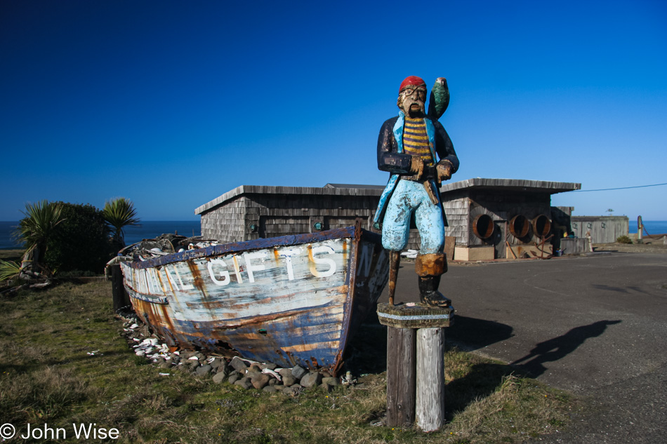
We had passed Sealines Nautical Shop south of Yachats when it was still open and thought we’d visit again on some upcoming visit. That day never came as they closed. Even before this day, when I snapped this photo of the fading boat and pirate, the owner had moved the shop to nearby Seal Rock, but we didn’t know that back then, nor would the place have had the charm of this seaside location. Every time we pass it, we remember fondly this former roadside treasure.

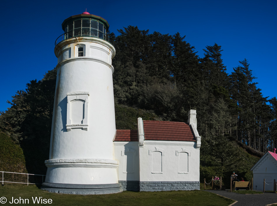
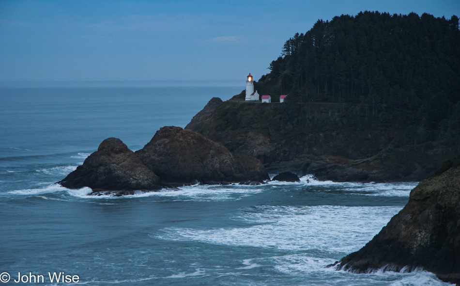
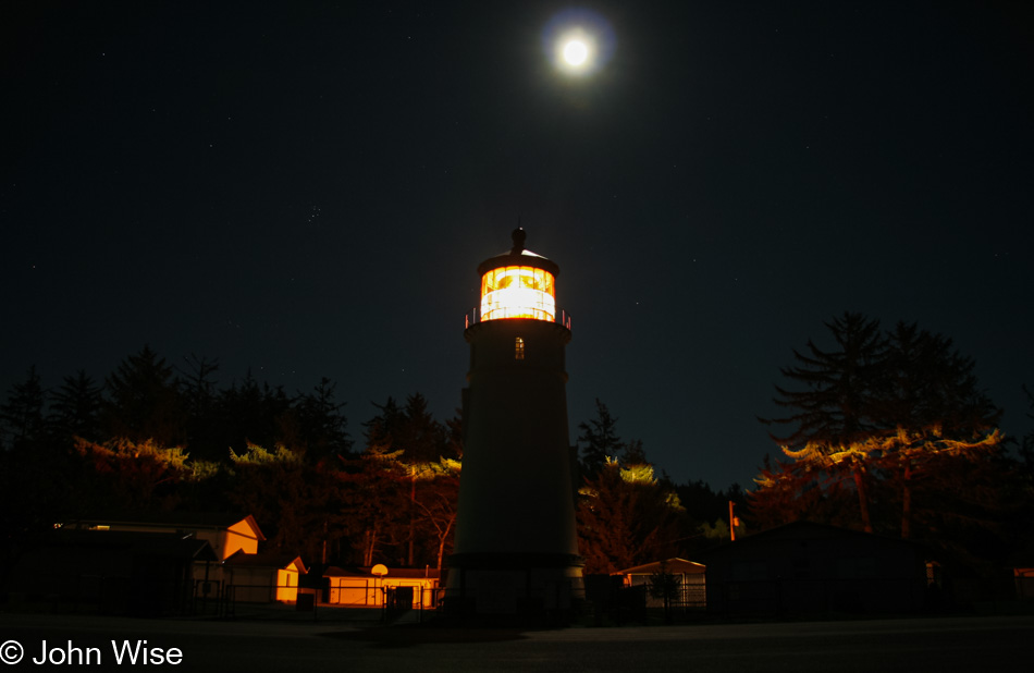
Never met a lighthouse we didn’t like. The other day, when we were visiting Carl Washburne State Park and hiking the China Creek Trail through the rain forest, we didn’t have enough time left in the day to hoof it out here to the Heceta Head Lighthouse, and the next day, the weather was poor. Here on Sunday, the day before we fly home to Phoenix, we are making time to properly visit.

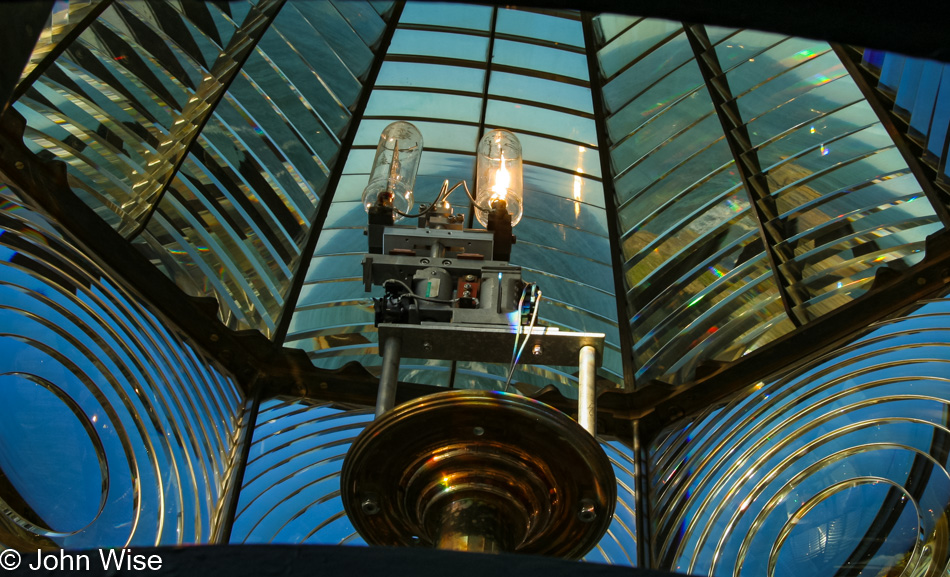
Yep, we even took the tour and were able to pop our heads up for a view through the ancient Fresnel lens.

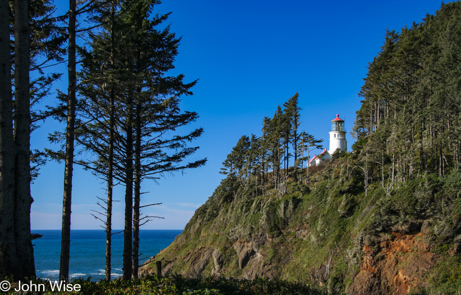
I have to appreciate how the park service keeps the trees cleared for this view of the lighthouse.

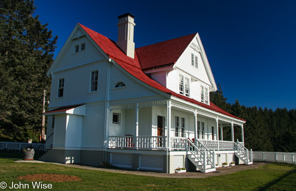
And finally, the Lightkeeper’s Home. Should you ever have an extra $1600 a night lying around to rent the entire house during winter, it can be yours on your next vacation. Otherwise, it’ll be about $1900 a night in prime tourism season.

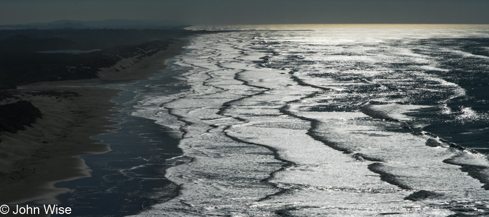
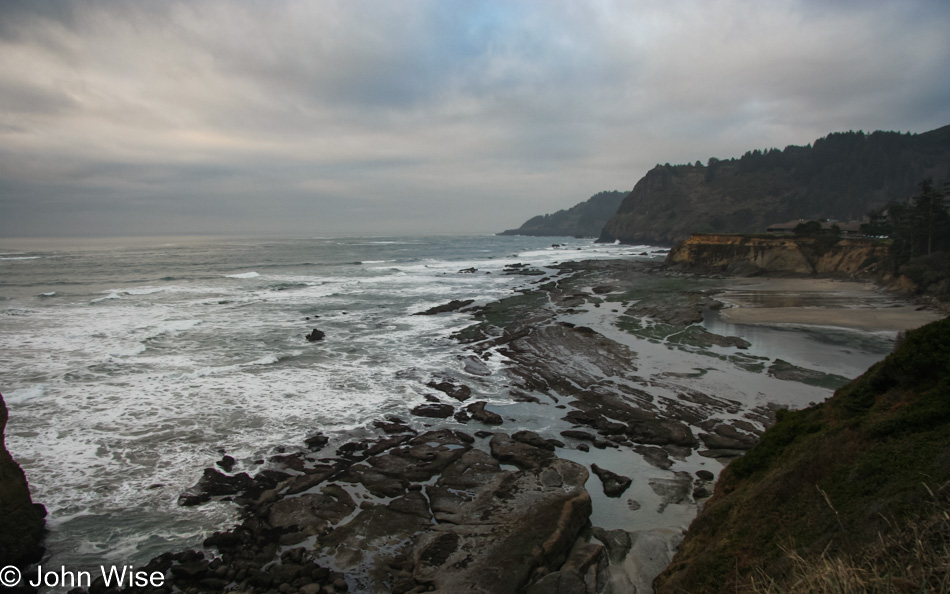
Here I am, 15 photos into this blog post with nine more images ahead of me, and I’m wondering how I thought it was a good idea to select so many. There were more than 390 photos shot on this day, so as a percentage, I was pretty discriminating. Okay, no, I wasn’t, as there are a lot of crap images in that directory that needed trimming. I can’t be certain without checking all of my other Oregon blog posts over the years, but it seems like this view looking south towards Florence is a recurrent theme.

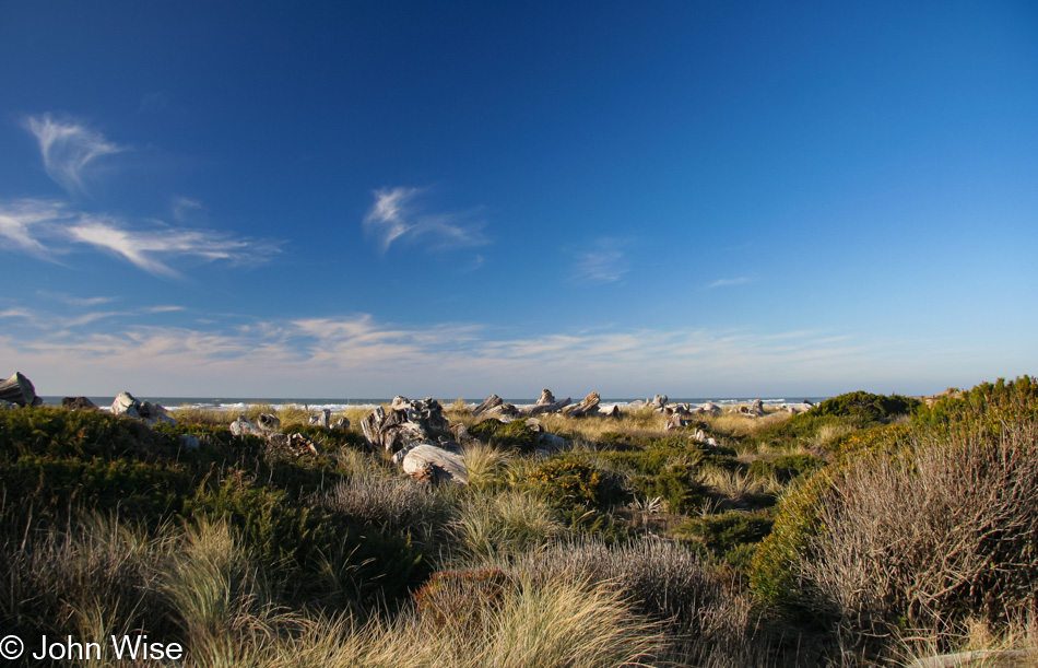
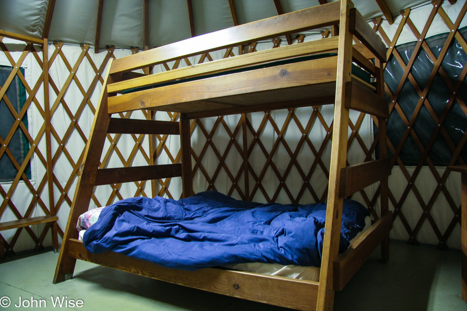
Our visit today to Bullards Beach State Park piqued our interest in staying in a yurt here, though obviously, we can’t do that on this trip as we already had reservations long ago.

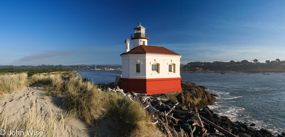
The Coquille River Lighthouse at Bullards is usually open for visits, but sadly, its Fresnel lens is long gone.

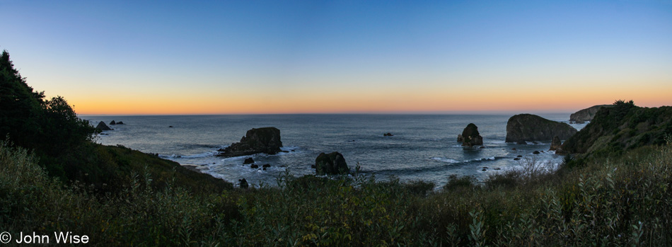
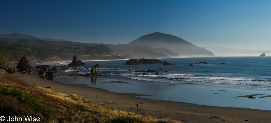
Magical Bandon. This year, 2007, was when real estate was booming here, with locals talking of Californians buying up everything. There was serious resentment going on as while some locals benefited from high prices others were noticing that people who called this home year-round were going to be priced out of the market. After the real estate bust the following year, things pulled back, but with vacation rentals and Airbnb being viable investment opportunities, the trend continues with inflated prices. But you can easily see why.

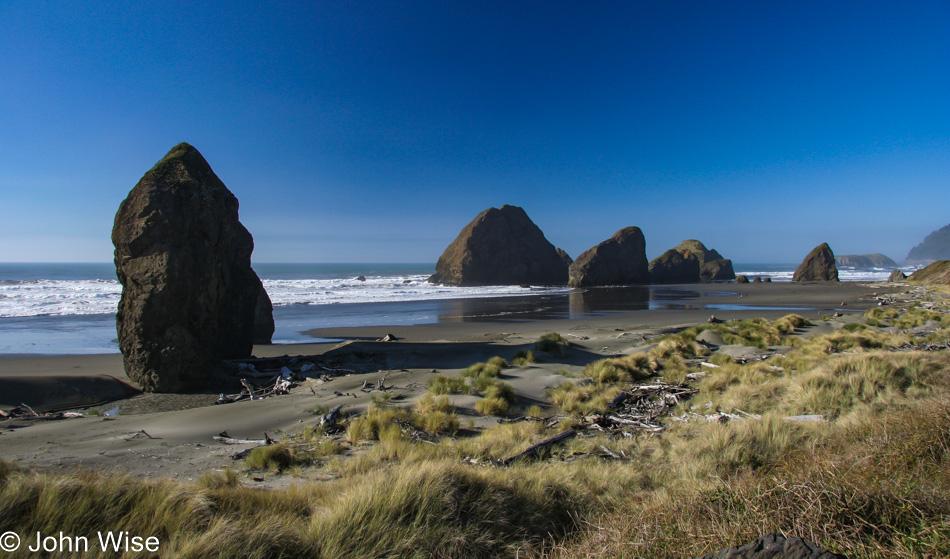
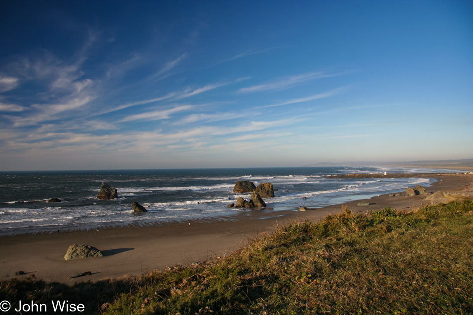
The view from the beaches of Bandon are equally beautiful.

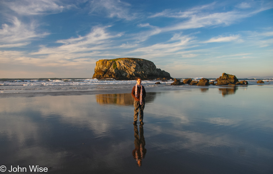
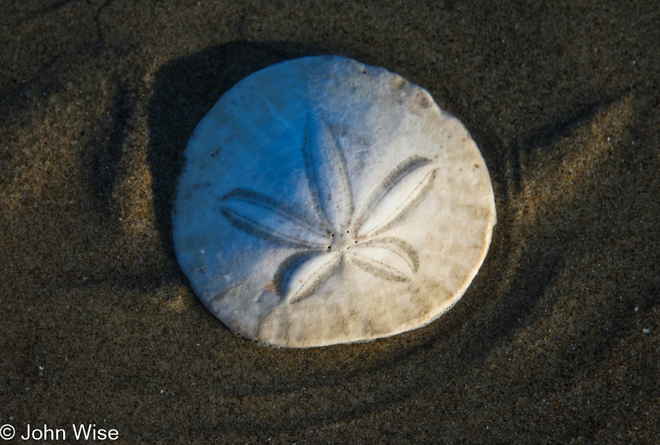
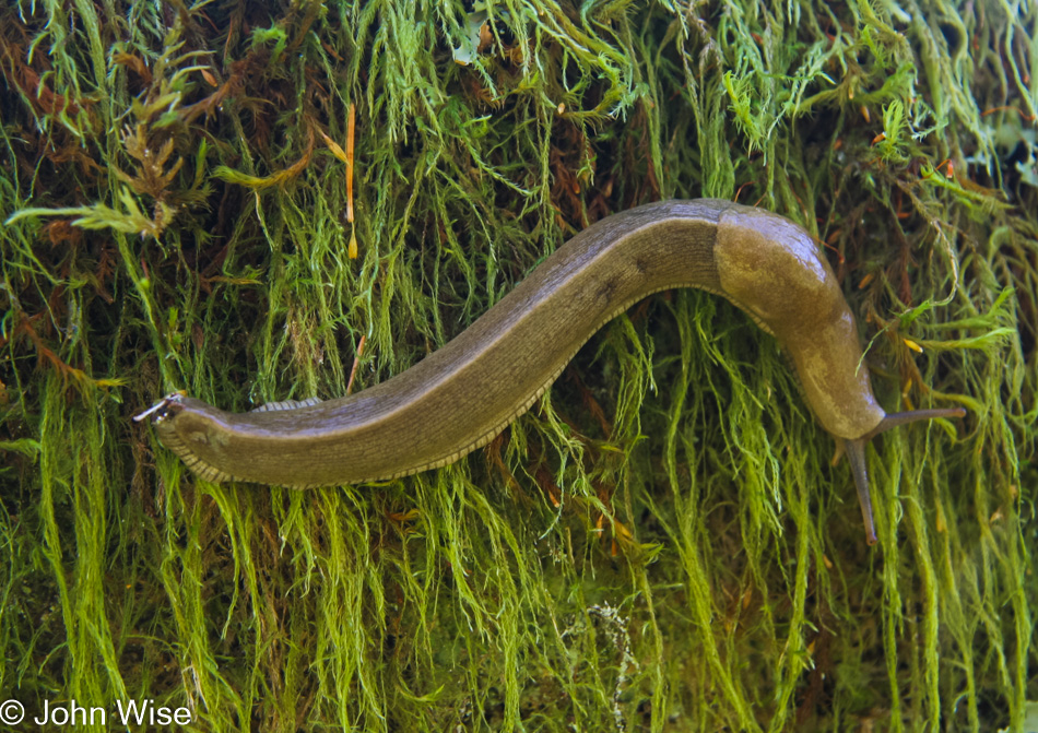
The same goes for what’s on the beach 🙂

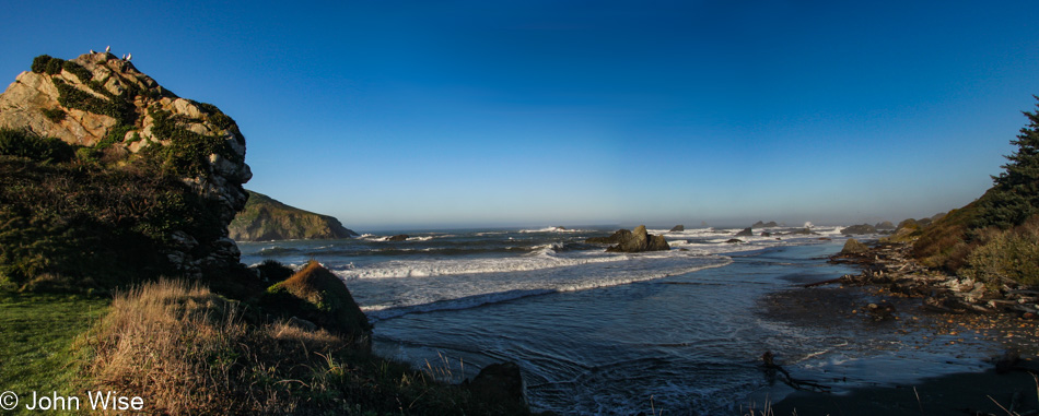
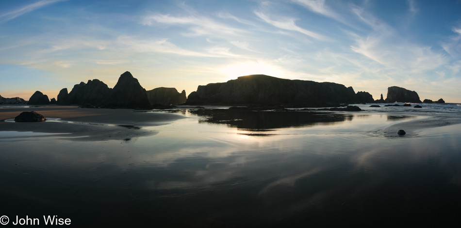
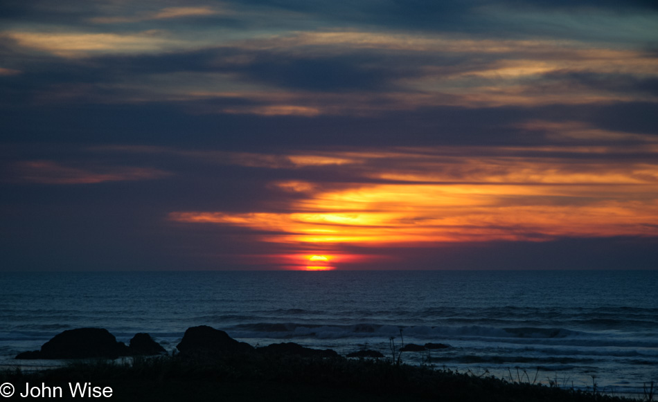
Our destination for the evening would be back south in Brookings for another night at Harris Beach State Park and our last night in a yurt during this trip. I don’t believe we ever repeated this feat of staying in a yurt every night of an Oregon road trip, as the occasional shower from the comfort of a motel room seemed like a nice break from the communal showers at the state parks. Anyway, Brookings is still 83 more miles south of here, and instead of wasting precious sunset time, we just hung out in Bandon and enjoyed the view.

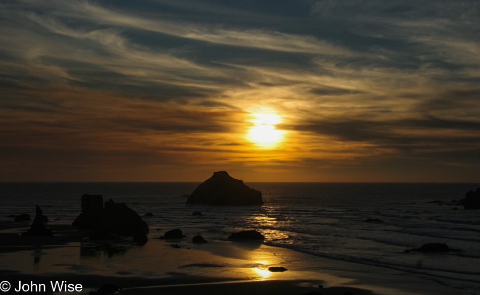
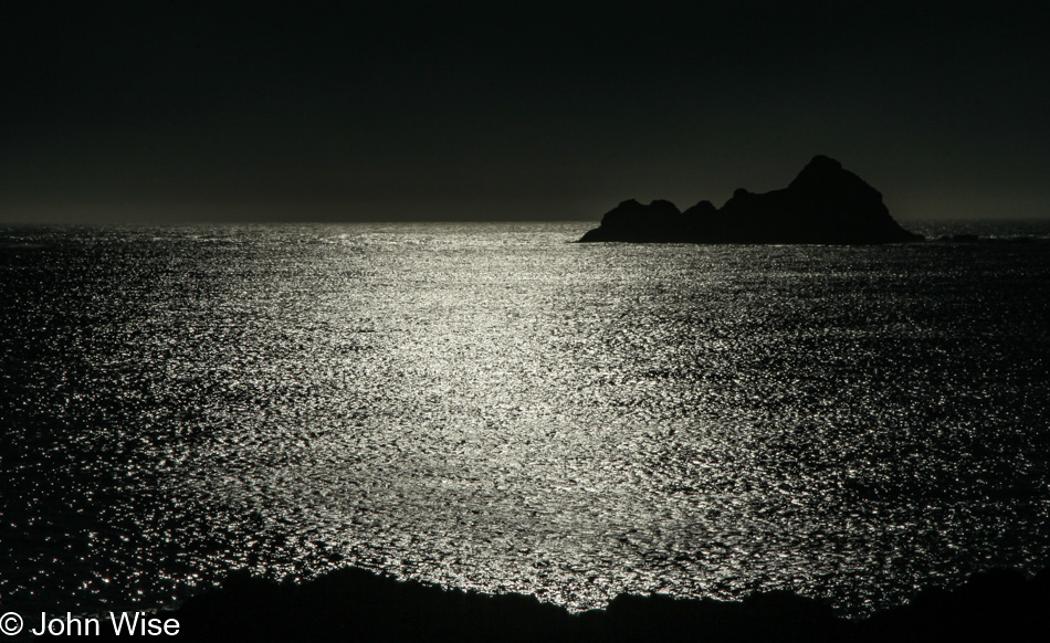
If you can’t already tell, the rock closest to the setting sun is Face Rock.

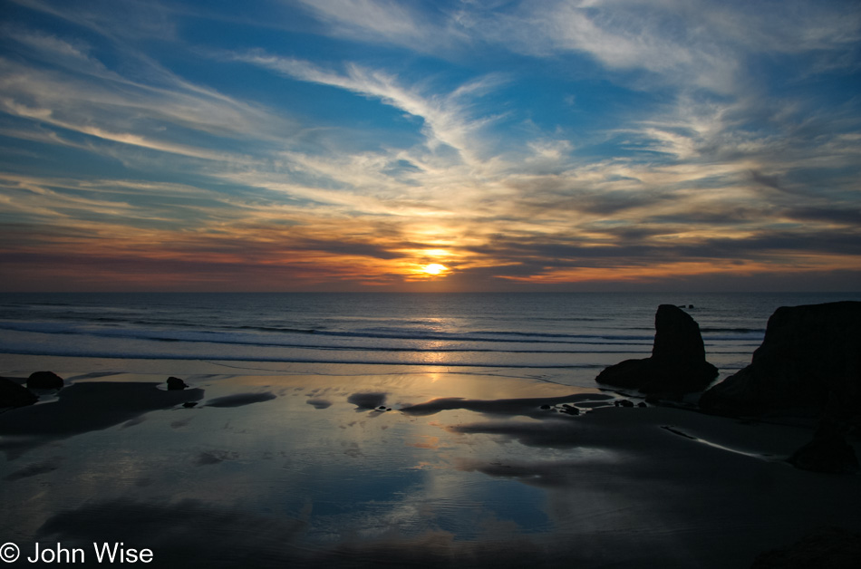
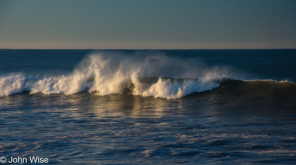
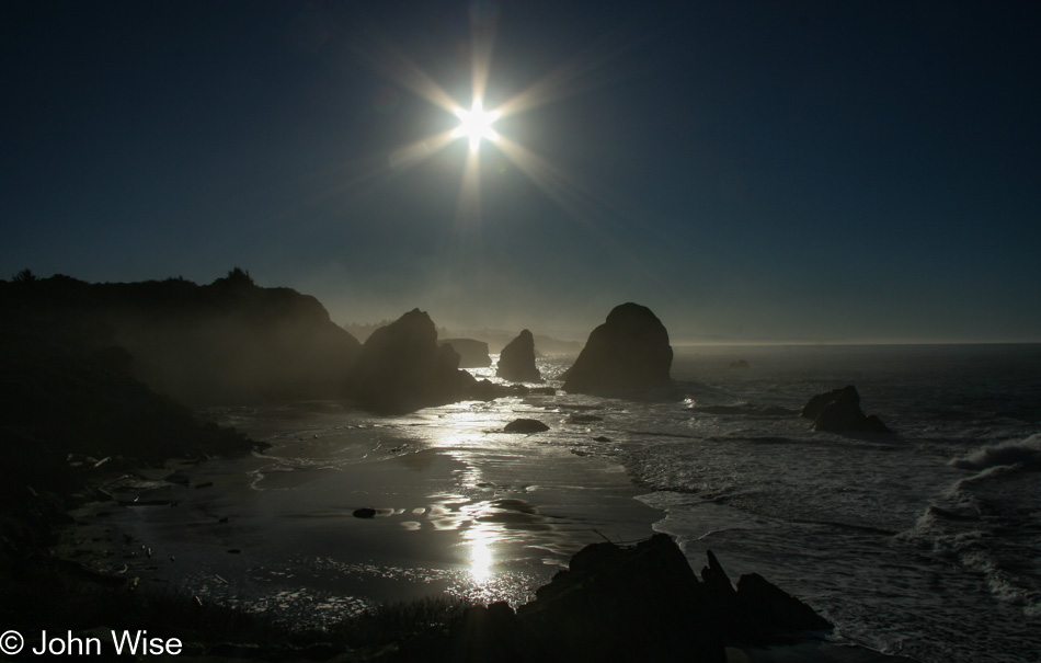
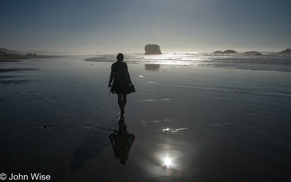
Sure, we still have a couple of hours driving before us, but we’re not leaving until we can no longer see a glimmer of the sun.

It was just a few more minutes after this when we could turn on the heater and start to warm up after a chilly late afternoon at the ocean. We’d do it all over again if we could have added just one more day to our vacation.

Gray Day on the Oregon Coast

As stated in the previous posts, which I have to recognize you may not have read since readers likely find this entry by searching, there were a few rudimentary notes accompanying a single daily photograph from back in 2007 when we made this trip up the Oregon Coast. For some reason or other, I didn’t bother to even do that for the last few days of our journey. While I expanded those posts with extra photos and a bunch of new text, I do not have the benefit of even a paragraph to help flesh out this day and the two that follow. I’m not going to try and interpret where I was with my thinking 13 years ago when we stood here looking out at Heceta Head Lighthouse or any of the other locations along the path we followed this day.

I will, though, try to add location data, such as this shot that comes from the Cape Perpetua Scenic Area.

Then there’s this image of a crashing wave that must be about 30-40 feet high. I shot this at Devils Churn, also part of Cape Perpetua. For some reason, I don’t have many images of the churn itself. This would have been our first-ever visit, and while the explosive water out at the shoreline was spectacular, it would be on a subsequent visit that I’d learn why this location earned its name. Of the few photos I did take, the water rushes into the gap on our right and sloshes around. Coming back on a different visit to Oregon, when conditions were right, we witnessed the water pounding itself into a frothy creamy-like consistency, which splashes and ripples into sculpted, transitional works of art that ride on the pulsing current. I hope that at the time we were here, I already clearly understood the dynamics of how weather, time of day, and time of year impact a place and influence its appearance. Maybe I did get it back in 2007, but I feel that I understand this a lot better at this stage in my life.

Hey, I’ve got a great idea. How about you step out of the car with some of our bread and see if the seagulls will take it from your hand? It turned out that this is a great way to recreate scenes from Alfred Hitchcock’s classic film The Birds.

Our original itinerary had us traveling from Waldport east on the 34 through Tidewater and Alsea before reaching Philomath out near Corvallis before turning west on Highway 20 through Blodgett and Eddyville, finally going south on Elk City Road and following a small road to Toledo and then Newport back out on the coast. With the gray weather, we must have decided that the photography of the countryside would be less than great, so we skipped the 125-mile loop detour and went straight to Newport.

While we didn’t go to the aquarium specifically to see this Baron Vladimir Harkonnen fish stuck to the tank window, it was certainly a highlight.

Caroline struggled to identify this bird, as finding photos of it wasn’t all that easy. Sure, it kind of looks like a puffin, but they have seriously distinctive colorings, while this bird is gray. Well, it turns out that the winter plumage of the Tufted Puffin looks just like this.

As for this bird, it remains a mystery shorebird that escaped her best efforts to identify it.

On our left is one of the iconic sights found on the coast of Oregon, but since we have arrived at low tide my photo was less than stellar, so I present you with Otter Crest Beach North of Devils Punchbowl Natural Area.

From The Lookout here at Cape Foulweather, you can have one of the most unique views on the entire Oregon coast.

This is the view south. You should make a visit yourself to see the view out to sea or up north; it’s well worth your effort.

In our memories, we’d passed the Lincoln City Glass Center a hundred times before we finally committed to stopping in and giving it a go. As a former union member of the Glass Bottle Blowers Association of Los Angeles back when I worked for Owens-Illinois as an apprentice bottle maker, I’d had enough of playing with glass, so I operated the camera while Caroline worked to make her dream come true.

Her objective was to make a “Wave Float” using the colors of the area that would remind us of the Oregon coast for years to come should we not be able to return. Little could we have guessed back then that over the next 13 years, we’d return 11 more times. The float still sits on our counter, and should the day come when we move back to Europe; it is one of the things that will come back with us.

The night was spent in a yurt at Beverly Beach, which turned out to be our least favorite State Park with too much road noise from Highway 101, not that we didn’t try it again.

Green Snow

Yet another gorgeous day! With only 45 miles to drive between campsites today, we arrived at Carl Washburne State Park quite early. Plans were that we would hike to the Heceta Head Lighthouse the next morning, but as we were here so early and who knew what tomorrow would bring, we opted to take the hike today. Immense was the beauty we walked into. The greens were electrified, misty light rays poked through towering trees, and mushrooms dotted the landscape. Walking along the trail, there were parts of the forest where one could imagine green snow had fallen overnight, carpeting the forest in emerald hues. It seemed rare to see two of the same types of mushrooms; everywhere we looked, a new, bigger, redder, whiter mushroom would poke through the moss. Our walk became a crawl; hours passed, literally, before we made it to the fork that would take us either to the lighthouse or to the beach. With early sunsets at this time of year, we opted for the beach route. Low tide greeted Caroline and me on a broad, flat, sandy beach reflecting the golden sun and, further north, exposed tide pools with anemones, starfish, barnacles, and mussels. Another perfect day.

That’s how this blog post sat here for over a dozen years until here in late 2020. While mulling over our previous trips to the Oregon Coast after our return from our Pandemic Dictated Remote Self-Isolation Vacation, I noticed a serious void of photos on the blog while a number of worthwhile images existed that could have been posted. The bandwidth options back then severely limited what we could share, so a paragraph of text and a relatively low-res image per day was all I could deliver. But now I can do a little updating and some digital housekeeping by bringing in more details to the visual narrative of the trip wherever possible.

The original post let go of the morning spent walking out near the Umpqua Lighthouse area and jumped to Carl Washburne due in part to what I said in the paragraph above but also due to the fact that I wasn’t all that comfortable with writing yet. It probably took me as long to write 100 words back then as it now takes me to write 500 but that’s just a wild-ass guess.

We’re in the sand dunes of Reedsport, heading north. I should point out that the fleece Caroline is wearing she picked up at Monterey Bay Aquarium down in California, one of our absolute happy places on Earth. The shirt was from Yarn School in Harveyville, Kansas, where she had learned to spin yarn. Also, note the GPS in her right hand; the world had just been introduced to the first smartphones at that time, but it would still be half a dozen years before we’d get our first one. All the waypoints we took back then have sat around worthless in some directory I’m too lazy to find and delete.

The China Creek Trail at Carl Washburne State Park. We had passed by on a couple of prior occasions, but someone had assured us that it was one of the greatest trails on the entire coast. After this, I don’t believe we ever missed an opportunity to walk it again and again.

The silly writings of enchanted forests may not be so silly after all, as this would qualify as just that to me.

From this first visit to all subsequent visits, I’ve never tired of seeing the variety and often bizarre beauty found in these fungi.

Surprises pop up all the time. I have to admit that I didn’t make my best effort to effectively photograph our time in the rainforest, probably because I was so overwhelmed by it all.

The Hobbit Trail brought us to the beach.

Caroline walking barefoot on the beach at Carl Washburne State Park.

Happy as clams.

Normally, we find these guys gutted and often upside down after a seagull cleans it out. I can no longer remember if this guy was stunned, alive, dead, partially consumed, and abandoned on our approach, but I do know that we didn’t make a meal of it.

Nor do we eat sand dollars.

We were in no hurry to go anywhere this afternoon as our lodging was right here across the street at Carl Washburne in one of two yurts in the park.

Perfect Day

We were hoping for reasonable weather; global warming delivered a perfect day. Caroline sprung from the yurt with glee. The sky was a perfect blue, and it was cold enough to warrant a couple of cups of hot coffee from our favorite little coffee shop in the whole world – Dutch Bros! A bit of fog adds mystery to the landscape, and it turns out that extraordinary high and low tide events are happening while we are traversing the coast. The drives between campsites are short so we have more time for sightseeing and sipping coffee. Our first hike on this trip was a part of the Oregon Coast Trail – the OCT in local parlance.

So here’s the tragedy of the photos that follow here on this day and the next four: Originally, I had posted the above text on this day (the 22nd), and there was one paragraph that accompanied a single photo on the 23rd. After that, there was nothing. I hadn’t even posted photos. As a matter of fact, the photos you are seeing are what necessitated this explanation, as back in 2007, when these posts were originally created, we were still dealing with poor bandwidth, and I could only include 1 photo per post, and even those were low resolution so it wouldn’t take 5 minutes for my homepage to download. Now what? I can’t muster anything meaningful to say about the individual images, as whatever thoughts were had back then are now lost to time.

While the images stay with us and will hopefully always be a part of how we see the world, whatever thoughts we were having back on these fall days cannot come back.

As we walked along the ocean here at Harris Beach on this day, there was a part of us changing as this marked not only our 8th visit to Oregon, though some of those had been very brief, it was also so far our lengthiest and most immersive stay on the coast.

These vistas, fog, the sound of crashing surf, silvery ocean, spectacular sunsets, and the nature of our accommodations in yurts all worked to ensure we’d be back time and again. How many times we couldn’t even imagine back then?

This was the original photo that accompanied this blog entry, as it was posted back in 2007. At that time, my blog was a “Photo Of The Day” affair, known then as POTD. It seemed perfectly adequate to post a single photo of a travel day with a small blurb to mark the occasion. Prior to this, people allowed their old photos to languish in drawers hidden away with all relevant data that pertained to whatever specifics they once knew about the people and locations long gone with fading memories. That Caroline and I would have some small snippet from the day, and a photo tied to it would allow us to return to the computer and dig out the old images so we could once again walk in the paths that we had traveled so many years before.

Back then I could never imagine that I’d take more than a quarter of a million images and delete nearly 25% of those as the quality was so poor. With so many photos saved as bits on a hard drive, there’s really no easy means to scan digital memories. Even so, many of the ones I’ve saved are far from worthy of looking at again. The saving grace is that I can still scan them and pull out a handful that still represents the best of the day.

Take this photo of misty trees near Cape Ferrelo, just 4 miles north of the photos from the beach pictured above. With 340 photos that track the majority of the day, we can glean points along our route that are obvious, and then with some Google Streetview sleuthing by Caroline, we can learn that we’d spent about 2 hours exploring Harris Beach in the morning, before making our way up here.

There are photos that, at first blush, are not all that appealing, but apply some lighting adjustments, and maybe I can breathe life into an otherwise lackluster image. Somewhat tragically I was shooting jpeg instead of RAW in 2007 when memory cards were still expensive and our lust to travel demanded we cut as many corners as possible. We loved staying in yurts; they were our cheapest options short of camping, but some of these mornings would dip into the upper 30s, and we didn’t feel prepared for that level of discomfort.

All these years later, I could have easily assumed that somehow we’d been transported to the Carl Washburne State Park much further up the road, as that’s where my memories are strongest for seeing a wide variety of mushrooms. These photos were, in fact, taken on the Oregon Coast Trail (OCT) near the House Rock View Point.

Not that it matters one little bit that we saw a banana slug on Thursday, November 22nd, 2007, on the OCT, but we did.

Pistol River State Scenic Viewpoint on a lovely day. What more can I say?

My lovely wife Caroline walking barefoot next to the sea on a perfect day.

That’s Humbug Mountain in the distance, as seen from the Battle Rock Wayside Park here in Port Orford.

Only minutes later, we were standing on the dock in Port Orford. It hadn’t magically become night in an instant; this is just the nice effect of a small aperture on a camera that is adjusting to the blinding reflection of the sea, or maybe I pointed the camera at the sun before locking the aperture to get this effect. In either case, it’s not the truth of the image that’s important but the feeling these locations inspired as we stood there for our minute or two we were so fortunate to be present.

Umpqua Lighthouse in Reedsport, Oregon

It’s nearly impossible to make out the red light coursing over the trees, but it’s there. On a quiet night under the waxing gibbous moon, we stood in awe of the Umpqua Lighthouse, watching the silent light turn and dreaming of those at sea so many years ago who used this beacon to stay alive on a treacherous ocean. Our yurt is only down the road, our second time staying out here.

Redwoods

Redwoods National Park in California

Time to hit the road, well, after taking to the skies. Today, Southwest Airlines flew us to Sacramento, California, after a short delay while they exchanged planes since the one we had boarded first was leaking fuel from the engine. Flying meant we were ill-prepared for camping, requiring us to purchase supplies. Walmart and Whole Foods were the two stops that brought us up to speed. Now, on the way, we aim for the Redwoods National Park on our way to the Oregon Coast State Parks, where we’ll be roughing it in yurts.

Harris Beach State Park in a yurt Brookings, Oregon

Those Mongolian-influenced tents come with a heater, lockable door, beds, table, light, windows, picnic table, and barbecue. The weather is beautiful, and things are looking good. Tonight, we are back at Harris Beach State Park for the third time in the past five years. As a matter of fact, we’ll be staying in yurts for five consecutive nights. This year, we got smart and decided to bring our own bedding, as sleeping under our comforter with pillows picked up locally is far better than our sleeping bags, or so we hope.

My Favorite Futon

A six inch layer of latex, cotton batting, and a layer of wool are the components that were made into our new futon

Mwahaha, now I have the secrets required to build my own futon, start a nationwide chain of stores and destroy the puny competition. All thanks to Tom at Futon Favorite in Phoenix, Arizona. Actually, Futon Favorite custom-made our new futon mattress to my specifications – what a treat. We started with a six-inch layer of latex, wrapped that with multiple layers of cotton, threw on a thick layer of wool, which allows our futon to be fireproof and not have to be treated with boric acid. Finally, it was all wrapped up and sewn into a cotton cover. Tom was hundreds of dollars cheaper than anyone else I could find who was selling healthy futons. Now, a month after sleeping on our new mattress, all I can say is, WOW! We love our new bed. Ok, Tom, this was my pitch for your store – Futon Favorite at 509 E. Camelback Road with the toll-free number: 1-888-763-8866 his website is at www.futonfavorite.com – now what kind of discount are you going to give me on those Tatami Rice Mats?