International Folk Art Market – Santa Fe

The International Folk Art Market in Santa Fe, New Mexico

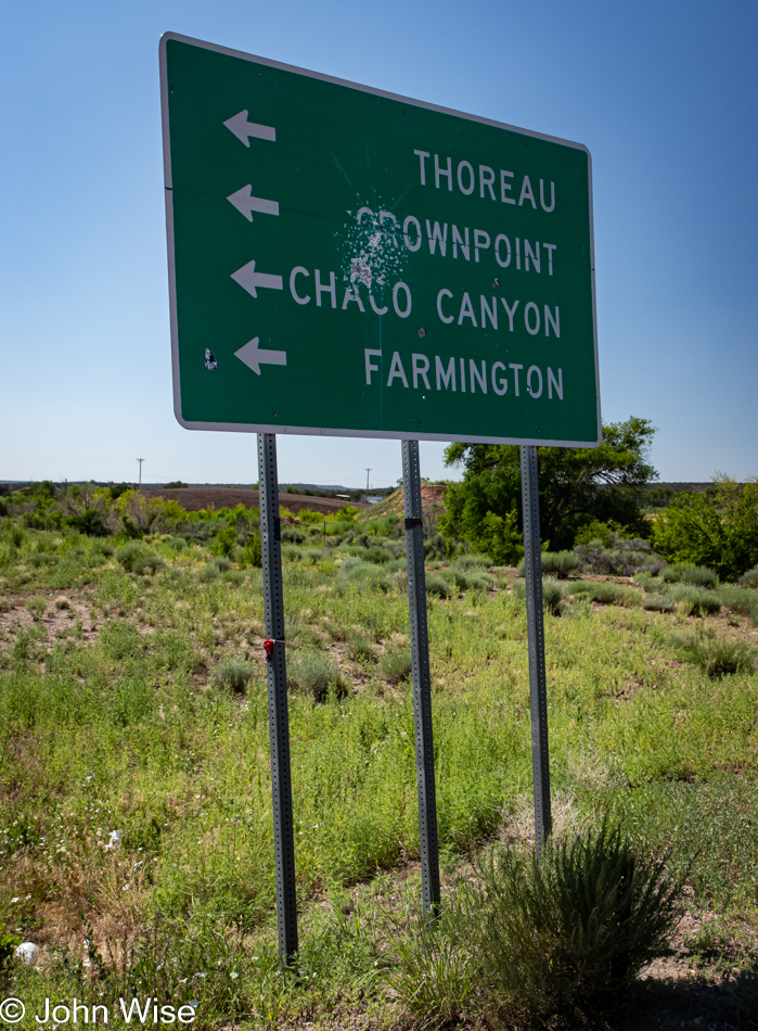
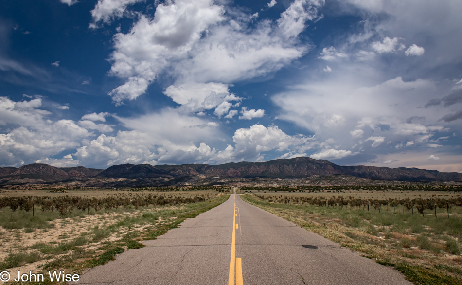
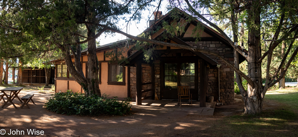
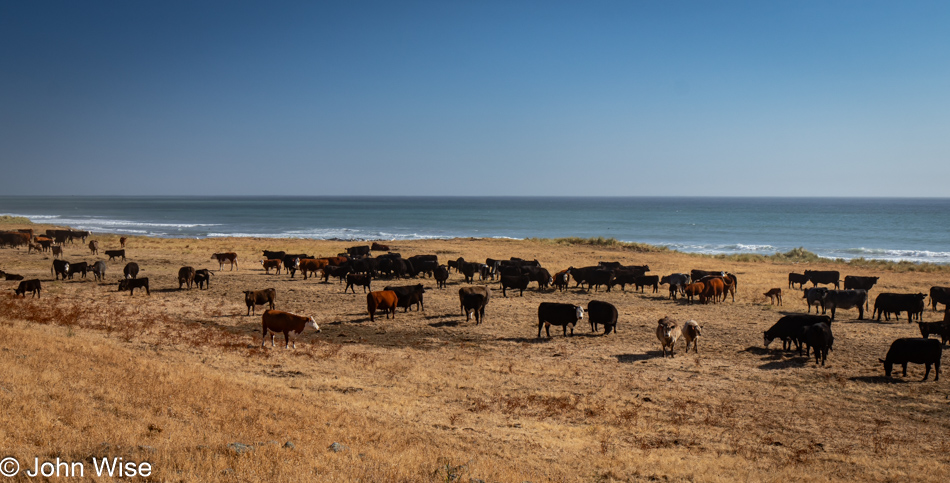
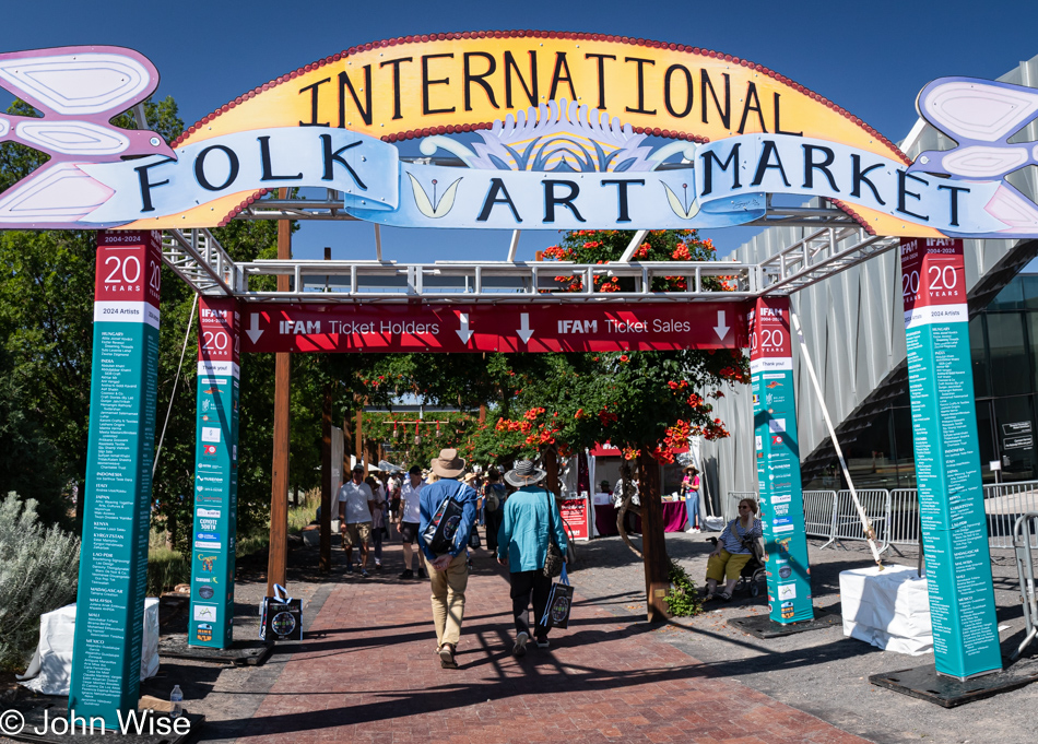
Shop, eat, nap, repeat – not necessarily in that order. New Mexico state law says that visitors must eat as much green chile as possible, and we try our best to meet that obligation by visiting the Pantry down the road from our Motel 6 (paid $85.95 a night). Green chiles are the state food, flower, plant, symbol, mascot, decoration, main export, and the mandated color of wedding attire. There are old adobes that have been found to have been made of green chiles, gas stations sell a green chile blend of fuel, and the local chickens taste like green chile. If you’ve never tried green chile apple pie, you don’t know what you’ve been missing. After paying homage to this New Mexican staple, a nap was in order, but also because we had more than 90 minutes before our timed entries would allow us to begin our third visit to the International Folk Art Market here in Santa Fe.

Caroline Wise at Ecuadorian booth at the International Folk Art Market in Santa Fe, New Mexico

Shop with frantic madness to separate ourselves from whatever money we had before our visit in order to leave with some rare items that Caroline will wear and use into the future with a solid knowledge of their exquisite nature and significant history. In comparison to certain designer fashions, these things might be considered inexpensive, but compared to what is spent by the majority of humanity, a dress dyed with caracol snails for a shade of purple is likely an article of clothing that many on earth would have to work months to afford. I should add that nothing Caroline takes home with her is disposable or fast fashion. All of it certainly falls into the category of slow fashion and will likely be used and cherished by her until the end of her life.

I mention fast fashion because Caroline recently pointed out that the average American disposes of 81.5 pounds of clothing per year. I find this impossible to believe, considering I throw away six pairs of boxer briefs per year (I checked against my Amazon orders), which weigh 15 ounces for the entire package, while my short-sleeve XXL shirts that weigh about 11 ounces each are worn until Caroline can no longer reasonably repair them, between three and four years each (as evidenced from photographic proof seen here on my blog). My convertible quick-dry shorts weigh 14 ounces; my handmade socks are never thrown away, and a pair of Levi’s are one pound each. Approximately every three years, I’ll have tossed about 12 pounds of clothing or four pounds per year. Caroline, on the other hand, only throws away underwear and factory-made socks, which weigh far less than anything I send to a landfill. Anything else she rids herself of (which is incredibly rare) goes to Goodwill for recycling into other people’s hands. As a couple, we shed approximately six pounds of clothes per year compared to others who are apparently tossing 163 pounds of clothing. [In fairness, we should probably add the weight of the items that I have donated, but even those would only be a couple of pounds at most – Caroline]

Caroline Wise visiting Papua New Guinea booth at the International Folk Art Market in Santa Fe, New Mexico

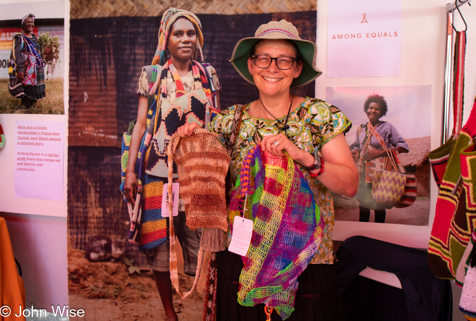
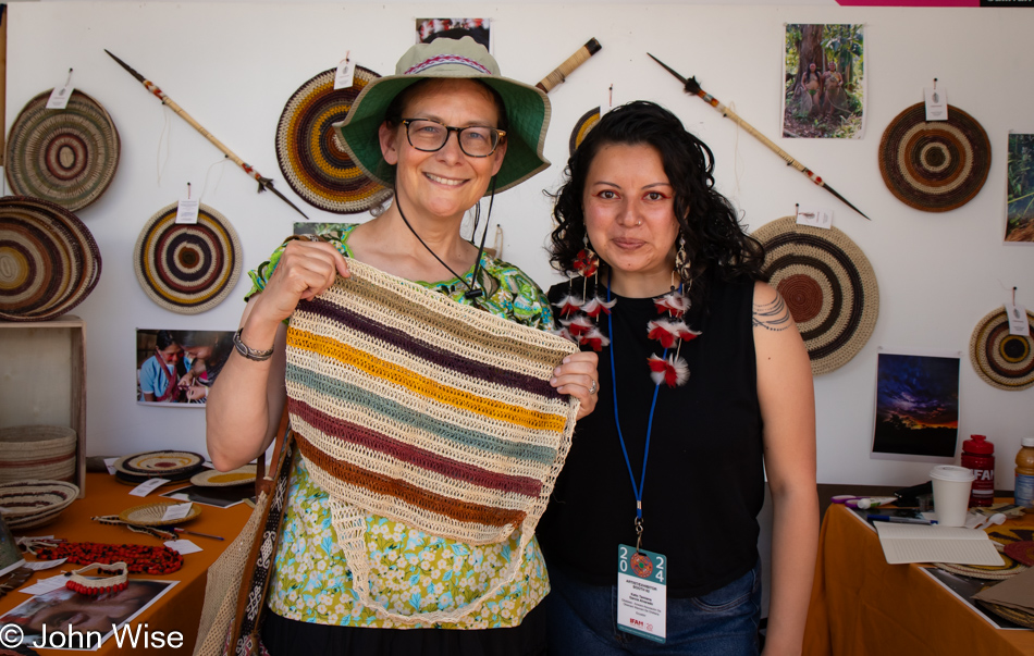
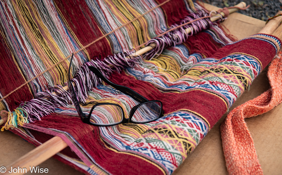
Caroline’s first purchase was the bag from Ecuador, seen in the photo above this one, while these two bags were made by handcrafters in Papua New Guinea. There was a time when my wife would use the same bag until its functionality would no longer be serving that purpose. Now, she’s a bag fetishist. [I prefer bag enthusiast – Caroline]

Caroline Wise at Ethiopian booth at the International Folk Art Market in Santa Fe, New Mexico

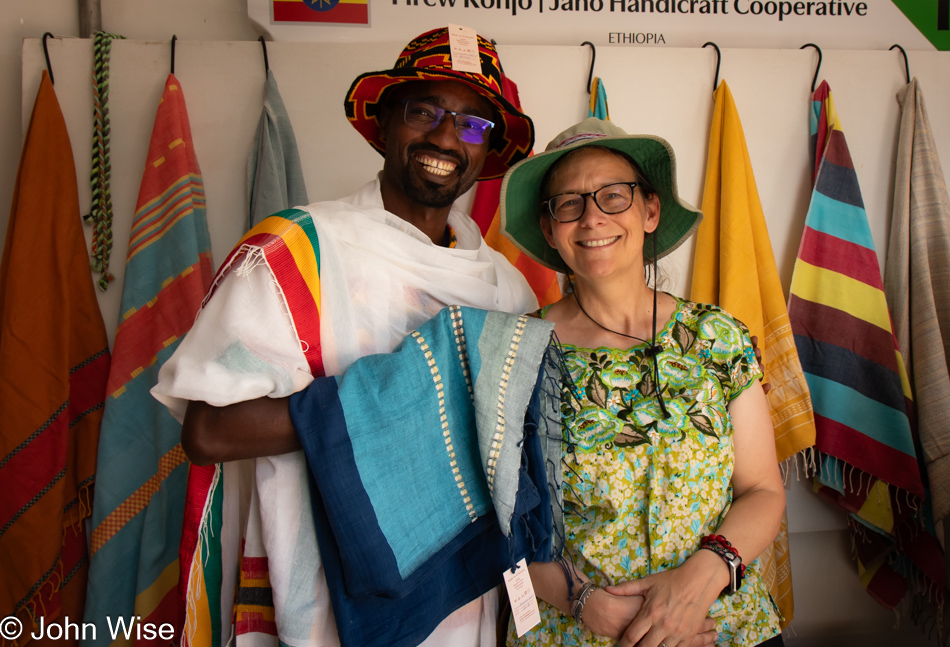
Hand-woven, knitted, embroidered? Yes to all of those, and she has an extra soft spot if they are shades of blue. The shawl we just bought came to the U.S. with this young man representing an Ethiopian cooperative.

Backstrap weaver at the International Folk Art Market in Santa Fe, New Mexico

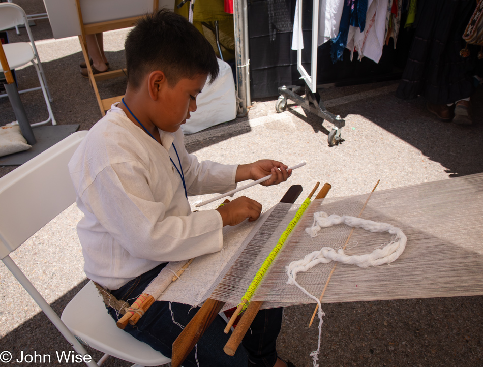
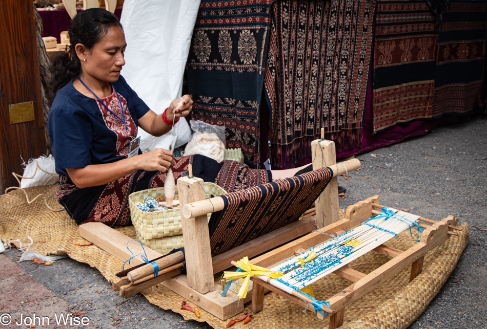
This young boy has the opportunity to become a bit of a celebrity in the world of backstrap weaving if he keeps up his practice and turns his attention to the mastery and art of the craft, as this is typically women’s work. While women reach those heights, too, as they are the heart and soul of this ancient process, somehow, the peculiarity of men performing this work remains an anomaly.

Caroline Wise at Mexican Dreamweavers booth at the International Folk Art Market in Santa Fe, New Mexico

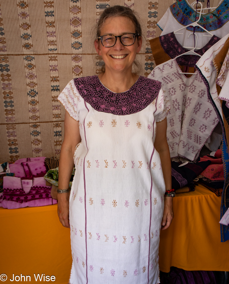
It’s not every day one can go buy a dress made with thread that’s been dyed this particular shade of purple. It is extremely rare. The color is from the caracol púrpura (Spanish name) or, as it is known in Oaxaca from the Mixtec word, Tixinda. The purple snails that are responsible for this shade are not easily found, as they must be collected and “milked” at low tide when licensed Mixtec dyers are allowed to utilize them. Unlike murex mollusks, which are known for their imperial purple dye and have to be killed in order to harvest their dye, these Oaxacan snails can remain alive at the shore to help dye yarn or fabric by the collectors on the spot and then put back into crevices they are found in. Due to the labor-intensive work, garments made using yarn dyed from Tixinda are not cheap. Only the embroidery thread on the color and the purple on the main body of this huipil dress is from the snail. Yes, this came home with us.

Backstrap weaver at the International Folk Art Market in Santa Fe, New Mexico

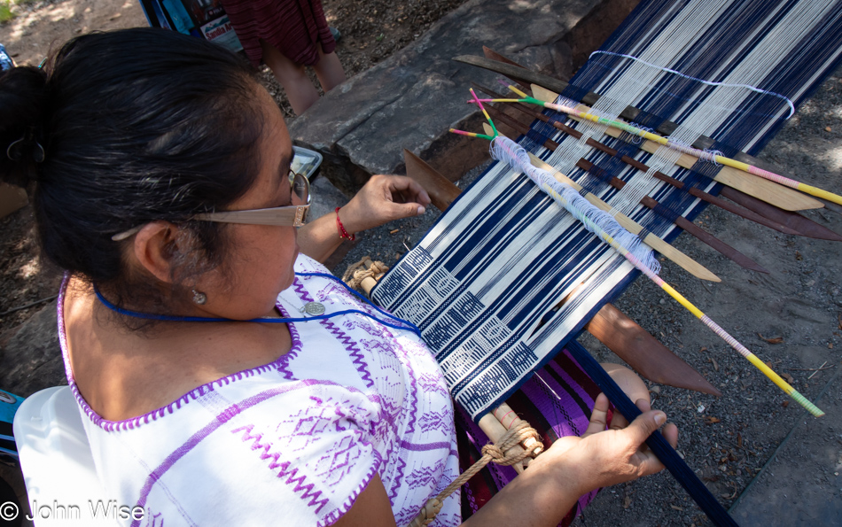
This woman from the artist group Mexican Dreamweavers is helping keep alive the practice of sustainably dying with the sacred hues of the purple snail. They are the cooperative that made the dress Caroline purchased.

Backstrap loom at the International Folk Art Market in Santa Fe, New Mexico

I tend to believe that the artists who travel to America for this market, who are able to demonstrate their craft, find greater interest from the attendees, but I also understand that the added expense of bringing not only enough product to satisfy the demands of those who might want to buy something over the three days of the International Folk Art Market but having someone on hand to speak about their work and handle transactions can become a cost-prohibitive venture.

Suvanese weaver at the International Folk Art Market in Santa Fe, New Mexico

Last year, Caroline purchased a garment from Meet The Makers Indonesia, a collective promoting Indonesia’s craft traditions. At this booth, we once again met Maria Cristina Guerrero, who recognized us. This year, the collective found sponsorship for this lady from the island of Suva. Her name is Ice Sarlince Tede Dara, and she’s been weaving since she was six years old. Having the funds to adequately represent craftspeople from Indonesia, they were also able to bring anthropologist and author Dr. Genevieve Duggan, who’s an expert in all things Suva fiber arts-related. Caroline did, in fact, buy a sarong from these ladies, but more about that tomorrow when she’ll be wearing it.

Pin from Peru at the International Folk Art Market in Santa Fe, New Mexico

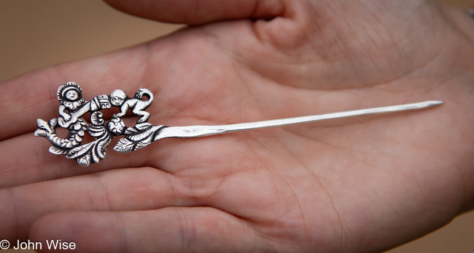
Not much in the way of jewelry was interesting for Caroline after buying a dozen or more bracelets the previous year, but this pin from Peru caught her imagination, and so it came home with us.

La Dame Blanche performing at the International Folk Art Market in Santa Fe, New Mexico

It was still early afternoon when we left Railyard Park, where IFAM is hosted, stopping at the Chicago Dog Express near our motel for what was supposed to be the best hot dog in Santa Fe. We’d have tried it last year, but whenever we left the market they were already closed. Had we eaten one of their dogs last year, we would have skipped it this year. While the idea of a green chile hot dog sounds great, it wasn’t, and their Frito Pie was lacking too. Maybe if we’d been stoned our opinion would have been different. Back at the motel, I was once again in the prone position and napping.

What does one do after their second nap? One eats again, but not before going back to the market for a nice relaxed stroll through the vendors as the heavy crowds have dissipated. It was probably about 6:00 when we walked over to La Choza for; you might have guessed it, more green chile. We knew quite well what we were getting ourselves into and were resigned to the knowledge that we’d be waiting a good long time before being seated. Sure enough, it was close to an hour before our name was called, but it was worth every minute of waiting. After dinner, we were walking along the train tracks when a live performance up ahead motivated us to take a gander at who was playing, that and a great groovy beat. The band features a Cuban singer and flutist called La Dame Blanche, which is also the name of the group. This woman rocks and with her band gave us the perfect end to the day.

Holbrook, Arizona to Santa Fe, New Mexico

Interstate 40 exit for Thoreau, New Mexico

We had a sound plan for the day, which started in Holbrook, Arizona: Find breakfast, get on Interstate 40 to Albuquerque, transition to Interstate 25 north, arrive in Santa Fe, New Mexico, around noon. Breakfast was the first thing that took a left turn. Switching things up, we drove to the 66 Restaurant and walked in to find an empty, somewhat stenchous, liminal space that was creeping out both of us. Without anyone up front, there was no shame or awkwardness in turning around and walking out. Just across the street is the Camaleon Cafe, a Mexican-influenced joint we’ve eaten at before. Pulling up, we saw two cars with people waiting for the place to open at 7:00. As the “open” sign was turned on, we paused, waiting for the others who arrived before us to make their way towards the door. The guy we parked next to stepped out of his 30 or 40-year-old pickup wearing blue jeans that were held together over the knee with bright yellow gaffer tape. His belt was adorned with about 25 rounds of .45 caliber bullets for the Colt 45 revolver on his hip. The man’s accent was thick with a drawl, which triggered Caroline to lean in towards me once we’d sat down to suggest that this must have been the man Pixar modeled the character Mater after in their film Cars.

Caroline Wise in Thoreau, New Mexico

After breakfast, we weren’t on the freeway long before I started bristling at being on one of America’s Most Ugly Highway Ever. With two options, one that detoured way up north to Shiprock and Farmington, New Mexico, and the other that would swing us through Crownpoint, New Mexico, we opted for the latter choice as it promised to add only one hour to our journey, and we could still reach Santa Fe early enough to visit what some call the oldest church in the United States. So, just past the Continental Divide, at the Thoreau exit, following the sign with the shotgun blast and four bullet holes, we began our detour. Gas is cheap in New Mexico, but it comes with a price. While pumping gas, Caroline was attacked by a rat that burrowed into her neck and turned her into a zombie. Right, like Caroline knows how to pump gas, she can’t even drive a vacuum or adequately operate a broom. Anyway, you can see from her weak grip on the rat that she wasn’t going to dislodge this rodent who was neck deep in her neck, so I had to stop taking photos, grab the rat, resulting in the breaking off its head, and like a tick’s disembodied head holding fast to a body part, it had to be removed. Obviously, I had to apply suction, except Caroline shrieked at me, “No HICKEY,” leaving me no choice but to splash her with gasoline, ignite it, and cauterize the wound while inadvertently sealing the rat head into her neck. We’ve decided not to seek medical attention at this time, hoping we can pop it out later like an overloaded zit ripe for plucking.

Near Smith Lake, New Mexico

I’m sure that had the weather not been so idyllic, we might have still arrived in Santa Fe before 1:00, but then we would have also needed to take into account that we had entered the Mountain Daylight Savings timezone and had lost an hour leaving Arizona. I’ll just cut to the chase: this one-hour addition to our drive time ended up eating an extra six hours of distraction. There, it’s in the open: we are idiots, and that bottle of Smart Water I inadvertently bought instead of the Dasani I thought I’d grabbed did nothing to contribute to our intelligence. However, I’d argue that getting off a major interstate is seriously smart because when do you see these kinds of sights from a freeway?

Near Crown Point, New Mexico

As I drive along, I’m listening to Caroline’s instructions, who, when she has signal, is busy studying maps and zooming in, trying to determine the viability of routes that may or may not be paved. It wasn’t only the contrast in colors that drew my attention to these cliff faces. I was on the lookout for petroglyphs but didn’t see one.

Horse in White Horse, New Mexico

Hello, pinto stallion, hanging out in the desert near White Horse. We were surprised that he approached Caroline, gave her a sniff, and decided he wasn’t interested. Most times, these horses move away from us the moment we step out of our car.

Approaching Pueblo Pintado, New Mexico

We’re on Indian Service Route 9, approaching Pueblo Pintado, somewhere out there.

Ruin off Indian Service Route 9 approaching Torreon, New Mexico

While economic opportunities are rather grim on the majority of western Indian reservations, there is no denying that, even in ruin, these places are profoundly beautiful. But visual aesthetics on gorgeous days do not feed families, pay to maintain homes, repair cars, or bring the inhabitants into contact with healthcare or advanced education. I know that I tend to over-romanticize what could be made of these lands, but the reality is that tourists, and even the majority of travelers, want convenience, luxury, and iconic locations that serve egos and not unique experiences. There’s a reason why financially successful Native Americans who are on the Rez are most frequently connected to a casino and not a location where we can stay a few nights in an indigenous dwelling, wake up to learn how to make the local bread and explore the flora and fauna of significance in the community.

NM Route 279 near San Luis, New Mexico

Just look at all this intense landscape and dramatic clouds. Not another vehicle for as far as the eye can see, and never a semi truck drifting in and out of the lane. It’s just the occasional bird, animal, or tumbleweed too close to the road.

NM Route 279 east of San Luis, New Mexico

Out of sight in the distance at the foot of those mountains is New Mexico Route 550, two lanes in each direction. While it’s not a freeway, it’s too damn big, and as quickly as possible, we’ll be aiming for another of these smaller roads.

NM-550 on the Jemez Pueblo, New Mexico

Okay, so NM Route 550’s views aren’t all bad. Regardless, a few minutes later we turned east on Route 4.

Frybread for sale on NM-4 in San Isidro, New Mexico

Here in San Ysidro, sandwiched between the Zia and Jemez Pueblos, we found a couple selling red posole, green chili stew, and frybread, so we bought one of each, pulled up a couple of chairs and enjoyed a most awesome lunch.

NM-4 south of Jemez Springs, New Mexico

As the weather is apt to do during monsoon season in the southwest, a blustery storm can just show up out of nowhere. A bit farther up NM Route 4, we drove right into that storm, and ten minutes later, were already on the other side of it.

Valles Caldera National Preserve in Jemez Springs, New Mexico

While we didn’t realize it initially, we’d driven this road before. It dawned on us when we saw the ruins of the Jemez National Historic Landmark. We drove by under the foul weather but decided to keep going. What we really couldn’t remember was this vast open area that turned out to be the Valles Caldera National Preserve. It only became a part of the national park system back in 2015, well after we last passed through in 2003. Back then, this was a ranch. It may be difficult to see, but there are about 30 elk in the foreground. That was until a motorcyclist with a stupidly loud engine scared them, and they bolted for the forest.

Valles Caldera National Preserve in Jemez Springs, New Mexico

We turned into the preserve, believing we’d only be here momentarily to see what was what.

Valles Caldera National Preserve in Jemez Springs, New Mexico

Well, it sure is pretty out here.

Caroline Wise at Valles Caldera National Preserve in Jemez Springs, New Mexico

Had a great conversation with the ranger, bought the illustrated version of The Hidden Life of Trees by Peter Wohlleben, and learned that they have a Junior Ranger program here, which Caroline is being sworn in for. There’s far more to see and visit here at Valles Caldera, but learning about it all firsthand will have to wait for a future visit.

Apricots from Robert Oppenheimer's home in Los Alamos, New Mexico

Look, we found these apricots just hanging around on a local tree, and instead of letting them fall to the ground and go to waste, we collected a bunch after sampling them, finding them worthy, and hoping we weren’t violating any rules.

Robert Oppenheimer's home in Los Alamos, New Mexico

Okay, the truth is more like there’s this apricot tree on the left of Robert Oppenheimer’s old house in Los Alamos, and seeing neither he nor his family is here to enjoy them anymore, we took it upon ourselves to taste the sweet fruit found at the Father of the Atomic Bomb’s former abode.

Replica of front gate at Los Alamos, New Mexico

Thought we were going to visit more history here, where the first nuclear bombs were first built, but this was insulting. What you are looking at is a plywood facade in front of a couple of public toilets; maybe the real guard shack is still a national secret and is kept in a secure location, away from prying eyes.

Last minute addition: on our way through town, Caroline’s eagle eye (actually a snail feeler) caught sight of Close-Knit Yarn Cooperative, which somehow was opened well past 6:00, an anomaly for a town of this size. It turned out that there were about seven women in the shop knitting, which was the real reason they were still open. Why were they all masked up like it was the summer of 2020? We weren’t inquisitive enough to ask, nor was Caroline impertinent enough to correct the owner that the knitting pattern designer Stephanie van der Linden is not, in fact, Dutch but certainly German.

Leaving Los Alamos, New Mexico

We were still nearly an hour away from Santa Fe, but this was to be our last photograph as we were descending the Pajarito Plateau, home of the Manhattan Project seventy-eight years ago, and were finished being entertained for the day. After checking into our room, we headed to the Pantry (the OG location on Cerillos Road), knowing full well that we would be eating breakfast there in less than 12 hours, but we’d never visited for dinner, and one can never have too much green chili when visiting New Mexico.

The People’s Wigwam

Jim Jones Shooting Range in Payson, Arizona

For countless years, I’ve wanted to stop and snap a photo of this sign pointing visitors/victims to the Jim Jones Shooting Range here in Guyana, Arizona. Oops, I meant Payson, Arizona. I was 15 angry years old when I learned of the People’s Temple and their White Nights event in a South American jungle where Jim Jones led over 900 people to commit mass suicide/murder. The following year, I found the audio recording from the last hour of the camp. It was called The Last Supper and was the grimmest thing I’d ever heard. Forty-six years later, I can’t see the name Jim Jones without thinking of the sounds of those dying and the pictures of dead people bloating in a jungle, hoodwinked by a charismatic cult leader under the guise of religious devotion for economic salvation.

Sunset north of Heber-Overgaard, Arizona

Now, here I am, 45 years, seven months, three weeks, and one day (or 16,671 days in total) later, having watched countless sunsets in between, celebrating life. Cults of various types have become the norm, and many people are prepared to sacrifice their lives for the megalomaniacal musings of captivating and persuasive sociopaths inspiring devotees through twisted ideas of what freedom, god, guns, and evil mean. While some have an unhealthy preoccupation with influencing others or being followers, Caroline and I take our passion for self-discovery on the road and interpret what life means to the best of our ability when gazing upon whales, looking into the sunset, and basking in the beauty of what others are creating in the various arts.

Wigwam Motel in Holbrook, Arizona

Mind you, this is not always the easiest of journeys. Not only do we grow older and maybe a bit tired, but society would prefer us to comport ourselves with the symbols, cultural icons, zeitgeist, and conformity afflicting the masses. That won’t do, as here, at 61 years old, the anger of the 15-year-old still seethes against the machine of subservient consumerism and commercial religious zealotry that drives insecurities and uncertainties. Having only returned home 72 hours earlier following our month in Oregon, we must remain relentless in our push to experience life on the terms we brought to the game ten, twenty, thirty, and forty years ago. So, tonight, we pulled into the Wigwam Motel once again. We’ve lost track of how many times these ancient concrete bungalows have welcomed us.

Wigwam Motel in Holbrook, Arizona

What’s the occasion, you might ask? We are on our way to the 20th anniversary of the International Folk Art Market that welcomes artists, creators, and celebrants of world culture to the semi-arid mountain desert city of Santa Fe, New Mexico.

End of Oregon Summer Trip

Tonopah, Nevada

After nearly 40,000 words, 573 photos, about 200 miles of walking and hiking, 18 days of remote work, and 12 weekend days (including a holiday), our month away from Arizona ends today. Our only goal is to get home as quickly as possible, and it is with dread that we leave Tonopah, Nevada, because we are anticipating a crush of traffic passing Vegas and Kingman before encountering the impatience of idiots trying to race through Wickenburg to Phoenix, making for dangerous driving.

Somewhere in Nevada

But those worries were for naught as it was smooth sailing. Sure, Las Vegas was its usual zone of drug-fueled stupidhead drivers, and there was a backup trying to merge on Interstate 40 in Kingman, where we pulled over at Popeye’s for some spicy chicken sandwiches, but other than that, it all went well, allowing us to cover the 509 miles home pretty quickly, getting home before 4:00 p.m. Seventy-two hours later, we’d be leaving again, this time for Santa Fe, New Mexico, but only for a long weekend.

A Small Slice of California

Clear Lake near Lucerne, California

This is Clear Lake, as seen from Lucerne, California. We’d already passed Lake Mendocino, but I need to make haste in getting this post finished because the reality is, I’m sitting down to write this post on July 10th at 8:30 p.m. after arriving at the Wigwam Motel in Holbrook, Arizona, on our way to Santa Fe, New Mexico, because our travel schedule is rather relentless this summer. So, the fewer photos I have to write to, the better I can expedite this missive and get into the trip we started only three days after we returned home from our stay in Oregon.

California Route 20 going east in the Central Valley

We drove out of the Coastal Range as our route took us east before our hard turn south to finish our drive home. The golden grasses of this state never fail to impress us. They’re also beautiful when they are green, though that doesn’t seem to happen frequently.

California Route 20 going east in the Central Valley

Not too far along, we enter the vast, flat middle of California, where 25% of America’s food supply is grown, with fully 40% of all fruits and nuts.

California Route 20 going east in the Central Valley

I can’t say we’ve ever seen fields of sunflowers out here before, but there is the fact that it’s a rare day that we find ourselves out and about during summer.

U.S. Route 50 in the Eldorado National Forest, Sierra Nevada Mountains in California

Due to needing to drive over 500 miles (805km) today to reach this evening’s hotel, we were trying to be judicious with the number of stops we were making. Obviously, we are no longer in the Central Valley; we have started climbing up the Sierra Nevada Mountain Range. Yosemite National Park is still well south of us.

U.S. Route 50 in the Eldorado National Forest, Sierra Nevada Mountains in California

Only after passing the turnoff in the Meyers area to South Lake Tahoe did the heavy traffic abate, allowing us the opportunity for a break to stretch our legs, find a discrete spot for taking care of some particular business, and when inspired, take another photo. Usually, we try to incorporate all those things in a single stop.

West Fork Carson River in Markleeville, California

Crossing the West Fork of the Carson River in Markleeville.

California Route 89 near Markleeville, California in the Sierra Nevada Mountains

We should have more time to do justice in exploring this area because it feels as though we are unceremoniously racing right through here.

California Route 89 near Markleeville, California in the Sierra Nevada Mountains

Out here, we are feeling very alone, and that’s a good thing.

California Route 89 near Markleeville, California in the Sierra Nevada Mountains

Routes 88, 4, and 108 slice a path roughly east/west, while the 89 travels mostly south, which is the road we are currently on.

Caroline Wise at Monitor Pass near Lake Tahoe, California

The section of California 89 that crosses Monitor Pass is pointed absolutely east at this time. The pass is at an elevation of 8,314 feet or 2,534 meters.

California Route 89 near Topaz, California in the Sierra Nevada Mountains

We are descending out of the mountains to a wide valley below, where we’ll join U.S. Highway 395, also known as the Eastern Sierra Scenic Byway.

California Route 89 near Topaz, California in the Sierra Nevada Mountains

Not a mile further down the road, we were struck by this basin and how pretty it was.

U.S. 395 looking south to Mono Lake in California

That’s Mono Lake in the distance, we’ll certainly be stopping as it’s been 20 years to the day since we were last here. What a strange coincidence.

Boardwalk to Mono Lake in Lee Vining, California

This boardwalk, which really goes about nowhere, wasn’t here the last time we visited. The old adage, “Everything changes,” still rings true.

Caroline Wise at Mono Lake Navy Beach Viewpoint in Lee Vining, California

We stopped in Lee Vining at a gas station for ice and to ask if the guys might know where there’s a beach at the lake where people can swim because we didn’t have a recollection of exactly where we were on one of those previous visits when Caroline got in with the brine shrimp and swarming alkali flies that are in wild abundance, nearly creepily so, here at the shore. The younger of the two men recommended Navy Beach, but no sooner did he answer us that the other guy, half-toothless and maybe a bit inebriated, asked if we worshipped Satan. I answered him, “Not recently, how about you?” He offered up a simple “Yeah,” so I threw him the hand gesture for devil horns. We fist-bumped, and Caroline and I walked out, mouthing WTF to each other and holding back a laugh until we were in the car. Seriously, one of the great moments of our day.

Mono Lake Navy Beach Viewpoint in Lee Vining, California

Now, here I am thinking about this encounter, and as I write about this day, I just went to reference our old July 6th, 2004 visit, literally exactly 20 years ago. Back on that day, we had wanted to visit the Devils Postpile National Monument near Mammoth but were dissuaded because I didn’t want to wait on a shuttle. So, we detoured to eat pastries from Schatt’s bakery, with me mocking their product with a pun of the baker’s name. Next up, we drove through Death Valley via Crankshaft Corners on rough dirt backroads when it was hot as hell, as in close to 120 degrees. Where’d we go from there? To the Devils Golf Course, of which I wrote about letting “Satan play through.”

That guy at the gas station somehow understood that we’d made a deal with the devil somewhere in our past, and this was evil’s way of hinting to us that we were living on Satan’s dime.

Mono Lake Navy Beach Viewpoint in Lee Vining, California

Now if the deal with the devil were in any way true, I assure you that I wouldn’t have bargained for the abundance of travel where I could marvel at rainbows, seashores, pretty flowers, dripping mosses, tufas, romantic sunsets, and a wife who marvels at sand dollars, yarns, and music that makes her cry, my deal would have been to have John McAfee’s life of hookers, cocaine, and $100 million to fuel a salacious life of hedonism and absolute irresponsibility.

Granite Mountain near California Route 120, California

Another new road was added to our historic Map of America, where we track the roads we’ve driven. This is California Route 120 from Mono Lake, which is bringing us to Nevada.

Benton Hot Springs, California

There are some mighty remote hot springs in what is nearly a ghost town here at the crossroads near the Nevada-California border. Returning here will take a serious effort, as Benton Hot Springs is truly off the beaten path.

On U.S. Route 6 entering Nevada

While the sun was quite low in the sky when we merged onto the Grand Army of the Republic Highway, we’d covered the majority of Routes 120 and 6 with enough light to feel we had a good idea of what the terrain looked like, so we can properly claim to have experienced this corner of America.

Belvada Hotel in Tonopah, Nevada

It was well after 9:00 p.m. when we pulled into Tonopah, Nevada, where I’d booked a stay at the historic Belvada Hotel. Rare is the day we sleep in accommodations more than a couple of floors high, with such lofty prices of a couple of hundred dollars for the night. Was it worth it? Not really, other than the idea that we are helping support a small town and a historic site. Next time, we’ll stay at the world-famous Clown Motel, also here in Tonopah, though, at $175 a night, it isn’t all that much cheaper. No matter as using Satan’s credit card, we can have anything we want.

Hello Again, California

Cape Sebastian Scenic Overlook south of Gold Beach, Oregon

Is that California out in the distance? Not yet, but soon. Today’s setup down in Gold Beach was intentional for what would be our next stop today. First though, we made this quick stop at Cape Sebastian, not only for the view, but as a reminder that we want to take the trail from up here all the way down to the ocean.

Meyers Creek Beach north of Pistol River, Oregon

This is the spot we had to visit as our last stop in Oregon on this mighty, amazing coastal adventure we’ve been experiencing. Meyers Creek Beach has long been a favorite.

Meyers Creek Beach north of Pistol River, Oregon

Before we ever knew the proper name of this beach, we called it the Sharkfin Beach for obvious reasons. It is this rock jutting out of the sand and sea that created this affinity and keeps us coming back.

Meyers Creek Beach north of Pistol River, Oregon

We took time to linger in the fading moments that could be allocated to time on the Oregon Coast. While there’s some likelihood we’ll return this November, as I’ve already started making reservations, one never knows what tomorrow brings, so we have to take every second to absorb all we can.

Caroline Wise at Meyers Creek Beach north of Pistol River, Oregon

Note the hands in the pockets instead of holding the reins of Happy McKiteFace; there was no wind here, zero, zilch.

Coastal sand verbena at Meyers Creek Beach north of Pistol River, Oregon

Leaving the beach, we caught a whiff of this flowering plant that is not in bloom during our November visits. It is coastal sand verbena, and it smells brilliant.

Redwoods in Northern California

We’re on Wonder Stump Road just north of Crescent City, which is less than 15 miles from where we crossed from Oregon to California on Highway 101.

Redwoods in Northern California

These trees are today’s first encounter with the redwoods, and while some may think that 5 million of these giants of the more than 100 million that once existed is an adequate number, keep in mind that there are 39 million people living in California and nobody is suggesting the state is running out of habitable land. The tree we are standing below might be about 30 feet in diameter, meaning it could be about 300 to 400 years old. The Lost Monarch tree in Jedediah Smith Redwoods State Park has a circumference of approximately 84 feet (25.6 meters) while the oldest redwood is estimated to be about 2,200 years old, so even if humanity were to attempt to restore what we’ve ruined, not us, our children, grandchildren, or great-grandchildren would be around to see one of these trees reach even this circumference.

Redwoods in Northern California

It’s peculiar to my primitive brain how I can be so impressed standing at the base of one of these trees, and yet there is an entire ecosystem above me that is unvisitable and must remain a big unknown to my senses. The canopy of the redwoods may as well be at the bottom of the sea or on the moon.

Redwoods in Northern California

The Wonder Stump Road might only be two miles long, but we were lost under these trees for nearly as long as it would have taken to walk the road.

Overlook in Klamath, California

Had our goal been to get as far south as fast as we could, our time at the edge of the continent would have been a lot shorter, but that would have brought an unceremonious end to this trip, and so our route was designed to maximize time at the coast and allow us to dawdle.

Wilson Creek Beach in Klamath, California

Wilson Creek Beach was afforded a quick stop, a photo and go.

Prairie Creek Redwoods State Park in Orick, California

We’ve turned off Highway 101 at the Newton B. Drury Scenic Byway in the Redwoods National Park on the way to the Prairie Creek Redwoods State Park to slow things down even further. To simply drive by and ignore these trees and their lush environment feels like sacrilege.

Tiger Lily at Prairie Creek Redwoods State Park in Orick, California

Caroline spotted tiger lilies next to the road, but often, there was nowhere to easily pull over, so we continued on until we found some near a pullout.

Prairie Creek Redwoods State Park in Orick, California

Sadly, there’d be no time for a hike into the woods because while we can take our time, as long as we reach Ukiah, where we have a hotel reservation, I have plans for a side trek off the beaten path to a place on the coast we’ve never visited before.

Prairie Creek Redwoods State Park in Orick, California

These forays into forests that stretch far into the sky are difficult places to photograph, at least for me, as there is so much to see and only so much that can be captured adequately in a photo. While standing under these ancient and massive trees inspires us, there is no easy method of sharing just how grand it all is.

Prairie Creek Redwoods State Park in Orick, California

The ancestors of redwoods emerged about 200 million years ago, and then about 50 to 100 million years ago, the species split into the two types we know today, the coastal redwood and the giant sequoia. Maybe that’s what contributes to the sense of otherness, or whatever it is that feels different than other places; there are few living things on earth that we can stand amongst that have been on the planet longer.

Patricks Point Drive in Patricks Point, California

Heed this stop sign, or you will certainly regret your indiscretion. We are on Patricks Point Road.

Luffenholtz Beach in Trinidad, California

This is Luffenholtz Beach south of Trinidad, and while Caroline and I drove at least part of this road back in 2006 (we know we did because there’s a blog post) neither of us has any recollection of that drive. As a matter of fact, in 2020, we thought we were traveling this road for the very first time, stating just that in a post.

Mattole Road near Ferndale, California

We have left Highway 101 again, this time for a road we are absolutely 100% certain we’ve never driven before. The initial stretch of road is California 211, but in Ferndale, the road shrinks as we head out on the Mattole Road for the Lost Coast.

Mattole Road heading towards Cape Town, California

Many sections of the road out here are only a single lane, and they are also in tight curves with big blind spots, so stopping is not an option. Then, we emerge from the dark forest into wide-open vistas that are idyllic, serene landscapes.

Mattole Road heading towards Cape Town, California

Without guardrails, I’m inclined to hug the centerline and drive at barely 20mph, else we risk falling off the road and into the infinity of time.

Cape Town, California

We’ve arrived in Cape Town, as in California, not South Africa.

Mattole Road heading to Black Sand Beach on The Lost Coast of California

After driving for a while, we had some idea of the frequency of other cars traveling this road and felt okay about stopping in the middle of the street and jumping out for a photo.

Adjacent to Black Sand Beach on The Lost Coast of California

You wouldn’t know it from this view, but we’ve arrived at the Black Sand Beach down here on the Lost Coast north of the King Range National Conservation Area. I’ll turn around and show you.

Black Sand Beach on The Lost Coast of California

There’s nothing and almost nobody else down here.

Caroline Wise and John Wise at the Black Sand Beach on The Lost Coast of California

Well, there were these two dorks hanging out looking for the things we’d possibly not seen before.

Gumboot chiton shell at the Black Sand Beach on The Lost Coast of California

Seek, and you shall find. We were on our way back to the car when I spotted something peculiar that turned into the great treasure of this month away from Arizona: the shell of a gumboot chiton.

Point of Cows on Mattole Road at The Lost Coast of California

Somewhere along the road, and not marked, is the Point of Cows. That’s what we are calling this in lieu of finding the exact spot from the map.

Mattole Road near Petrolia, California

This concludes our coastal adventure as we turn inland and start the serious effort to move ourselves closer to home.

Lindley Ranch in Petrolia, California

Much of the landscape for the first 20 miles after leaving our turn inland was similar to what we were driving past on our way out, but still, I felt I should offer at least a peek at what is on this end of Mattole Road as we drive through Petrolia.

Mattole River Bridge in Honeydew, California

Our last photo of the day is from the Mattole River Truss Bridge in Honeydew, population 277, of which we met three of the locals. They were sitting near the bridge and informed us that this old relic from 1920 is going to be torn out and replaced with a modern structure. We learned a few other things from the heavily stoned and friendly people, but what they didn’t tell us was that we should probably have used this bridge and taken the northern route back to Highway 101 because the way we went included some sandy loose gravel sections of road in tight curves on steep mountainsides. More than once, I was given an adrenalin boost from the abject terror I was feeling as we started losing traction, and fear informed me that if I lost momentum, our tires would never grip this stuff well enough to let us finish going up the incline. I was close to panic. Consequently, I didn’t stop one time before reaching Highway 101, and by the time we reached Ukiah for the night, I was exhausted. What an adventure it was.