Independence Day in Oregon – Day 3

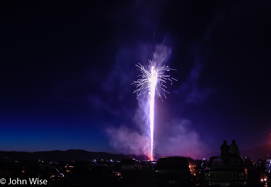
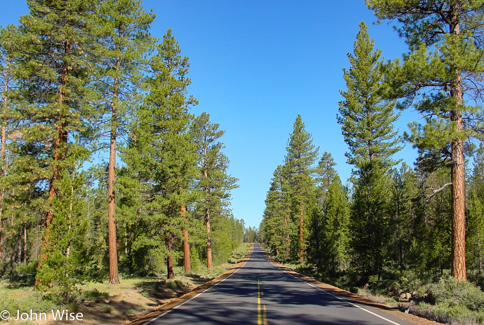
Though we were up late last night for the fireworks, we still woke up shortly after the break of dawn this morning and were getting gas by 6:30 (we’re still unaccustomed to having someone else fill our tank here in Oregon). Between stretches of the forest, we also drove through some beautiful meadows and spotted four pronghorn antelope basking in the sun while we basked in their glory from our perspective driving by.

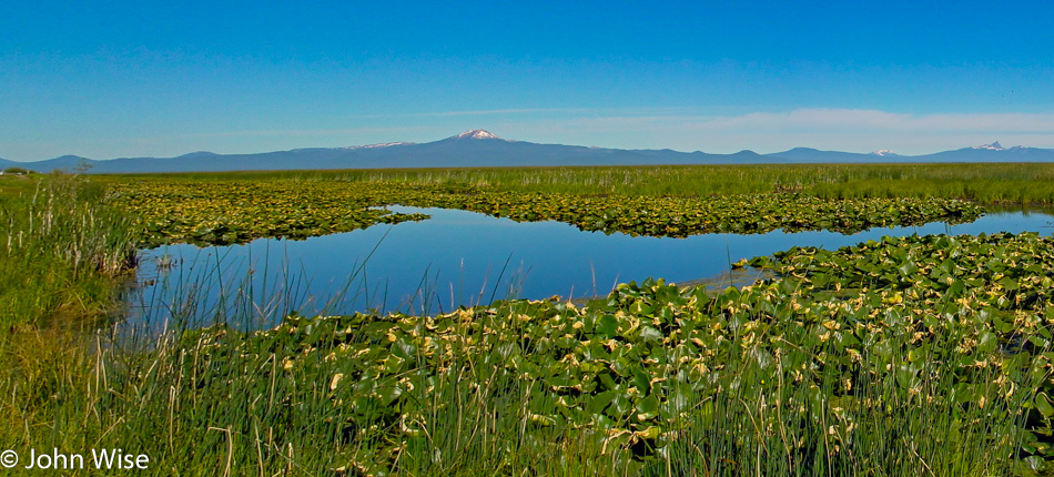
Our path wasn’t the most direct, but it was certainly scenic. County Road 676, also known as Silver Lake Road, passes through the wetlands next to Wocus Bay and the Klamath Marsh National Wildlife Refuge. While passing through the refuge, we spotted a beaver, cormorants, and geese.

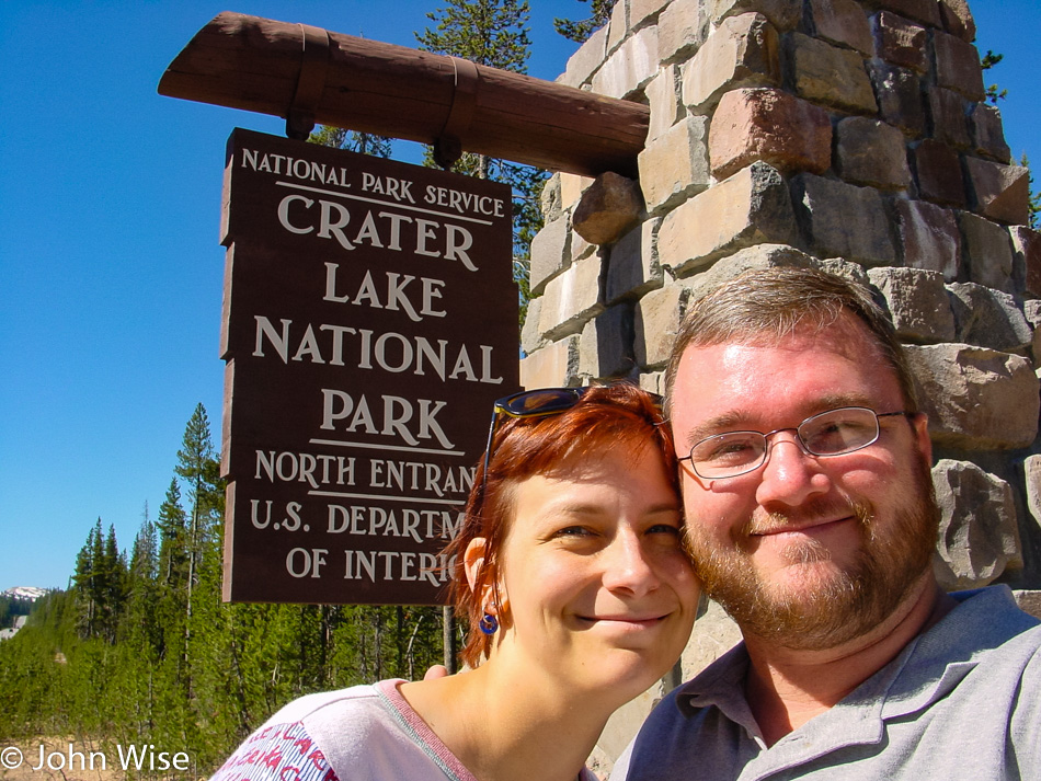
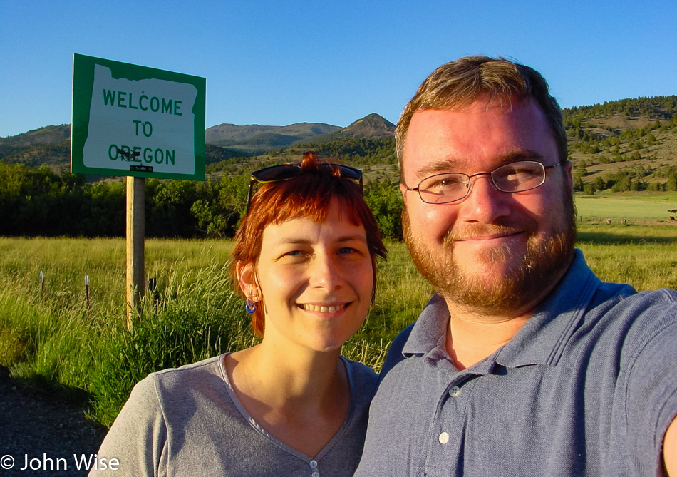
By 10:00, we are pulling into Crater Lake National Park, and the furthest northwest we’ll travel on this extended long weekend, Silver Lake on the way here this morning was a bit further north. After checking out the park map, it’s decided to take the loop drive around the lake going clockwise.

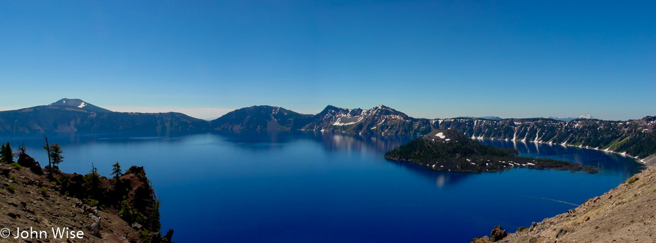
Our view of the lake is a spectacular one. The color of the water is the bluest we’ve ever seen; maybe it has something to do with how deep it is, as it is the deepest lake in the United States at 1,949 feet or 594 meters. Or maybe it’s the elevation here where the caldera rim reaches heights of 8,000 feet or 2,400 meters above sea level. Maybe it’s the fact that no stream or river runs into the lake, as this lake has been filled with rainwater and snow. But the reality is that it’s probably the combination of all these factors. On the right of the lake is Wizard Island, which is a cinder cone formed about 7,000 years ago. The island’s peak is 767 feet above the surface of the lake, but incredibly, it sits on the caldera floor over 2,000 feet down below. The trees on the island have never been harvested, with some of them clocking in at over 800 years old now.

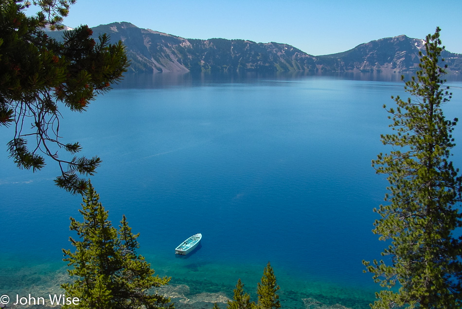
We are heading down the Cleetwood Trail which is the only trail in the park that takes you lakeside.

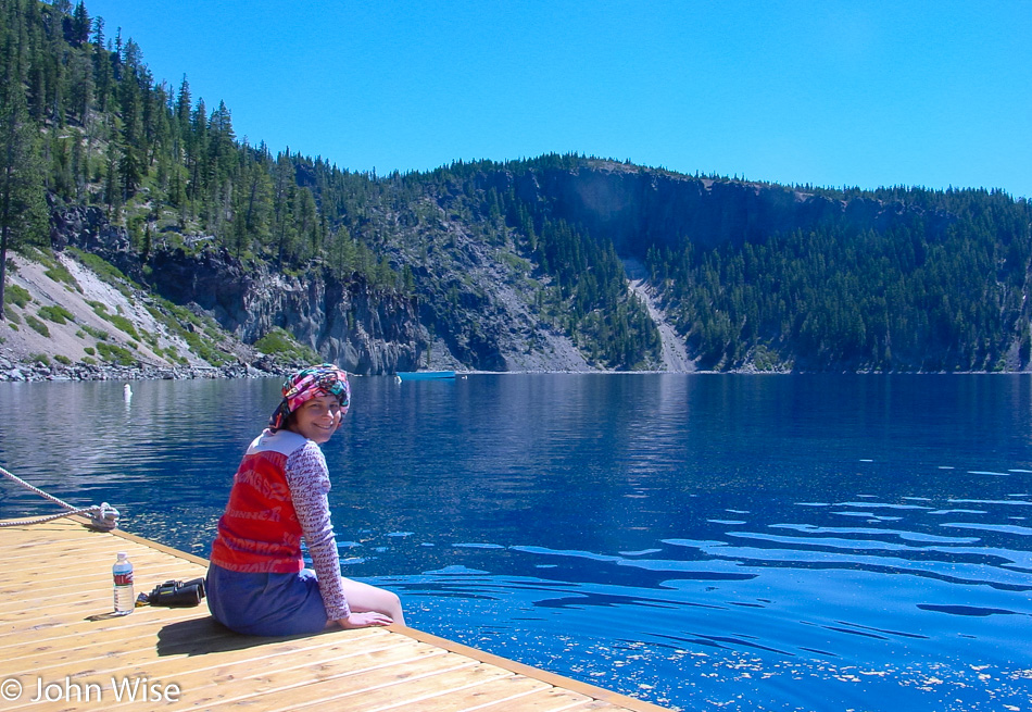
Kind of a strange thought that we are atop a 2,000-foot-deep caldera here at water level and that where Caroline is sitting used to be a mountain peak that towered over a mile above her. That mountain peak was called Mount Mazama before it exploded in a fit of volcanic fury just 7,700 years ago. While in human terms, that might seem like a lot, in geological terms, that was a split second ago.

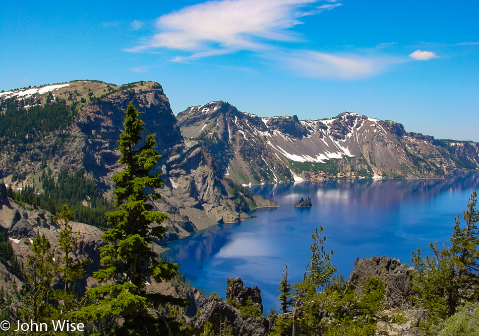
The scenic drive doesn’t exactly follow the crater rim; east of the lake, we drove through a beautiful canyon complete with several waterfalls, including a larger one called Vidal Falls. A little bit further down the road, we returned to the lakeside and were able to catch this great view of Phantom Ship, that black rock in the lake that stands 170 feet high.

Just three hours after our arrival we were already heading for the exit but stopped at the visitors center for some tchotchkes because life without a fridge magnet is meaningless and empty.

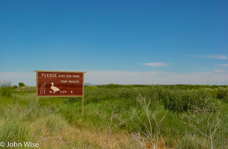
Driving south towards California, we pulled over to a scale and learned the useless information that our car weighs 1350 pounds. After arriving in California, we stopped to pay a visit to the Klamath Basin National Wildlife Refuge in Tulelake. Here in the refuge, we spotted some black-necked stilts, glossy ibis, and western coots, so like the sign points out, “Don’t run down your wildlife.”

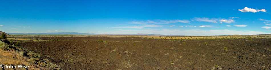
Just a few minutes south of the refuge, we enter Lava Beds National Monument and are nervous that the visitor center might already be closed as it’s a bit after 5:00. With that in mind, we stopped here at the Devil’s Homestead Lava Flow overlook and were just as quickly off and running again hoping the visitor center might be open longer than others.

Lava Beds National Monument in Tulelake, California

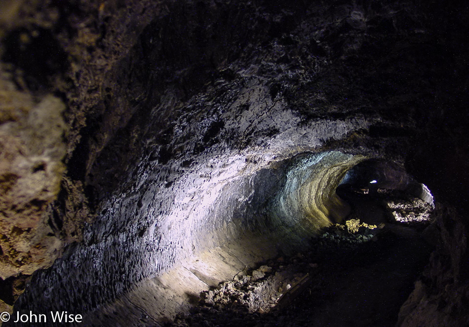
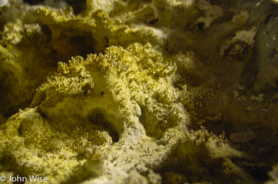
Wow, the visitors center is open until 5:30 leaving us 10 minutes after we arrived to buy a magnet and find out what else we can do with our shrinking day. Drats, there are no magnets, might as well go home! Just kidding. We walked over to the closest and most easily accessible lava cave equipped with lights, explanatory signs, and a stairway right in the visitor center parking lot. One of the major attractions at Lava Beds is that people can explore over a dozen of these caves; helmets and lamps are available at the visitor center for the unprepared, as long as one arrives in a timely manner. Lava caves are formed when the flowing lava cools off on the surface, building a roof, while the hot lava below continues to run until it empties, thus leaving a tunnel. During the cooling process, interesting underground shapes can be formed, and sometimes these tunnels cross or are re-melted and re-cooled during and after a volcanic event.

Lava Beds National Monument in Tulelake, California

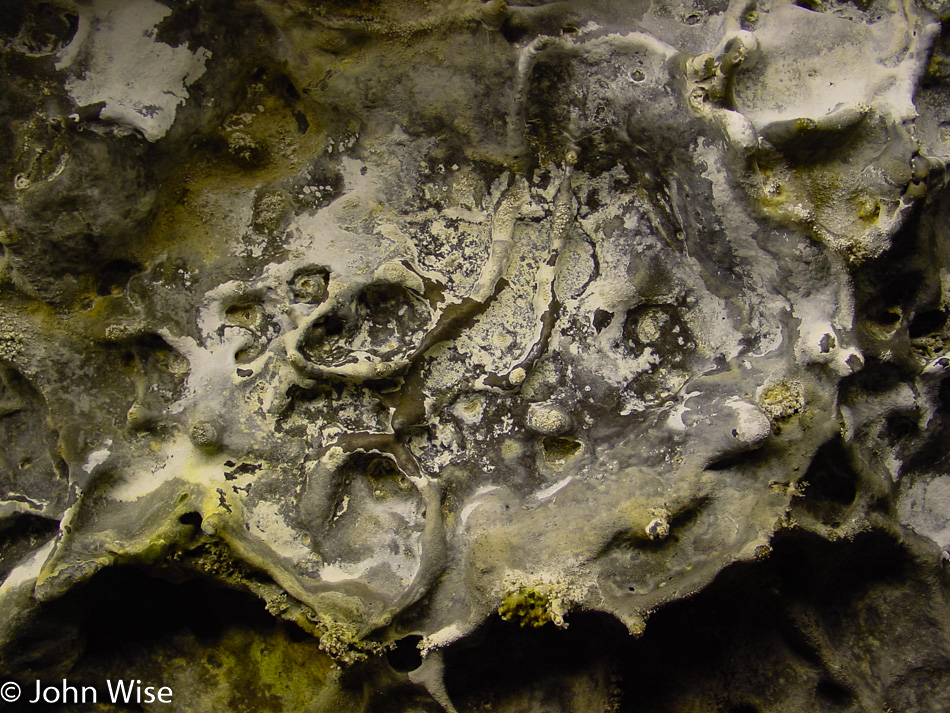
Melted stone, dripping calcified minerals, lichen, a bunch of spider webs, and people have replaced the 2,200-degree lava that once flowed through here, and we’re probably luckier for it.

Lava Beds National Monument in Tulelake, California

We are out of the cave less than 30 minutes after we entered it; this is the downside of trying to do a little bit of everything in the shortest amount of time.

Lava Beds National Monument in Tulelake, California

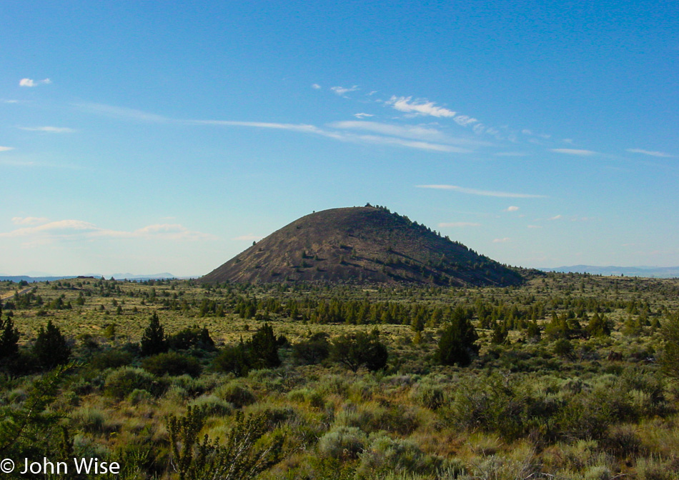
A cinder cone that one day might grow into a full-fledged volcano. Tomorrow, we’ll continue the volcanic theme with a visit to Lassen National Park, but for today, we need to get along as we are hoping to get down to Susanville that on a direct route wouldn’t be too far away, so we’ll take the long way so we can get a glimpse of what you see in the next photo.

Mount Shasta, California

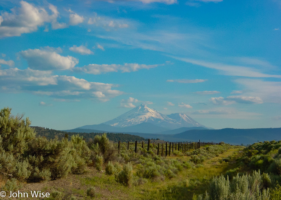
This is Mount Shasta, standing at 14,179 feet above sea level, a dormant volcano. Maybe this road trip should have been themed as the “Volcanic Run.”

VW Beetle covered in insects

It was quite a detour around Mount Shasta and Weed, California, but I’d seen those iconic images of the Weed sign with Mt Shasta framed behind it and just had to see it for myself. We stopped for gas in McCloud, and while we were enjoying the views, we were almost shocked at the carnage on the bumper. I’ll spare you the closeups.

Mount Lassen, California

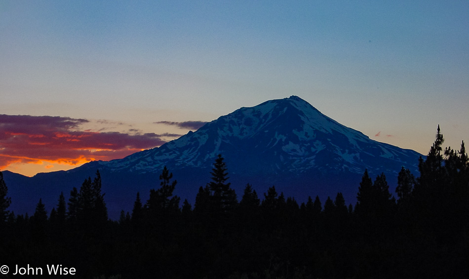
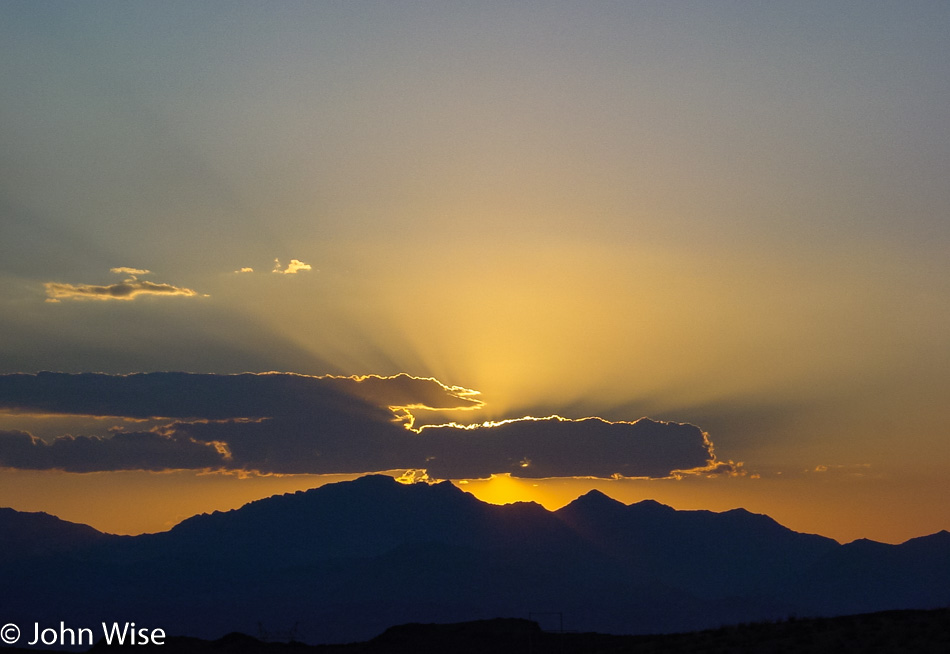
The sun setting in the distance, and yet another view of Mt Shasta.

Caroline Wise at Frontier Inn in Susanville, California

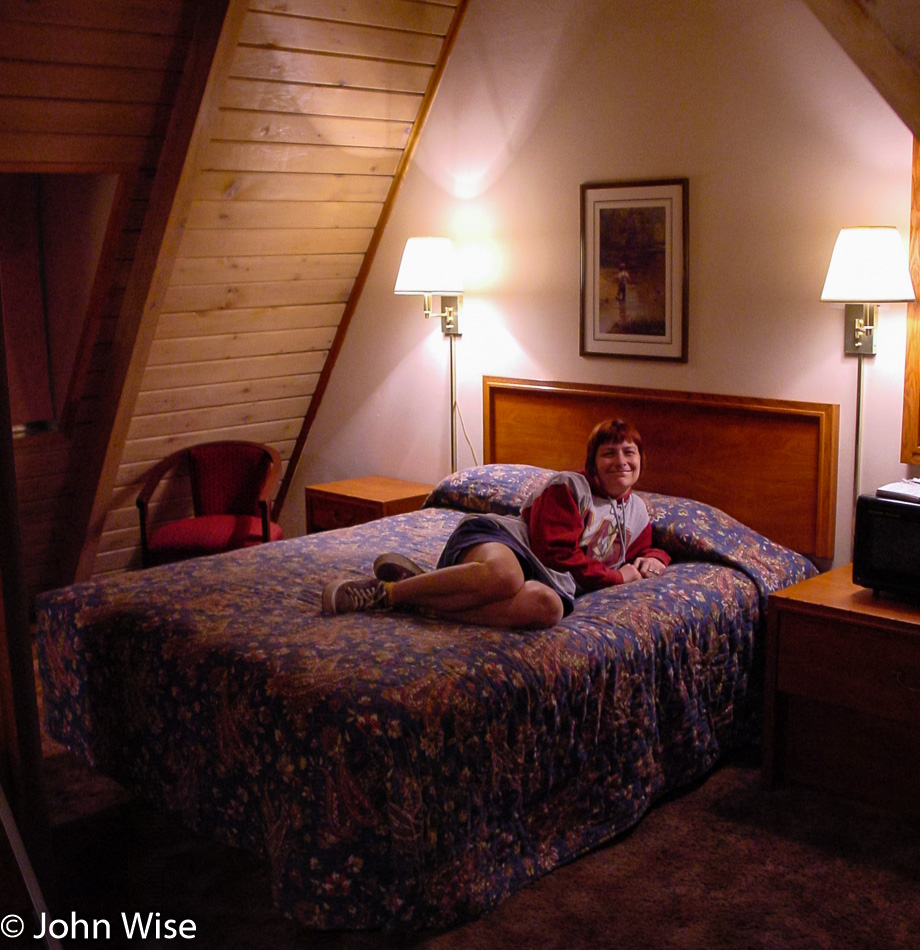
We finally arrived in Susanville, California, at 11:00 p.m. and had a seriously funky room here at the Budget Host Frontier Inn.

Independence Day in Oregon – Day 2

Saddle West Casino in Pahrump, Nevada

We left the Saddle West Hotel Casino RV Resort, one of two motels in town, at about 6:00 in the morning. Pahrump has a big advantage in comparison to other Nevada towns – especially those in neighboring Clark County (such as Vegas, Henderson, and Laughlin) – prostitution is legal here in Nye County; several billboards enlighten the unsuspecting (?) traveler of this fact, and there is even a brothel museum. We are probably going to come through here again on a future trip and hope to take a closer look at that. Another curiosity finds a home here in Pahrump; the radio show Coast to Coast AM hosted by Art Bell lives and operates from out this way. If you ever wondered why he opens his show with “from the kingdom of Nye” – now you know.

Just north of town, we turned west on Highway 190 in the direction of the California state line and Death Valley National Park, but on this side of the border lies a small exclave called Devils Hole bordering Ash Meadows National Wildlife Refuge. Naturally, we were curious and had decided to pay a visit to both. Another “Devils Something” notch on our National Park bedpost, who could resist? While a lady at a gas station effectively placed some doubt in our minds whether our Beetle could handle the unpaved road into the refuge, we also started to wonder what kind of “meadow” we could hope to find since, for several miles, we saw nothing but the usual stuff such as dry shrubs, sagebrush, and short trees. Nevada certainly managed to make it all look pretty enough and even arranged some wildlife for us: we saw several bighorn sheep standing on a hill in the distance. We eventually hit our turnoff into the refuge, although there was no sign other than “Bill Copeland Memorial Highway.” Judging from the map and the fact that we were heading for a faint cluster of greenery, we started believing that we were on the right track.

Caroline and I were beginning to have doubts about whether we would be able to access Devils Hole from our current location. We drove right by it because it was just a chain-link fenced-off area that looked like a lot of nothing. The Hole lies near the refuge’s northeastern exit, which is stocked with xeroxed info maps; that’s how we realized that a) we had just missed Devils Hole, the world’s only habitat of the Devils Hole Pupfish (clap, everybody), and b) that we hadn’t even seen the best of the Ash Meadows Refuge yet. But first, we turned around and pulled off the road next to the (closed) access road to the Devils Hole parking lot. They even discourage you from parking near the Hole. Devils Hole is not very scenic but is a rather heavily guarded scientific research area. We hung out for a short while, trying to spot one of the elusive and precious fishies in the water below us, but that proved impossible even with binoculars at the ready.

Highway 373 led us to the other side of the refuge to visit the crown jewel itself, the interpretive boardwalk to Crystal Creek Spring. The reason why there are these patches of green meadows and wetlands out here lies in the hidden groundwater.

The area has a large reservoir of “fossil” water, meaning it stems from an ancient melted glacier. It surfaces in various spots in this valley, offering habitats for various kinds of – you guessed it – desert pupfish, including the Ash Meadow pupfish. These wily little fellows have the capability of surviving even in the meekest of hostile puddles. Farmers used to pump the water away from the springs, and the pupfish all but disappeared, but in recent years, the larger springs are being restored, and the pupfish are recovering. Unlike the nearly barren Devils Hole, Crystal Creek Spring is an incredible oasis, overwhelmingly beautiful, clear, and deep. You can see the pupfish swimming near the algae at the bottom with the naked eye.

By now, it was time to jump into the Beetle again and continue on our journey. We rejoined the paved road on Highway 373 North until reaching the junction of Highway 95 West. About 40 miles further on, we passed the little town of Beatty, Nevada, and turned onto Highway 374 towards the Californian border. Four miles out of Beatty, we found Rhyolite – our next destination. In 1908, this was Nevada’s third-largest town, sprawling with over 8,000 inhabitants. Today, only a few of the brick structures remain, most of them in ruins. Rhyolite’s most interesting building is the “bottle house,” made with the help of over 10,000 bottles (mostly beer bottles of the pre-Budweiser variety). The place is in pretty good shape compared with the schoolhouse, for example.

An example of one of the buildings in this ghost town that hasn’t fared well over the intervening years of neglect and lack of a population.

The same can be said about vehicles that were left to the elements; they likely won’t be driven again any time soon.

Just next to the Rhyolite townsite (in the suburbs, so to speak) lies an outdoor art exhibit of a curious kind – the Goldwell Open Air Museum, a project of the late Belgian artist Albert Szukalski (1945-2000). He founded the museum in 1984 with his sculpture “The Last Supper,” and later on, several other sculptures by various and distinguished artists were added, such as the true blond above. A truly unique art experience that has been seen by millions of visitors on their way to Rhyolite.

Finally, we headed back towards Beatty, where we stopped for gas, postcards, and the loo. On the way out of our pit stop, we saw a sign offering “free police car rides.” Unfortunately, only for shoplifters; what a drag. Near the Esmeralda County line but still in Nye, we passed another example of the kind of business that Nevada is famous for, and I’m not talking about casinos. For some reason, these establishments are usually called “So-and-so Ranch,” although, in reality, the buildings resemble double-wide trailers. Anyway, in case you ever asked yourself what a brothel in the middle of nowhere looks like, wonder no more.

The road had started to climb higher and the surroundings became a tad greener and then dipped again for another encounter with the lovely sagebrush, especially true when it is fresh and fragrant. We are looking at a small corner of Palmetto, Nevada. Founded in the early 1860s after silver was found in the area, the town went through not one but two revivals, only to disappear for good during its last downturn. It was named after the local Joshua trees which the settlers thought were related to palm trees. A few miles past Palmetto, we spotted a few bighorn sheep; unfortunately, there was no chance to pull over for a picture.

Back in California for only about 10 miles before swinging back into Nevada. While we have now passed through Oasis, California, we can’t tell you much about it.

Where the heck are we where people have to be warned about not bringing their explosives-laden vehicles through the main gate? This is obviously not Disneyland.

Mountains and sagebrush are not a bad combo.

We needed to dig into some driving as the day was quickly getting away from us since we had spent a fair share of our time checking stuff out, but this scene was too pretty to let pass. We are on the road passing through Nixon in rural western Nevada, looking out over Pyramid Lake. A bit further up the road, we’ll encounter Gerlach, Nevada, and remain on state route 447 until we return to California on our way toward Cedarville and points beyond.

This is Just Stuff and is a place for a bit of all things, including souvenirs, because once you enter Pine Creek on the Oregon border, the first thing you are likely needing to do is shop in a little funky joint to jump right into the Oregon vibe.

This is our second time this year and the second time in our lives that we are visiting Oregon. The first time this past March, we crossed over an eastern border of the state; this time, it’s a southern border. If you believe you are starting to see a trend, you’d not be mistaken. I can nearly assure you that it’s only a short matter of time before we enter the state over on the southwest side to take in Coastal Oregon from that perspective.

Is it a real geyser? Who cares? It’s pretty and reliable.

This single rocket on the Fourth of July is why we’ve driven nearly 1,000 miles to Lakeview, Oregon. Sitting on top of trucks and in lawn chairs like we’re at the drive-in in rural America is what the celebration of freedom is all about. Happy birthday, America!

Independence Day in Oregon – Day 1

Caroline Wise and John Wise driving away from Phoenix, Arizona

Our Independence Day adventure started after picking Caroline up from work at 4:00 p.m., bags packed, cooler fully loaded, and gas in the tank. While we made our way northwest towards Wickenburg, we watched looming dark monsoon clouds building up and could not help wondering whether we’d miss a good rain in the valley while out on the road; this is usually how it works.

Nothing, Arizona

At Wickenburg, we turned north on Highway 93, which brought us to Nothing, Arizona, which is actually a little something. What exactly Nothing is remains unknown as we didn’t need gas and there was nothing we needed from the All Mart store. North of here, the road becomes known as the Joshua Tree Parkway of Arizona. We did get rained on a little near Wickieup, and a few times, lightning flashes were visible to the east, but no monsoons like the clouds earlier portended.

Sunset near the Arizona and Nevada border

We crossed the Colorado River into Nevada at Bullhead City but didn’t bother to stop in Laughlin, NV instead opting to enjoy the beautiful sunset we were driving into. As darkness fell, we turned off the road at Searchlight and started zigzagging back and forth over the Nevada/California state lines a bit until we finally reached Primm, Nevada.

Whiskey Pete's Casino in Primm, Nevada

Why would we go out of our way to visit this tiny speck on the map? Because we found out that Whiskey Pete’s Casino here has on display the bullet hole-ridden “death car” of Bonnie and Clyde! As it turned out, the car was relocated into the shopping mall connected to the Primm Valley Resort and Casino across the freeway. It used to be called the “Primadonna Resort” – “Primm-adonna”, get it? They did come to their senses at the end of the nineties, apparently, and renamed the place. On our way into the mall, we watched a bat circling just a few feet over our heads. spooky!!!

Bonnie and Clyde's bullet ridden car in Primm, Nevada

The old car is sitting in a glass box featuring a couple of showroom dummies dressed in period clothes sporting nasty-looking weaponry. Caroline rather liked “Bonnie’s” dress; it was red and black and very tasteful, while the “men” were wearing suits. It was kind of creepy to look at this vehicle where two people were practically executed.

Clyde Barrow's shirt he died in

In another display was the shirt that Clyde Barrow wore the day he was killed. An amazing fact is that he was a very small man; Caroline might barely fit into that shirt! There were a lot of additional items on display referring to Bonnie and Clyde here.

Not pictured is the armored car that belonged to Dutch Schultz, although his car looked a lot more snazzy than theirs. It seems their notoriety far surpasses his “more modest” claim to fame – he was “only” known as the “Bronx Beer Baron,” controlling the booze trade and numbers racket in the Bronx and surrounding areas in the 1920s. I can’t quite tell why the sign said “Dutch Schultz/Al Capone gangster car” – maybe Al snapped up the custom-built armored limousine after Dutch’s untimely demise? The car does sport some bulletholes but is otherwise flawlessly restored. Dutch, by the way, was shot in a bar in 1935 and kicked the bucket in a hospital soon after without ever revealing the perpetrators, thus inspiring William S. Burrough’s book “The Last Words of Dutch Schultz” (among others).

Buffalo Bill's Casino in Primm, Nevada

Primm Valley Resort also hosts “fun” events such as concerts by Eddie Money, Loverboy, and Survivor on the 4th of October. I guess the name “Survivor” says it all! Primm’s third casino, in addition to Whiskey Pete’s and Primm Valley, is Buffalo Bill’s, home of the “Desperado,” one of the world’s tallest and fastest roller coasters (at least at some point), which was not running when we arrived, lucky Caroline! Instead, we enjoyed Buffalo Bill’s neon marquee, surely one of the prettiest casino signs seen so far! But it was now 9:45 p.m. time to hit the road toward our hotel about 80 miles away in Pahrump, Nevada. Thirty minutes later, we passed a gun range offering submachine guns for passing tourists to come to shoot stuff up with. Still feeling gangster feverish, we would have stopped to give it a try, but business hours are only 9:00 a.m. to 9:00 p.m. Where is a 24-hour machine gun range when you need it?

We arrived in Pahrump at about quarter to midnight and were happy to fall into bed.