Big Bend, Carlsbad, Bosque, Petrified Forest – Day 4

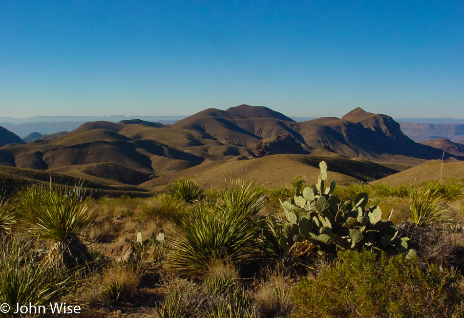
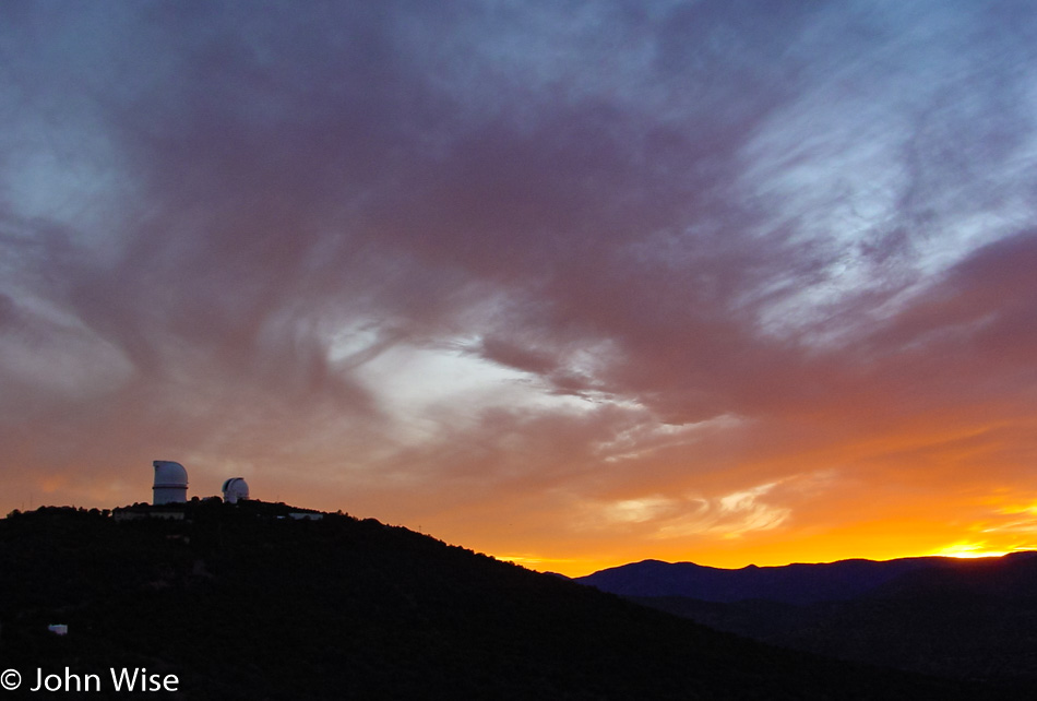
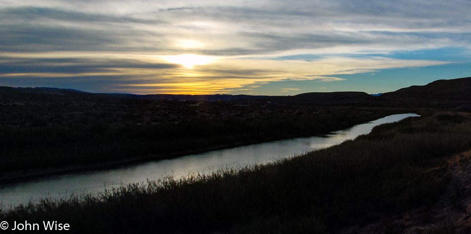
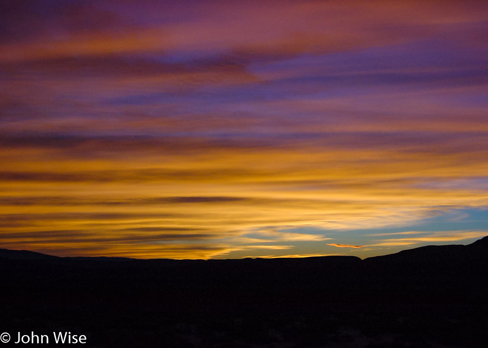
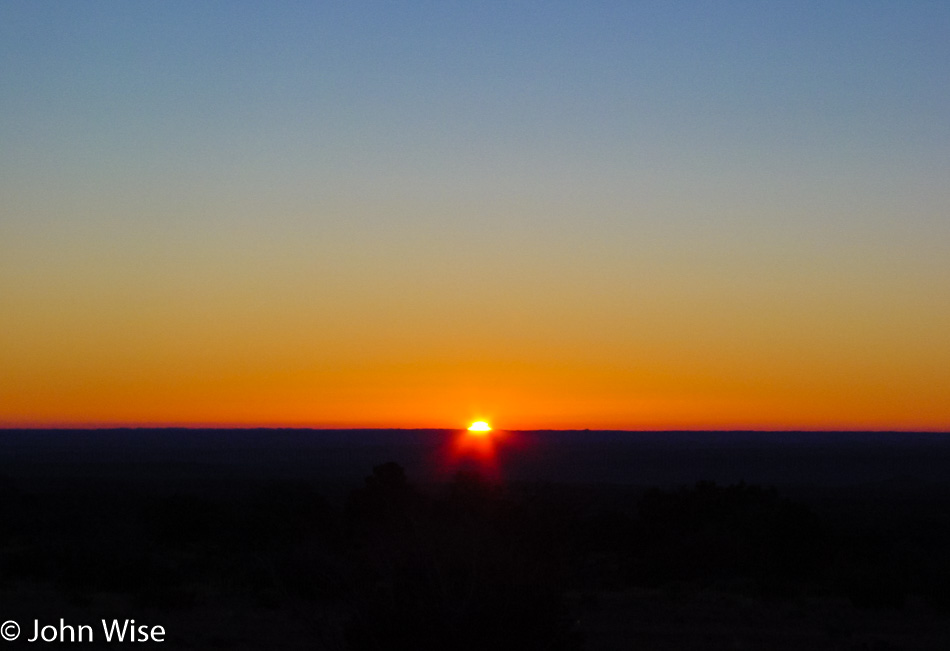
As you would have seen from yesterday’s post, Texas is not only a big flat, wide-open expanse of nothingness, though, from this photo, one might not be blamed for thinking just that. I could try explaining that we are up early due to our 100-mile drive to Carlsbad Caverns this morning or that we want to beat the crowds, traffic, bad weather, or whatever else, but there’s none of that. We just tend to be early risers while on vacation for these particular moments when the sun starts crawling back up over the horizon. Today’s sunrise is brought to you from near Manzanita Springs up Frijole Ranch Road in the Guadalupe Mountains National Park.

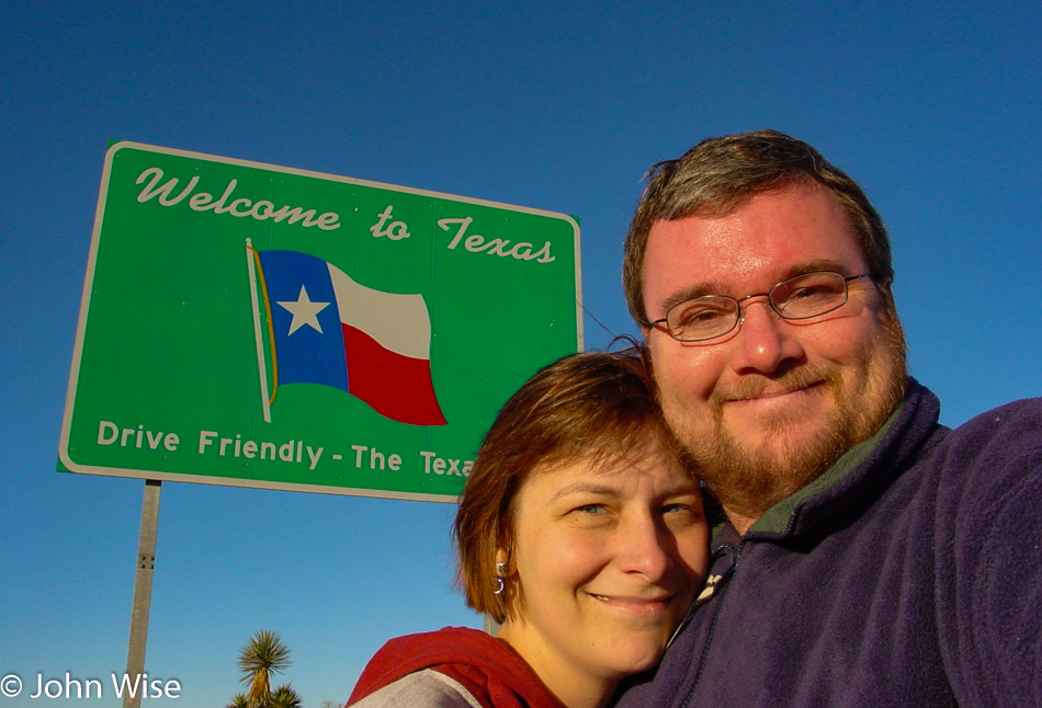
Wait a minute, I thought we were going to New Mexico? Well, we’ve taken our photo in front of a New Mexico state sign, but it was already evening when we crossed into Texas the other day, so we are making up for that.

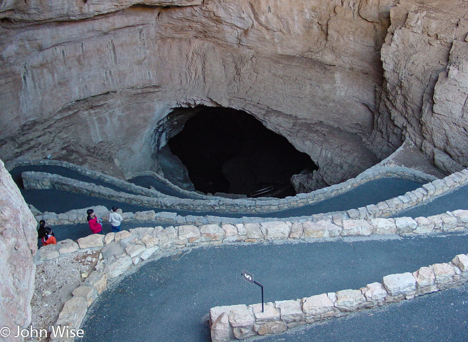
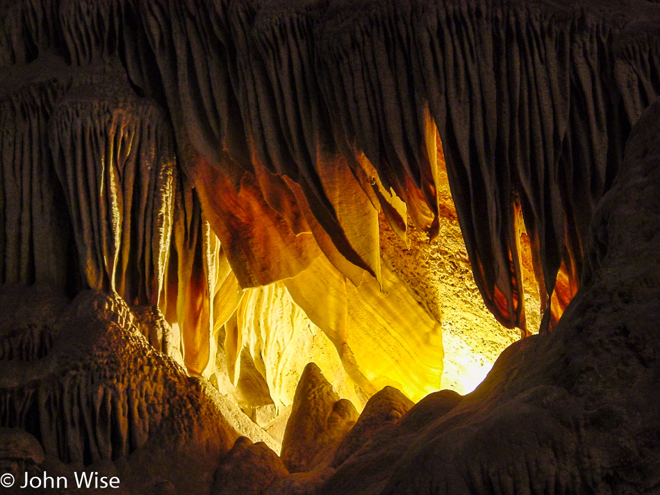
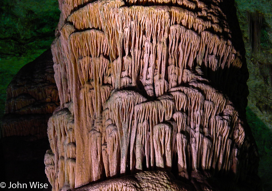
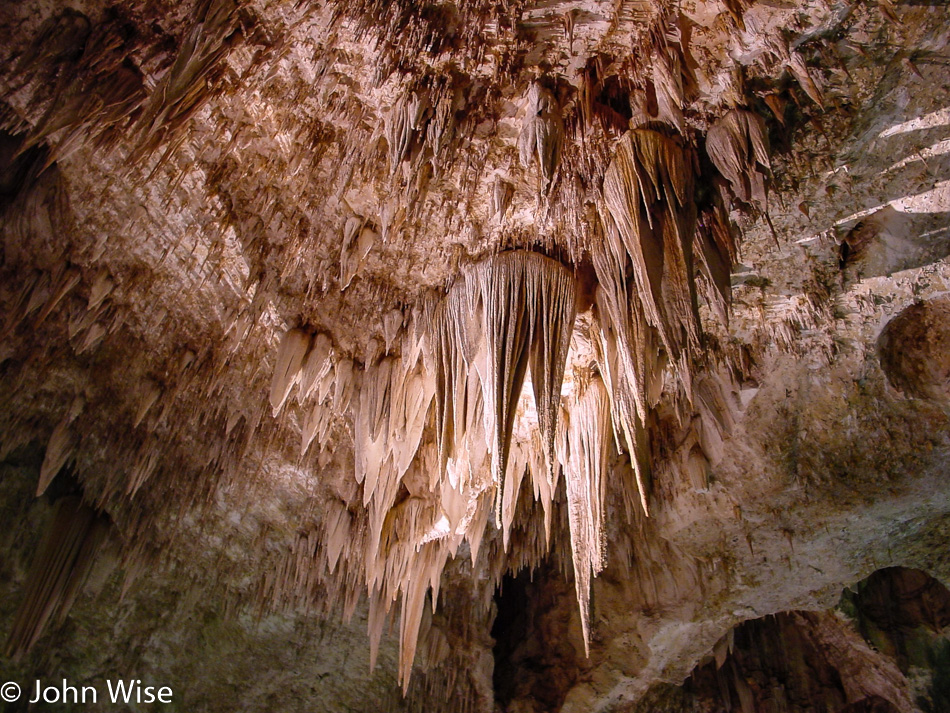
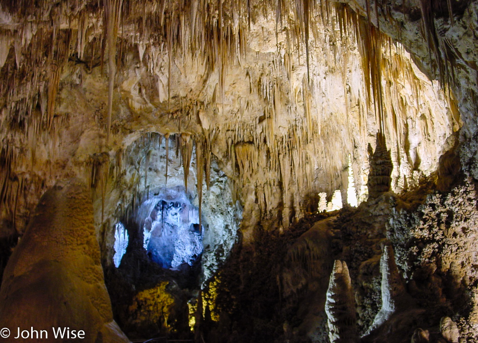
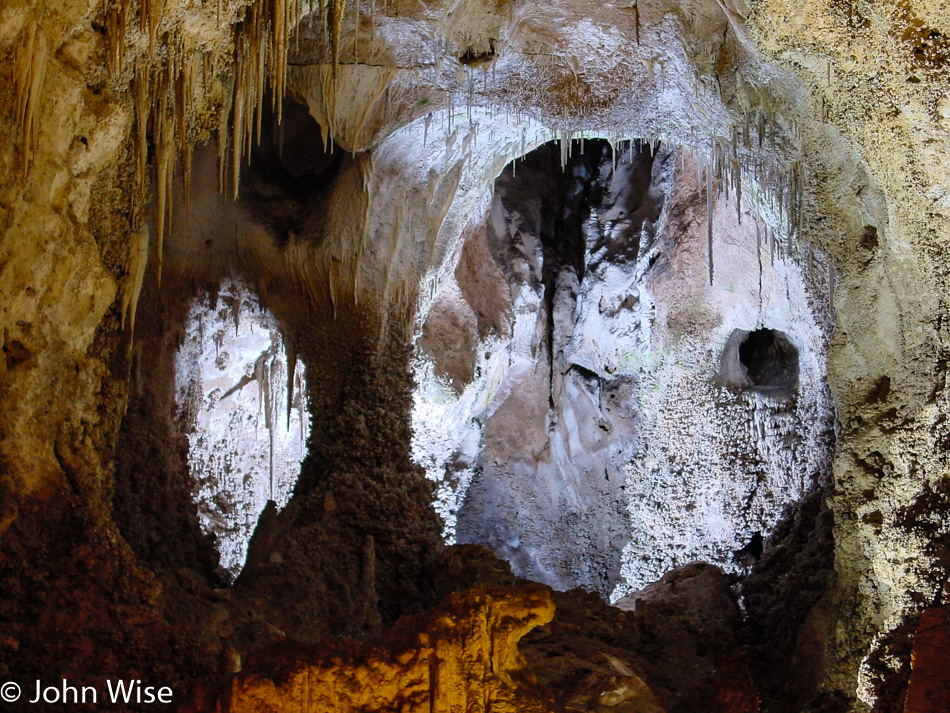
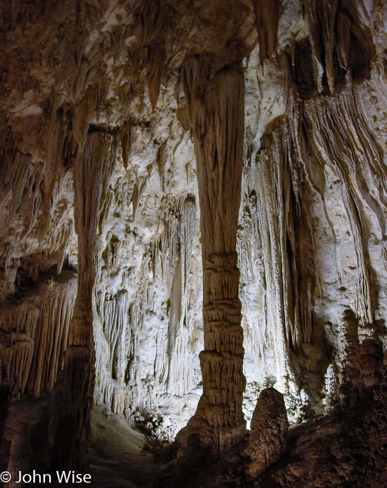
Taking the time to walk in the natural entrance of Carlsbad Caverns National Park. Why we didn’t do this on our previous two visits is beyond me; what a great way to enter the cave. Oh wait a minute I know why because we were in such a hurry on those trips like we are so often on any of these journeys. For the record, our first visit was in 1997 with Ruby and Axel Rieke and then in 1999 with Robert Bell and Mark Shimer. This is the third visit and the first in the 21st century. I’d be willing to bet a dollar it won’t be our last.

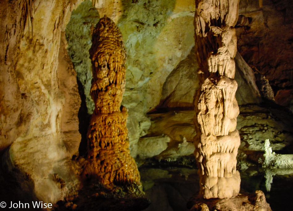
Nothing much has changed since we first visited five years ago; then again, this cave is mostly dormant now, and other than theft, nothing should be changing.

One thing that’s different, I can point out, is our ability to take somewhat better-quality photos. On our first visit in 1997, there were no consumer digital cameras beyond some early low-res thousand-dollar cameras that were horrible in low light. By 1999, we finally moved solidly into the world of 1 megapixel (1MP) images, and while a Nikon 2MP camera came out too, trying to figure out where you wanted to spend nearly a thousand dollars was seriously difficult, especially in an area of technology that felt like it was heating up and that we were seeing rapid advancements. A year later, we bought the camera that I’m using today, the Sony Cyber-shot DSC-S75 with 3MP, which was only $599.

While I’m looking back at our improving ability to take photos, I’ll add one more thing. I would love to be using a DSLR (Digital Single Lens Reflex) camera, but consider that the 1.3MP Kodak that came out in 1991 cost $30,000, and an upgraded DCS-460 with 6MP of quality was released in 1995 for almost $36,000, and you should be able to see that the trajectory there is still a pricey one. By 1999, the Nikon D1 with 2.7MP capability brought the price way down to only $4,995, but this was still far too expensive for what amounts to being a disposable camera. Unlike film cameras of 100 years ago, which still can take interesting photos, I don’t think the low-quality images we are getting right now from digital cameras will survive the test of time.

All the same, seeing these photos after our trip and the incredible detail available from an all-in-one point-and-shoot digital camera are astonishing to me.

The larger point of this exercise of documenting our trips out in America and taking notes when we can find the time is to create a document that demonstrates what is possible by two people who are throwing off the responsibilities of conformity. Our condo is for sale, we’ve chosen not to have children, we don’t much care about holidays, birthdays, or anniversaries, and are quite okay with a hedonistic lifestyle of relative selfishness that eschews typical consumption patterns.

And all of this is for our effort to witness as much beauty and novelty as our time and budget will allow.

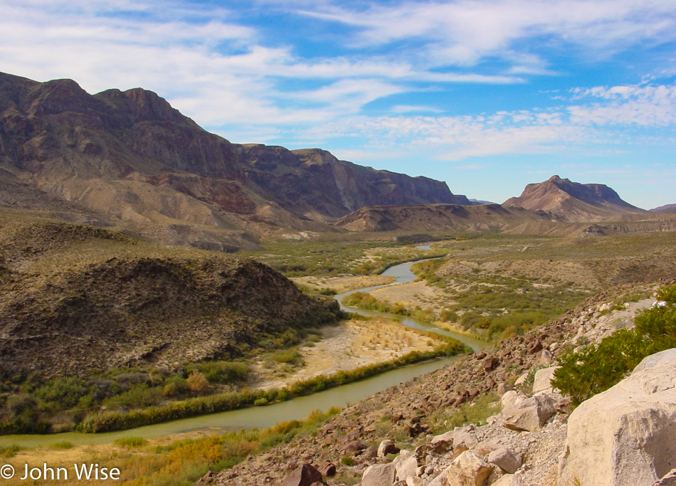
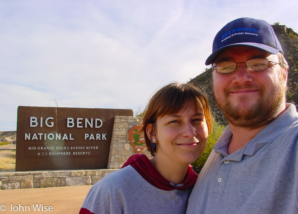
One of the greatest tools to access vast amounts of beauty is the National Park Pass. For only $50 a year or $10 for a senior pass if you are old enough (and that’s for the rest of your life!), you gain access to over 350 parks and monuments. This year alone, Caroline and I visited 20 National Parks and Monuments including Walnut Canyon, Redwoods, Yosemite, Sequoias, Death Valley, Lava Beds, Lassen, Crater Lake, Rocky Mountains, Devils Tower, Mt Rushmore, Colorado National Monument, Natural Bridges, Grand Canyon, Canyonlands, Mt St Helens, Olympic, Big Bend, Carlsbad Caverns, and Petrified Forest which we will visit tomorrow.

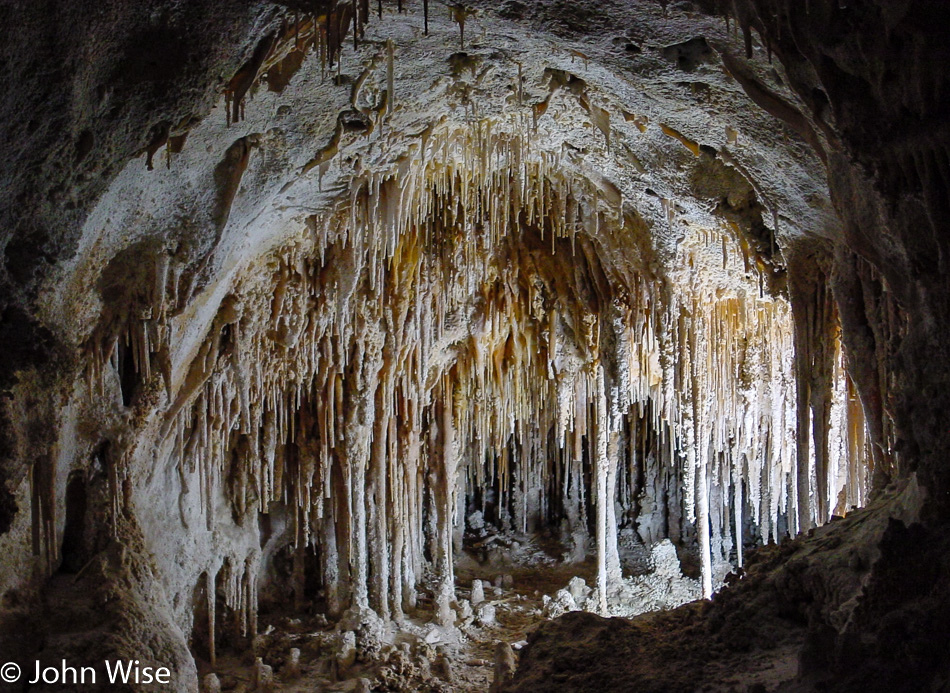
The aptly named soda straws. Looking at the formations in Carlsbad, Caverns never get old.

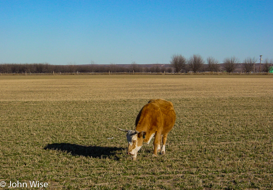
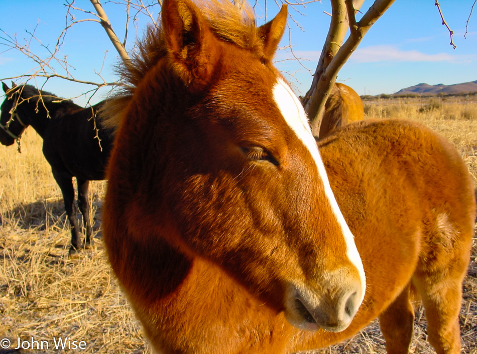
Because livestock also deserves to be recognized.

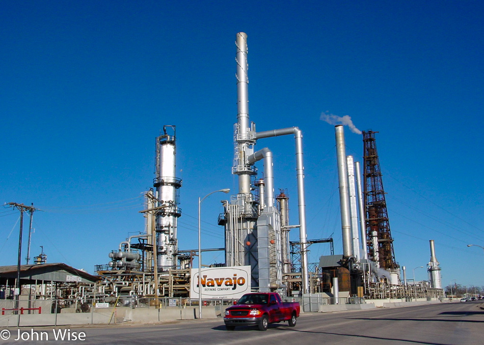
Sometimes, driving across New Mexico, it seems like the majority of the state’s economy is derived from oil and gas, maybe aliens, too.

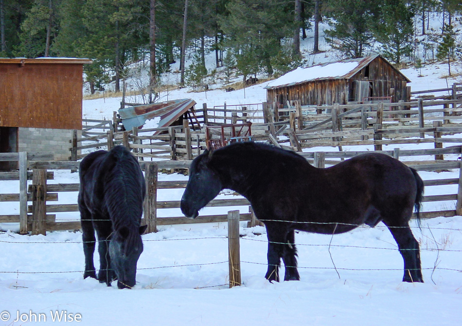
By the time we reach Cloudcroft, there’s enough snow on the ground that we know we don’t want to go deeper in the mountains, and up in Ruidoso, where we’d planned on staying, it promised to be much snowier. So when we reached Highway 54 going north, we stayed at the lower altitude and hoped to find something up that way.

We’ll be calling it an early night as we have to wake shortly after four in the morning to make the 100-mile drive to Bosque del Apache south of Socorro, New Mexico. On our previous visit back in March, a docent at the wildlife refuge told us that the best time of year to visit is around Thanksgiving into January, when the largest number of migratory birds are hanging out. She also insisted we show up before sunrise to witness a “fly-out” that is allegedly one of the most spectacular sights one can see of wildlife in this part of North America. We grabbed a room at the Rainbow Inn in Carrizozo and were headed to sleep before 9:00.

Big Bend, Carlsbad, Bosque, Petrified Forest – Day 3

We only have to drive north about 280 miles today, and so with that knowledge, we can linger out here at Big Bend National Park among the cactus, shrubs, brown grasses, and whatever else might come our way. While there may be things for us to come back to on a future visit, we also have to take into account that this is way off the beaten path. At this moment, we are about 740 miles from home or approximately 1200 kilometers, not the quickest of drives to make.

I should have had Caroline put her head down here for scale because these are the biggest cactus paddles I have ever seen.

We’re out wandering through the park on our way to nowhere in particular. Once we arrived this morning, we headed over to the Ross Maxwell Scenic Drive and have been digging it so far.

Wow, it’s a staredown with a javelina, and I can only hope it’s not feeling intimidated, as I’d prefer that it keeps its distance. I’ve heard somewhere that they have poor eyesight but an acute sense of smell so that while we may be a blur they can smell our presence. Here’s wishing this one smells our curiosity and inches peacefully closer so we can get a better look. Shortly after seeing this guy and not very far from the Castolon Visitor Center, a mountain lion leaped across the road. There was no way in the half-second it moved between the deep grasses across two lanes that I was ever going to be able to take its photo, but there it was, the very first mountain lion in the wild we had ever seen. Of course, we stopped at the visitor center and reported our sightings.

Yesterday, we thought we were near the Santa Elena Canyon, but we were closer to the boat launch than the canyon trail, and so on the recommendation of a ranger, we are taking the short walk on that trail that takes us right to the Rio Grande.

Mexico is so close we could reach out and touch it. What a beautiful canyon this is.

Our exit from the park will be off the Old Maverick Road; it’s unpaved and dusty in sections, but it does take us by an old stone house called Luna’s Jacal. Turns out that old man Luna built a very short house of rock, earth, and plant fiber, which allowed it to remain cooler in the blistering summer temperatures. He farmed out here by diverting water out of nearby Alamo Creek. Some people choose a hard life, others have no choice.

Fort Davis National Historic Site is our next stop on this Christmas journey through the desert.

This one-time frontier military post played a key role in the war to clear Native Americans from their lands, and to be honest; I’m conflicted that we have monuments to our ancestor’s determination to relocate or exterminate a people. Earlier, we’d passed a monument erected in 1936 that recognized a ranch and its role during the clearing of Indians and bandits back in 1880 – 1882. Relating bandits in the same sentence with Native Americans feels pretty damn disparaging to me. While I can appreciate the historic nature of these buildings at the fort, I feel that the wrong committed out of here is not adequately acknowledged. I suppose, though, that is the nature of the perspective of the winners; had Hitler won World War II, I guess Dachau could be a monument to the period when the country was clearing the land of Jews.

Up here, at the elevation of 6,791 feet above sea level on Mount Locke, is the McDonald Observatory. This is a bonus site on this trip, as we had no idea that we’d find an observatory out here.

With about 60 miles between us and any city of relatively medium size and being over a mile above sea level, it makes perfect sense to place a number of telescopes out here.

The visitor center is already closed, and it’s too early to get a look at the stars. Doesn’t matter, though, as you typically need reservations, and events are held sporadically; better to check their event calendar should you decide to visit.

I don’t know what happened to the day, and then all of a sudden, we are moving into the night. Oh yeah, it’s wintertime, and the days are short. Up to Van Horn on Interstate 10 for our overnight in some anonymous cheap motel.

Big Bend, Carlsbad, Bosque, Petrified Forest – Day 2

It never fails that getting away from a major freeway allows us to see the world change in dramatic and beautiful ways. We are well outside of El Paso now; as a matter of fact, we entered Texas at 6:00 this morning. By the time we stopped for this photo of the pony in the rising sun, we were on the US-90.

Good thing we have our ice chest with us because eating here at the old HiWay Cafe is now out of the question.

Well, no wonder the cafe had problems staying in business; the town of Valentine, where it’s at has a population of only 217.

Update: As of 2016, the population has dwindled to only 125 residents. By 2023, it was 73.

Welcome to Marfa! I’d already known the name of this town from a stint in drug/alcohol rehab I did back in 1983 (I think that was the year). By some freak chance, I ended up in a hospital in Century City, California, across the street from the Twin Towers as they were known (used for the exterior shots of the TV series L.A. Law), and after I’d been there about a week some homeless guy was brought in by a taxi driver who told the people that greeted this transient that he’d been on the floor of the taxi tripping out about the threat of being shot on his way in.

More than a few of us wondered why they allowed the heavily bearded old guy in this place on the edge of Beverly Hills. Over the next days, I’d walk by his room, and on one occasion I heard him listening to Kraftwerk, which at the time seemed kind of out of the ordinary. Another time, I caught the Screamers and thought, “NO WAY!” I was 20 years old and had been deep into the Los Angeles punk scene, and this dude was just too old for punk; he was probably about 50. Yeah, one more time strolling by, except this time, I thought I was hearing Devo’s rumored but unreleased Muzak recordings. I had to stop in and ask.

The guy had told me that the Screamers had recently played at his birthday party. I was incredulous. Regarding Devo, I was correct, and he told me that Mark Mothersbaugh was his friend. “So, who are you?” He answers me with another question, “Have you ever seen the film Giant with James Dean?” My answer was no, as I loved horror and sci-fi growing up. “Well, what about the film Easy Rider?” I excused myself, explaining I was a punk/industrial kind of person and that the hippy stuff of the late ’60s was more my dad’s generation than mine. “What about Apocalypse Now?” With that, he struck a nerve: he was the crazy photographer! I had just met Dennis Hopper. The old guy taught me a lot over the next couple of weeks, including planting the seed of taking an interest in his film career that early on took him to Marfa, Texas, where he was featured in the film Giant with James Dean and Elizabeth Taylor.

Out of Marfa and onto US-67 heading for the Mexican border. Along the way, we passed through the Shafter Ghost Town; not many ghosts, but many ruins remain, although they are fading from the sun and wind that constantly gnaw at their existence.

This old javelina didn’t make it out of town and was lying here drying out like the rest of everything that passes through. Looking back, I should have grabbed one of those fangs for a pendant, though I guess that practice was reserved for those who took the animal’s life.

Entering a familiar-looking country reminiscent of Arizona. Strange to think that we’re in America, but just a stone’s throw across the river is Mexico. We tried visiting Fort Leaton State Historic Site in Presidio, but it was locked up tight, the first place to put on the list of places to come back to.

How this “stream” got named the Grand or Big River is beyond me, but this slice between Mexico and the United States is the famous Rio Grande, sometimes known as Rio Bravo. It’s really true what Will Rogers once said about it, “The only river I know of that is in need of irrigating.”

Hoodoos in Texas, who knew?

Back in the day, maybe John Wayne and Clint Eastwood visited these places, but today, there are very few people wandering around and even fewer living out here. The truth is more mundane, with this place called Contrabando having been built in 1985 for a Roy Clark film titled Uphill All The Way.

Update: A flood six years after we visited caused serious damage, and by 2015, most of the buildings were removed.

This National Park right here is the primary reason for our visit to our southern border in deep Texas. Big Bend seemed like a remote enough corner that might not be too busy on Christmas day, and so here we are.

Just us and the tarantulas. Well, there are probably some snakes, scorpions, bats, coyotes, and a few javelinas roaming around too.

With a loose framework identified for this road trip, you can bet we don’t have much time to explore the longer trails that might show us some of the more off-the-beaten-path locations. We’ll just add Big Bend to the list of places we’d like to return to.

On our way to the park, we had stopped in Terlingua to check into the Longhorn Ranch Motel and RV Park to ensure we had a room for the night else we would have had to leave the area early and head up to Alpine, Texas, on the US-90 for our overnight. With plenty of time now available, we were able to take a hike out along the Rio Grande and enjoy the sunset. We can report that in our entire time along the river from Presidio to Lajita for nearly 50 miles and then again here in the park, we never once encountered the hordes of immigrants racing across the border that so many people up north fear. Matter of fact, in talking with some locals, they said the border issue is grossly overblown and that for hundreds of years, people have been going back and forth across this border for work and family without issue. Sadly that lack of hysteria doesn’t sell well to idiots who feel that the potentially shitty jobs that immigrants often take are under threat.

Caroline is dipping her feet in the Rio Grande near Santa Elena Canyon. She would have walked in, but how would it have looked if, at that moment, an official or border agent had seen her walking out of the Rio Grande coming from the direction of Mexico, which is just 30 feet away? What we did see in Mexico were a few wild donkeys yay, wildlife!

I have to wonder which side is Mexican sunset and which side is American sunset and if they have to have papers to cross borders. Merry Christmas, everyone.