Mexican Hat and Surroundings

Mexican Hat, Utah

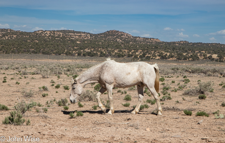
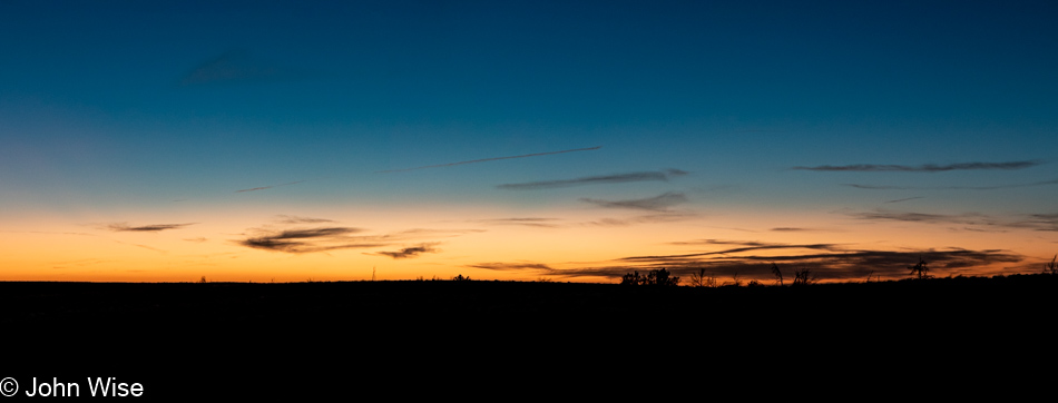
Today started out on the wrong foot, with us deciding at 5:00 am that the commitment to haul ourselves nearly 4 hours north wasn’t going to be happening. The original idea had us revisiting Horseshoe Canyon, but after a night of sleep that was more akin to playing the rotisserie chicken game until 5:00, when I finally dragged my exhausted body over to turn on the loudest air conditioner in all of southern Utah (that at least helped get some sleep), we decided to change plans.

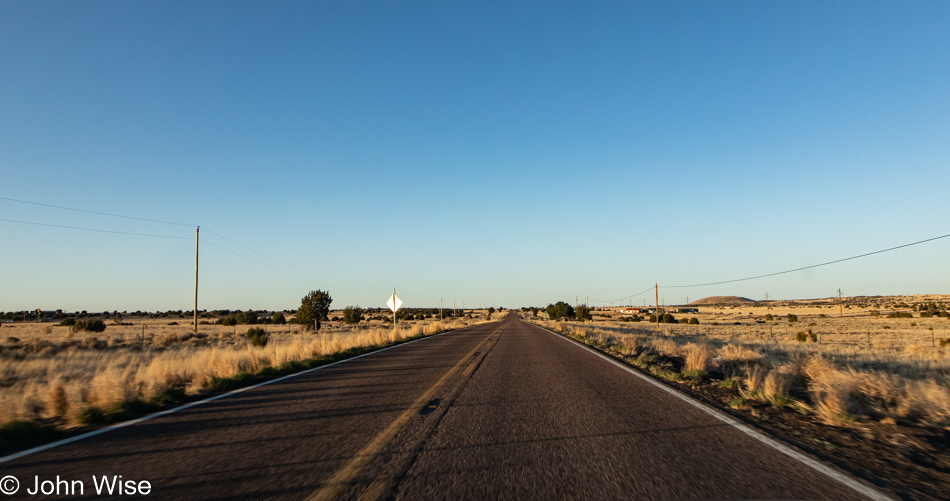
It was already after 7:00 when we finally hit the road, a bit disappointed that we bailed on our plans at the last minute, leaving us relatively aimless other than knowing we were going north. We drove into the gloomy, overcast morning. The only thing we could muster those first minutes was stopping at the Mexican Hat rock on the other side of town.

Mexican Hat, Utah

Not more than a few more miles beyond that was the turnoff to head out of Goosenecks State Park. This, too, would be a revisit, but sometimes it feels that almost everything in America qualifies as that for us.

Goosenecks State Park in Mexican Hat, Utah

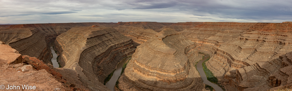
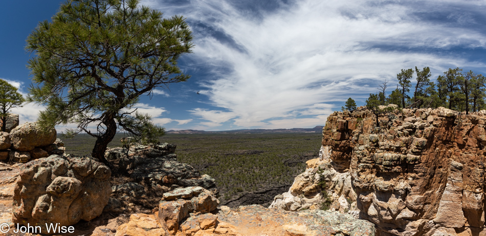
Back a hundred or so years ago, on our last trip out here, we believed we were the only people at this overlook; that’s not true this time. Maybe it’s a Memorial Day Weekend thing, but a half dozen campers are parked along the rim, and there are a few other visitors out here just for the peek into the depths below.

Goosenecks State Park in Mexican Hat, Utah

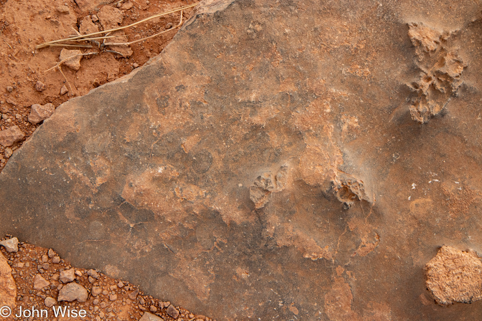
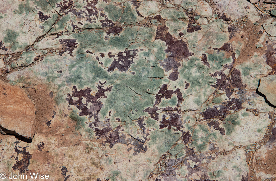
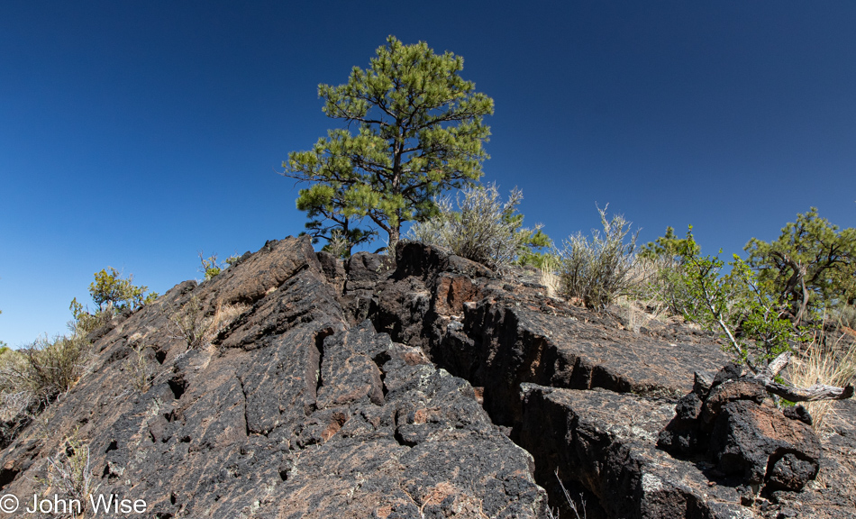
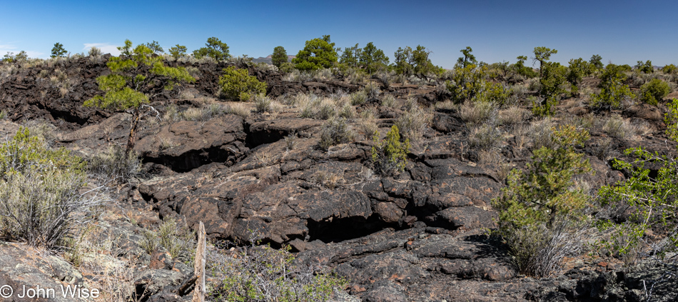
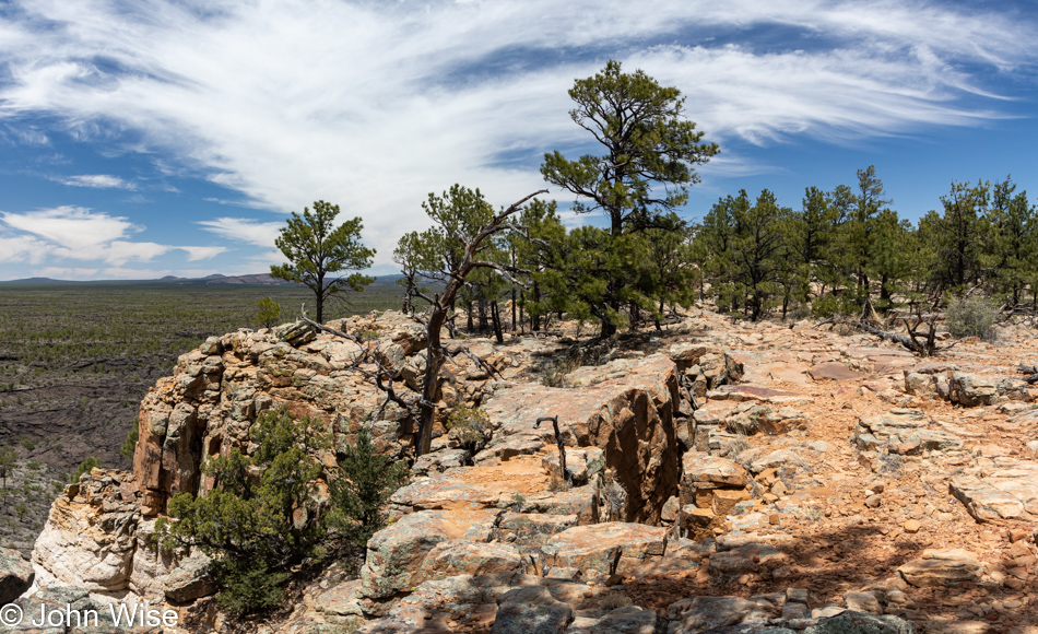
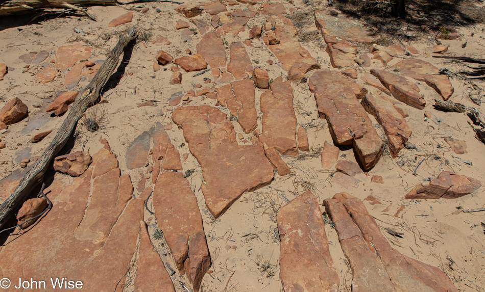
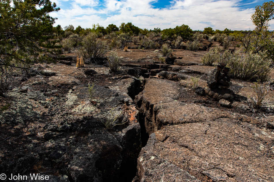
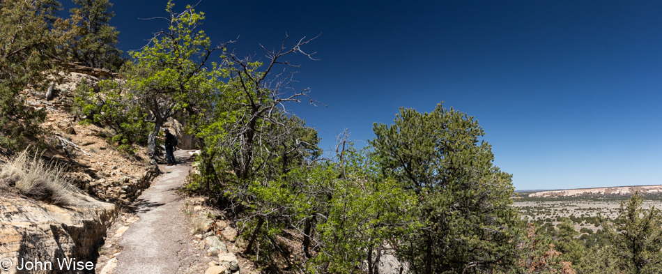
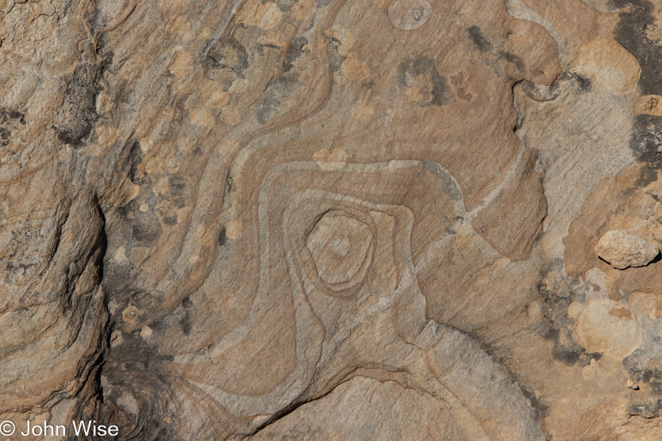
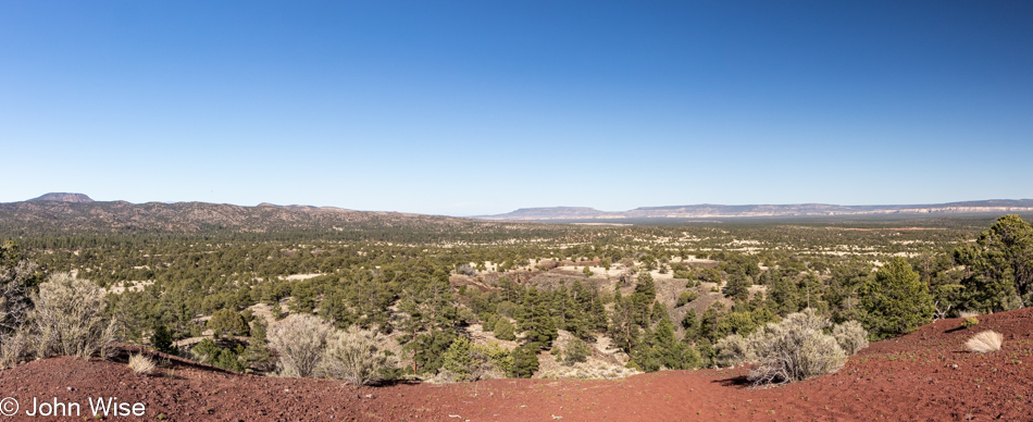
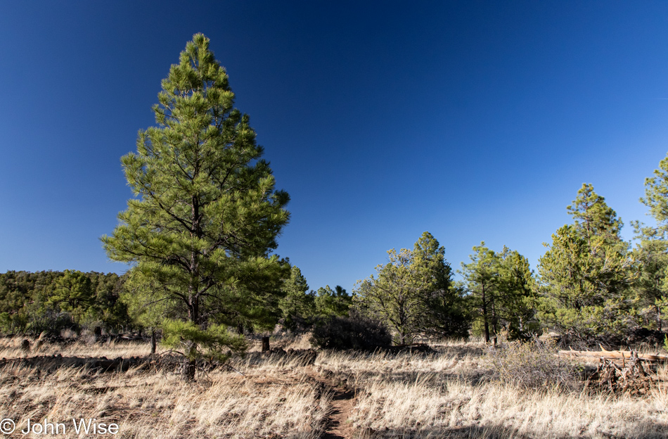
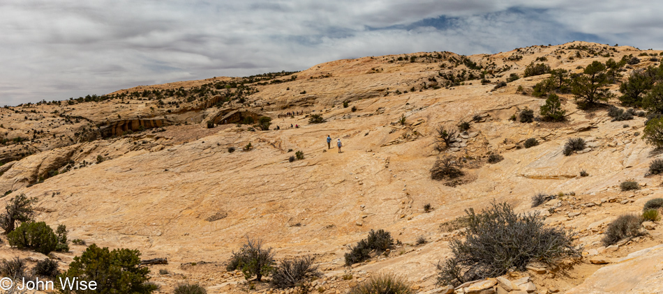
It’s a beautiful 2-mile roundtrip walk out to the trail’s end. Along the way, I’m enchanted by the rock formations we’re walking over as there are hints of a marine past where it appears to Caroline and me that a shallow sea influenced the look of this fossilized sandstone. Caroline picks up on the thought that these look as though they have a milky translucency where she can glean hints of the underlying structure that formed these rocks.

Goosenecks State Park in Mexican Hat, Utah

I’ve stared hard, contemplated, and searched my memories, trying to find what this reminds me of, and maybe the best I can come up with is a dry lake bed that’s been compressed by subsequent layers accumulating on top of it. How often do we stop to consider just what it is we are walking on? The reality is that we are walking atop history, usually oblivious of how familiar we’d be with it. If I knew I was walking on a lake bed, a shallow sea, or a broad river bed, it would change how my imagination would contextualize the environment I’m experiencing as I strain to see what might have been prior to my arrival.

Heading up the Mokee Dugway in Mexican Hat, Utah

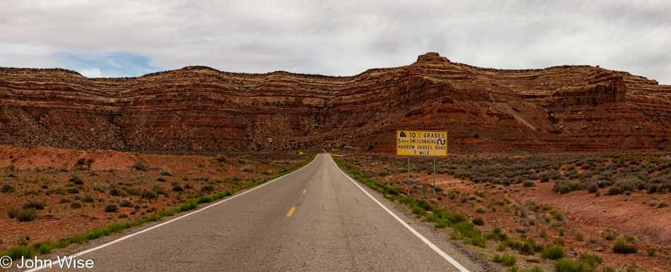
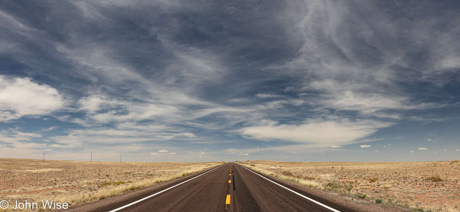
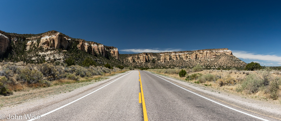
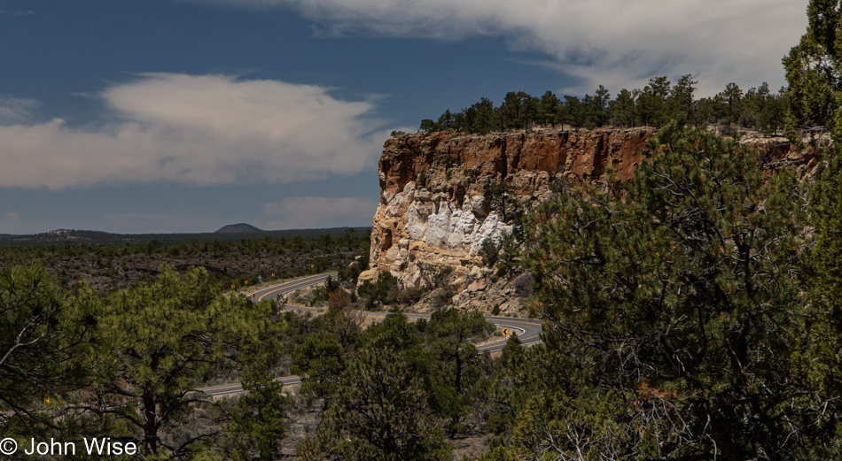
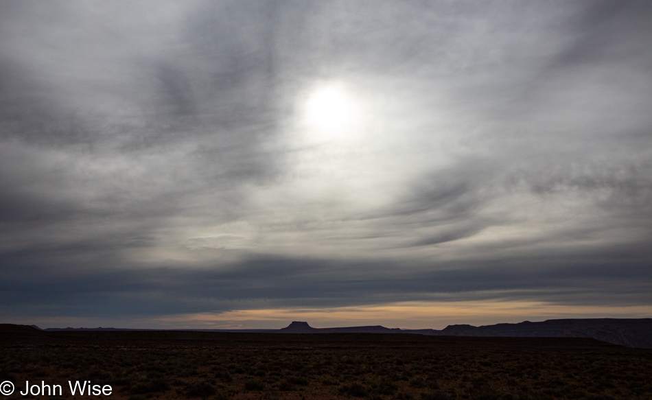
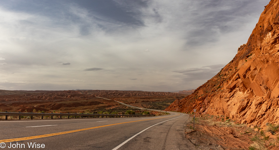
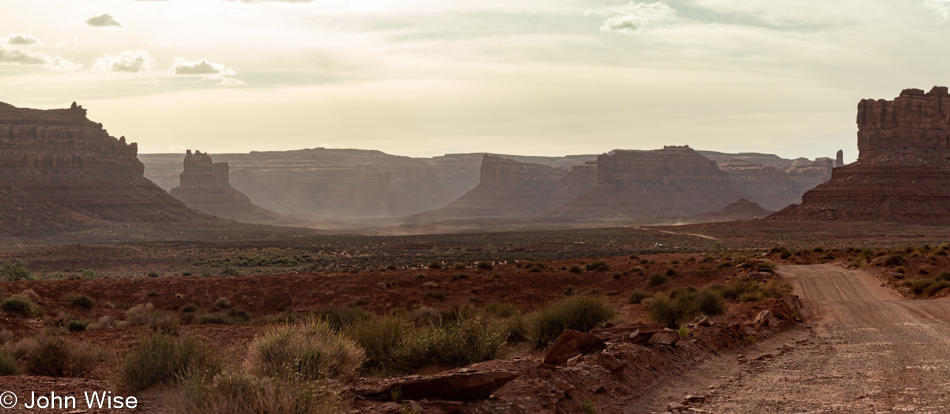
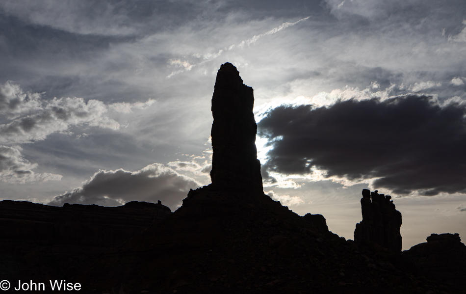
With the overcast sky, we agree that there’s nothing to be gained driving up the scary Mokee Dugway and that we will take the right turn just before the ascent and drive through Valley of the Gods before returning to the road that will take us up Bluff way.

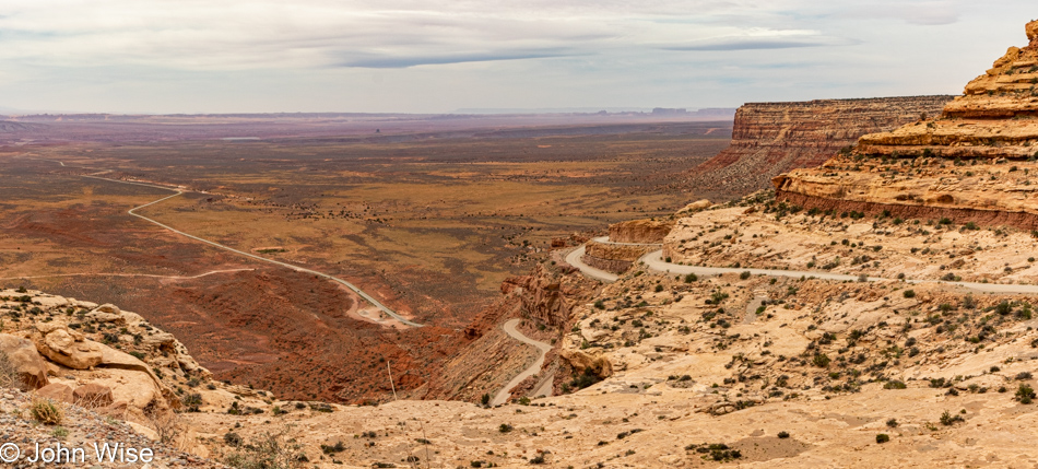
We made the right turn, and not 5 seconds later were making a U-turn to face our fears and drive up the dugway; not my idea, mind you. We know we’ve driven down it a couple of times, but we had no recollection of going the opposite direction, not to say we haven’t, as in having taken so many road trips across the Southwest, maybe a thing or two gets lost to time.

Heading up the Mokee Dugway in Mexican Hat, Utah

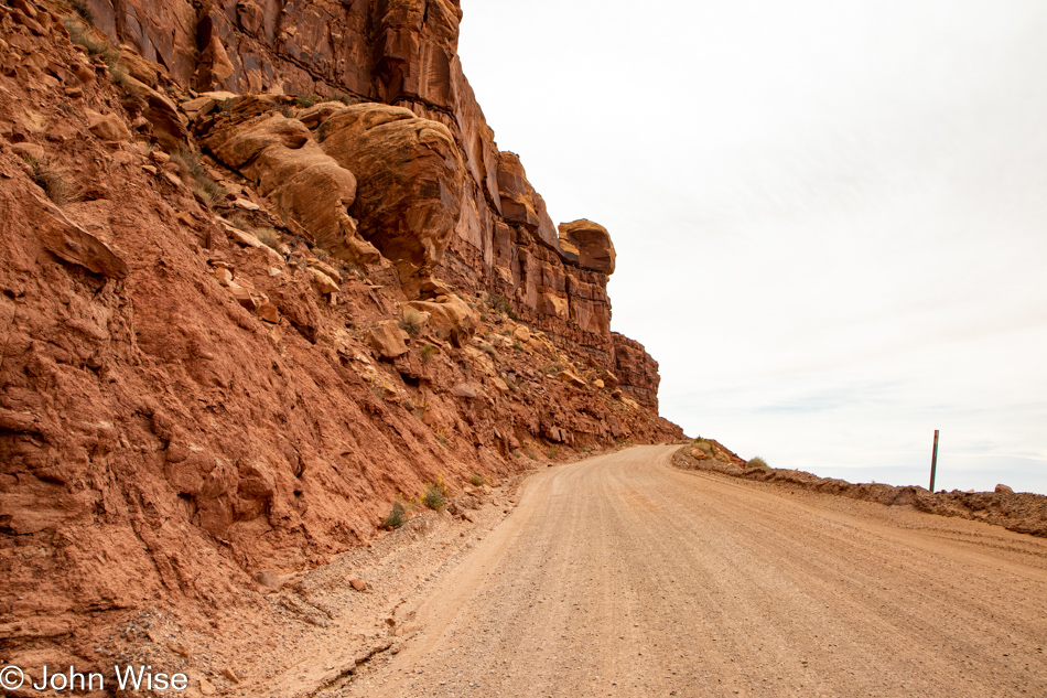
It’s a white knuckle climb up the 3-mile (4.8km) series of switchbacks that will take us up the 1,100 feet (335 meters) needed to find our way onto the top of the mesa. We had the opportunity to learn one bad aspect of going up instead of down: if you encounter someone going down on the really narrow parts, they have the right of way, and you have to back up. This was the point where Caroline was questioning her enthusiasm for this diversion instead of an easy drive through the Valley of the Gods.

Heading up the Mokee Dugway in Mexican Hat, Utah

By the way, when we got home after this trip, we looked at our old photos that lay witness to our travels over the Mokee Dugway and now have to question if we’ve ever driven down the narrow dirt road. How could we have lost those memories that we’ve apparently always driven up the Dugway?

Butler Wash Anasazi Ruins Trail in Bears Ears National Monument, Utah

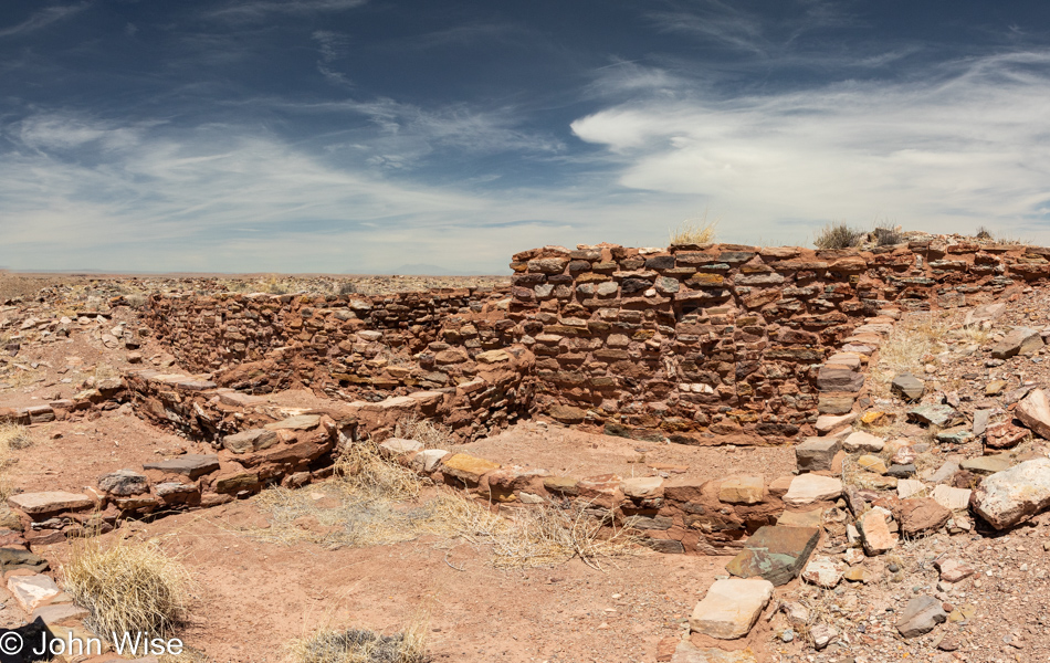
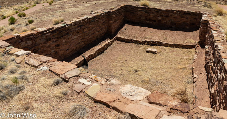
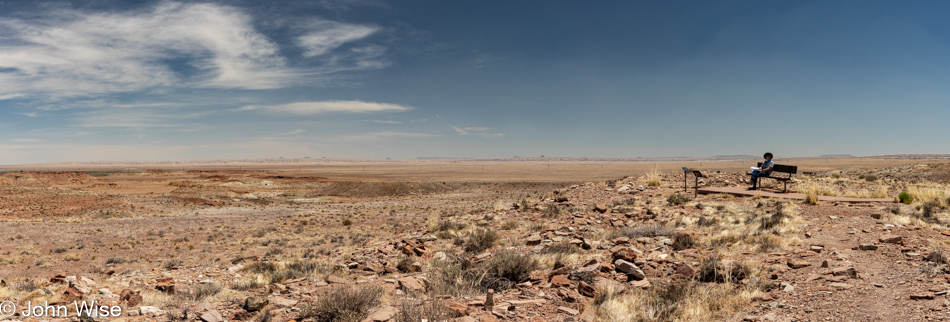
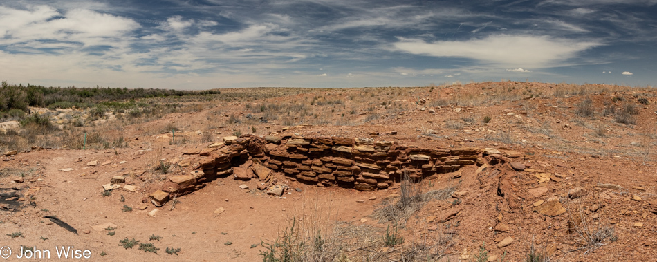
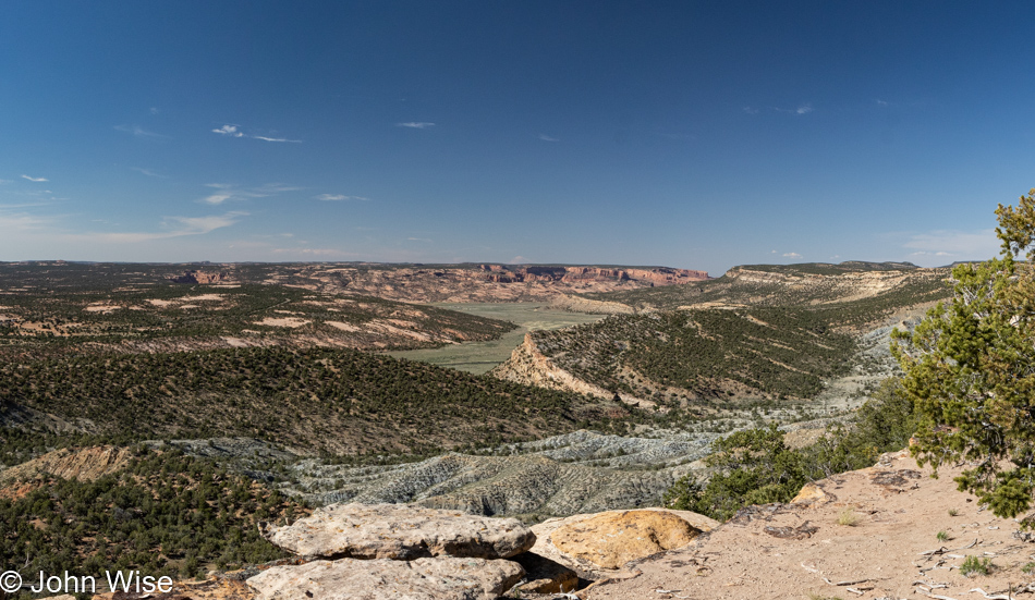
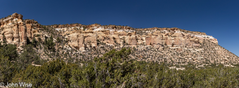
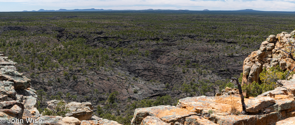
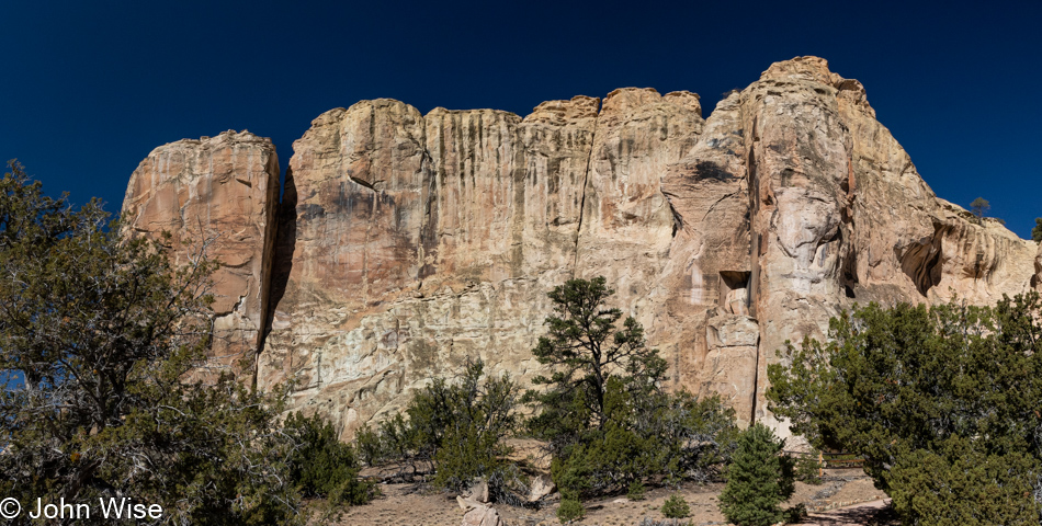
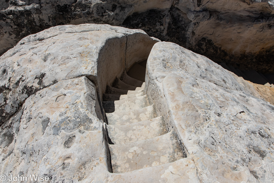
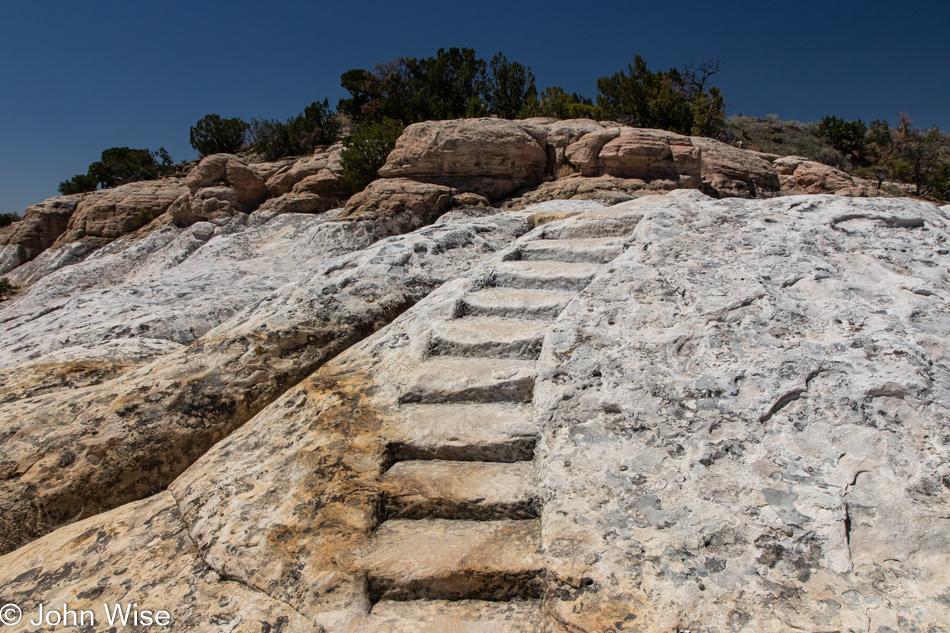
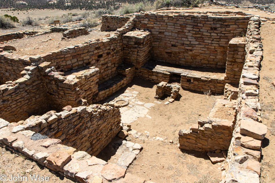
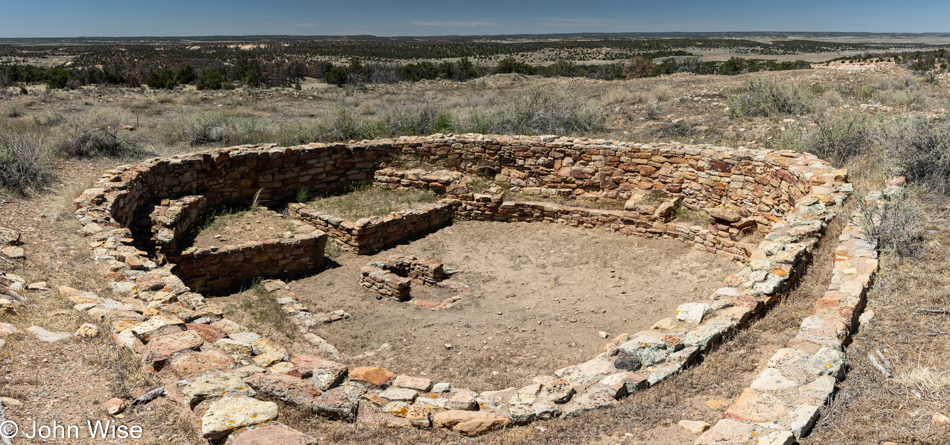
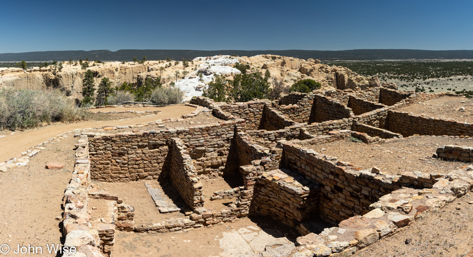
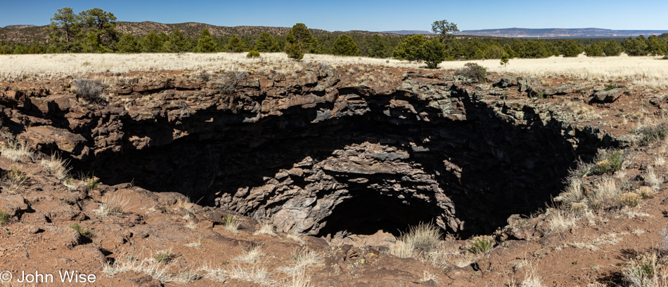
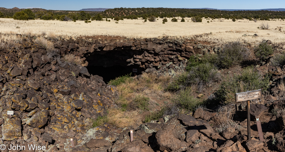
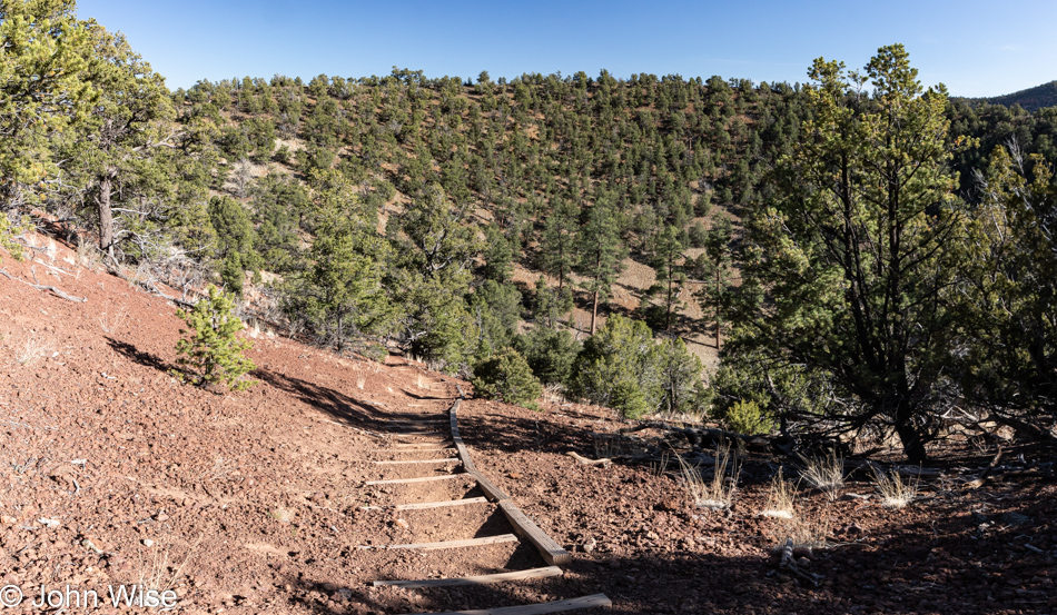
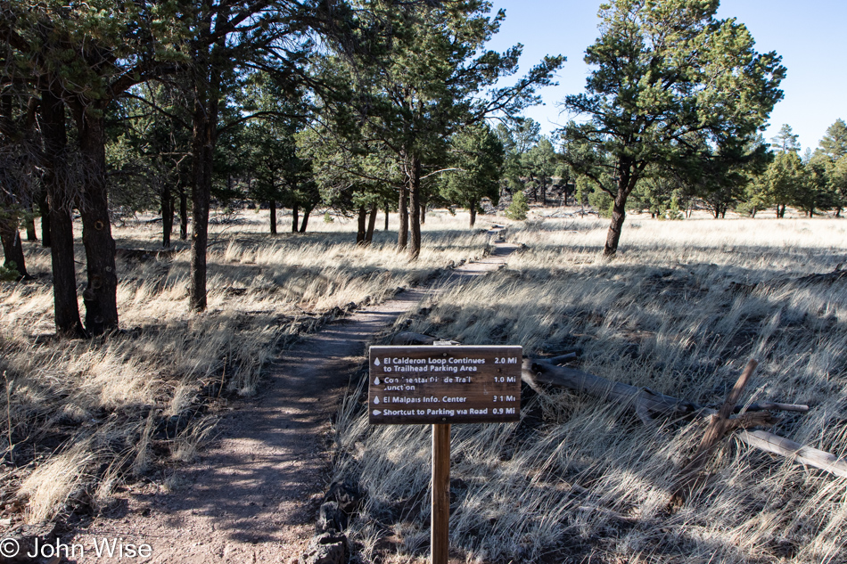
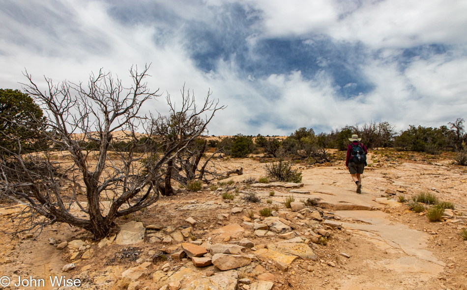
Not prepared to turn around and return the way we came, we continued up the road into Bears Ears National Monument. We passed one spot that talked to our curiosity, but it was supposed to be part of tomorrow’s adventure and so we just kept on driving. When we saw the Butler Wash Anasazi Ruins Interpretive Trail sign, we turned in there as it sounded compelling.

Butler Wash Anasazi Ruins Trail in Bears Ears National Monument, Utah

Before our next mini-adventure in the continuing bigger adventure, it was time for lunch. We turned to a new favorite, bologna, and boiled egg sandwiches, but it turned out to only be a snack as in a couple of hours, we’d pull over for another round. Done with that, it was time to hit the trail.

Butler Wash Anasazi Ruins Trail in Bears Ears National Monument, Utah

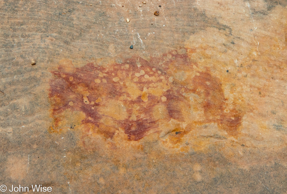
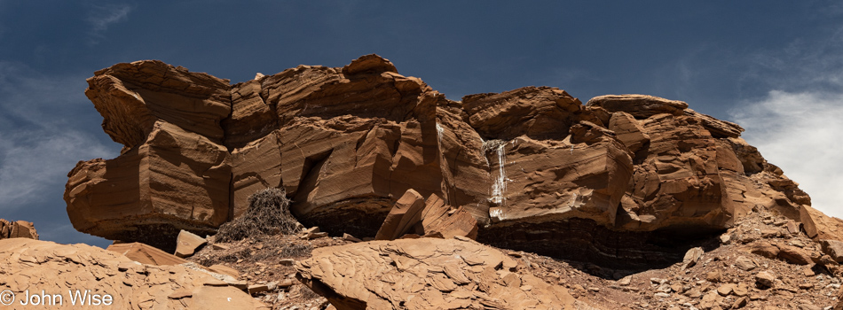
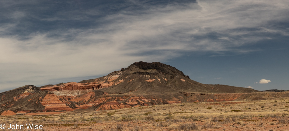
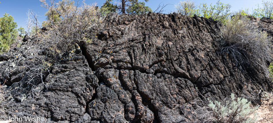
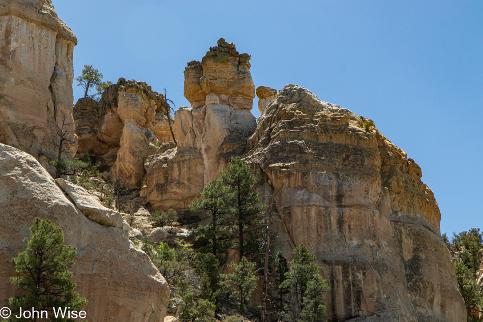
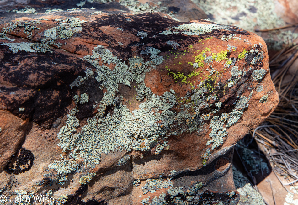
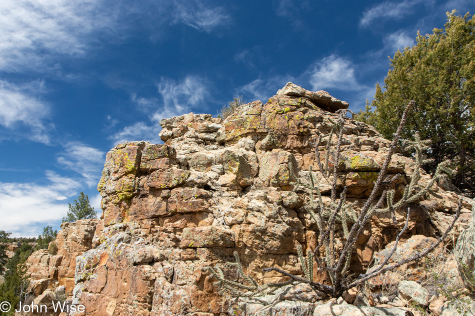
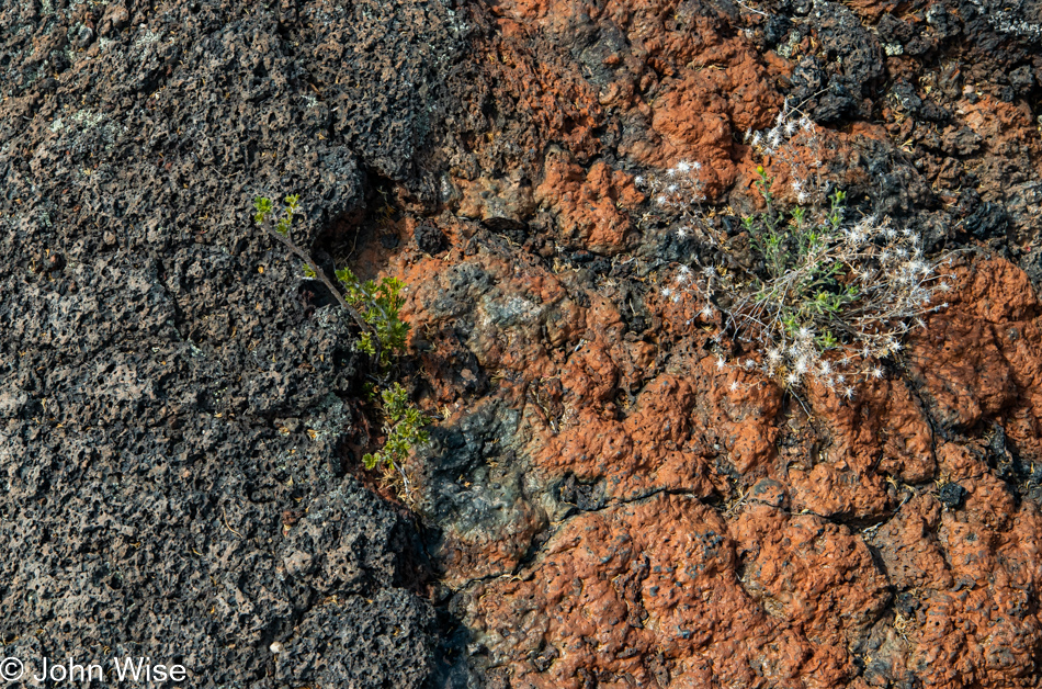
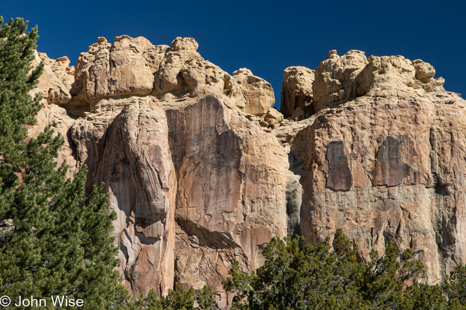
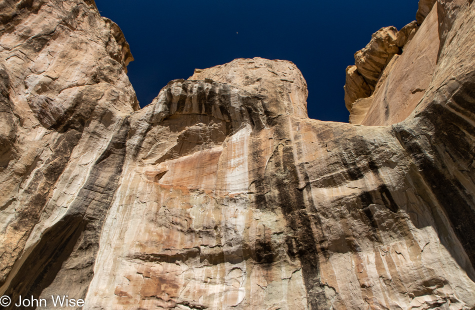
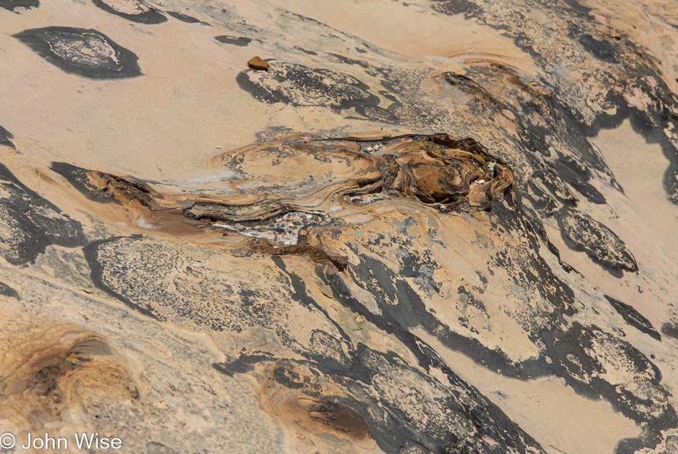
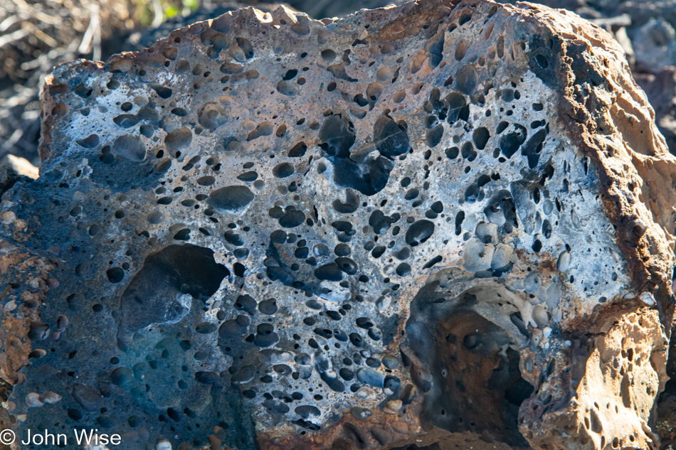
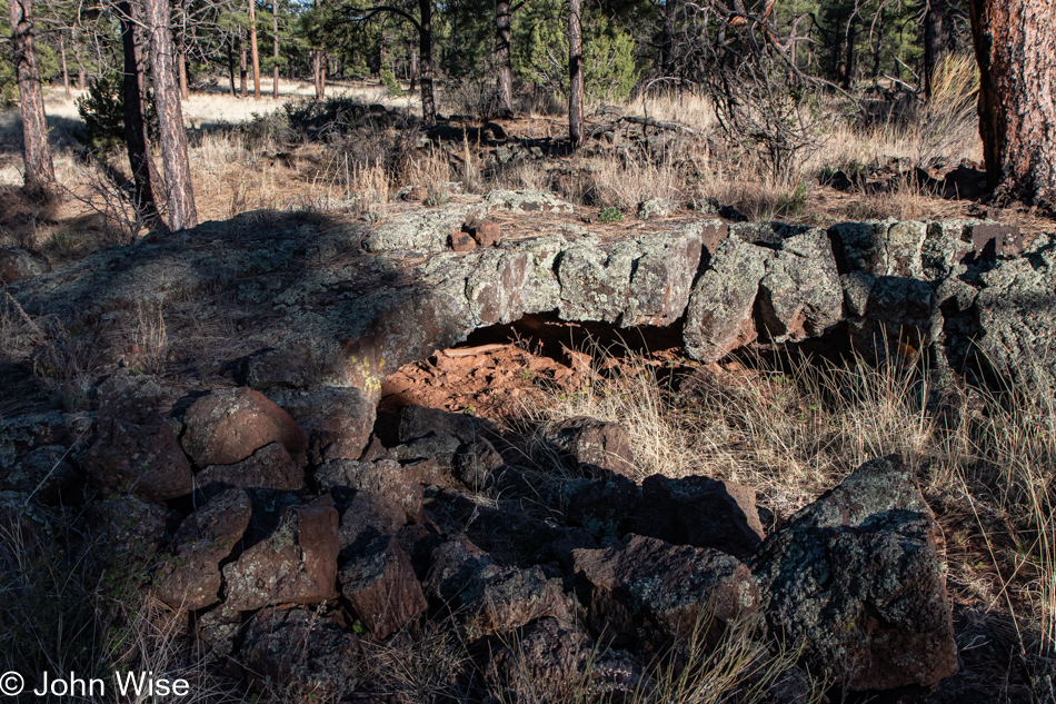
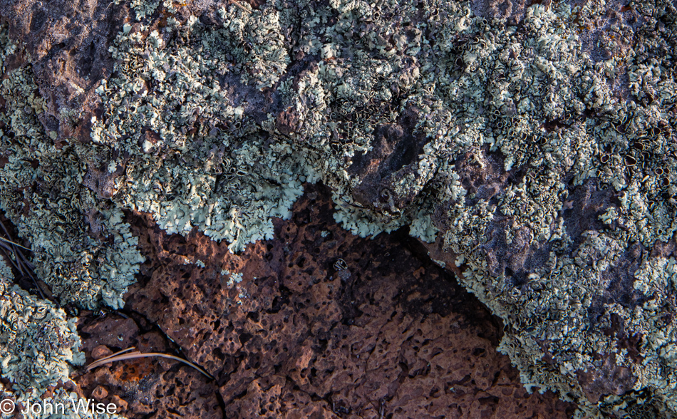
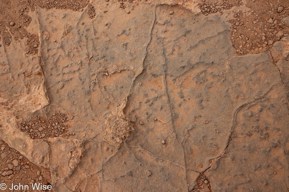
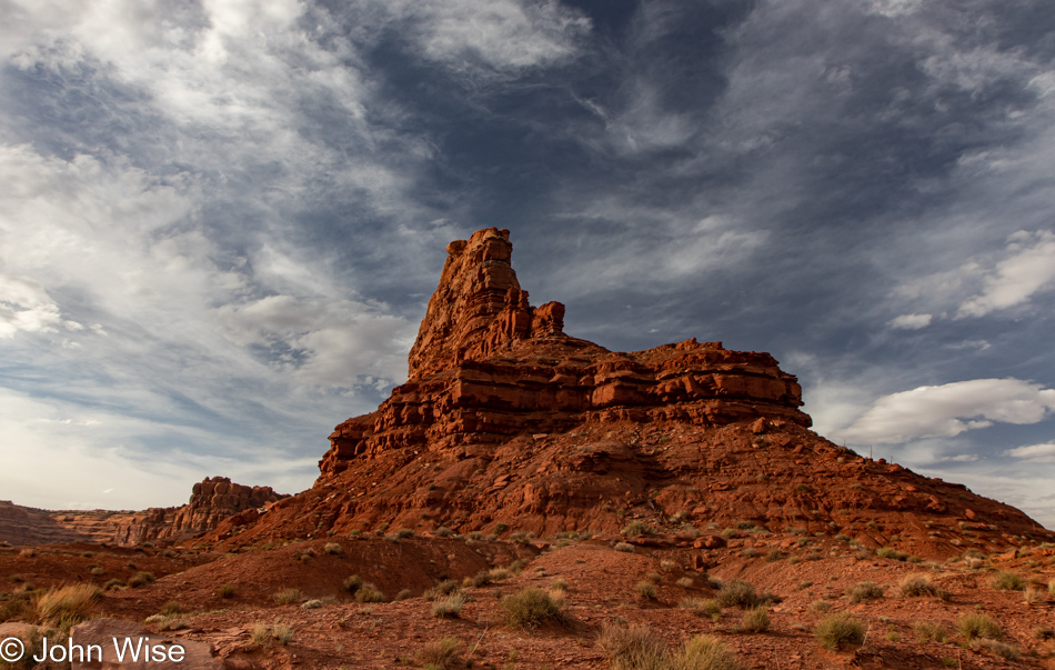
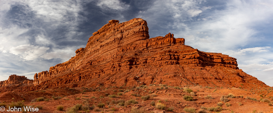
Back when accretion was at work accumulating successive layers of sediments, something was happening here that will remain inexplicable to me. While I have some sense that the oxidation of iron is playing a role in creating rust, I’m desperate to know precisely why this bit of sandstone is red and orange. If it’s being excreted over time as it’s exposed to the elements, then why just here? What are the processes going on in the sandstone that are drawing particular minerals to this location? I should have been a geologist.

Butler Wash Anasazi Ruins Trail in Bears Ears National Monument, Utah

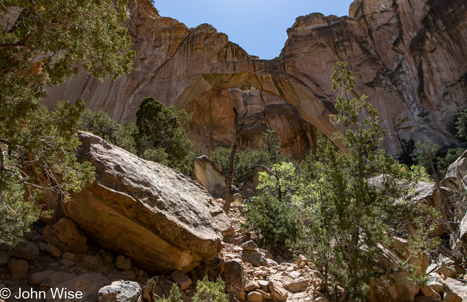
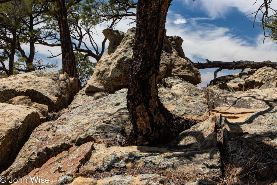
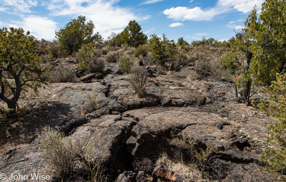
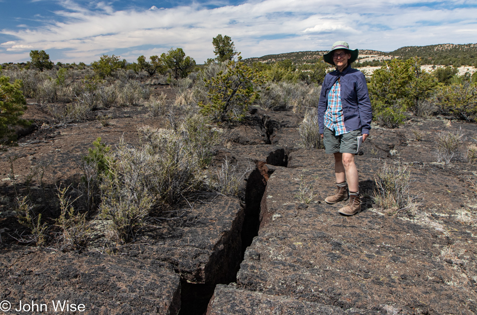
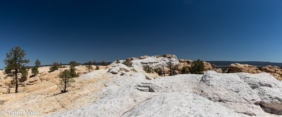
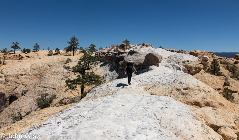
There’s something missing from this photo. Namely, the layers of earth that used to be here but are now scraped from view by good ol’ Mother Nature, who eroded that history and delivered it somewhere else. What remains allows us to see the sand dunes that were petrified somewhere in the distant past. Like a kind of two-legged ant, we walk in the gap of time where once a hidden sandwich from another era hid the story of the earth unfolding.

Butler Wash Anasazi Ruins Trail in Bears Ears National Monument, Utah

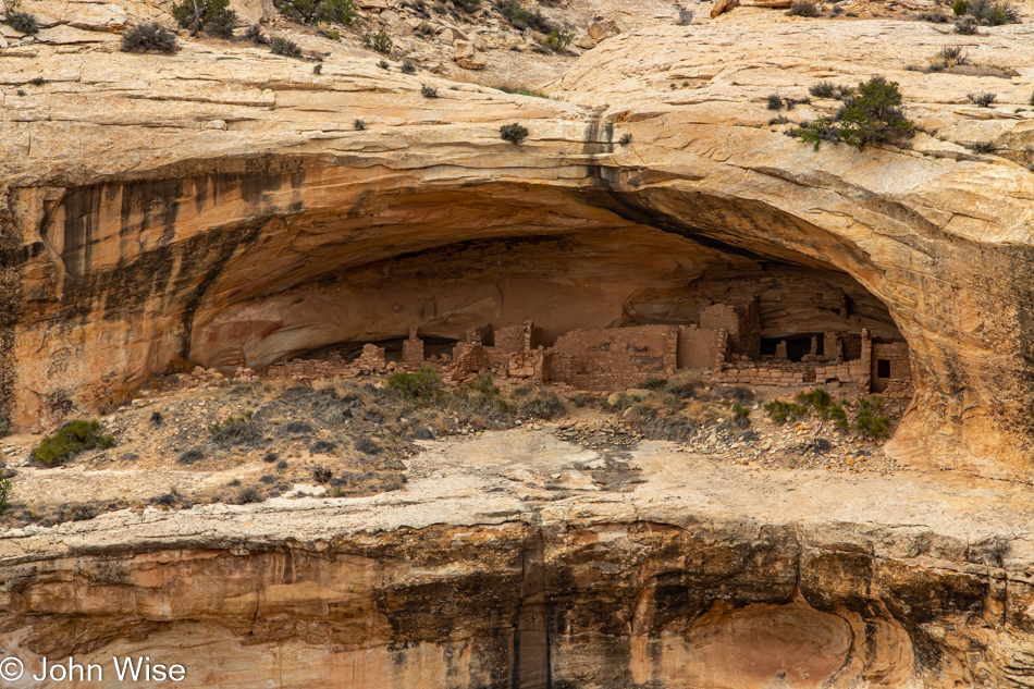
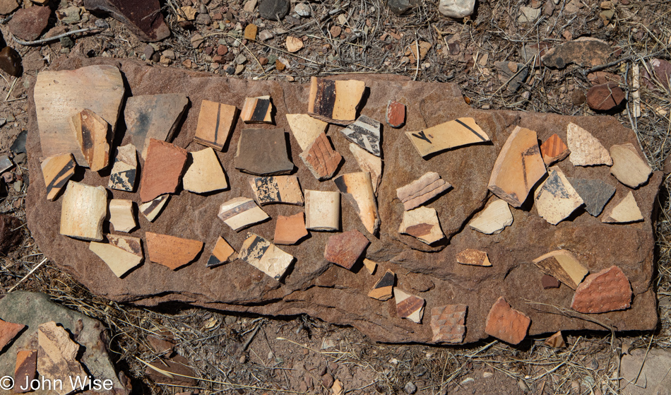
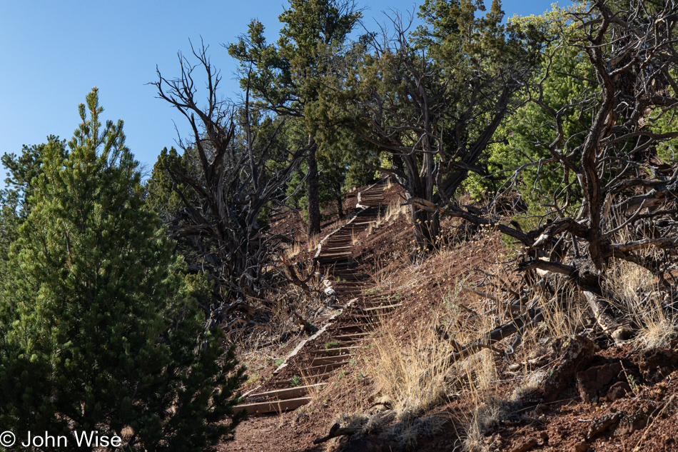
The easy hike was a beautiful one that brought us to an overlook of the ruins; sadly, it was marred by “that” family who are in the universe all by themselves. Loud, obnoxious, and oblivious to anyone else who might not want to be witness to their antics on the other side of a barrier or running over a path as they tried to find a way to visit the ruins in the caves that seem off-limits to us.

Bologna and egg sandwich

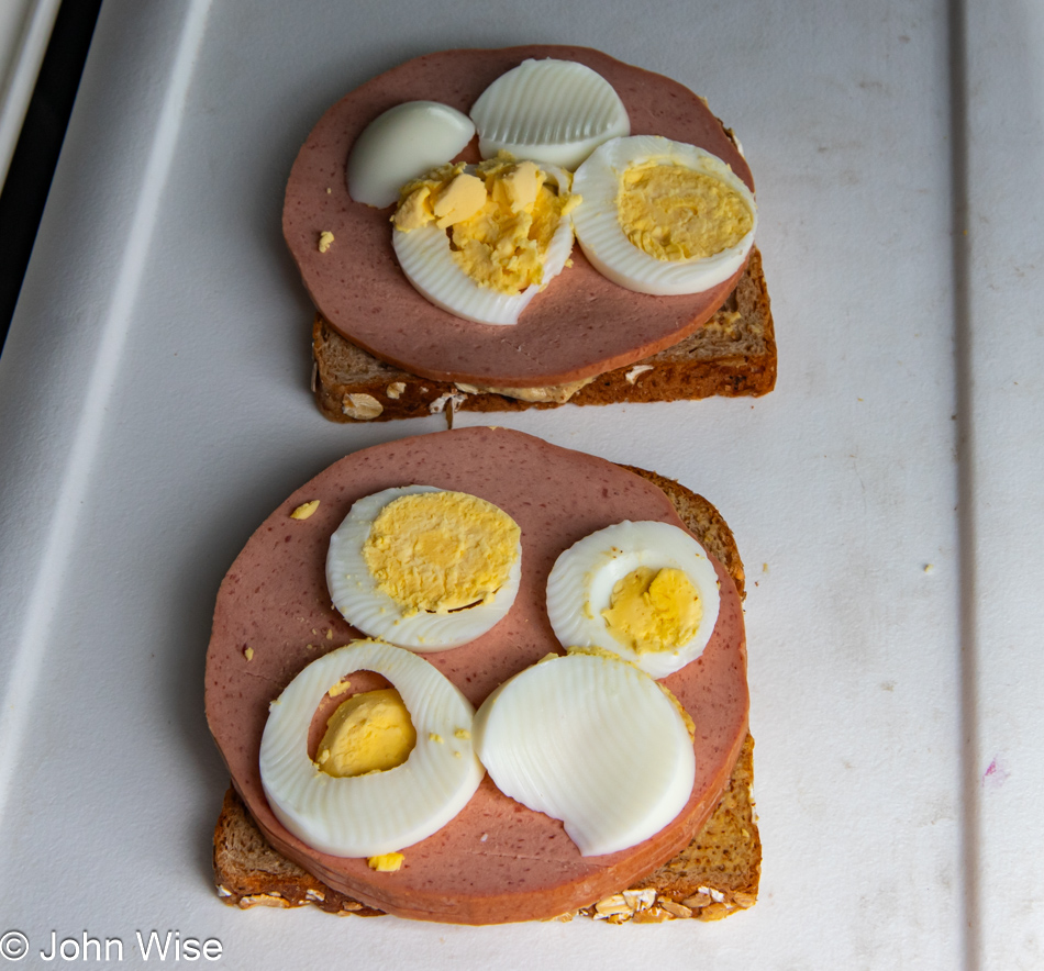
Back at the main north-south highway, we took a short drive north to Blanding because, though it was mid-day, we’d not yet had coffee, and we were in dire need. With headaches fading (yes, we are addicted to caffeine) and pep returning to our senses, it was a snack or eat; we pulled over for round two of our culinary delight. Looks appetizing, huh?

White Mesa, Utah

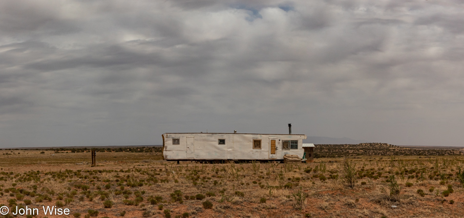
I don’t believe White Mesa, Utah, ever had a golden age, but then again, which Indian lands ever had that after colonization?

Bluff Fort in Bluff, Utah

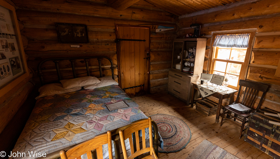
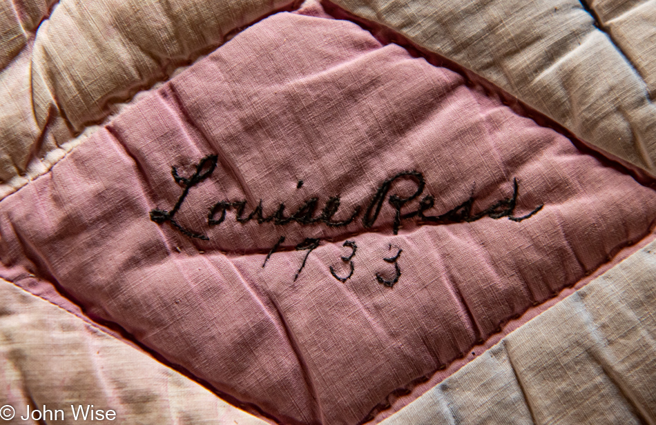
How have we failed to visit the Bluff Fort on previous visits to this corner of Utah? Cynicism is the likely answer, as there’s a certain amount of cheese factor going on, but today, this was a GREAT stop. Thanks to the docents and staff for sharing some great details that told the harrowing story of the pioneers who first came into the area via covered wagons that should have never made the trek.

Bluff Fort in Bluff, Utah

Well then, things come into focus after returning to Phoenix and searching like mad for almost 5 minutes for clues as to why we never stopped at Bluff Fort. The visitor center/co-op building, which is the main focal point of a stop here, wasn’t opened until 2013, and somehow, a decade passed by without our passing through Bluff.

Bluff Fort in Bluff, Utah

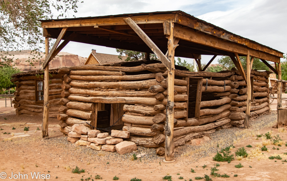
Learning of the hearty natures of the pioneers who toiled to reach this remote outpost is nearly gut-wrenching. They sliced their way through a small gap in a wall of rock so they could go forward, but not before having to use men, horses, and ropes to guide their wagons down the steep, rough trail they’d forged. Then, there were floods from the nearby San Juan River and the simple hardships brought on by being so far away from any other community.

Today, Bluff is heading for the toilet. My apologies to the citizens of Bluff, but the Bluff Dwelling Resort & Spa is the ugliest nod to the artificial opulence desired by a certain elitist segment of our population who have no compunction with gentrifying authenticity with their fake realities. Don’t get me wrong, I really do dislike the pretentious banality that often arrives with wealth, but what is an otherwise poor community supposed to do when the majority of Americans can no longer afford to get off the beaten path? Again, let’s try to find some honesty: that majority could afford to come out to these out-of-the-way destinations, but why would they want to walk away from their self-imprisoned existence sitting in front of another iteration of their favorite videogame, the 17th season of some lame series, or from witnessing the 48th time their favorite sports franchise meets some other team.

Just like Jackson, Wyoming, Steamboat Springs, Colorado, and Sun Valley, Idaho, those places won’t fade off the map like so many American cities as the wealthy have realized the incredible value of living somewhere profoundly beautiful. I guess Bluff, Utah, has the added benefit of having the San Juan River running through it, which in the southwest United States is a treasure when such a valuable resource such as water is disappearing in the larger communities being left by the rich who can gentrify the places they want for themselves. No, seriously, I’m not bitter or anything.

San Juan River at Sand Island in Bluff, Utah

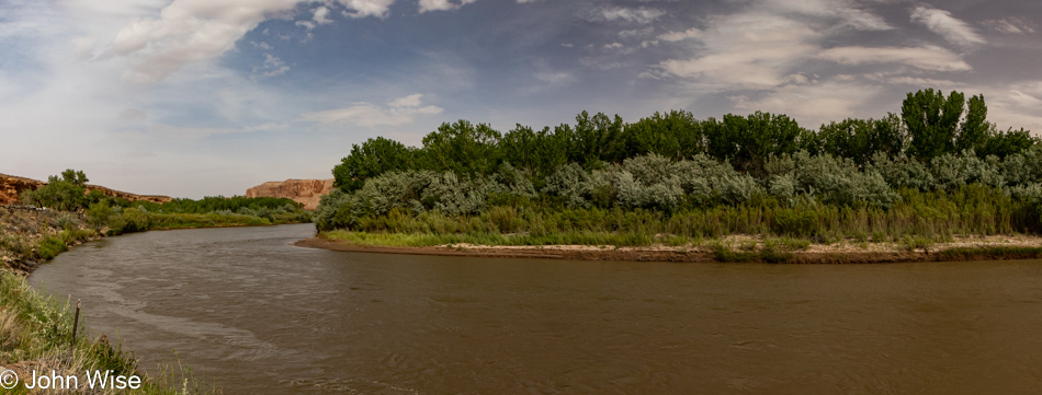
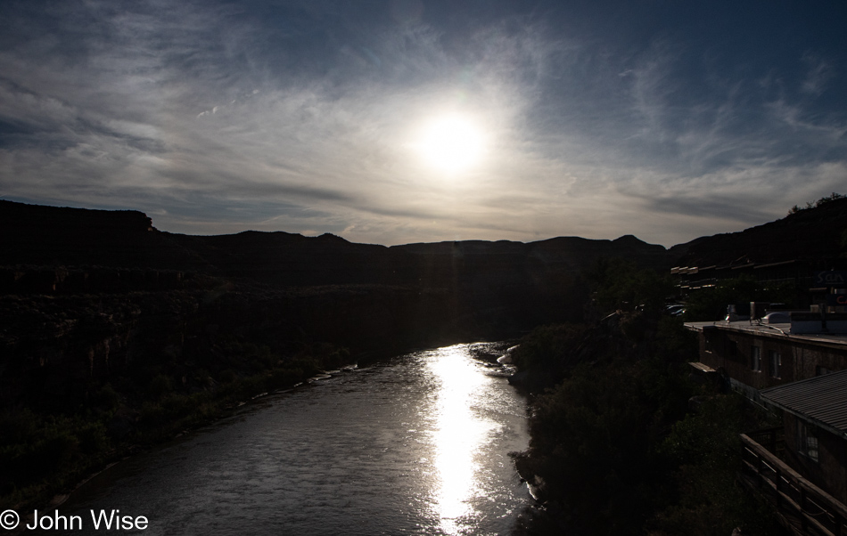
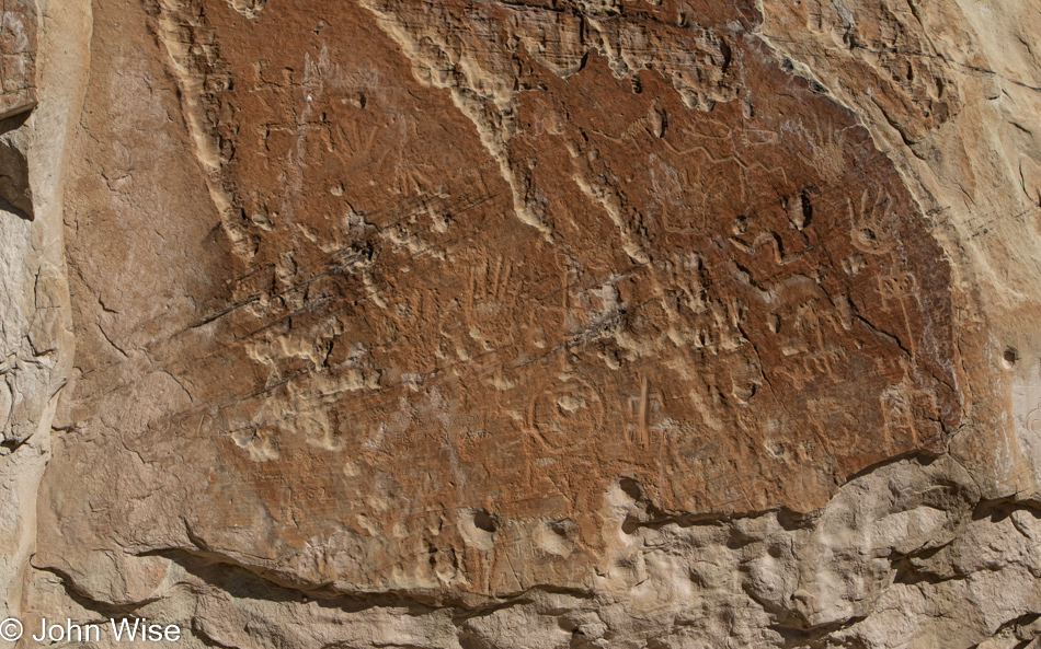
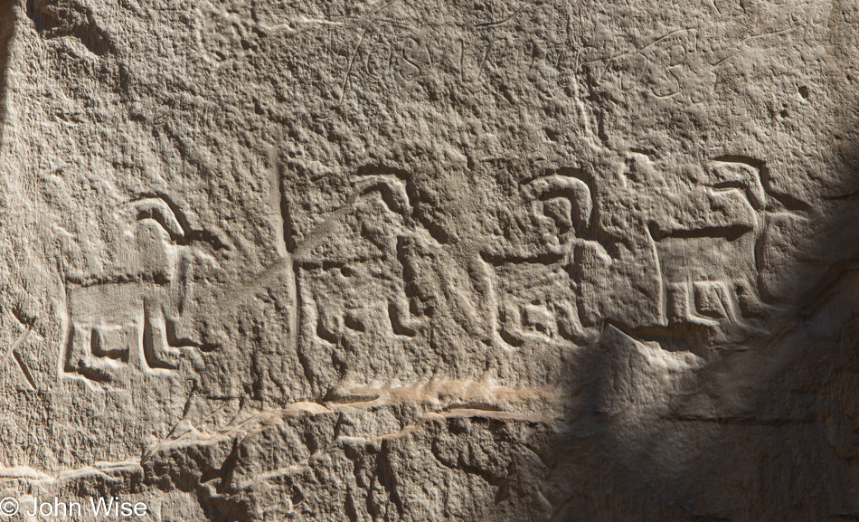
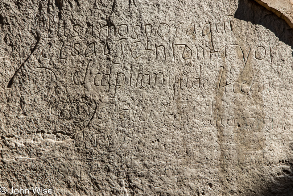
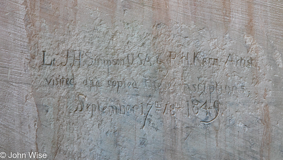
Inspired at the moment by a sign reading Sand Island that pointed the way down to the San Juan River, a quick left turn not only brought us riverside but there’s an incredible panel of petroglyphs.

Petroglyphs near the San Juan River at Sand Island in Bluff, Utah

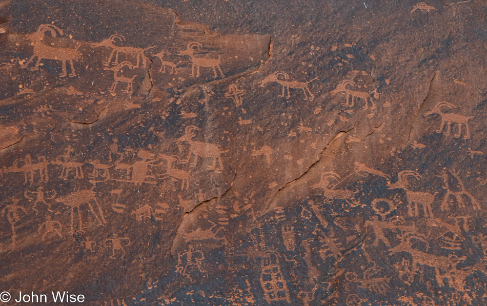
I’ve interpreted this panel for the first time ever; it reads: don’t allow the wealthy interlopers to steal the lands and resources available to all. Too late ancient ones, our souls were cheap fodder easily traded with the hopes we’d be able to take a selfie of ourselves with some rich and famous douchebag who was second in importance only to our children. We are a collective of toolbags. About now, you must be wondering, “Jeez, John, what crawled into your crack?” The sad reality of dreamless people who want nothing more than cheap gas, bullets, and drive-thru convenience.

Petroglyphs near the San Juan River at Sand Island in Bluff, Utah

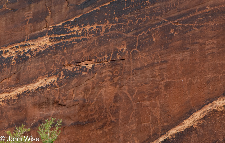
There are three figures here with three bars over their heads; they are tapping into other dimensions to discover how to cope with the future that is going to arrive, where much of their world would disappear in the clutch of the conquering force. Today, I’m one of those persons with three bars over my head looking into the higher dimension, trying to discover how to cope with the conquering force of wealth that has no space for the peasantry of common people just as our ancestors had no space for the indigenous people that populated these lands before them. All around me, I witness the mass of America moving onto a virtual reservation where the resources of the intellect have been stripped bare.

Highway 191 south of Bluff, Utah

If only I could find the time to write these narratives in situ when I’m resonating with the beauty and happiness of the moment instead of trying to capture recollections of these days a week later. In the interim, there have been 17 mass shootings, with the most recent one happening in the past 12 hours right in Phoenix, Arizona, where I’m trying to write this. To say I’m distracted by our abhorrent and vulgar attitudes when these incredible sights should soothe our abysmal and wretched selves would be an understatement. Aside from Caroline’s and my opportunity to indulge in such wonderful distractions, where am I supposed to find hope that America isn’t headed into the abyss of self-destruction?

Valley of the Gods in Mexican Hat, Utah

But this post is not supposed to be about the woes afflicting those I cannot see; I’m here to capture not only the visual impressions of a couple in love traveling into deeper love but also to write about the gravel, clouds, scrub brush, dust, bumps, colors, and the oohs and aahs found between the sighs of wow from the woman traveling with me.

Valley of the Gods in Mexican Hat, Utah

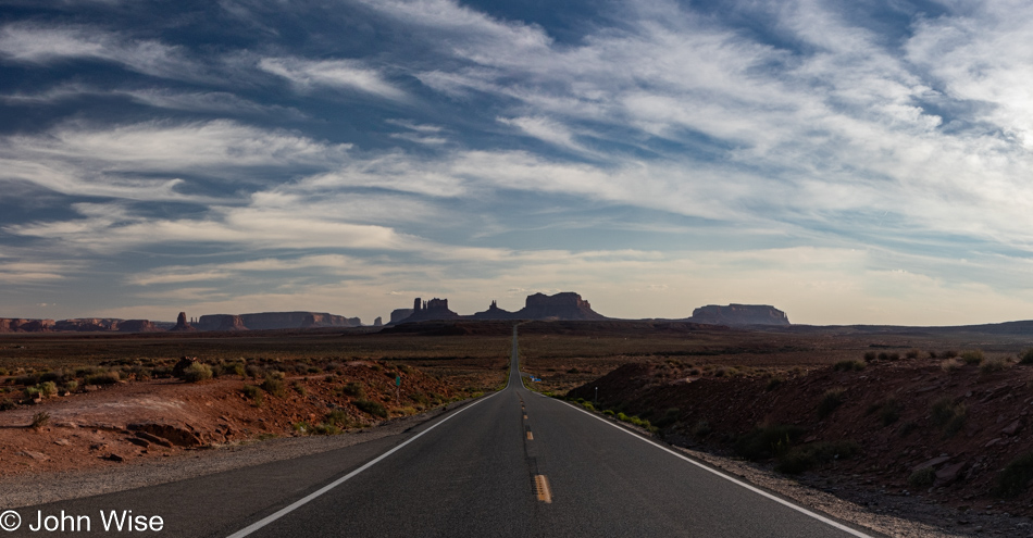
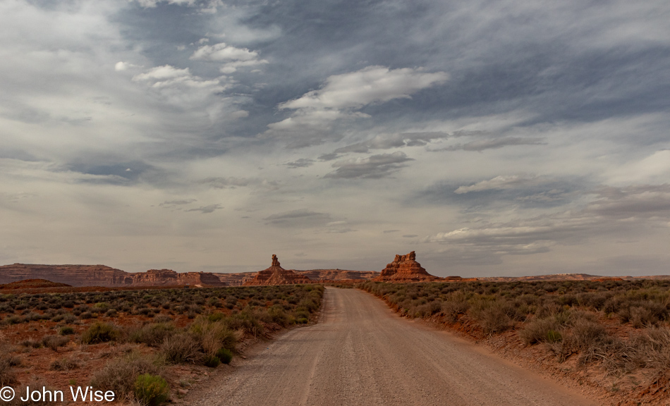
Welcome to Valley of the Gods.

Valley of the Gods in Mexican Hat, Utah

Here, in the presence of such a large nature, we bow in the silence of awe. It was either something like that or a non-stop series of under-the-breath utterances of wow in between, repeating how incredibly lucky we are to afford ourselves these experiences.

Valley of the Gods in Mexican Hat, Utah

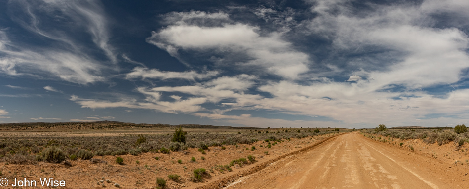
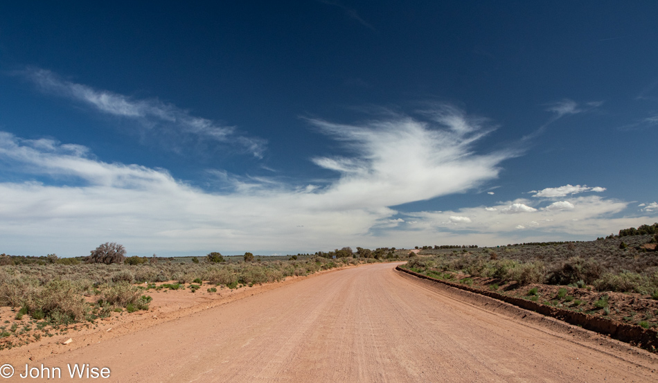
Had we opted to venture onto this 17-mile drive this morning, we would have traveled under the gray, overcast sky, so this is working out perfectly. Another thing, compare the price of this drive (FREE) with that “other” 17-mile drive ($11.25) taking looky-loos past pricey homes (median price about $5 million depending on the source) and derpy golfers who effectively dropped a testicle on the green as an offering to play Pebble Beach ($575 for a round) and you’ll either guess that we are relatively poor or class snobs resentful about our own bourgeoisie status, maybe both?

Valley of the Gods in Mexican Hat, Utah

I admit that the 17-mile drive in Carmel, California, has the Pacific Ocean, but with a little imagination, one can still witness the inland sea, oceans, and lakes that once welcomed marine life right here, and don’t forget the dinosaurs.

Valley of the Gods in Mexican Hat, Utah

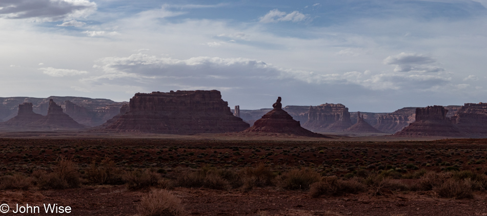
I just went on an internet hunt to find out if this butte had a name, and while I came up empty-handed, I did find more than a few unsatisfied visitors to Valley of the Gods. I could take 100s of images of a pile of poop on a sidewalk, but I doubt I would ever find even one that represented an aesthetic that might inspire others to look for the best in random poop left in our environment. On the other hand, there are those who share with others reviews such as, “Meh” and “The first few miles were OK. After that it got pretty boring” about a majestic place such as this. I understand that we all have a different sense of what constitutes beauty, but to be so devoid of empathy, soul, intrinsic values, or a basic understanding of how time and earth sciences create such unique complexity just casts those imbeciles into the pool of troglodytes.

Valley of the Gods in Mexican Hat, Utah

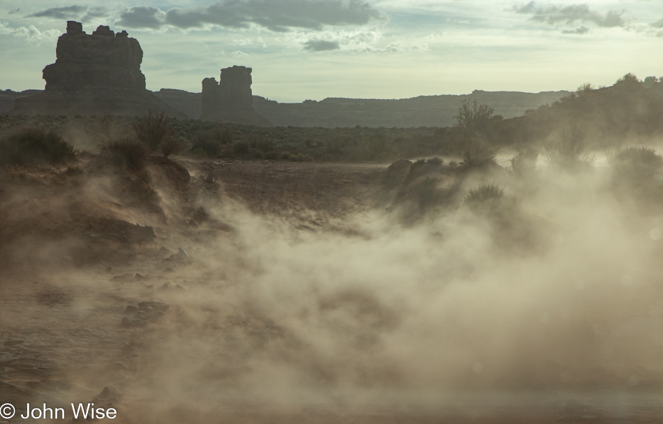
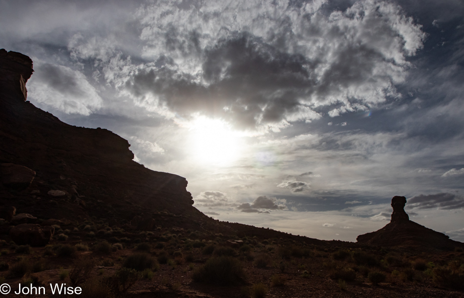
Oh my god…just look at all that dust blowing up in the hostile winds, trying to antagonize my allergies and ruin how clean my car is. What’s wrong with nature obscuring my view and wrecking photos? I hate Valley of the Gods; it’s just a bunch of boring meh-ness with no redeeming qualities aside from the fact it doesn’t carry an AR-15 to mow us down as we drive through. Why are we even out here in this monotonous land of endless tedium where everything is ugly and stupid? You know what’s tedious? This snark that detracts from settling into extolling virtues of yet another place we passed through in, yep, you can guess it, AWE!

Valley of the Gods in Mexican Hat, Utah

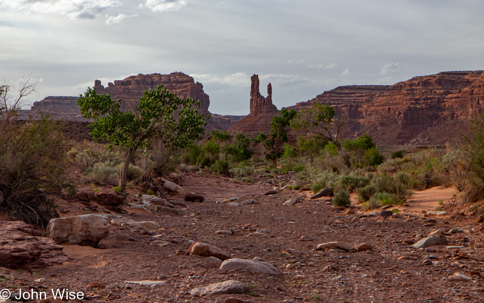
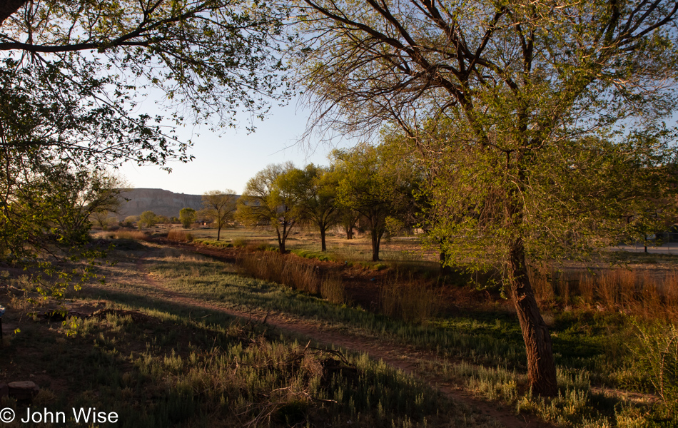
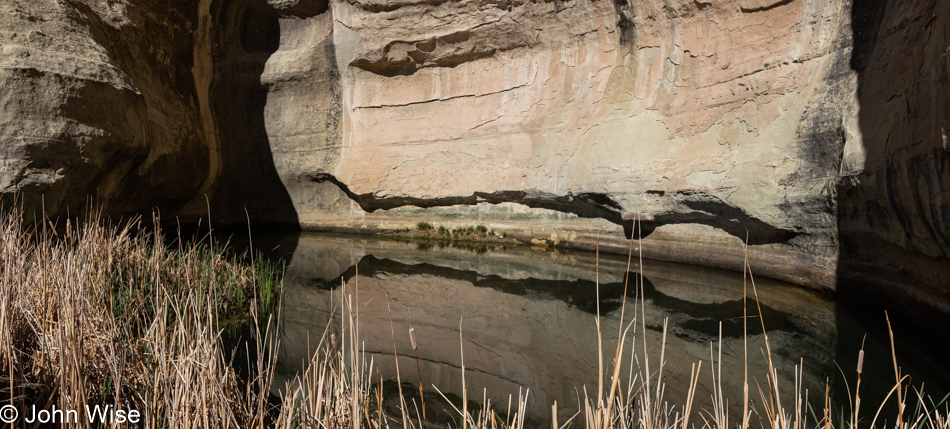
Greenery in the desert is a sign that water runs through here. The astute will know that this is a wash on those rare occasions when rain has been falling in the surrounding area. I’m simultaneously happy we are not here while it’s raining (we’d certainly be stuck in the mud) and disappointed that we can’t be on hand for one of those moments when water feeds the dry earth we’re traveling over right now.

Valley of the Gods in Mexican Hat, Utah

Every turn, every moment, every view is changing the way things look. By the time we reach a place, it often appears quite different than it did from a great distance, from just 200 feet away, and the spot we stopped at to take a photo. Perspective shifts sure are easy in the great outdoors if you are looking for them, so why are they so hard to come by as people look within?

Valley of the Gods in Mexican Hat, Utah

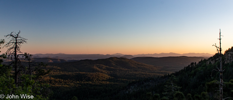
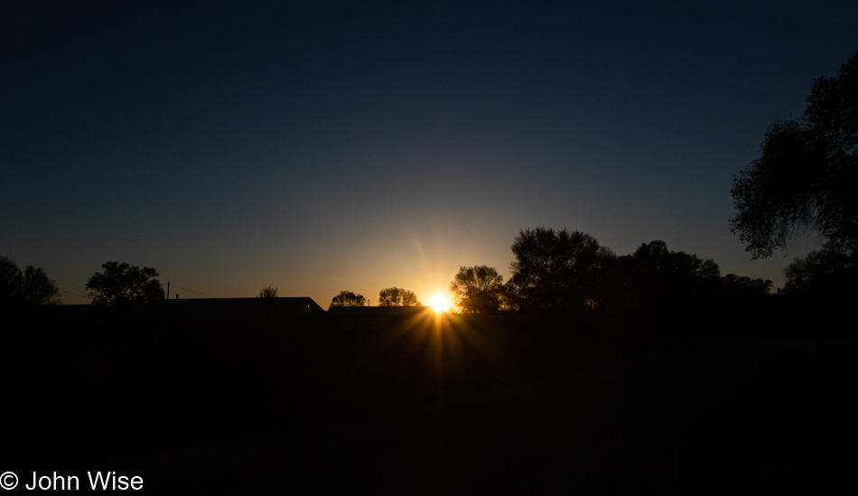
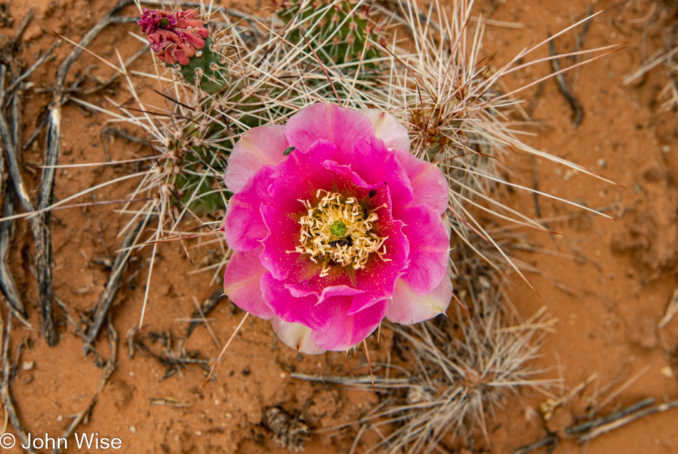
The sun will set on the landscape but only temporarily, as opposed to the imminent day when it sets on us for eternity. Until that day, how many sunrises and sunsets will you have seen, not metaphorically in the sense that you were aware they were happening and could picture them in your mind’s eye but that you’d seen with your own eyes? Why isn’t the real mark of luxury the cumulative number of times we can lay claim to having watched waves lap at the shore, witnessed the leaves of fall change color, seen the bud of a cactus blooming, or the coming into focus of a rainbow spreading across the sky? The obvious answer is that we cannot easily parade impressions around but we can arrive in the right car, have the big home, or the pricey clothes that offer nothing about how rich someone is experientially.

Mexican Hat, Utah

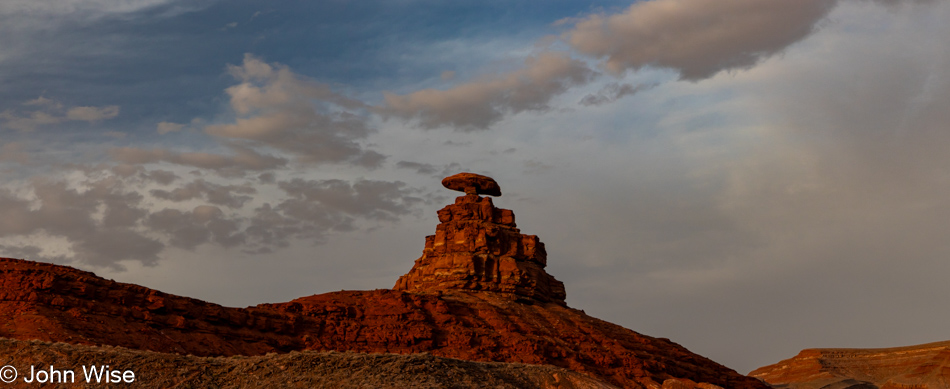
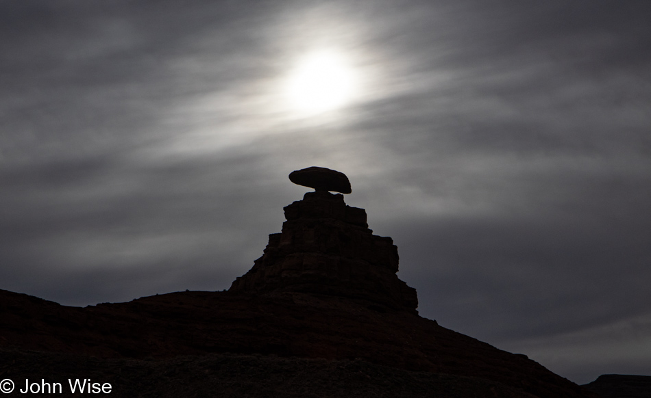
Maybe you’ve read all this before right here on my blog, but I’d argue that just as I never tire of seeing this rock balanced atop a small butte that inspired the name of this community of Mexican Hat, it, like my words, enter reality and hang out until time and nature erodes them until they crumble and are lost in time. So if you continue returning to these pages, the canyon that is John is what you are visiting, and while the angle of the sun, the position of the clouds, and the time of day might alter how things are seen, you might witness much the same thing until an arm from my river of thought carves a new pathway that breaks out of the routine flow.

Mexican Hat, Utah

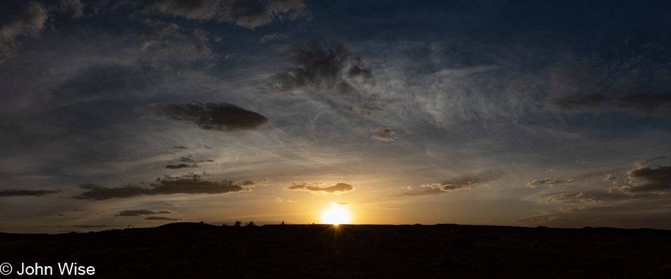
Enough of this; it’s time to eat, not only for the day the events pictured above took place but at this moment I’m writing these words. Seeya later, sun. With my senses satiated, I need to heed the beckoning of my stomach, though compared to the exquisite nature of the meal that followed on this travel day, the lunch I’m about to jump into pales in comparison. On second thought, there is no comparison.

Hank Whipple at Mexican Hat Lodge - Home of the Swingin' Steak in Mexican Hat, Utah

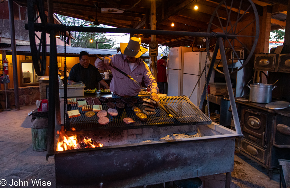
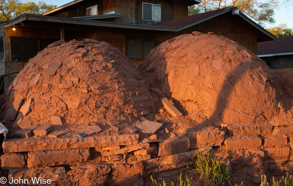
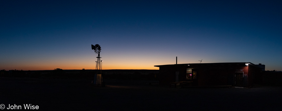
This is grill master Hank Whipple, whose family operates this outpost called Mexican Hat Lodge, affectionately known as the “Home of the Swingin’ Steak.” Last night, this man grilled me up a 20-ounce (almost 600 grams) ribeye steak (entrecôte), but eating that whole thing after 7:00 pm was a mistake in judgment because that hunk of meat lying in my gut commanded serious attention, thus disrupting any hope of blissful sleep. So, tonight, not only are we eating earlier, but I’ve opted for the more manageable 8 ounces (228 grams) of flank steak. As for Caroline, come on, she’s always reasonable.

Meandering Hopi and Navajo Lands

Wigwam Motel in Holbrook, Arizona

Only a few hundred feet from the railroad tracks and well within earshot of the rail crossing just up the road, our sleep was punctuated by the sound of trains passing throughout the night. Small price to pay considering we’re sleeping in a 72-year-old concrete wigwam. And not just any wigwam, mind you; John Lassiter of Pixar passed through this area on vacation some years ago and, inspired by many of the sights he had encountered (including the Wigwam Motel), he would make some of those locations famous as they found their way into the animated feature film Cars.

Wigwam Motel in Holbrook, Arizona

During many of our previous visits to Holbrook, we used the old town here on Route 66 as a waypoint before moving on to other places that drew out more of our curiosity. Well, today, we’re taking the time to walk around in order to get a better feel for the place.

Holbrook, Arizona

Last night, I forgot to point out the difference in gasoline prices between the Phoenix area and these northern climes: we paid $4.39 a gallon up this way and $5.19 down in Phoenix. Why this large delta in prices? This doesn’t make sense as hauling fuel further away should also impact prices, but I think what’s at work is that the oil companies know that the populations of big cities have more income, and so, in effect, they can squeeze us for greater profit while only making a reasonable amount of money in rural areas that would otherwise harm the lower-income population. That, or we are subsidizing rural America so they can better survive what is often a meager poverty-level existence?

Holbrook, Arizona

Walking down Hopi Drive, once the old Route 66, offers a tragic view into the nostalgia that hangs over this part of Holbrook as while a few businesses are hanging on most are gone, and what remains grows long in the tooth. Surprisingly, an old movie theater is still here, and had we known, we likely would have stopped in last night for the only showing of the day at 7:00 pm of Top Gun Maverick. Joe and Aggies Cafe, we’ve eaten at before, is shuttered, and its dusty windows offer a glimpse into a time capsule.

Holbrook, Arizona

While we’ve always had a soft spot for old signage, it’s only now occurring to me that signs such as this one at Butterfields Steak House would never be affordable today. Handcrafted, heavy steal, blinking lights, and neon towering 30 feet over the road, these are now relics of the past for old towns like this. I’ve likely shared this before, but it was back in 1969 or so when I first passed through this area and had the sound of the passing trains during the night seared into my memories. While I can never know which motels or restaurants we stopped at during our epic cross-country trip from Buffalo, New York, to Long Beach, California, where my father was living, I do have distant images stored in my memories of waiting for tables at noisy cafes, looking at wildly colored desert landscapes, and endless roads.

Holbrook, Arizona

Some of the old motels have been converted into long-term rentals, albeit without any of the services that once serviced rooms every morning, invited guests into pools, and brought people into experiences that would last lifetimes.

Holbrook, Arizona

Decaying places become sad tragedies of forgotten pasts when a new generation has little to no connection to what has been. At least with the ancestral Native Americans, there’s mystery remaining in the scattered ruins, eliciting a deeper wonderment where we try to imagine something so distant that it defies our ideas of just how things worked.

Holbrook, Arizona

When it comes to America’s relatively recent past, I think most romantic notions are gone, and the antiquated, weathered relics are skipped over as our modern car culture seeks out drive-thru convenience and luxury that allows people to separate themselves by class compared to 60 years ago when we were all just Americans out for adventure into the unknown.

Holbrook, Arizona

Achtung Europäer, this is part of why you want to travel to the United States. It doesn’t matter if Romo’s on Route 66 is good or bad, but you will have eaten Mexican food at a diner with a mural of a taco, burrito, and a chili pepper racing down the road through Monument Valley and past petrified wood as you yourself move between those areas.

Holbrook, Arizona

How does one shit on the past? Read the bottom of the sign, Vape Smoke Shop featuring vapes, E-juice, and CBD. Sure, life evolves and goes on, and who buys rocks these days anyway or wants to stop in at a trading post to buy tchotchkes from an old man selling junk made in China? All the same, we don’t turn old churches into sex shops (not that anyone goes to those anymore either), but to desecrate through neglect and abandonment the adornments that were part of a prosperous past is the ignorance of a culture that has failed to understand exactly what it is that makes other places that cherish their history so attractive.

Homolovi State Park in Winslow, Arizona

Homolovi is Hopi for “Place of the Little Hills,” and that’s exactly where we headed after leaving Holbrook.

Donkeys at Homolovi State Park in Winslow, Arizona

Within eye-shot of Interstate 40 is this state park that not only features donkeys staring at people menacingly but there are also seven ancient Pueblo sites dating from 1260 to 1400.

Homolovi State Park in Winslow, Arizona

The people who lived here are called the Hisat’sinom, which is Hopi for “long-ago people.”

Homolovi State Park in Winslow, Arizona

While outsiders might consider this a site of Native American ruins, the Hopi consider it to still be spiritually alive. As such, the broken pottery shards scattered across the Pueblos were the belongings of ancestors; they are not here as souvenirs, and out of respect, visitors should do their best not to collect the personal belongings of others. Just try to imagine that your grandparents died and your family was preserving their home as a shrine to their lives, but random visitors wandered into their bedroom and helped themselves to your family’s heirlooms.

Homolovi State Park in Winslow, Arizona

I wonder how many times I’ve written the explanation that this underground room is a kiva used for ceremony and political purposes?

Homolovi State Park in Winslow, Arizona

Maybe it looks desolate to us here 600 years after the villages were abandoned, but we can’t know life here back when the nearby Little Colorado River sustained life. As white Americans moved in back in the 1870s, they made off with many of the stones from the pueblos to build their own homes in a place such as Sunset, Arizona, that was eventually washed away during one particular bad flood of the river. There were other towns out here that didn’t make it either, such as Brigham City and Obed, while Joseph City, with a small population of 1,307 inhabitants, has managed to hold on.

Homolovi State Park in Winslow, Arizona

As of today, 2022 will be known as the Year of the Lichen in John and Caroline’s fake Chinese calendar of themed years.

Donkeys at Homolovi State Park in Winslow, Arizona

A gang of thug donkeys challenges us to just try passing them without making offerings. Tired of dried grass and some noxious plants that are unpalatable to all life, they held their ground with a menacing look of “Give us carrots or suffer the consequences.” Sorry, donkeys, but we have popcorn, bologna, boiled eggs, granola, and soy milk in the car, not exactly gourmet donkey fare.

Homolovi State Park in Winslow, Arizona

Loud squawking coming from a crevice allowed us to spot a raven’s nest with two juveniles awaiting feeding from mom and dad. But it was the thing that was nearly overlooked that should have first grabbed our attention…

Homolovi State Park in Winslow, Arizona

…the ancient nest remains of what I can only guess is from eagles that once lived in the area. When I asked at the visitor center what this was, I was told that it was the accumulation of debris from the ledge above. Right, a small bit of lifeless rock above somehow collected twigs of a near-uniform size and then deposited them right here at the base of this cliff-face. I’d guess that eagles have been nesting here for centuries and that even before this easily identifiable pile was built, there’s an even older layer that sits below the small number of rocks that fell at some point in the past. Those pieces of sandstone should be able to be aged depending on the amount of patina if any, that exists on them. Golden eagles still live in the area and are of religious significance to the Hopi people. Come to think about it, maybe the person at the visitors center didn’t want to identify exactly what this was in order to stop the curios from dissecting/desecrating this beautiful old nest.

Homolovi State Park in Winslow, Arizona

Eagle food remains.

Homolovi State Park in Winslow, Arizona

Most of the stones that comprised this village closest to the river are long gone as I guess they were the easiest to pilfer for the town down the road that is no longer down said road that is also no longer in existence.

Arizona Highway 87 in Northern Arizona

Well, we know where we’re goin’
But we don’t know where we’ve been
And we know what we’re knowin’
But we can’t say what we’ve seen

And we’re not little children
And we know what we want
And the future is certain
Give us time to work it out

We’re on a road to nowhere
Come on inside
Takin’ that ride to nowhere
We’ll take that ride

Arizona Highway 87 in Northern Arizona

Junior Geologist John is going out on a rim here by taking a WAG (wild-ass guess) about what we are looking at. Could this be a cinder cone that sprouted out of some sandstone hills that eroded all around us? Could these be here because the lava covering protected them from being scraped off the landscape?

Arizona Highway 87 in Northern Arizona

There we were; one minute, we were admiring some horses walking a fence line, and the next…

Somewhere between Indian Route 4 and Route 41 on Hopi Lands in Arizona

…we are driving down a dirt road that disappears on the horizon.

Somewhere between Indian Route 4 and Route 41 on Hopi Lands in Arizona

After following the dirt road for an infinity, we found ourselves beginning to wonder, just how long is infinity?

Somewhere between Indian Route 4 and Route 41 on Hopi Lands in Arizona

Hello, startled young bull; we apologize for interrupting your meal, but do you know where we are? He answers, “Down the road is a freckled horse, but he’s a bit aloof and unlikely to help you, though he certainly knows these lands.” Well, thanks, but I now have to wonder how is it we were able to communicate with a bovine?

Somewhere between Indian Route 4 and Route 41 on Hopi Lands in Arizona

Hey, Mr. Horse with the freckled neck, the startled bull behind you told us you know the way, “I do; just follow me.”

Somewhere between Indian Route 4 and Route 41 on Hopi Lands in Arizona

Well, this just looks like more of the same, only different.

View from Black Mesa, Arizona

After countless miles in the dirt, sand, rock, uphill, and over dale, we immediately recognized the land far away from this overlook. Our road would take us right through the gap in the distance to Tsegi, Arizona.

Burned remains of the Anasazi Inn at Tsegi Canyon near Kayenta, Arizona

The Anasazi Inn that once stood here on Highway 160 is now mostly gone. Fire, looting, and possibly other forces have decimated this plot of land until what remains standing is a shell seen here and a couple of other remnants. The image in this photo is from a collaboration between poet Esther Belin and the photographer of Jetsonorama. On the left of the mural was the following note:

BELIEVE – Afterward we will get up. All together, with the sound of canyon wind howling, red clay masks preserving our faces. Our government clothes tattered, no longer creased with false doctrine. The pressurized steamed language escapes from the pores of our skin. The monogrammed label “Property of U.S. Government” erased from memory. Our teeth, sweat, saliva, fingernails, strands of hair recompose as the daughter of First Man and First Woman. The four support pillars reconfigure the directional mountains. The zenith and nadir bolt lightning into our backbone. The stone knife in our hand slays monsters. The sun rays fasten us snuggly to Nahasdzáán. The rainbow tethers a shield over us. All together, the intertwined winds breathe again. — Esther Belin

My apologies for not being able to maintain the format of the poem. Should you want to learn more about the project it might be found between www.jetsonorama.net, www.justseeds.org, and www.artjounalopen.org.

Burned remains of the Anasazi Inn at Tsegi Canyon near Kayenta, Arizona

Someone out there used to stay at the Anasazi Inn in Tsegi, Arizona. They don’t know yet that it’s been wiped off the map, and maybe that person has some random memories of having stayed there. Might they remember the linoleum floor that was part of the experience? This is nearly all that is left that is still recognizable; in time, it too will be gone, and only the impressions still surviving in brains will be left.

Agathla Peak in Navajo or Spanish: El Capitan south of Monument Valley in Kayenta, Arizona

There should be many things between here and there or here and where we’ve been but often the dearth of things capturable is bigger than the space they fail to fill. Opportunities to cater to desires and experiences unknown to those moving through an environment are lost when the means or knowledge remain in a void as inaccessible as my wishes to discover what I’m missing. Not being Diné nor having the means of meaningful investment, I cannot act as the proxy that would bring forth what lies in the margins of my imagination that would take us beyond the space between.

Agathla Peak in Navajo or Spanish: El Capitan south of Monument Valley in Kayenta, Arizona

At least there’s El Capitan waiting to serve our senses.

U.S. Highway 163 looking towards Monument Valley

And after that, our first glimpse of Monument Valley.

Monument Valley from Forrest Gump Point in Mexican Hat, Utah

Little did I know what I wasn’t seeing here at Forrest Gump Point; I wasn’t seeing the crowds that apparently wait for the weekend before making their pilgrimage.

San Juan River in Mexican Hat, Utah

Passing over the San Juan River is the turning point, and I know we are not far from finding our pangs of hunger satiated by a slab of cow that has been foisted upon a swinging grill where it will cook to perfection over an open fire. Then, in the shadow of Valley of the Gods, we’ll sit roadside as we have many a time prior and enjoy another aspect of perfection as the sun sets and we bask in full stomachs and the knowledge we’ve already arrived and have no further to go than upstairs to survive the Mal de Puerco.

Trip 10 is Here!

Caroline Wise and John Wise leaving Phoenix, Arizona

It all seemed so easy six months ago when I opened that spreadsheet and entered a column of dates on its left side. Those dates were calculated at approximately two weeks apart, other than where I knew we’d be away for longer stretches such as the Mexico vacation and around holidays where we might be able to be gone for 4 to 6 days. Today, we are venturing into one of those 6-day affairs because it is Memorial Day Weekend and the beginning of summer. We know better than to travel on Friday or Monday, so we leave on Thursday afternoon and return Tuesday night.

While I’m excited as always to be going out on the road, I’d be remiss to not admit some laziness nipping at the heels saying, “Take a break and just chill out at home.” We are now in the 100s (38c+) here in Phoenix, Arizona, and the heat suggests that lethargy isn’t a bad thing; my brain says something different.

So, where’s this big adventure taking us here at the end of May? The core of this journey will have us between Monument Valley, Mexican Hat, Valley of the Gods, Bears Ears National Monument, Canyonlands with a return to Horseshoe Canyon, and finally, Flagstaff for some long-neglected sights.

But for now, my time in the coffee shop is coming to an end, and all those prep things I need to finish before hitting the road are yet to be done, as I simply let everything go until the last second. Those things are the tedious chores that, once done over a hundred other times, become a quick jam so Caroline and I can get down the road with most everything we need without worrying too much about anything left neglected at home.

Finished all the things requiring finishing. There was so much running around that I was able to go from a measly 3,500 steps as I dropped Caroline at her office this morning to my requisite minimum of 10,000 steps when I returned to get her. It was 4:00 pm when I arrived and surprise of surprises, she was ready.

Four Peaks off the Beeline Highway in Arizona

Up the Beeline Highway for the 2nd time this month but instead of going east to New Mexico as we did two weeks ago, we’ll head north up to Holbrook before continuing on to Utah tomorrow. Considering the size of tonight’s small town and that it’s Thursday, we checked out our dinner options and fixed on stopping in Payson as it looks like Holbrook rolls up the sidewalks at 8:00 pm. Well, before arriving in Payson, we stopped along the highway at the Mogollon Rim Visitor Center to grab this photo of the desert with Four Peaks in the background.

Near Woods Canyon Lake in Payson, Arizona

Dinner was effectively American diner fare, nothing great, nothing horrible. On these trips into big nature and small towns, it’s a rare day we stumble into a culinary delight as my daughter and I did last year at Piccola Cucina Ox Pasture in Red Lodge, Montana, or as Caroline and I did just two weeks ago at Ancient Ways in Ramah, New Mexico. There have been other little treasures found along the road, but they are few and far between. This doesn’t imply any kind of disappointment, as fine dining and gourmet meals are not what we are searching for when visiting places with grand vistas that act as the greatest food for the eyes. Zoom in to this photo, and to the right, you’ll see some jagged peaks in the far distance; you are looking at the Four Peaks from about 80 miles away (128km).

Near Heber, Arizona on Highway 377

It’s about 8:00 pm when we turn left off of Highway 277 and join Highway 377 which will bring us right into Holbrook in about half an hour. Like so many drives out of Phoenix intended to position us somewhere further up the road, it not only shortens our drive the following day, we hope to miss the majority of traffic that is escaping our sprawling city. With only 3.5 hours left in drive time, if we were to head directly to our destination of Mexican Hat, Utah, we’d have plenty of time to wander over the Hopi and Navajo Lands.

Extra tidbits: Caroline was knitting the second sock of a new pair she’s making me, and just before sunset, I asked her to read some Proust to us in our ongoing efforts to tackle In Search of Lost Time. We are currently about 480,000 into the 1.2 million words that comprise this French novel.

Wigwam Motel in Holbrook, Arizona

It’s dark, and most of the lights are off here at the Wigwam Motel after we checked in, so this was the best photo I was able to capture, though I shot about 20 others. We’re now set up in our tiny room, with a tiny toilet, tiny desk, and too fat of pillows but that’s all great as we are once again sleeping in a wigwam on old Route 66.

Inside our room at the Wigwam Motel in Holbrook, Arizona

They are not fancy, but they are a cultural luxury, and as one of only three of the original Wigwam Villages still in existence, it’s an experience that is absolutely worth repeating. Come to think of it, maybe it’s time for us to stay in Village #7 over in Rialto/San Bernardino, California, during our upcoming July visit. This location in Arizona was known as Village #6, and the other remaining property is in Cave City, Kentucky.

Squeezing Everything Out of Sunday

Wake, shower, pack, eat breakfast (including blue corn pancakes), and get moving down the road. If we timed things correctly, we’d arrive at the El Malpais National Monument visitor center just as they were opening at 9:00. This sounds a bit rushed, and maybe it was a little, but we were moving further away from Arizona on the day we’d be heading home.

Caroline had finished the junior ranger booklet last night so we could pass through Grants, New Mexico, on the north side of the park, eliminating the need to double back later in the day to return it. Sworn in once more, this probably brings her close to 1,000 such badges she earned over the years.

These are the sandstone cliffs we were seeing in the distance yesterday while hiking on the cinder cone over at the El Calderon trail, it turns out that these are technically not a part of the park here at El Malpais. I suppose when one considers that El Malpais translates from Spanish to the bad country or badlands, it makes sense as the fossilized lava fields that make up the majority of the national monument are jagged, sharp, treacherous, and simply not very hospitable.

Just how angry that environment of nearly raw lava is will be experienced firsthand as we venture out on the Acoma-Zuni Trail. Prior to our arrival, we’ve read multiple times about the importance while hiking this 8-mile trail to always keep sight of the next cairn that will direct us through the maze that awaits us. Water, sunscreen, and a couple of snacks are in the bag, and we are ready to tackle what we can, which, by the way, is not the entirety as we are not fooling ourselves that we can hike 8 miles across and then turn around and hike back.

It’s called the common collared lizard, but, come on, with a blue-green body, yellow head, and yellow speckles down its back, I’d say this is anything but common. Also uncommon, it sat there making eye contact as I slowly approached to take its photo. I did not use a telephoto lens; I just walked up, pushed my camera closer, and snapped off a few shots.

Somewhere nearby, another hiker, a solo woman hiker, went by in a bit of a blur, she was on a mission. That mission has to do with the Continental Divide Trail that slices through here, using the Acoma-Zuni Trail. Her direction suggests she was on a southerly trek, which would also imply that this is not a thru-hike but working on another segment of a multi-year hike, likely the last bit of the 3,100-mile trail. A badass in the badlands.

At 59 years old, you might think I’ve learned a lesson or two about expectation, but every time we venture out on a new trail, I’m of the opinion that this one will be somehow easier than those we’ve traveled before. What happens is that reality intrudes on my fantasy, and I learn that new challenges are being presented. Steep-sloping rocks were not part of what was in my imagination, nor were chasms opened up by the ancient lava. The advice I’d read that hikers on this trail would benefit from hiking poles and gloves should have been heeded, but know-it-all John isn’t comfortable with being weighed down with unnecessary things like poles, an extra lens, water, food, or any of that other junk, it’s just me and my camera. So how is it that I’ve not died of exposure, dehydration, or starvation out in these environments? I have a wife who doesn’t see the world quite the same way I do and drags all that stuff and more along with us on her back, well, everything but the hiking poles that we are reconsidering the need for.

Thorns and beautiful flowers were the least of our worries out here. Come to think about it, I don’t think Caroline really had any worries at all.

It was me who had worries, fears, and anxiety as things grew steeper, chasms became deeper, and the angles sharper. All this, and we weren’t even 2,000 feet across the 7 miles of fossilized lave that was still ahead of us. Sadly, it was paralyzing enough that I had to turn back, and obviously, Caroline would be doing the same. Just as I run into debilitating emotions that stop me from getting further at times, one of my greater disappointments is that it also stymies Caroline’s opportunity to see more. Sure, she does her best to assure me that at least we were able to see and experience the things we’d never have already seen had we stayed at home, but this is still small consolation for the parts of the journey denied her.

So, with the Acoma-Zuni Trail now behind us, we are on to the next part of the day’s activities as we continue south.

We pulled into the parking lot at La Ventana Natural Arch and met another person hiking the CDT (Continental Divide Trail). A Lithuanian, though he calls Poland home, he’s on a 6-month visa in order to have enough time to complete the entirety of the hike from Mexico to Canada. Tom is his name, and he’d just descended that area in front of us, probably to the left. On a previous visit to the United States, he completed the Pacific Crest Trail. We left Tom with an ice-cold refill of one of his water bottles before taking off for our short walk to view the arch

There’s a massive arch in the center of this image, though it’s not exactly easy to see. I even went beyond the barrier to scramble up the well-used unofficial path of those who break the rules trying to get a better photo, only to learn that there isn’t a better photo to be had from here. Maybe at different times of the day, the light hits things just right so that the scale of things can be appreciated better, but today at mid-day, it just wasn’t happening.

We are heading up there somewhere next.

Just below this point, we parked the car near some picnic tables and walked through a lot of sand up here on the Narrow Rim Trail, that’s a 7.3-mile out-and-back hike.

In no time, we’re atop the cliff and walking in wow.

Cairns identify the way when the trail becomes difficult to see.

How it is that we are the only ones up here is astonishing as although the trail is considered moderate in difficulty, these old people think it’s pretty easy and seriously pretty on the eyes. As a matter of fact, we are bowled over and maybe a little bit disappointed that we didn’t head directly to this part of the park because we are well aware that we’ll not be able to make it to the overlook of the arch due to the time constraints that now exist if we want to get home before 10:00 pm. We won’t turn into pumpkins or stones should we not get home prior to that, but driving at night comes with growing uncertainty the older I get, or maybe I’m no longer able to deal with fatigue the same way as I could 20 years ago.

A little more than a mile into the hike we start discussing if we’ve gone far enough. We agree we have, but it’s so incredibly, perfectly beautiful out here that we’ll just keep on a short bit more, just to the next corner to check out the view, and then we’ll reconsider.

This keeps on like that until we’ve hiked at least 2 miles up the Narrows Rim for this look facing northwest behind us. It cannot be overstated how we are walking in the profound, crushed by the gravity of what is being offered us up here all alone. How can it be possible that we are experiencing this without a thousand others walking with us, confirming to one another that we are the fortunate people of the earth, unable to comprehend why it should be us? With eyes saturated, we agree that this is really as good a spot as any to turn around. Sure, we know we are only about 1.5 miles from the overlook that would offer an overhead view of La Ventana Arch, but if we went that far, what would we have to come back to?

Yesterday, I didn’t think I had anything else to say about lichen, and then I somehow found something, but today, I’m not even going to try other than to ask, isn’t it magnificent?

People may extinct themselves, but as the saying goes, life finds a way, as evidenced by a tree growing out of rock. If you know me, you might be asking, “Hey John, did you just quote Jurrasic Park?” Just remember that I was once young and watched the same pop pap that all of us take in, and as I’ve explained before, I had to stop as those things not only become ingrained in my memories, they become poisons that take a greater place in my head where that damned theme song to Gilligans Island or Arnold telling us, “I’ll be back,” continue to live.

While the Acoma-Zuni trail is further north of here, this is essentially what we were supposed to be hiking upon. It all looks so innocuous from a few hundred feet above, but I swear that down there, I had the feeling that those rocks were the jaws of some t-rex bent on consuming me. I should give this writing exercise a break about right now as once I start drifting into movie references I have a hard time pulling myself back from that ledge.

About to reencounter the flat earth, we’ve already decided to stick around one of the picnic tables to enjoy our lunch right here instead of searching for something hot that would just make us later getting home, seeing that it would have us sitting down for the meal because I prefer not to eat from styrofoam while moving down the road.

This was the smart thing to do as otherwise we’d have brought all this food just to take it home. I now know that I’m a fan of bologna and hardboiled egg sandwiches on multi-grain bread; the only thing missing was potato chips sitting atop the egg slices. Add an apple, some popcorn, and a couple of cashews, and this made for the best lunch we’d ever had on this particular Sunday in May during 2022. If we could do it all over again, we’d rewind the tape and not change a thing.

I thought we were heading home, but the short Lava Falls Trail held enough attraction for Caroline that we turned down the short dirt road for the drive to the trailhead.

The trail is a short 1-mile affair rated as easy, but that doesn’t take into consideration that hikers have to step over what amounts to chasms. I believe something goes haywire in my brain when out in nature, as I’d swear this crack in the earth appeared much larger in person than what I see in my photograph. Maybe I should blame Herr Nietzsche for planting those thoughts regarding the staring into ravines (or something to that effect) for my looking for my inner lusus naturae somewhere down there in the darkened bowels. Would Freud suggest that my fear is of the below and going down while ascending and going higher is my preferred space? Ah yes, thanks to my mother who abandoned me as a child, I’m afraid of what represents her vagina, but on the other hand, I’m afraid of heights; do they represent the large phallus of the father? Good thing I’m no Freudian scholar or any other scholar for that matter, as I’m fairly certain, I’d be in the first order of scatological demon-freaks plumbing the genital metaphors due to my potty mind that on occasion reveals my aged childish imagination.

Yesterday on the El Calderon trail, we learned about why there were black and red cinders in different areas; they stem from different volcanic eruptions. There are also obvious reasons why lava can have color variations, such as we saw there on the trail and here at Lava Falls; the black lava has more magnesium, while the red contains more iron. I thought this was a great example of two flows that sit right next to each other and yet are chemically quite different.

Following the path of the cairns is the advice proffered, but I’ve run out of faith and chosen our return to the safety of anywhere else instead of finishing our loop trail. Maybe by writing about hiking poles once again, I’ll draw closer to finding the religion of using these crutches. With that in mind, I did a quick search for the pros and cons of hiking with poles; steadying yourself in precarious balancing situations is the number one pro, while having your hands free for quick photos is the first con I’m noting.

If you were to glance over our photos of traveling in Europe, you might arrive at the conclusion that we are church snobs. Far from it, we love all churches but especially Catholic ones, as they are mostly open. Here in Quemado, New Mexico, at the intersection of Nothing and Vast Openness, we encountered the Sacred Heart Church. It’s a small affair, and it being Sunday, it just had to be open.

Built during the 1930s, around the time that Quemado was referred to as the Rodeo Center of New Mexico, this church is a pretty good reflection of the building materials available in the area. Historical information about this area is sparse, though a book titled A History of Highway 60 and the Railroad Towns on the Belen, New Mexico Cutoff by Dixie Boyle seems to have the most data about the area in general that I could find.

Thirty-five miles later, we are back in Arizona with only 236 miles (380km) until we reach home.

We jumped back in time at the Arizona State Line, gaining time and allowing us to live the 16th hour of the day all over again. It’s as though we see the future from the past that was already lived once but is now happening in a new space. Looks good from here.

We’d simply turned around to look into the distance of where we’d come from and were curious if we were, in fact, gleaning two event horizons separated by the quanta of perception as we traveled through the wormhole called Daylight Savings Time. What is found behind is not so ahead, which implies we are moving between dimensions, right?

As if the intra-time portal opened between the geographic regions of Arizona and New Mexico wasn’t enough, we stumbled into a full eclipse of the moon. Not just any eclipse either, as you can easily see, this is a Blood Moon that prophecy suggests will guide Caroline and me into a blissful future paved with great happiness.

A Perfect Saturday in New Mexico

Sunrise in Zuni, New Mexico

Out with the rising sun, barking dogs, hornos (beehive-shaped adobe ovens pictured below), and a man named Elroy singing us a song dedicated to John and Caroline while accompanying himself on the air guitar; this was a first. That’s how our perfect Saturday began in the Native American village of Zuni, New Mexico.

Bread ovens in Zuni, New Mexico

We are staying at the one and only place for lodging in this small town of approximately 6,000 people, the Inn at Halona. Further north up on Interstate 40, traveling from Gallup, Grants, and Albuquerque to points further east, the towns along the freeway are noisy, generic, and sad. Some might argue that Zuni, a bit south of all that, is sad, too, but they’d be wrong. It’s simply reflecting with brutal honesty how colonizers disadvantaged a people for which there was little room in the expanse of white America. In this sense, Zuni is much like Window Rock, Arizona, or Oglala, South Dakota, but the locals have never been less than stellar with us. It’s strange how those on the margin are often some of the most generous people we meet during our travels.

Zuni, New Mexico

Last night, during a late check-in, we learned (maybe we were reminded, I’m not sure) that breakfast was included. Since the Halona Inn is a bed and breakfast, it should have been apparent that it would include the first meal of our day. We dined on a sumptuous affair crowned by blue corn pancakes and served promptly at 7:00. Trey is our server and cook, and I’d likely be correct in saying that she’s A’shiwi (the Spanish named the people of this region Zuni). Her enthusiasm and friendliness really contributed to breakfast being better than it might have otherwise been.

El Morro National Monument, New Mexico

There was some hesitation in eating breakfast at the Inn as we’d brought our own to allow us to get out on the trail at daybreak, but thinking twice about it, a hot breakfast here on the Zuni reservation sounded enticing. Good thing it worked out this way and that we were willing to linger a bit longer on our way to El Morro National Monument as it turned out that the park doesn’t open until 9:00 anyway. We waited less than 5 minutes before the automatic gate swung open, allowing us to make our way to the visitor center and the trailhead.

El Morro National Monument, New Mexico

There are three possible paths from here for us to take; the first goes to the right to Inscription Rock and Mesa Top Trail Loop further on. We can go left directly to the Mesa Top Trail and the Pueblo ruin we’ll also reach if we take a right. Our third choice is to turn around and leave; well, that’s hardly a viable choice after putting ourselves out here just for this anticipated hiking adventure.

El Morro National Monument, New Mexico

We opted to go to the right to match our political affiliation (NOT), and the first unexpected sight is found here in this alcove. Signs of waterfalls abound. Obviously, with the cloudless blue skies that are accompanying our day, there’s not a drop of moisture that will flow from those chutes carved into the sandstone. But just below…

El Morro National Monument, New Mexico

…is this pool with a depth of about 12 feet. This reliable source of water brought people into the area for centuries.

Petroglyphs at El Morro National Monument, New Mexico

Obviously, Native Americans were the first in the area centuries before anyone of European descent arrived on the scene.

Petroglyphs at El Morro National Monument, New Mexico

The Ancestral Pueblo Indians who lived on the cliffs above were present from around 1275 to 1350 AD, while the Zuni/A’shiwi have been living in the area for about 1300 years.

Inscriptions at El Morro National Monument, New Mexico

Then, back in about 1540, Francisco Vázquez de Coronado first encountered the Zuni. Whether he made it to this watering hole remains unknown, but there you have it, a European in the Southwest of the North American continent. Sixty-five years later, Juan de Oñate passed through here, leaving his autograph on Inscription Rock. This photo is not of that precise panel but is a fair enough representation of the style of messages left when Spaniards were passing through. Juan de Oñate came to New Mexico in 1598 and became a villain in the eyes of the Puebloan Indians in the area when he ordered the slaughter of 500 people in retribution for the killing of a dozen conquistadors in 1599.

The inscription pictured above says, “We passed by here, the Sergeant Major and Captain Juan de Archuleta and Adjutant Diego Martin Barba and Ensign Agustin de Ynojos. The year of 1636”

Inscriptions at El Morro National Monument, New Mexico

Skip this part of my story if you want to avoid controversial politics about which I’m opinionated but ofwhich I am no expert. A segment of America is raging at the moment of this writing about Critical Race Theory (CRT) and the Great Replacement bizarro idea. Critical Race Theory opponents are afraid that white children might be made responsible for answering to the misdeeds of their forefathers, while the Great Replacement asserts that minorities are out to replace white people. I’m of the belief that the white Christian hegemonistic bias that has been at work for far too long upon these shores is afraid to let go. Where once we railed against primitive, archaic people who originally populated this country, we ourselves are now the primitive, archaic people afraid of change.

Although white Europeans from Spain arrived in the lands that would become the western United States 80 years before the pilgrims landed and Ponce de Leon visited what would become Florida in 1513, I was taught that American history really begins at Jamestown in 1607 and at Plymouth Rock in late 1620 and then again in 1776 while the interloping Spaniards were of no particular consequence as they were not from North European stock anyway which is where the good god-fearing Christians come from. Was the Catholicism of the Spaniards part of the problem and the reason why there was so much controversy around John F. Kennedy becoming president as a Catholic? Our fundamentalist roots that took hold in the northeast feel like a boat anchor holding America back as we’ve sacrificed education (maybe a poor example, but look at the first carving made by an American citizen at this monument that includes a typo, insciptions) in order to enforce a kind of intellectual violence aimed at maintaining conformity and fear of the future. Our common knowledge is no longer commensurate with the rigor required at this time in history.

Someday, this massive tottering chunk of sandstone will collapse, and the monument at El Morro will be changed. With the passage of time, the inscriptions carved on these walls, noting who passed through here starting before 1605 and continuing until the early 20th century when this area was designated a national monument, will all fade and disappear. But none of this will change the fact that this was a part of our cultural history and remains part of the permanence of the earth. In my brief moment of being human, I have the opportunity to experience these things the way they are, understand how they were, and hope to leave it all in at least the same condition with which I was fortunate enough to have been presented. Maybe that’s the best we can do with nature and history, but regarding our intellectual and cultural capacity, we should always be striving to build personal monuments that can best weather the elements of reflection and accountability.

El Morro National Monument, New Mexico

We slog up the switchbacks as we need to gain elevation if we are to capture what lies above in the unknown heavens that remain out of sight.

El Morro National Monument, New Mexico

But don’t forget to get lost in the enchanting details that might otherwise remain unseen should your desire to reach the destination have you racing over the trail. This applies not only to the day or hour but to the entirety of your life.

El Morro National Monument, New Mexico

So, there you are, traveling with confidence and curiosity until you encounter the BLOCK. Fear drills into you, and uncertainty grips your strength as the ability to carry on is no longer certain. The good intentions begin to crumble. That’s just what happens to me every time I reach that place in my path where my personal weakness rears its ugly head, screaming at me to start trembling. I oblige as I consider the abyss I’ll certainly stumble into because the sides of the path ahead that would otherwise support me fall abruptly into apparent nothingness. This is my fear of heights, where an irrational mind is making decisions that would stop me in my tracks. It does happen that I am forced to give in to that crippling effect, but today won’t be that time.

El Morro National Monument, New Mexico

Before we ever got out here, I examined the trail from across the ridge using our binoculars. I watched a family of five traverse the terrifying heights of near-certain death with their 5, 7, and 8-year-old (my estimation) children seemingly oblivious of their own mortality; oh yeah, they are at that age they are unaware of such things. I had to dig deep to muster the strength of determination if we were to see that pueblo ruin on the other side with our own eyes. I just had to share this experience with Caroline instead of denying the two of us the reward of accomplishing what we set out to do. This idea of never giving up sure comes at a cost; in this instance, it’s called panic.

El Morro National Monument, New Mexico

If you look at the photos I’m sharing here on the razor’s edge and wonder what the big deal is, consider that I’m only able to stop and snap an image where I’m absolutely certain about my footing. Ambiguity about my wavering center of gravity requires I focus on the most serious of tasks, where are my safe places, and don’t fixate on the potential of my feet not performing as they have for more than 55 years. This photo of the stairs was one such moment where I still had a split second to grab the photo and capture this brilliant carving showing us the way down. The place I was standing was not ideal, but I was able to bring up the camera just long enough to snap this image, not two shots, just this one, of which I was uncertain if I’d framed it decently.

El Morro National Monument, New Mexico

Breathe, find the center, look around, and calm down. There’s immense beauty out here and profound accomplishment when each step demands a level of commitment that, from moment to moment, feels impossible. I cannot photograph the places that offer the greatest accomplishment, that of me overcoming me, but when I get to my safe place, I can stop to revel in what I just did and the wonderful new sights and vistas that have opened up for me having gone through the impossible. Writing when I’m less than inspired is part of this design to go further. I don’t always have inspired words; some could argue that I never have but I do have the wherewithal to not give up or take an alternative easy path. As much as I loathe the difficulties, I’m aware that I’m able, with enough effort, to make the kinds of strides that, in retrospect, gave me more life than I would have otherwise found in front of a TV, playing a video game, or tossing back a drink at the sports bar. That’s right; I’m here on the Headlands Trail at El Morro, finding out more about myself, love, aesthetics, beauty, strength, and the universe just by looking at the patterns found in a random spot of sandstone.

El Morro National Monument, New Mexico

This is how we ascend to heights above our meager beginnings. From deep below, where we dwell in the murky world of our naivete and ignorance, we watch the shadows of others creating our false reality while, on rare occasions, the individual arrives on the scene who appears to have been born with an impatience to see, know, and do more. Then the question arises once you’ve climbed those stairs: do you own a vocabulary and evolving knowledge of the world to find sense and meaning in that obscure realm of the unknown you’ve not experienced prior to your arrival?

El Morro National Monument, New Mexico

Look for luxury hotels in New York City, and you’ll easily find a dozen that will want more than $1000 a night; if you are seriously wealthy, you can part with as much as $75,000 per evening. Should you want to spend a weekend between a pueblo and a kiva, well, that’s priceless, priceless because it’s not available. There’s no such accommodation or situation that allows a visitor to spend any amount of money or time that brings them into the history, ritual, ceremony, or sharing of the sacred with the Puebloan people of the Southwest. For me, and if I can speak for my significant other, the sacred, be it sea, mountain, creature, desert, sunrise or sunset, cathedral, laughter, or the imagined world of what might occur within the kiva, these are the most profound luxuries that can only be experienced with the desire to travel further within ourselves.

El Morro National Monument, New Mexico

Though I’ve written more than a few times about kivas, I should consider that not everyone knows what they are as they encounter one of my posts. A kiva is a subterranean room, as pictured here and above, that at one time had a roof over it. These rooms were used for the rites of the Kachina and for political meetings. Among the Puebloans of today, kivas are still in use, but there is no invitation for outsiders to witness the proceedings due to our white-dominant culture having never been able to demonstrate respect for the practices of a people long considered not only primitive but subhuman, too. As a white man, I have no possible ability to conceive of what it’s like to be a person of color who’s been marginalized as a type of animal any more than I can understand what it is to be a woman, a fish, or a grain of sand.

El Morro National Monument, New Mexico

We’ve been making movies for more than 100 years, and while we’ve explored themes of aliens, monsters, outer space, the bottom of the sea, all types of realms out of fantasy, heroes, love, tragedy, war, cooking, dancing, and most anything else imaginable out of the more than 250,000 films ever made but there are very few that portray Native Americans in a realistic light. What was life like for the Ancestral Pueblo Indians? What did the area around Phoenix, Arizona, look like 1500 years ago when the Hohokam Indians built irrigation canals, farmed, and possibly visited Chaco Canyon over in New Mexico to trade with other indigenous people coming up from Central America? Sadly, my head is full of images of Indians on horses yelping while shooting arrows at cowboys, which always won when it comes to movies.

El Morro National Monument, New Mexico

Now, just because the surface of things might be blemished by events that occurred deep in history, that doesn’t make us accountable for the flow of nature and how the world was evolving. Maybe what affected the variations that occurred in this sandstone were anomalies, and for some viewers of these artifacts, the uniformity of what their expectations informed them to appreciate is not being met here, but for others, this is a mark of perfection. What I mean to say is that ugly things certainly happened in our recent histories, but that doesn’t imply we’ll be perpetuating those poor behaviors; if we are, that’s a different matter. If we fail to address those who would bring intentional harm to people, places, and things that we should know better through reasoning, then our complicity in inflicting damage is an issue we must face and suffer the consequences of our own gross stupidity.

Junior Ranger Caroline Wise at El Morro National Monument, New Mexico

On the other hand, we can all quite easily celebrate the potential good within us when we slow down, take the time to get out of our routine, and maybe even do something that’s not altogether easy. From creating a grueling travel itinerary that promises to bring us to difficult junctures to those delightful moments when, after completing a junior ranger booklet, Caroline is awarded a badge that affirms she’s learned something more about the place we just invested so much in being at.

Ancient Way Cafe in Ramah, New Mexico

Time for a pause in the philosophy of participation and awareness; our stomachs needed to take the stage. Our expectations were low out here in Ramah, New Mexico, population 505; how good might a meal be in a town this small? Off the chart is the answer. The Ancient Way Cafe served us Reuben and BBQ brisket sandwiches that were nothing less than terrific; we skipped the potato chips, opting for a salad, and then, against our better judgment, we considered dessert. Really, nothing, in particular spoke to us, but a sweet sounded nice after our morning hike; plus, we are on vacation. With serious reluctance, we agreed on their apple pie ala mode but not just any apple pie but New Mexico style, meaning it came with pine nuts and green chili. No way, fresh apples, spicy chilies, not a lot of sugar, and an awesome crust. This required a couple of cups of coffee so we could kick back and enjoy this unexpected luxury. There is no doubt in our minds that this will be the best pie we have this year as it’s easily the best pie we’ve had in years.

A perfect start to the morning, a perfect hike, perfect weather, and a perfect lunch all lend appreciation to our basking in the incredible where the horizon only holds more promise of great things. Sure, we could choose to see the cost of gasoline, lodging, and food as being impediments to enjoying these moments, but those are small consequences of using our time to find something more meaningful within ourselves that also works to further cement the intense relationship we share.

Caroline Wise at El Malpais National Monument Visitor Center in Grants, New Mexico

We jump-started Sunday by making the nearly hour-long drive to Grants, New Mexico up on Interstate 40 to dip into the El Malpais National Monument Visitor Center. By collecting the junior ranger booklet today, we’d be able to drop it off in the morning tomorrow to avoid backtracking up north instead of starting our trek home to the southwest. It’s not that we’d be in a hurry to rush home come Sunday, but by being able to retain the 90 minutes we might lose by needing to return to Grants, we’d have more opportunity to linger in the areas we might find attractive. Regarding this park and how to pronounce its name, we just learned this today: the park service says it is spoken this way: ehl MAHL-pye-EES.

Grants, New Mexico

Interstate 40 was a culture killer. The small businesses that once lined the legendary Route 66 have been devastated. Driving through Grants is a great example of what is lost when progress demands that speed and efficiency rule the day, which, to be fair, should be expected when projections of traffic would overwhelm the previous roadway. Without economic assistance after the interstate came in, many small businesses shut down, and their properties were left to rot as sad reminders of a romantic age following World War II, when Americans ventured into parts of their country they may have only seen in the movies. Our elderly relatives who stayed in quaint motels with air conditioning, phones in the room, and swimming pools after a day of driving nearly 50 mph before stopping at the trading posts and diners along the way were building mythologies of the Great American Road Trip. Today, many of those roads are within what we refer to as fly-over states as commercial aircraft made it cheaper to fly between Des Moines and Las Vegas. Off-ramps where cars and trucks rapidly decelerate from 80mph are now the surviving stops along America’s highways where people dip in for refueling, a cup of coffee, and some fast food from one of the available drive-thrus. And all this from the guy who’d like to brag about a lack of nostalgia.

El Calderon Trail at El Malpais National Monument in New Mexico

In trying to bring more detail to these posts, I often spend no small amount of time researching something or other about a particular location, in this instance, our next trail called El Calderon. I’m expecting somebody’s name, or maybe the word is related to the caldera, but what was nearly at the top of the list was the urban dictionary definition that brought a nice chuckle to my inner-14-year-old immature self; it reads: noun 1. A large, cavernous asshole similar to the caldera in a volcano; a hot, steamy, wide vagina. Example: Diarrhea erupted out of Erick’s Calderon like hot magma out of a volcano. Yep, I can see that in my photo.

El Calderon Trail at El Malpais National Monument in New Mexico

Well, this is an uncomfortable transition as I’m not able to muster an idea of how I go from the previous subject reference to talking about the beauty of lichen. I just searched the 2,870 published blog posts I’ve written over the years and see that I’ve written about lichen some 30 other times. I’m not going to take the time right now to read those posts as though I might discover some essence of lichen I’ve not yet shared. As a matter of fact, I hope that someone reading this might call me out for grasping at nothing to cover that I have nothing to say about this lichen growing on volcanic scoria rock.

El Calderon Trail at El Malpais National Monument in New Mexico

The lava tubes are off-limits here during our visit; seems that they might be forever off-limits. In the case of the bat cave, which is the hole straight ahead, due to a host of human impacts on the colony, we are no longer welcome lest we extinct them. To the left of this image in the same depression is the Xenolith cave, which requires a permit to visit, though I think those are currently not available.

El Calderon Trail at El Malpais National Monument in New Mexico

We’ve entered the El Calderon cinder cone, and while there’s a certain cool factor, there’s also an accompanying pucker factor. Sure, these loose cinders have been relatively stable for 115,000 years by now, but how does one ever really know when the steep slopes of a volcanic cone might crumble in a landslide, dragging trees, cinders, and John to the bottom of the cone?

El Calderon Trail at El Malpais National Monument in New Mexico

Frightened as I was, walking on millions of tiny hard rocks that seemed to shift with every step, I made it up to the rim trail.

El Calderon Trail at El Malpais National Monument in New Mexico

Looking out over the cone rim, I quickly ascertained that nature would be intent on taking my life today if I dared venture out upon the edge. I was freaking out as it was, walking on cinders contained by these meager pieces of wood that offered me little in the sense of personal security. I could see across the way an invitation to join the abyss as I was certain to slip on my fear.

El Calderon Trail at El Malpais National Monument in New Mexico

Oh yeah, flat land. Not only was this path going to bring us back to the parking lot, but it would also allow us bragging rights about that day we were out on the Continental Divide Trail; who cares that it would only be one mile of the 3,100 mile total?

El Calderon Trail at El Malpais National Monument in New Mexico

As ejecta leave the comfort of the netherworld and come to fly through the air or flow upon the surface of Earth, the escaping gases leave these holes, and it is this kind of volcanic rock I was referencing when I wrote of lichen growing upon scoria, a few photos above.

El Calderon Trail at El Malpais National Monument in New Mexico

We’ve been out here among the trees and volcanic debris, falling in love with how beautiful it all is, how isolated we feel as there’s nobody else on the 5.6-mile trail with us, and how lucky we are to even want to be in these types of places. And though we are approaching 1o miles and our feet are tiring, we really don’t want the trail to end.

El Calderon Trail at El Malpais National Monument in New Mexico

Going into this, we had no idea that New Mexico had an official state grass, but it turns out that this Blue Grama is, in fact, the grass that holds that distinction.

El Calderon Trail at El Malpais National Monument in New Mexico

Should we jump on it or crawl under it? Caroline wanted nothing to do with either idea, well, neither did I…until I saw that on the left side, there was a hole that would make for an interesting framing of her face if she got up in there. Still a big nope. Was it the chance of snakes being under there or that I might walk over the volcano bridge trying to scare her that she stayed away?

El Calderon Trail at El Malpais National Monument in New Mexico

Oooh, am I looking at filaments of fungi colonized by cyanobacteria? You betchya. While the species looking at this lichen (me, the human) has been walking the earth for about 2 million years, and this particular example of its creatures will likely only be here for about 80 years, there are lichens on our planet that have been dated to 8,600 years old. The descendants of this composite organism have existed for between 250 – 480 million years with some controversial research suggesting that forms of lichen might have existed over 2 billion years ago. Not that this stuff really matters, but in some sense, this is like time travel, where, right before our faces, we are able to look into the proverbial faces of a living thing that predates everything else around us.

And then totally unrelated (unless you are interested in the appearance of life on this planet), but one of those facts (unless you are a fundamentalist) that piques my sense of aha-ness is how, while looking at the lichen, I consider what my wife shared with me last week. She said, “Isn’t it strange to think that sharks have been swimming in the ocean since before there were trees?” There’s a species that survived planetary cataclysm, extinctions including that of the dinosaurs, and ice ages, but it might not survive us because humans hate sharks and would rather eat or kill them instead of allowing them to coexist. Oh, you want to remind me that we are doing the same with wolves and bears? For the sake of life here on earth, lichen can consider itself lucky that we’ve not figured out how to make bullets small enough to wipe it out.

Maybe my point is that while we are allowed to fall into the magnificence of nature, it seems we are just as happy to have our eyes glued to television screens, our minds stuck on the shenanigans and crimes of celebrity and politics, and our souls bound to the lies we tell each other for the cause of making money and busy work so we don’t explore deeper questions of existence. So what is smarter, lichen or the two-legged idiots that would burn the planet to a crisp if it made madmen richer and eternally famous?

Caroline Wise and John Wise on the El Calderon Trail at El Malpais National Monument in New Mexico

Jeez, what am I thinking when all I really want to do is finish this post so I can move further down the metaphorical trail here days after we left the literal trail called El Calderon? As I typed the last period after three paragraphs and 385 words above, which are just a small part of the over 4,500 words of this post that will never be read, I have to wonder why I didn’t just break it up to fill the spaces below. There’s an easy answer here that goes like this: writing allows me to linger in the experience of walking in the infinity of potential enjoyed beyond the confines of time and space we typically live in while in the routine of life. Out here, everything is blooming, happening, sparkling, and emerging before our senses. So the longer I dwell here with the images cementing memories of what might have otherwise passed, I’m still hiking in the woods with the smiling-faced human seen here in this photo among the lichen, trees, bugs, scoria, blue grama, and a trillion other things we missed.

El Calderon Trail at El Malpais National Monument in New Mexico

I’m starting to see a trend with these travel blog posts, specifically, Saturdays, where I pen this monumental screed that is likely quite duplicative of what preceded it. Don’t worry, though; I won’t give up writing about each and every trip we take this year, regardless of how repetitive I might be. I’m not too worried that I’ll write verbatim what’s been written before, but what choice do I have other than plagiarizing myself? Hmmm, I’m not cutting and pasting elements from those previous missives, so technically, I’m not really plagiarizing myself, but is there a word for being so thematically similar that it might sound like I’ve said it all before? Not to be indignant but even if I were redundant, who f’ing cares? I will forever know things about my life shared with Caroline that will remain vibrantly alive in our shadow years, where the glow of memories will be inching ever closer to darkness and my ultimate demise. The sun may be setting, but our enthusiasm to set out on yet another trail is not diminishing, and my desire to capture some tiny intrinsic part of what made a day special is still running full steam ahead.

And so I write, trying to catch those elusive rays that illuminate not just the day but our continuing appreciation of the world and each other. This is all nothing more than the next installment in the saga of love, love of nature, love of sound, scent, hands, smiles, and the most tender moments found when love appears as golden as what lies ahead on the horizon of where we are yet to travel.

Off To New Mexico – Trip 9

Somewhere off AZ Highway 260 west of Payson, Arizona

Binoculars, check. Telephoto lens for wildlife, check. Hats and sunblock, check. Floors mopped, A/C set, toilet clean, dishes put away, okay then, we are ready to go. With the car packed already, we just needed to set the alarm and hit the road. Drats, we forgot to bring soy milk for our cereal, no big deal; we’ll stop at Safeway in Payson to pick something up. Oops, I forgot a knife for spreading mustard for my sandwiches and peanut butter for Caroline’s; still, no big deal as we can get something at a fast food joint or Starbucks. By now, we’re about 15 miles down the road and just a mile from where we’ll turn east to make our way out of town in earnest when something mysterious out of the universe triggers me to ask about Caroline’s boots. From the whip pan of her head towards me, I know that we don’t have them with us. While she could hike in her sandals, I turned around to head home. By the time we are back on the road, it’s apparent we won’t make it to our hotel in Zuni, New Mexico, by the time their front desk closes, in part because it’s an hour later over there. This delay will also cramp our ability to stop for photos or a proper dinner.

Somewhere on AZ Highway 61 direction St. Johns, Arizona

The next admission is loaded with shame. Knowing we’ll be getting in after 9:00 and that our food choices will be from the menu of nothing, we make two stops, first at McDonald’s in Payson for hors d’oeuvres, and then, 90 minutes later in Show Low, we pulled into Sonic for corndogs. Yeah, we did that. And then we drove, kept on driving, and drove some more. Well, we didn’t actually have to drive all that far, as today’s adventure is a mere 275 miles (444km) from home. but still, it took over 4.5 hours.

Witch Well Store at the intersection of AZ Highways 191 and 61 in Northeast Arizona

We’ve passed this intersection likely more times than most Arizonans ever will; we are at the junction of Arizona state routes 191 and 61, where the Witch Well Store and Tavern has stood for at least as long as we’ve been passing through. It’s the only thing out here for over 20 miles in any direction. Fifteen minutes after turning onto the 61, we are passing into New Mexico, and then just 15 minutes after that, we’ll be pulling up to the Halona Plaza and calling the Inn as we can’t find it in the dark. In a few minutes, we’re being shown our small, on the verge of tiny, room. I have to pop open the windows as things are too warm for me. As I sit down to write this brief post with a minimum of photos documenting the day, I’m surprised how chilly the air is outside here while it starts to dip below 50 degrees (9 Celsius), though the dogs barking in the distance don’t seem phased by lowering temps and they continue to chat amongst themselves, or maybe their barks are trying to ask their owners to bring them into the warmth.