The People’s Wigwam

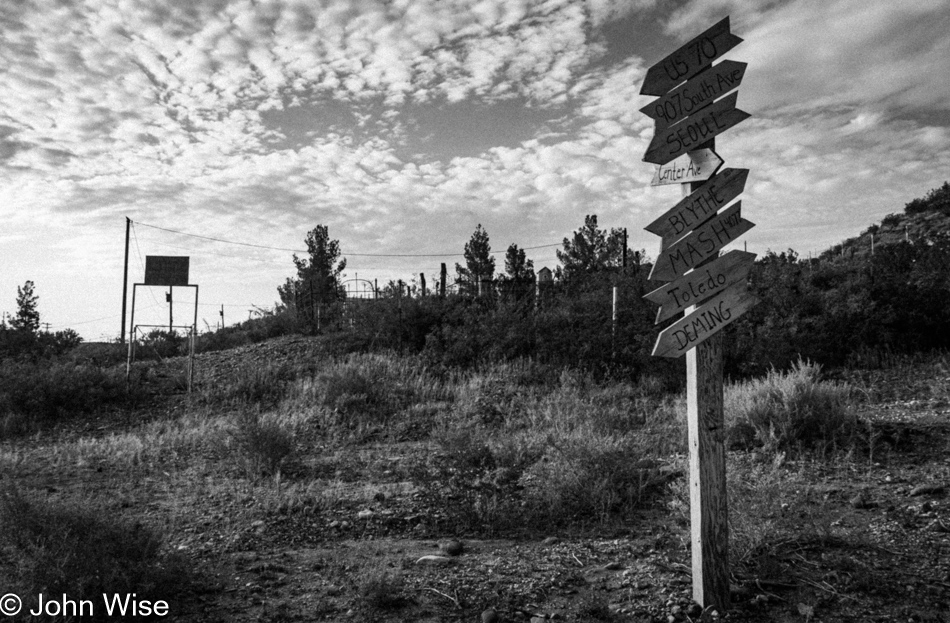
Jim Jones Shooting Range in Payson, Arizona

For countless years, I’ve wanted to stop and snap a photo of this sign pointing visitors/victims to the Jim Jones Shooting Range here in Guyana, Arizona. Oops, I meant Payson, Arizona. I was 15 angry years old when I learned of the People’s Temple and their White Nights event in a South American jungle where Jim Jones led over 900 people to commit mass suicide/murder. The following year, I found the audio recording from the last hour of the camp. It was called The Last Supper and was the grimmest thing I’d ever heard. Forty-six years later, I can’t see the name Jim Jones without thinking of the sounds of those dying and the pictures of dead people bloating in a jungle, hoodwinked by a charismatic cult leader under the guise of religious devotion for economic salvation.

Sunset north of Heber-Overgaard, Arizona

Now, here I am, 45 years, seven months, three weeks, and one day (or 16,671 days in total) later, having watched countless sunsets in between, celebrating life. Cults of various types have become the norm, and many people are prepared to sacrifice their lives for the megalomaniacal musings of captivating and persuasive sociopaths inspiring devotees through twisted ideas of what freedom, god, guns, and evil mean. While some have an unhealthy preoccupation with influencing others or being followers, Caroline and I take our passion for self-discovery on the road and interpret what life means to the best of our ability when gazing upon whales, looking into the sunset, and basking in the beauty of what others are creating in the various arts.

Wigwam Motel in Holbrook, Arizona

Mind you, this is not always the easiest of journeys. Not only do we grow older and maybe a bit tired, but society would prefer us to comport ourselves with the symbols, cultural icons, zeitgeist, and conformity afflicting the masses. That won’t do, as here, at 61 years old, the anger of the 15-year-old still seethes against the machine of subservient consumerism and commercial religious zealotry that drives insecurities and uncertainties. Having only returned home 72 hours earlier following our month in Oregon, we must remain relentless in our push to experience life on the terms we brought to the game ten, twenty, thirty, and forty years ago. So, tonight, we pulled into the Wigwam Motel once again. We’ve lost track of how many times these ancient concrete bungalows have welcomed us.

Wigwam Motel in Holbrook, Arizona

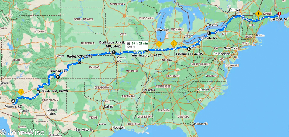
What’s the occasion, you might ask? We are on our way to the 20th anniversary of the International Folk Art Market that welcomes artists, creators, and celebrants of world culture to the semi-arid mountain desert city of Santa Fe, New Mexico.

End of Oregon Summer Trip

Tonopah, Nevada

After nearly 40,000 words, 573 photos, about 200 miles of walking and hiking, 18 days of remote work, and 12 weekend days (including a holiday), our month away from Arizona ends today. Our only goal is to get home as quickly as possible, and it is with dread that we leave Tonopah, Nevada, because we are anticipating a crush of traffic passing Vegas and Kingman before encountering the impatience of idiots trying to race through Wickenburg to Phoenix, making for dangerous driving.

Somewhere in Nevada

But those worries were for naught as it was smooth sailing. Sure, Las Vegas was its usual zone of drug-fueled stupidhead drivers, and there was a backup trying to merge on Interstate 40 in Kingman, where we pulled over at Popeye’s for some spicy chicken sandwiches, but other than that, it all went well, allowing us to cover the 509 miles home pretty quickly, getting home before 4:00 p.m. Seventy-two hours later, we’d be leaving again, this time for Santa Fe, New Mexico, but only for a long weekend.

A Small Slice of California

Clear Lake near Lucerne, California

This is Clear Lake, as seen from Lucerne, California. We’d already passed Lake Mendocino, but I need to make haste in getting this post finished because the reality is, I’m sitting down to write this post on July 10th at 8:30 p.m. after arriving at the Wigwam Motel in Holbrook, Arizona, on our way to Santa Fe, New Mexico, because our travel schedule is rather relentless this summer. So, the fewer photos I have to write to, the better I can expedite this missive and get into the trip we started only three days after we returned home from our stay in Oregon.

California Route 20 going east in the Central Valley

We drove out of the Coastal Range as our route took us east before our hard turn south to finish our drive home. The golden grasses of this state never fail to impress us. They’re also beautiful when they are green, though that doesn’t seem to happen frequently.

California Route 20 going east in the Central Valley

Not too far along, we enter the vast, flat middle of California, where 25% of America’s food supply is grown, with fully 40% of all fruits and nuts.

California Route 20 going east in the Central Valley

I can’t say we’ve ever seen fields of sunflowers out here before, but there is the fact that it’s a rare day that we find ourselves out and about during summer.

U.S. Route 50 in the Eldorado National Forest, Sierra Nevada Mountains in California

Due to needing to drive over 500 miles (805km) today to reach this evening’s hotel, we were trying to be judicious with the number of stops we were making. Obviously, we are no longer in the Central Valley; we have started climbing up the Sierra Nevada Mountain Range. Yosemite National Park is still well south of us.

U.S. Route 50 in the Eldorado National Forest, Sierra Nevada Mountains in California

Only after passing the turnoff in the Meyers area to South Lake Tahoe did the heavy traffic abate, allowing us the opportunity for a break to stretch our legs, find a discrete spot for taking care of some particular business, and when inspired, take another photo. Usually, we try to incorporate all those things in a single stop.

West Fork Carson River in Markleeville, California

Crossing the West Fork of the Carson River in Markleeville.

California Route 89 near Markleeville, California in the Sierra Nevada Mountains

We should have more time to do justice in exploring this area because it feels as though we are unceremoniously racing right through here.

California Route 89 near Markleeville, California in the Sierra Nevada Mountains

Out here, we are feeling very alone, and that’s a good thing.

California Route 89 near Markleeville, California in the Sierra Nevada Mountains

Routes 88, 4, and 108 slice a path roughly east/west, while the 89 travels mostly south, which is the road we are currently on.

Caroline Wise at Monitor Pass near Lake Tahoe, California

The section of California 89 that crosses Monitor Pass is pointed absolutely east at this time. The pass is at an elevation of 8,314 feet or 2,534 meters.

California Route 89 near Topaz, California in the Sierra Nevada Mountains

We are descending out of the mountains to a wide valley below, where we’ll join U.S. Highway 395, also known as the Eastern Sierra Scenic Byway.

California Route 89 near Topaz, California in the Sierra Nevada Mountains

Not a mile further down the road, we were struck by this basin and how pretty it was.

U.S. 395 looking south to Mono Lake in California

That’s Mono Lake in the distance, we’ll certainly be stopping as it’s been 20 years to the day since we were last here. What a strange coincidence.

Boardwalk to Mono Lake in Lee Vining, California

This boardwalk, which really goes about nowhere, wasn’t here the last time we visited. The old adage, “Everything changes,” still rings true.

Caroline Wise at Mono Lake Navy Beach Viewpoint in Lee Vining, California

We stopped in Lee Vining at a gas station for ice and to ask if the guys might know where there’s a beach at the lake where people can swim because we didn’t have a recollection of exactly where we were on one of those previous visits when Caroline got in with the brine shrimp and swarming alkali flies that are in wild abundance, nearly creepily so, here at the shore. The younger of the two men recommended Navy Beach, but no sooner did he answer us that the other guy, half-toothless and maybe a bit inebriated, asked if we worshipped Satan. I answered him, “Not recently, how about you?” He offered up a simple “Yeah,” so I threw him the hand gesture for devil horns. We fist-bumped, and Caroline and I walked out, mouthing WTF to each other and holding back a laugh until we were in the car. Seriously, one of the great moments of our day.

Mono Lake Navy Beach Viewpoint in Lee Vining, California

Now, here I am thinking about this encounter, and as I write about this day, I just went to reference our old July 6th, 2004 visit, literally exactly 20 years ago. Back on that day, we had wanted to visit the Devils Postpile National Monument near Mammoth but were dissuaded because I didn’t want to wait on a shuttle. So, we detoured to eat pastries from Schatt’s bakery, with me mocking their product with a pun of the baker’s name. Next up, we drove through Death Valley via Crankshaft Corners on rough dirt backroads when it was hot as hell, as in close to 120 degrees. Where’d we go from there? To the Devils Golf Course, of which I wrote about letting “Satan play through.”

That guy at the gas station somehow understood that we’d made a deal with the devil somewhere in our past, and this was evil’s way of hinting to us that we were living on Satan’s dime.

Mono Lake Navy Beach Viewpoint in Lee Vining, California

Now if the deal with the devil were in any way true, I assure you that I wouldn’t have bargained for the abundance of travel where I could marvel at rainbows, seashores, pretty flowers, dripping mosses, tufas, romantic sunsets, and a wife who marvels at sand dollars, yarns, and music that makes her cry, my deal would have been to have John McAfee’s life of hookers, cocaine, and $100 million to fuel a salacious life of hedonism and absolute irresponsibility.

Granite Mountain near California Route 120, California

Another new road was added to our historic Map of America, where we track the roads we’ve driven. This is California Route 120 from Mono Lake, which is bringing us to Nevada.

Benton Hot Springs, California

There are some mighty remote hot springs in what is nearly a ghost town here at the crossroads near the Nevada-California border. Returning here will take a serious effort, as Benton Hot Springs is truly off the beaten path.

On U.S. Route 6 entering Nevada

While the sun was quite low in the sky when we merged onto the Grand Army of the Republic Highway, we’d covered the majority of Routes 120 and 6 with enough light to feel we had a good idea of what the terrain looked like, so we can properly claim to have experienced this corner of America.

Belvada Hotel in Tonopah, Nevada

It was well after 9:00 p.m. when we pulled into Tonopah, Nevada, where I’d booked a stay at the historic Belvada Hotel. Rare is the day we sleep in accommodations more than a couple of floors high, with such lofty prices of a couple of hundred dollars for the night. Was it worth it? Not really, other than the idea that we are helping support a small town and a historic site. Next time, we’ll stay at the world-famous Clown Motel, also here in Tonopah, though, at $175 a night, it isn’t all that much cheaper. No matter as using Satan’s credit card, we can have anything we want.

Hello Again, California

Cape Sebastian Scenic Overlook south of Gold Beach, Oregon

Is that California out in the distance? Not yet, but soon. Today’s setup down in Gold Beach was intentional for what would be our next stop today. First though, we made this quick stop at Cape Sebastian, not only for the view, but as a reminder that we want to take the trail from up here all the way down to the ocean.

Meyers Creek Beach north of Pistol River, Oregon

This is the spot we had to visit as our last stop in Oregon on this mighty, amazing coastal adventure we’ve been experiencing. Meyers Creek Beach has long been a favorite.

Meyers Creek Beach north of Pistol River, Oregon

Before we ever knew the proper name of this beach, we called it the Sharkfin Beach for obvious reasons. It is this rock jutting out of the sand and sea that created this affinity and keeps us coming back.

Meyers Creek Beach north of Pistol River, Oregon

We took time to linger in the fading moments that could be allocated to time on the Oregon Coast. While there’s some likelihood we’ll return this November, as I’ve already started making reservations, one never knows what tomorrow brings, so we have to take every second to absorb all we can.

Caroline Wise at Meyers Creek Beach north of Pistol River, Oregon

Note the hands in the pockets instead of holding the reins of Happy McKiteFace; there was no wind here, zero, zilch.

Coastal sand verbena at Meyers Creek Beach north of Pistol River, Oregon

Leaving the beach, we caught a whiff of this flowering plant that is not in bloom during our November visits. It is coastal sand verbena, and it smells brilliant.

Redwoods in Northern California

We’re on Wonder Stump Road just north of Crescent City, which is less than 15 miles from where we crossed from Oregon to California on Highway 101.

Redwoods in Northern California

These trees are today’s first encounter with the redwoods, and while some may think that 5 million of these giants of the more than 100 million that once existed is an adequate number, keep in mind that there are 39 million people living in California and nobody is suggesting the state is running out of habitable land. The tree we are standing below might be about 30 feet in diameter, meaning it could be about 300 to 400 years old. The Lost Monarch tree in Jedediah Smith Redwoods State Park has a circumference of approximately 84 feet (25.6 meters) while the oldest redwood is estimated to be about 2,200 years old, so even if humanity were to attempt to restore what we’ve ruined, not us, our children, grandchildren, or great-grandchildren would be around to see one of these trees reach even this circumference.

Redwoods in Northern California

It’s peculiar to my primitive brain how I can be so impressed standing at the base of one of these trees, and yet there is an entire ecosystem above me that is unvisitable and must remain a big unknown to my senses. The canopy of the redwoods may as well be at the bottom of the sea or on the moon.

Redwoods in Northern California

The Wonder Stump Road might only be two miles long, but we were lost under these trees for nearly as long as it would have taken to walk the road.

Overlook in Klamath, California

Had our goal been to get as far south as fast as we could, our time at the edge of the continent would have been a lot shorter, but that would have brought an unceremonious end to this trip, and so our route was designed to maximize time at the coast and allow us to dawdle.

Wilson Creek Beach in Klamath, California

Wilson Creek Beach was afforded a quick stop, a photo and go.

Prairie Creek Redwoods State Park in Orick, California

We’ve turned off Highway 101 at the Newton B. Drury Scenic Byway in the Redwoods National Park on the way to the Prairie Creek Redwoods State Park to slow things down even further. To simply drive by and ignore these trees and their lush environment feels like sacrilege.

Tiger Lily at Prairie Creek Redwoods State Park in Orick, California

Caroline spotted tiger lilies next to the road, but often, there was nowhere to easily pull over, so we continued on until we found some near a pullout.

Prairie Creek Redwoods State Park in Orick, California

Sadly, there’d be no time for a hike into the woods because while we can take our time, as long as we reach Ukiah, where we have a hotel reservation, I have plans for a side trek off the beaten path to a place on the coast we’ve never visited before.

Prairie Creek Redwoods State Park in Orick, California

These forays into forests that stretch far into the sky are difficult places to photograph, at least for me, as there is so much to see and only so much that can be captured adequately in a photo. While standing under these ancient and massive trees inspires us, there is no easy method of sharing just how grand it all is.

Prairie Creek Redwoods State Park in Orick, California

The ancestors of redwoods emerged about 200 million years ago, and then about 50 to 100 million years ago, the species split into the two types we know today, the coastal redwood and the giant sequoia. Maybe that’s what contributes to the sense of otherness, or whatever it is that feels different than other places; there are few living things on earth that we can stand amongst that have been on the planet longer.

Patricks Point Drive in Patricks Point, California

Heed this stop sign, or you will certainly regret your indiscretion. We are on Patricks Point Road.

Luffenholtz Beach in Trinidad, California

This is Luffenholtz Beach south of Trinidad, and while Caroline and I drove at least part of this road back in 2006 (we know we did because there’s a blog post) neither of us has any recollection of that drive. As a matter of fact, in 2020, we thought we were traveling this road for the very first time, stating just that in a post.

Mattole Road near Ferndale, California

We have left Highway 101 again, this time for a road we are absolutely 100% certain we’ve never driven before. The initial stretch of road is California 211, but in Ferndale, the road shrinks as we head out on the Mattole Road for the Lost Coast.

Mattole Road heading towards Cape Town, California

Many sections of the road out here are only a single lane, and they are also in tight curves with big blind spots, so stopping is not an option. Then, we emerge from the dark forest into wide-open vistas that are idyllic, serene landscapes.

Mattole Road heading towards Cape Town, California

Without guardrails, I’m inclined to hug the centerline and drive at barely 20mph, else we risk falling off the road and into the infinity of time.

Cape Town, California

We’ve arrived in Cape Town, as in California, not South Africa.

Mattole Road heading to Black Sand Beach on The Lost Coast of California

After driving for a while, we had some idea of the frequency of other cars traveling this road and felt okay about stopping in the middle of the street and jumping out for a photo.

Adjacent to Black Sand Beach on The Lost Coast of California

You wouldn’t know it from this view, but we’ve arrived at the Black Sand Beach down here on the Lost Coast north of the King Range National Conservation Area. I’ll turn around and show you.

Black Sand Beach on The Lost Coast of California

There’s nothing and almost nobody else down here.

Caroline Wise and John Wise at the Black Sand Beach on The Lost Coast of California

Well, there were these two dorks hanging out looking for the things we’d possibly not seen before.

Gumboot chiton shell at the Black Sand Beach on The Lost Coast of California

Seek, and you shall find. We were on our way back to the car when I spotted something peculiar that turned into the great treasure of this month away from Arizona: the shell of a gumboot chiton.

Point of Cows on Mattole Road at The Lost Coast of California

Somewhere along the road, and not marked, is the Point of Cows. That’s what we are calling this in lieu of finding the exact spot from the map.

Mattole Road near Petrolia, California

This concludes our coastal adventure as we turn inland and start the serious effort to move ourselves closer to home.

Lindley Ranch in Petrolia, California

Much of the landscape for the first 20 miles after leaving our turn inland was similar to what we were driving past on our way out, but still, I felt I should offer at least a peek at what is on this end of Mattole Road as we drive through Petrolia.

Mattole River Bridge in Honeydew, California

Our last photo of the day is from the Mattole River Truss Bridge in Honeydew, population 277, of which we met three of the locals. They were sitting near the bridge and informed us that this old relic from 1920 is going to be torn out and replaced with a modern structure. We learned a few other things from the heavily stoned and friendly people, but what they didn’t tell us was that we should probably have used this bridge and taken the northern route back to Highway 101 because the way we went included some sandy loose gravel sections of road in tight curves on steep mountainsides. More than once, I was given an adrenalin boost from the abject terror I was feeling as we started losing traction, and fear informed me that if I lost momentum, our tires would never grip this stuff well enough to let us finish going up the incline. I was close to panic. Consequently, I didn’t stop one time before reaching Highway 101, and by the time we reached Ukiah for the night, I was exhausted. What an adventure it was.

Happy 4th of July from Oregon

Fogbow at Depoe Bay, Oregon

The exit portal found in this fogbow opened at the rocky shore of Depoe Bay, allowing Caroline and me the chance to begin the process of leaving Oregon. Without the fogbow, we’d have been stuck here on the coast; not a bad thing, mind you, but we do have other places to be, such as Santa Fe, New Mexico, next week. Now I’m getting ahead of myself – more about that trip later. For now, I have to contend with the situation that we are taking the next four days to drive back to Arizona, which also implies that there will be no blogging during those days and I’ll fall behind, but who’s not up for a big challenge?

R2D2 on the side of Highway 101 in Oregon

It’s the 4th of July today, Independence Day for the United States, where we celebrate the birth of our country, and this Star Wars fan sent R2-D2 out to the curb armed with the stars and stripes to remind everyone to give a nod to this special day.

Mindy and Caroline Wise in Yachats, Oregon

The original departure plan called for us not to get out of the car before we were south of Florence, but that couldn’t really be adhered to anyway, as we knew we’d stop in at the Newport Cafe for yet another yummy Pacific Seafood Scramble. Somehow, we managed to skip one more stop at Boiler Bay to look for whales, but reaching Yachats and seeing that the farmer’s market was happening on this holiday, we had to stop, and good thing we did. Not only did we score another loaf of sourdough from Mindy the Baker, but across from her, we met Broom Chick. Twenty years or more ago, Caroline and I bought a handmade gnarled corn broom at the Renaissance Festival in Arizona. While it’s well worn, we use it to this day. Well, that might not be true much longer as Caroline thought it was high time to replace it, and Samantha the Broom Chick herself, was selling her brooms at the market, and it turns out that it was her company that made our old broom, too. Sadly, we learned that we wouldn’t be able to have our relic given a makeover, so it’ll become our outside broom, and the new one will take its place in our kitchen. [We also stopped one more time at the Green Salmon for more herbal tea of the Crater Lake variety and a couple of mushroom-themed souvenirs. – Caroline]

Thor's Well at Cape Perpetua in Yachats, Oregon

Nope, this is not Florence. We have pulled over near Cape Perpetua south of Yachats for one more look at Thor’s Well hoping that since it is shortly after low tide, we might get a better look into the well. That didn’t quite happen, as you can see for yourself the fountain of water splashing out of this amazing natural feature. Being too close could be life-threatening.

Heceta Head Lighthouse in Florence, Oregon

Here at Heceta Head Lighthouse, we are closer to Florence, but still 13 miles north means we were stopping again.

Sea Gypsy Cottage Gallery in Florence, Oregon

Incorrigible could be our middle name while traveling because here we are, just a few more miles south, and a pond across from Woahink Lake captured our attention. As soon as we were out of the car, something else caught our eyes. This Sea Gypsy inviting people into a gallery was on duty, but I was resilient to Caroline’s pleading and held fast to the idea that we didn’t have the time for a visit.

Water lilies across from Woahink Lake in Florence, Oregon

Of course, we did have time to take photos of the lily pads and their blossoms, as we’d never seen this pond blooming before. Or maybe we had, but neither of us had a memory of such.

Oregon Dunes National Recreation Area Waxmyrtle Campground in Dunes City, Oregon

We made it past Florence and were able to skip another stop at the Happy Kamper Yarn Barn, made easier as it was closed. We also drove right by the Darlingtonia site, but did pull over here at the Waxmyrtle Campground at Oregon Dunes National Recreation Area in Dunes City.

Oregon Dunes National Recreation Area Carter Lake Campground in Dunes City, Oregon

We didn’t get far before taking yet another right turn off Highway 101 into the Carter Lake Campground, also part of the Oregon Dunes National Recreation Area.

Tahkenitch Lake in Gardiner, Oregon

For more than 20 years, we’ve wanted a photograph of Tahkenitch Lake in Gardiner, but getting to a place with a good, clear view was never easy, nor was it today. The “official” overlook one might hope to catch is overgrown, but today’s weather was so perfect we just had to finally figure this out. We located glimpses of the lake through the trees driving back to the north, then parked as far off the road and walked along a narrow piece of the highway to where we could see the lake. Caroline felt she could navigate our way through the dense undergrowth and brambles over the steep terrain, and sure enough, she got us to a small clearing that offered us the greatest view ever of this wild landscape.

Caroline Wise at Driftwood Farms Yarn shop in Reedsport, Oregon

For her terrific pathfinding effort, I rewarded her with a visit to the Driftwood Farms Yarn shop in Reedsport, which, being open, helped in this special gift of mine. Heck, I even offered her a small budget for yarn and roving from my personal bank account that may or may not actually be a shared account that her paycheck is deposited into, but that’s of no real concern. What’s important is my incredible generosity letting her spend her own money.

This stop was a twofer, as we finally learned about My Yarn Shop, which used to be located in Coos Bay, further south of us. That shop in Coos Bay has been closed for a long time. It turns out that its owner, Judy Mogan, heiress to a lumber company, had passed away, and the family working to settle that part of her estate worked out a deal with the owner of Driftwood Farms for her to take on the extensive, seriously absurd, collection of yarn that Judy had amassed. I cannot emphasize enough just how large a collection of yarn was stuffed into her retail space on South Broadway in Coos Bay. It was literally tons of yarn that is now in the possession of Kim and her daughter and business partner, Jessica. Anyone interested in buying random 100-skein boxes of mystery yarn should reach out to the ladies for a real yarn bargain.

Oregon Islands National Wildlife Refuge in Bandon, Oregon

Here we are at Oregon Islands National Wildlife Refuge in Bandon, and because I can’t bring you here myself, I’m including plenty of photos so you can get some small sense of how perspective and position on the bluffs or on the beach can greatly alter the view and make this one of the great stops on the coast. Today the weather was great, but the winds quite strong, making it a bit difficult to stand near the cliff edge.

Oregon Islands National Wildlife Refuge in Bandon, Oregon

The same place zoomed in. Pretty, isn’t it?

Oregon Islands National Wildlife Refuge in Bandon, Oregon

Looking to our right from the overlook. We never tire of this view. Off to my right is Cosmo, the Tufted Puffin statue, whose photo (under cloudier conditions) I shared on a previous visit.

Oregon Islands National Wildlife Refuge in Bandon, Oregon

Down here on the beach below the Coquille Point, there was no escaping the heavy winds either, nor could we escape the intense beauty of it all.

Oregon Islands National Wildlife Refuge in Bandon, Oregon

The third and final view south down the coast.

Face Rock State Scenic Viewpoint in Bandon, Oregon

While Face Rock is just a short drive south of where we just were, this is not looking to the south but is more northwest.

Devils Kitchen in Bandon, Oregon

This being a trip of zooming into the map for any hint of places that might offer us beach access, we discovered this new-to-us location known as Devils Kitchen, also in Bandon.

Devils Kitchen in Bandon, Oregon

The previous view was looking north. This is the view to the south, our direction of travel today.

Hotdog from Langlois Market in Langlois, Oregon

Once again, our entire trip has been centered around the idea that we had to make another pilgrimage to the Langlois Market in, you guessed it, Langlois, Oregon. This small town carries big heft as this little shop has sold over 1,519,845 of their world-famous hot dogs served with their secret mustard and great pickles, though we skipped the onions that should be there, too.

Iris at Floras Lake and the Boice-Cope Park in Langlois, Oregon

As I said, we are zooming into maps, and this find, also in Langlois, is at Floras Lake and the Boice-Cope Park.

Kiteboarding on Floras Lake in Langlois, Oregon

Neither Caroline nor I had any idea that watching a bunch of people kitesurfing would be so exhilarating. These talented weavers, who use massive sails to drag them across the calm waters of Floras Lake, are seriously talented athletes who fly at high speed over the surface of the lake.

Beach next to Floras Lake in Langlois, Oregon

While we could have stayed at the lake for hours, the nearby beach beckoned, but only for a few minutes.

Kiteboarding on Floras Lake in Langlois, Oregon

And then we were right back at the lake watching people flying into the sky, then landing again before the wind recaptured their kite, caught hold after they turned around, and had them speeding away from us.

Garrison Lake in Port Orford, Oregon

As much as I could have stayed there forever, mesmerized by the potential that someone was going to fly off into the ocean, Caroline reminded me that we would probably want to check into our motel before midnight. But then, approaching Port Orford, she spotted Garrison Lake on the map and told me to make a turn and go this way and that. While I might have had a differing opinion about this situation, she, being the navigator, effectively tricked me into not only breaking the spell kiteboarding was having on me but she had me going somewhere that wasn’t our cheap-ass motel.

Fawn at Garrison Lake in Port Orford, Oregon

“But John, I know how much you enjoy seeing fawns because you once told me it was the first movie you remember seeing at the drive-in movie theater in Buffalo, New York, when you were only four or five…and how you cried when Bambi’s mom was shot. I thought you’d like coming out here to see fawns. Google’s mapping service showed me that there were three young deer frolicking by the shore.” What? Excuse me? Then Caroline tried convincing me that just as they show Dunkin’ Donuts and Starbucks on maps, they added wildlife sightings, too. I think she’s pulling that roving she bought earlier over my eyes.

Garrison Lake in Port Orford, Oregon

Strange how a dozen miles north, the wind was nearly howling and here at Garrison Lake, things were as calm as could be, tranquil even.

Sweet Pea at Tseriadun State Recreation Site in Port Orford, Oregon

You have no idea how many times Caroline and I have shared between us that we feel like we’ve seen everything there is to see on the Oregon coast, but this trip has turned out to be an eye-opener. We have arrived at Tseriadun State Recreation Site, also in Port Orford, late in the day, as in after 8:00 p.m. These flowers are sweet peas, a toxic plant if eaten, but perfectly delightful to be gazed upon.

Caroline Wise at Tseriadun State Recreation Site in Port Orford, Oregon

So much to see, so little time, though our opportunities are greater than most others. We are grateful.

Tseriadun State Recreation Site in Port Orford, Oregon

We are also incredibly fortunate. To have started the day with a fogbow and now to be greeted by a sun dog, effectively a sun rainbow.

Tseriadun State Recreation Site in Port Orford, Oregon

A funny thing happened on the way to the sunset on the other side of a giant rock separating the two halves of the beach here: my camera battery malfunctioned. I took a spectacular photo of this very location with my phone, but the colors are hysterically out of sync with the tones I achieve with my DSLR. I liked the image enough to share it on Facebook – click here to see it. Having never heard of this beach, our expectations were low, but after visiting, we’ll make a note to return again one day.

Tseriadun State Recreation Site in Port Orford, Oregon

This final photo south of Port Orford, just before the sunset, will have to stand in for our fireworks shot because, at 10:00 from the balcony at Motel 6 in Gold Beach, our photos turned out horribly. We didn’t try very hard, and I only used my phone as I was too lazy to set up for shooting under poor lighting conditions. It was after all already a 17-hour day of impressions, and it was so nice to simply watch the beautiful show and listen to the crazy echoes bouncing off the adjacent mountain across the Rogue River. Wow, we’ve stumbled into another perfect 4th of July. Happy birthday, America! We hope you can survive this existential crisis you are suffering through.

Never Ending Oregon Adventure

Boiler Bay in Depoe Bay, Oregon

Out at the fog line between Fogarty Creek and Gleneden Beach, two whales were working the seas early, letting us have one more in the countless number of whale sightings we’ve experienced on this trip. Our first stop was once again at Boiler Bay, where we’ve had such great luck with whale watching.

North Fogarty Creek Beach in Depoe Bay, Oregon

North Fogarty Creek Beach was the destination where we collected our steps this morning. That we’d be foiled in getting all we wanted wasn’t known just yet.

Sea Stars at North Fogarty Creek Beach in Depoe Bay, Oregon

Little did we suspect it would be low tide and that we’d run into this family of sea stars posing in the hopes of becoming internet famous.

North Fogarty Creek Beach in Depoe Bay, Oregon

Draining sands leave incredible patterns when the tide recedes into the ocean.

North Fogarty Creek Beach in Depoe Bay, Oregon

And not all the patterns are the same.

North Fogarty Creek Beach in Depoe Bay, Oregon

Like I said.

North Fogarty Creek Beach in Depoe Bay, Oregon

The rock formations way out act as a breakwater for the waves, leaving this part of the shore temporarily calm until the waves return to breaking over the walls.

Caroline Wise at North Fogarty Creek Beach in Depoe Bay, Oregon

Choosing what to do and see next requires studied consideration from Caroline.

Anemone at North Fogarty Creek Beach in Depoe Bay, Oregon

As for me, I just look for more anemones, mussels, barnacles with large peduncles, and sea stars.

North Fogarty Creek Beach in Depoe Bay, Oregon

Barnacles on an island deny me an inspection of their clustering families.

Fresh Rockfall at North Fogarty Creek Beach in Depoe Bay, Oregon

This is a very recent rockfall, likely in the past hours, as nearby we saw other footprints and dog paw impressions on this side of the beach which is not accessible during high tide but they were obviously left recently in wet sand close to the waterline. We could see how high the tide had been in other parts of the beach and the sand underneath the fallen rocks was clearly smoothed by its lapping water during the night. The smaller chips and stones were absolutely undisturbed and looked fresh.

Bald Eagle at North Fogarty Creek Beach in Depoe Bay, Oregon

A couple of gulls were seen chasing this bald eagle away, and its presence wasn’t enjoyed by the pigeon guillemots who were hanging out on the edges of Fishing Rock. In case you were wondering about the coloring, juvenile bald eagles are dark.

Boiler Bay in Depoe Bay, Oregon

For the duration of this trip and during previous visits over the years, we’ve been calling this general area Boiler Bay, and while that’s correct (the wayside is officially called Boiler Bay State Park), the spit of land that juts furthest into the sea and which we are standing on was, in the past, more commonly called Government Point.

Caroline Wise at Elsie's Discount Roving in Depoe Bay, Oregon

This is not always the easiest shop to visit. We were just about to give up when the owner stepped out of her home and asked if she could help us. That person was Elsie, the proprietor of Elsie’s Discount Roving in Depoe Bay, and those two rugs are going home with us.

Caroline Wise at Gilgamesh Brewing in Lincoln City, Oregon

On Sunday, Caroline and I stopped in at the Lincoln City Outlets, looking for a few things, such as jeans and a couple of books. My very old pair of jeans that have been worn during many a winter in Arizona, trips to Europe, and here in the cold summer environment of Oregon have given out. Caroline tried performing an emergency repair, but with each squat for a photo, I was putting too much pressure on the crotch that has been hanging low due to my significant weight loss since the jeans were purchased. No luck at the store, so I ordered those online later that night. The books we wanted were The Hidden Life of Trees: What They Feel, How They Communicate by Peter Wohlleben and The Overstory by Richard Powers, also about trees. Unfortunately, here in the heavily forested lands of coastal Oregon, the bookshop didn’t have either. Walking through the outlets on that day, Caroline considered trying a beer at Gilgamesh Brewing, hoping for an Enkidu brew.  We decided to give them a try today since she won’t be around for happy hour with her coworkers on Friday. They missed the opportunity to brand one of their brews Enkidu, and so Caroline settled on a flight. [My favorite were the Mamba ale and DJ Jazzy Hef hefeweizen (I’m not a fan of some of these names), but the IPAs/pale ales were nice and also the coffee-infused beer. – Caroline]

Cascade Head Rainforest Trail in Otis, Oregon

Also, this past Sunday saw us hiking the Lower Cascade Head Trail. I already wrote about my underlying tensions of being on popular trails in that day’s post. This here was the alternative I had wanted to hike; it is the Cascade Head Rainforest Trail that we are getting in before leaving Depoe Bay tomorrow.

Cascade Head Rainforest Trail in Otis, Oregon

Ferns add vibrant green accents to much of what we see in the forests up here, but maybe because they are so ubiquitous, I seem to neglect paying enough attention to focusing on them exclusively.

Cascade Head Rainforest Trail in Otis, Oregon

So often, many of the most beautiful mini-gardens are found growing out of the broken stumps and fallen trees that adorn the forest.

Banana slug on the Cascade Head Rainforest Trail in Otis, Oregon

Kind of ironic that this is the biggest banana slug we’ve ever seen, and we didn’t have a banana with us to show the scale of this giant. I could tell you that it was larger than my hands, but for all you know I might have tiny Trump hands.

Salmonberry on the Cascade Head Rainforest Trail in Otis, Oregon

Salmonberries! This trail is now depleted of these tasty morsels as we ate them all. Seriously, we must have munched on no less than 40 each.

Cascade Head Rainforest Trail in Otis, Oregon

While we’ve experienced plenty of the coast and low tides on this extended stay in Oregon, I’d hardly gotten enough rainforest therapy, so this was just what I needed to balance it all.

Cascade Head Rainforest Trail in Otis, Oregon

At a point, we made the conscious decision to avoid the Carl G. Washburne State Park with its China Creek Loop via Valley Trail on this trip, as that is likely our favorite trail on the entire coast, and we’d like it to remain that way. This decision was based on our experience on Amanda’s Trail south of Yachats and the dearth of mushrooms. We figured it’s too dry a time of year for those fungi and that China Creek Loop likely holds a significant part of its enchantment due to mushrooms and newts that prefer wetter times of the year.

Neskowin Beach in Neskowin, Oregon

When we were at Gilgamesh Brewing, Brandon, our server, picked up on Caroline’s German accent and consequently shared with her his time studying in Tubingen. When asked about the cost of living on the coast, he told us that he shares a tiny 300-square-foot studio with his wife for $800 a month up in Neskowin (just up the road from Lincoln City), which reminded Caroline that we’d not visited the Proposal Rock area up there yet like we’d wanted to. With the negative tides, the Neskowin Ghost Forest should have been well exposed, too bad we’d gotten carried away with the tide pools. All the same, we decided to visit the beach up there, seeing how the Cascade Head is just south of the area.

Caroline Wise at Neskowin Beach in Neskowin, Oregon

Wind on our last full day on this central part of the coast was all the reason Caroline needed to bring Happy McKiteFace out so it might feel the wind one more time under its wings.

Proposal Rock at Neskowin Beach in Neskowin, Oregon

This is Proposal Rock on Neskowin Beach, and somewhere behind it are the Ghost Trees that are named such because an earthquake caused a subduction event and landslide that saw the trees drop into the ocean and then get broken off and buried in a subsequent tsunami. The trees are best (or maybe only) seen at low tide and that wasn’t happening tonight. Caroline did manage to find a full can of La Croix grapefruit soda on the beach and that was enough of a reward for us.

Caroline Wise and John Wise at Boiler Bay in Depoe Bay, Oregon

Look at these two growing older farts, falling into the subduction zone of aging and getting buried in a tsunami of memories. While this time up in Oregon has been a “remote working” opportunity, both of us feel that the whole thing has been like a vacation.

Sunset at Boiler Bay in Depoe Bay, Oregon

Of course, we had to stop in at Boiler Bay yet again with the hopes of spotting more whales. Though they weren’t to be seen, we did find this awesome sunset just hanging out, waiting to be appreciated. We offered it what it needed, and in return, it gave us everything we needed before heading back to the house in Depoe Bay for our last dip in the hot tub.