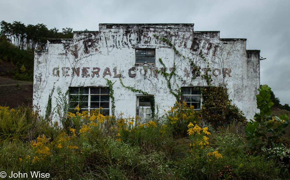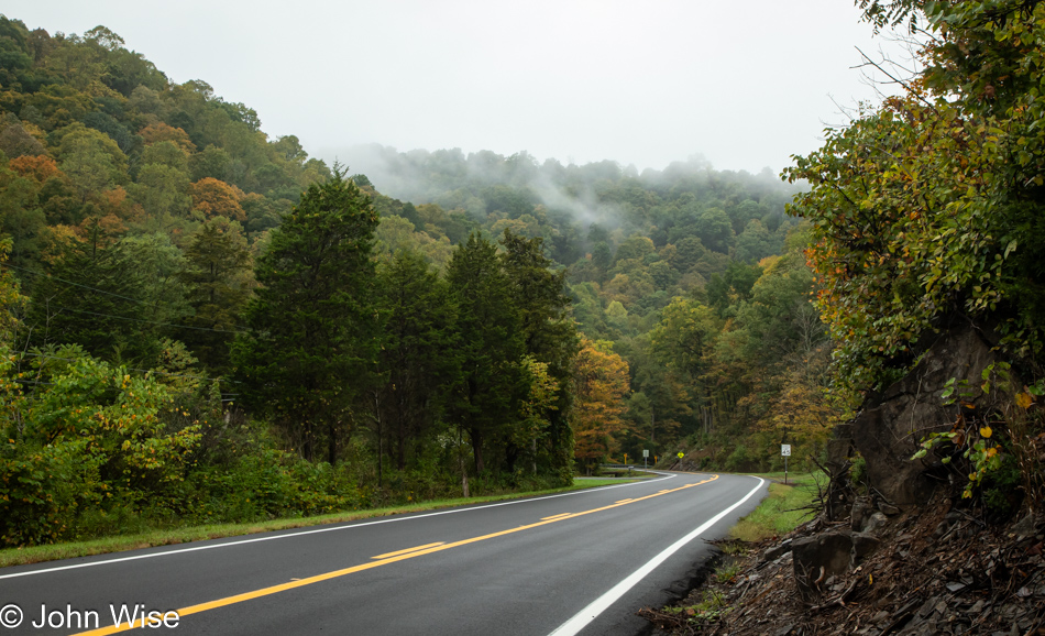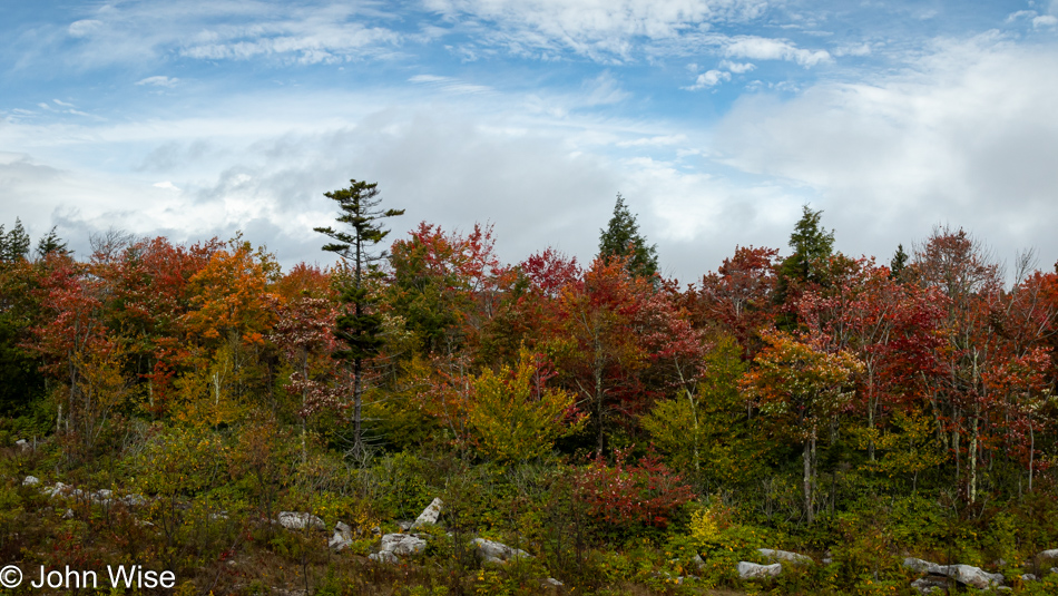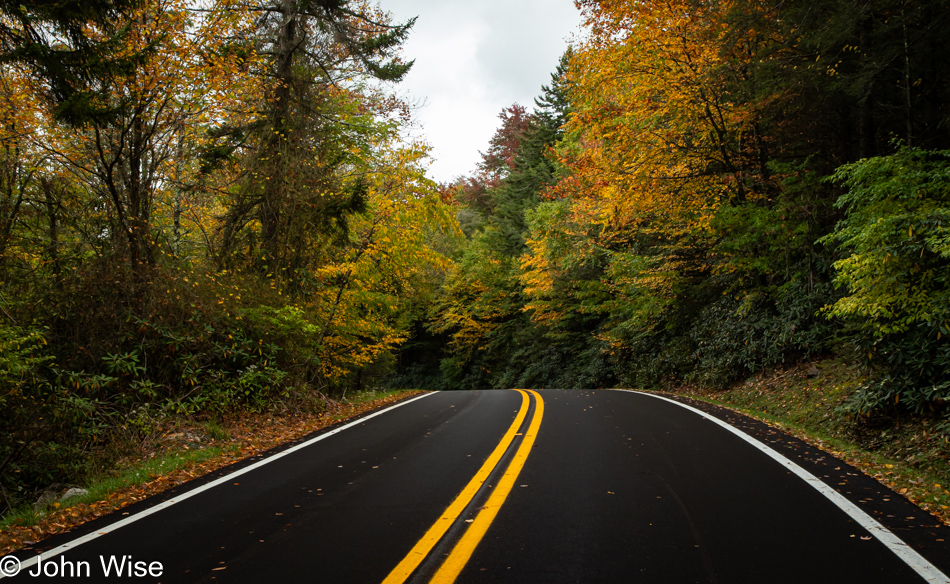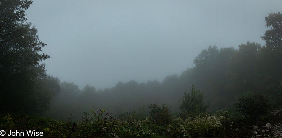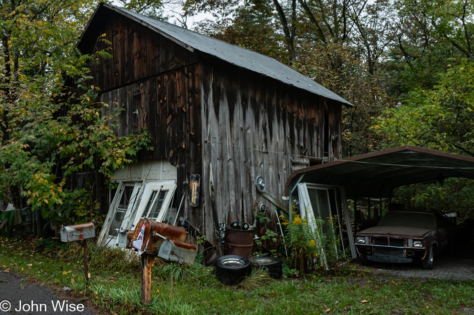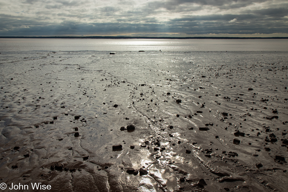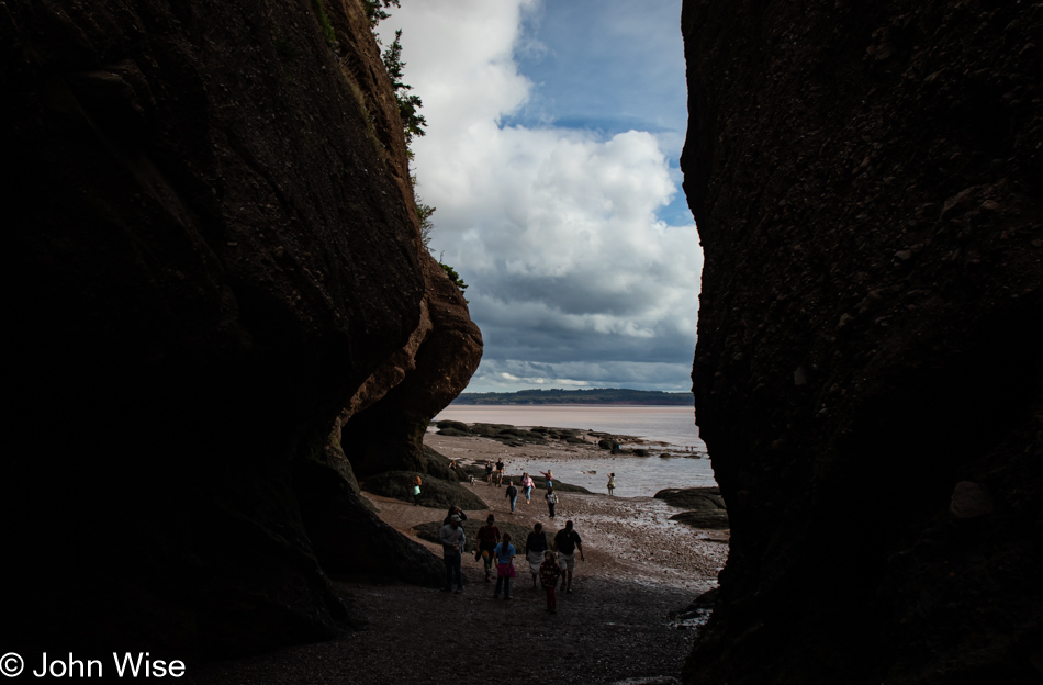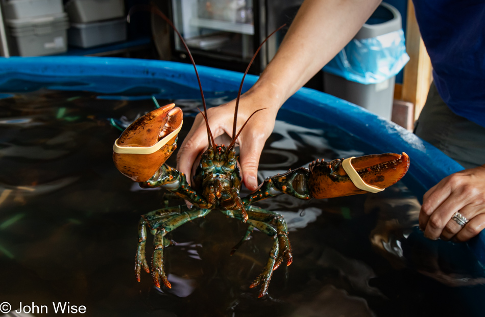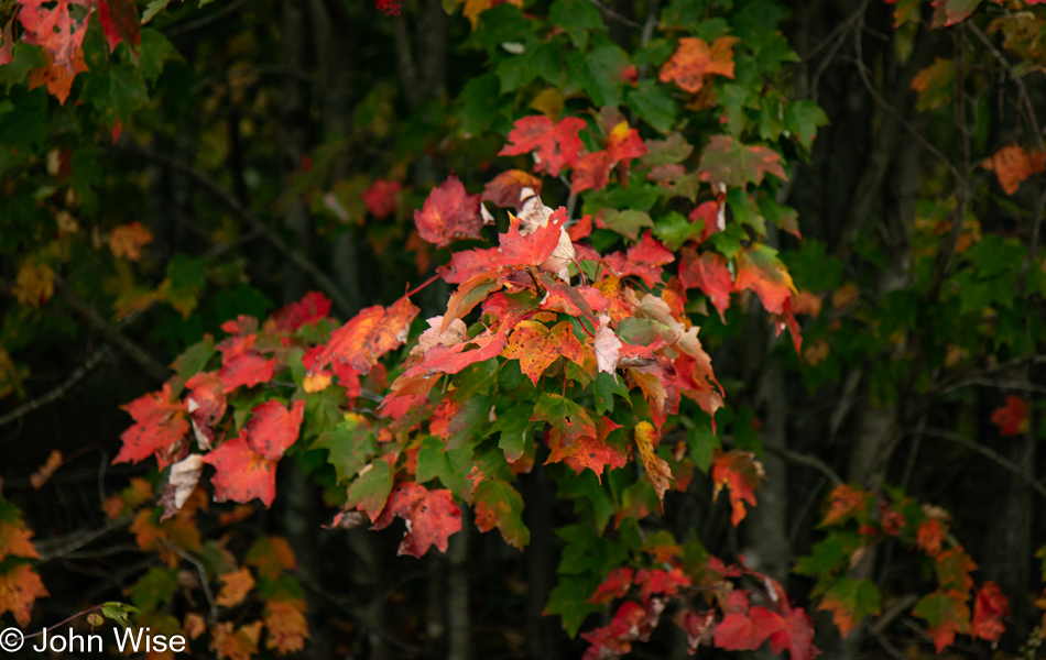
Terra Nova National Park in Newfoundland

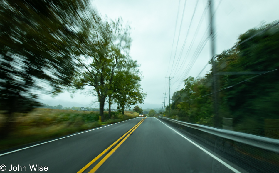
Trans Canada Highway east of Gander, Newfoundland, Canada

This is not a photo of mulching, but nearby, there was a sign announcing that mulching of the roadside was taking place, had taken place, or would take place, and that got Caroline to wondering why Canada mulches their roadsides while the United States mows them. So, upon getting home, I asked Claude 3.5 Sonnet (one of my go-to handy-dandy AIs) what its thoughts were, and it shared ideas about nutrient return to the soil, better resistance to erosion, a better wilderness aesthetic, and potentially better-insulating properties during harsh winters. Then, after consulting both Claude and Meta AI Llama 3.1-405B about the composition of the photo, specifically the rock, it seems that there is a consensus that we are looking at granite, which they say makes sense considering this is bedrock from the Gander Geological Zone that was exposed in cutting the Trans Canada Highway. I also inquired about the thin topsoil, which they said was consistent with an environment scraped down to bedrock during the last glacial period when the ice was retreating and finally disappeared between 7,000 and 9,000 years ago, which doesn’t allow much time in geological terms for topsoil to collect.

Joey's Lookout in Gambo, Newfoundland, Canada

I can’t explain this as I’m unfamiliar with Canadian culture, but why the country adopted the nickname of Joey for Erich Honecker, the General Secretary of the Socialist Unity Party of East Germany, baffles my imagination. Maybe back when Canada was part of the Communist Bloc countries during the Cold War, Honecker visited Newfoundland and stood here, kind of like in 1976 when Queen Elizabeth II visited the Trinity Church in New York City, which was commemorated with a plaque noting her visit. Hey, Newfoundland, I was only joking. Joey’s Lookout was named after the former Newfoundland Premier Joseph R. Smallwood, who was born in Gambo. He was called the province’s “Father of Confederation” after bringing Newfoundland into Canada. Funny enough, Joey, as he was affectionately known, worked for the socialist newspaper The Call while living in New York City.

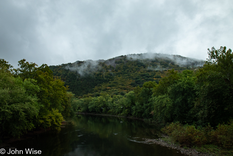
Gambo River in Newfoundland, Canada

From the moment I saw the view from the overlook, I was intrigued by what lay below, but we had places to be, so we kept going. That was until we began to cross the Gambo River, and I turned around for a better look at the rock-strewn riverbed. While maneuvering, Caroline found a smaller road that might take us right by the area we were looking at from the overlook, so we had to go. This little detour is now responsible for ten photos in this post, thus helping push the total to 55 images, which promises to make for an extraordinarily long blog entry.

Trail on the Gambo River in Gambo, Newfoundland, Canada

I had to wonder when we parked the car what exactly the sign “Use trail at own risk” was warning us about. Just what is ahead that warrants such a sign? Have I seen such a warning before on other hiking trails?

Trail on the Gambo River in Gambo, Newfoundland, Canada

For the sake of brevity, I’ll try to keep the verbiage regarding the following photos to a minimum, as what can be said about cattails? Well, we now know from experience: don’t pick these and take them home because there will come a time when the temperature and humidity reach a sweet spot that will have the cattail bloom, and you’ll come home to an explosion of cattail fluff, a lot of fluff I can tell you.

Trail on the Gambo River in Gambo, Newfoundland, Canada

From the Aster family of flowers, pretty, huh?

Trail on the Gambo River in Gambo, Newfoundland, Canada

A couple of dozen islands in the river channel made the view from the overlook so interesting.

Trail on the Gambo River in Gambo, Newfoundland, Canada

With my jaw agape and eyes peeled, looking for the perfect beauty shot that stood out from all the other beautiful places, I scoured the area, trying to determine the best range of colors and textures of surfaces. It is only now, back at home and writing these posts, that I can understand that part of the attraction I couldn’t appreciate while in Newfoundland was the relative uniformity of the ground reflecting the work of those glaciers that have created the conditions for the land to appear as it does.

Trail on the Gambo River in Gambo, Newfoundland, Canada

Maybe I’ve seen similar things in other locations, possibly in Alaska or Wisconsin, I’m not sure, but I can say that after witnessing countless terrains and ecosystems that have shared an incredible diversity of life, colors, shapes, contrasts, and challenges to my senses, everything is forever feeling new like they are greeting me for the first time.

Trail on the Gambo River in Gambo, Newfoundland, Canada

Sure, the focus is on the aster, but I also hoped the shallow depth of field allowed the lichens to show through, and while difficult to make out, I’m guessing that the rock is something found in the area called amphibolite.

Trail on the Gambo River in Gambo, Newfoundland, Canada

Maybe I’m looking at biotite gneiss or schist; I can’t really know, seeing how I’m not a geologist, but I’m certainly a curiologist.

Trail on the Gambo River in Gambo, Newfoundland, Canada

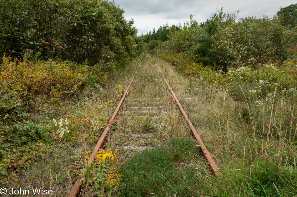
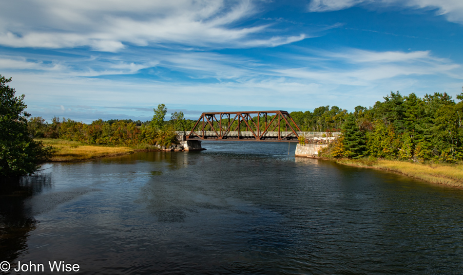
This old bridge is a remnant of the railroad that once ran across Newfoundland, but in 1988, after suffering years of financial losses, the Trans Canada Highway made it fully obsolete, and on September 30th of that year, the last train made its final run. This is also the end of our detour, but not before I note that the old railway line was converted into the Newfoundland T’Railway Provincial Park that runs from St. John’s to Channel-Port aux Basques with branches going to Bonavista, Carbonear, Lewisporte, Placentia, and Stephenville, thus creating a trail system that is 549 miles long (883 km) and suitable for hiking, snowmobiling, or mountain biking. A couple of days ago, Caroline noted that we spoke with a couple at the Lobster Cove Lighthouse in Rocky Harbour. Something they shared was their lament that they’d only visited Newfoundland for the first time the year before and now wished for more time to explore the island, which brings us to Reason #8 for a return that might be an impossible dream: riding the length of the T’Railway while balancing other obligations, curiosities, and the fact that we are aging. Reading our notes at the bridge, I’d be amiss if I didn’t share that we were just as quickly gone from there as it was extraordinarily windy, but not before we spotted a seal spying on us from the water.

Terra Nova River in Newfoundland, Canada

Crossing over the Terra Nova River means we are only a couple of miles from the border of Terra Nova National Park and about ten minutes from its visitors center. Regarding this name, Terra Nova is Latin for New Land and was the original Portuguese name for the island.

Bridge near Visitor Center in Terra Nova National Park, Newfoundland, Canada

I’ll never remember the woman’s name at the visitor center who helped us navigate the course of our visit, but I hope never to forget how incredibly friendly and enthusiastic she was about guiding us into a course of exploration that would make for such a memorable day in the Terra Nova National Park and allowed us to gather the best sampling of the diversity found here.

Bridge near Visitor Center in Terra Nova National Park, Newfoundland, Canada

At Newman Sound, we crossed a small arm of a much larger arm leading to the Atlantic Ocean while walking over the bridge pictured above this photo. This is one end of the Coastal Trail, a 5.9 mile (9.5km) out-and-back hike of which we’ll only be exploring a small part for a quick impression before moving on.

Coastal Trail near Visitor Center in Terra Nova National Park, Newfoundland, Canada

We walked about a half-mile along the coastal inlet before turning around and heading to our next location.

Goowiddy Path in Terra Nova National Park, Newfoundland, Canada

On the north side of the visitors center, we explored the Goowiddy Path, which was supposed to lead us to an interesting feature a short way up the trail. Goowiddy is a Newfoundland word for low shrubs.

Barachois on the Goowiddy Path in Terra Nova National Park, Newfoundland, Canada

That area of interest is what is called a Barachois, which means a sand or rock bar that forms a lagoon. It was the recommended end of our walk here on the Goowiddy Path, which has been popular with birds, especially a couple of kingfishers, which we were lucky enough to hear before seeing them fly off. This bird is more likely a sandpiper as the willets have typically migrated by the end of August, but we can’t really know as this is all we saw of this little guy.

Southwest Arm Trail in Terra Nova National Park, Newfoundland, Canada

From that obviously busy and overcrowded area near the visitor’s center, we made our way to the Southwest Arm Trail, where we did not encounter another person. The truth is that we didn’t bump into anyone else on the Coastal or Goowiddy Paths, either. This national park is pretty quiet at this time of year.

Southwest Arm Trail in Terra Nova National Park, Newfoundland, Canada

Here it begins: the trail, the mottled sunlight, shadows, and shades of greens, grays, and browns conspire to pull us into a trance. The visual song of the forest is a lullaby that brings us deeper into ourselves as we sink into the environment.

Southwest Arm Trail in Terra Nova National Park, Newfoundland, Canada

To linger here and return again and again, even if only by photos and words, is the clear objective of giving in to the seduction such places can affect upon those of us with inclinations towards being in love with the world when for a short amount of time, we have escaped the chatter of minds concerned with things human and are returned to being one with nature.

Southwest Arm Trail in Terra Nova National Park, Newfoundland, Canada

The beavers that built this pond are not concerned with yesterday or tomorrow. They, by their nature, live in the moment where the instinctual tasks demanded by their existence allow them to tend to a life with purpose in a universe shaped largely by their actions to sculpt such places.

Southwest Arm Trail in Terra Nova National Park, Newfoundland, Canada

Our opportunities to escape the noise within our heads are rare. Even when looking out upon perfection, there’s often a critical mind that, through our ignorance, suffering, or other afflictions, we cannot escape those situations to allow ourselves to fall into these scenes. Those who kayak these waters, fish, and camp along their shore are the fortunate ones. They are returning to the solemnity of presence after having learned the important life lesson: this is what feeds your soul.

Southwest Arm Trail in Terra Nova National Park, Newfoundland, Canada

Somewhere under that entanglement of twigs and branches is the palatial mansion of a beaver family in whichever way that is configured in their kingdom. I don’t know that I’ve ever seen such a grandiose beaver lodge, but I’d wager that if I were a beaver, I’d feel like the winner of the billion-dollar lottery and that I was living on easy street.

Southwest Arm Trail in Terra Nova National Park, Newfoundland, Canada

Come to think about it, here Caroline and I are in the rare position of finding ourselves 3,988 miles (6,418km) from home, standing over a lush green carpet of moss. At previous times in human history, it would have required no less than 235 days to walk here, and that would be with the availability of a trail, ease of finding food and water, and weather that would have worked in their favor. Instead, people can come here from just about anywhere else on Earth in fewer than 24 hours to enrich their lives, should they begin to understand what the attraction to such sights can do for them.

Southwest Arm Trail in Terra Nova National Park, Newfoundland, Canada

Missing one wing and completely motionless, we thought that this dragonfly was dead; that is until I got closer than this, and those wings started buzzing as it lifted off the boardwalk and moved on to somewhere else.

Southwest Arm Trail in Terra Nova National Park, Newfoundland, Canada

If my puny brain worked on my behalf with the rigor I’d like to exercise, I’d share a story here of the infant slug and mushroom that would carry a valuable lesson loaded with knowledge as important as any of Aesop’s fables, but my abilities fall distantly short of manifesting that type of genius.

Southwest Arm Trail in Terra Nova National Park, Newfoundland, Canada

With this image, I bring you to the end of our visit to the Southwest Arm Trail.

Blue Hill Overlook in Terra Nova National Park, Newfoundland, Canada

This is the fourth destination we visited in the park today, the Blue Hill Overlook. The view looks out over the boreal forest of the park, and the sliver of water towards the foreground is the Blue Hill Pond, while the larger body of water is the long finger of the Atlantic Ocean reaching far inland from the Bonavista Bay.

Caroline Wise and John Wise at Blue Hill Overlook in Terra Nova National Park, Newfoundland, Canada

We’ve found these Muskoka chairs seemingly everywhere as we travel through the Maritimes, and while Americans might want to call them Adirondack chairs, the Canadian version has a curved back (yolk), distinguishing it from the American variant.

Blue Hill Overlook in Terra Nova National Park, Newfoundland, Canada

Need a mountaintop privy? Caroline did, and this outhouse served its purpose. Strangely, there was no sign pointing out that this toilet was nestled away for the convenience of visitors back in the trees. I didn’t peer in, so I can’t share what one should expect in a Canadian outhouse in a national park, but Caroline has that first-hand experience. Maybe she’ll tell us a thing or two about what to expect at the end of summer. [All I can say is that it was in good shape, not bad at all. – Caroline]
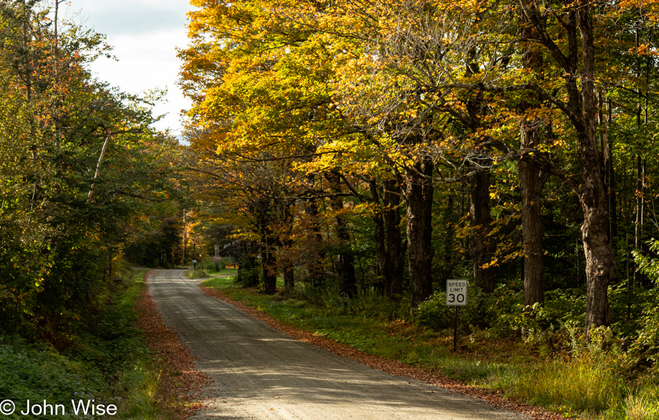
Pissamare Falls on the Coastal Trail in Terra Nova National Park, Newfoundland, Canada

We are back on the Coastal Trail, but at the other end, where the Pissamare Falls are located.

Coastal Trail in Terra Nova National Park, Newfoundland, Canada

By the time we leave Terra Nova later this afternoon, we’ll have walked approximately 7 miles (11km) of the trails in the park, leaving about 42 miles (67km) of trails to explore should we return to Newfoundland. Is this Reason #9? Let’s ask Caroline. [I’d love to come back and, this time, climb all the way to the top of the… oh wait, we’re not there yet! Keep going, gentle reader. Caroline]
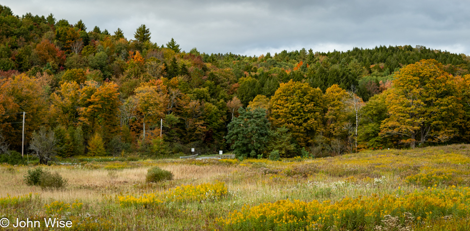
Fire Tower at Ochre Hill in Terra Nova National Park, Newfoundland, Canada

Our second-to-last destination for the day is the fire tower at Ochre Hill. When we arrived at the tower, it was a bit more overcast than seen here, but the sky had time to clear while we talked with a German couple who’d been traveling around North America for months in a camper van they had shipped over from Germany. After talking with them for a solid half-hour, another couple came walking around a corner, who also turned out to be Germans. There we were, five Germans and an American, not a Canadian in sight – what are the odds? [Even funnier was that they were all from Bavaria – Caroline] Before leaving, Caroline wanted to go up the tower. She made it two-thirds of the way before the metal grating that allowed her to see the ground below and the strong winds convinced her she’d seen enough. The photo of the view she took is terrific on her phone, but should you want to see just how terrific it is, visit Terra Nova for yourself. It’s well worth the effort.
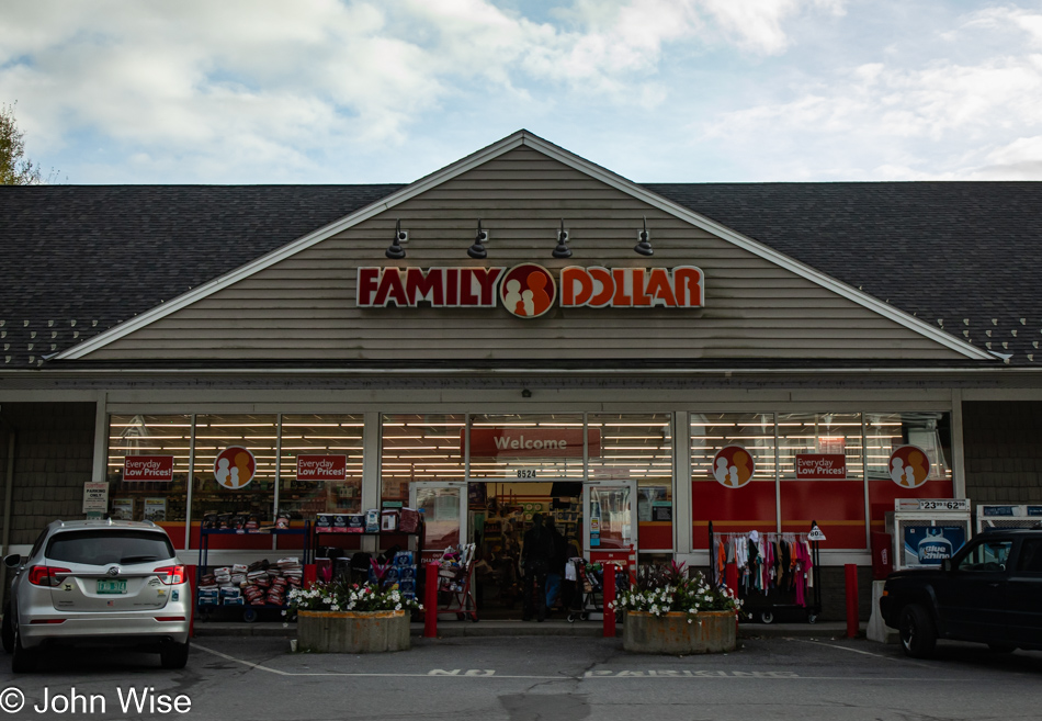
View from Ochre Hill in Terra Nova National Park, Newfoundland, Canada

My fear of heights stopped me from stepping on that tower. There were witnesses below who might have noticed my display of fear. I preferred to be aloof and appear not to care about such things because I’m an idiot. This view sucks compared to what my wife saw.

Ruffed Grouse near Ochre Hill in Terra Nova National Park, Newfoundland, Canada

On our way down Ochre Hill, this ruffed grouse was apparently trying to figure out life because right there on the road with our car heading towards it, it seemed to be contemplating its options. I expected the bird to skedaddle as I stepped out of the car and that my opportunity to get a closer shot would be lost, but no, it just moved around and continued to pose for my camera. That only lasted until I pressed my luck, trying to get even closer to capture more details of this gorgeous bird.

Red Admiral Butterfly at Sandy Pond in Terra Nova National Park, Newfoundland, Canada

Our seventh and final location in the Terra Nova National Park today is at Sandy Pond, where we encountered another winged object of beauty, this red admiral butterfly. I suppose this place right here is a good spot to note that a few days ago, Caroline learned of the passing of her dear friend, Sandy Gally. The two met on August 8, 2008, at a natural dying workshop in Blue, Arizona, and have been friends ever since. Sandy had experienced health issues for some time, but still, like so many deaths, hers arrived out of thin air in some ways.

Sandy Pond in Terra Nova National Park, Newfoundland, Canada

It took Caroline a few days for the news to sink in, and it was here in the park that she felt the first inklings of grief and the loss of her friend.

Sandy Pond in Terra Nova National Park, Newfoundland, Canada

I just learned a lesson about writing. It’s difficult to come back from sharing information about a friend’s passing to the flow of discovery and delight.

Sandy Pond in Terra Nova National Park, Newfoundland, Canada

Mortality, though, is an important topic, one that I’m well aware of and consider often, possibly too often. At 61 years of age, with some morbidities potentially accelerating my demise, I cannot ignore the significance that on my horizon stands an exit, hopefully, a distant one. That portal may not be paved with the verdant cover and abundance of life growing out of what has come before it, such as we see in the forest. My death is not of much concern to the inevitable state I will fall into, as I understand that any potential future will not include my presence at some point yet to be determined, but there is the matter of what I leave behind. I don’t mean the fertilizing potential of my ashes or remains; I’m more concerned about the woman who will find herself alone. True, the reverse could be my situation where unexpectedly, she departs before me, skipping out on the pain of being without the other who has brought so much shared joy into each other’s life. On the other hand, this is a futile exercise of thought, as none of us have figured out how to read the future, and we never know the fate that awaits us, even what tomorrow or the turning of the next corner has to offer.

Sandy Pond in Terra Nova National Park, Newfoundland, Canada

For now, the next corner offers ferns in a light that begs for capturing by my lens and putting away those other thoughts that are, at best, amorphous and entangled in a complexity of threads that have no resolve.

Sandy Pond in Terra Nova National Park, Newfoundland, Canada

If AI is to be trusted (and why shouldn’t it?), this lichen is likely known as Old Man’s Beard, and I suppose mine resembles this description, so I’ll go with it and state that unequivocally and without a doubt, this is Old Man’s Beard.

Sandy Pond in Terra Nova National Park, Newfoundland, Canada

There are moments when we are on these trails and then again when we are at home looking at these images that we are absolutely incredulous that we were allowed to be here, that we had the wherewithal to place ourselves in such an environment, and that life has smiled so kindly upon us that this was our fortune. We are not millionaires; we have not inherited a thing, and we must sacrifice other things to bring ourselves into these rare experiences. How rare? Only about 40,000 people visit this national park annually, so just how many actually bring themselves out on this particular trail that is merely one of a dozen? It is more common in the United States to be a millionaire, as there are nearly 25 million of them, but we are part of that tiny group of 40,000 who know a fraction of the delights found here in Terra Nova.

Sandy Pond in Terra Nova National Park, Newfoundland, Canada

Add to this that we are likely the only humans who have or will have ever seen these mushrooms, and this should inform you of the kind of wealth we collect. These are our unicorns, our genie in the bottle, the found diamonds in the rough waiting for our arrival.

Sandy Pond in Terra Nova National Park, Newfoundland, Canada

Black spruce trees are a certain indicator that we’re in a boreal forest, also known as taiga. Dwarf plants and low shrubs make up large parts of the biome in these ecosystems due to the poor soil quality following the last ice age when glacial activity scrubbed these lands clean. Almost shocking for me was to learn that this type of environment is only about 12,000 years old, coinciding with those retreating glaciers and that they are the second in size only to deserts, covering 11.5% of Earth’s land area. Not only is the black spruce popular for making chopsticks, it is the provincial tree of Newfoundland and Labrador.

Sandy Pond in Terra Nova National Park, Newfoundland, Canada

Recently, one of my social media feeds that drops random bits from history brought my attention back to Tollund Man, the 2400-year-old body found in the Bjældskovdal peat bog in Denmark, which had me thinking about our encounter with bogs (actually, I think we were visiting fens) and the sphagnum moss at their surfaces that is the most obvious indicator of the peat below. The difference between a bog and a fen is simple: a bog relies on precipitation for water, while a fen receives its water from the ground or accumulating flows draining from a slope or accumulating in a depression. This took me on the chase to learn more, and I found that these types of moss contain antimicrobial phenolic compounds that are high in acidity, have tanning properties, and are conducive to preserving things, including peat itself. Without peat, whiskey aficionados wouldn’t enjoy the same drink, some cultures would have gone cold with no other source for keeping a fire in their hearths, and a vast store of carbon wouldn’t exist. I wonder where else this exploration of sphagnum moss would go if finishing this post wasn’t my objective.

Sandy Pond in Terra Nova National Park, Newfoundland, Canada

Sometimes, when you find the name of a plant, you want to share it for no other reason than that it’s an interesting one. This is royal dwarf sheep laurel.

Sandy Pond in Terra Nova National Park, Newfoundland, Canada

Being in a national park, we knew better than to harvest anything, but upon getting home, I threw some Labrador tea into a shopping cart so we could try the drink popular with Athabaskans and the Inuit.

Sandy Pond in Terra Nova National Park, Newfoundland, Canada

Circling around the eastern shore of Sandy Pond, we are reaching the end of the trail and are beginning to look forward to a break from our race to see as much of Terra Nova as we have.

Caroline Wise at Sandy Pond in Terra Nova National Park, Newfoundland, Canada

Maybe the name Sandy Pond should have made it obvious, and then after we arrived, the signs pointing to the swimming area could have been another clue, but a sandy beach was not in my book of expectations.

Sandy Pond in Terra Nova National Park, Newfoundland, Canada

We had one more raised boardwalk to traverse before returning to the parking lot, and again, outside of my expectations, there was this series of ponds to the east of Sandy Pond. I shot 480 photos on this day, and while sitting in a coffee shop writing this post a couple of weeks later, I cannot remember the circumstances surrounding this waterway, but I had an inkling of a memory that told me to check those photos I’m not including from that day. Sure enough, just before this series of four images stitched together in a panorama, there was a close-up shot of the entangled mess of branches that formed one small part of the beaver dams sequestering the waters we are walking above.

Hodderville, Newfoundland, Canada

Sometimes, our ability to execute our movements in coordination, allowing for the most accurate chasing of remaining light, hits the mark. Our stop at an Esso Station in Lethbridge also hit that mark, where I spotted a sign for the Dairy Bar that claimed to have dozens of soft serve flavors. Caroline tried insisting that we needn’t stop, but I prevailed, and lucky for her, I did. She left with a maple and blueberry mix of soft serve, and happiness doesn’t begin to describe her joy. We made one error, though: we paid before ever looking at their selection of hard ice cream, and they had Grape-nut ice cream. In addition to the maple soft serve her friend Christine had recommended, Caroline had also read about tiger tail and Grape-nuts ice creams on one of her favorite Internet sources, Atlas Obscura, and here it was. I ordered a scoop so we could try it, knowing that we’d probably throw most of it away, considering how much soft serve she had in the cup she was already eating. To my astonishment and her regret, she finished both.

Hodderville, Newfoundland, Canada

From the randomly painted trash bins in front yards to boulders and mailboxes, Newfoundlanders enjoy adding a splash of color to their environment.

Red Fox at Hodderville, Newfoundland, Canada

We were on a detour, not a big one, but one that was taking us up the west side of the peninsula where, in Hodderville, we encountered foxes that appeared far too familiar with passing humans, as in they were looking for handouts. This was our first time seeing black foxes, and while I got a photo of them, it was on the street, and this pretty red fox in the grass looked sweeter.

Russelltown Inn in Bonavista, Newfoundland, Canada

What a lovely room we checked into at the Russelltown Inn in Bonavista, but if we were going to have a hot dinner, we needed to get moving right back out of our luxury accommodations. A quick scan of options showed me that the Boreal Diner was our best bet, but they recommended reservations. I called, but they couldn’t seat us for another hour. But we could sit at the small 4-person bar immediately, and with that, we locked our room and walked over. Going over the menu, it only took a moment to decide on the 5-course tasting menu until we waffled, considered a 3-course variation, and finally settled on sharing the 5-course while adding an extra scallop appetizer and a tasting size portion of the maitake, carrot polenta, and mint sauce entree.

The restaurant is in a small two-story house and is an absolute gem, surprising us that something so grand should be in such a small town of 3,200 people. The scallop appetizer was the only dish that was wanting; it needed something, but it wasn’t there. No matter, the local bluefin tuna appetizer was amazing, especially the emulsion made from bluefin tuna bits and bobs. The duck preparations, one with a fennel puree and the other with a parsnip puree, were both perfect. The maitake dish hit its mark, and finally, our final entree was the seared ribeye cured in koji served with pickled mushroom puree, celery root, and pickled shallot. Remember all that ice cream and soft serve? That didn’t stop us from ordering dessert, one of which came with us; yes, we ordered two because we couldn’t settle on one. The blueberry cake was packed up, and the strawberry cake with local strawberries and a scoop of partridgeberry sorbet was packed in. It seems futile to point out that this was one more epic day in a sequence of epic days.

Fogo Fail with a Twillingate Twist

Birch trees outside of Deer Lake, Newfoundland, Canada

I’d love nothing more than to start this new day with a sunny report of how the unfolding wonders of amazement greeted us, and of course, I have the option to sanitize my notes because there’s no contract saying I have to share the screed I noted at breakfast, but maybe there’s something to learn from them as I age, so here they are: “A large group of seniors were already at the small buffet-style breakfast room. From the looks of the bus out front, this was a group tour. They are retirees acting in ways that reinforce my ideas that I’m not cut from the cloth that allows me to perform with the herd. Our ages are not all that different, but this cattle call involving a bunch of people in their late 60s, 70s, and 80s who are slipping into motion that mimics those of sloths while they don the cloaks of befuddlement with a lumbering oafishness makes me bristle. Like oblivious, self-absorbed teens, they are no longer aware of the world around them; their group has become a cocoon, isolating them from anyone who might enjoy exercising their determination to do things before their next birthday, still many months away. I am not one for group tours, cruises, stadium events, or anything else that pulls together a large mass of doltish troglodytes. I’m afraid this leaves me sounding like a grumpy old man. Yeah, I guess the shoe fits; if only I could use it to kick some of these people to the side.”

Grand Lake in Newfoundland, Canada

These moments act as a strong reinforcement of the need to remain active, be engaged and aware, maintain alertness, and work hard to hold on to the mental faculties that best exercise the mind. There are caveats I’m well aware of regarding this mantra, and they relate to issues with myself or my wife that I can’t anticipate where something or other will befall us, limiting mobility, intellectual acuity, or stamina, maybe everything all at once. In the arrogance of relatively good health, I can claim that my time in the world will, at some point, have to suffice as the totality of major experiences acquired to that point of a kind of disability, but what if I’m not satisfied at that time, what if I desperately need one last hurrah? Maybe that is the commonality of those on the bus tour, though I don’t think so. To keep speaking from my ass, I believe they all waited until retirement age to start living their dreams, and somehow that translates into, “I no longer have to be in a hurry for anybody else, nor do I have to demand a damned thing from my brain as my mind and body have worked enough during this lifetime.” Again, this compels me to rage against allowing myself to languish, so maybe the lesson they inadvertently teach me is more valuable than the guilt I feel for writing such rubbish and demonstrating my gross intolerance.

Birchy Lake, Newfoundland, Canada

It’s time to move on. It was 8:00 when we finally left our hotel, filled the gas tank, and replenished the ice chest. The first photo was of birch trees. Why did we need a photo of common birch trees? While they are found in Flagstaff, Arizona, and other corners of our state, they are not to be found in the Phoenix area, and six months from now, would we remember the trees we saw in Newfoundland? As for the lake mirroring the clouds, that is Grand Lake. Finally, with only a few birches visible in this photo, we are at Birchy Lake.

Birchy Lake, Newfoundland, Canada

While looking at the map at today’s locations, I saw Reason #5 for our return to Newfoundland, which Caroline discovered yesterday: it was at Roddickton-Bide Arm on the eastern side of the Great Northern Peninsula and is known as the Underground Salmon Pools. Let your imagination work on that one. Anyway, we are still at Birchy Lake for obvious aesthetic reasons, that and the black bear that scooted quickly into the woods next to where I’d pulled over. Thinking better of getting out of the car so close where it might still be lingering, I drove back to the other side of the bridge we’d just crossed and took up a place there, not only gazing upon the perfectly still waters of the lake but also eyeballing the treeline across the way in the hopes that the bear would show its face. I never saw the bear again, but rest assured that its backside was a mighty fine example of bear butt.

Greenbay overlook, Newfoundland, Canada

There’s an inherent danger when, after a vacation, I turn to writing these posts. (Of course, that’s if I fell behind while we were traveling, which I did.) That danger occurs when I turn to maps to study locations that may be visible in the distance of the image I’m writing for. That’s exactly what just happened; instead of isolating my focus on the Green Bay Overlook with a view of the arm of the sea that ends near South Brook, I let my eye wander and ended up exploring parts of the southern coast of Newfoundland. Actually, I fell off of Newfoundland into the sea and saw the islands of Saint Pierre and Miquelon, which, while served by ferries from Newfoundland, are not Canadian at all but French. After exploring the islands using StreetView, I’ve found Reason #6 for our return. Then, while not immediately obvious, if you zoom in on southern Newfoundland, you’ll find roads that lead down to Burgeo and Seal Cove, places I thought were simple place names without populations that might be visitable via watercraft. Nope, we can drive right on down there, but is this Reason #7, or should I lump it into #6 as it was part of drifting from the area I was supposed to be studying?

Goodyear's Cove Park in South Brook, Newfoundland, Canada

It was so pretty from afar that we had to get a better look, and the Trans Canada Highway we were traveling on led us right to Goodyear’s Cove Park; it was an easy and quick pull-off. There is some confusion going on here, so please, if any Newfoundlanders should read this, I’d swear that we read Green Bay Overlook on the previous photo, but my map sleuthing skills say this is Halls Bay, and though we are at Goodyear’s Cove Park, we are in front of Wolf Cove. If you are confused, so am I.

Goodyear's Cover Park in South Brook, Newfoundland, Canada

What is not ambiguous is that the water is crystal clear, and this must be a great place to camp, aside from the likely road noise that might be ever-present over the evening. Here I go again: I revisited the maps, looking for a campground farther north, but instead, I found more islands and a place at the end of a road over on Snooks Arm called Brent’s Cove. I’m starting to think it would have been advantageous to have finished all the writing I’d ever do about this vacation while we were still at each location because this post-travel exploration is having me project these images and memories on new locations that are convincing me that we must make every effort to visit the farthest corners of this island of Newfoundland.

Eagles off Trans Canada Highway, Newfoundland, Canada

The juvenile bald eagle on the lower branch is laughing at me and how easily distracted I am by the next shiny object, while the one above is giving me the side-eye and saying, get serious and stop daydreaming. There is serious stuff that needs to get done.

Near Rocky Brook, Newfoundland, Canada

Go north for a while, go south, north again, then east, a little south, a bit north, and some more eastward stuff before more north. Is there a straight line on this island? This pond was near Rocky Brook, almost perfectly south of South Brook.

Near Rocky Brook, Newfoundland, Canada

We weren’t back in the car 15 seconds before Caroline told me how much she’d like me to turn around, asking, “Didn’t you see that deep red tree?” I had, and maybe I wanted to ignore it, even though I, too, knew it was this side of incredible.

Near Rocky Brook, Newfoundland, Canada

Not even a mile farther down the road, Caroline is voicing how she hopes she doesn’t forget how beautiful all the trees are, their layers, colors, density, and different tops. Believing this to be code for me, I stopped the car without her needing to demand it. I pulled over so both of us could get out to admire more trees.

Rattling Brook Road on way to Norris Arm, Newfoundland, Canada

I don’t need a lot of persuasion to leave the TCH (Trans Canada Highway) and take the detour Caroline found on the map, which she assures me is a short loop back to the main road. With a lovely name, it was easy for her to find my agreement to travel a short distance on Rattling Brook Road.

Rattling Brook Road on way to Norris Arm, Newfoundland, Canada

Sure, this photo is a bit abstract, but the glass insulators were a novelty to us. If we have seen such things on previous trips, somehow they didn’t tug at our attention in the same way, or maybe it was the gorgeous blue and white sky coloring them in just this way that was the inspiration.

Rattling Brook Road on way to Norris Arm, Newfoundland, Canada

The loop might only be seven miles, but at the rate we are stopping, we’ll turn a 15-minute drive into an hour of investigating everything along the way, which I admit is one of the luxuries of traveling on a road nobody else seems to be using today.

Farmers Market in Norris Arm, Newfoundland, Canada

We were nearly back to the highway before Caroline’s incessant whining about having passed the farmer’s market in Norris Arm convinced me, if only to stop the wailing next to me, to turn around for the excruciating two-mile drive back. Anything for the wife, right? I’ve got to admit that this return had a big impact on our vacation because it was here that we would leave with about 4 pounds of fresh partridgeberries, a jar each of pickled cabbage and spiced carrots, and a jar of cooked seal meat. The seal flippers that were being advertised were fresh, but there was no way they’d survive in our ice chest for the next two weeks before they’d be unpacked in Arizona. As for the fresh partridgeberries, a farmer assured us they would easily survive on ice. We were on top of the world and maybe a little apprehensive about whether we’d like the flavor of seal. Well, the Newfoundlanders love it; hopefully, we’ll understand why after we get home.

Loon Bay, Newfoundland, Canada

You’ll never be able to appreciate the glee, joy, and absolute delight Caroline was feeling at this location, knowing that she was at Loon Lake, a place honoring all loons, such as herself.

Ferry to Fogo Island at Farewell, Newfoundland, Canada

This is the line at Farewell Harbour for the ferry to Fogo Island, and from the title of today’s post, you should already know that this means something was going to fail with our plans for an overnight stay. One of the ferries that works the route broke down, creating a huge backup, meaning that it would be at least six more hours before we arrived on the island and that by that time, between 9:00 and 10:00 p.m., it would be impossible to get something to eat. Then we had to consider that even if we broke open our jar of seal meat and spiced carrots, we’d still have to contend with the possibility that leaving the island might be just as difficult, and that would put us in a bind of reaching our next destination in a reasonable amount of time. So, we called the Airbnb host to explain the dilemma. She was gracious and understanding enough to let us bail out on our commitment. I can’t imagine the trouble this unreliable ferry must cause for the $2,000-a-night Fogo Island Inn, with a two-night minimum stay when guests spending thousands to be there can’t reach the island in a timely way.

Llama near Port Albert, Newfoundland, Canada

Distraught at losing this lifetime opportunity to visit Fogo Island, we consulted the frolicking Magic Llama of the Newfoundland Heather as to what our course of action should be. With simple and clear instructions, it pointed west and blinked four times, signifying we had to cross over the water to a fourth island from where we sought this guidance and then telepathically flashed the word Twillingate into both of our minds. We understood our new course and set the proverbial sails for points unknown. A new adventure was upon us, and the disappointment of missing Fogo Island was dissipated, thanks to Magic Llama.

Hillgrade, Newfoundland, Canada

We crossed over the uninhabited Chapel Island onto New World Island, where we thought we were about to enjoy some lobster in Hillgrade at the Sansome Super Lobster Pool. With the name lobster featured so prominently, it seemed obvious that we’d be eating lobster, right? Well, this close to the end of the season, there was no lobster to be had from the super pool, and though the host assured us that the fish and chips were awesome, we maintained our resolve to find something better. Plus, it’s ugly confession time; on the way to the ferry earlier, hungry for lunch and without any other options, we stopped at a McDonald’s, giving in to the incessant advertising for the new Big Arch, their Biggest Burger Ever, and the biggest culinary mistake of our vacation. Hours later, the tangy sauce was lingering as though it was mocking us for falling for an advertising campaign that proved effective against our puny minds.

Walter B. Elliot Causeway to Twillingate, Newfoundland, Canada

Leaving one island for the next, this time, we were heading to South Twillingate Island.

Twillingate, Newfoundland, Canada

The rugged rocky shore, small waves breaking into white, frothy surf on top of the blue sea under blue skies, and the lush green island separating it all lend significance to a spectacle of beauty that has this welcome to historic Twillingate feeling heartfelt.

Prime Berth in Walter B. Elliot Causeway to Twillingate, Newfoundland, Canada

The Prime Berth Twillingate Fishery & Heritage Centre was already closed as we were passing by, which was unfortunate as we’d loved to have checked out the whale bones. While they are interesting to us, this does not rise to the level of bringing us to Reason #7 for a return. So you understand, we will require 12 solid reasons for our return unless I change that criteria to six should I fail to get the Maritimes out of my head.

Caroline Wise looking out at Twillingate, Newfoundland, Canada

Halfway, give or take a bit, between South Twillingate and North Twillingate.

Twillingate, Newfoundland, Canada

View of the Little Wild Cove from North Twillingate, our fourth island on this trek.

Twillingate, Newfoundland, Canada

These accumulations of experiences, sensations, images, and memories gather a momentum that, when framed within a filter of exuberance, can have the effect of convincing us that we’ve peered into a corner of the universe where we can convince ourselves that we’ve experienced a kind of perfection demanding our return. This is often most obvious after visiting places like Disneyland, tropical islands, and deeply historical locations such as the Vatican, Rome, Athens, or Machu Picchu. Maybe tragically, this attraction and encounter with the ideal can persuade people that they no longer want to risk not experiencing the same thing again, and so they return over and again, looking for a repeat of that treasured experience. Something within Caroline and me has allowed us, maybe spurred us on, to risk disappointment while hoping for an outcome that will give value to our investment in going to new places, which is certainly happening here in the Maritimes.

Crow Head, Newfoundland, Canada

We’ve reached the end of the road; we can go no further. Somewhere out before us and across the Labrador Sea is Greenland, and if we turn our gaze slightly to the right over the Atlantic Ocean, Ireland can be found on a very distant horizon.

Long Point Lighthouse in Crow Head, Newfoundland, Canada

Is it just me, or does the Long Point Lighthouse at Crow Head look like a vintage square milk bottle?

Long Point Lighthouse in Crow Head, Newfoundland, Canada

Seeing that we’d not be sleeping on Fogo Island and getting a room out here in Twillingate would cut our time at the Terra Nova National Park, we decided to take advantage of being able to be farther along on our journey in the general direction of the park and turned our focus on pushing on to Gander for the evening. From our perspective, arriving after dark, Gander has very little to offer. Take a gander at the top things to see or visit in Gander, and you’ll notice that it’s mostly nothing. I don’t mean to diss the town; it seems to be there primarily due to its airport and its purpose during World War II and hasn’t found another reason to exist since then aside from being a stopover for those traveling the Trans Canada Highway. It did provide us the opportunity to eat at Jungle Jim’s Bar & Eatery, which we’d seen plenty of advertisements for during our short time here in Newfoundland, probably because they have a couple of dozen locations spread out between here, New Brunswick, and Nova Scotia.

Thrombolites and Ophiolite – Newfoundland

Gros Morne National Park in Newfoundland, Canada

A week ago, we met Bob and Sandra Alston on their farm in New Brunswick and learned a few things about covered bridges, their farm, and tourism in the Maritimes. When we told them that our trip would take us all the way to Newfoundland, the two of them, nearly simultaneously, asked if we’d be visiting Flowers Cove. Hearing that we knew nothing about the location, they enthusiastically shared details of their first visit to this fossil site on the Great Northern Peninsula of Newfoundland and that thrombolites were the main attraction. I assumed they meant stromatolites, as found at Shark Bay, Australia, which certainly piqued our interest. We noted it and started looking into the place after we drove away. Following our itinerary, we had planned to visit Gros Morne National Park, about 75 miles (120km) north of our hotel today, while Flowers Cove was 228 miles (367km) farther north. Adding a few hundred extra miles of driving would mostly eliminate a proper visit to the national park.

East Arm in Gros Morne National Park in Newfoundland, Canada

After last night’s terror storm and this morning’s forecast for “cloudy with a chance of more rain,” we decided to opt for the rare opportunity to visit one of only two sites on earth where this type of fossil is located instead of hiking under gray skies. Certain that this was the better option for spending our first day in Newfoundland, we were off shortly after sunrise. There is a dilemma buried in this decision because Gros Morne, a world-renowned site known for its spectacular beauty, was supposed to be the first national park we’d visit in Newfoundland, and I had planned some great hikes for us, yet here we are, heading to a relatively unknown location, to us anyway, whose only promise was that we’d be in the car for a majority of the day, though at least not in the rain.

Gros Morne National Park in Newfoundland, Canada

The cloud cover breaking up above us does nothing to change our intention to visit Flowers Cove because, by now, we are excited to see the lumps of cyanobacteria fossils awaiting our visit.

Gros Morne National Park in Newfoundland, Canada

We are sacrificing four hikes in the park today under increasingly beautiful skies, not the gloom we were threatened with earlier. I have to wonder about this process that predicts bad weather only to be replaced by heavens of blue punctuated with little fluffy clouds. I know the answer: it is the dynamic energy created by the presence of the two of us and our overwhelming abundance of love that thwarts the weather gods’ ideas of putting a damper on our parade, thus allowing the universe to entertain us with joyful brilliance during our explorations.

Gros Morne National Park in Newfoundland, Canada

Not knowing if the heavier clouds would remain at bay, the idea motivating the frequent stops was to capture as much of the emerging beauty of the Great Northern Peninsula we were heading into. Not knowing if we should ever again have an opportunity to explore such a remote land, we need to go slow and take in as much as possible, which isn’t performed efficiently when in a moving car, though I’d argue that a little something and even weak first-hand impressions are better than nothing.

Gros Morne National Park in Newfoundland, Canada

Looking across the landscape, the most evident feature to pick up on is the need to linger here, there, and everywhere. These momentary glances do not allow the environment to sink in properly, and by now, we are well enough traveled to understand that relatively brief visits will not permit these sights to penetrate our minds with a deep level of familiarity where we gain a sense of knowing the place. We would require a solid week or more, just in this general area, watching the weather come and go while inching across the shore, trails, and mountains to see and hopefully feel the tiniest fraction of understanding where we are. That, though, is not what life offers us. We have limited amounts of time to dedicate to such pursuits with equally limited budgets. That is the reality of tempering what one desires against the circumstances of what one can achieve.

Gros Morne National Park in Newfoundland, Canada

In years past, when we began to understand the calculus of time and budget against the constraints of lifespans, health, and curiosity, it was a conundrum to me that we are not awake at an earlier age to understand the value of what is obtained when experiencing the novelty found in new places, foods, conversations, ideas, and the struggle to learn how to be open to such things. Instead, we trade delight and a greater potential for happiness for consumer certainties that are supposed to deliver the ecstasy of existence, but that’s a marketing lie intended to mold impressionable people into obedient consumers requiring therapy, alcohol, pharmaceuticals, and illicit drugs so they can mask the ill effects of a life that seems to be failing to bring joy. Please believe me; I’m well aware of my pollyanna-esque and overly idealistic viewpoint that everything is healed and made better by falling into new experiences. We also require a fair amount of education to decipher the world we are out discovering, and simple survival isn’t always an easy way forward, but the majority of North Americans I encounter have skewed, broken, and downright deranged views about where happiness can be found. And while one size does not fit all, there are universal truths, such as the fact that humans must look out and forward, that we must feed our senses with new information, and that most of us are easily delighted when seeing rainbows, leaping dolphins, wagging dog tails, and the smiles of babies, so, while we may not be adept at appreciating the face of big nature, I believe that’s because we are not familiar enough with such pleasantries.

Gros Morne National Park in Newfoundland, Canada

This is not a television episode, nor is it a TikTok clip; it’s not a sporting event or a job promotion. It is simply the sea reflecting the sky bordered by mountains, cliffsides, grasses, bushes, and two pairs of eyes admiring the idyllic beauty of a Newfoundland landscape that is absolutely new to the senses of the people owning those eyeballs. Should you be foolish enough to read this stuff, you must sometimes ask if any of this is what’s flowing through my head at these precise moments. The answer would be a combination of yes and no because much of this is written after our visit, and some of the thoughts arise from my observations about why we were alone out here and why, at home, I seemingly never find people to eavesdrop on who are extolling the magnitude of experiences found in places of great solitude.

Lobster Cove Lighthouse in Rocky Harbour, Newfoundland, Canada

Then, there’s the contradiction of my words compared to what we enjoy while often being the only visitors to a destination. I say through one side of my mouth that others should be out here sharing the experience, then we run into another couple who were out here before our arrival only to have us intruding on their solitude and me feeling as though they were somehow going to spoil our visit.  So, what do you want John? Total isolation or a vibrant bunch of fellow travelers? And what if they end up being tourists? These are the conundrums facing places like Venice, Italy; Santorini, Greece; or Barcelona, Spain, that have become victims of their success in attracting visitors, and if over-tourism were to occur out here on the Great Northern Peninsula of Newfoundland, my experience would surely suffer. All the same, I still believe I’d enjoy having others to compare notes with who also share this profound love Caroline and I have for places of stunning beauty. [We did end up chatting with the other couple for a while, something that would happen over and over on this trip: good conversations with friendly strangers, whether people working the shops and hotels or fellow travelers. – Caroline]
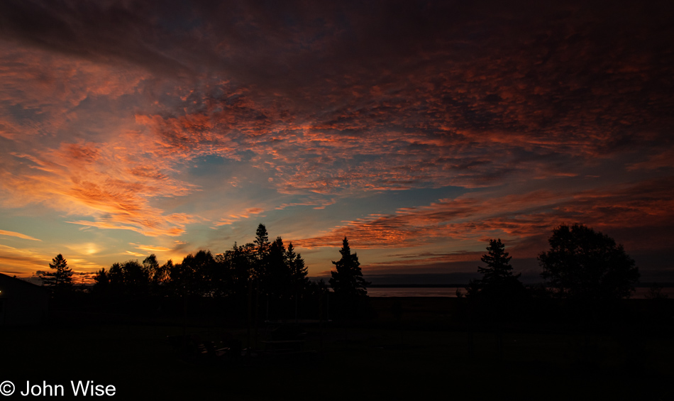
Highway 430 in Newfoundland, Canada

After writing the last few paragraphs, I’ve been struggling and considered eliminating them more than once to allow a more poetic jaunt in penning the words that might relate some of the awe-inspiring and stark beauty playing a central role in this landscape. This, though, is my public journal, where I have near-total control over the conversation I’m having with myself. I say near-total as my wife (editor) has worked hard to help me avoid the embarrassment of veering into being a total noodge stuck in the depths of crankiness that would overwhelm the better parts of the dialog I present here.

Gulf of St. Lawrence off Highway 430 in Newfoundland, Canada

Today’s survey of this remote peninsula will not include L’Anse aux Meadows National Historic Site further north. During our travel planning, the idea of dedicating a day of driving over 300 miles (482km) to the UNESCO World Heritage Site, a day to wander the grounds, and a day of returning to where the drive would have begun seemed excessive to visit an archeological recreation of what might have been there about 1,000 years ago. Now, after seeing this landscape, I’d like to look out over the area where the Labrador Sea meets the Atlantic Ocean to consider what Leif Erikson and his explorers might have been seeing and encountering nearly 500 years before Christopher Columbus landed in the Americas. When the Vikings came here, Indigenous inhabitants known as the Beothuk people already lived on the island, but they didn’t survive later European encounters. The last Beothuk people died in 1829. While Flowers Cove is only 75 miles (120km) from the site, the timing cannot work today as we are already pressing into the late day with this change of plans. We’ve not been in Newfoundland 24 hours yet, and we already have two places on the map drawing us back for a return visit, Gros Morne and L’Anse aux Meadows.

Highway 430 in Newfoundland, Canada

All travels are a bridge to somewhere, and if a tiny morsel of phone connectivity allows for internet searches, you can rest assured that Caroline will be on the hunt for important stuff, such as our next stop.

Caroline Wise at Skivvers Fibre Studio in Cow Head, Newfoundland, Canada

In a peculiarly named tiny coastal town called Cow Head, with a population of only about 500 people, Caroline found the only yarn shop on the Great Northern Peninsula; it is called Skivvers Fibre Studio, and they were open. Before even looking at a single skein of yarn, Jessica, the young lady operating the shop on this day, offered to show us around with our first stop at a pan of recently harvested Japanese indigo leaves grown by the owner, Veronica Bavis. Walking into the shop’s dye lab, we passed a couple of looms and at least one spinning wheel, and we were both surprised at the level of sophistication and capabilities working here at such a remote outpost and in such a tiny space. As the conversation moved through the various fiber arts, the quest for local yarns was voiced, and we were shown the very limited quantities. Three handspun hand-dyed skeins were on hand, and we chose the yarn dyed with logwood and cochineal and a skein of a natural color blended with odds and ends from needle-felting roving spun into it. They were spun with Newfoundland heritage wool. The black skein of uncertain origin was left on the shelf.

But there was more: we don’t visit faraway yarn stores without me grabbing at least one skein of sock yarn, and today was no different. I opted for a black walnut bark hand-dyed 75% Superwash Merino wool with a 25% nylon blend (that last part is for durability, and trust me, you need that nylon). Caroline also picked yarn for a pair of socks for herself, dyed with cochineal and various flowers. Finally, a group called Fleece Artist from Halifax, Nova Scotia, created a series of yarns with colorways based on the hues and tones found in some of the most famous Canadian national parks. This skein is for Claudia over in Germany, inspired by the colors found in the Gros Morne National Park we’ve been driving through this morning.

Indian Pond near Hawks Bay in Newfoundland, Canada

Having spent a considerable amount of time at Skivvers, only halfway to Flowers Cove, we had to press the gas pedal and stop dillydallying. An hour later, we were at Hawke’s Bay with another hour to go before reaching our destination if we could resist stopping for more photos.

Near Barr'd Harbour in Newfoundland, Canada

That intention didn’t last long when we stopped for this shot only 20 miles further north. We were looking up the road from near Barr’d Harbour.

Deadmans Cove in Newfoundland, Canada

Another forty miles, and if for no other reason than its name, we had to stop to memorialize Deadmans Cove. The vantage point is failing us as it’s not adequately showing the glacially shaved rocks just offshore that are mostly a uniform height and were the real draw that had me pulling over. When considering the effects of the last ice age, it’s dumbfounding to think that there were between 1.2 and 1.9 miles (2 – 3km) of glacial ice covering these lands, and to this day, the northern side of the island is still experiencing a post-glacial rebound where the land is rising. I don’t know how others’ imaginations work, but the idea that I could be standing in front of a wall of ice between 6,300 and 10,000 feet (2,000 and 3,000 meters) directly in front of me, stretching high into the sky, baffles my senses to their core.

Bear Cove in Newfoundland, Canada

Another mile and Bear Cover near Salmon Rock was making such a perfect reflection of the dramatic shift in the sky that an extra minute added to the drive wouldn’t matter. Plus, we were now only three miles away from the thrombolites.

Lichen at Flowers Cover in Newfoundland, Canada

This is and isn’t a thrombolite; more importantly, it is not a stromatolite. This lichen has taken up a position on a thrombolite, but this doesn’t offer any clue about the size and shape of these extraordinary 450- to 470-million-year-old fossils. For age comparison, dinosaurs existed between 66 million and 245 million years ago.

Thrombolite at Flowers Cove, Newfoundland, Canada

Cyanobacteria formed both thrombolites and stromatolites; the difference lies in how they fossilized. The thrombolites found here at Flowers Cove formed by a fossilization process where the structures in the cyanobacteria clumped together due to irregular periods of calcification. The Greek word thrombos means “clot.” On the other hand, stromatolites fossilize in a layered manner, also known as lamination, and show a clear, repetitive growth pattern. When these fossils were alive hundreds of millions of years ago, they were environmental engineers producing oxygen, sequestering carbon dioxide, and creating habitats for other early life. In effect, they helped pave the way for making the planet habitable for the explosion of life about to leave the oceans, coinciding with the emergence of the earliest land-based plant life.

Thrombolite at Flowers Cove, Newfoundland, Canada

Caroline stands in for the banana to show the comparative size of these fossils. If you look to the left, you’ll see a boulder sitting atop the fossils; it’s a glacial erratic, which, in case you don’t know, is a rock that a retreating glacier has transported here. If you think you are seeing another glacial erratic further to the left, that was a spinning-top mushroom-shaped thrombolite that appears to have broken off its foundation.

Flowers Cove, Newfoundland, Canada

Caroline and I each went our own ways to examine the details of the fossil field, looking for angles that somehow spoke to us. It’s not easy to take in and decipher the magnitude of what role these thrombolites played in changing earth’s chemistry so we’d one day be able to stand at the seashore atop these ancient reminders of what were once lifeforms and contemplate our place in the long tree of life.

Thrombolite at Flowers Cove, Newfoundland, Canada

Being here at low tide was opportune as it allowed us to investigate many more thrombolites that would at other times be surrounded by seawater, but even with the low water levels, getting to the other side south of where we were would have either required a boat, or a walk around deeper water to which our limited time was saying no. Even with a slightly shorter drive south (we were staying in Deer Lake about 35 miles northeast of where we began this morning), we still had close to 200 miles ahead of us before checking into our hotel. By the time we had snapped more photos than we could ever share, we’d spent a solid hour among the ancients and could have easily used a second hour.

Highway 430 near Plum Point, Newfoundland, Canada

I joked with Caroline that I was going to turn left as I’d decided at the last minute that we would have to visit L’Anse aux Meadows and that I didn’t care if we had to drive back in the dark, in the rain, risking hitting a moose or caribou, we needed to commit to driving that extra hour to take a peek, but I was joking, and she wasn’t falling for me trying to bait her. Instead, we are near Plum Point, admiring the dwarf trees after stopping for gas and soft serve.

River of Ponds, Newfoundland, Canada

This is the River of Ponds. Somehow, there’s a lot to unpack with that name that I can’t really understand even as I write this, but there’s something there. It’s funny how particular words or a sequence of words resonate differently with different people. Who hasn’t fixated on a word for a time because it strikes their ear in a peculiar way, staying with them for hours or even days and becoming an earworm? When Caroline and I were early in our relationship, there was something about my enunciation of the word “difficult” that struck her ear, having her share with me how much she enjoyed how it sounded. For a moment, the sequence “River of Ponds” says something to me, inexplicable in its construct but intriguing with what it paints in my hearing and thought.

River of Ponds, Newfoundland, Canada

Still on the same bridge over the River of Ponds, where you can see a pond in the background, while behind it, well out view, is the River of Ponds Lake that’s about 9 miles long fed by a series of other ponds all nestled in the forest like a series of Matryoshka dolls, except they’re made of water and each successive pond is not always smaller or larger than the next. Maybe my analogy was a bit of a leap, but if you consider the forest the container of variable-sized bodies of water, you might catch a glimpse of what I’m inferring.

Parson's Pond, Newfoundland, Canada

For the most part, we were driving straight through on our way south. This was in Parson’s Pond, about 10 miles north of Cow Head, looking north.

Moulting Pond in Parson's Pond, Newfoundland, Canada

We were pulling over again only half a mile further, this time in front of Moulting Pond, on the southern end of Parson’s Pond. Maybe I should point out that the body of water seen in the photo above this one is not a bay affected by the changing tides of the Gulf of St. Lawrence but the town’s namesake, Parson’s Pond, probably the largest pond I’ve ever seen, and we could only see a tiny fraction of it. Then, consider that this pond right here, of which you cannot see all, is possibly 1/20th in size compared to its giant neighbor.

Highway 430 in Newfoundland, Canada

While you can’t see it from here, nor could we, I thought I’d use this view that looks far into the distance to add a note about the future. Earlier in the post, I mentioned that we already have two reasons for returning to Newfoundland. Well, here’s a third. In the far north, east of the Viking site of L’Anse aux Meadows, lies Quirpon Island, with a lighthouse and the former lightkeeper’s home that now acts as an inn for a small handful of visitors. To get to the 1.5 by 3.4 mile (5.5 km by 2.5 km) tiny island, one of the three staff members picks up visitors in a Zodiac for transport to the island and a beautiful 3.4 mile (5.5km) hike after you land that brings you to the lighthouse. Meals are included, and while a bit pricey at $850 for two nights, it is high on the list of places to return to, and reason #3.

Highway 430 in Newfoundland, Canada

What do we sacrifice when knowing that we can’t have it all? Nothing, because even when finding the tiniest experiential morsel, we’ve already had it all. We must relish those things we have acquired from these ephemeral realms, knowing that impressions are all we are allowed to carry with us and that there is no possibility of pulling the magnitude of everything into our being. There will always be things undone, people unknown, conversations lost, and opportunities just outside of our grasp. We can focus on what is denied us, or we can find enchantment in the breadth of what has been won, achieved, and shared, as well as the potential of this new information to inform a better tomorrow.

Gros Morne National Park in Newfoundland, Canada

Here we are back in the Gros Morne National Park, and Caroline is recognizing that we have made such great time returning to where our day began that we might, after all, have the opportunity to collect an experience from the park that was at the top of the list of activities originally planned for today.

Tablelands Trail in Gros Morne National Park in Newfoundland, Canada

We arrived at the Tablelands trailhead at 6:30 for a hike that must be compressed into something significantly shorter than our typical indulgent hiking times if we were going to cover the 2.5 miles (4km) easy walk to the end of the trail and return to the car before dark. With no time to waste, we got moving, not sprinting, but not dawdling either. This is where the second unfamiliar word in today’s blog post title comes in: we are hiking on ophiolite.

Tablelands Trail in Gros Morne National Park in Newfoundland, Canada

Ophiolite is part of the earth’s mantle and can also be found on the ocean floor; neither place is easy to explore. Through uplift and the plate tectonics that move continents, this corner of Newfoundland features a large area of this rare bit of earth. The soils made from the various minerals that constitute ophiolite are poor in nutrients and high in toxic metals, so for plant life to take hold is a struggle, which is why much of this area at Tablelands is barren. Had we arrived an hour before, my photos would have offered better examples of the orange and rust hues of the iron-heavy mantle. Reading about how this part of earth became exposed from the depths of our planet, I learned that it was the closing of a long-gone ocean, the Iapetus Ocean, to be specific, after the super-continent Rodinia was breaking up into Gondwana, followed by Pangaea which leads us to our current landmass configuration. The closing of Iapetus that produced the Tablelands was also responsible for forming the Appalachian Mountain range.

Caroline Wise and John Wise at Tablelands Trail in Gros Morne National Park in Newfoundland, Canada

Reason #4 inspiring a return visit to Newfoundland: an hour at the Tablelands will never suffice. Plus, I forgot to lick a rock to learn what ophiolite tastes like. By the way, it is no coincidence that today’s shirt is ophiolite-colored; everything is going according to plan, my plans within plans. I wonder if I lick the ophiolite, will I be able to transform into a Third Stage Guild Navigator?

Tablelands Trail in Gros Morne National Park in Newfoundland, Canada

What a modern-day yellow brick road looks like to me. Do you wonder what we found at the end of the boardwalk? We found a waterfall, but sadly, it was not the Water of Life; ask me how I know. My apologies if these references to the 1984 version of Frank Herbert’s Dune made by David Lynch have failed to resonate with you. They entertain Caroline and me, and that’s all that matters.

Caribou in Gros Morne National Park in Newfoundland, Canada

In the fading light of the day, but not so little that I couldn’t capture one decent photo of this slipper-wearing caribou, we have now seen a real caribou in the wild for the first time in our lives.

Sunset in Trout River, Newfoundland, Canada

We weren’t finished wresting more from a day that kept giving. We continued until we reached the end of the road found in Trout River and exhausted all of the possibilities of adding more to more.

Caroline Wise on the shore at sunset in Trout River, Newfoundland, Canada

This was the end of the road, but not the end of the adventure. After our race to the seashore to gather the last moments of light from the distant sun and now hungry, I asked Caroline to check the door of the Seaside Restaurant right next to the beach we were standing on while I fetched the car. We were certain it was already closed, but to our surprise, they were open and willing to feed us. From there, a cascade of wonder unfolded.

We craved something fresh to whet our appetites, which arrived in the form of a salad, a little reluctantly as we always enjoy splitting steamed mussels, but this would be our introduction to partridgeberries we’d fall in love with. They are similar to lingonberries; maybe they are the same thing, but these were bona fide Newfoundland partridgeberries and a flavor we hadn’t anticipated enjoying out here. While we were waiting for the main course, Caroline visited a nearby sales rack on one side of the dining area to peruse the wares, where she found a bottle of bakeapple sauce and a small jar of partridgeberry spread. The bakeapples (strange name) are very similar to cloudberries found in Scandinavia. [I have read a few times now that the name derives from the French “baie qu’appelle?” or “What’s this berry called?” I would also like to add once more that I couldn’t believe that we ran into so many friendly people today, from the couple at the lighthouse in the morning, Jessica at the yarn store, locals near the Tableland trail who alerted us to the possibility that we might see a caribou, to our lovely hosts at the Seaside Restaurants. – Caroline]
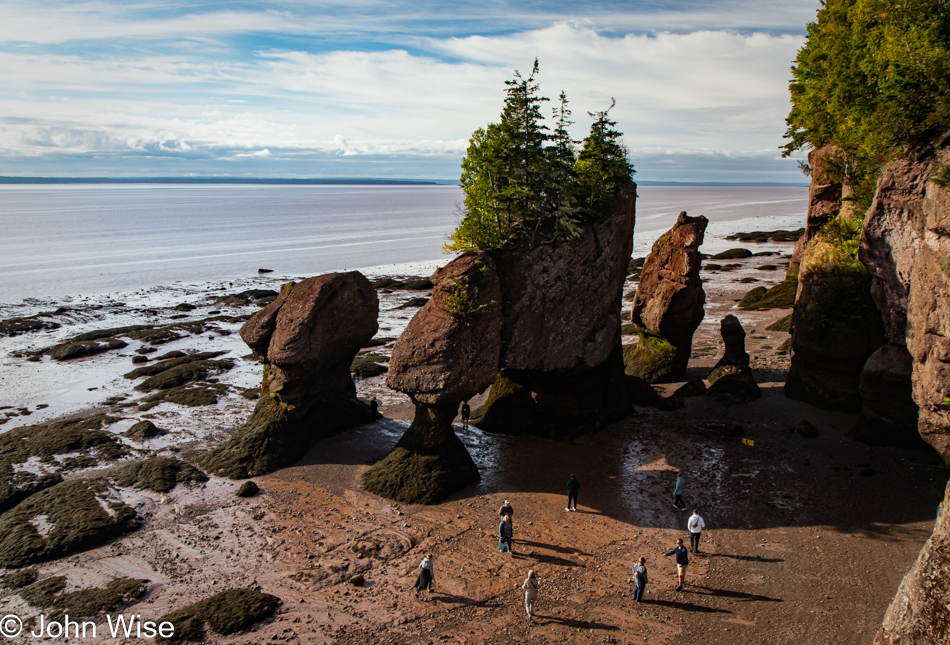
Dinner, too, veered into the exotic, as who can say they’ve enjoyed a meal of cod tongues? We can, but to be clear, the name of this dish is a bit deceptive because a cod tongue is a piece of meat harvested from near the gill that is kind of a cross between fish and scallops. They are not tongues, as cod do not have such things. Desert was a shared slice of partridgeberry pie and the delight that arrived with a perfect day that, for 14 solid hours, delivered everything required to create non-stop astonishment. Yeah, that was our day.

Ferry to Newfoundland

Sunrise in Ingonish Beach, Nova Scotia, Canada

What do you make of the serendipity in situations that unfold in ways that almost seem intentional, as though moments were designed for perfection and you just happen to be there? This happens so frequently for Caroline and me that we joke about how it was in the early travel plans when I was working out the logistics of what should be where, including the wildlife, sun, shade, and when we should round corners to emerge upon a perfect scene playing out on the stage before us. Waking at the Island Inn Bed & Breakfast in Ingonish Beach, Nova Scotia, we were up, packed, and downstairs before sunrise. Out on the veranda, awake even before us, sat one of the owners. I’d stepped out to see if there was a sunrise view, but all I found were trees until he told me that I should get moving down the hill of their yard over to the left, where there was a perfect location to catch the sunrise. This is that spot. The sequence of events, needing to be awake before sunrise, walking outside instead of grabbing coffee first, the owner sitting out front, him seeing my DSLR and understanding what I was looking for, it all came together in a way that was quite serendipitous to me.

Caroline Wise in Ingonish Beach, Nova Scotia, Canada

How do you improve something that is already delightful? Double it. Here I am with Caroline looking at me from across the table, knitting my next pair of socks while enjoying a cup of coffee, and on my screen, where I’m getting some writing in while we are waiting for breakfast, is Caroline looking at me from across the table in Brackley Beach on Prince Edward Island already six days ago. Hmmm, six days ago, I fell behind in documenting our vacation, at least to an extent, as we do have the photos and notes on my phone that explain where they were taken, and on occasion, there are useful tidbits written there. Such is the luxury of having a phone with a stylus for writing on the screen. I try to keep up with the preparation of photos so they can be uploaded, properly tagged, and titled within the post they accompany, giving me accurate location data when I finally find the time to sit down and write. With more than six hours onboard our ferry this afternoon, I plan to write like the wind if I can resist being distracted looking out over the Gulf of St. Lawrence during our crossing to Newfoundland.

Cabot Trail in Nova Scotia, Canada

Breakfast was running later than hoped, putting us on a bit of an edge due to our self-awareness and abundance of familiarity with our greatest personal weakness. There was just no way we’d get in the car and resist stopping for photos, which would further delay our arrival at the ferry terminal, risking our trip to Newfoundland. Our visit to that seemingly remote island in the Atlantic starts after we land at Channel-Port aux Basques on the southwestern corner of the island. We will spend a week traveling the breadth of Newfoundland before ending our stay in Argentia, southwest of St. John’s, on the eastern side of the island. If we miss our ferry today, we cannot just catch a flight from Halifax to St. John’s and race over to the opposite side of the island to take up our planned visit – we’d be toast. On the other hand, if something goes wrong on the other end of our visit to Newfoundland, Caroline could fly out of St. John’s and skip across North America to Phoenix while I weather the situation and figure things out from there. The imperative nature of this calculus demands we do this flawlessly. Yes, there is tension, but not so much that after enjoying our simple and delicious breakfast and jumping in the car, we aren’t already pulling over for a photo within ten minutes of heading south.

Cabot Trail in Nova Scotia, Canada

There’s no denying that a viewpoint overlooking the coast, such as this one right here, may not present itself again. Yeah, we’d better stop for this photo, too, but only this one. While we’re at it, why not bring up a song, say something like An Innis Aigh (The Happy Isle) from the Rankin Family to fill our eyes with tears and put giant lumps in our throats? That was a great idea, Caroline; maybe we should try listening to it a second time, or worse, let’s bring up Fear a Bhata from the Corrie Folk Trio with Paddy Bell, and we can pull over and properly weep. It turns out the Rankins, as they are also known, were from Mabou on the west coast of Cape Breton Island, and the song, An Innis Aigh, is a traditional Scottish Gaelic language song. All versions of this song can render tears from those with sensitive hearts, be careful when and where you listen to it.

Englishtown, Nova Scotia, Canada

“Yes, Caroline, I know. It is an impressive causeway and maybe the shortest ferry ride we’ve ever taken, and this is a spectacular view of it all. Fine, but I swear, this is the last stop before reaching North Sydney.” I promise this is how I remember the conversation, so let me stop my editor, who will likely feel like she has something to correct here by blaming the incessant need to make these stops on me, but SHE’S LYING. In these moments, I’m the voice of reason. She was hung over from soft serve. I know unequivocally that my version of everything is always correct. I can already hear her brief retort, “Pfft!” [Pffft indeed – Caroline]
Seal Island Bridge in Southside Boularderie, Nova Scotia, Canada

We were both in agreement that we could afford this stop as that bridge there, the Barra Strait Bridge, connecting us to Boularderie Island, meant that we had plenty of time to reach the ferry, which was now only 20 minutes away. And, of course, we were good and early among the first cars to line up at the terminal.

Caroline Wise on ferry to Port aux Basques, Newfoundland, Canada

Get ready for it. This is my Frankfurter with two wieners. You probably think I mean Wieners, as in Austrians from Vienna, but no, I’m referring to the “his and her” hotdogs with ketchup and mustard that are supposed to be celebrating not only today’s ferry crossing but last year’s ferry trip on a ferry in Norway when we had two pølse (pronounced “PUHL-seh”) which were topped with crispy onions that truly set them apart and caused these to fall a bit flat. That, though, is getting ahead of myself, as there was supposed to be not only an innuendo about Caroline’s wieners but also that two hotdogs have four ends, and there’s this joke about bratwurst having two ends that I was going to try fitting into whatever it was I started to write here, but that’s starting to feel superfluous to this belabored attempt at humor, so I think I should just quit. Under her breath, Caroline whispers, “PUH-lease.”

Low Point Lighthouse in New Victoria, Nova Scotia, Canada

This is a perfect follow-up to the last paragraph: the Low Point Lighthouse. No kidding, that really is its name at the tip of New Victoria on our way out of Sydney Harbour. Next stop, Newfoundland.

Ferry to Port aux Basques, Newfoundland, Canada

I can’t tell you what the attraction was, but after Caroline returned from an exploratory run of the ferry, she returned and showed me a photo on her phone that she had taken of this spot onboard where people can bring their pets for relief from those functions that are better expressed outside than in the seating areas. Showing me the photo wasn’t enough, though; she wanted, no, she needed me to see it for myself, and so, here we are, admiring what is likely one of the most peed-on floating fire hydrants on our planet. Is there a Guinness Book of World Records entry for such an accomplishment?

Ferry to Port aux Basques, Newfoundland, Canada

It was good to get out and see things on the Gulf of St. Lawrence, so far from shore that I couldn’t see land. This is my first time so far out on open water, and if Caroline hadn’t dragged me out, I would have kept my nose glued to my screen, transferring remembrances of experiences to my electronic reminder called blog. Maybe the moments out here should be of greater value, and while epiphanies and self-discoveries could be encountered, I try to weigh the value of that against what we will find on these pages or not find if I do or don’t write the events that have already passed. Striking balances for those inclined to all-or-nothing mentalities is always going to be a struggle. It’s a good thing that love has a way of prying stubbornness of purpose to listen to heartfelt words that easily convey that this other person requires your attention.

Taking another break from knitting and writing, we visited the deck with a restaurant for a bite to eat. When the server brought us our meals, I started to complain about this being the worst whale-watching tour we’d ever booked. Just then, a fellow passenger got our attention and said, “Yeah, but what about those dolphins riding the bow waves?” Redemption was achieved, and I thanked the server for not only delivering our food but also bringing the aquatic entertainment at the opportune moment to make our repast truly enjoyable.

Ferry to Port aux Basques, Newfoundland, Canada

What the seas lack in fury, I’m making up for in the storm of writing volumes about the previous days. I’ve been so focused aboard our ferry that I passed 5,000 words in the past hours, and yet, I’m still days behind. Aside from me missing the fluid world of the ocean upon which we were floating, we were also missing wifi and electrical outlets for charging things in a world now absolutely dependent on such necessities. Strangely, I was able to maintain my phone and internet for the majority of our 207-mile journey, which helped me save my in-browser writing and take advantage of my reliance on Grammarly, so my hotspot came in handy for the duration of our afternoon ferry trip.

Ferry to Port aux Basques, Newfoundland, Canada

Approaching Newfoundland and Port aux Basques near the end of the day, I might have been harboring a quiet wish that I’d been able to sit outside and taken in the shift of the midday to this dramatic golden hour sky when poets, artists, and musicians should be finding inspiration in the play of light, shadow, and transitional hues that are painting the world in once-in-a-lifetime scenes of splendor.

Channel Head Lighthouse at Port aux Basques, Newfoundland, Canada

While I wasn’t so fortunate to have watched the evolution of such scenes over the sea, I was on hand to capture them for Caroline and I to better reflect on the conditions that greeted our arrival on Newfoundland. What I couldn’t capture was a bit of conversation while in the restaurant. We had our first encounter with the Newfoundlander accent demonstrated by our young server, who confessed that when dealing with visitors, it’s simply easier to drop the heavy accent to avoid the misunderstandings and incessant “Excuse me?”

Port aux Basques, Newfoundland, Canada

More than New Brunswick, more than our visit to Prince Edward Island or Nova Scotia, the excitement of landing on Newfoundland is creating a palpable energy that says we are arriving in a truly exotic location. It always looked so remote on the map; it was as distant as the moon. Now, so many lifetimes later, we are here at the shore, about to encounter this faraway place that has required serious effort to visit. In a few more minutes, we’ll take our first steps into this place that holds a mystique bordering on the ethereal with its rugged beauty we’ve only seen in photos and expectations, or is that fear of meeting the Old Hag of lore? Maybe some of the appeal is derived from the local whale hunting history, and while we are happy the practice has come to an end, we fell in love with the subject back when we were reading Moby Dick. Then, there was cod, a major industry in Newfoundland from the 15th century through the early 20th century. Again, a book, this time Cod: A Biography of the Fish that Changed the World by Mark Kurlansky, probably influenced our ideas and love affair with visiting this island as Newfoundland played a crucial role in supplying the world with salt cod, often called bacalao or bacalhau. Then, there must be 100 other forgotten stories, histories, and folklore that have played into our imaginations regarding Newfoundland. Today, we start to realize our dreams of being here.

Ferry at Port aux Basques, Newfoundland, Canada

Little did we know that those dark clouds on the horizon warned of a terrifying gauntlet of treacherous driving to reach Corner Brook, Newfoundland, 135 miles (217km) north of Port aux Basques. Before that ordeal, we were treated to the longest wait for fast food at a little shop called Mary Brown’s Chicken and the weirdest time zone change that moves the hands of the clock only thirty minutes from the Atlantic Time Zone, the only time zone in North America to do so. We are now on Newfoundland time.

Trans Canada Highway #1 in Newfoundland, Canada

To the west, everything looked fine. Under the reassuring view of this calm sky and ocean, we began our long drive to the hotel I had booked many months ago. Good so far.

Trans Canada Highway #1 in Newfoundland, Canada

Due to our long wait for what seemed to be the only option for dinner this evening, we were nearly alone on our drive north as it seemed like the others on the ferry made tracks to get out of this southern port, or so we thought.

Trans Canada Highway #1 in Newfoundland, Canada

After this view of the mountains and the lenticular clouds we admired in the late dusk sky, there would be no more photos of the rest of the drive. Terror set in with rain so hard that it came down in sheets on the darkest roads we’d ever driven that lacked visible lane lines. Combine that with truckers who were still departing Port aux Basques and obviously familiar with driving in these conditions as they barreled past my white-knuckle death grip on a steering wheel that was being jerked about thanks to potholes and puddles that seemed intent on ending our lives this night. Then, when we thought it couldn’t have been any worse, flashes of blindingly bright lightning struck so close to the car that deafening thunder shook it before the full illumination of the electrical storm faded. At barely 35 miles per hour, with emergency flashers going, we crept up the road, begging the universe for a slowdown of the onslaught. We didn’t pull over and wait it out because there was no shoulder, and when a small bit of dirt road on the right did appear, we couldn’t judge how muddy or deep the water was, so we had no choice but to continue the crawl forward in nearly crippling fear. Arriving at our hotel in a trembling state of exhaustion, I wondered what the Gaelic song would be that describes nearly shitting one’s pants during the ugliest tempest ever.

Cape Breton Highlands on Nova Scotia

Cape Breton Highlands National Park, Nova Scotia, Canada

Here we are on the famous Cabot Trail in the Cape Breton Highlands National Park, feeling the Scottish sense of things that Nova Scotian Premier Angus L. MacDonald wanted to impart on these lands nearly 100 years ago for tourism purposes. That was some great insight from a politician during an age when murmurs of World War II were first being sounded, and industrial manufacturing and natural resource exploitation were in full effect. We made our first encounter with the Cabot Trail last night when we arrived at Margaree Harbour for sunset, and our hotel in Chéticamp, 15 miles farther north, put us in a perfect location to enter the national park first thing this morning.

Cape Breton Highlands National Park, Nova Scotia, Canada

I’m not certain if the gray skies were a curse or blessing, but without sharp points of light on this pond and the bleached grasses and trees reflected in its still waters, I can only wonder if this scene would have been as intriguing as it was. Stepping from the car to capture the image, I startled a beaver into returning to the water from where it was tending beaver business on dry land. What it was doing remains a mystery, as only its quick motion alerted me to its presence. In the tangle of monochromatic reflections to the right of this image, you might be able to spot its lodge.

Beaver at Cape Breton Highlands National Park, Nova Scotia, Canada

While the beaver that ran back to the pond disappeared, another one closer to me apparently didn’t notice me admiring it and swam by as though Caroline and I were invisible.

Cape Breton Highlands National Park, Nova Scotia, Canada

Our first “look-off” of the day, which is the Canadian term for pull-out or scenic overlook. Well, seeing how much we enjoy taking in tilted strata, we don’t mind taking advantage of today’s first look-off and imagining the continental shifting and uplift that has to occur to create such a phenomenon. While not shown, the coast up here is a rocky one, not a bit of sand for sun worshippers looking to improve their tans, not that the weather is cooperating on that front either.

Cape Breton Highlands National Park, Nova Scotia, Canada

Hopefully, not ever look-off demands we do so, but this overview of the area to the south that we have traveled up so far couldn’t be ignored. Below and to the left is the cove we had just stood in, we are atop that cliffside.

Cape Breton Highlands National Park, Nova Scotia, Canada

Reflecting on reflections where thoughts cannot always adequately mirror feelings that this is the domain of poetry and music.

Cape Breton Highlands National Park, Nova Scotia, Canada

Angled, gnarled, and storm-and-wind-worn surfaces are like the faces of people who have lived hard lives with deep lines and creases etched into their character. Nature is showing you her old face, but can we recognize her?

Cape Breton Highlands National Park, Nova Scotia, Canada

The wish for clear skies may yet be granted, but the heavy gray and billowy white clouds looming over the highlands have their own appeal in shaping a dramatic landscape.

Cape Breton Highlands National Park, Nova Scotia, Canada

The Cabot Trail was named after the explorer John Cabot, who landed in the Maritimes of Canada in 1497. It was a nice gesture of remembrance, except he apparently landed on Newfoundland, not Cape Breton Island. No matter, since the branding is simply great, and exacting historical details are better left to the pedants.

Corney Brook Trail at Cape Breton Highlands National Park, Nova Scotia, Canada

Our first hike of the day was on the 4.1 miles (6.6km) long Corney Brook Trail (these are not those falls).

Corney Brook Trail at Cape Breton Highlands National Park, Nova Scotia, Canada

These are the falls to which this trail leads. Should you wonder about the forest trail that brought us out here, we started hiking in the shadows of the overcast sky, but reaching the halfway point back to our car, the sky cleared and opened in a glorious blue, changing the appearance of things. Considering how many other photos we wanted to share from the rest of the day, those from most of our hike needed to be pared.

Ruffed Grouse on Corney Brook Trail at Cape Breton Highlands National Park, Nova Scotia, Canada

Be quiet, walk with a soft step, leave your dog behind, and be patient, and you, too, might encounter a ruffed grouse on your trails.

Corney Brook Trail at Cape Breton Highlands National Park, Nova Scotia, Canada

Approaching the end of the Corney Brook Trail, we encountered the glorious blue ocean, following the peeling away of the heavy clouds that had threatened our day with a slight pallor of gray.

Cape Breton Highlands National Park, Nova Scotia, Canada

The brilliance of slicing such narrow bands of roads at the edges of the sea cannot be overstated. We are forever grateful to those laborers who toiled under the conditions of rain, mud, and blistering sun to carve these pathways through dense forests on steep slopes next to precarious cliffsides.

Cape Breton Highlands National Park, Nova Scotia, Canada

I don’t know if Canada ever clearcut this forest in the national park. I’d like to believe that it wasn’t and that this diversity of tree types, heights, and colors represents the same diversity of flora that has lived on the north end of this island for many thousands of years.

Bog Trail at Cape Breton Highlands National Park, Nova Scotia, Canada

Had you asked us prior to our visit to the Bog Trail where we’d rank such a path, it would probably be at the bottom of our choices, but after arriving here, there’s some likelihood that we spent as much time exploring these wetlands on a 0.5km/0.3m boardwalk as it took us to hike the 4 miles of Corney Brook.

Pitcher Plant on the Bog Trail at Cape Breton Highlands National Park, Nova Scotia, Canada

While sharing some visual characteristics of tundra, this boreal bog is not that, but it is nice to be experiencing glimpses of that type of ecosystem. This blossom is from the purple pitcher plant, a carnivorous specimen also known as the side-saddle flower or, my favorite, turtle socks.

Sphagnum Moss on the Bog Trail at Cape Breton Highlands National Park, Nova Scotia, Canada

I could easily be mistaken because, regarding the effectiveness of my memory, I forget a lot of things, but I believe this was our first encounter with sphagnum moss during all of our travels. Should I be wrong, Caroline will leave a note pointing out the dozens of other locations we’ve fallen into the visions of fractal recursiveness that grows out of place we’ll never identify. How do I know that? I reached in to not only touch the moss itself, but I was wondering how thick and soft the bed of mosses was before sending fingers probing for the ground but pulled back after thinking better of the idea, wondering if there might be another type of carnivorous plant in the depths just laying in wait to snack on fat man fingers. [I tried to remember when and where we might have seen this moss before but couldn’t come up with a location either, so it certainly was our first deep encounter with sphagnum moss. By the way, we also learned that technically, this bog isn’t a bog at all but a slope fen because there is a steady source of water, and the surface area lies on a mountain slope. Caroline]
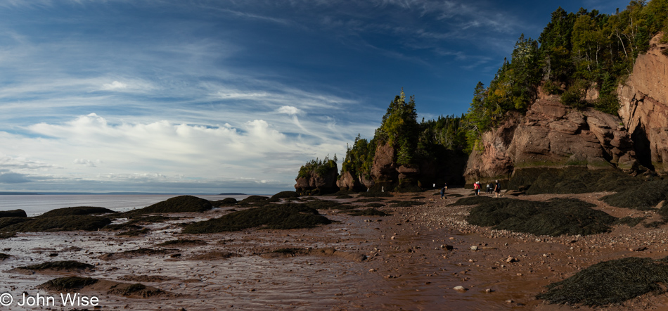
Pitcher Plant on the Bog Trail at Cape Breton Highlands National Park, Nova Scotia, Canada

The infamous finger-eating pitcher plant makes an appearance after lurching out of the moss, hungry for what I fortunately denied.

Bog Trail at Cape Breton Highlands National Park, Nova Scotia, Canada

Green frogs were talking with each other around this pond. By our count, there were three of them. We lingered a while longer, hoping that in our stillness, they’d get squawking again; sadly, our patience was for naught as they fell to silence. That’s relative, though. Here we were on a slow crawl over the bog trail, taking an inventory of everything our eyes and ears could take in. We’d be the first to admit that the very idea of visiting a bog doesn’t at first blush sound all that exciting, but now that we know, we’ll never second guess the potential held in this type of wetlands. With only a single day to explore the park and one more trail we knew we wanted to hike, our departure from the bog was bittersweet.

Benjie's Lake Trail at Cape Breton Highlands National Park, Nova Scotia, Canada

Farther down the park road, we were soon at Benjie’s Lake Trail.

Benjie's Lake Trail at Cape Breton Highlands National Park, Nova Scotia, Canada

Hints of the fast-approaching autumn are showing up here and there, such as the ferns next to our trail that are turning orange.

Benjie's Lake Trail at Cape Breton Highlands National Park, Nova Scotia, Canada

While the park’s elevation isn’t all that high, there is something top-of-the-world feeling out here. [I had that feeling too, and I believe that was because of the stunted trees. They are kept short by the poor soil conditions and harsh winters. Caroline]
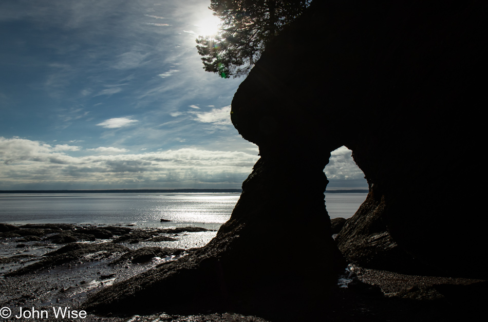
Benjie's Lake Trail at Cape Breton Highlands National Park, Nova Scotia, Canada

Reaching the lake, we caught up with a couple of German guys who’d raced past us and ended up talking with them for a good 20 or 30 minutes until a couple joined the small viewing area, and we decided to leave them to a moment of solitude.

Benjie's Lake Trail at Cape Breton Highlands National Park, Nova Scotia, Canada

The trail out and back is easy peasy and easily negotiated by almost every skill level of hiker, the same was true for the bog trail.

Cape Breton Highlands National Park, Nova Scotia, Canada

Emotions swoon at the vista with a perfect blue ocean punctuating the scene, motivating me to bring the car to a quick stop. We both leap out of the car, proclaiming this as the best view ever, even when we already know with absolute certainty that the previous look-off was, without a doubt, the best ever.

Cape Breton Highlands National Park, Nova Scotia, Canada

But then we see clouds reflected on the ocean’s surface, and now we have to admit that we are being gobsmacked by Mother Nature’s relentless onslaught of all that is beyond terrific.

Caroline Wise in Pleasant Bay, Nova Scotia, Canada

Down the hill in Pleasant Bay, the devil found in the signs announcing soft serve and ice cream takes a commanding spot on our shoulders and, speaking louder than any angel, tells us “No.” It forces us to pull over for yet more indulgences, reassuring us that vacations were created just for this reason. Caroline finally found tiger ice cream, a typical Canadian treat of orange-flavored ice cream with dark streaks of black licorice (or, in this case, chocolate), and I opted for maple walnut. I got the better deal, and when she was finished with hers, we returned for a scoop of the yummier stuff for her. By now, I’m trying to reassure her that all the soft serve and ice cream are not making her fatter, just a little fluffier. Sitting here in front of the small shop, windchimes sang to us in the gentle breeze that, like the name of the town, was pleasant at 61 delightful degrees. Crickets chimed in, celebrating with us that we were still in shorts and short-sleeved shirts, with the glow of summer carrying forward for a little longer.

Cape Breton Highlands National Park, Nova Scotia, Canada

And that’s it for our visit to the Cape Breton Highlands National Park, but we still have some driving left today on the Cabot Trail.

Beulach Falls in Cape Breton Highlands National Park, Nova Scotia, Canada

Was that a national park sign we passed? Nope, it showed a turn-off from the Cabot Trail that leads visitors to the Beulach Ban Falls outside the park. Caroline’s quick search-fu abilities told her to insist on us turning around, which I promptly did because what else do I have on my agenda besides nothing other than making my travel companion, best friend, wife, and Love-ah from the prestigious Welshley Arms Hotel happier than she was seconds ago?

Beulach Falls in Cape Breton Highlands National Park, Nova Scotia, Canada

Do you see them? No, it’s not pareidolia this time. There are no faces, well maybe there are, but I’m more interested in the many capons gracing the length of the waterfall. Have I just discovered caponidolia? It’s as though the white streaks of water are the fat dripping from my love-ahs fingers. Reading the tea leaves of the future, first when Caroline edits this and then subsequently years from now after returning to it again, she’ll groan, wishing I hadn’t gone to that Saturday Night Live skit that’s been haunting us for decades. She’ll wonder, has this knucklehead run out of oomph on what to write next, or does he really feel this way regarding such a beautiful place?

Beulach Falls in Cape Breton Highlands National Park, Nova Scotia, Canada

This is awkward. I don’t know how to follow up on that moment of idiocy without continuing the nonsense, but even I grow tired of my half-hearted attempts at well-worn grandpa humor that doesn’t always hit its mark. I suppose I can point out the obvious: this photo contains dark red and brown soils, lit with mottled light from the sun that manages to find a way through the canopy, combined with the moss, roots, dark shadows, and abundance of green has all the elements of a perfect spot on the trail that even had there not been an exquisite whispy waterfall at its terminus, would have nevertheless been spectacular.

Cabot Trail in Nova Scotia, Canada

Two guys from Toronto were sitting at this look-off. They had it all to themselves until we came along to share the viewpoint with them. As I chatted with them, Caroline busied herself among the nearby plants. What could she have been doing over there?

Red Admiral Butterfly on the Cabot Trail in Nova Scotia, Canada

She and this red admiral butterfly were communing, and somehow, it kept hanging around long enough for her to pull me over to see if I could get a photo of this guy, too. Maybe it was high on milkweed, or there’s an herb that acts to hypnotize it, but it wasn’t budging from its perch. I had brought my walking-around lens, my telephoto lens, and my super-wide lens along on this trip, but somehow, the macro was a lens too much; it’s back home in Phoenix doing absolutely nothing for me. Come to think about it, that macro would have come in handy at the bog.

Dingwall Harbour, Nova Scotia, Canada

This is Dingwall Harbour; it is not Meat Cove. It is also the farthest north we’ll travel on Cape Breton here in Nova Scotia. Meat Cove would have been even farther at the absolute northern end of the island, but as you can see from the low position of the sun and lengthening shadows, we couldn’t afford the extra couple of hours that would have been spent going to and fro. With 42 trails still to hike in Cape Breton, 14 more in Kejimkujik, more than a dozen provincial parks, and at least two wildlife refuges of note, it would be easy to spend a solid ten days on Nova Scotia familiarizing ourselves with an abundance of beauty that I feel exceeds what our expectations might have been before coming to the Maritimes.

Green Cove Overlook in Cape Breton Highlands National Park, Nova Scotia, Canada

There’s still 1.4 degrees of sunlight slicing across a thin layer of the earth’s surface above sea level; if we hoof it, we can capture a new level of astonishment, joy, and delight, the wife says with excitement that I cannot deny.

Green Cove Overlook in Cape Breton Highlands National Park, Nova Scotia, Canada

While she’s out finding her happy place here on Green Cove Overlook, I found mine with this cairn.

Green Cove Overlook in Cape Breton Highlands National Park, Nova Scotia, Canada

Caroline found her happy spot here with a slightly different angle, attributing it to the intrusions of the pink pegmatite dikes sandwiched in the granite with that awesome cairn too distant to play a significant role. The truth is that she took a better photo but with a caveat. Using my cell phone, which she now calls the clown camera, Samsung’s automatic HDR function can create emphasis in colors where my DSLR fails. [However, in some situations, the colors look ridiculously fake, which is where the “clown” thing comes in – Caroline].  The problem with the “clown photos” is their poor resolution. They are not low res, but they were created to look awesome on a small hi-res phone screen, not on other devices or large screens. Unable to choose which photo was better, we decided we could both be happy by posting both, even if the pink bands are not as luxuriantly saturated as they are on my phone. Speaking about luxuriant saturation, that’s where we are here on vacation.

Going to Cape Breton Island

Lunenburg, Nova Scotia, Canada

A funny thing happened on the way to photograph sunrise in this UNESCO World Heritage Site known as Lunenburg, Nova Scotia. There we were, sitting on the west side of Lunenburg Harbour, waiting for the sun to peek over the horizon to illuminate the town when a kindly gentleman who works for the Bluenose Golf Club up on the hill behind us stopped, rolled down his window and said, “Hello folks, there’s a spot up the hill next to the clubhouse that is a great location to photograph the harbor, you are welcome to head up there.” Wow, starting the day with another incredibly friendly encounter, not someone yelling, making mad hand gestures, or beeping their horn in anger that our car is half an inch in the road; just a great tip for capturing a better view of the town. These positive impressions of the people of New Brunswick, Prince Edward Island, and Nova Scotia are making big impacts on us, yet everyone is warning us that we’ve seen nothing yet until we get to Newfoundland, where we’ll encounter TRULY friendly people.

Blue Heron in Lunenburg, Nova Scotia, Canada

What should I say about a blue heron I’ve not said before? Out of curiosity about how many references I’ve made to these large birds previously, I searched my index of posts, and 42 entries show a potential to hold something or other mentioning herons. But as they say, that was then, and this is now, so I’d better dig in and find a frame of reference. There wasn’t an epiphany in seeing this bird looking for breakfast, and though I scrambled to affix my telephoto lens, it’s not the photo I’d like to have taken, the one where you can look into its eye, but it is a reminder that we sat there for a good long time watching it hunt patiently. Moving to and fro ever so slowly, it keeps one eye on the environment and the other on what is just below the water’s surface. With a twitch of its head, it seems it has identified a meal; holding its gaze, it waits and then steps forward, waiting again until it repeats the action. Then, in a flash, it thrusts its head below the waters and pulls up a fish for its cold meal.

Blue Heron in Lunenburg, Nova Scotia, Canada

Tempt fate and get impatient; you might lose what you were seeking, and so it was as I continued trying to inch forward for yet a better shot of the heron until it had enough of my encroachment and decided it was time to find different hunting grounds. This worked for us, too, as it was time for us to find a bite to eat.

Lunenburg, Nova Scotia, Canada

The “end of the season” effect is coming on strong, and finding breakfast this Wednesday morning is proving difficult.

Lunenburg, Nova Scotia, Canada

We stroll up and down the streets, having to check on places as our search results from the giant search engine that will go unnamed have proven inaccurate time and again.

Lunenburg, Nova Scotia, Canada

If only we could find one open place, maybe even an IHOP. No, just full stop; we’ll never eat at that place ever again, never. [John conveniently forgets to mention that we also passed by an open Subway that failed to attract us, even though it advertised lobster subs, which sounds like blasphemy but it appears Canadians are very fond of the chain. – Caroline]
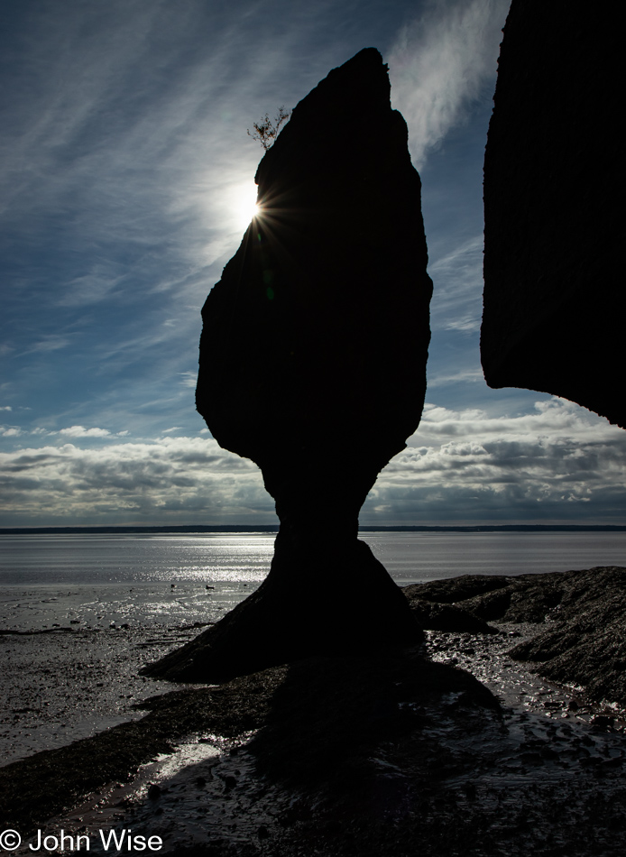
Lunenburg, Nova Scotia, Canada

We finally, and with some reluctance, dip into the Nº 9 Coffee Bar, hoping they also have a bite to eat. Lo and behold, they have yummy breakfast galettes and lemon berry scones that were so good we got one for the road. Being the only place in town open for a coffee and a bite to eat, the galettes were sold out before we finished our coffees. The interior of this multi-room coffee bar is uniquely beautiful in its historic layout. Like the patient heron, good things come to those who wait.

Lunenburg, Nova Scotia, Canada

Crossing the street on our way to the harbor for a post-breakfast walk, a guy in a red car was driving by. It was the watchman from last night, but I couldn’t get his attention to thank him again for the great laughs and learn his name.

Lunenburg, Nova Scotia, Canada

It turns out that finding the right light, angle, and environment surrounding a three-masted tall ship such as the Picton Castle is not an easy task if you want to create a dramatic photograph of such a thing.

Lighthouse Market in Mahone Bay, Nova Scotia, Canada

Without waiting around for Lunenburg to waken for its business day, if anything is, in fact, open after the main tourism season started shutting down, we left town but didn’t get far before this small shop called the Lighthouse Market in Mahone Bay had Caroline asking me to stop. This would be the location of our one and only regret of the trip: we didn’t buy one of the small lighthouses in front of the shop. It would have been a perfect addition to the area next to our front door back home.

Whynachts Point in Nova Scotia, Canada

There’s some German influence going on here as this is in the area of Whynachts Point, which is incredibly similar to the German word for Christmas, Weihnacht.

Hacketts Cove in Nova Scotia, Canada

Nothing much here at Hacketts Cove aside from a glorious day with reflective shallow waters showing us where we’d like our summer home to be located.

Peggy's Cove in Nova Scotia, Canada

A few days ago, we had decided we’d detour from our planned drive out to Peggy’s Cove due to the reality of how much time this would add to our route in real life compared to the fantasy I was dreaming of when I planned this grand adventure. Too many people along the way asked if our road trip included Peggy’s Cove, insisting that we had to visit, so here we are, getting our first glimpses of what differentiates the landscape of this corner of Nova Scotia, making it so attractive to others who’ve already visited this place.

Lighthouse at Peggy's Cove in Nova Scotia, Canada

It’s the barren granite creating a stark contrast with the surrounding sea and sky that allows Peggy’s Cove to capture the enthusiasm of all who visit.

Peggy's Cove in Nova Scotia, Canada

These smooth surfaces were the handy work of retreating glaciers that scraped the earth flat, creating a scene that has become iconic in my vision of what fishing villages on the North Atlantic should look like.

Peggy's Cove in Nova Scotia, Canada

This was one of those lucky moments when our arrival, timed with the end of the season, meant we easily found parking, and while we were certainly not alone here, the place was not overwhelmed. Just outside of town was one of those electronic signs that tell visitors how many available parking spots were still open. We also passed more than a few parking areas for tour buses. The summer must see these streets teaming with tourists; you can bet we are happy to see this place under beautiful skies, on a beautiful day, with beautiful scenery, experienced by these two people in love celebrating such sights.

Peggy's Cove in Nova Scotia, Canada

Peggy’s Cove should be visited for at least one overnight. A little more than an hour is not enough.

Gift shop in Peggy's Cove in Nova Scotia, Canada

Visiting the gift shop called Hags on the Hill backfired on Caroline, as it was me who’d be leaving with a treasure representing our vacation in the Maritimes: This cutting board, or maybe it should be a giant charcuterie platter, but that would be ridiculously too big for us, and so it must serve the utility of being a cutting board as I’m not taking home a decoration. When it becomes scuffed, scored, and loses some of its beauty, I’ll know that it served a purpose greater than a cosmetic one.

Peggy's Cove in Nova Scotia, Canada

Our imaginations tell us that we are seeing hints of what areas of Greenland and Labrador might look like, piquing our interest in visiting those places, too. Maybe 2026 will see us hitting the Faroe Islands, Greenland, and Svalbard. Labrador will have to wait as, in my mind’s eye, it is more difficult to visit than the other three locations.

Whistle Berry Market in Salt Springs, Nova Scotia, Canada

We needed a washroom, Canadian for the restroom or toilet, and the Whistleberry Market just off the road looked like a good bet for facilities. Wow, this Mennonite grocery is one of the greatest small grocers we’ve ever visited; seriously incredible regarding the variety and freshness of everything. While I was having some salt & pepper beef jerky made right here by the owners packed up for me, Caroline spotted Damson plums, something almost impossible to find in the States but the most common plums sold in Germany, essential for plum cake. Out in the parking lot, we tried the jerky and promptly turned around to buy another pound and a half so we’d have some after we returned to Arizona.

Cape Breton Coast in the distance at Creiguish, Nova Scotia, Canada

We have reached the focus of our drive north today, Cape Breton. Unlike other islands so far on this trip, we reached this one by crossing a short causeway. The land barely visible on the horizon in this view from the Creignish area is Nova Scotia. The coastal road we’re taking north is called the Ceilidh Trail in honor of the region’s Scottish heritage. Ceilidh is the Gaelic word for a party.

Cameron Pond near Judique, Nova Scotia, Canada

I think I’ve finally discovered something about these travels and their relationship to love that makes them so appealing. When we arrive at a place, we share oohs and aahs about how amazing it is that we are where we are. We hold hands, smile at one another, hug, and generally celebrate our opportunity to be out and about. Then it’s on to the next location, but along the way, those things that attract our interest illicit more curiosity and have us reaching out to each other again. Stop the car and visit a place; even if it was kind of meh, we still laugh about it and joke that, sure, we’ve seen better, but we’re out with each other, and that’s all the reason to again, exclaim our love for each other. So, instead of Skype and text messaging over the course of a workday, on vacation, we are always in each other’s proximity, giving us every reason to glance over and, with a knowing look, offer a smile that oozes love and affection. With all this constant shared love going on 15 hours a day, it is no wonder our vacations are top-notch perfection that leaves us wanting more.

Caroline Wise at Cameron Pond in Judique, Nova Scotia, Canada

Like I said, smiles. We are at the Cameron Pond near Judique. It is pictured in the photo right above this one, and there’s this xylophone by the pond with two mallets for those inclined to play the pond some music. While I plink-plonked along, Caroline played a little melody for the mosquitos that attracted them to take up perches on her fair skin, jamming to the beat of “Mosquito” by the Yeah Yeah Yeahs with their proboscises.

Port Hood Provincial Park in Port Hood, Nova Scotia, Canada

This is the Gulf of St. Lawrence, as seen from the beach at the Port Hood Provincial Park, to be precise. We took a break from our drive to give Caroline a few minutes of beach combing time. You can’t really see her bare feet in the photo, but I assure you that she’s been walking through this cold water.

Port Hood Provincial Park in Port Hood, Nova Scotia, Canada

Same location, different direction.

Near Mabou Beach, Nova Scotia, Canada

In case you didn’t know, Cape Breton Island is the home of the Cape Breton Highlands National Park, which we’ll visit tomorrow. The scene across the waters near Mabou Beach is far more idyllic than the photo portrays. Suffice to say that everyone who loves beautiful landscapes should visit this corner of the world.

Sunset at Margaree Harbor, Nova Scotia, Canada

While we have to live with the adage, “Better than nothing,” I would recommend that others visit the Maritimes the first chance they can so they have many years ahead of them and can return often. Do not, if you can afford the time, race through the environment as we are doing, though like the saying states, it’s better than nothing.

Near Margaree Harbor, Nova Scotia, Canada on the way to Cheticamp

Our sunset was at Margaree Harbor, and like our images at the Port Hood Provincial Park, the above photo of the sun and this one of the coast are at the same location, looking in opposite directions.

Near Margaree Harbor, Nova Scotia, Canada on the way to Cheticamp

And with this final image, we effectively conclude the visual storytelling that shared our day with you. We weren’t finished driving yet as we still had a short drive to Chéticamp, where we were booked for an evening at Laurie’s Inn and snagged the last reservation for dinner at the excellent L’Abri Café. Regarding dinner, we might be easily influenced by the perceived quality of food after starting with a giant bowl of steamed mussels, as by the time we finish them, we are falling into bliss, and our bias has been swayed. Thinking about things that way, every perfect moment leading up to the end of the day has likely tipped our bias into believing everything found in each moment has led us into these expressions of exuberance and possibly an inability to be fair judges of what others might be critical of.