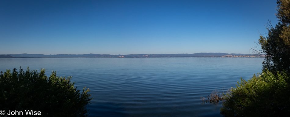
This is Clear Lake, as seen from Lucerne, California. We’d already passed Lake Mendocino, but I need to make haste in getting this post finished because the reality is, I’m sitting down to write this post on July 10th at 8:30 p.m. after arriving at the Wigwam Motel in Holbrook, Arizona, on our way to Santa Fe, New Mexico, because our travel schedule is rather relentless this summer. So, the fewer photos I have to write to, the better I can expedite this missive and get into the trip we started only three days after we returned home from our stay in Oregon.
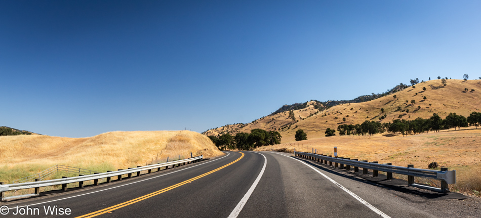
We drove out of the Coastal Range as our route took us east before our hard turn south to finish our drive home. The golden grasses of this state never fail to impress us. They’re also beautiful when they are green, though that doesn’t seem to happen frequently.
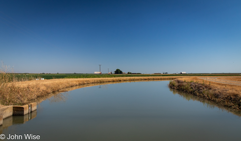
Not too far along, we enter the vast, flat middle of California, where 25% of America’s food supply is grown, with fully 40% of all fruits and nuts.
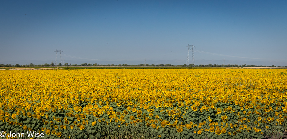
I can’t say we’ve ever seen fields of sunflowers out here before, but there is the fact that it’s a rare day that we find ourselves out and about during summer.
Due to needing to drive over 500 miles (805km) today to reach this evening’s hotel, we were trying to be judicious with the number of stops we were making. Obviously, we are no longer in the Central Valley; we have started climbing up the Sierra Nevada Mountain Range. Yosemite National Park is still well south of us.
Only after passing the turnoff in the Meyers area to South Lake Tahoe did the heavy traffic abate, allowing us the opportunity for a break to stretch our legs, find a discrete spot for taking care of some particular business, and when inspired, take another photo. Usually, we try to incorporate all those things in a single stop.
Crossing the West Fork of the Carson River in Markleeville.
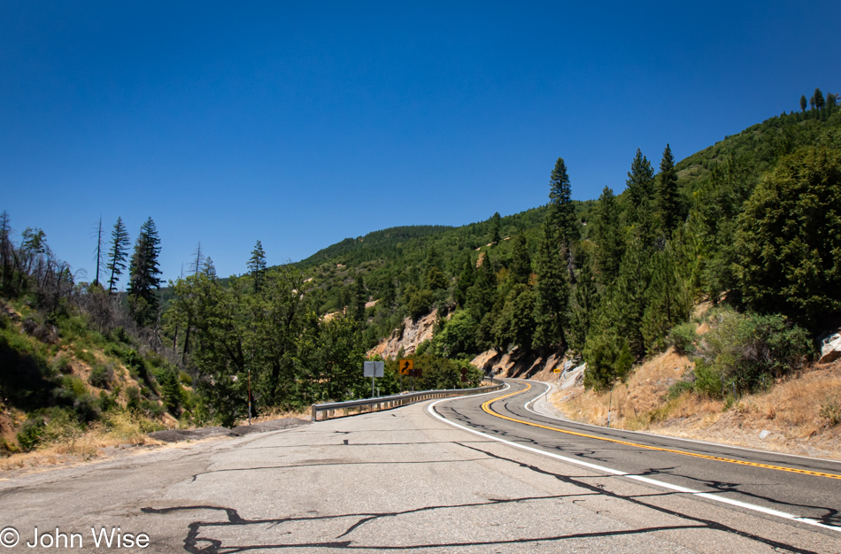
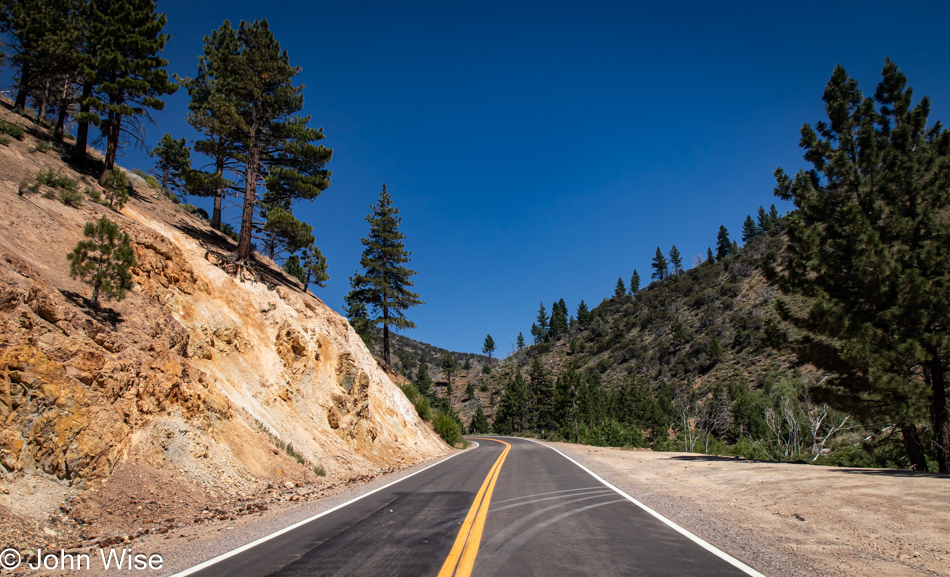
We should have more time to do justice in exploring this area because it feels as though we are unceremoniously racing right through here.
Out here, we are feeling very alone, and that’s a good thing.
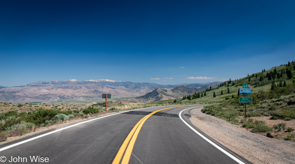
Routes 88, 4, and 108 slice a path roughly east/west, while the 89 travels mostly south, which is the road we are currently on.
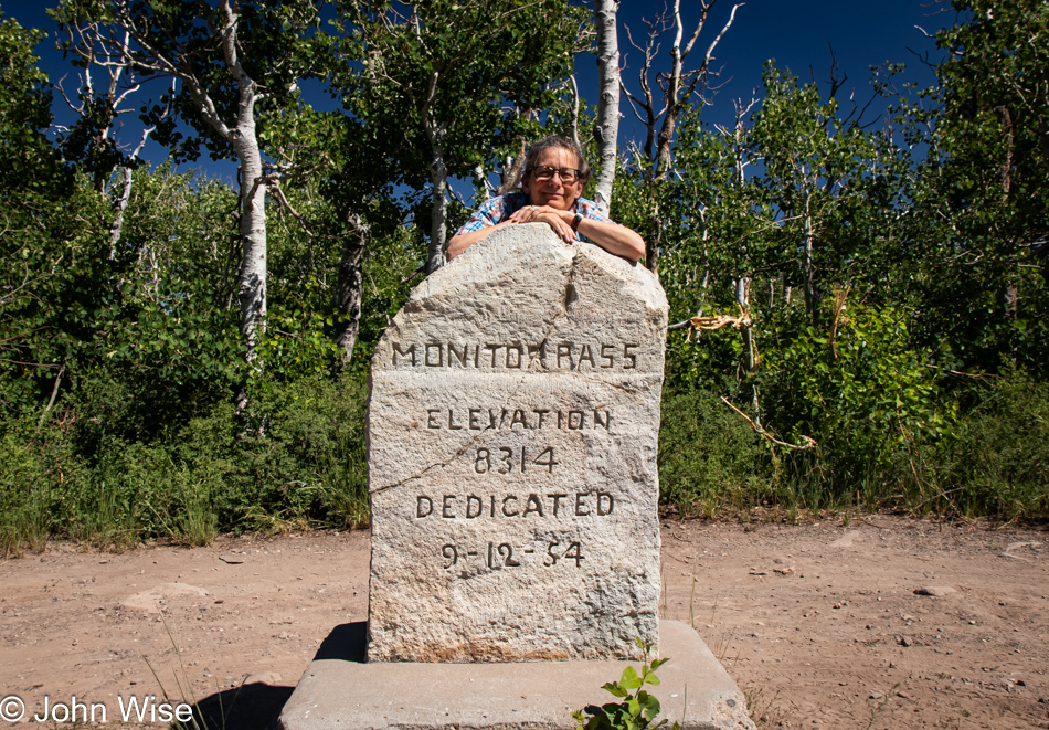
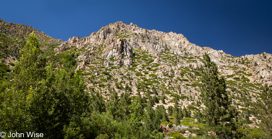
The section of California 89 that crosses Monitor Pass is pointed absolutely east at this time. The pass is at an elevation of 8,314 feet or 2,534 meters.
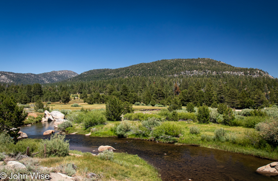
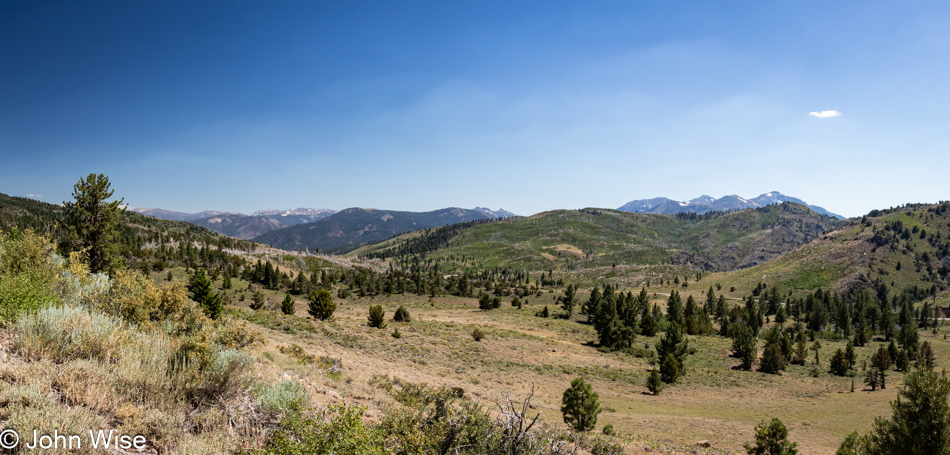
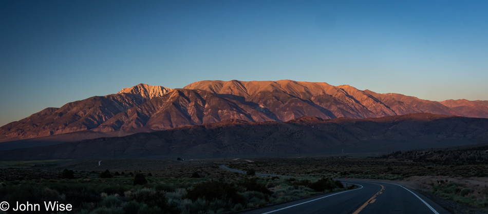
We are descending out of the mountains to a wide valley below, where we’ll join U.S. Highway 395, also known as the Eastern Sierra Scenic Byway.
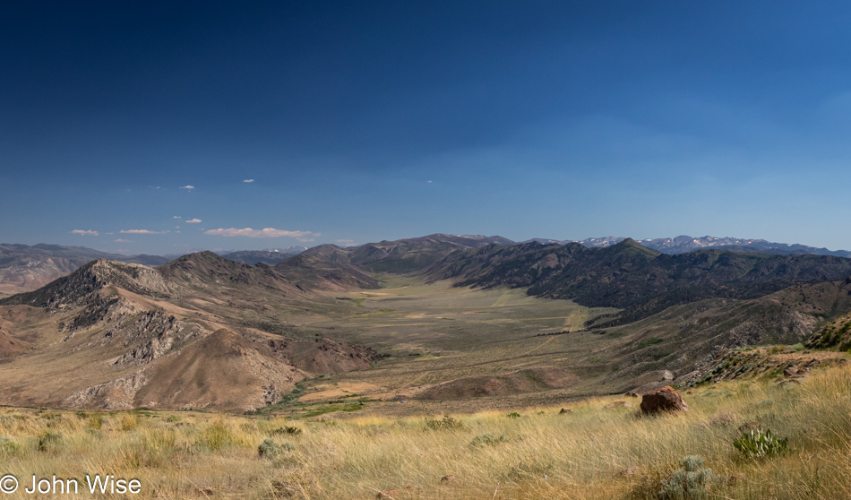
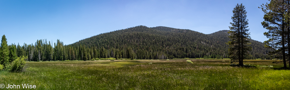
Not a mile further down the road, we were struck by this basin and how pretty it was.
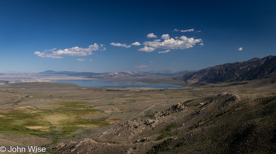
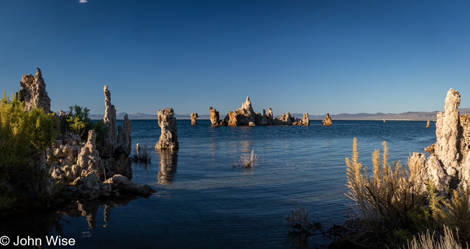
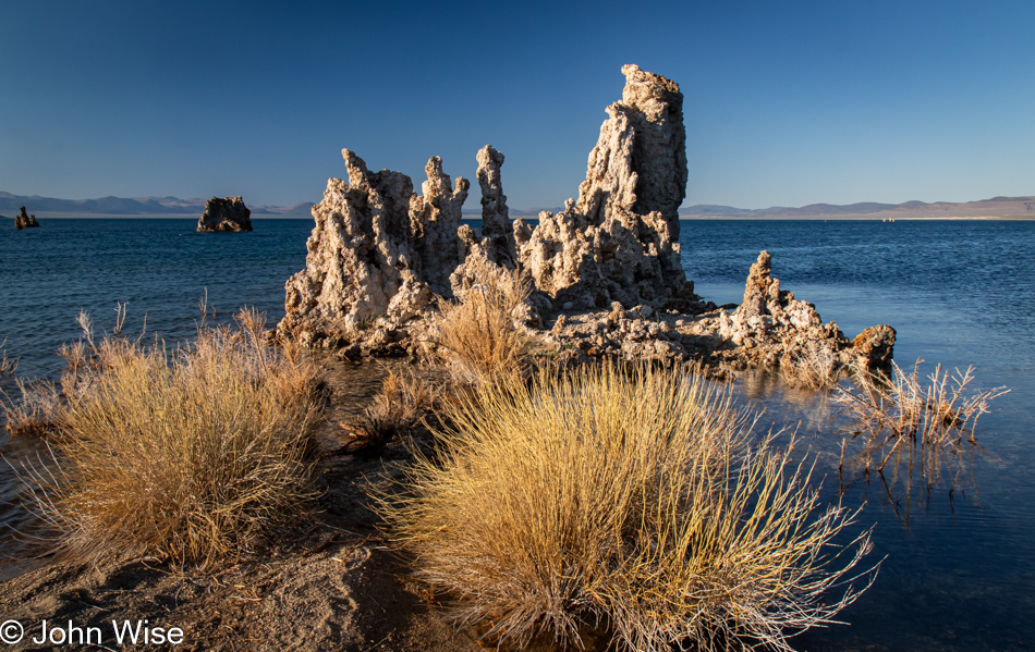
That’s Mono Lake in the distance, we’ll certainly be stopping as it’s been 20 years to the day since we were last here. What a strange coincidence.
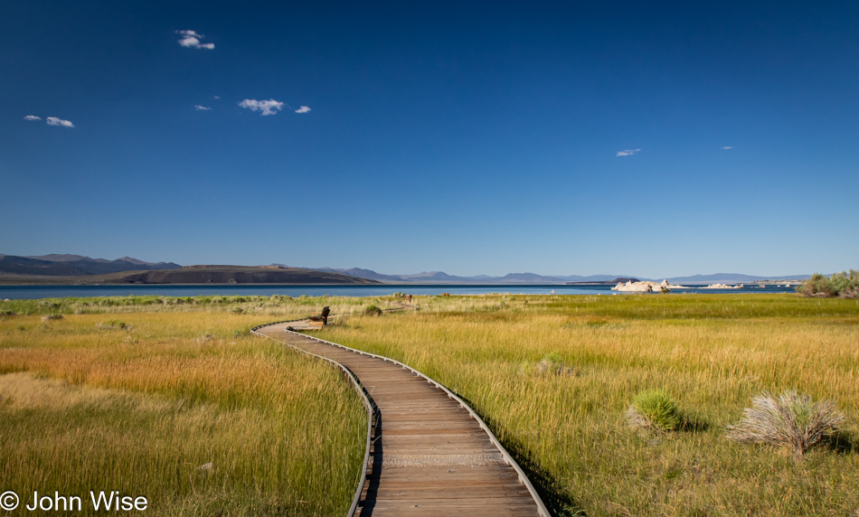
This boardwalk, which really goes about nowhere, wasn’t here the last time we visited. The old adage, “Everything changes,” still rings true.
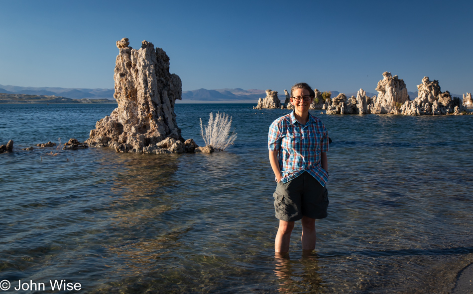
We stopped in Lee Vining at a gas station for ice and to ask if the guys might know where there’s a beach at the lake where people can swim because we didn’t have a recollection of exactly where we were on one of those previous visits when Caroline got in with the brine shrimp and swarming alkali flies that are in wild abundance, nearly creepily so, here at the shore. The younger of the two men recommended Navy Beach, but no sooner did he answer us that the other guy, half-toothless and maybe a bit inebriated, asked if we worshipped Satan. I answered him, “Not recently, how about you?” He offered up a simple “Yeah,” so I threw him the hand gesture for devil horns. We fist-bumped, and Caroline and I walked out, mouthing WTF to each other and holding back a laugh until we were in the car. Seriously, one of the great moments of our day.
Now, here I am thinking about this encounter, and as I write about this day, I just went to reference our old July 6th, 2004 visit, literally exactly 20 years ago. Back on that day, we had wanted to visit the Devils Postpile National Monument near Mammoth but were dissuaded because I didn’t want to wait on a shuttle. So, we detoured to eat pastries from Schatt’s bakery, with me mocking their product with a pun of the baker’s name. Next up, we drove through Death Valley via Crankshaft Corners on rough dirt backroads when it was hot as hell, as in close to 120 degrees. Where’d we go from there? To the Devils Golf Course, of which I wrote about letting “Satan play through.”
That guy at the gas station somehow understood that we’d made a deal with the devil somewhere in our past, and this was evil’s way of hinting to us that we were living on Satan’s dime.
Now if the deal with the devil were in any way true, I assure you that I wouldn’t have bargained for the abundance of travel where I could marvel at rainbows, seashores, pretty flowers, dripping mosses, tufas, romantic sunsets, and a wife who marvels at sand dollars, yarns, and music that makes her cry, my deal would have been to have John McAfee’s life of hookers, cocaine, and $100 million to fuel a salacious life of hedonism and absolute irresponsibility.
Another new road was added to our historic Map of America, where we track the roads we’ve driven. This is California Route 120 from Mono Lake, which is bringing us to Nevada.
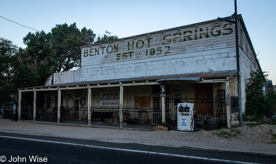
There are some mighty remote hot springs in what is nearly a ghost town here at the crossroads near the Nevada-California border. Returning here will take a serious effort, as Benton Hot Springs is truly off the beaten path.
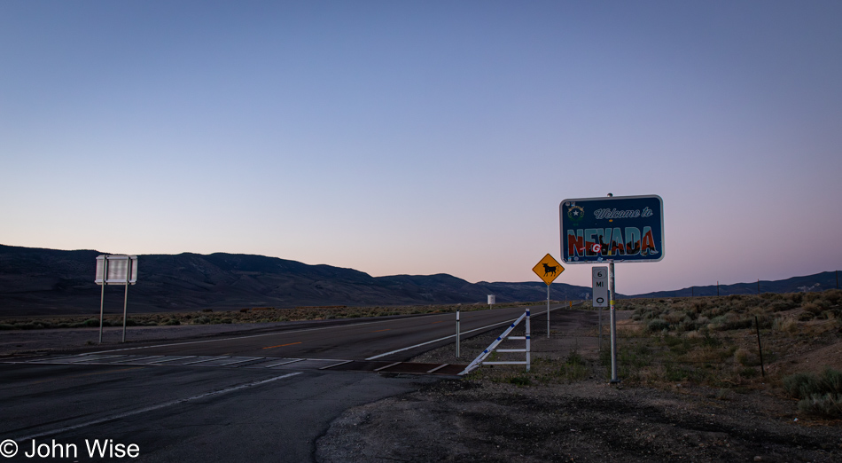
While the sun was quite low in the sky when we merged onto the Grand Army of the Republic Highway, we’d covered the majority of Routes 120 and 6 with enough light to feel we had a good idea of what the terrain looked like, so we can properly claim to have experienced this corner of America.
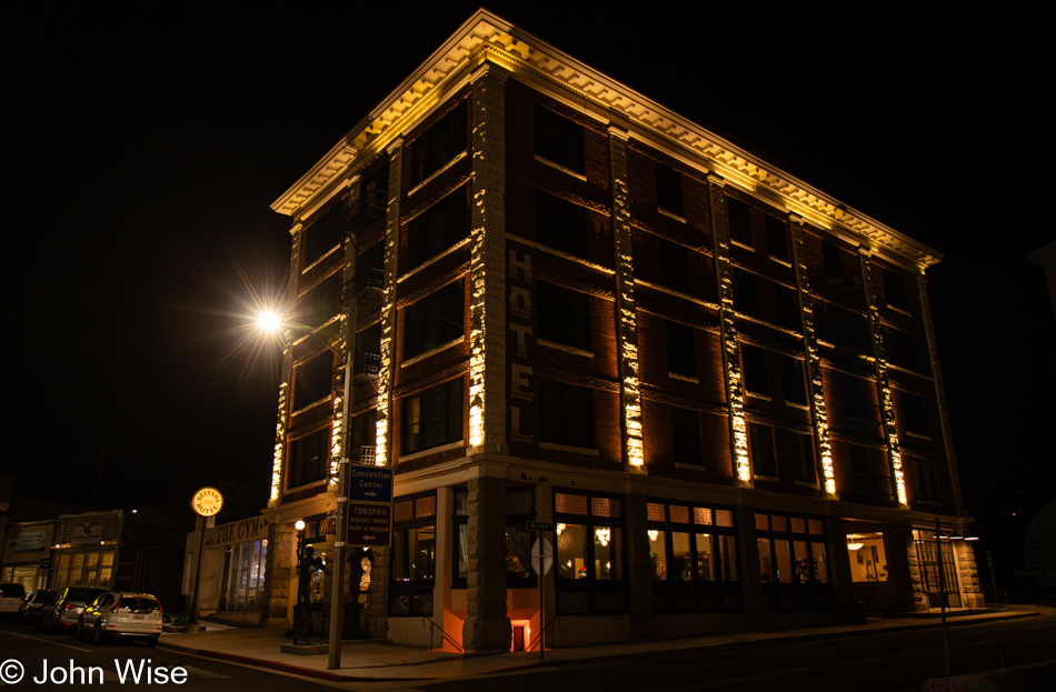
It was well after 9:00 p.m. when we pulled into Tonopah, Nevada, where I’d booked a stay at the historic Belvada Hotel. Rare is the day we sleep in accommodations more than a couple of floors high, with such lofty prices of a couple of hundred dollars for the night. Was it worth it? Not really, other than the idea that we are helping support a small town and a historic site. Next time, we’ll stay at the world-famous Clown Motel, also here in Tonopah, though, at $175 a night, it isn’t all that much cheaper. No matter as using Satan’s credit card, we can have anything we want.