This is one of those days dictated by driving requirements where a destination and hotel reservations are already fixed, but that doesn’t stop flights of fantasy from intruding into our thoughts to help paint new dreams. With only 45 miles between us and Lassen Volcanic National Park, we’d like to return to that park for a hike up the volcanic peak, which we didn’t have time for during our previous visit 20 years ago. Crater Lake, last visited 20 years ago, will also be nearby today, but we know that the rim drive doesn’t typically reopen until early July due to the heavy snow, so we discussed the possibility of making a trip up this way again later in the year just for Lassen, Lava Beds, and Crater Lake National Parks.
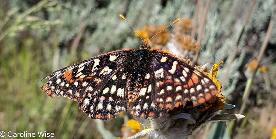
We thought we might have seen an eagle, which might have been appropriate considering that we were driving by Eagle Lake up California Highway 139, and then there were the pelicans weaving in and out of tufts of grasses, which were likely floating islands of tule reeds, growing in the shallows of the southern end of the lake. I shouldn’t forget to mention the ducks and other birds, but it was this fritillary butterfly that Caroline ended up capturing with her camera in between its frantic fluttering about.
I am compelled to overshare, which I think, in part, is triggered by the countless times I’ve casually listened to people stating how much they dislike driving big distances. For them, the drive is boring, there is nothing to see, their spouse/children/dog/cactus are too impatient after 26 minutes in the car, or they’d like to go but are waiting for the right time. There is no “right time” to get out on the roads of the country we live in! So much changes over the years, and time easily gets away from us.
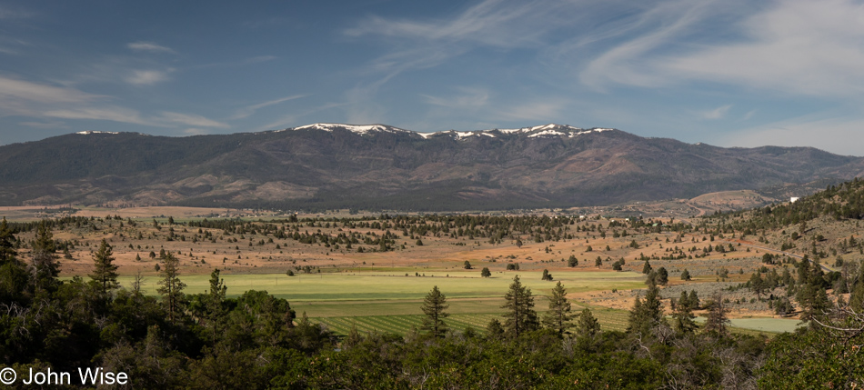
We’d been passing marshy lands for miles…
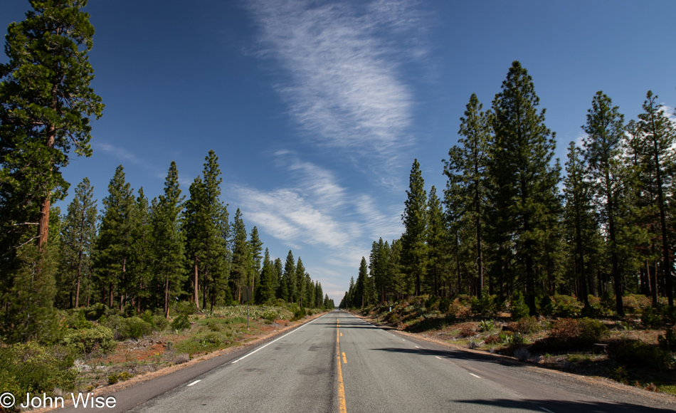
…and slicing through just as much forest.
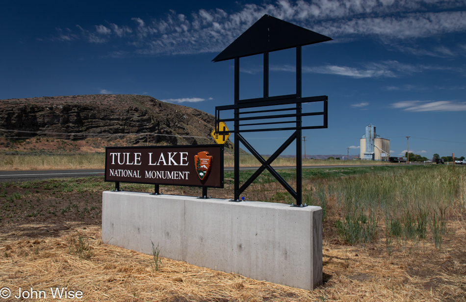
Seeing how we’ve never traveled this exact road through California before, we were surprised by this sign for Tule Lake National Monument, which prompted us to stop in the visitor center and learn why a lake had become a national monument. Well, it turns out there is a giant chunk of history, none of it good, that happened right up here in the Klamath Basin, once known as the Everglades of the West and subsequently as a concentration camp for Japanese people during World War II.
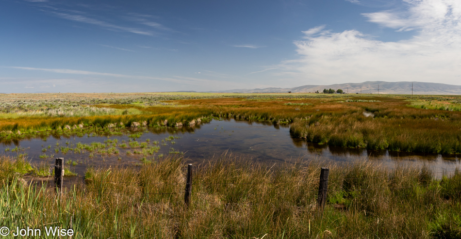
First up, the Everglades part of the story: Tule Lake had once been a very large lake, that is, until the Bureau of Reclamation decided that the wetlands and lake needed draining so farmers could use the land. Today, 95% of the wetlands are gone, as are the majority of the millions of birds that contributed to the area being called the Everglades of the West.
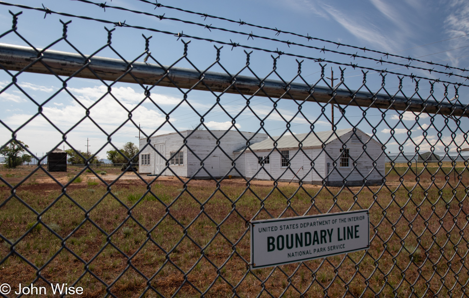
Then there’s the matter of what once had been the largest concentration camp for Japanese prisoners. I mean American citizens of Japanese ancestry. At the largest capacity, 18,700 mostly Americans were imprisoned here, though, over the four years that the camp was in operation, more than 29,000 men, women, and children alike were kept here. Like the majority of the ten concentration camps operated in the U.S., most of the facilities were cleaned off the map while American forces in Europe helped ensure Nazi Concentration Camps remained to remind the world of the injustice endured by “Undesirable” European citizens. Only a handful of minor buildings still exist here at Tule Lake, such as this old jail that can only be visited at 9:30 in the morning, when staff is available. During the years of incarceration, these Japanese Americans lost their homes, businesses, and property, but let’s get real: everything was seized from them, just as the Germans had done with Jews, Roma, gays, people with handicaps, Slavs, and others.
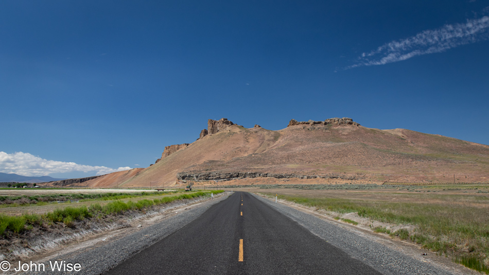
Oh damn, I almost forgot the injustices committed against Native Americans, such as the Klamath People, the Modoc, and the Northern Paiutes, who were part of a band known as the Yahooskin. Back in 1954, federal recognition of the Klamath Tribe was terminated with the loss of all of their lands. By 1986, recognition was restored, and they were granted about 1% of their former lands, or an area the size of Central Park in New York City. Anyway, enough of the pedantic stuff; we are out here to visit Petroglyph Point in the Lava Beds National Monument.
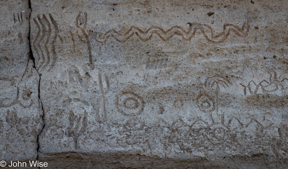
Of course, all of the petroglyphs are behind a fence due to the truly wretched amount of destruction they’ve suffered. This was not a fun place to visit.
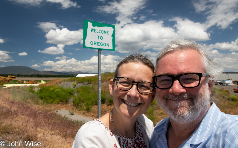
Oh, looky here. You see that “Welcome to Oregon” state sign behind us? Well, that can only mean that we are arriving at our happy place, though for anyone who knows us, everywhere is our happy place. Wait, that’s a lie! I really don’t like Walmart.
If I shared a photo of every moment worth remembering for Caroline and me, I’d have to record everything to video, only turning it off when we pass through cities and towns that have succumbed to franchise mania.
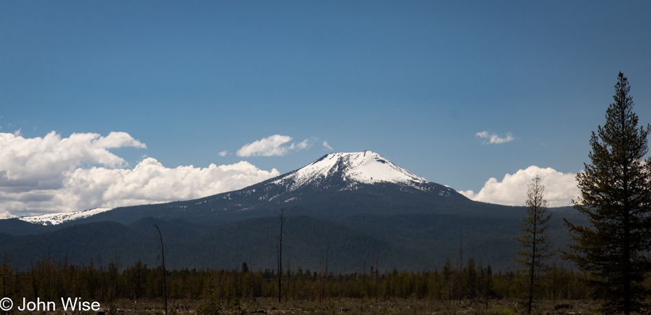
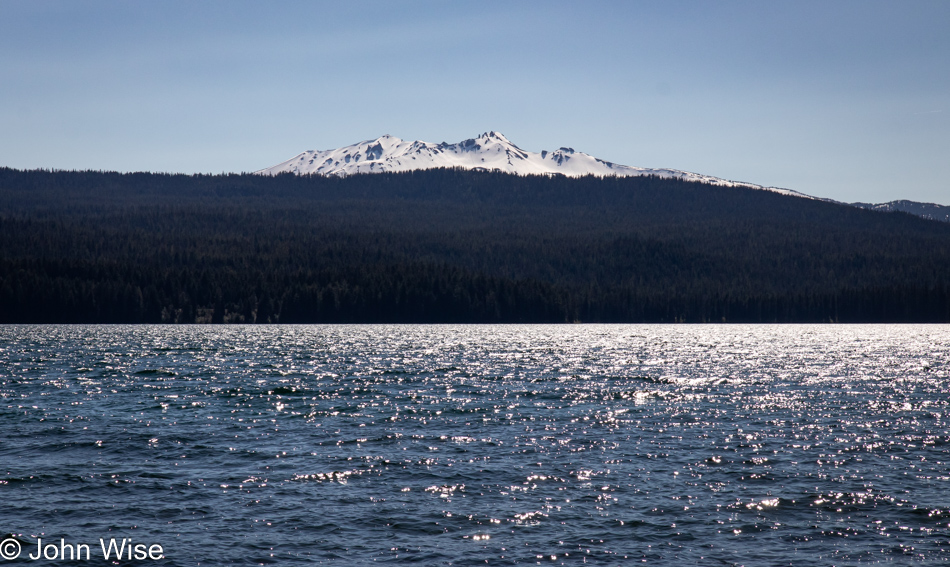
Some miles behind us we saw a great cragged peak behind the Upper Klamath Lake, and while I would have liked to share an image of it, there was nowhere to pull over to snap an image. So, I present you this nameless still-snow-covered mountain to capture the spirit of my intent.
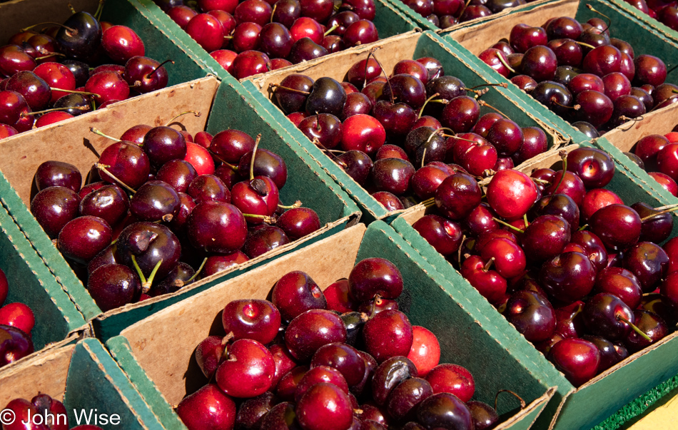
At midday, we stopped in Klamath Falls, Oregon, for lunch at Dave’s Brawny Burger, after which Caroline indulged in her second milkshake on this trip in so many days. This one was huckleberry-flavored. Passing through Chemult, Oregon, the Featherbed Inn we once stayed at has been rebranded, but that wasn’t surprising. These cherries, on the other hand, were a pleasant surprise. For a second, I needed to think about this idea and realize that in an age when nearly all fruit and vegetables are available year-round, it is at these seasonal times when things are at peak flavor that we have to take advantage of this opportunity, and support these roadside vendors.
Diamond Peak over Odell Lake in Crescent, Oregon.
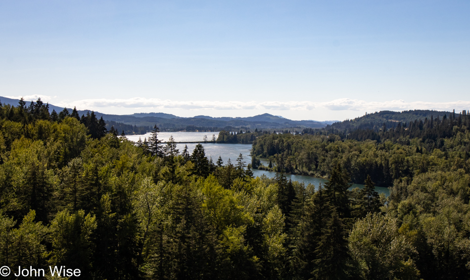
With all the driving we are doing today and yesterday, we are coming up short on our step count, so we try from time to time to get ourselves out of the car for a short walk. This stop was on the outskirts of the town of Lowell, Oregon, where we were able to walk across some railroad tracks and up onto the Lookout Point Dam, separating the namesake waters behind it and the Dexter Reservoir ahead.
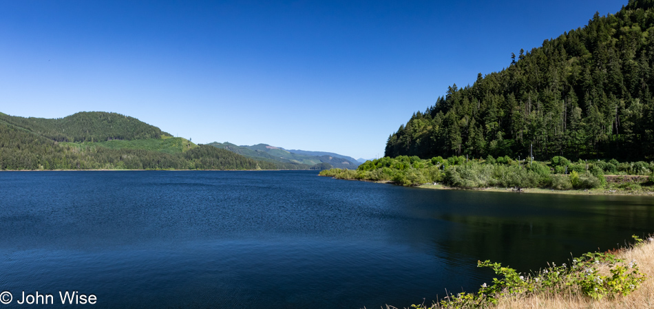
These are the waters I was just mentioning: Lookout Point Lake.
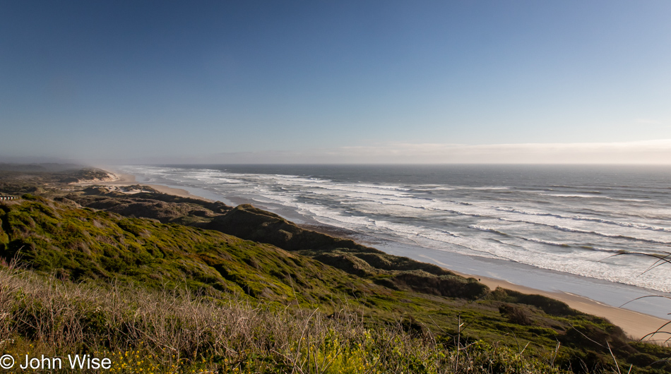
We were already familiar with the road that would bring us from Eugene, Oregon, to Florence, Oregon, as it’s the one we drove on our last visit to the coast back in 2022. This is taken from the Pacific Ocean Southview Overlook. Over the years, I’ve taken more, a lot more, than the 240,779 photos that are on my computer today, and it is for a situation just like this that I could benefit from an AI that can scan all of my photos and group similar locations together, identify the specific locations if possible, and when requested, fix the poor resolution of those images I shot that are between one megapixel and about eight megapixels.
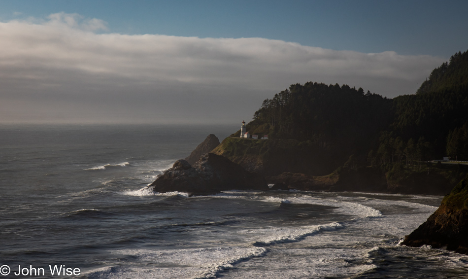
Just a little further up the road, a sketchy corner on the wrong side of the street has us crossing our fingers about oncoming traffic as we bolt out of our mountain-hugging lane to stop at the Heceta Head Lighthouse overview perched at the edge of the earth.
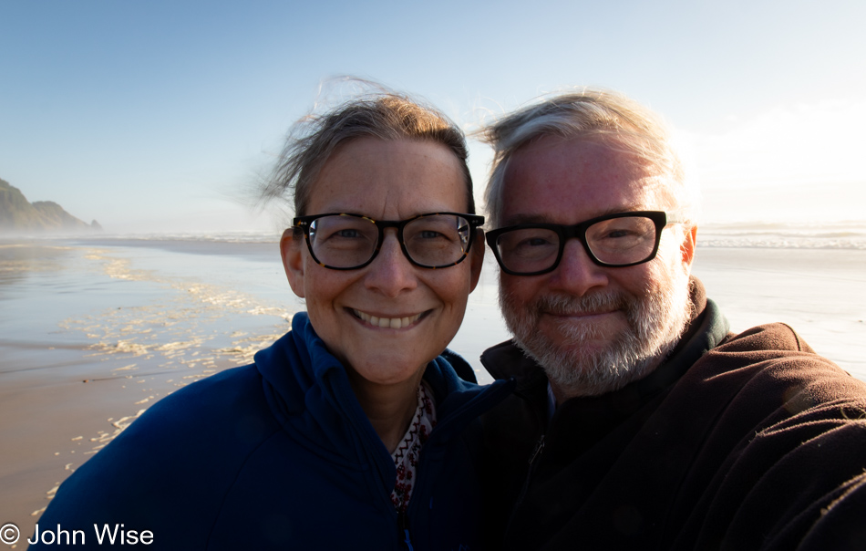
It was shortly after 7:00 p.m. when we stopped at the Carl G. Washburne State Park Beach just for the facilities, only to find out they had been locked up tight at 7:00. Undeterred, we peed our pants, girded our loins, and washed our bits in the tropical waters of the Oregon Coast. These are the satisfied faces of having wet ourselves just before walking into the surf to rinse off.
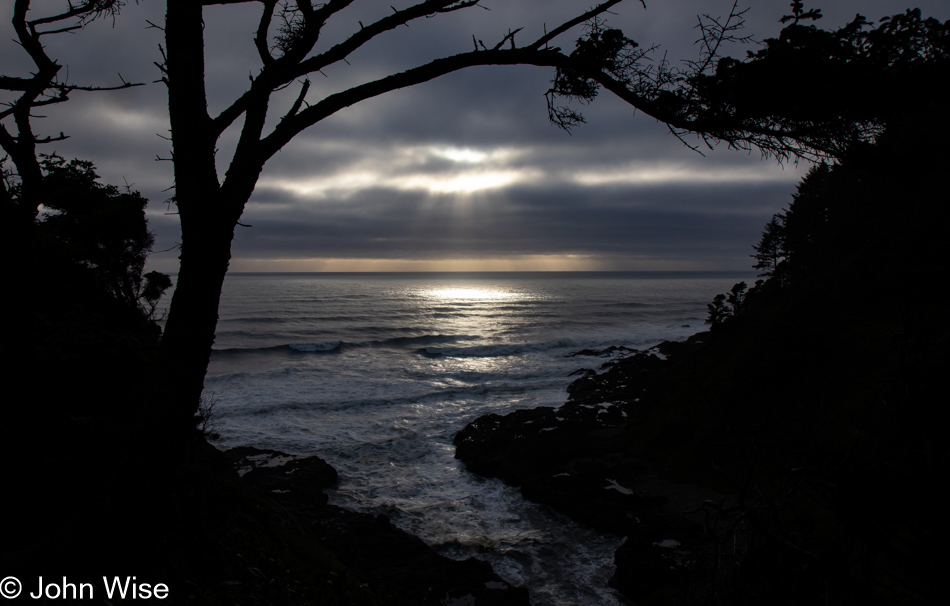
Our last stop trying to capture what will have to stand in for sunset was at the Devils Churn overlook south of Yachats, Oregon. Dinner was a simple shared bowl of steamer clams at Luna Sea Fish House in Seal Rock before finishing our drive to Lincoln City, where we’d be staying a night before taking over a house back down the road for the next few weeks. More about that tomorrow.