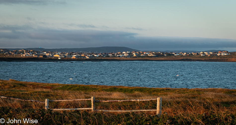
This kind of morning is only found on vacation, well outside a typical day’s routine. On almost any other day, we don’t wake with the idea that we’ll take a coastal drive to the uppermost point of a spit of land to visit a lighthouse, walk along the sea, or find ourselves on an island, for that matter. Today, we woke in a bed that was not our own, though we got in the car that was ours, and then we did our best to reach the lighthouse. Finding a place on the map is easy, interpreting the series of turns to get there presents no difficulty navigating, and sharing excitement about where we are going requires no effort, but getting there, even if it’s only four miles away, is the hard part. When a bleached, rough-hewn post-and-rail fence stands in grasses before a small bay with an idyllic view of red, white, and yellow houses across the way (exactly what you think a seaside village should look like), you must stop, enjoy the scenery, and celebrate that this is the reality of a vacation that you were bargaining for.
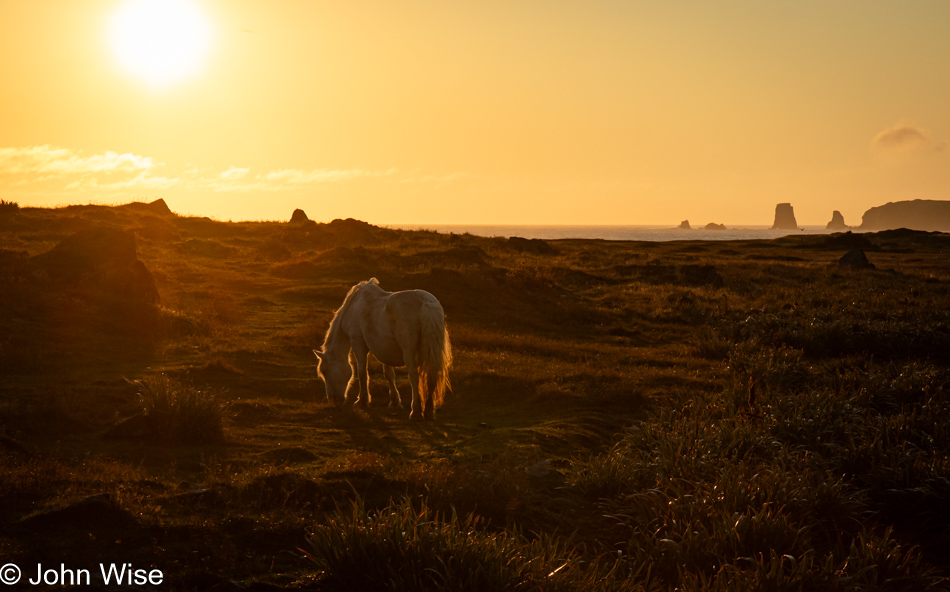
A photograph is an easy thing to see; they are so easily transmittable and shared. What’s not so easy is seeing a horse in the morning light with its mane, tail, head, and legs framed in golden hues by a molten gold sun and sky with sea stacks jutting out of the ocean in the distance. For that, you must be ready to see more, change your plan, leap from the car, find the aperture that won’t turn the horse into a silhouette, frame things the best you can, hope you don’t spook the horse into going somewhere else, pray that focus is tight, and start snapping the shutter. Maybe you wanted the horse to present a better profile, or if it would only approach you, the perfect image could have been had, but those moments are elusive and driven by flights of fantasy. Next time, the stars might align in a configuration I could have never imagined, and the zenith of my skills will finally find their outlet where I can feel like I’ve gained the experience to create a proper work of art. Until then, I don my well-worn hat of the amateur and am grateful for another opportunity to practice.
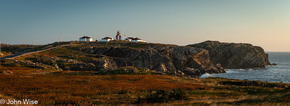
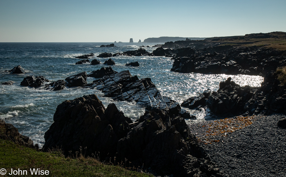
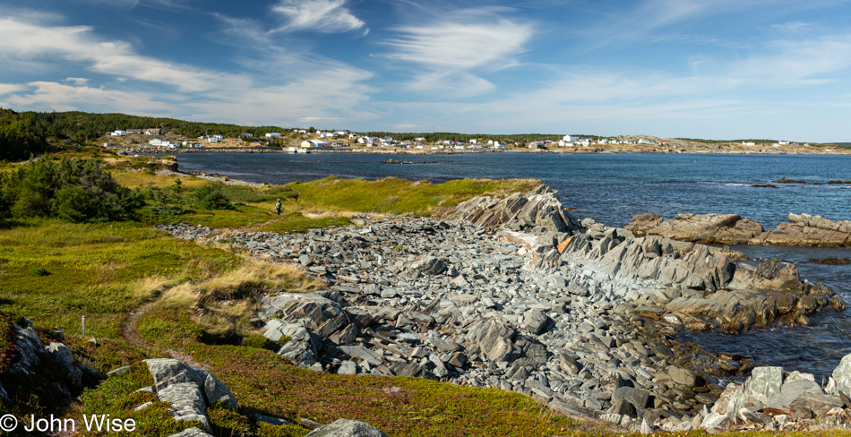
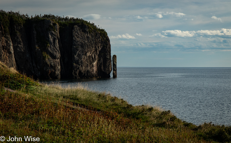
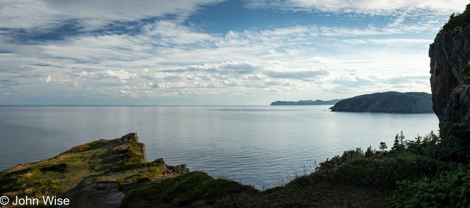
Our first glimpse of the Cape Bonavista Lighthouse Provincial Historic Site.
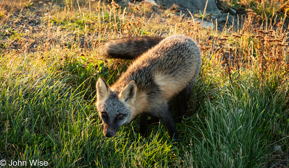
This beautiful fox will not be the only one we see out on this peninsula this morning, and while I initially thought it was begging for food, I quickly changed my mind, deciding it was simply curious about checking me out. I’ll admit that after seeing the other foxes yesterday, I tried offering them a morsel. Yes, I know that’s wrong, but they weren’t interested in the least, and I figured it would be the same situation here, not that I tested it. I can’t say that their approach was without apprehension on my part, as the somewhat aggressive motion toward me had me thinking about rabies or that they were angry about our proximity and about to fend us off. Instead, as long as I made no swift motions, they would approach, look at me, take a sniff from a safe distance, and return to the hunt. It makes sense that they cannot lose their hunting sense and rely on humans to throw them snacks as they have a long season of needing to fend for themselves when visitors are few and far between. Watching the foxes hunt was fascinating as it seemed obvious they were watching with their ears, following the movements of tiny rodents in the underbrush. Without being able to catch sight of them, when the catch was in the right spot, the fox would quickly bury its head deep in the bushes (maybe I should say goowiddy instead) to snatch breakfast from its hiding place.
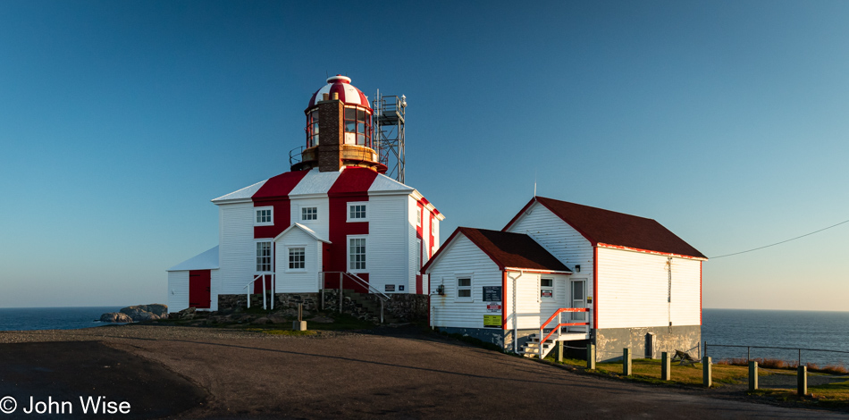
Add one more reason for our inevitable return to Newfoundland: this old lighthouse from 1843 was not yet open, which is a shame as the tower is visitable. Why would one want to climb the stone tower? The reason is obvious: the same seal oil-fueled catoptric light used back in the 1800s is still up there, and that’s something neither Caroline nor I have ever seen.
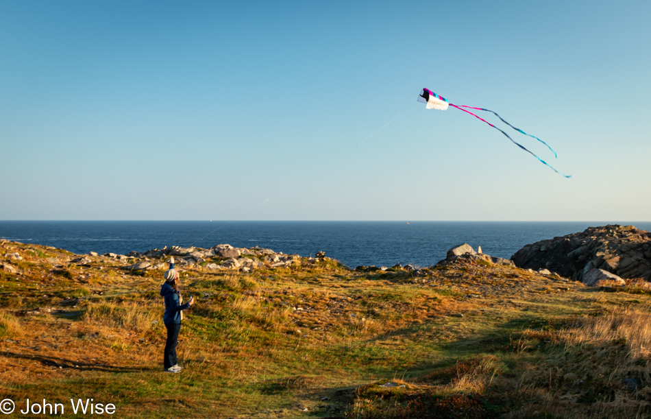
For a minute, maybe less, I paid attention to Caroline bringing out Happy McKiteFace for a flight under the shadow of the lighthouse, but once I had an adequate photo, I turned my attention back to the foxes who were working the landscape hunting for food.
It is the wrong time of year to be here to see the local puffin colony that summers on a nearby rock or the whales that pass the point, and it is far too late in the season to witness icebergs floating by, lending the name Iceberg Alley to this northeast coast of Newfoundland. But it is the right season to see other delightful sights, such as the smile on Caroline’s face when I circle back to her flying her kite.
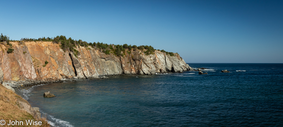
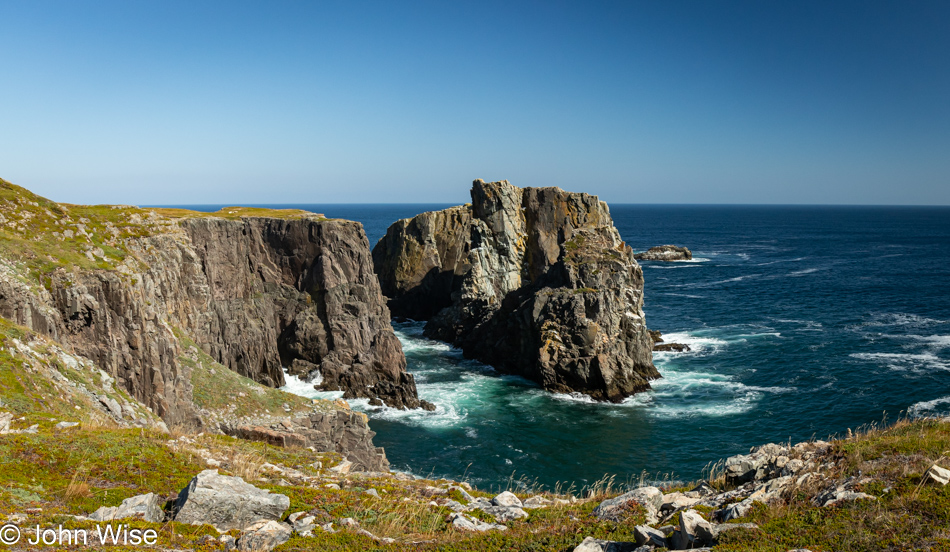
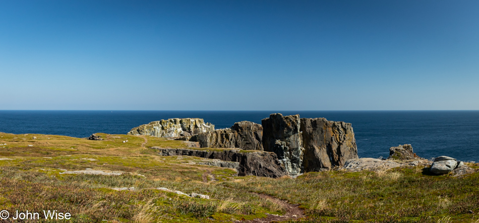
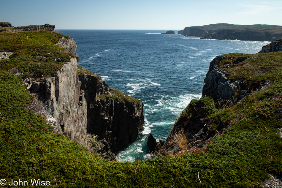
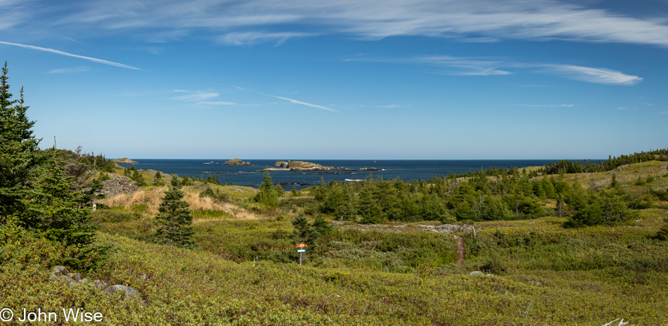
If the lighthouse was Reason # 9 for our return to Newfoundland, I’ve just uncovered Reason #10, and it’s right here, though we didn’t understand where “right here” was when we were right here. Not only is this corner of the island around Bonavista part of the Eastern Hyper-Oceanic Barrens ecoregion, but we were also on our way to the Dungeon Provincial Park, part of the Discovery UNESCO Global Geopark. Leaving Arizona weeks ago, I knew nothing about any of this. A shame, though, with such an ambitious itinerary to take in so many various points in the Maritimes, certain knowledge of these facts likely couldn’t have changed our plans, though our explorations might have been better informed.
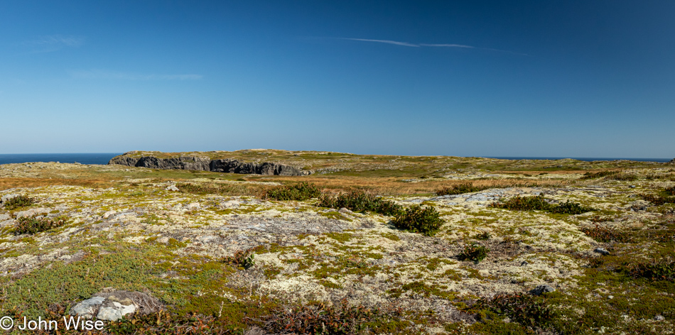
These photos are from the Dungeon area, though I’m not sharing a photo of that yet as it was cast in deep shadow during this visit. You will have to wait until after our next hike when, with a better position of the sun, we return to the Dungeon for a better look. First, though, what is the Eastern Hyper-Oceanic Barrens ecoregion, you ask? Due to the area being exposed to the harsh North Atlantic Ocean with the combined influence of the cold Labrador Current and the warm Gulf Stream, the sloping, rocky peninsula experiences a unique climate with high precipitation, strong winds, and cool temperatures. This accounts for the almost treeless, nearly barren landscape dominated by low-growing shrubs, grasses, and mosses. That’s a quick explanation describing the area, and then there’s the geology that plays a large role, which is where the designation of Discovery UNESCO Global Geopark comes into play. A Geopark exemplifies a geological area of significance while also noting the cultural and historical importance of the region.
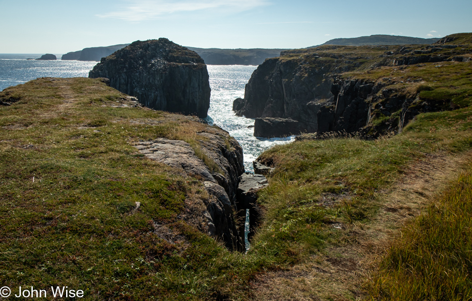
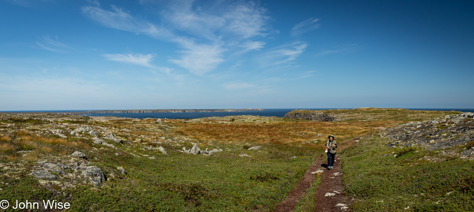
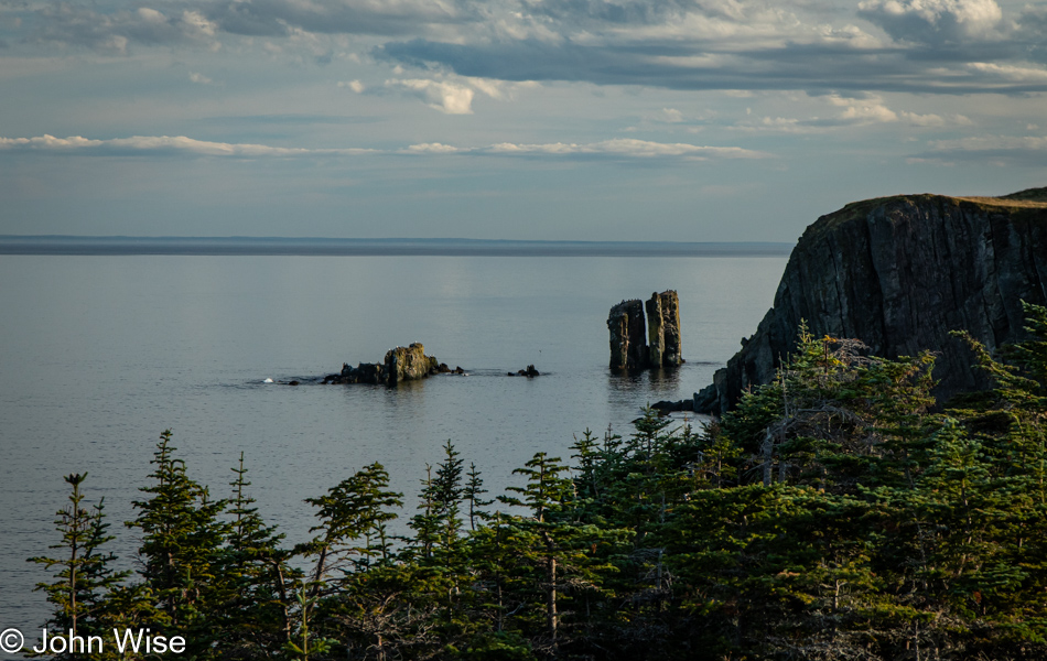
The Dungeon was the first Geopark Caroline spotted on the map; another was nearby at Spillars Cove on the Cable John Cove Klondike Trail. It is called the Chimney. Later, we’ll stumble upon a third Geopark site, more of that when we get there. It turns out that there are ten sites in total, meaning we’ll have missed seven of them. But I need to back up. After our early visit to the Dungeon, we needed to head back into town because we’d agreed with our host that they’d drop off breakfast and coffee at our front door at 8:00. Following that, we packed up our things in the car and drove to the parking lot at the Chimney, or so we thought. With other cars parked at what looked like a trailhead and other people walking over the hillside, we figured this was the place. When our paths crossed, the other hikers on the way back to their car said that the Chimney had been their objective, but they had trouble finding the trail. Our confidence assured us that we knew what we were doing and their fate would not be ours.
Then, here we were, not at a crossroads but at an impasse, though not exactly that either, as we thought we could make out the faint hints of places others had walked, so we ventured forth.
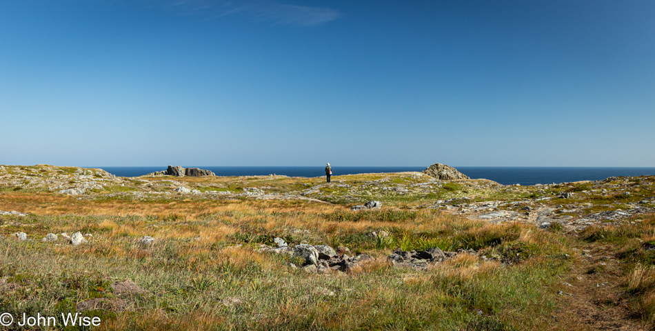
Maybe Chimney Rock is down one of these crevasses or over a cliff? Nope, nothing that looks remotely like a chimney.
Maybe this is it? No way, a sea stack, maybe, but who cares? Our hike across the outcropping has been terrific, so who cares if we miss the main feature? It’s got to be out here somewhere, and it’s not like we can get lost, even if we have to retrace our footsteps over the boreal tundra.
After maybe a half-hour of wandering the cliffsides, making impressions of new trails, we finally spotted the actual trail, which was confirmed to us when we saw a couple of hikers walking along. I yelled over to them, standing seemingly too close to a cliff for comfort, asking if we were on the right trail for the Chimney. That couple assured us we were now on the trail and said we should come over. I answered back, “It looks kind of scary to someone afraid of heights,” to which the woman replied, and I quote, “Oh, then you’ll poop your pants over here, come on!” This funny couple from British Columbia, Canada, seemed surprised when we pointed out which way we had come from, informing us that we must have been in the overflow parking area. The woman told us that this trail was one of her favorites in all of Newfoundland and that the best overlook of the Chimney was to our right, which was also the way back to the trailhead.
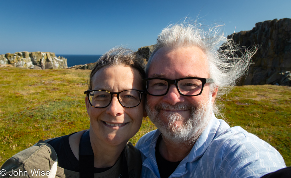
Good thing that we weren’t lost forever because who wants to read about two old people wandering the wilds of Newfoundland without water, food, sunblock, or common sense, with headlines exclaiming, “Tragedy befalls unprepared Arizona couple who left the trail and suffered a bitter end.” Elated, we stopped to take a selfie, proving that we were still alive on the ground next to the sea instead of some celestial cloud-like place in heaven. We now felt like professionals, intrepid explorers of the world, able to bushwhack our way back to civilization, or was that shrubwhacking? In any case, we kept our wits about ourselves and survived the ordeal to tell the tale.
Yep, that’s our trail, mere inches away from a death crack that takes visitors straight to a watery hell if they don’t wedge themselves in the narrow gap where they can starve to death instead of falling to their demise.
By now, we thought that what is considered the Chimney somehow eluded our attempt to find it. Still, we are happy to have been here.
We are resigned to make our way back to the car if only we could stop investigating every corner.
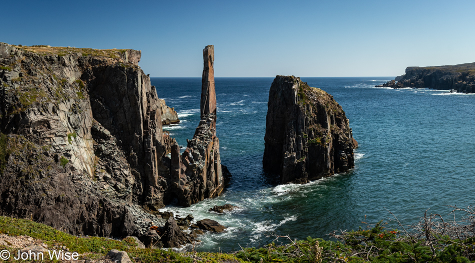
Hey Caroline, “Maybe those signs over there…” Oh, look here, I think we found the Chimney. Had we found that other parking lot, I think our visit might have been finished in about 15 minutes instead of the hour we were out stumbling across a landscape in search of this elusive rock column that, in actuality, is quite easy, nee, impossible to miss.
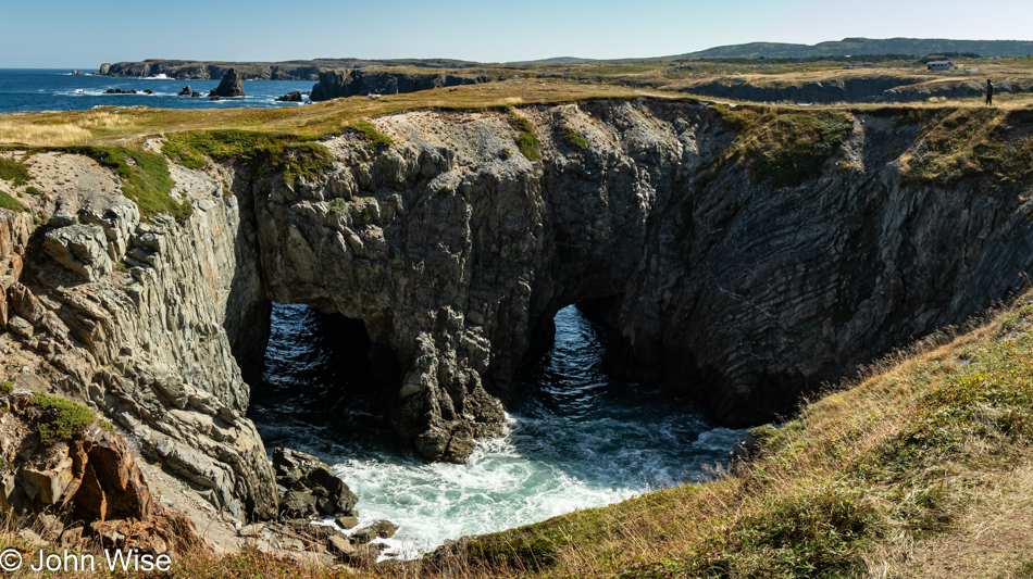
Not too far away, another gravel road brought us back to the Dungeon, the remains of an ancient sea cave that collapsed, creating this massive hole with dragon’s eyes. If you look to the right, an idiot banana dressed in human clothes is out walking on a trail that lets batshit crazy visitors circumnavigate the top of the Dungeon; my sphincter bristles in quivering fear simply writing this.
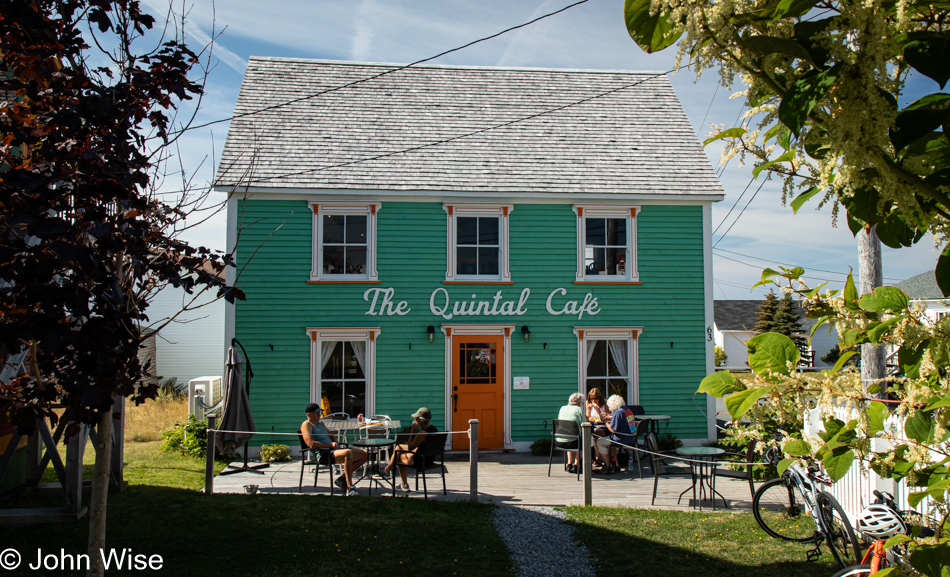
Maybe you are thinking, “No way, this is too quaintly beautiful to be real,” I’d almost have to agree if it weren’t for the fact we were about to have lunch here. But this being us, nothing is as straightforward as it might seem; before arriving here at the Quintal Cafe, the open sign for the Sweet Rock Ice Cream Shop snagged Caroline’s attention like a loon catching sight of a favorite fish. I didn’t know it was snack time, and it certainly wasn’t lunchtime, but after talking with the guy in the shop for over a half hour, lunch started seeming like an option we should consider. Asking for his advice, he told us the best sandwiches in town were to be had at this cafe next door to the Boreal Diner, where we ate last night. As for the pre-lunch partridgeberry cheesecake ice cream, it was so-so. According to Caroline, there were not enough partridgeberries.
Not having put a dent in Caroline’s appetite, we pulled up to Quintal and quickly determined what we’d order. Had we an inkling of how ginormous lunch would be, we’d have shared something. Caroline wanted the fishcakes, and I opted for the turkey club sandwich, which the ice cream vendor had extolled as a great bargain and equally amazing. Oh My God, my dinosaur-satisfying sandwich was so big that half of it was packed up and put in the ice chest for some future meal should we again find ourselves in the wilds facing starvation. While I would have loved nothing more than to sit here, trying to catch up in some small way with the week of writing I was behind with, we needed to continue down the road under these beautiful skies of finding new things.
Earlier, I said we’d stumble into a third Geopark. Well, here we are at the Capelin Gulch Fossil Site, quite by chance. Driving south of Port Union in the Melrose area, a spectacular view had us taking a small detour on a loop road, and then an even smaller loop had us trying to get closer. That’s when I caught sight of the Discovery UNESCO Global Geopark logo and made a quick left turn, informing Caroline that there seemed to be another Geosite down this road. Now at home, getting ready to write about this visit, it was nearly impossible to discover anything about it, probably because this and three other public sites were only brought into the Discovery Geopark system in mid-2023, and it seems that the internet hasn’t caught up with them yet.
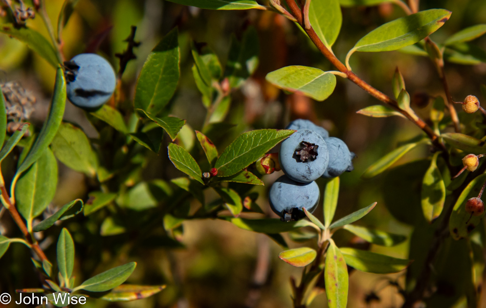
Is it our imagination, or do wild blueberries taste better than farmed berries?
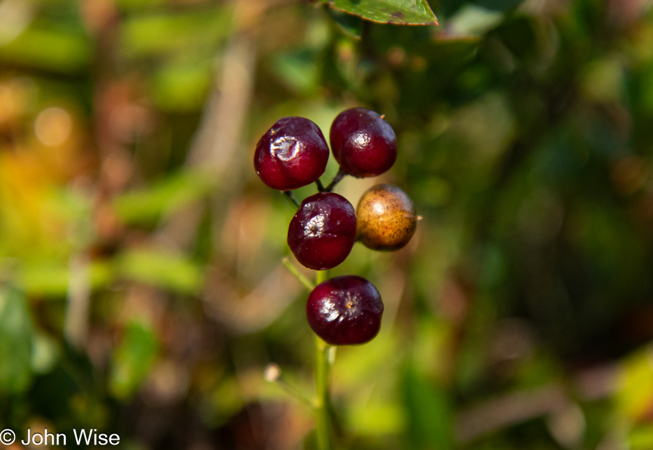
Caroline insisted these were partridgeberries and joyfully started popping them into her mouth. She handed me a couple; they seemed rather bitter instead of the sour taste I expected. They also had seeds. At some point, she thought maybe they weren’t partridgeberries but might have been lingonberries, but I told her that lingonberries don’t have seeds of that size. She tried reassuring me that they were some type of currant and safe to eat. I guess she was correct because I’m here able to write this.
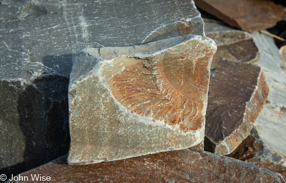
Approaching the rocky coast, we started seeing fossils and a nearby sign that informed us that the plant fossils found here are from the Ediacaran period of Earth’s history, or about 550 million years ago.
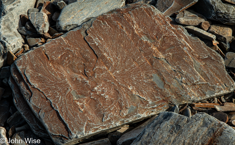
There are fossils everywhere, but they are all fragments, and without a guide, we don’t know what we are looking at.
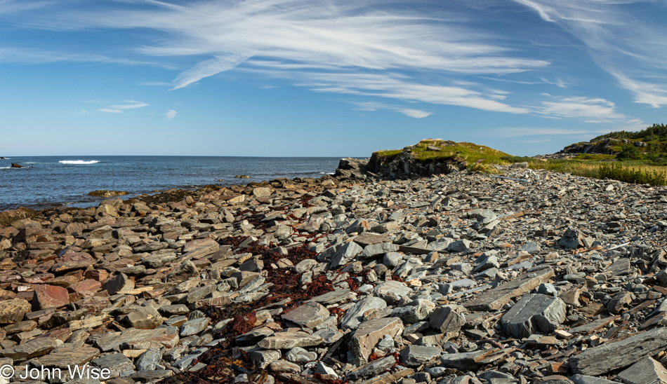
There are hints of fossils everywhere, with more likely being exposed after each passing storm.
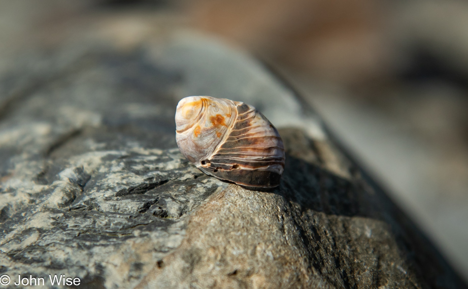
The fragile resting on the resilient, the rare found on the common. Should we ever return to this exact place, there’s a likelihood that this rock will still be here, but this chance encounter with the snail shell will remain the only time in my life that I will have seen this particular shell before it returns to the fabric of elements. Maybe, if I were an enlightened entity, I’d understand that, in essence, we are always seeing everything in all as it transitions in and out of the matrix of temporality.
While Caroline was busy over at the first cove, I continued down the rough path, trying to see where the trail continued until I came to a point where things got sketchy and too close to a cliffside to go on, and while I could see where the trail continued, I wasn’t certain that we’d be able to loop around, so this would be where we doubled back to where the trail began, except while Caroline was out in her world, she found a couple of urchin tests, its internal sphere-shaped shell, and a single raspberry, that we shared. A shared raspberry, that’s love.
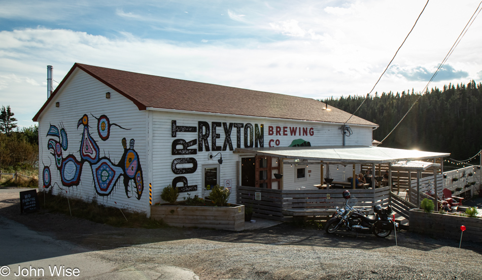
Was it the mural, the weather, or that we’d seen Port Rexton beer featured at one of the restaurants we’ve eaten at? Whatever the motivation, we pulled up and were happier for the experience, even if we were running slightly behind schedule. Walking up, we passed a small trailer on the other side of the brewpub; it was a spot to get a bite to eat called Oh My Cheeses. Without the slightest desire for food, we walked right by and into the brewery, looking for souvenir beer to bring back to the States. The pub’s interior is terrific, and after Caroline sampled a few of the beers on tap, we were heading back to the car with a small selection of cans when she voiced regret for not trying the beer slushie made with Sea Buckthorn Sour and peach lychee juice. We were not going to leave with regrets, but then again, we will leave with regrets.
After putting the beer in the car and walking past Oh My Cheeses again, the woman inside the trailer said hi, and we got to talking. Somewhere in the blurry sequence of events, one of us returned to the pub and ordered the beer slushie as we waited for a signature award-winning cheese sandwich known as the Violet to be made. We were definitely not hungry, but the description of homemade blueberry jam, bacon, and aged white cheddar topped with balsamic glaze and fresh basil persuaded us that if we split the sandwich, we’d find space. Plus, it was more like dessert, not that Caroline needed dessert after having started lunch with ice cream, but that’s of no consequence because, in the interim, we’d gone on a wild adventure involving getting lost in the wilds of Newfoundland, so this was more of a celebratory moment required to replenish those spent calories. Sure, we finished it, but this was where the regret came in following the gluttony of wanting it all.
We were in Port Rexton, not for views, beer, or grilled cheese sandwiches, but for a hike on the Skerwink Trail.
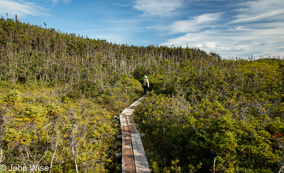
Being a contrarian, I opted not to start the Skerwink Loop Trail the official way, taking the trail under the large arched sign welcoming visitors. Instead, we headed up what essentially was the trail exit on the right. I think my main attraction for putting this trail on our itinerary was the sound of the name, which we learned is a local word for the shearwater seabird.
Considering that we hadn’t arrived here until 4:30, we intended to nab a brief taste of the trail, turn around, and get back on the road for the three-hour drive to St. John’s still ahead of us. With the loop only 3.2 miles (5km) long and our routine walking speed of about 20 minutes a mile, we knew we could easily do the whole trail if we hoofed it. Of course, we don’t stop to gawk at beautiful sights on a walk through our neighborhood in Phoenix, nor do I pause to take 106 photos along the way. We also thought that if we weren’t making progress and felt we weren’t quite halfway, we could still turn around and bolt for the car. That common sense never reared its ugly head.
Like salmon spawning, we worked against the stream of those who took the trail as intended and kept going further into the depths of the Skerwink Loop.
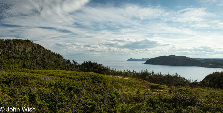
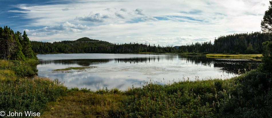
The first part of the trail took us past a pond to White Cove Beach, leading to some minor elevation gain for a nice overlook of the Trinity Lighthouse. There was also a side trail with what appeared to be some serious elevation gain to an overlook at the top of the mountain, but we were racing against time, so it was easily skipped. Easily for me, not so much for Caroline. If she looks at the one StreetView panoramic image from up there, she might curse me or insist that next time we are in Newfoundland, we’ll complete that part of the trail.
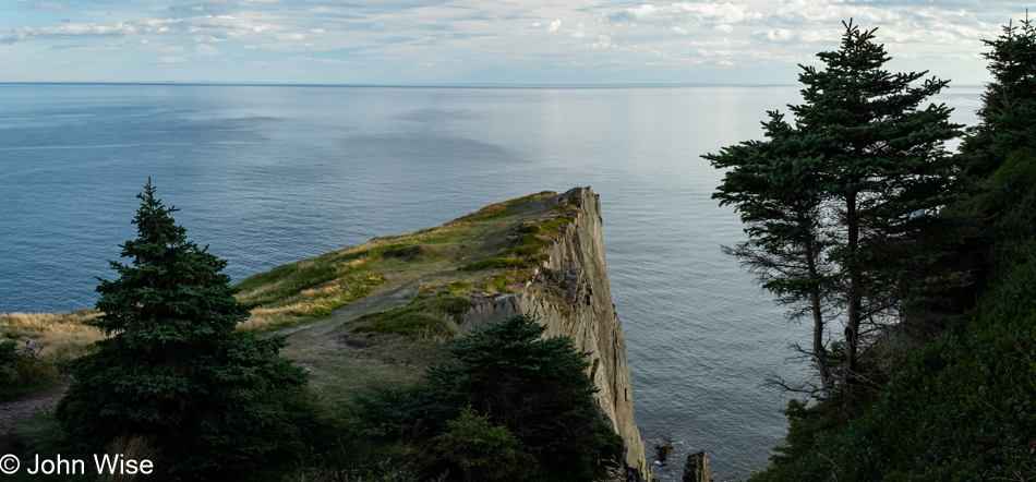
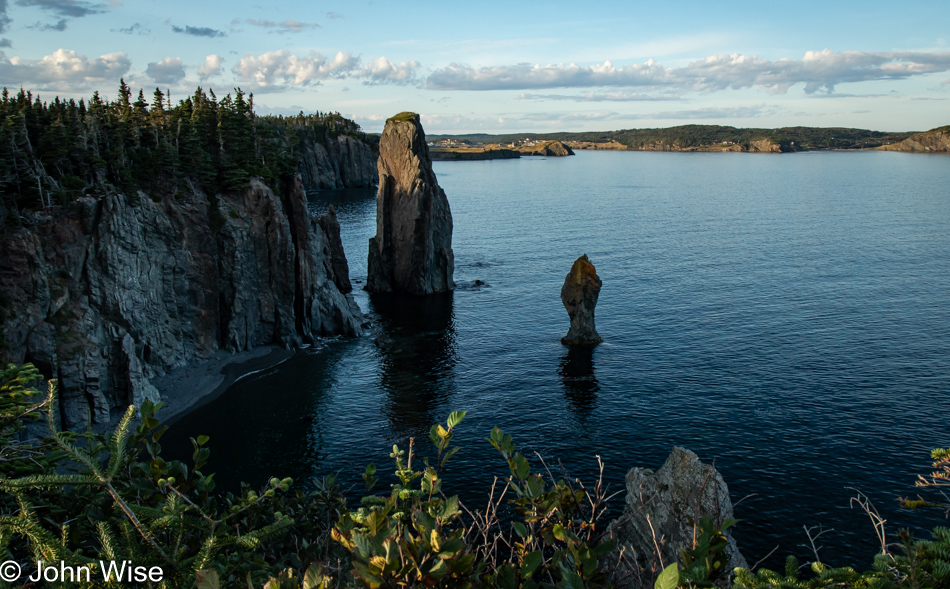
Once we reached the headland and the east side of the peninsula, the views became spectacular; not that the west side was Swiss cheese, but look at this. I don’t know if you can make out the trail that brings visitors to the edge, but that was a zone of butt-puckery I wasn’t ready to wrestle with.
It turns out that this side of the trail is considerably sketchier, meaning it is what I’d consider a somewhat frightening amount of exposure on steep areas literally carved out of a cliffside, but the views are, without a doubt, stunning.
And when you think you’ve been offered an adequate reward for the effort invested in hiking this trail, the payoff just continues.
When we arrived at the trailhead, two women were also starting the hike late. They took the trail to the left, and somewhere along the way out here, we passed each other, probably at the halfway point, because the four of us arrived back at the parking lot just minutes apart. When they saw us getting in our car, they turned around and came back toward us for a chat. It turned out that they were identifying with our Arizona license plate as they, too, had driven from Arizona, from nearby Mesa, and were surprised to encounter us neighbors so far from home. As I appreciated their efforts and the speed at which they covered the trail, I had to ask their ages; they were 71 and 69 years old. I must take note to remember them and hope I remain inspired by their tenacity and great health, enabling them to enjoy such big endeavors.
When one sees so many captivating sights, it’s easy to become lost in the perfect experience, leaving us wanting more. We entertain the idea that a subsequent visit should bring us back to this moment at the same spot, and while there are hints of those times when we return, it is the addition of new points on the map and adventures in proximity to a special place that has the effect of lending greater impact and draw after learning that we’ve not exhausted the possibilities to find new delights. While it is wonderful to revisit memories when impressions are so strong, I feel that gaining a more comprehensive overview begins the process of building a familiarity that lets us gather a sense of belonging.
This philosophy can be difficult to live with when we rush through a place, as we have here this afternoon. But, as convinced as we are that it all deserves a second glance, there are probably 1,000 other locations next to shorelines here in Newfoundland we are yet to explore that will be equally enchanting. There is an undeniable wealth of experience collected when our impressions entice us, even while we are still standing in situ, that we must return as soon as possible. We are building the memories of legends where epic love stories have unfolded.
Then, a half-hour later, maybe more or less, we are somewhere else falling into yet more awe-inspiring moments; this is the nature of the vacations experienced by the two of us.