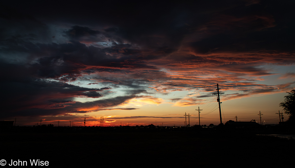
Showered, packed, and ready to go, I delivered bags to the car before sunrise, which allowed me to enjoy a glorious dawn on the Great Plains. But I wasn’t ready to leave as I had yesterday’s blog post to complete. Without a coffee shop or open diner, I had no choice but to deal with my narrative from the hotel room, missing whatever the sky had in store for the rest of the early morning.
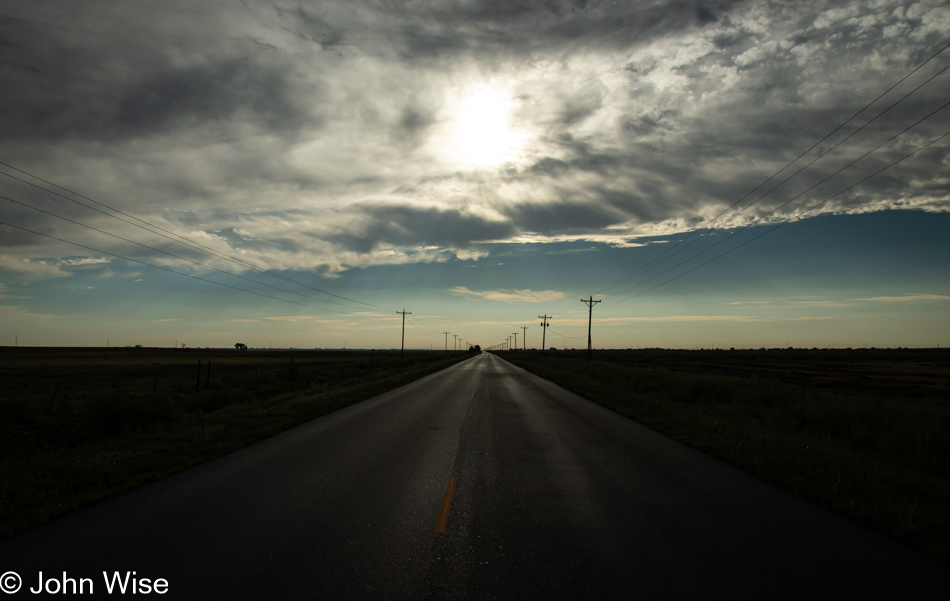
Forty-five minutes later, I was on the road toward Bristol, Colorado, and realized how enchanted I was by these flat lands. Up ahead at the intersections of Colorado 196 and US Route 385, 18 miles east of Lamar, I pulled over to step out of the car and take a moment. It’s certainly flat and a bit noisy with the insects abuzz, a bunch of barn swallows, and a lot of trucks. While it was early to desire nothing more than to pull up a chair and linger a while; that’s just what I felt would make the day so much better. It’s a good thing I didn’t pack a folding chair. Before leaving, I was able to listen to a few brief moments of the western meadowlark.
The few trees there are out here are associated with somebody’s property; I don’t believe there is one wild tree out here.
Nope, no bison here; you’d have to have wild grasslands and not the mono-culture farming that’s going on here on the Great Plains.
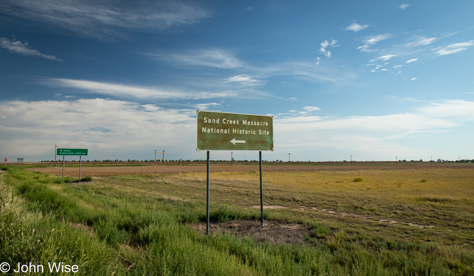
This sign reads, “Sand Creek Massacre National Historic Site.” With a designation like that, you know that whatever this was, it was bad. Because it was classified as such, you also should know that it involved the Indigenous people of these lands. If you spent time on the Great Plains, you’d understand the vast area this encompasses; it stretches in all directions, and then think that back in the day, it was grasslands as far as the eye could see. There were no roads, railroads, trees, or mountains, nothing on the horizon for many miles. When the massacre of Cheyenne and Arapaho people happened, it was 1864, three years before the first train would roll through, and the nomadic people who called these lands home knew quite well how to live and coexist in such a wide open space, but white Christian people did not. I have to wonder just how hateful were those god-fearing Christian settlers when it came to people with skin color and customs different from their own. This sign makes me feel that the land of the Great Plains is soaked in the blood and death of countless people, nearly all the bison, the habitats, and traditions that were being erased.

I love these old-grain silos, but finding information about them is not very easy. The design appears to be from the early 20th century, maybe around 1910. I’m going with this date due to several factors: the first important one is the design, which was popular between 1910 and 1940.
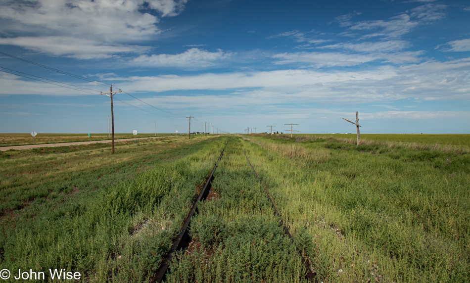
The next clues to the puzzle of how old the Sheridan Lake grain silo is came from this section of railroad track up the road in Towner, Colorado. I’d pulled over thinking I would snag an old insulator from the telegraph poles that still line the track, but no luck there. However, walking along the overgrown, long-retired track, I saw that a steel rail was stamped with a date of 1945. This would have had to have been post-World War II because all steel supported the war effort before that. The steel in train tracks is good for about 30 years before needing replacement, but I could see that being postponed due to World War II. Shortly after that, the highway system and modern trucking made the trains irrelevant, and now they are too expensive to remove.
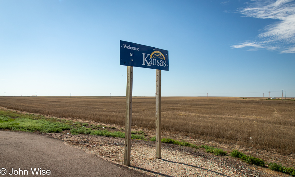
Welcome to Kansas.
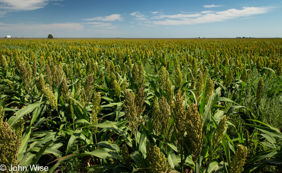
Animal feed or ethanol production? What else might the thousands of acres of sorghum be used for? It’s probably the same thing as with all the corn.
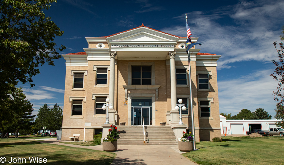
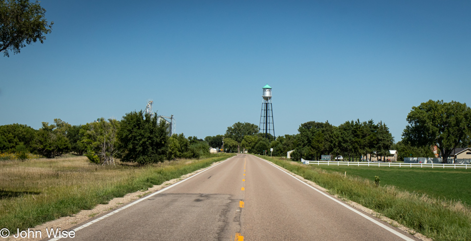
I’m not focusing on towns and cities because I’m too quickly passing through. Besides, many of them are tragic hulks of what they’d once been, but this Wallace County Court House in Sharon Springs, Kansas, has held up perfectly, just as much of the town. Tribune, Kansas, is holding on south of here; I passed through that town 30 minutes earlier. I was struck by the fact that I’d driven more than 50 miles without passing a gas station or convenience store, which had me thinking how nothing is conveniently had out here when medium and large cities are often more than 100 miles away.
Out of Oakley, Kansas, I started driving up US-83, which I’ve driven on before, most recently last May when Caroline left the Canadian border on this road, taking it as far as Texas. Before that, my daughter Jessica and I took refuge at a gas station at the Interstate 70 and US-83 intersection during a ferocious hail storm. Today, I’m only an 18-mile stretch of this iconic US-83 highway.
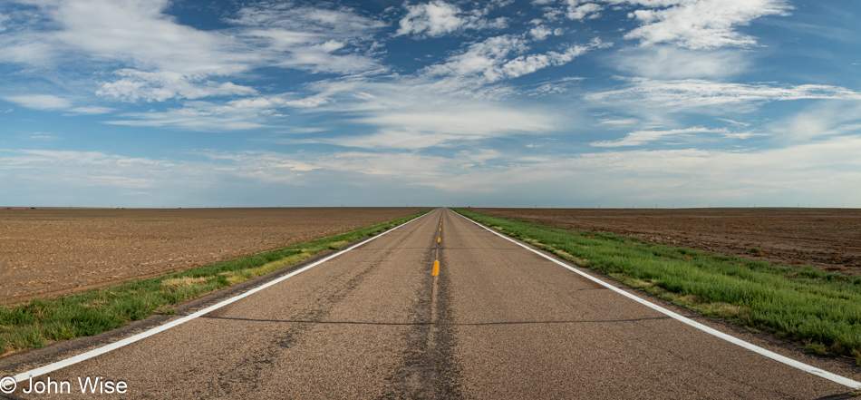
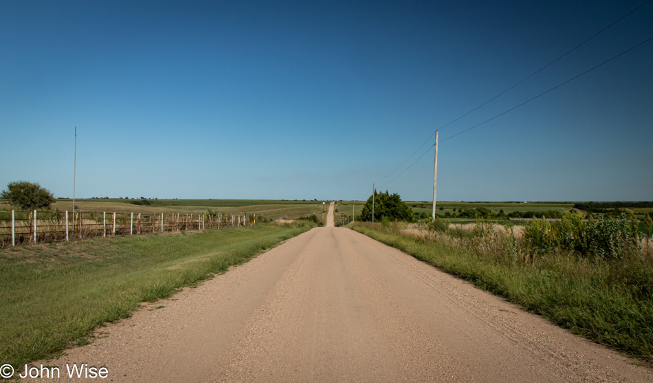
Right here, where US-83 crosses US-24, I turned left to venture down new roads. It’s still flat as a board.
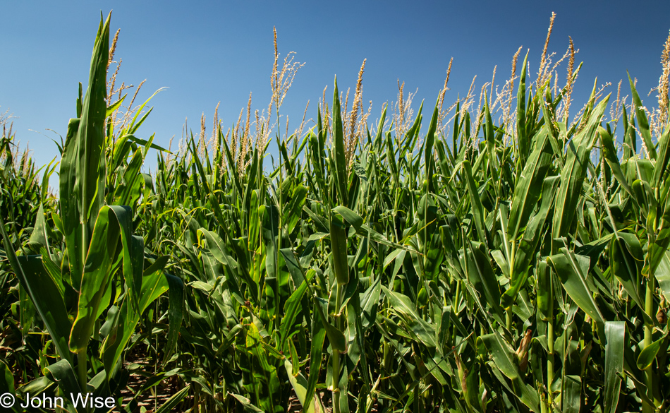
There’s not a lot of crop diversity on this 200-mile section of Kansas I’m crossing today: sorghum and corn, followed by more sorghum, more corn, and more corn.
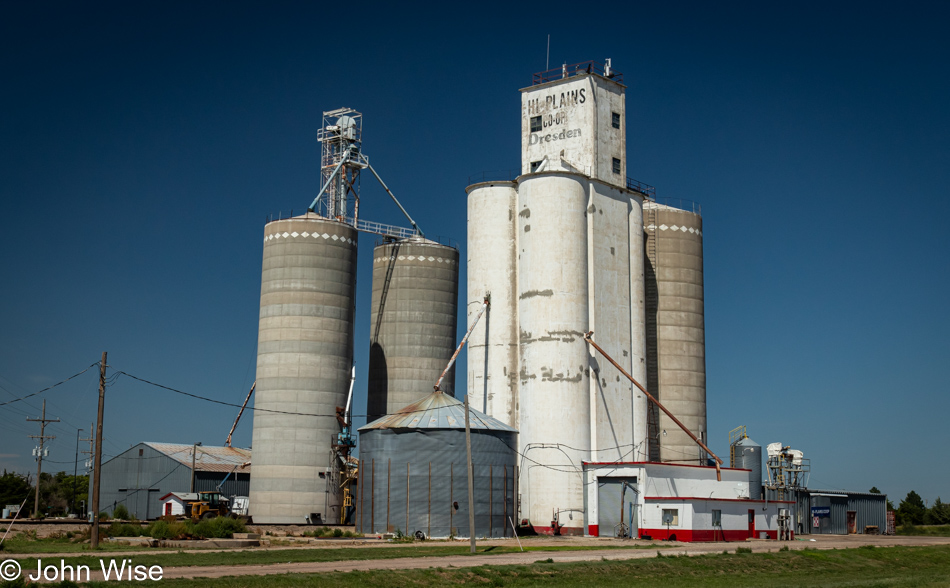
I’m still intrigued after all these years of stumbling across towns showing their heritage with names such as Dresden.
Welcome to Long Island, the one in Kansas, not New York. The landscape has been changing with more trees and hills; this can only mean one thing: we are approaching another state.
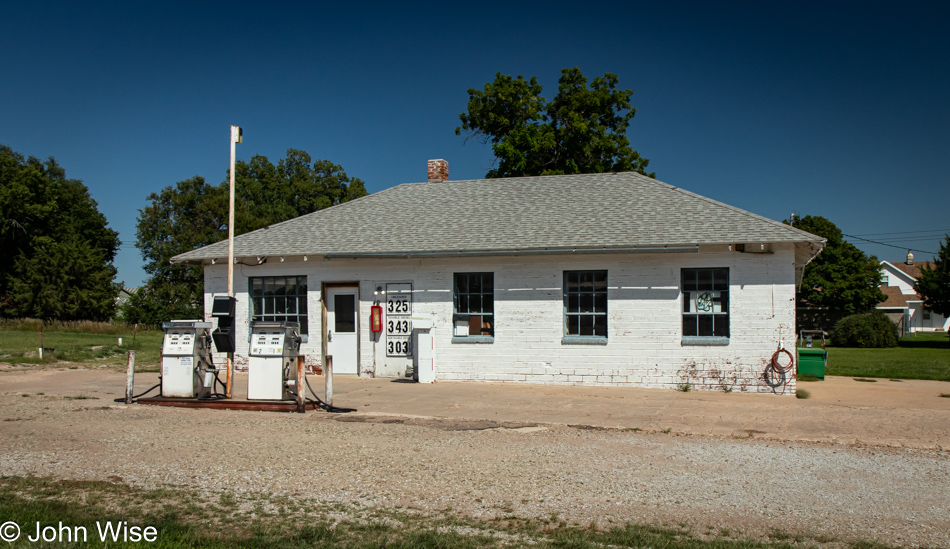
Nothing more than a simple and functional gas station. No vending machines, no lottery tickets, no fried chicken, and only two pumps. Sometimes, narrow choices and getting directly to the matter at hand is a great option.
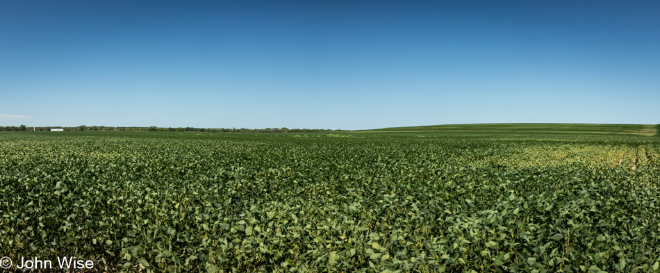
What’s this? A crop change? Could that be soybeans? Why, yes, it is. That must mean we’re in Nebraska!
The map app tells me that about nine miles down Cornhusker Road, which, as you can see, is unpaved dirt, is a marina on a lake in a town called Republican City, where I’ll find a restaurant on the water’s edge and some dinner. [Before anyone gets any ideas, Republican City is named after the Republican River – Caroline] In Alma, where I’m staying, there’s a pizza place open; that’s it. The guy at the front desk of the Super 8 ($80, including tax) told me that nothing is open because today is Monday. Please, someone, give me a memo next time I want to travel on Monday that it’s a bad idea should I want something other than diabetes fuel. So, what did I have at the marina restaurant? Yep, diabetes fuel with a burger and fries. Fresh pan-fried lake fish and steamed veg were not on the menu, though they did have an extensive selection of pizza.
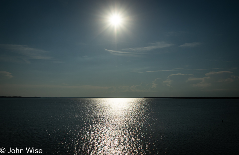
For everything else I prepped for before leaving Phoenix, fishing and grilling gear wasn’t part of that setup. Just behind me, while I was taking this photo from the top of the dam holding back the waters of the Harlan County Lake, I spotted fishermen in waders working the outlet waters of the reservoir about fifty feet below my vantage point. I have Caroline’s kite in the car, but what good does that do anyone?
We miss you over here