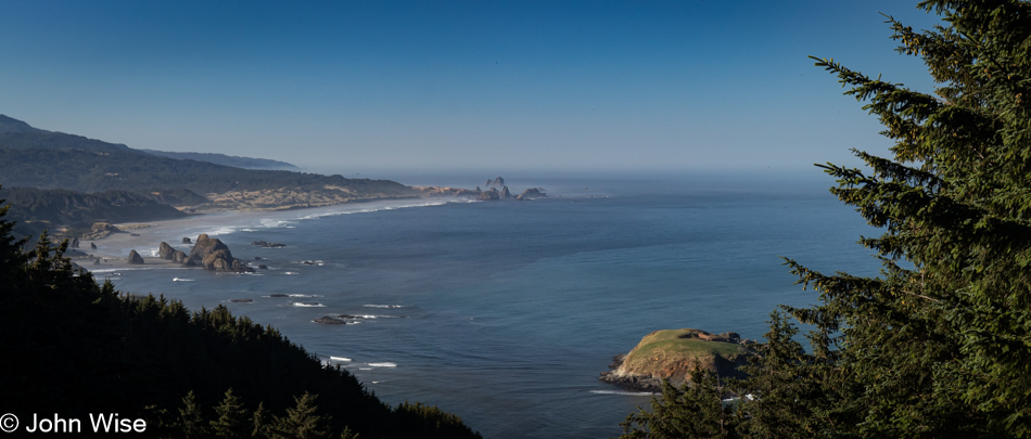
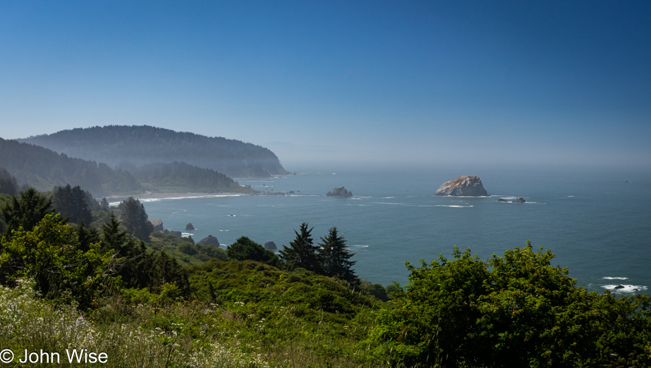
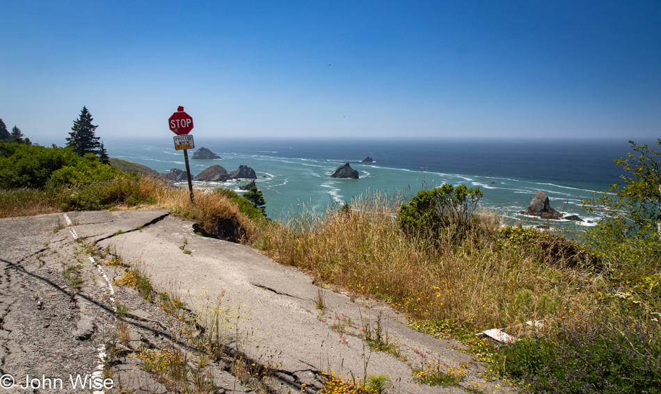
Is that California out in the distance? Not yet, but soon. Today’s setup down in Gold Beach was intentional for what would be our next stop today. First though, we made this quick stop at Cape Sebastian, not only for the view, but as a reminder that we want to take the trail from up here all the way down to the ocean.
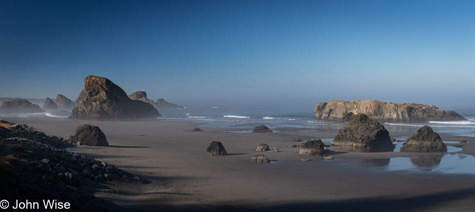
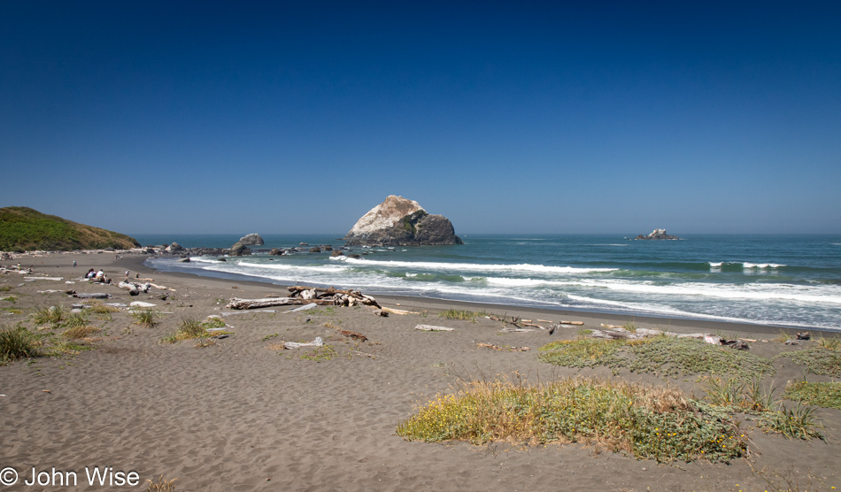
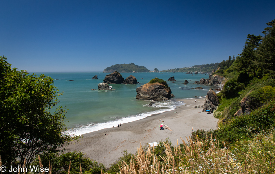
This is the spot we had to visit as our last stop in Oregon on this mighty, amazing coastal adventure we’ve been experiencing. Meyers Creek Beach has long been a favorite.
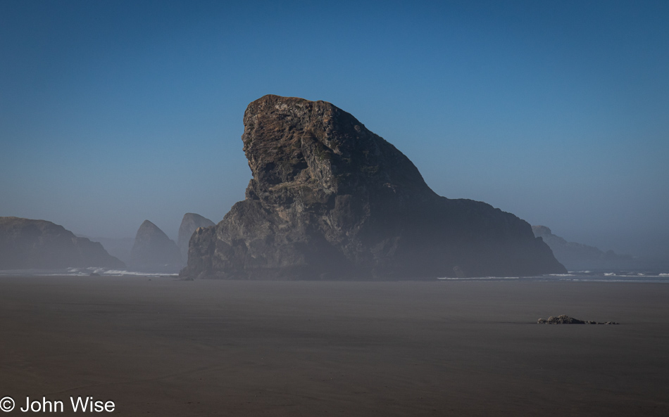
Before we ever knew the proper name of this beach, we called it the Sharkfin Beach for obvious reasons. It is this rock jutting out of the sand and sea that created this affinity and keeps us coming back.
We took time to linger in the fading moments that could be allocated to time on the Oregon Coast. While there’s some likelihood we’ll return this November, as I’ve already started making reservations, one never knows what tomorrow brings, so we have to take every second to absorb all we can.
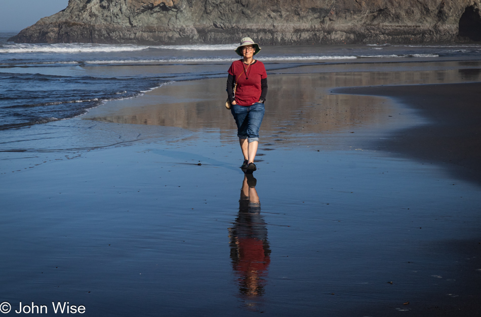
Note the hands in the pockets instead of holding the reins of Happy McKiteFace; there was no wind here, zero, zilch.
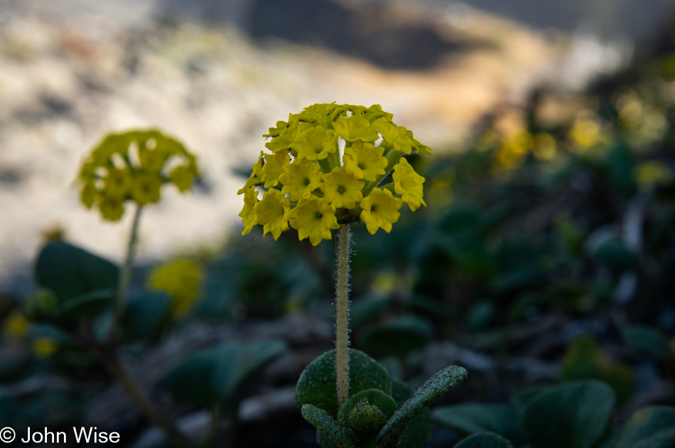
Leaving the beach, we caught a whiff of this flowering plant that is not in bloom during our November visits. It is coastal sand verbena, and it smells brilliant.
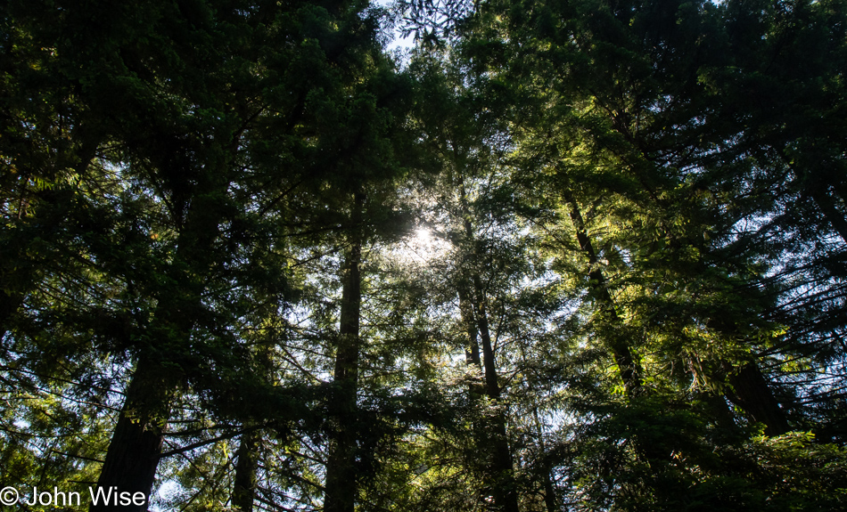
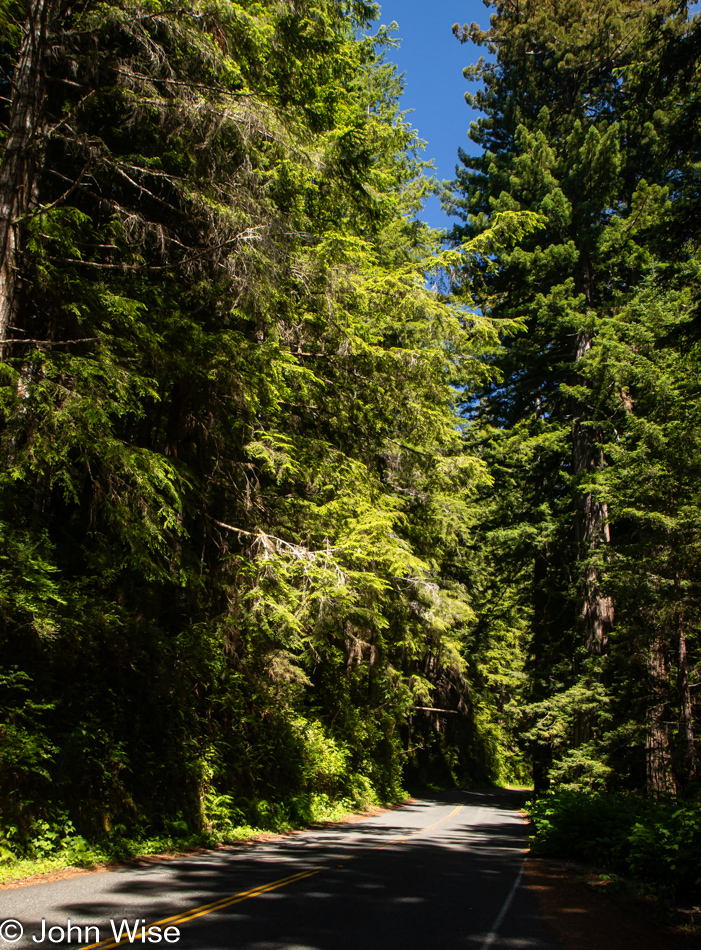
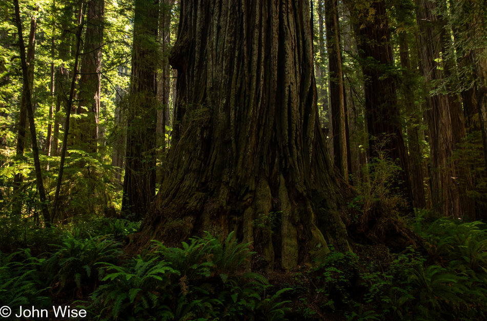
We’re on Wonder Stump Road just north of Crescent City, which is less than 15 miles from where we crossed from Oregon to California on Highway 101.
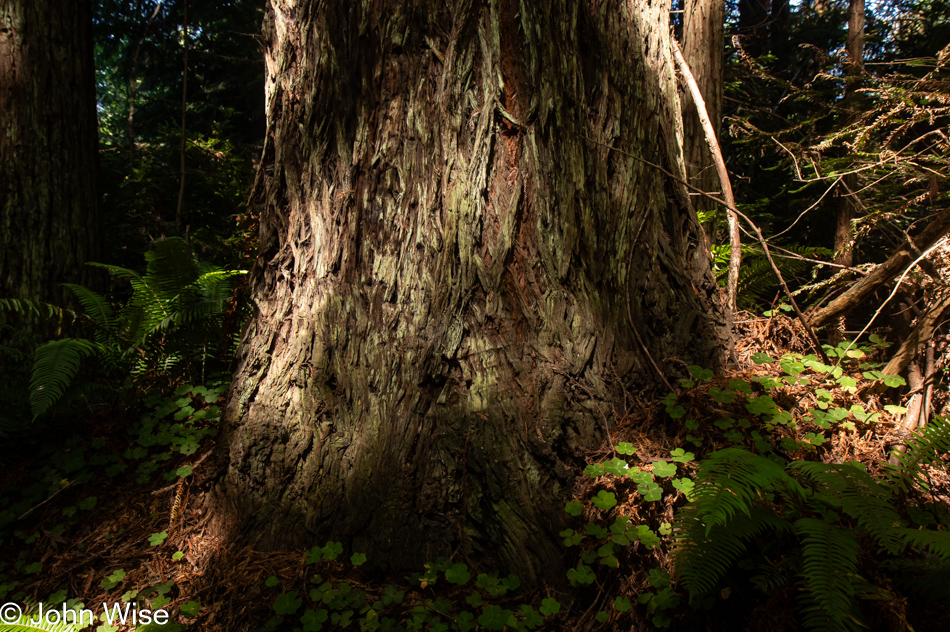
These trees are today’s first encounter with the redwoods, and while some may think that 5 million of these giants of the more than 100 million that once existed is an adequate number, keep in mind that there are 39 million people living in California and nobody is suggesting the state is running out of habitable land. The tree we are standing below might be about 30 feet in diameter, meaning it could be about 300 to 400 years old. The Lost Monarch tree in Jedediah Smith Redwoods State Park has a circumference of approximately 84 feet (25.6 meters) while the oldest redwood is estimated to be about 2,200 years old, so even if humanity were to attempt to restore what we’ve ruined, not us, our children, grandchildren, or great-grandchildren would be around to see one of these trees reach even this circumference.
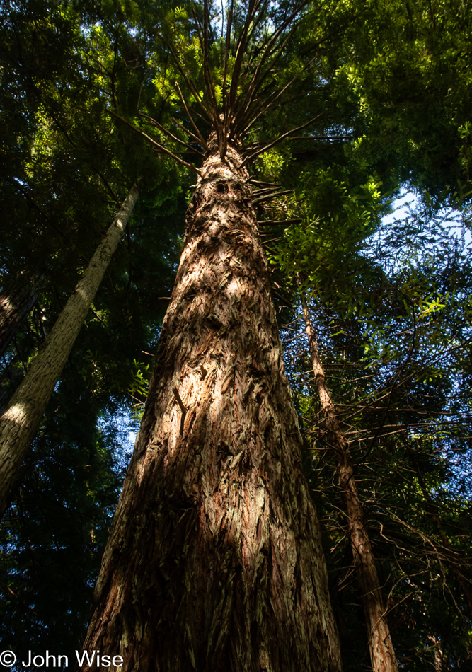
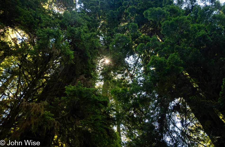
It’s peculiar to my primitive brain how I can be so impressed standing at the base of one of these trees, and yet there is an entire ecosystem above me that is unvisitable and must remain a big unknown to my senses. The canopy of the redwoods may as well be at the bottom of the sea or on the moon.
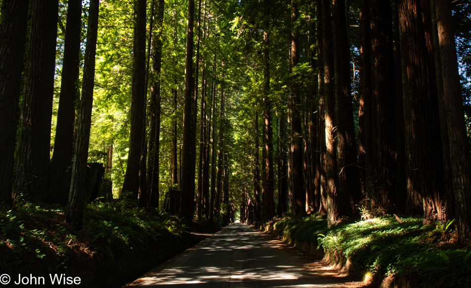
The Wonder Stump Road might only be two miles long, but we were lost under these trees for nearly as long as it would have taken to walk the road.
Had our goal been to get as far south as fast as we could, our time at the edge of the continent would have been a lot shorter, but that would have brought an unceremonious end to this trip, and so our route was designed to maximize time at the coast and allow us to dawdle.
Wilson Creek Beach was afforded a quick stop, a photo and go.
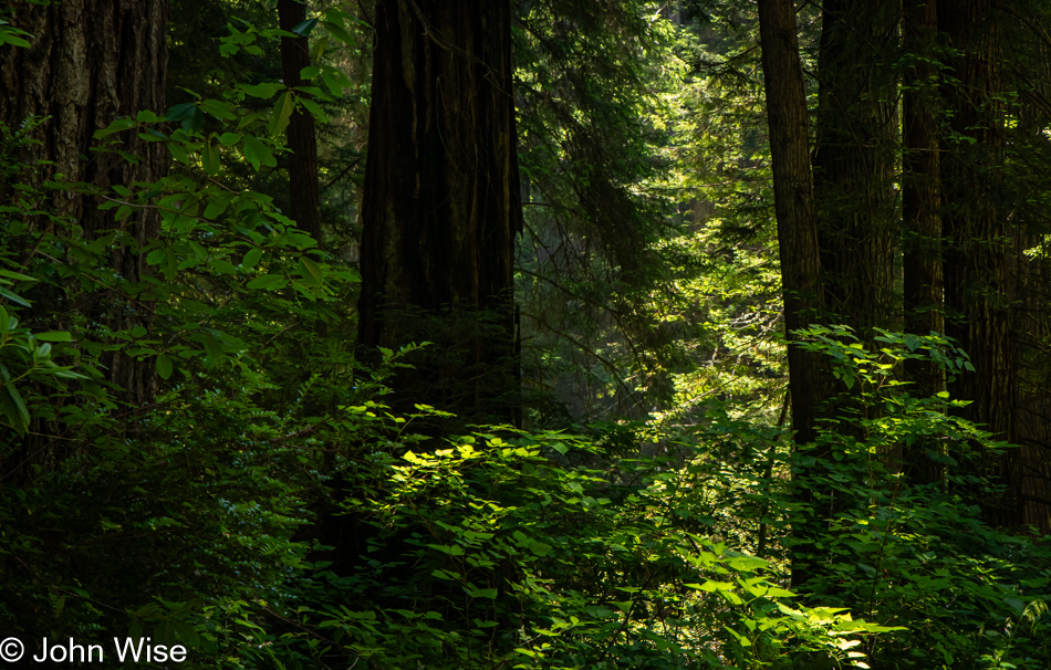
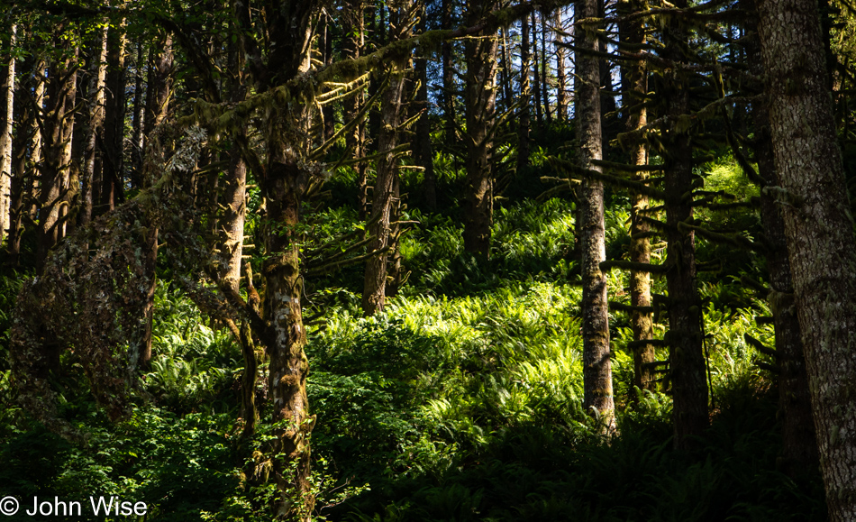
We’ve turned off Highway 101 at the Newton B. Drury Scenic Byway in the Redwoods National Park on the way to the Prairie Creek Redwoods State Park to slow things down even further. To simply drive by and ignore these trees and their lush environment feels like sacrilege.
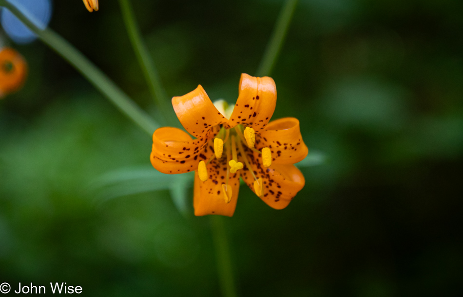
Caroline spotted tiger lilies next to the road, but often, there was nowhere to easily pull over, so we continued on until we found some near a pullout.
Sadly, there’d be no time for a hike into the woods because while we can take our time, as long as we reach Ukiah, where we have a hotel reservation, I have plans for a side trek off the beaten path to a place on the coast we’ve never visited before.
These forays into forests that stretch far into the sky are difficult places to photograph, at least for me, as there is so much to see and only so much that can be captured adequately in a photo. While standing under these ancient and massive trees inspires us, there is no easy method of sharing just how grand it all is.
The ancestors of redwoods emerged about 200 million years ago, and then about 50 to 100 million years ago, the species split into the two types we know today, the coastal redwood and the giant sequoia. Maybe that’s what contributes to the sense of otherness, or whatever it is that feels different than other places; there are few living things on earth that we can stand amongst that have been on the planet longer.
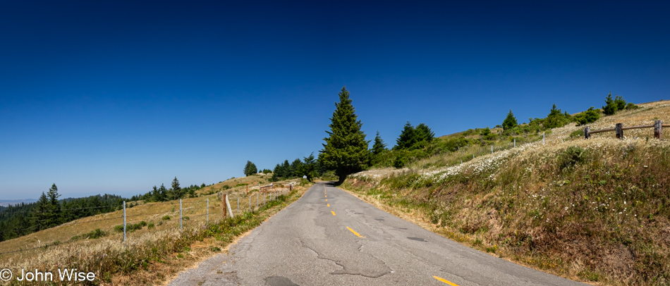
Heed this stop sign, or you will certainly regret your indiscretion. We are on Patricks Point Road.
This is Luffenholtz Beach south of Trinidad, and while Caroline and I drove at least part of this road back in 2006 (we know we did because there’s a blog post) neither of us has any recollection of that drive. As a matter of fact, in 2020, we thought we were traveling this road for the very first time, stating just that in a post.
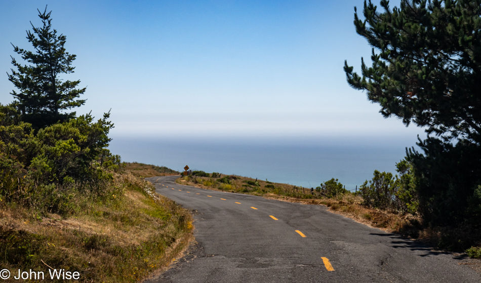
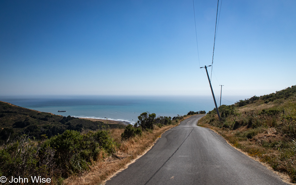
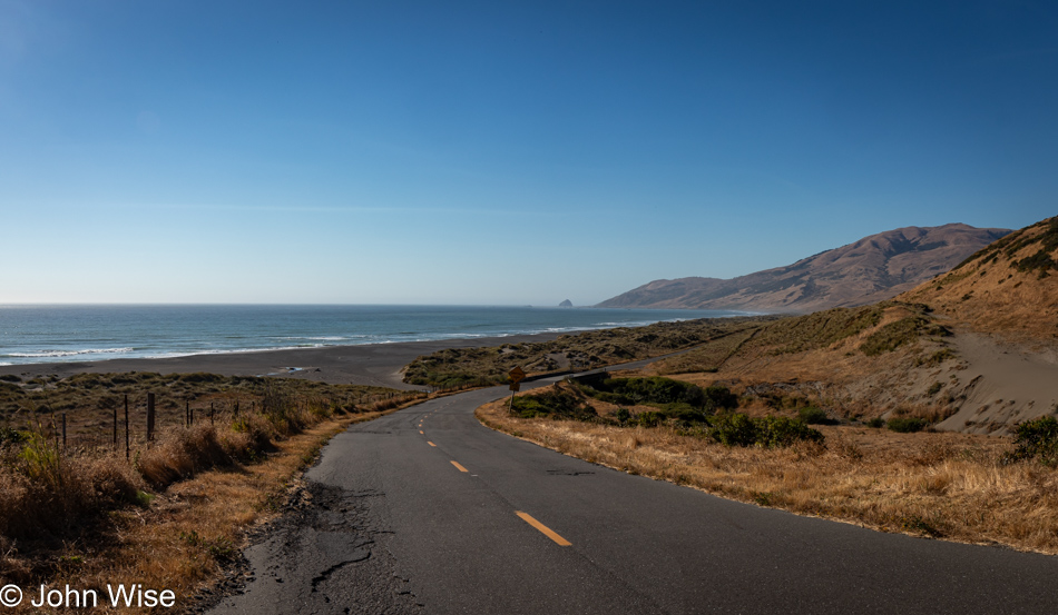
We have left Highway 101 again, this time for a road we are absolutely 100% certain we’ve never driven before. The initial stretch of road is California 211, but in Ferndale, the road shrinks as we head out on the Mattole Road for the Lost Coast.
Many sections of the road out here are only a single lane, and they are also in tight curves with big blind spots, so stopping is not an option. Then, we emerge from the dark forest into wide-open vistas that are idyllic, serene landscapes.
Without guardrails, I’m inclined to hug the centerline and drive at barely 20mph, else we risk falling off the road and into the infinity of time.
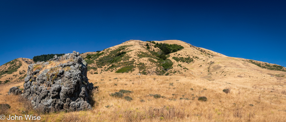
We’ve arrived in Cape Town, as in California, not South Africa.
After driving for a while, we had some idea of the frequency of other cars traveling this road and felt okay about stopping in the middle of the street and jumping out for a photo.
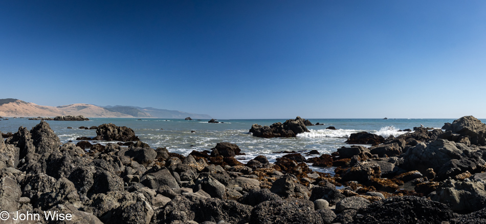
You wouldn’t know it from this view, but we’ve arrived at the Black Sand Beach down here on the Lost Coast north of the King Range National Conservation Area. I’ll turn around and show you.
There’s nothing and almost nobody else down here.
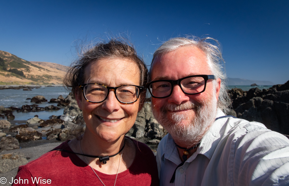
Well, there were these two dorks hanging out looking for the things we’d possibly not seen before.
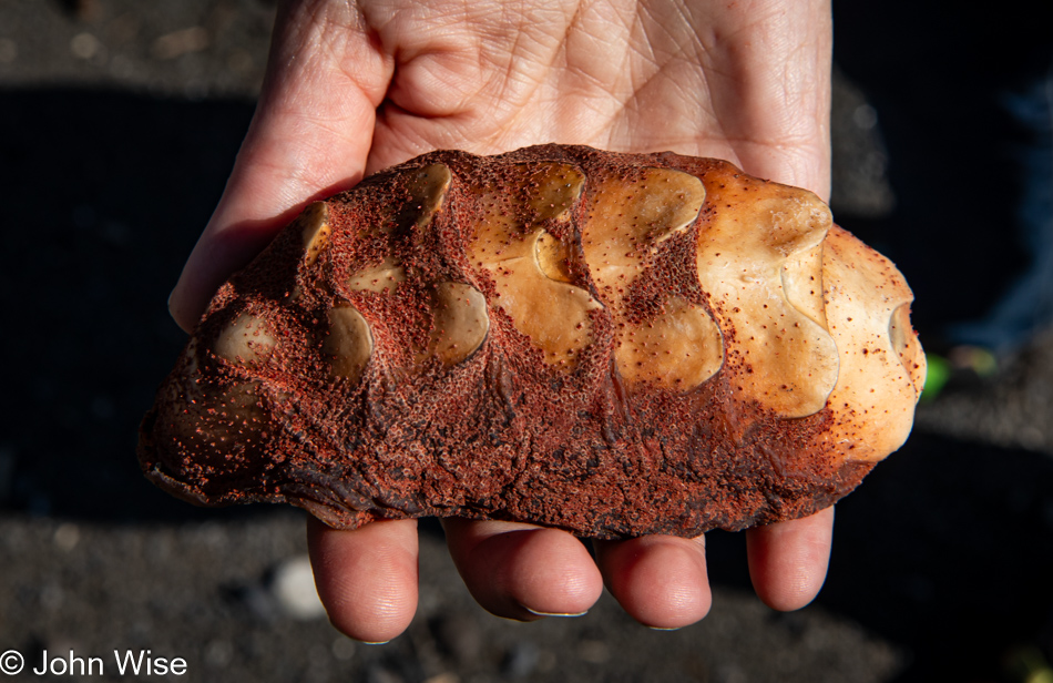
Seek, and you shall find. We were on our way back to the car when I spotted something peculiar that turned into the great treasure of this month away from Arizona: the shell of a gumboot chiton.
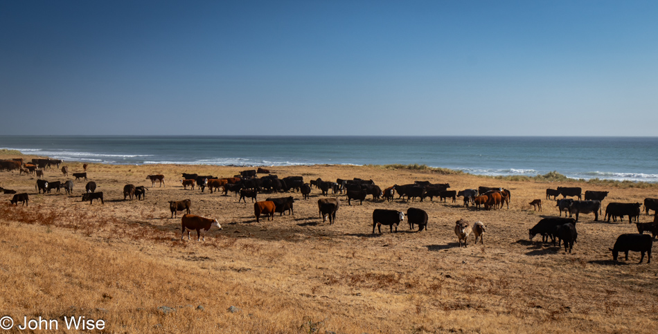
Somewhere along the road, and not marked, is the Point of Cows. That’s what we are calling this in lieu of finding the exact spot from the map.
This concludes our coastal adventure as we turn inland and start the serious effort to move ourselves closer to home.
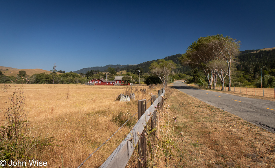
Much of the landscape for the first 20 miles after leaving our turn inland was similar to what we were driving past on our way out, but still, I felt I should offer at least a peek at what is on this end of Mattole Road as we drive through Petrolia.
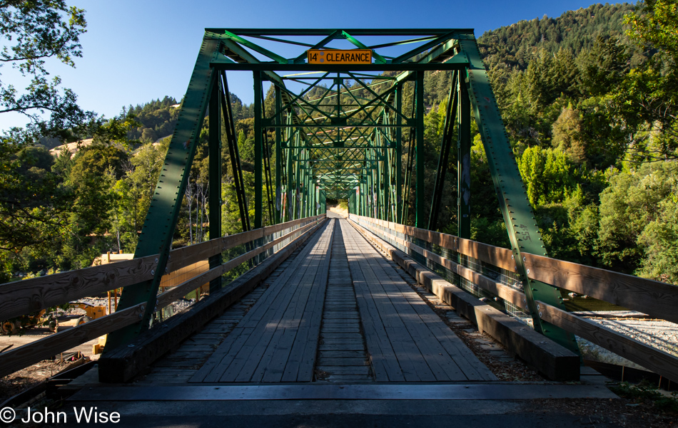
Our last photo of the day is from the Mattole River Truss Bridge in Honeydew, population 277, of which we met three of the locals. They were sitting near the bridge and informed us that this old relic from 1920 is going to be torn out and replaced with a modern structure. We learned a few other things from the heavily stoned and friendly people, but what they didn’t tell us was that we should probably have used this bridge and taken the northern route back to Highway 101 because the way we went included some sandy loose gravel sections of road in tight curves on steep mountainsides. More than once, I was given an adrenalin boost from the abject terror I was feeling as we started losing traction, and fear informed me that if I lost momentum, our tires would never grip this stuff well enough to let us finish going up the incline. I was close to panic. Consequently, I didn’t stop one time before reaching Highway 101, and by the time we reached Ukiah for the night, I was exhausted. What an adventure it was.