Today, Phoenix saw the arrival of Kings Döner, a restaurant serving comfort food with roots in Turkey that took off around the world, though it’s late coming to America. Döner kebap is a Turkish word that means “rotating roast,” which gave rise to gyros in Greece, al pastor in Mexico, and shawarma in the Arab world. And here we are on April 10th, 2025, our first döner shop in the state of Arizona.
Döner kebap really took off when Turkish immigrants in West Berlin during the early 1970s perfected this amazing creation. By the time I arrived in the Frankfurt area of West Germany in late 1984, the sandwich was already ubiquitous across the country, though I’d have to travel to the nearby city of Wiesbaden to find my favorite. When I visit Germany nowadays, Döneria in the Frankfurt neighborhood of Bornheim serves my current all-time favorite.
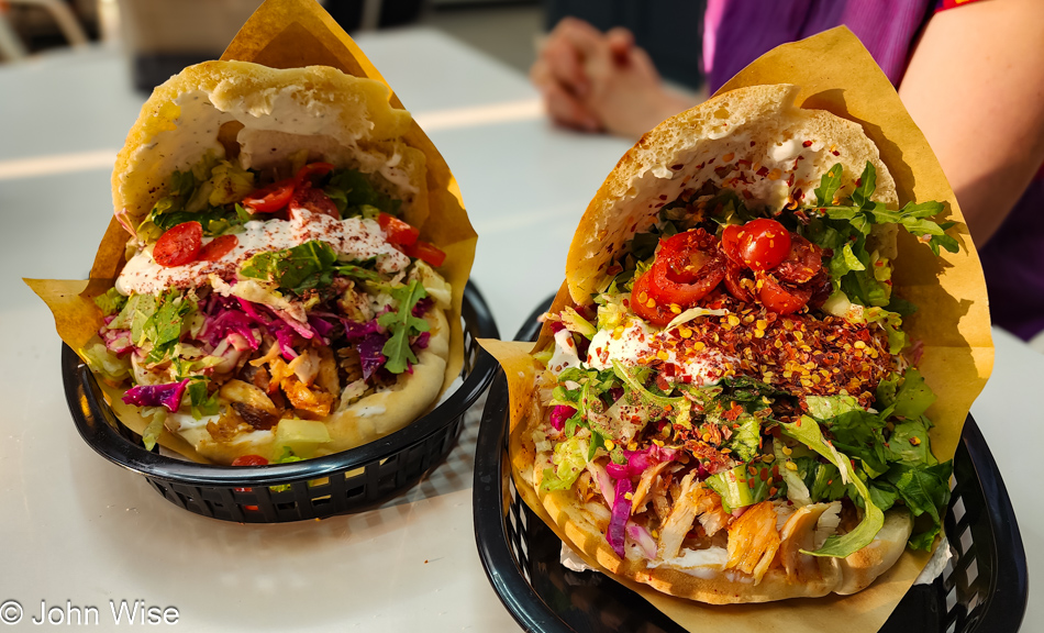
How does the Kings Döner compare? First off, all döner is different; there is no In-N-Out version of this sandwich that would act as a baseline. I opted for the chicken meat version for my morning breakfast döner. I was their first customer when they opened, as a matter of fact, this was the first döner the family made in America. My plan was, if I liked it, to return with Caroline later in the day so she could have a döner, too, and then I’d try the more traditional veal version. As in Germany, I ordered it without onion and added chili flakes. Now, having experienced their style, I will ask for extra meat and ask them to make it extra crispy. The guys also offer turkey meat, and for those who might be creatures of habit, they have gyros and falafel.
I’m returning this evening because their effort and taste of authenticity are now available in Phoenix, Arizona, and I have to support that. I love döner; other than New York City, I’ve never had this amazing sandwich in the States. I wish the family great luck in a market that hasn’t always embraced food diversity. Let’s hope the younger generation that took to ramen, boba tea, and poke bowls will find enchantment with döner, the king of sandwiches.